Download Agreement, Release, and Acknowledgement of Risk:
You (the person requesting this file download) fully understand mountain climbing ("Activity") involves risks and dangers of serious bodily injury, including permanent disability, paralysis, and death ("Risks") and you fully accept and assume all such risks and all responsibility for losses, costs, and damages you incur as a result of your participation in this Activity.
You acknowledge that information in the file you have chosen to download may not be accurate and may contain errors. You agree to assume all risks when using this information and agree to release and discharge 14ers.com, 14ers Inc. and the author(s) of such information (collectively, the "Released Parties").
You hereby discharge the Released Parties from all damages, actions, claims and liabilities of any nature, specifically including, but not limited to, damages, actions, claims and liabilities arising from or related to the negligence of the Released Parties. You further agree to indemnify, hold harmless and defend 14ers.com, 14ers Inc. and each of the other Released Parties from and against any loss, damage, liability and expense, including costs and attorney fees, incurred by 14ers.com, 14ers Inc. or any of the other Released Parties as a result of you using information provided on the 14ers.com or 14ers Inc. websites.
You have read this agreement, fully understand its terms and intend it to be a complete and unconditional release of all liability to the greatest extent allowed by law and agree that if any portion of this agreement is held to be invalid the balance, notwithstanding, shall continue in full force and effect.
By clicking "OK" you agree to these terms. If you DO NOT agree, click "Cancel"...
The last few summers have signaled a real decline in my climbing- a ruptured disc in my back which meant the end of my days as a runner saw to that. I climbed a combined seven peaks in the last two years, nothing too impressive, and it's been a frustrating time. This summer, though, I have been feeling stronger than I have in a while, and I was wanting to get out and test my conditioning. So, I set my sights on the combination of Missouri, Oxford, and Belford, which includes over 7400 feet of elevation gain. I looked around at quite a few trip reports, but there was little specific instruction on the route. I did decide to do Missouri first, just to avoid ascending that Belford shoulder, which is the longest stretch of climbing on the face of the earth, as well as the location of my getting hit with a gust of wind that dislocated and deformed one of my fingers. Roach suggests Missouri first, but offers only vague description of the crux- Missouri over to Oxford. I wouldn't be taking the entire Missouri ridge to Elkhead Pass, so I would have to return into the basin, but didn't know how far down to descent, is the trail to the pass helpful, and where do I am on the Belford ridge? Would I be bushwacking up a scree slope? Hopefully, this will offer some guidance to anyone who has this route in mind.
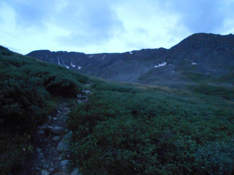
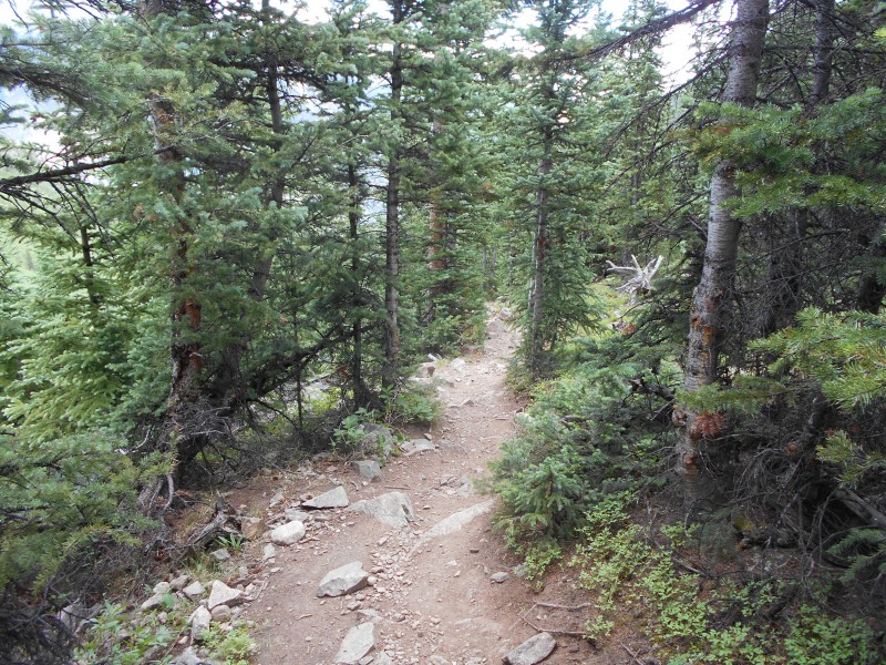
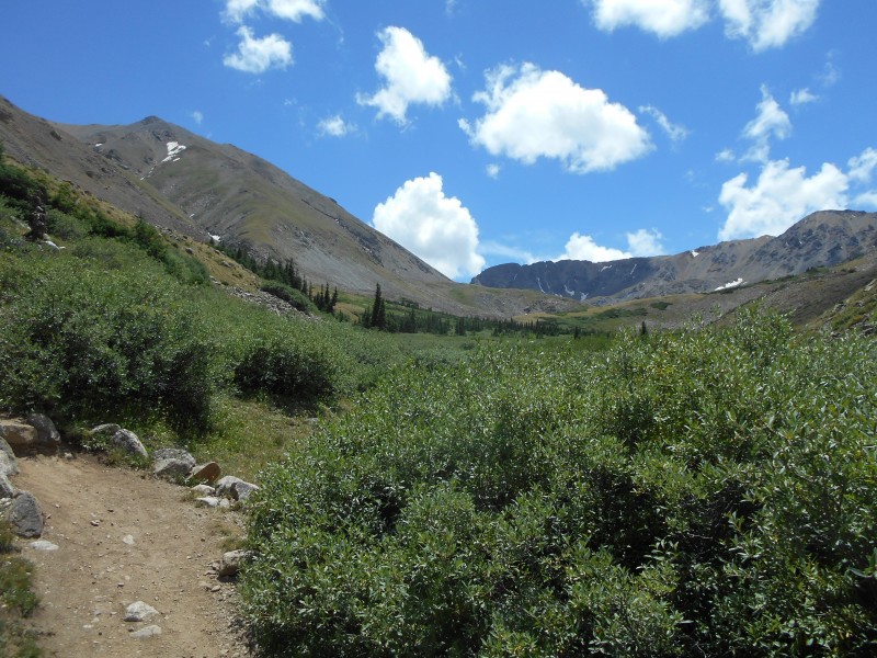
I slept in my car at the trailhead, and was up at 3:30AM. However, a 15 minute rain-burst kept me sitting and waiting in my car until I was able to begin at 4AM. Then, my headlamp was low on batteries, so I struggled to see the route in the dark, up those many switchbacks. My legs felt strong, and I was excited to be on my way with a challenge ahead. I was at the river crossing at 440AM, and passing the cabin into the basin at 455AM. Look into basin at daybreak
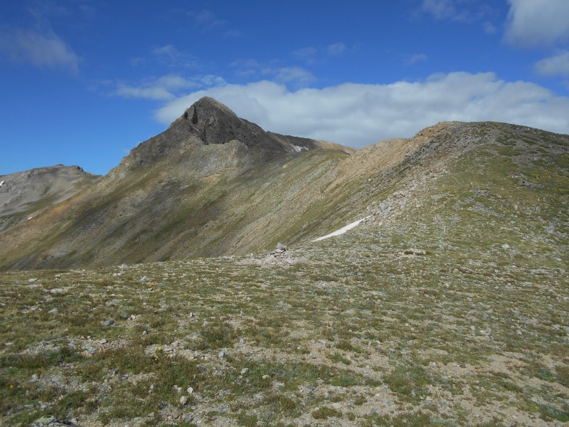
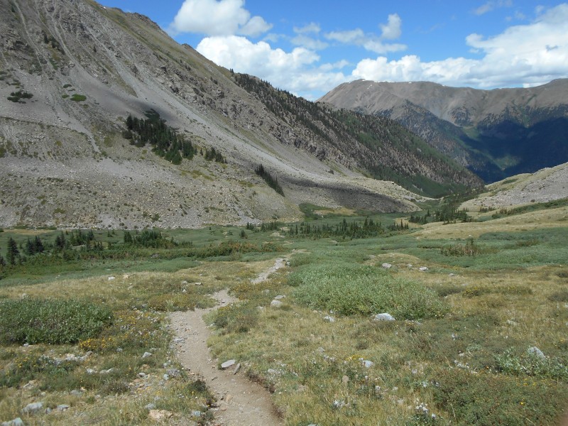
Passing through the basin at daybreak is a real treat, crossing the river and ogling the mountains on both sides. I shook a deformed fist at Belford's shoulder as I passed, and gained the levels through the basin. Before long Missouri was looking down at me, and at 6AM I was turning off the Elkhead Pass trail toward the Missouri ridge. Missouri patiently waiting for me Ascending the Missouri ridge Gaining the ridge The sun hiding behind Belford
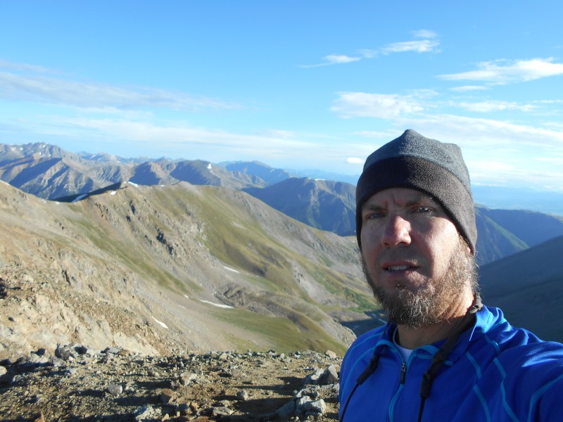
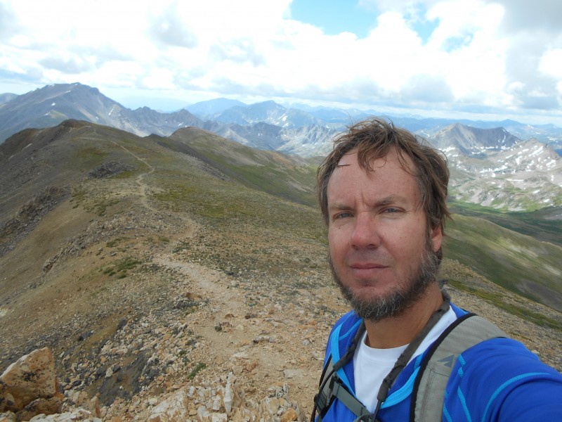
I gained the ridge at 640AM feeling great, and began the long, winding path toward the summit. Other than passing a few campsites in the dark, I hadn't seen anyone all day, and from 715-730AM, I had the Missouri summit all to myself. A little cool with a bit of a breeze, but it was so quiet and peaceful I didn't want to leave. As always, I thought of a few who had been here before, including Talus Monkey and my good friend Dave Peterson. Missouri summit
However, with the day I had planned ahead of me, I split before long. My plan was to be safe, and retrace my steps all the way along the ridge and back down into the basin on the standard route while planning my ascent of Elkhead Pass. The ridgeline past the Missouri summit looks far out of my league, and I was alone. I kept looking at the other side of the basin, trying to find the most sensible way to gain the ridge without a trail, and wondering if the Elkhead Pass trail would work to my advantage to get me halfway up.
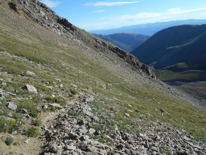
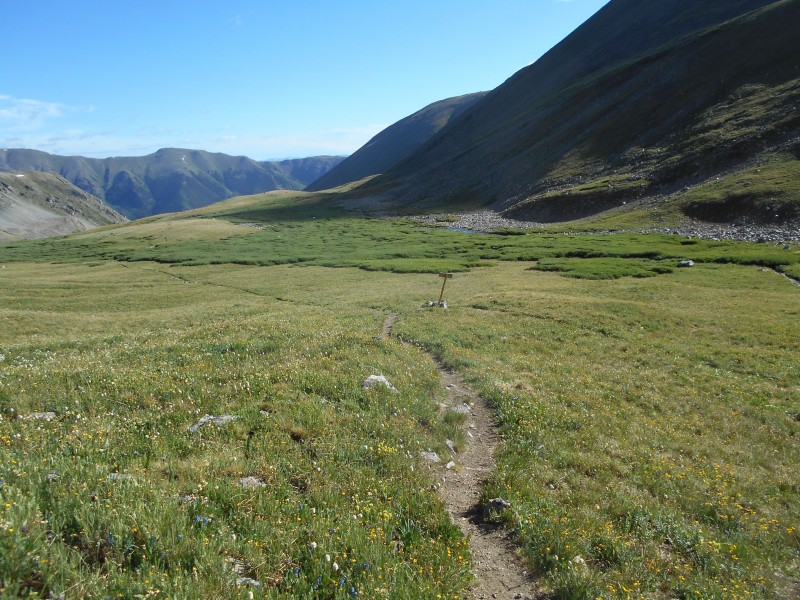
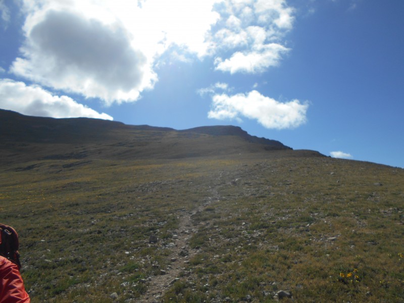
On the way down I met a couple of girls who had descended from Belford down Elkhead Pass to avoid that dreadful shoulder, and they explained that the trail would reach the pass, veer left, and take me all the way to the Belford to Oxford loop. They spoke well of the trail and had enjoyed it- this was the info that had been eluding me. I thought I would have to make my own path from the pass, but it was really quite simple. At 835AM I regained the junction at the Elkhead Pass trail, and started the ascent. Some Bob Dylan on my IPod, and I started working my way up. It really made things simple and reassured me that I wouldn't get into a scree-from-hell situation.
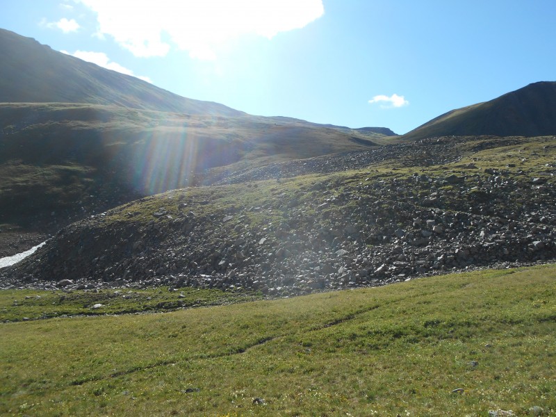
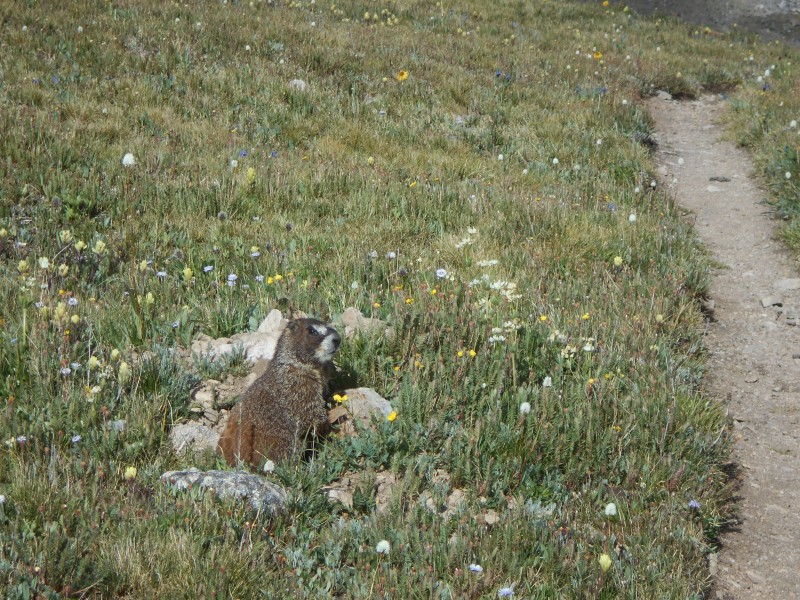
Elkhead Pass junction Looking up toward Elkhead Pass a friendly marmot Elkhead Pass toward Missouri Looking up from Elkhead Pass Looking down toward Elkhead pass Elkhead pass from Belford ridge Elkhead pass- another view
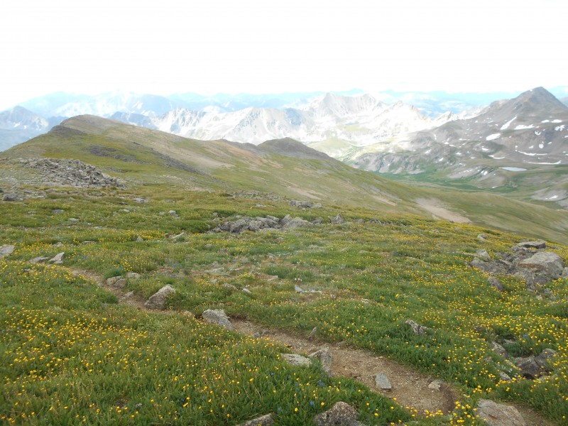
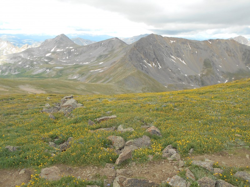
I told myself that this would be the crux of the day, but it was really pretty quick. I was grateful for the strong trail, which was never extremely steep. Glancing back over at Missouri, I was quickly regaining the elevation I had lost, and at 940AM I was topping out at the ridge- this is the end the the Belford 'plateau' where you turn left to start the saddle to Oxford. The whole day of climbing would be a total of about 7400 feet, so I was telling myself that when I got to this point, I would be about 80% done, and could just enjoy it. However, (is it just me?) looking across at Oxford in person looks a lot more daunting than in the pictures. It starts off pretty straight down, and you're thinking, "I'm gonna have to hoof it back up this in an hour? Crap-O-Matic!" There were some clouds forming, but it was still early, so I busted it down to the saddle and started the meandering ascent to the top of my second peak of the day- Oxford. wildflowers on the way to Oxford Me on Oxford, clouds forming
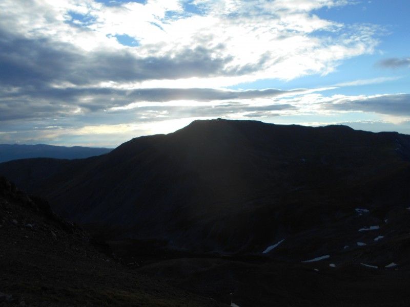
I was on top of Oxford at 1030AM, and had promised myself a long rest with some real food and water. However, the wind was picking up, the clouds were darkening, and all the other climbers were hightailing it out of there. Belford looked a long ways away, so I only rested for 15min before leaving Oxford. The plan was to cross Belford on its standard route back over the shoulder and to the car. I was feeling a bit weak, and just a little funny in my stomach. I hate deciding between racing the weather or stopping long enough to give my body the food and water it wants. Eat or hurry??? I chose weather, and was on my way. Belford summit
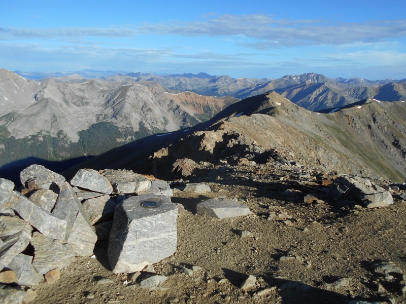
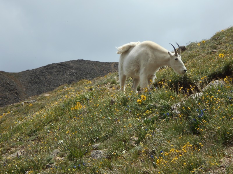
After the saddle, the return gets a bit steep for tired legs, and my legs were feeling it, but I pushed it, telling myself that this was the last bit of gain for the day. By 1125 I was on the Belford summit for my third summit of the day. This time I allowed myself to stay awhile, and ate a healthy dose of animal crackers, before leaving at 1150AM. Looking back down into the basin gave me such a peaceful feeling, and I was thinking how this is a climb I simply could not have done the last couple of summers. friendly goat down into the basin from Belford shoulder the walk out
The return to the car was lengthy down that cursed shoulder, but listening to Neko Case kept me company. I reached the Belford turnoff from the Elkhead Pass trail at 110PM and was back at my car just after 2PM. I was feeling like I was flying until I saw the flat tire on my car and realized there would be little time to celebrate. Nothing like changing a flat tire after a 10 hour hike! Still, the return to Denver filled me with thoughts of next climbs, and happy memories and bits of images from a day I will remember for a long time. I do enjoy that basin, and hope to return before too long! the last view of the basin
Thumbnails for uploaded photos (click to open slideshow):
That's a really neat area as your pictures nicely show. I did Belford/Oxford a few years ago
and descended via Elkhead Pass (being not sufficiently ambitious to take on Missouri). You're
right on about the queasy feeling one gets descending to the Bel-Ox saddle when you think
"Geez I'll have to ascend this!" But if you just put your head down and plod along it's not
all that bad (and certainly not as bad as the version of hell that is Belford's NW slope).
Nice job on getting all three and thanks for posting.
I did Bel/Ox, returning via the Elkhead Pass descent, on the 16th, just three days before your trip. I hiked in Friday night and camped about a half mile above the cabin, which made the trip up the Belford switchbacks at 3 a.m. actually quite pleasant, if windy, and I summited by 6:30 before the Saturday crowds arrived. After tagging Oxford I was not ready to face the conga line down the switchbacks and was delighted by the longer but gentler and lovely Elkhead route. Thanks for your photos; they will help me remember how great this area is when I return to Colorodo to bag Missouri next year.
Thanks for the great detailed trip report. We are climbing this area this weekend and your report adds very nice additional information from a first hand experience.
I'm also planning to be up that way this weekend, initially thinking to just hit Missouri and come back for the other two another time, but man, that trail across to Elkhead Pass looks mighty inviting and your pics make it look as beautiful as everyone else has claimed it to be. Will have to play it by ear, but you've given me some great information to start from. Nicely done!
What did your total mileage end up being for this?
According to Roach, the milage is 14.5 miles. By comparison, Longs is 15 miles, but only 5000 feet, vs 7400 feet on this trio.
Start early to give yourself a chance- good luck mr Chris!
I'm planning to do this route this Summer, thank you for the info!
Caution: The information contained in this report may not be accurate and should not be the only resource used in preparation for your climb. Failure to have the necessary experience, physical conditioning, supplies or equipment can result in injury or death. 14ers.com and the author(s) of this report provide no warranties, either express or implied, that the information provided is accurate or reliable. By using the information provided, you agree to indemnify and hold harmless 14ers.com and the report author(s) with respect to any claims and demands against them, including any attorney fees and expenses. Please read the 14ers.com Safety and Disclaimer pages for more information.
Please respect private property: 14ers.com supports the rights of private landowners to determine how and by whom their land will be used. In Colorado, it is your responsibility to determine if land is private and to obtain the appropriate permission before entering the property.