| Report Type | Full |
| Peak(s) |
Wheeler Peak - 13161 Mount Walter - 13133 Old Mike Peak - 13113 Truchas Peak - 13102 Middle Truchas Peak - 13066 North Truchas Peak - 13024 Lake Fork Peak - 12881 Chimayosos Peak - 12841 |
| Date Posted | 07/29/2016 |
| Date Climbed | 07/02/2016 |
| Author | Chicago Transplant |
| An Enchanting Independence Day Trip To New Mexico's 13ers |
|---|
An Enchanting Independence Day Trip to New Mexico's ThirteenersPeaks climbed (in chronological order) Truchas Group (July 2-4) Truchas Peak (13,102') - 2nd highest peak in NM, Rio Arriba and Mora County and Peco Wilderness High Points Middle Truchas Peak (13,066') - not ranked "Medio Truchas Peak" (13,060') - not ranked North Truchas Peak (13,024') - 3rd highest peak in NM Chimayosos Peak (12,841') - 7th highest peak in NM Wheeler Group (July 5) Mount Walter (13,133') - not ranked Wheeler Peak (13,161') - NM state, Taos County and Wheeler Peak Wilderness High Point Simpson Peak (12,976') - not ranked Old Mike Peak (13,113') - not ranked "Fairchild Mtn" (12,819') - 9th highest peak in NM Lake Fork Peak (12,881') - 6th highest peak in NM Kachina Peak (12,481') - not ranked 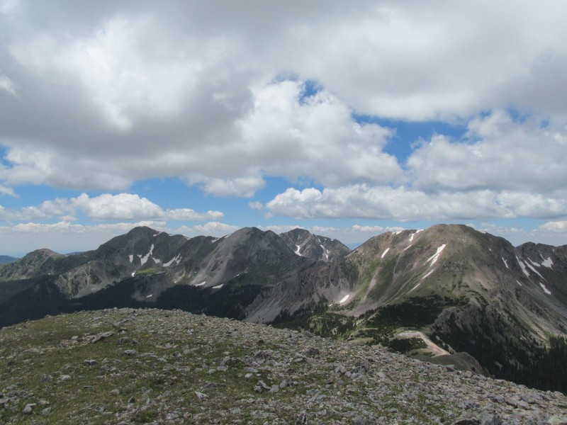 Introduction Well it sure has been a while since my last trip report (almost 3 years), I guess between work and climbing peaks, I just haven't really found much time to write about them lately. This particular trip, however, just seemed like there was very limited published beta on our routes and I always like to try and post things that I feel will have some value for others down the road. The architecture firm I work for has been designing a new hotel in Taos Ski Valley, and my duties include field visits. It just so happened that my next scheduled visit was the Wednesday after the Fourth of July holiday, seeing as Tuesday would be mostly spent driving down anyway, it was pretty much a no-brainer to just take Tuesday as a vacation day and stay down there the whole weekend. My girlfriend was able to get the time off too, and we started making plans to become New Mexico 13er finishers, after all even including all the unranked ones, there are only 7. The New Mexico 13ers are clustered in two areas of the Sangre de Cristo mountains, one between Taos and Santa Fe in the Pecos Wilderness, and one at the head of Taos Ski Valley. The southern group is home to 2 ranked (Truchas and North Truchas) and 2 unranked (Middle Truchas and "Medio Truchas"), while the northern group boasts the state's highpoint (Wheeler) and its 2 unranked sub-peaks Walter and Old Mike. The trailhead for the Wheeler group being basically where I park for my site visits lent it to be better at the end, so we set our sights on the Truchas Group first, heading straight down on Saturday from my house in Edwards. A quick stop for lunch and trail food at Cid's Market in Taos and we were off to find the trailhead. Cid's is a pretty cool little store, similar to Natural Grocers with great bulk dried fruit, nuts and granolas for the trail, and of course some New Mexican dried chilies! Truchas Group Research on this group yields the occasional horror story of vehicle vandalism at the Quemado Falls trailhead, a trailhead that also seems to have suffered a wash out on the road. Combined with a maze of confusing roads that aren't well mapped, high clearance requirements and State Land Grant permissions, we decided that the Santa Barbara approach would be the way to go. We headed out of Taos on NM 518, then went west (right) on NM 75 to the town of Penasaco. Here NM 75 swings a large bend to the right, you want to turn left on NM 73 and follow for about 1.5 miles to the turn off for the Santa Barbara Road (Also FS 116) and turn left. The campground is at the end of this road after about 6 miles, just before the campground is a sign for the free hiker's trailhead, we parked here.  From the parking area, we headed towards the campground where we found a bypass trail signed for our trail, (#25) and a note that its 12 miles to Santa Barbara Divide making us glad to be backpacking these and not trying a day trip! Weather was good, no rain but there was enough cloud cover to not have the sun beating on us which was nice. The early part of the trail is pretty mellow and soon enters the Pecos Wilderness, crosses the creek on a bridge and passes a trail split just over 2.5 miles in. Another maybe quarter mile you will come to a stream crossing where we found a balance beam log to cross on. This seems to be about the effective end of the day hiker's tolerance. If you have sandals you may be better off with them than trying to balance the log with a heavy pack. The trail continues through some nice meadows with some camping potential to about the 6 mile mark where another stream crossing on a balance beam (or sandals) starts the long ascent to Santa Barbara Divide. There were very limited (if any) places to camp for the next 4 miles, so keep that in mind. We found a nice campsite about 10 miles in, a couple hundred feet off the trail above the shores of No Fish Lake and settled in with dinner and some water filtering before calling it a night. We were both amazed at how lush this area was, and how much deadfall there was. The trees were also quite tall considering we were at nearly 11,500; in some parts of Colorado we would have already been above treeline! 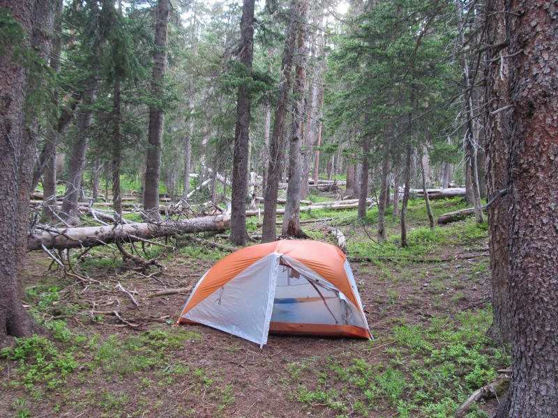 The next morning we made quick work, under half an hour, to the 12,000 foot Santa Barbara Divide. As such, the 12 mile sign at the trailhead was probably inaccurate and it's probably more like 11 to 11.5. Some lingering fog on the pass obscured our view of the peaks as we found our way to Truchas Lakes on the trail, as you descend off the divide you want the right branch. 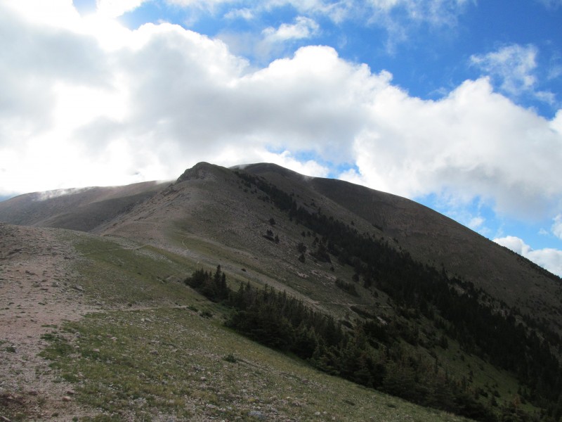 We were hoping to climb the east ridge of Truchas, but really had not seen any information on what it might go at. The fog kept that as a mystery for now, and we hoped it would lift soon so we could get a better look at what we might be getting our selves into. In either case, if we did decided on a different route we would have to pass this ridge anyway so we continued on. 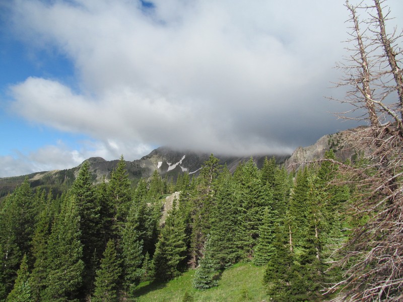 As we worked our way along the trail, we quickly arrived at Truchas Lake where we could start to see part of our proposed traverse above. We were happy to see that it looked very reasonable from this angle! A short trail error at Truchas Lakes, we ended up taking a trail that was not the true trail but just an access point to the opposite shore. We did some off trail bushwhacking to try and stay high before angling across a meadow and finding the trail below to our left. 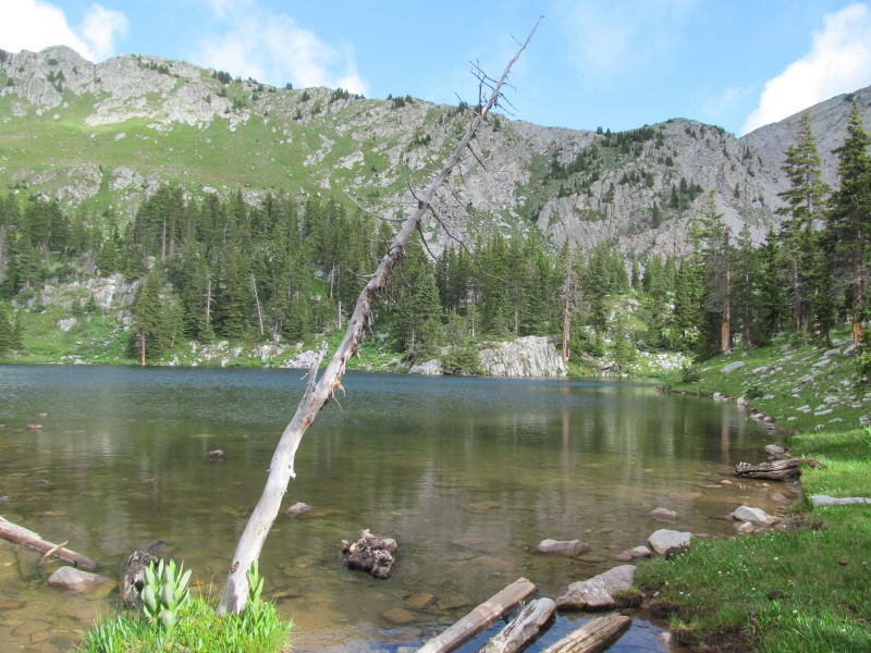 We quickly founf ourselves at a tarn at the base of Truchas Peak's east ridge, now in the sun. From our view, the ridge definitely looked like it would climb well, as did not see any towers or notches and saw plenty of grass bailouts to the left if we needed them. We left the trail here and ascended the steep slope to the ridge crest. There is a steep grass slope with plenty of forest cover, but we decided to get our scramble on early and used a series of 3rd class ledges on the left. 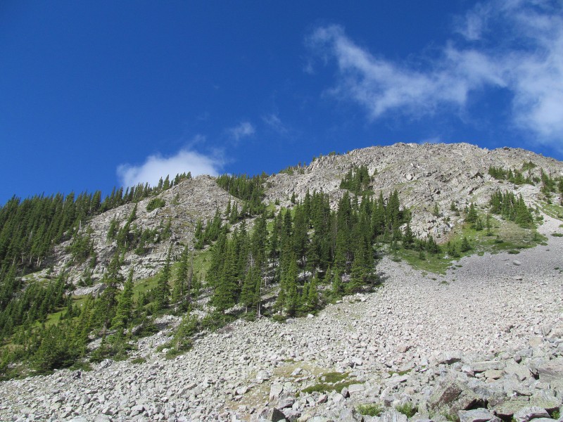 The view of the remaining ridge from treeline showed why many consider the Truchas Peaks to be New Mexico's finest, much more aesthetic and rugged in character than the usual gentle class 2 peaks around these parts. 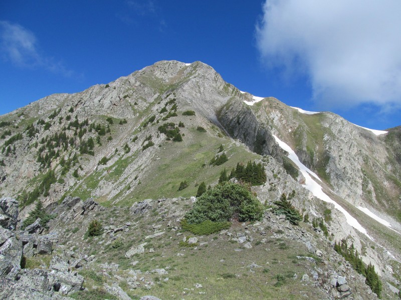 We tried to stay directly on the ridge crest as much as possible to maximize scramble opportunities, which never exceeded class 3 and were on good quality rock. Some trees on the ridge crest made it interesting, even up as high as 12,400'. The rock was more of a quartzite akin to Colorado's Grenadiers than to anything I have seen in the Sangres previously, and we found it really fun to climb. If one wanted, there are plenty of grass options to the left of the ridge crest to keep it class 2, but we recommend sticking to the fun rock! 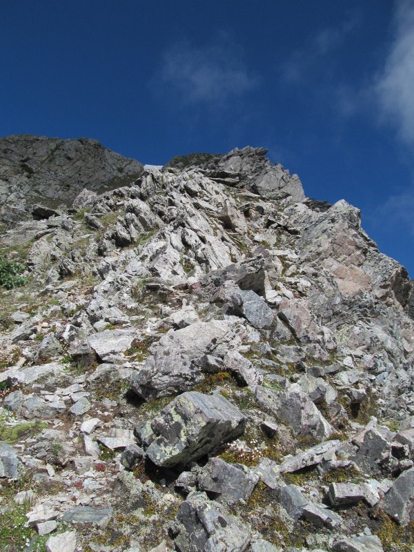 Soon we found ourselves on our first summit where the views were far reaching, even with some cloud cover limiting them a bit. Truchas Peak has 4000' of prominence, so you can see a long way, but many of the farther peaks (such as Wheeler 40 miles to our north) were in the clouds themselves. 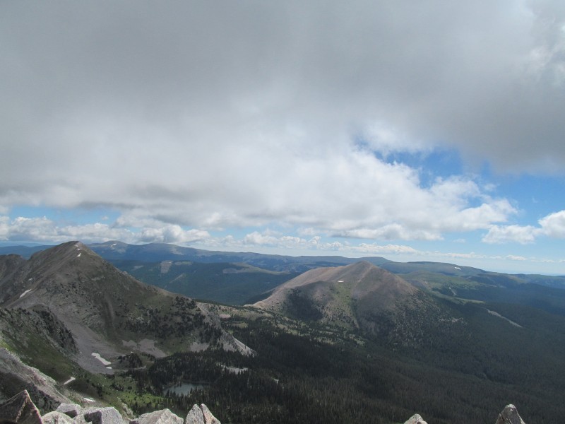 It was now time to get on with our attempt to traverse all four Truchas Peaks in one swoop, something I had not actually been able to find any information on anyone having done before. I doubt it's a first ascent, and we are certainly not claiming such, but it did mean that we were headed into the unknown. Kind of nice in the modern internet age of beta overload, and I almost feel guilty for publishing it. The first part of this ridge is just class 2, descending off of Truchas Peak on a mix of talus and grass. There are some segments of climbers trail, and as you begin the ascent towards "Medio Truchas", we took a climbers trail that bypasses and saves having to climb "Medio Truchas" twice. 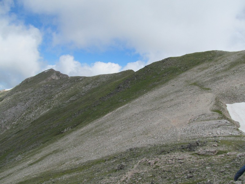 As it petered out we then did an ascending traverse of the grassy slopes to the ridge crest where the remaining way can be kept at class 2 despite some dramatic drop-offs to your right (north). From the summit we got a good view of North Truchas as part of our proposed traverse, one notch looked like it might bet interesting, but overall we were looking forward to the ridge and we had confidence that it would go. 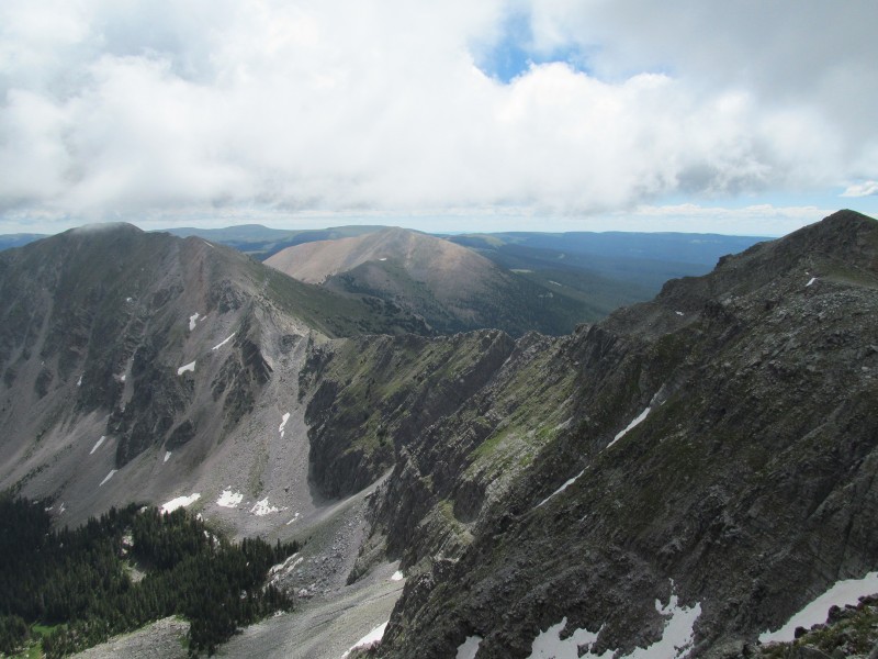 The traverse to "Medio Truchas" then went quickly on the ridge crest, admiring to the drop offs to our north. We even saw a marmot hanging out on one of the exposed ledges, what a great perch! 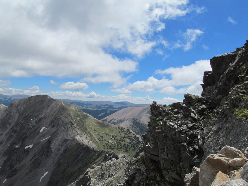 Now on the summit of "Medio Truchas", we took a brief moment to enjoy the view of the connecting ridge to North Truchas before descending into the unknown. 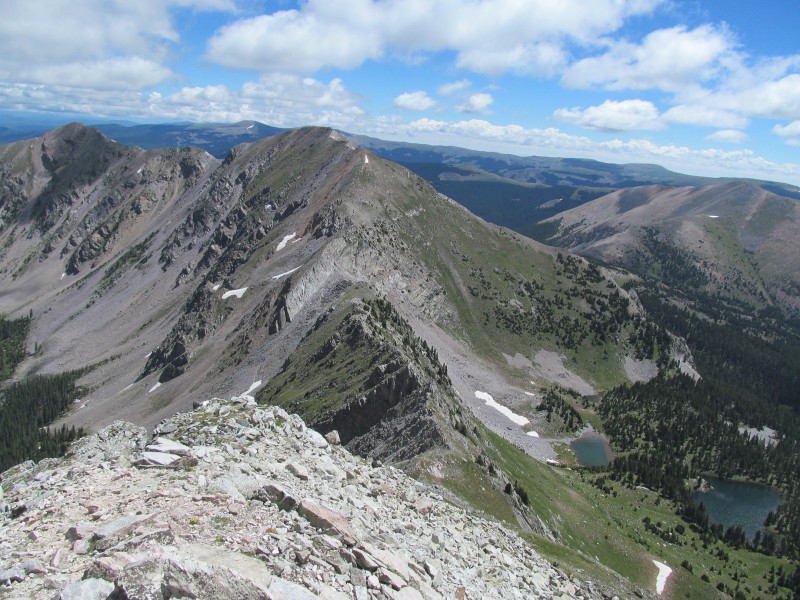 The initial decent was on steep talus, a little loose but manageable. Some minor routefinding was required to bypass a couple of steps in the ridge, but we found the route to be fairly obvious. After this initial drop, the ridge turned into a sawtooth of good quality rock and some really fun scrambling. The route was generally no more difficult than class 3; however we did not always look around for a class 3 route if a class 4 move presented itself. We stayed as close to the ridge crest as possible the entire way, the only place I really remember us needing to get off was at a prominent notch (which was visible from Middle Truchas). That notch was the only thing that from afar even really caught our attention, and we were pleased to find it reasonably straight forward to figure out and quite fun to climb. 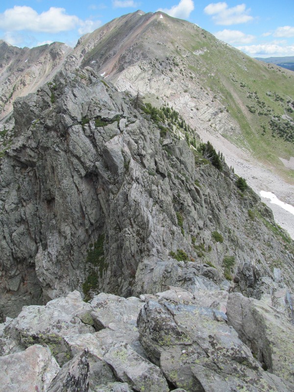 What surprised us most were the trees, some legitimate 15 foot tall pine trees, along this ridge up at 12,500. Treeline just seems to be a lot higher in New Mexico! The ridge continued on with plenty of good quality class 3 scrambling, but as we neared the saddle we quickly started to realize the crux may lay ahead of us. 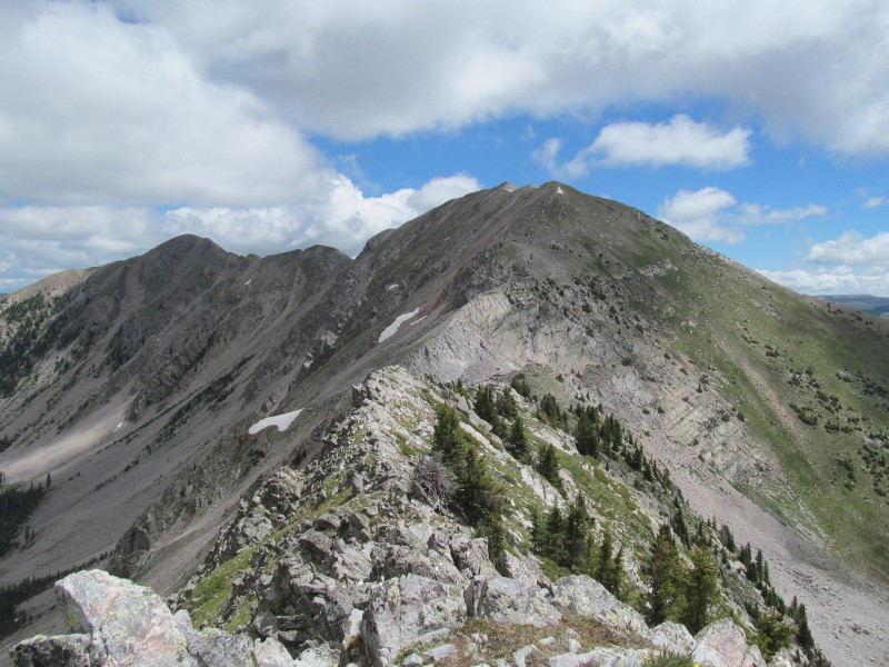 An imposing headwall guards the route up North Truchas from the saddle, plus we had one more steep downclimb to reach the saddle. As we neared the downclimb, we were able to find an exit that kept it class 3, and we started to see what looked like a breach in the headwall beyond. Looks like this ridge will go after all! 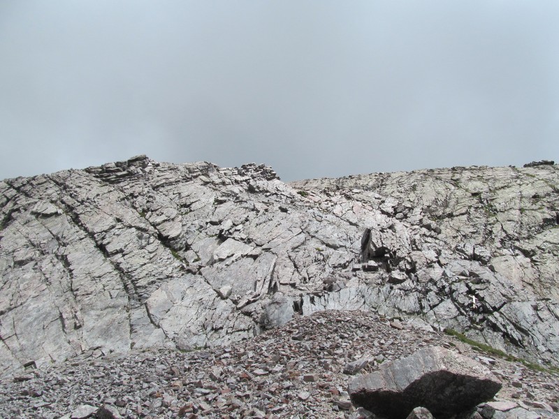 We scrambled more or less directly out of the saddle, angling slightly right as we went up. This lead to a steep gully which we left early to take on the upper portion of the headwall directly on class 4 terrain with great holds. It was only about 20 feet, but we both wished it was much longer! The rock was again quartzite and a delight to climb, probably the most fun scrambling of the entire trip, too bad the whole ridge couldn't have been like this. 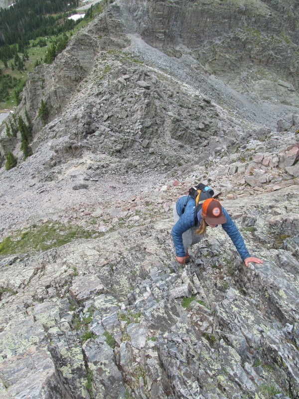 As we crested this feature the ridge above eased to broken rock with grass and the remainder of the route to the summit was class 2, we just had one sort-of catwalk like feature on the crest of the headwall to reach easier terrain. There was some exposure to the right. 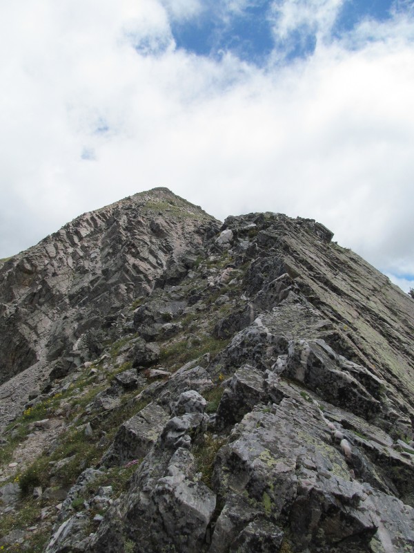 The views of the north side of Middle Truchas from here were impressive; these peaks are definitely winners in the scenery sweepstakes. I wonder if there are any good ski lines off Middle Truchas! 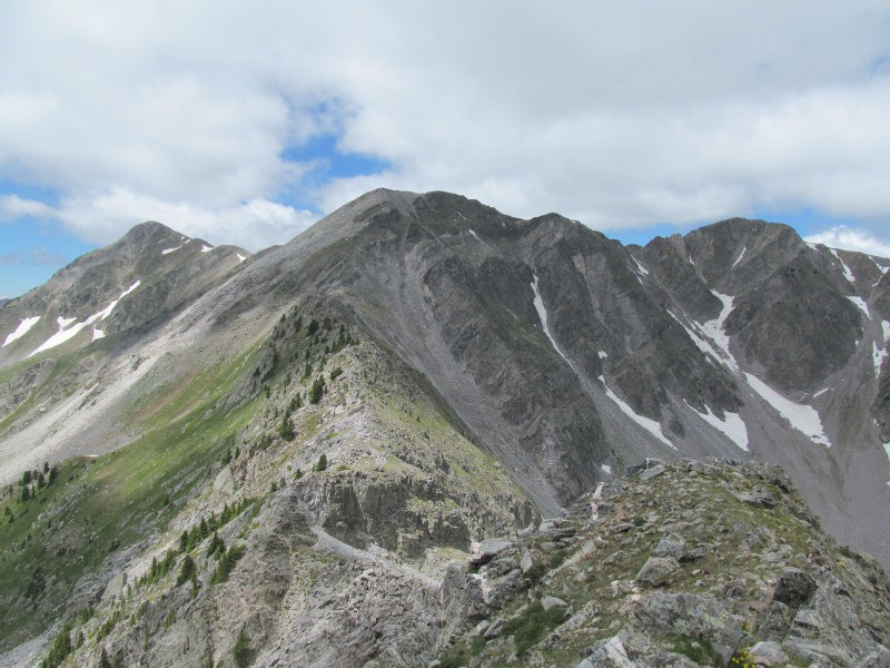 The descent off North Truchas back to the Santa Barbara Divide is via what would be considered this peak's standard route. It is just a steep grassy class 2 slope about a thousand feet above the divide. As it leveled out near the divide there was some route finding through the krummholz (one of our favorite words) before we were deposited at the trail.  We decided the weather looked good and our legs felt good, so why not head up the 800 or so feet from the saddle to the top of Chimayosos Peak, a neighboring 12er. The ascent went quickly, initially on a bit of a climbers trail, then over a gentle grassy false summit before the final push to the top. The views from here back to the Truchas Peaks made the effort well worth it, plus it's the 7th highest ranked peak in New Mexico. Chimayosos also dominated the view from our trail in the day before, so the views back down the valley were quite nice, and reminded us how far in we were from the car. We then descended back to camp, probably only took about an hour from the summit, and made our dinner and settled in for the night. 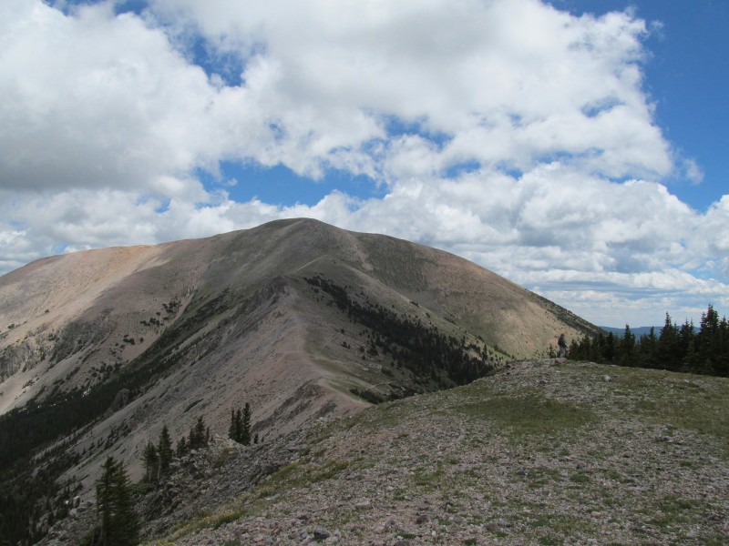 The next morning we packed out, enjoying a quick head-dunk in the creek along the way which was a welcome refreshment now that the sun was shining. We hit the road and headed to Taos where delicious New Mexican food was enjoyed at Orlando's in El Prado, a place I have made a regular stop on my work trips. A little side trip to wander the shops in Taos and then it was off to find a campsite along the road up to Taos Ski Valley to rest up for our planned finale, a circumnavigation of the upper Taos Ski Valley. Of course we couldn't resist a little treat on the way, Arroyo Seco is home to a fantastic little ice cream place called the Taos Cow, check it out if you are in the area. Wheeler Group We made the (for me anyways) all-too-familiar drive up to Taos Ski Valley and parked near the construction site, but for once I was here for something far more enjoyable that reviewing construction progress. It was finally time to climb Wheeler Peak after nearly a year since my first site visit. We decided we were going to try and go for a big loop of the entire basin, starting at Bull-of-the-Woods trail, and descending the resort off Kachina Peak. As my girlfriend likes to say, "legs love long days!" 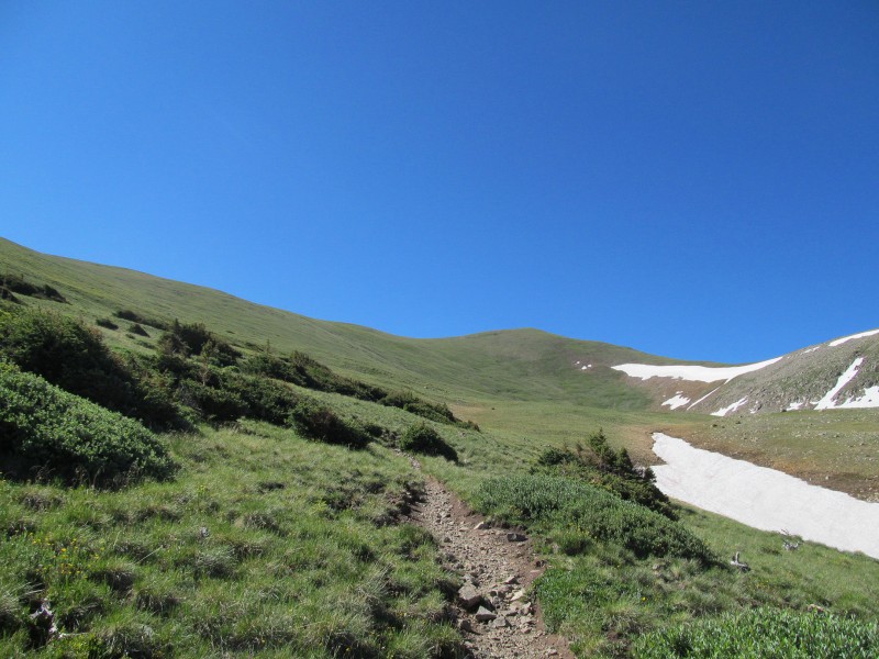 The Bull-of-the-Woods trail is about 7.5 miles one way to the summit of Wheeler, and while not the shortest route for the peak, is considered by many the more scenic option. At first the trail climbs steeply along a creek before topping out on a divide where we were surprised by a truck diving up from another direction. Apparently there is a road up here, but I think it's private? There were some side trails as there is also a network of local mountain bike trails up here, but generally the main trail was dominant and easy to follow and in some places it even took on more of the shape of an abandoned road. We bypassed the unranked peaks that are just off the trail, and stayed on the main trail to save ourselves for the long ridge run beyond. There were a couple of other hikers, one guy coming down, and two guys coming up. One of the guys coming up had an open radio and we were trying to stay ahead, hoping for some peace and solitude later on the summit. Unfortunately after passing Frazer Mountain, the trail drops down into La Cal Basin by a good 250 feet or more before climbing up Mount Walter. 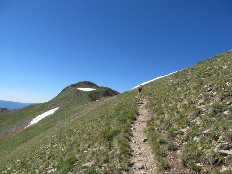 Trying to stay ahead of the guy with the radio, Mount Walter (which is unranked) became a blip that we just passed over as we pushed towards the true summit. Here there were more people and our summit push seemed like a waste of time as it didn't give us the solitude we hope for, but we did manage to summit in only about 3 hours, which would give us plenty of time for the traverse ahead. 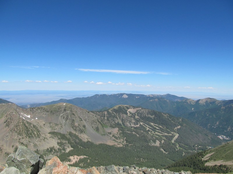 The views were great and we had a really clear day, to the north we could see Culebra and the Spanish Peaks, to the south the Truchas Group. The summit plaque honored the peak's namesake, and was quite festive for the holiday weekend. 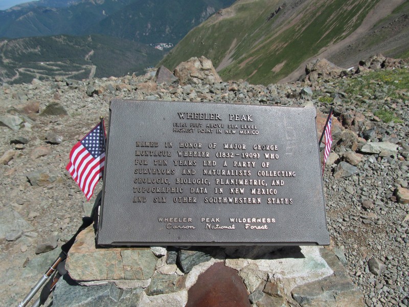 We descended, passed over Simpson and followed a climbers trail out to the summit of Old Mike Peak (which in another 20 or so years will be my namesake). Here we had a more enjoyable summit break on what was now our New Mexico 13er finisher. Wait, didn't we just climb our first one like 2 days ago? Hmm, I wonder what the FKT for New Mexico 13ers is? More on that later. Back across Simpson, it was now time for our traverse. I had seen one trip report on this site (thanks, Ryan!) so we knew it would go, but we weren't too sure of the details. Sometimes it's more fun to just do a quick skim and leave the discovery to yourselves when you are on the ridge. I'm sure a few people are doing just that on this report, and hopefully they enjoy their trip as much as we did. The first obstacle is a false summit shown on the map as PT 12728, there was some fun class 3 scrambling including an enjoyable headwall and some fun towers. 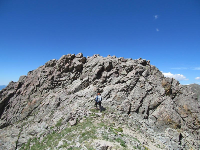 There were a few areas with some decent exposure, but the rock was really good. Nothing too hard and the route was really intuitive, just a lot of fun. 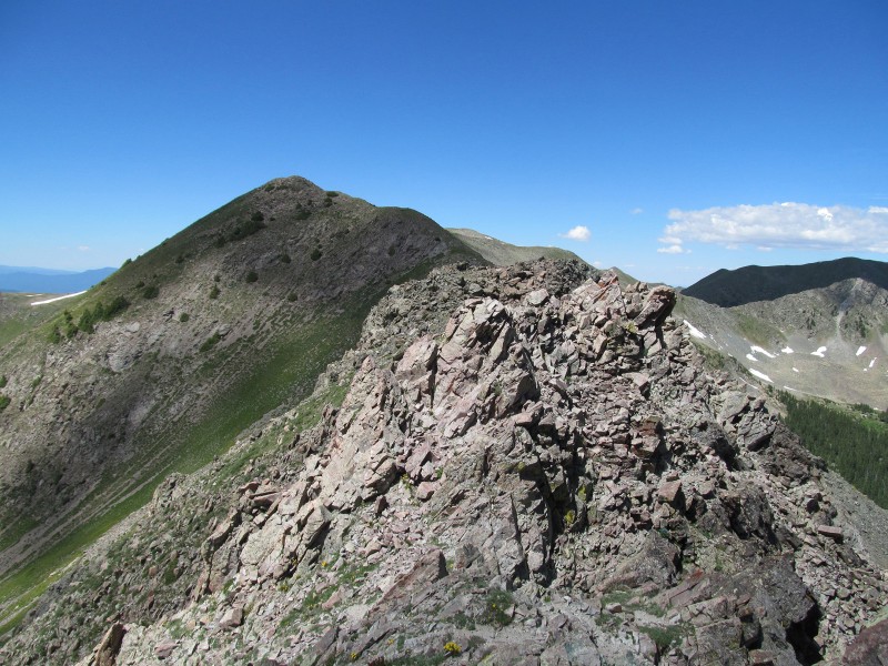 The entire route was also dotted by surveyor markers with cairns, not sure what they are for but the ridge is the Wheeler Peak Wilderness boundary line, so maybe they are survey markers for that? A few of them were in rather precarious spots, kudos to the people who put them in! They went almost the whole way to Lake Fork Peak! The descent of 12728 was mostly just class 2 grass with a little bit of scrambling near the saddle at around 12,200', including a cool exposed slab. 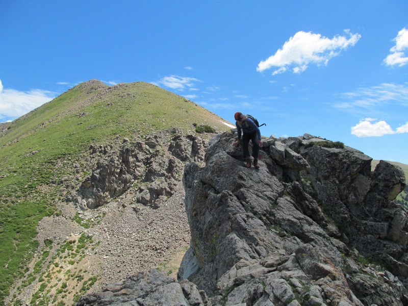 At the saddle once again were more trees, which continued to grow even up the left side of the ridge up our next peak. Did I mention the higher treeline in New Mexico? The ridge up to the summit of PT 12819 (aka "Fairchild Mountain") was a mix of some easy scrambling and grass (with the occasional tree), as we tried to stay directly on the crest. 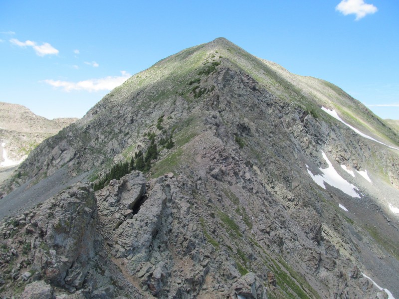 Generally we tried to stay as close to the ridge crest as possible the entire traverse and maximize our scrambling potential. The route did have some areas where class 2 terrain was just a few feet away, but what fun is that? 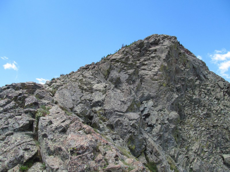 At this point we were in essence as far from our car as possible, way at the head of the valley. The route ahead of us looked pretty straight forward, maybe a little more scrambling, but mostly it seemed to be just a ridge walk. Next up was Lake Fork Peak, we dropped off "Fairchild" on class 2 grass with the occasional rock to the saddle, below which was a nice looking late to the south. 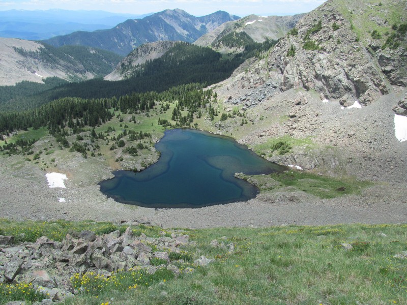 From the saddle, we ascended the mix of grass and rock that surprisingly held a few little scrambly sections if one sticks directly to the ridge crest as we did. There is once again a lot of grassy terrain off the ridge crest if one wanted to keep it class 2, but we just kept wanting to maximize our scrambling opportunities and enjoyed the crest.  After cresting a false summit, the rest of the way to the summit eased up to a mostly flat grass ridge that was a welcome reprieve on a long day. We enjoyed the views of Wheeler across the basin, and the ridge traverse behind us before heading to our final peak of the trip.  The initial descent was talus to a long flat section, then we had to drop to the left (west) of the ridge crest to avoid a rather large steep step that was unexpected before easier terrain led to the saddle. One last short scrambly slab above the saddle (and of course a few more high New Mexico trees) and we were well on our way to the summit of Kachina. Throughout the day, and this last grassy section was no exception, we were admiring all of the tiny flowers on the ridge, including some beautiful Alpine Forget-me-Nots that are smaller than the shoelace holes in my boot! 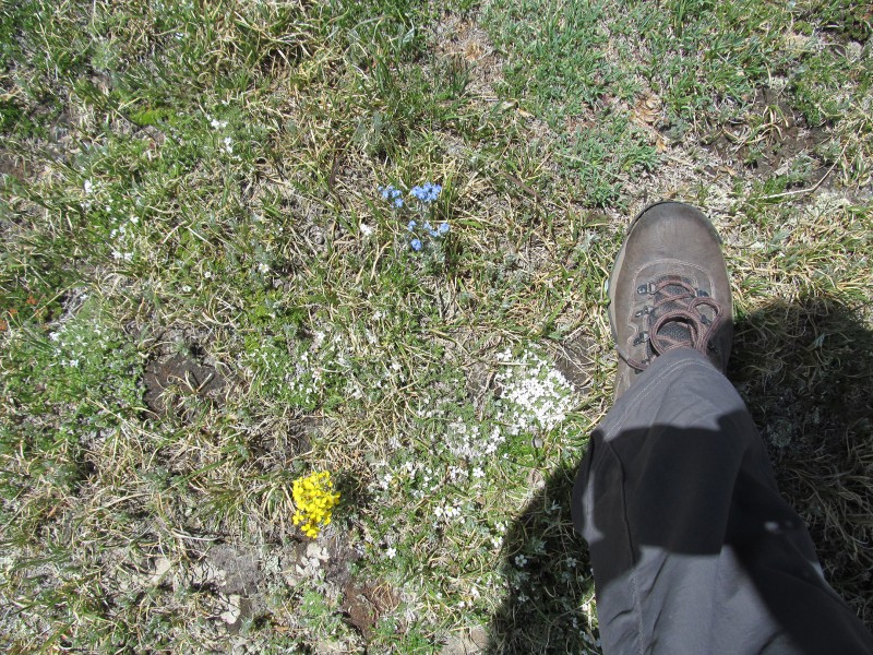 The summit of Kachina was our first sign of civilization since Wheeler as we were now atop the ski area. A look back at Lake Fork clearly shows the steep step we avoided downclimbing, luckily the bypass was quite obvious. All in all the route finding on all of our ridge traverses were pretty intuitive, which is good because I don't think we saw a cairn or route markers of any kind. Just those ridge crest survey markers, but they were certainly not marking the route given where some of them were located. 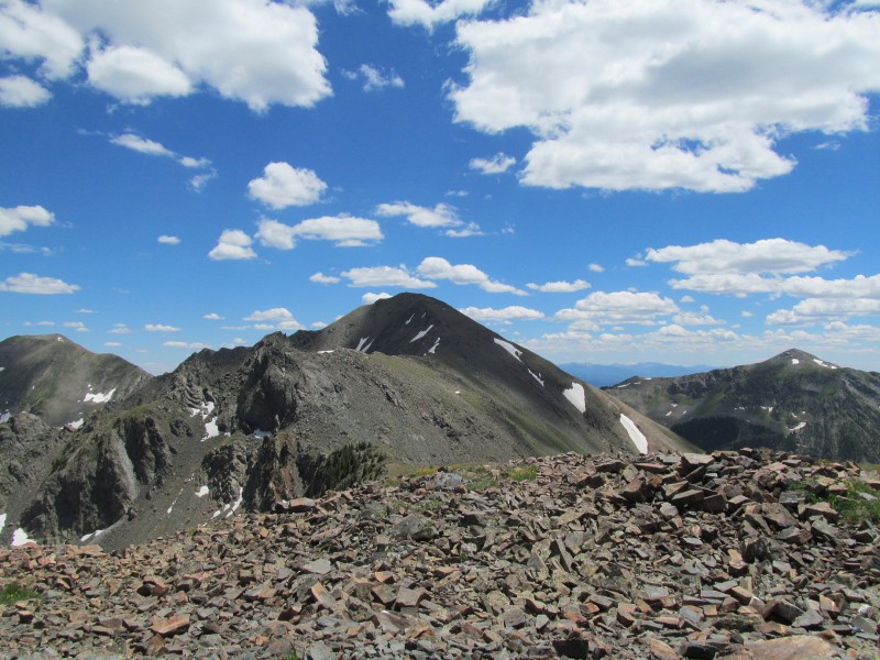 The new lift is not without controversy as locals were disappointed to have their hike-to powder stashes replaced by lift served terrain. I can see why, the terrain from above looked like it would be some great stuff in winter, and I hope to get back to ski it. We followed a flagged route down the face that seems to be the start of a future summer trail which made our descent through the cliff bands and chutes easier to determine. 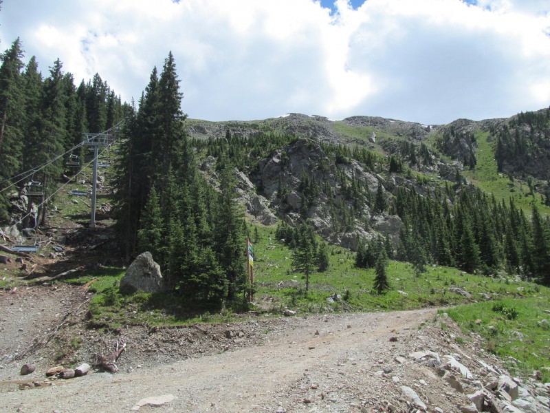 Once at the base of the lift it was just a stroll down the service roads, past a cool waterfall, and back to the project site and my car. Off to town for more delicious New Mexican food (this time at La Cueva, try the Ceviche!) before having to conduct my site walk and meetings on Wednesday. My girlfriend had enough in the tank for one more 12er while I was working, so of course another stop at Taos Cow on our way of town was in order! 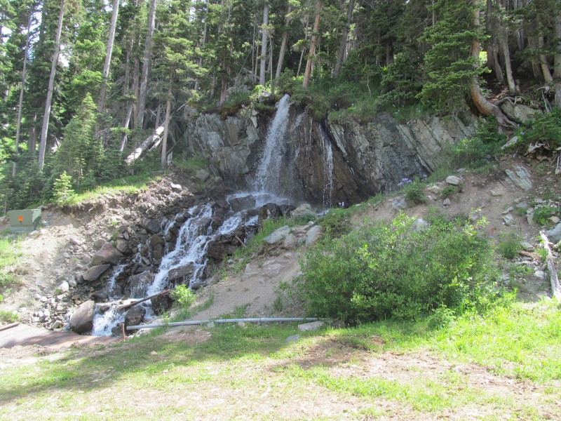 Conclusion It was great to be able to explore these peaks finally, and to become a New Mexico 13er finisher. Admittedly, this is a much easier list than my Colorado ones, but we really enjoyed the trip and the change of scenery. It gave me a new appreciation for the Sangres, and for New Mexican peaks as much of the terrain I had driven through in my past NM visits is very dry and high-desert like. Being in the lush forests and the grass and flower covered ridges was quite nice! The scrambling, a lovely surprise. As for that FKT, well it does stand for "fastest known time", and while we certainly did not set any speed records we might just well have set an FKT by accident anyway? For people curious about such things, we left Santa Barbara trailhead at 3.06 pm on Saturday and got back to the car after Wheeler at 3.49pm on Tuesday. That gives us a trip total of 72 hours and 43 minutes car-to-car. We have no idea if anyone else has done all of these peaks back-to-back like this, but if anyone wants to break our "record", trust me, it would be easy to do! We did have a fairly leisurely weekend that included an extra night before packing out of the Truchas Peaks, and several extra 12ers after all. I think we had less hiking time than we did rest time! With the recent excitement over speed records in Colorado, we just thought it be fun to see what our overall time was just for our own amusement. We look forward to seeing someone crush our "record" soon, if it even is the record at all. Regardless, we really enjoyed our weekend and thought it was an excellent way to spend 4 days before I had to walk the project site. Its pretty cool to be able to look up at Wheeler from the project now and know that I have been up there, makes that Taos Cow ice cream taste even better! Thumbnails for uploaded photos (click to open slideshow):
|
| Comments or Questions | |||||||||||||||||||||
|---|---|---|---|---|---|---|---|---|---|---|---|---|---|---|---|---|---|---|---|---|---|
|
Caution: The information contained in this report may not be accurate and should not be the only resource used in preparation for your climb. Failure to have the necessary experience, physical conditioning, supplies or equipment can result in injury or death. 14ers.com and the author(s) of this report provide no warranties, either express or implied, that the information provided is accurate or reliable. By using the information provided, you agree to indemnify and hold harmless 14ers.com and the report author(s) with respect to any claims and demands against them, including any attorney fees and expenses. Please read the 14ers.com Safety and Disclaimer pages for more information.
Please respect private property: 14ers.com supports the rights of private landowners to determine how and by whom their land will be used. In Colorado, it is your responsibility to determine if land is private and to obtain the appropriate permission before entering the property.


