Download Agreement, Release, and Acknowledgement of Risk:
You (the person requesting this file download) fully understand mountain climbing ("Activity") involves risks and dangers of serious bodily injury, including permanent disability, paralysis, and death ("Risks") and you fully accept and assume all such risks and all responsibility for losses, costs, and damages you incur as a result of your participation in this Activity.
You acknowledge that information in the file you have chosen to download may not be accurate and may contain errors. You agree to assume all risks when using this information and agree to release and discharge 14ers.com, 14ers Inc. and the author(s) of such information (collectively, the "Released Parties").
You hereby discharge the Released Parties from all damages, actions, claims and liabilities of any nature, specifically including, but not limited to, damages, actions, claims and liabilities arising from or related to the negligence of the Released Parties. You further agree to indemnify, hold harmless and defend 14ers.com, 14ers Inc. and each of the other Released Parties from and against any loss, damage, liability and expense, including costs and attorney fees, incurred by 14ers.com, 14ers Inc. or any of the other Released Parties as a result of you using information provided on the 14ers.com or 14ers Inc. websites.
You have read this agreement, fully understand its terms and intend it to be a complete and unconditional release of all liability to the greatest extent allowed by law and agree that if any portion of this agreement is held to be invalid the balance, notwithstanding, shall continue in full force and effect.
By clicking "OK" you agree to these terms. If you DO NOT agree, click "Cancel"...
After climbing Quandry Peak last summer and being surprised at how much more difficult it was than I had been led to believe, I made up my mind to climb fourteeners that were said to be less difficult than Quandry. The plan was to climb, Sherman, Huron, San Luis and Bierstadt, but my parents (who I climb with) heard from friends of theirs that Uncompahgre Peak was "easy" and the trip report videos they watched made the hike seem much less difficult than they had originally believed. So, I agreed to go, and prayed that they were not misled. I am writing this report to warn any person who sees the trip reports that make this peak look like a walk in the park, to not assume that it will be just as "easy" for you. There is no such thing as an easy fourteener, and Uncompahgre Peak is no exception.
Nellie Creek Road:
We camped in our camper towards the bottom of Nellie Creek road, and set out in our Jeep at 5:05am. We weren't on the road long before we picked up two hikers whose car couldn't make it up the 4wd road. (Disclaimer: Nellie Creek road is a complete 4wd road, you need a vehicle with good clearance and 4wd capabilities, or else you will have to hike up. The hike up is a slow 4 miles uphill, and in addition to the late start you will have on the actual trail, you will use so much energy on the hike to the trailhead, it will make the actual 14er hike that much more difficult. ***If you choose to hike up, please know that there are three wide stream crossings, where you will have to take off your boots, or choose wet feet, I suggest bringing along sandals or something for this part.) We continued on for 45 minutes up the 4wd road to the trailhead and started hiking at 6:00 am. This time of day, is almost full daylight and we did not need our headlamps.
The lower trail:
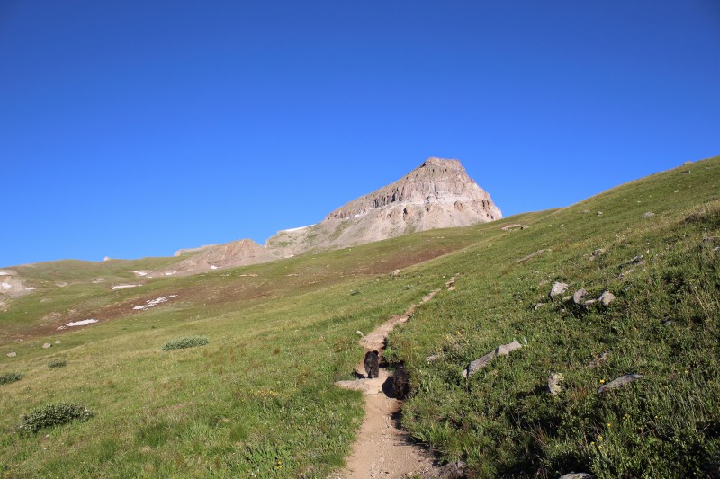
We hiked through the trees on a gentle incline for about a half hour and emerged into the basin where we would continue hiking at a steady but gentle incline for a few miles.
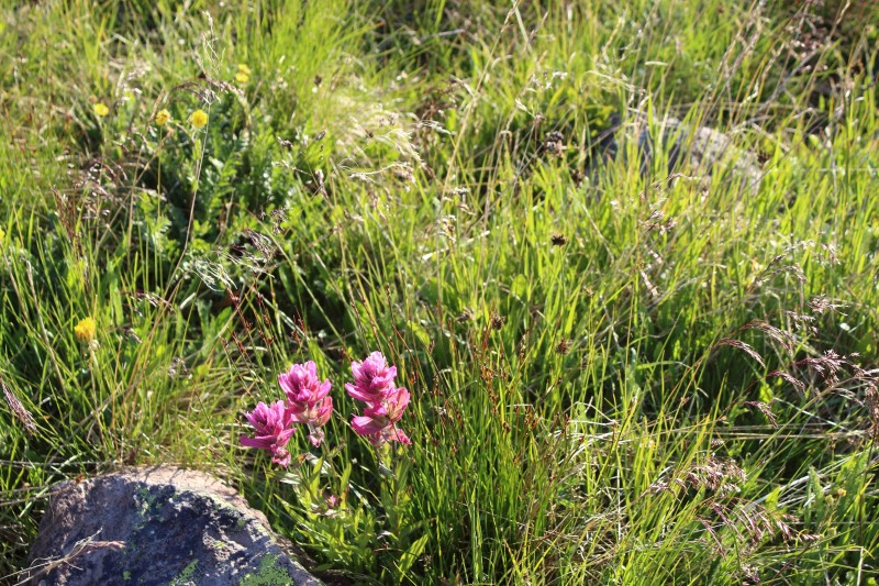
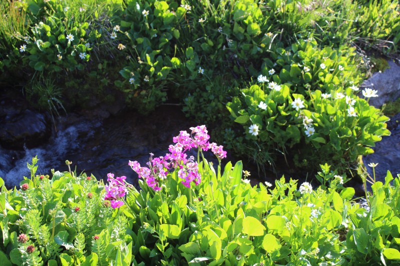
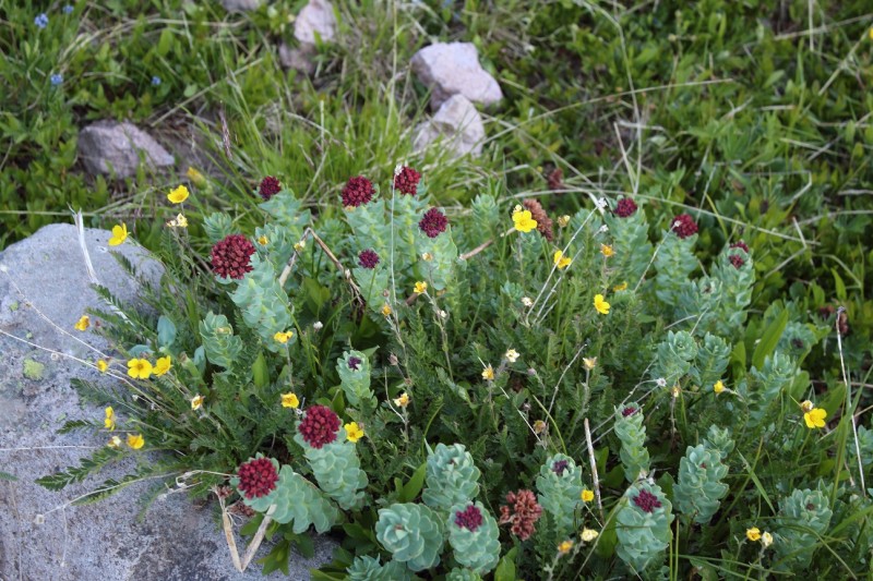
Let me tell you, if you are looking for a beautiful hike with lots of wildflowers, this should be on the top of your list.
(I have never seen more Colorado blue Columbines in my entire life!) We hiked among the columbines, indian and rose paintbrush, bluebells, wild daisies and more throughout the entire hike. I couldn't have asked for a more beautiful abundance of wildflowers and natural beauty on a hike.
The trail itself was perfect and well maintained.
(Shout out to all the trail maintenance volunteers!)
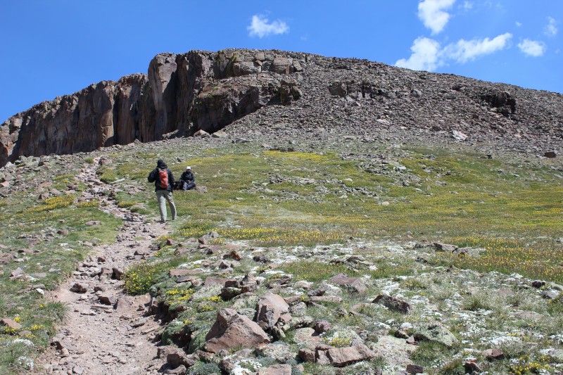
We hiked gradually and slowly up the trail among the green for a couple of hours, the green began to fade and the rocks began to take their place, but the trail stayed steady.
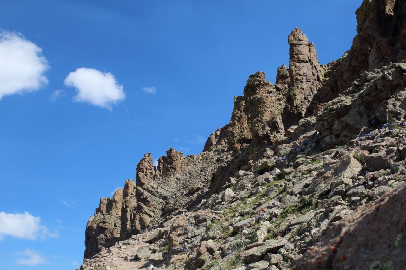
Once we hit the first ridgeline, the wind hit us at the same time that the incline began to really steepen. The fast gusty wind had us make use of all of our extra packed layers, and had us thanking the stability of our trekking poles. After this level part of the first ridgeline the trail steepens and the switchbacks begin.
(At this point I would like to point out that no matter how "smooth sailing" a trail is, elevation is a cruel wench. The trail may be gradual and steady, but when you are hiking up so high in elevation, even a gradual, steady, "easy" trail is difficult.) The rocky switchbacks were steep, and thus it was slow going. We continued up against the wind until we reached the next ridgeline.
The views of the neighboring peaks were stunning.
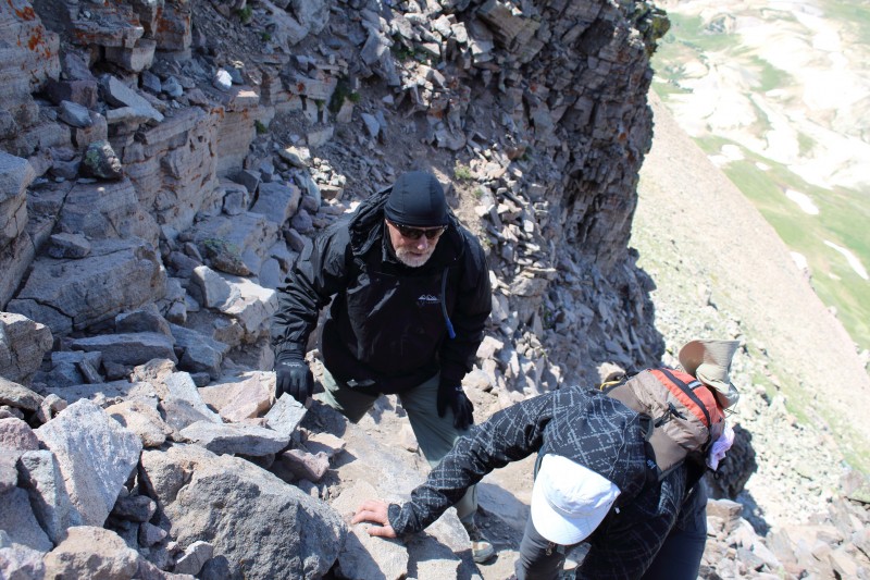
Then we truly begain our ascending scramble.
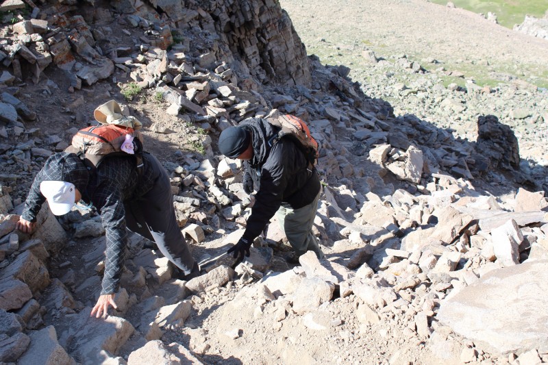
We had to climb up (hand over fist) this steep rocky coulour. ****Dont underestimate this! The rocks are loose in places, and the literal climb up this, can even make the least height fearing person's heart rate quicken (especially in the fierce wind).
After you climb through the coulour, you still have to scramble over some boulders, just follow the cairns and you will do just fine (there isn't much of a trail here).
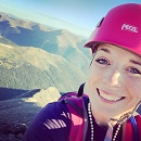
Huge shout out to my mother who looked her lifelong deep fear of heights straight in the eye and climbed up all of this.
After the boulders, the trail becomes a trail again as you trek along the front of the mountain, then it levels off.
(moment to rest before final assent)
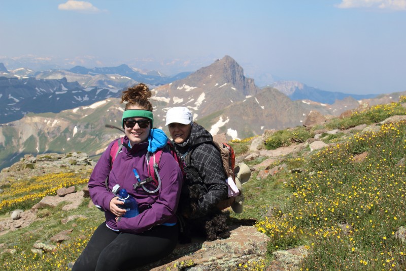
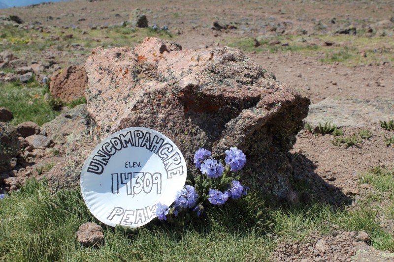
We followed the trail up (less than ¼ mile) to the summit.
We made it to the top in about 5 hours (yes, I know that is a long time) but we still made it!
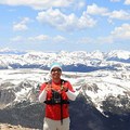
The summit is large, there is a lot of room to explore and take in different vistas. I couldn't get a good exposure/cliff photo because the wind was so gusty. We spent about a half hour on the summit, eating our snacks and resting then headed down.
Things to take away:
-The summit marker is on top of one of the boulders, you wouldn't look for it there because it doesn't seem to be the highest point.
-My GPS watch tracked the ascent to be 5.41 miles and 3,074 feet of elevation gain. Both of those stats disagree with the posted info. I am not saying that it is right, but just a heads up.
-Most everyone we talked with along the trail mentioned that they thought this hike was harder than they were expecting.
-All together there were probably 25 other people hiking the trail.
-The vault toilet at the trailhead is out of commission, with no intention of being fixed.
Thumbnails for uploaded photos (click to open slideshow):
Thanks for such pretty pictures and an eye opening TR. It has happened to alsmost all of when someone told you that a hike was pretty easy but when you went on it, you realized it wasn't as easy as they described it.
I am doing it this coming weekend along with Wetterhorn. I am feeling confident but hey, everyone has got a plan until they get punched in the face ;)
Which GPS watch do you use? I use a Fenix 3 and its altimeter doesn't work as great. It surely tells you the correct distance but not the elevation. Even if I calibrate it at the TH and once at the summit, it still calculates the altitude wrong. I trust my actual GPS more than the watch. Watch mostly just collects the heart rate data and my pace etc.
Thank you so much for posting. Uncompahgre is next on my list...just hoping I can talk my dad into it! It looks very steep and scary at some parts, I have more trouble going DOWN then going up...picture #16 is making me nervous :shock:
Safari-Barbie,
The little colour that you climb up is a bit steep and scary, I am not really afraid of exposure, but with the wind, my heart rate quickened for sure. A huge testament for this climb being manageable is my mother, she is severely afraid of heights, so much so that it has kept her from submitting Sneffles, but she made it up, despite her tears and shaking, she kept her head down and focused on the terrain directly in front of her, and it worked! You should be fine, this bit of rough stuff doesnt last all that long anyway.
Good luck!!!
Caution: The information contained in this report may not be accurate and should not be the only resource used in preparation for your climb. Failure to have the necessary experience, physical conditioning, supplies or equipment can result in injury or death. 14ers.com and the author(s) of this report provide no warranties, either express or implied, that the information provided is accurate or reliable. By using the information provided, you agree to indemnify and hold harmless 14ers.com and the report author(s) with respect to any claims and demands against them, including any attorney fees and expenses. Please read the 14ers.com Safety and Disclaimer pages for more information.
Please respect private property: 14ers.com supports the rights of private landowners to determine how and by whom their land will be used. In Colorado, it is your responsibility to determine if land is private and to obtain the appropriate permission before entering the property.


")
")
")
")
")
")
")
")
")
")
")
")
")
")
")
")
")
")
")
")
")
")
")
")
")