Download Agreement, Release, and Acknowledgement of Risk:
You (the person requesting this file download) fully understand mountain climbing ("Activity") involves risks and dangers of serious bodily injury, including permanent disability, paralysis, and death ("Risks") and you fully accept and assume all such risks and all responsibility for losses, costs, and damages you incur as a result of your participation in this Activity.
You acknowledge that information in the file you have chosen to download may not be accurate and may contain errors. You agree to assume all risks when using this information and agree to release and discharge 14ers.com, 14ers Inc. and the author(s) of such information (collectively, the "Released Parties").
You hereby discharge the Released Parties from all damages, actions, claims and liabilities of any nature, specifically including, but not limited to, damages, actions, claims and liabilities arising from or related to the negligence of the Released Parties. You further agree to indemnify, hold harmless and defend 14ers.com, 14ers Inc. and each of the other Released Parties from and against any loss, damage, liability and expense, including costs and attorney fees, incurred by 14ers.com, 14ers Inc. or any of the other Released Parties as a result of you using information provided on the 14ers.com or 14ers Inc. websites.
You have read this agreement, fully understand its terms and intend it to be a complete and unconditional release of all liability to the greatest extent allowed by law and agree that if any portion of this agreement is held to be invalid the balance, notwithstanding, shall continue in full force and effect.
By clicking "OK" you agree to these terms. If you DO NOT agree, click "Cancel"...
With a journey out to Grand Junction for a week of work coming up I was able to persuade my friend to leave the Friday before and make a sweeping loop to snag 2 peaks down in the San Juans before heading to GJ. We planned on doing Wetterhorn on Saturday and follow it up with Uncompahgre on Sunday. I didn't really feel like putting the extra miles on my Jeep so we decided to rent an SUV. The two 4-wheel drive roads to the two trailheads are actually pretty rough so we chose the category "4-Runner or similar"...they stuck us with a Hundai Sante Fe...absolutely no resemblance of a 4-Runner. This thing had the lowest clearance possible for these roads, we passed a Jeep Wrangler about a mile into the road for Uncompahgre and he just looked at me and asked dryly "you sure you want to do this?". But we made it without any issue...take that Wrangler guy!
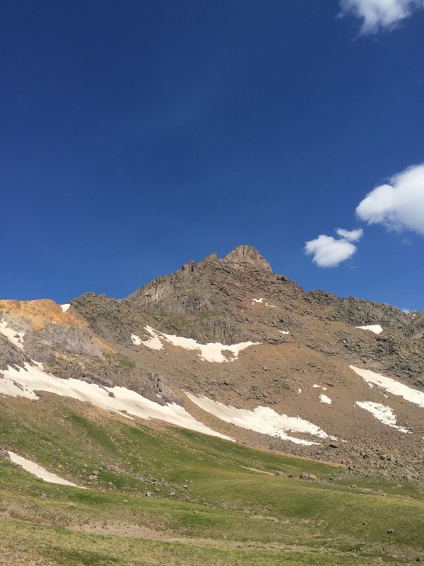
We awoke and hit the trail on Saturday a few minutes past 6, with the lower mileage and elevation gain there was no reason to make a pre-sunrise start. There is a really nice trail that leads you all the way up to Wetterhorn's Southeast ridge. It splits twice from two other trails without a sign specifically saying "Wetterhorn" so you just have to know the route. Once you reach the ridge you tackle a steeper dirt trail before hopping on rock for the rest of the hike. First full views of Wetterhorn
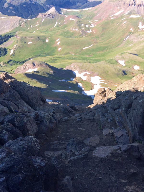
When you reach the first section you need to either get over or go under and around a rock rib before going up the farthest gully. You can see where you need to go the whole time so you can pick whatever line you feel fit. The easiest route is to descend slightly and go under the rib or you can go up and over the rib with some Class 3 and maybe a low Class 4 move, the mountain is your canvas so paint your own route. Looking down the first gully
Once you reach the top of the gully you run into the two notchs and you can see the summit.
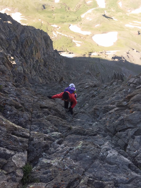
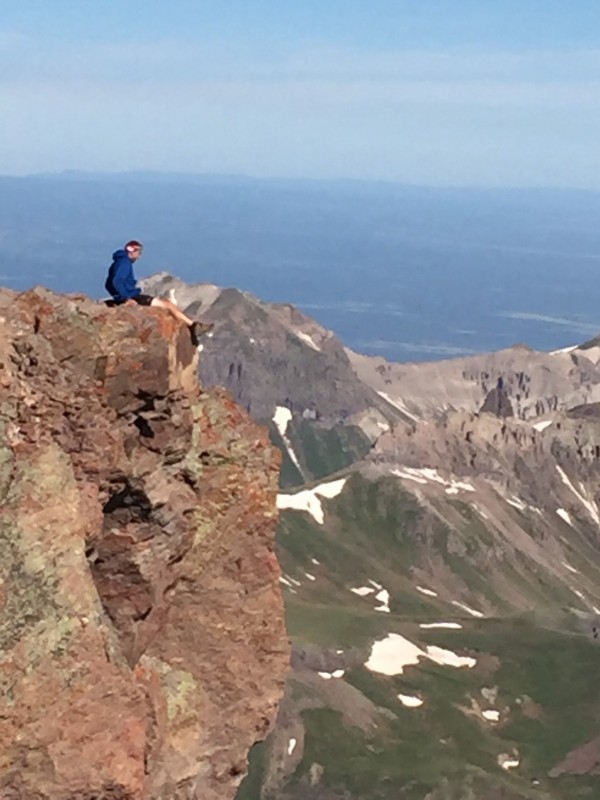
Like the route description says take the farthest right notch and descend a flat rock to where you will start the final summit pitch. This was the first Class 3 and definitely the most exposed route that my friend had ever done and she made it without too much of a problem! The rock is super solid and really fun with no tricky moves, I would give it low Class 3 with the exposure being the thing that gives people the most trouble. Like I told her, confidence and patience are key to learning how to climb harder terrain. There is a flat ledge towards the top that you can take a quick break on or you can just bomb it to the top. There is a little less opportunity to make your own line like the previous section but you can get a little creative if you feel like it. Coming up the exposed Class 3 summit pitch
Once up this face, the landscape opens up to a great summit view of Matterhorn and Uncompahgre to the East and Sneffels to the West. Matterhorn in the foreground with Uncompahgre center back
Like all climbing, especially exposed climbing, going down is the more mentally challenging portion but all the foot and hand holds are solid and I only had to front face on a section or two. Overall this mountain is pretty cool and gives you some fun climbing without making you walk a marathon to get there. The snow climb up the face looks like a great challenge in the future!
We grabbed some food in Lake City, I would recommend trying Climb Elevated Eatery, it was pretty solid! After that we hopped back in the car and made our way to Uncompahgre where we head a run in with the Wrangler guy and took a freaking Sante Fe across a few stream crossings...should put that in their next commercial. There are some great camping spots closer to the trailhead with access to the creek for a nice ice bath. Similar to Wetterhorn, if you can make it up the 4-wheel drive roads both of these mountains offer a low mileage and elevation gain route option. Without the Class 3 section to worry about we slept in and hopped on the trail a little before 7.
There is nicely maintained trail that will take you all the way to the small Class 2 scrambling section. Unlike Wetterhorn, you can see Uncompahgre's massive summit the whole way and any trail split offs are specifically marked. Pretty much the whole route up Uncompahgre
It's a straight forward approach that also gives you a view of Point 13,158, which looks like it could offer some exciting terrain if you take the saddle between it and Uncompahgre. Point 13,158 from the saddle of Uncompahgre
Once you switchback on the East face you will switch over to the West side and take some Class 2 or easy Class 3 (do what pleases you) scrambling to the easy final summit stretch. Coming down the Class 2+ on Uncompahgre
The views from this summit are pretty awesome and it gives you a little bit more respect for Wetterhorn as the summit portion looks gnarly. If you want to venture over to the North side of the summit the look down will surely make your stomach squirm and up your anxiety level! Slightly exposed summit setting
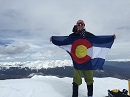
The descent down is just as straightforward as the ascent and with a good pace you can add this summit to your list within 4 hours of leaving the trailhead. 37 down, 21 to go!
Thumbnails for uploaded photos (click to open slideshow):
Thanks for the report and the pics! I am considering these two peaks this week and was curious about the road to the THs. Sounds like my 4WD Tacoma should be fine. Although I heard there were some tight/scary spots and I am not a world-class 4WD guy--true? Or not? Thanks, again and good luck on the rest of your climbs, Psemin42!
Oh yeah you should be fine coming up with your Tacoma, the road is rough but you can maeuever around most of the difficult sections! Best advice would be to try and head up later in the afternoon/evening in order to minimize the chance of running into someone else on the road coming down, there are not very many safe places to make passes. But these two peaks are definitely worth the stress of driving up to them! Have a good one
I'm heading down this weekend to check these two off...my 2012 Liberty with ATs should have no problem...sounds like some fun hiking! Congrats!
Caution: The information contained in this report may not be accurate and should not be the only resource used in preparation for your climb. Failure to have the necessary experience, physical conditioning, supplies or equipment can result in injury or death. 14ers.com and the author(s) of this report provide no warranties, either express or implied, that the information provided is accurate or reliable. By using the information provided, you agree to indemnify and hold harmless 14ers.com and the report author(s) with respect to any claims and demands against them, including any attorney fees and expenses. Please read the 14ers.com Safety and Disclaimer pages for more information.
Please respect private property: 14ers.com supports the rights of private landowners to determine how and by whom their land will be used. In Colorado, it is your responsibility to determine if land is private and to obtain the appropriate permission before entering the property.

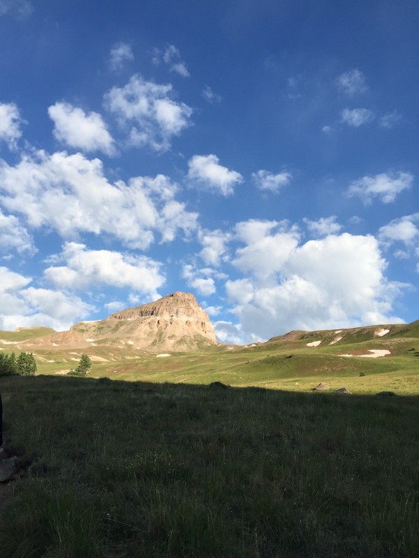

 Sun coming up in the valley on the way to Wetterhorn")
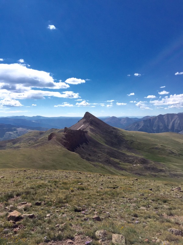
 Peak picture on Wetterhorn...36th summit")