| Report Type | Full |
| Peak(s) |
Hagerman Peak - 13,848 feet |
| Date Posted | 07/12/2016 |
| Date Climbed | 07/09/2016 |
| Author | Jon Frohlich |
| Additional Members | eskermo |
| Some 4wd roads, a dog, a lake, and one fine Elk |
|---|
|
7/9/16 ~12 miles, 4600 feet Start: 6:00am Summit: 10:45am End: 2:00pm Partner: Maya and Nick (this is better viewed with large photos) It's been tough to get down to the San Juans the last few years so I've been working on my remaining centennials elsewhere instead. After Thunder all that was left was Hagerman. Unfortunately that meant driving to Lead King Basin. I'd never heard anything good about the roads to get there and now I'd get to find out for myself. I put out a call for partners and Nick was up for going so we met up after work Friday night for the drive. I'd volunteered my lifted 4Runner for the task but I still was not looking forward to this. The drive out went smoothly for once all the way to Marble. Unfortunately as we reached Marble it was almost 9pm and getting dark. As we left town I had to make a decision. Which road did I want to drive in the dark? Well, neither obviously. Still have to make a decision I suppose. Or camp near Marble and drive early in the morning. Also not great. We ended up deciding on the road to Crystal instead of the high road. In theory at least it seemed like a safer bet. In reality driving the Crystal road in the dark is scary. It's narrow and rough. There are drop offs I could sort of vaguely see. Thankfully except for one car early on no one met us coming the other way from Crystal. Maybe no one else is dumb enough to drive this road at night. We eventually made it to Crystal and decided to see if we could make it all the way to Lead King Basin. Again, maybe not the best idea. We found the turnoff and I started grinding my way up higher on the road. Also narrow, also rough. Also fairly disconcerting in the dark. Finally after about a mile we saw a nice campsite on our right. I didn't know for sure how far we were to the trailhead but we assumed close. Good enough. I was done for the night. Nick set up his tent and Maya and I crashed in the back of the truck. 5am the next morning we all got up and got ready. We packed back up and I drove us the remaining 1/4 mile or so to the trailhead. It had turned out we were close but I was still glad we hadn't kept going. We set off from the car at 6am sharp and started making our way up the steep trail to Geneva Lake. The waterfall coming off the lake was beautiful and so far the day was spectacular. We reached Geneva Lake in about an hour and decided to try and cross the stream below the lake instead of above it. We found the log jam described in some trip reports but it wasn't completely continuous across the stream. I tried to jump it and didn't quite make it and ended up with a soaked boot for my trouble. Nick more wisely took his boots off and went across while I squeezed water out of my sock. Maya had no trouble and thought we were both being dramatic. The path after the stream crossing on the edge of the lake was a bit hard to follow with some downed trees and slick mud but we made it to the trail heading to Trail Rider pass in reasonable time and started our trek away from the lake towards Hagerman. The trail leading to the valley below Hagerman was really nice and we took a short break at a outcrop with a gorgeous view. 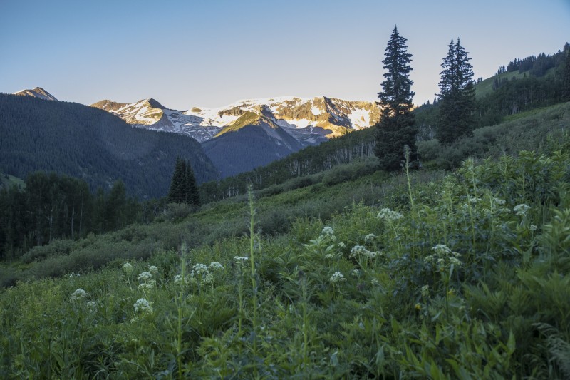 Heading out from the trailhead  Waterfall off Geneva Lake  Outlet stream from Geneva Lake 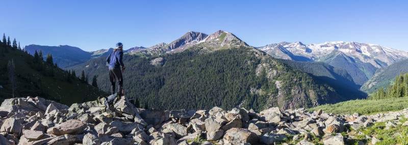 Rest spot 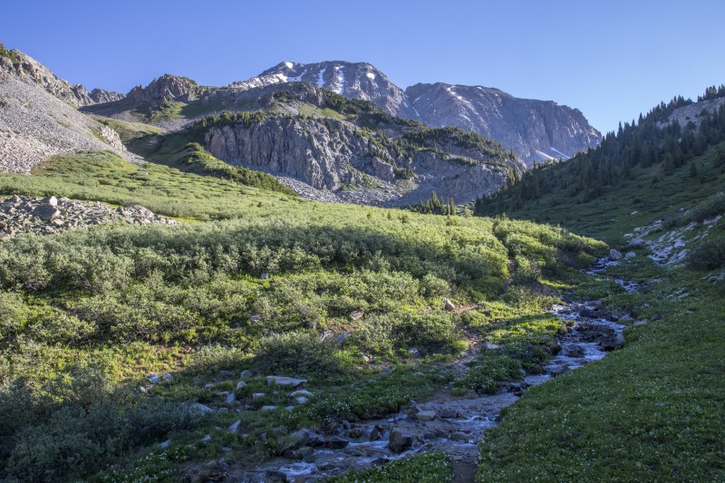 Looking up towards Hagerman from the trail junction 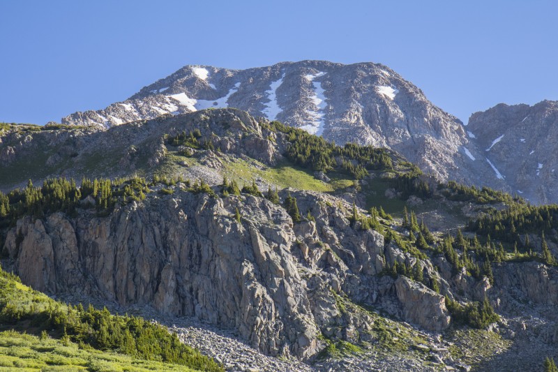 Closer look 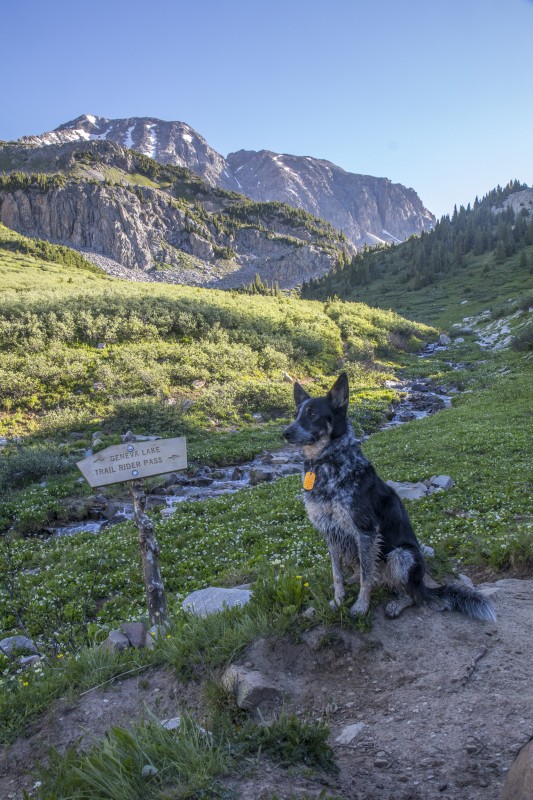 Maya makes sure the trail sign isn't going anywhere We had a quick debate about which way to use to gain the upper slopes of Hagerman. We eventually decided on the first gully we could see figuring that even though it wasn't where Roach said to go that it would still work just fine. Even better our chosen route had almost no willows to deal with once we left the trail. We gradually gained elevation up the grass until a little over 12,000 feet where we had another decision to make. Nick had talked about wanting to try the ridge on our way up instead of the south face. I was skeptical of whether the ridge was something Maya could handle. Eventually we compromised a bit. We headed farther up towards the south slopes of Hagerman before heading left towards the ridge. I figured this way if I thought it was too hard as we got closer that Maya and I could still head for the face without losing too much time. As we got closer I decided it was worth a shot so about 13,000 feet we wound our way up to the ridge and contemplated the remaining route. 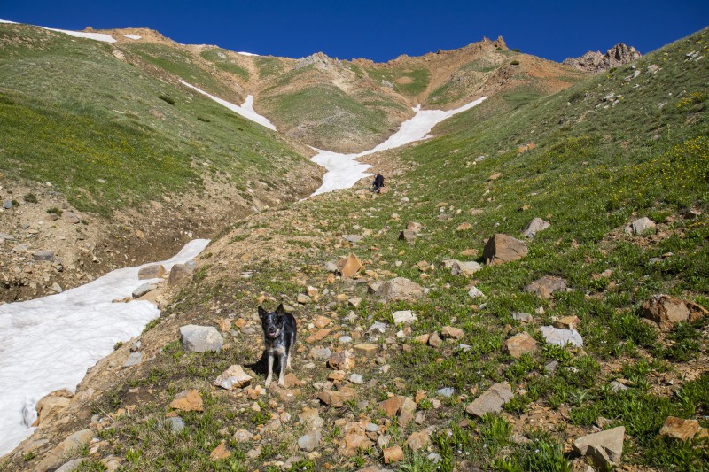 Up the grass 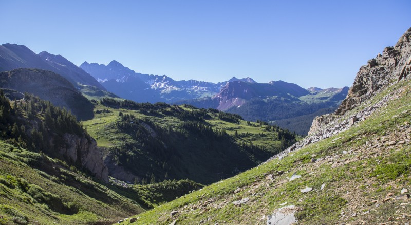 View opening up towards the Bells 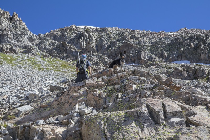 Heading into the upper slopes. Maya waiting for dad. 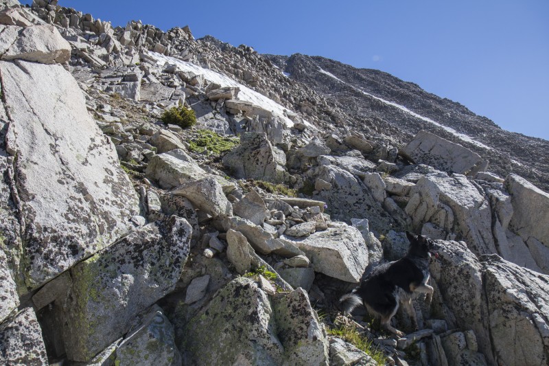 Maya makes a move 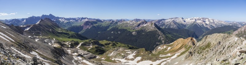 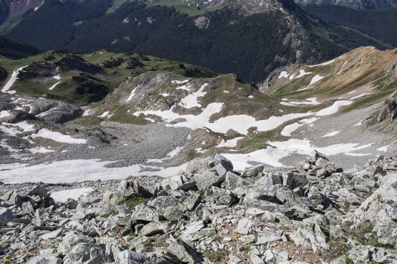 Looking down from near where we gained the ridge Nick led the way and Maya and I followed behind. The rock was mostly solid which was good. Nick took quite a few direct lines up the ridge while I took time scouting around for routes that worked for Maya. A few times I had to coax her around or over an obstacle. I think I lifted her up something twice. A couple of times I got 20 or 30 feet ahead and had to go back down to show her the way. Nick was patient and didn't get too far ahead while we worked through it one move at a time. This was definitely some solid Class 3 with some Class 4 throw in for good measure. The weather was absolutely perfect and there was no rush. Eventually as we got within about 200 feet of the summit the difficulty eased up a bit and we were able to make better time. Nick reached the summit a few minutes before us around 10:40am. We all hung out on the summit enjoying one of the nicest weather days I've ever had on a summit. We watched some people ascending and descending Snowmass across from us and enjoyed the amazing view. 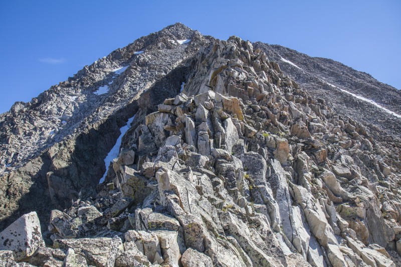 Looking up the ridge 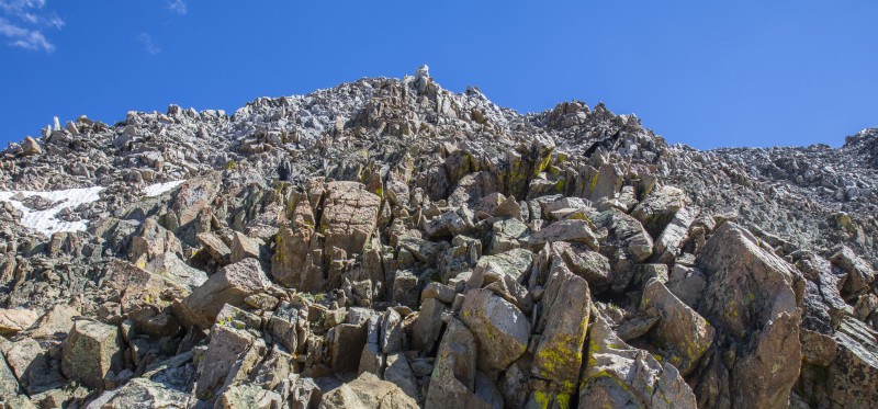 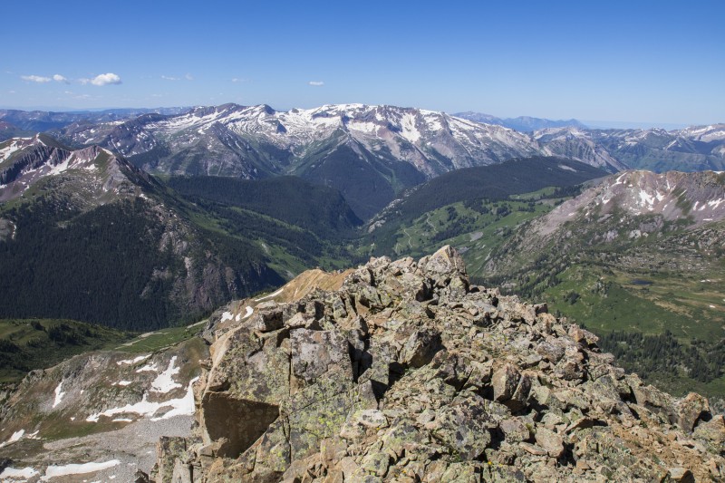 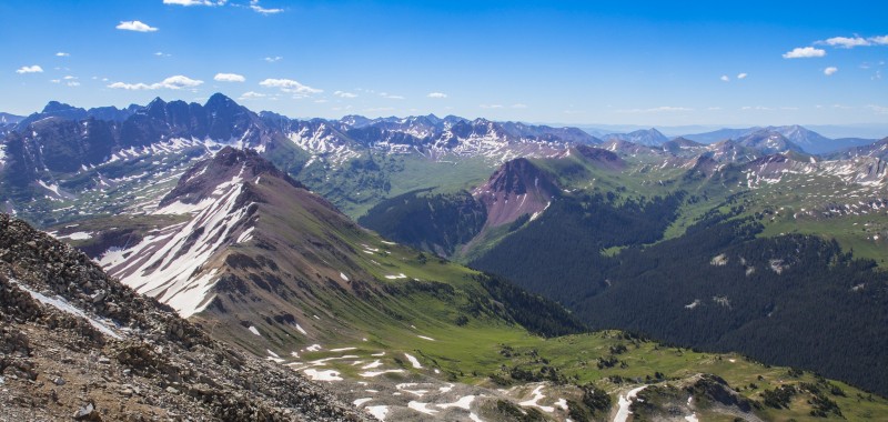 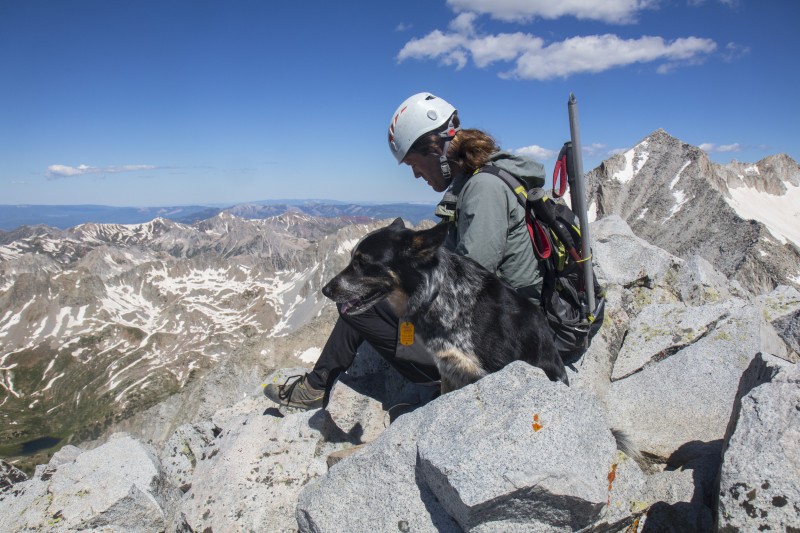 Nick and Maya on the summit 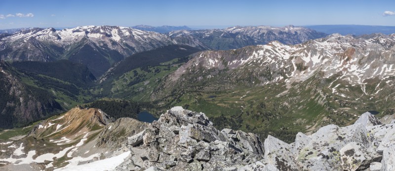 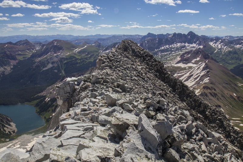 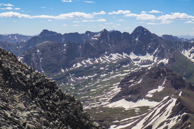 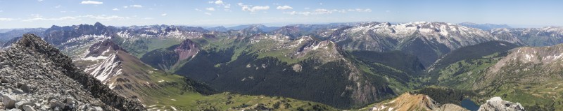 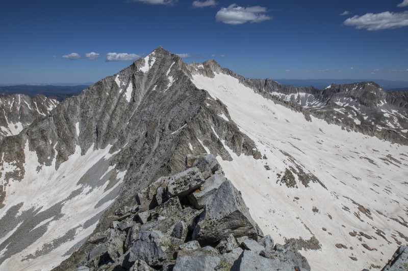 Snowmass across from us 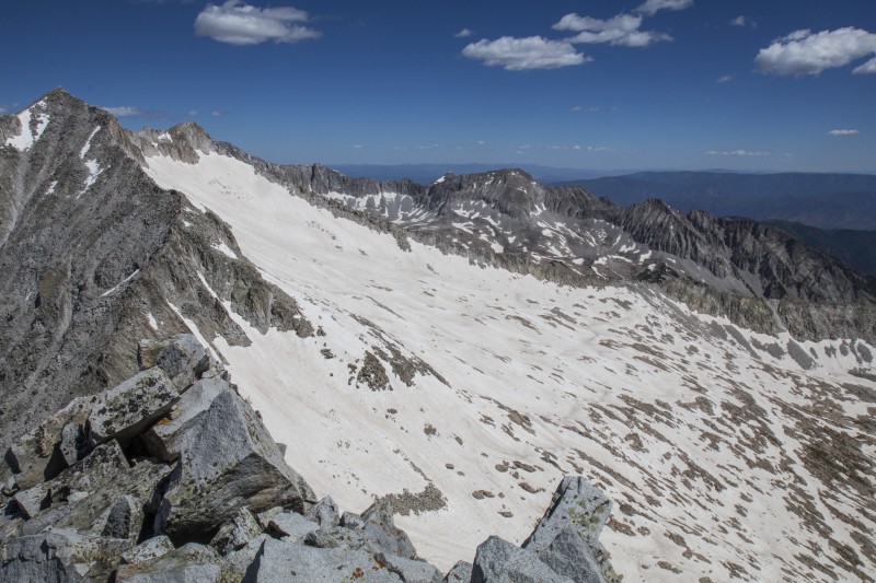 People on the snowfield if you look closely 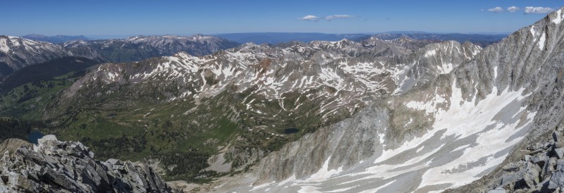 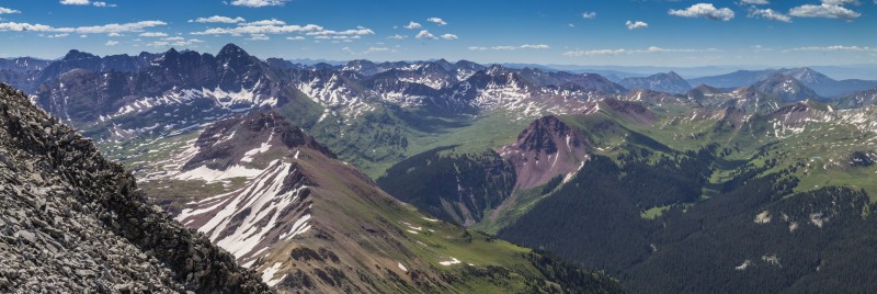 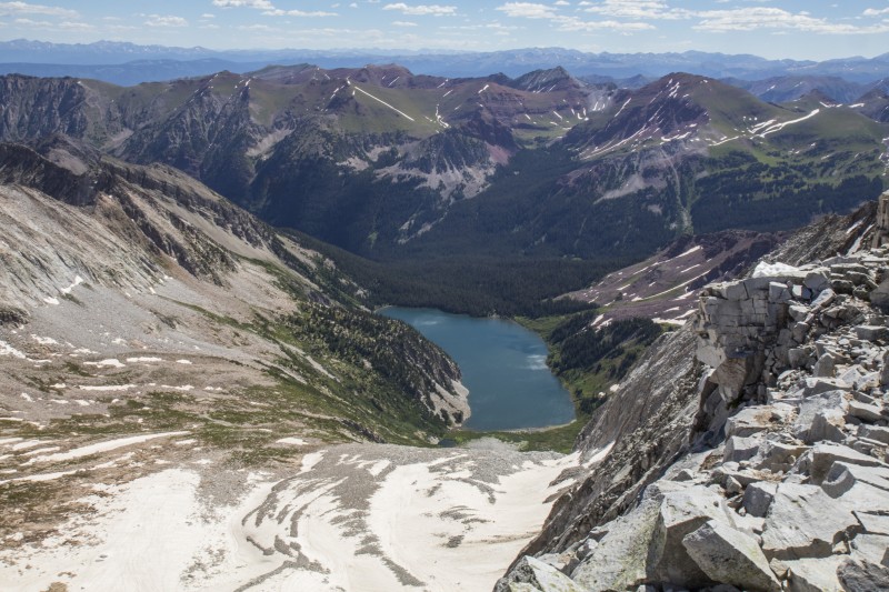 Snowmass Lake  Maya on the summit  Eventually we had to decide on a way down. The ridge seemed like a poor choice to descend so we decided to head down the face instead. Maybe the ridge would have been better after all because it quickly turned out that the upper part of the face was extremely loose. Nick and I decided to take separate gullies for safety but after Nick accidentally let loose a fairly good sized rockfall he decided his gully was a bad plan and joined us on our side. We all 3 carefully and slowly made our way down. Maya decided to try some glissading, quickly changed her mind, and joined us back on the rock. As we got lower the angle eased up and the terrain got a bit easier. I'd still say the south face is definitely somewhere you want to be very careful. It would also be much better as a snow climb. 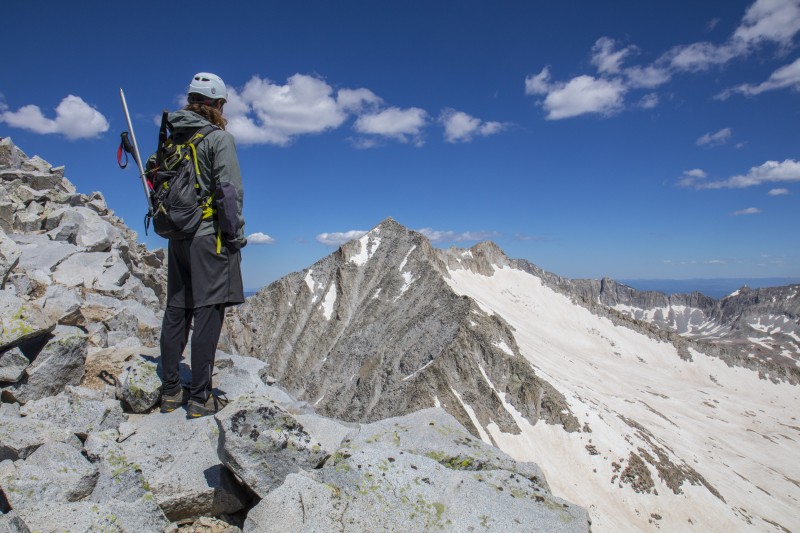 Nick as we started our descent 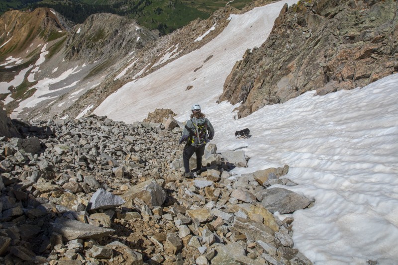 Heading down the scree 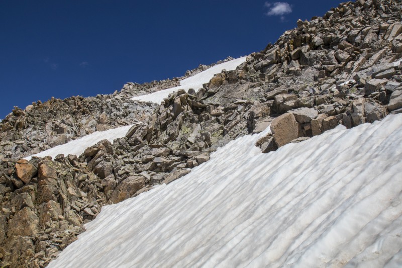 Back up towards the summit 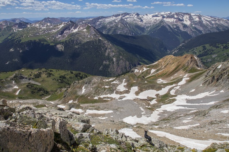 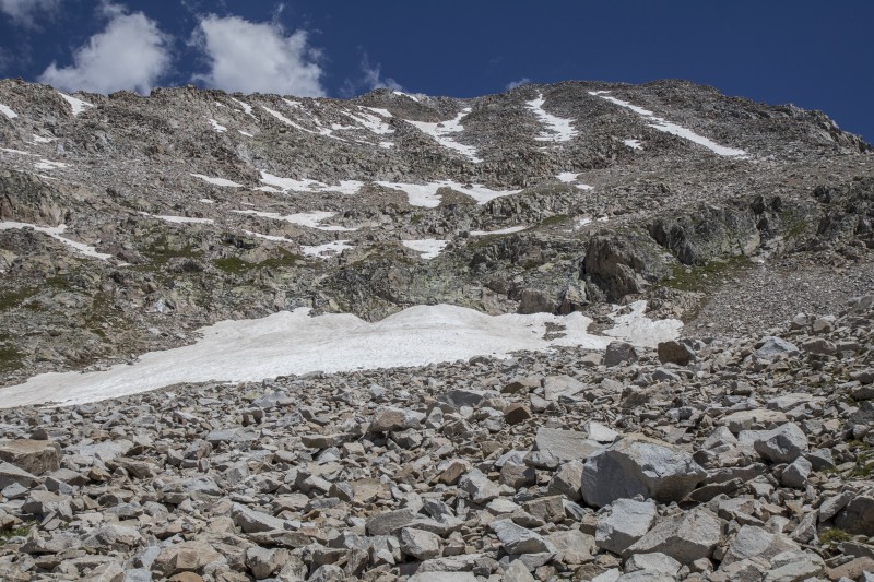 Southwest face from below We scree surfed and hiked back to the small basin around 12,400 feet and took a nice break in the grass. Nick decided to try the Roach gully for our descent and we followed him down. It went mostly fine except at the very end where it got narrow and we had to negotiate some willows and jump back and forth across the creek a few times. Eventually our descent put us right back at the trail junction where we'd left the trail that morning. We regrouped and started the long hike back to Geneva Lake and the car. Now that I got to see Geneva Lake and the valley in full daylight it was even more spectacular. I'd love to come back here to camp or just dayhike. It felt like a very special place. On the way out we chose the stream crossing above the lake which turned out to much easier than our crossing that morning. 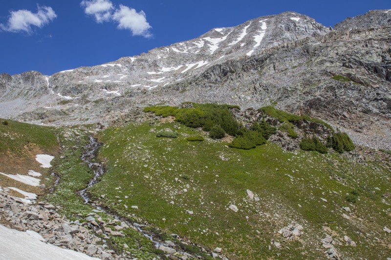 One last shot of Hagerman 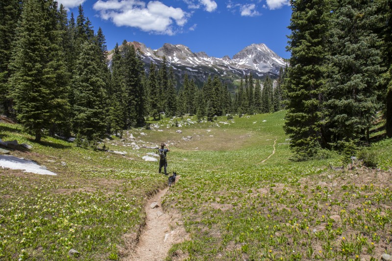 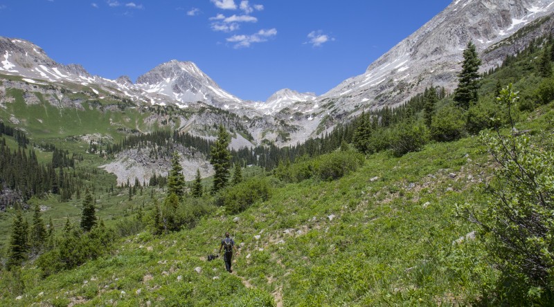 Amazing view 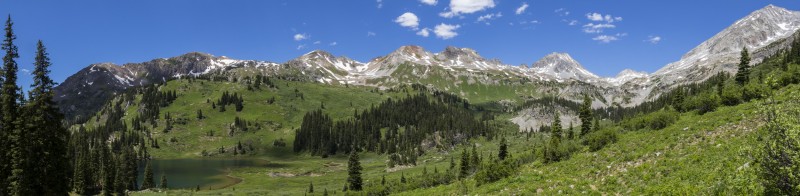 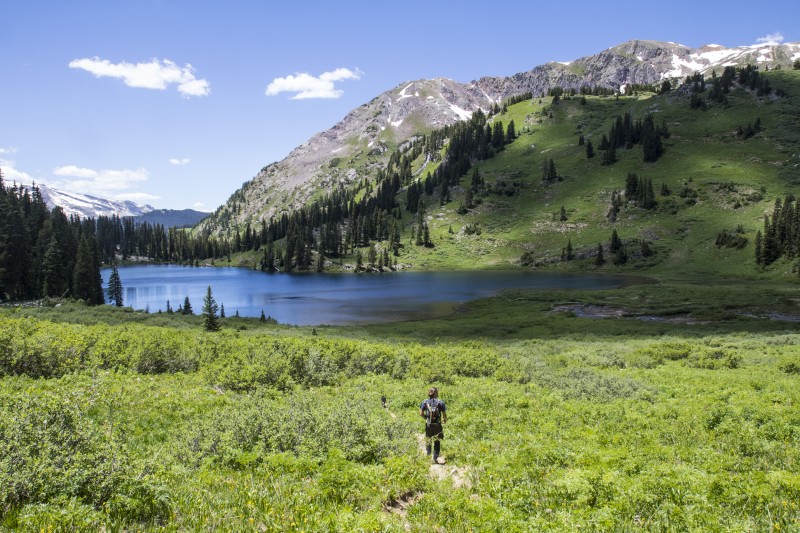 Geneva Lake 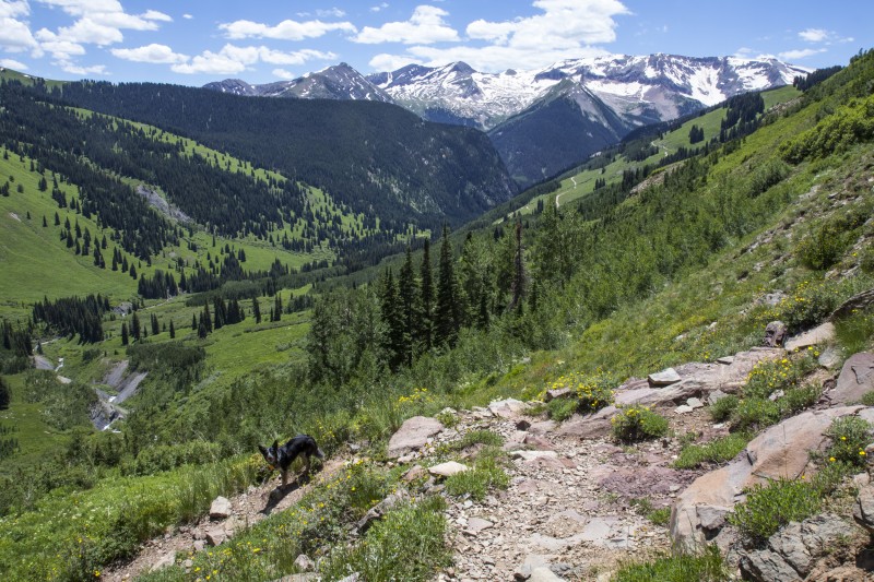 Closing in on the car We got to the car right at 2pm and each cracked open a beer to celebrate our successful day. Maya did not have a beer. After some relaxation time we got back in the car and decided to drive out the upper road. We'd met someone on the hike out that had come that way and said it was fine. The first few miles went just fine. The road is crazy and I can easily see how driving it wet would be terrifying but dry it wasn't too bad. Unfortunately about 2 miles from Marble we ran into the slowest group of 4wd drivers that I may have ever seen. There were all driving 1950's vintage Jeeps and going down the road at a pace so slow I probably could have walked faster. Eventually we got irritated with them, then they got irritated with us, and after some yelling back and forth they finally decided that maybe letting us go by was ok after all. Really it was only the rear vehicle that was being difficult. The others were very courteous and let us by quickly. At least driving the roads at night there's no other traffic to worry about. An amazing way to finish out the Elks. Now to find time for the San Juans..... Thumbnails for uploaded photos (click to open slideshow):
|
| Comments or Questions | ||||||||||||||||||
|---|---|---|---|---|---|---|---|---|---|---|---|---|---|---|---|---|---|---|
|
Caution: The information contained in this report may not be accurate and should not be the only resource used in preparation for your climb. Failure to have the necessary experience, physical conditioning, supplies or equipment can result in injury or death. 14ers.com and the author(s) of this report provide no warranties, either express or implied, that the information provided is accurate or reliable. By using the information provided, you agree to indemnify and hold harmless 14ers.com and the report author(s) with respect to any claims and demands against them, including any attorney fees and expenses. Please read the 14ers.com Safety and Disclaimer pages for more information.
Please respect private property: 14ers.com supports the rights of private landowners to determine how and by whom their land will be used. In Colorado, it is your responsibility to determine if land is private and to obtain the appropriate permission before entering the property.