Download Agreement, Release, and Acknowledgement of Risk:
You (the person requesting this file download) fully understand mountain climbing ("Activity") involves risks and dangers of serious bodily injury, including permanent disability, paralysis, and death ("Risks") and you fully accept and assume all such risks and all responsibility for losses, costs, and damages you incur as a result of your participation in this Activity.
You acknowledge that information in the file you have chosen to download may not be accurate and may contain errors. You agree to assume all risks when using this information and agree to release and discharge 14ers.com, 14ers Inc. and the author(s) of such information (collectively, the "Released Parties").
You hereby discharge the Released Parties from all damages, actions, claims and liabilities of any nature, specifically including, but not limited to, damages, actions, claims and liabilities arising from or related to the negligence of the Released Parties. You further agree to indemnify, hold harmless and defend 14ers.com, 14ers Inc. and each of the other Released Parties from and against any loss, damage, liability and expense, including costs and attorney fees, incurred by 14ers.com, 14ers Inc. or any of the other Released Parties as a result of you using information provided on the 14ers.com or 14ers Inc. websites.
You have read this agreement, fully understand its terms and intend it to be a complete and unconditional release of all liability to the greatest extent allowed by law and agree that if any portion of this agreement is held to be invalid the balance, notwithstanding, shall continue in full force and effect.
By clicking "OK" you agree to these terms. If you DO NOT agree, click "Cancel"...
Disclaimer: No one was raped or molested by goats and no marmots were harmed in the making of this story -- much to the disappointment of some.
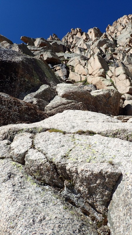
Boulder Problems
Friday, July 2nd - Thursday, July 7th Crew: Ricky (rijaca), Greg (highpilgrim), Mark Burgus, and Darin Peaks (in order they were hiked or climbed):
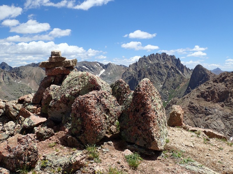
Jagged Mtn (13,824')
Pk Twelve (13,140')
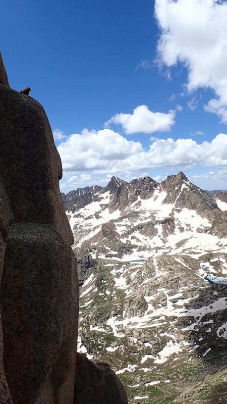
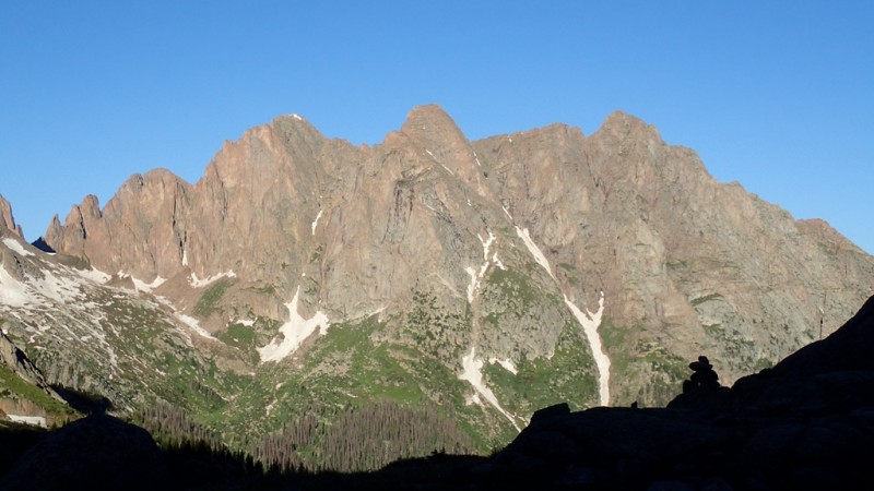
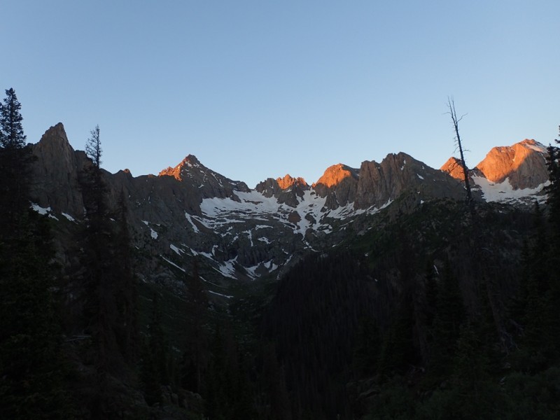
Knife Point (13,265') San Juan Mountains - The Needle Mountains
in The Weminuche Wilderness
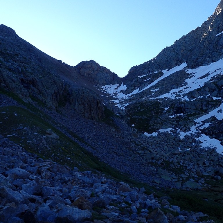
From Jagged Pass
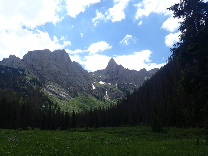
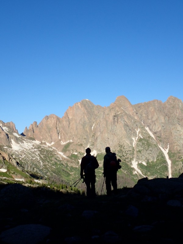
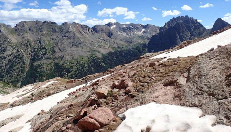
Pk Twelve - A Sleeper Among Giants
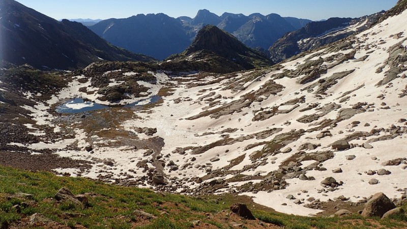
Daily view from our camp, with Knife Point on far right
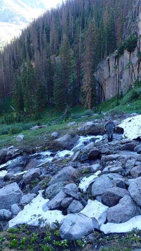
Trail Head: Needleton train stop Approach: Noname Creek trail
Note: The section of trail that parallels the Animas River is the same start as one would use to approach either Ruby or N Pigeon trails. However, once you come to the "camper's meadow" the Noname approach trail splits off (W side of meadow, or if going in - it will be on your left) and is marked on the treed edge of the meadow with a cairn and a downed tree. We found this on our return to Needleton. On our approach, we walked too far through the meadow and bush-wacked back to the Noname approach trail -- which was not a problem.
Miles & Vertical Gain for Approach to Noname camp: ~7mi's w/~2500' gain
Mark crossing Noname Creek before it dumps into the Animas River
Gear: typical multi-night backpack kits w/shared stove & water purification systems; small packs for use on day trips from camp; harnesses w/locker & ATC's; helmets; two 30m/8.5mm ropes; webbing w/leaver biner & rap ring; a few alpine draws & a few BD cams (finger size); ice axe & crampons (didn't use crampons)
Note: At the time of our trip, the three rap stations we saw and used had at least one new looking piece of webbing (red) and appeared to be in good condition. We used them. Did not fail!!
Resources Used for Trip Planning: 14ers.com; Dave Cooper's, Colorado Scrambles guidebook; Natalie's (snowalien) trip report from same time of year (in 2014) to gauge possible snow conditions; NOAA forecast
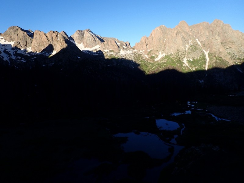
We had 4 absolute bluebird days
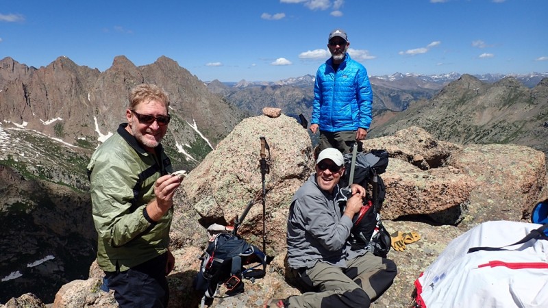
The Crew. Take notice the skull of a vile, thieving marmot!
Introduction
All work and no play. That's what (my) life feels like sometimes.
For those of us that are still part of the American workforce, no matter how long it's been since the last mountain adventure, work time gets in the way of play time. But it's ironic that while at work the thoughts of "play time" are always on the mind! Give it to the man.
Thankfully a wise man (or woman?) came up with the idea of vacation!!
Late March has me texting Ricky to ask about his 4th of July plans. He didn't have any, "yet."
I had a solution.
The few months go by and the time had nearly arrived for the trip. Weeks prior to the start of the trip, the four of us exchanged emails with lists of peaks and possibilities. As Mark said, "I can get big ideas while in the comfort of my living room." However, an idea is synonymous with suggestion, which is merely for consideration (and of course, dreaming).
We (or I) had a list of peaks to be hopeful for, but Jagged was the primary goal. Anything beyond that is "gravy." In the 'rough' plans was also the thought of moving camp mid-way through the trip to Ruby Basin so we could attempt the Animas group. Dreaming, always dreaming....
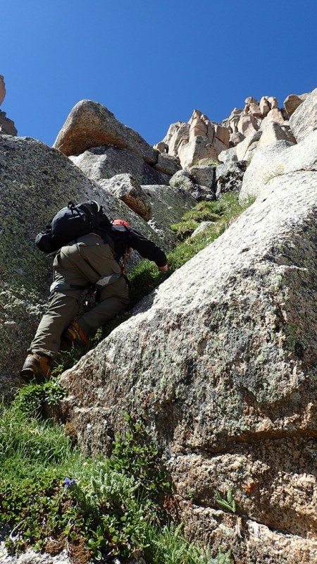
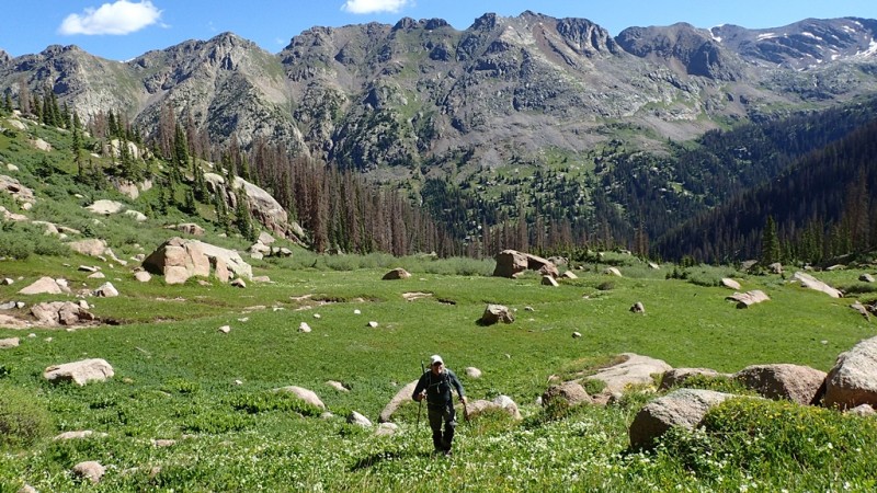
Day 1: The Approach to Noname Camp
The day prior to our train departure was a wet one, therefore soaking all vegetation on the approach. There was also sporadic light rain showers on our approach. Getting off the train at Needleton at ~11:30am with ~7 miles & ~2500' of gain ahead of us to "soak" it all in put a damper on the prospect of hiking peaks the next day. Not to mention the overloaded packs telling our bodies a rest day might not be a bad thing!
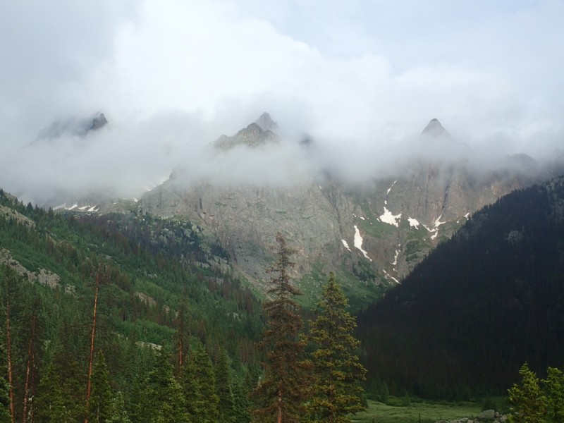
Lingering clouds obscuring the skyline
I got into camp first (~50yds beyond the Jagged cabin) and I was soaked through, so I quickly changed into dry clothes and set up my camp. As I did so, I took out my SPOT and sent an 'ok' message. I finished setting up my tent and hung my food & pack then hiked down the trail to meet up with the others.
A few minutes down the trail I met Ricky & Greg so we turned back together and went to our camp.
Mark would show up a little later.
We didn't make any definitive plans for the next day before going to bed, but that was ok.
Day 2: Recon Upper Noname
We all slept in a little the next morning -- none of us wanted to put our feet in soaked boots! However I wanted to get out for something, so after mulling over ideas while in camp with a partly sunny sky overhead, I put some plastic bags around my feet and plunged them into my boots. I had in mind to go do Knife Point. As I got my things together, I couldn't find my SPOT device. That's when I realized the noise I heard scratching outside my tent the night before was probably an animal (damn marmot) grabbing at my SPOT. The device was in a cloth/canvas like coat with a 'biner attached to it. After I sent my message the night before, I turned it off but didn't put it away like I thought I had.
Marmot Joe has got himself a shiny new toy!! (I hope he gets an acid tongue as he bites into the batteries...)
Leaving camp behind to see what's beyond
On my hike I missed the first turn at the eastern edge of the meadow that turns up to the N/NE to access the second higher meadow. This upper meadow, which can be thought of as the middle tier of a three tiered basin (or meadows) that makes up Noname. Anyhow, to access the W slopes of Knife Point, the second higher meadow of Noname is the access point. I muffed it.
I soon realized that I probably missed my turn, but decided I would continue on the trail I was on because it's the trail that would be used if we were to move our camp to Ruby Basin. After a ~1/4 mile, I decided that I had gone far enough to know the "route" to Ruby (which is ascending the slopes below Monitor's E face to the saddle of Monitor/Pk Twelve).
It was also at this point in my hike that I decided the day would become a recon mission for the routes & peaks we wanted the most (i.e., Jagged & Knife Point). So back to the Noname Creek crossing I went to find where I missed the turn off.
Although I knew I wasn't going to go to a summit I was very content on just getting out of camp and enjoying the basin. If you've been in this basin before, you must know as I do now that's it quite spectacular! My pictures suck in comparison to the real deal.
I found the correct trails to access the upper tiers of Noname and came to the highest and final 'meadow' that leads to Jagged Pass. I saw enough to know what we had to do the next day on our attempt on Jagged, so I turned back and went back to camp.
Take-a-ways From the Recon Mission
1.) Moving camp to Ruby would take an effort that seemed unnecessary given the opportunities of peaks accessible from Noname.
2.) The approach to Jagged Pass would likely take us 4hrs to reach from our camp, given our pace on Day 1. However our packs would be lighter!
3.) Noname Basin is freaking awesome!!!
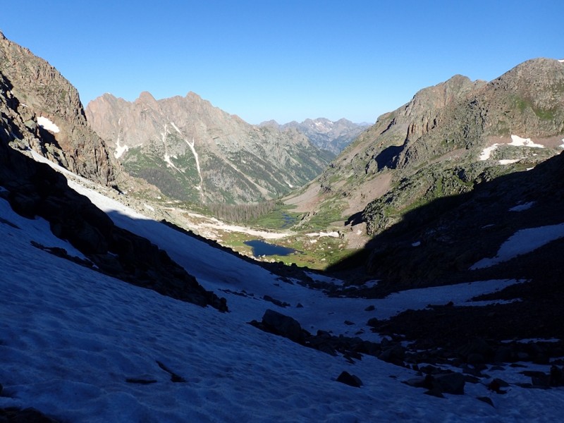
Liquid Shadows.... Looking down on the 'third tier' during our approach to Jagged Pass
Day 3: Jagged on the 4th of July!!
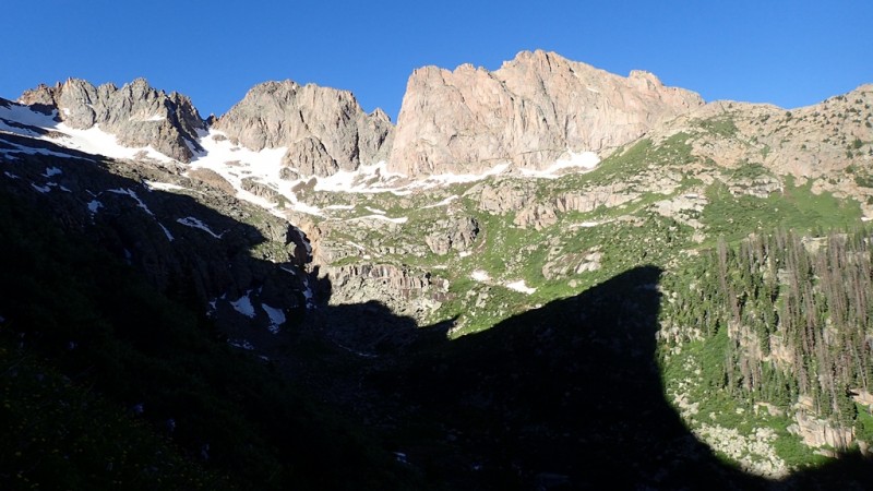
We left our camp at 4am under headlamps and a clear sky. A deliberate slow & steady pace brought us to the third tier where we sat down on a log at the prime camping spot in the entire basin for a short break before heading to Jagged Pass. Moods were good, weather even better.
First light hitting Sunlight (second from l.), Needle Ridge, Pk Eleven, Glacier Pt, & N Eolus (far r.)
Pilgrim coming up some slopes with the many flowing tarns of Noname below
Getting closer to the pass
Take it in
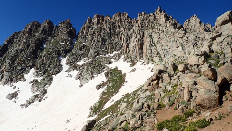
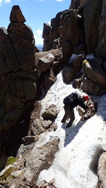
The snow on the W side of Jagged Pass was firm in the morning, where an ice axe was nice to have
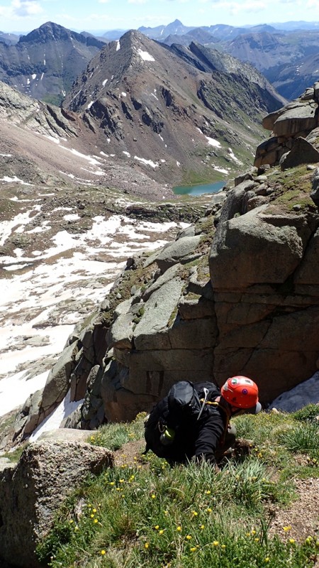
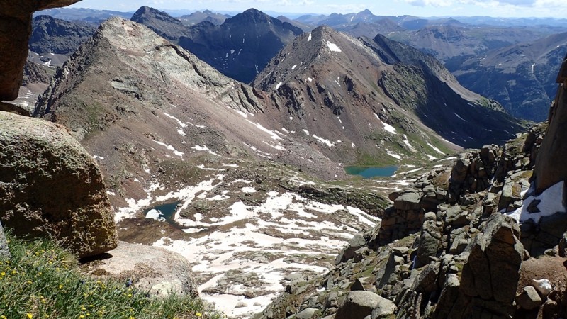
A view to the E from the pass....Oso beautiful!
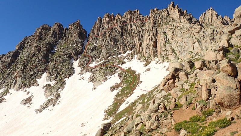
The red line is my best guess at our route
At the saddle, Ricky and I took a break to eat and drink while waiting for Mark & Greg to arrive. Not a bad place for a break!
We sat there and studied the face a little, and prepped for the climb by putting on our harnesses and getting out one of the 30m ropes we brought. I tied in and did my "best impression" of a kiwi coil (note to self: brush up on kiwi coil because it's been too long!).
When the guys arrived, they told us that we (Ricky & I) should plan to go on without them. This must have been a hard one to swallow since they both were looking forward to this climb. But they also realized that this wasn't the day for them to attempt Jagged. I appreciated their honesty and their willingness to take a step back so we could continue on. I think this was a good decision because we were not set up well for a 4-man team attempt on the peak. Thanks guys for your sacrifice....
Ricky and I started our traverse across the N facing slopes, only having to cross one snow slope which was in good shape for kicking steps and using our axes for effective self-belays across.
Once across the first snow slope, we did an ascending traverse on grass slopes, aiming to stay above the slabs as Cooper suggests in his guidebook.
We came to what I think is the first crux -- a slanted & wet dihedral -- which didn't look inviting. Instead, I saw a little steeper section that goes straight up to climber's right of the dihedral. Turns out that I topped out at the first set of rap anchors on that first crux. Perfect!
First bit of scrambling on the face
Looking back at Jagged Pass & beyond
Looking up first crux
C3-4 Grass Scrambling
One high snow traverse, but with enough exposed rocks to make for easy steps
Interesting scrambling on this route, with beautiful backdrops
Before leaving the saddle, I didn't review the route description from Cooper (but I did read it before going on the trip). Once on the face, the terrain reveals its weaknesses and it becomes somewhat obvious where others have been. There are some cairns along the route, but I think generally it's not too hard to figure where to go. Ricky excepted a belay in a couple of places, and there was at least one spot that gave me pause before committing to the necessary move for upward progress. In all, I think the N face scrambling is an interesting mix of moves and techniques, but not overly difficult. However, the head needs to be focused on the task at hand.
Best of all, when topping out in the notch to go out on the S face traverse, the views are one of those "wow" moments that are special in the mountains. My pictures can't describe the feeling, so I won't even attempt to show it.
However I'll share a couple of videos of the traverse on the ledge system on the S face of Jagged....Ricky, this is your 10 minutes....but more like a total of 1:38 (min/sec).....so don't let it go to your head!
The S side traverse, in my opinion, isn't as airy as I had expected it to be. But that's ok!
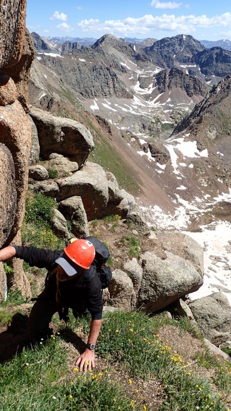
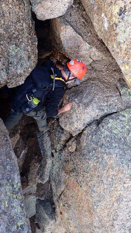
The chimney was a tight fit for a guy my size with a pack on, but I was able to squeeze up it. ;)
Looking down at Ricky near the exit of the chimney
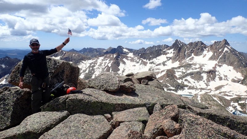
What better way can our Independence be celebrated?!
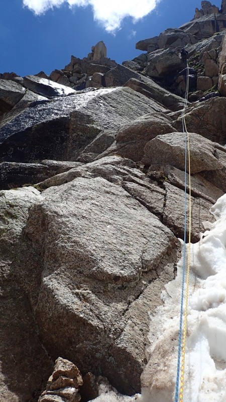
We didn't spend a lot of time on the summit since we didn't want anxiety to set in about the descent. However, there was no need to worry because the weather was still good and with some care we retraced most of our steps to the notch where we went on our first of three rappels, using both ropes tied together, although the first two from the top could probably be rapped with a 30m. The last rappel to get off the more challenging terrain warrants a 60m rap though.
Ricky on the last of the rappels -- picture also shows the first pitch we climbed
We got back to the saddle and could see some clouds to the W that looked to have some moisture in them, but we were mostly done with the difficult terrain. The snow below the saddle had softened too so it was in good shape for plunge stepping down.
Some very light hail dropped for all of ~30 seconds or so, and it also threw in a few sprinkles, but for the most part the descent back to camp went pretty well with both of us quite happy to have been able to get to the summit of Jagged!
~12hrs after leaving camp in the dark, we rolled in and enjoyed the evening.
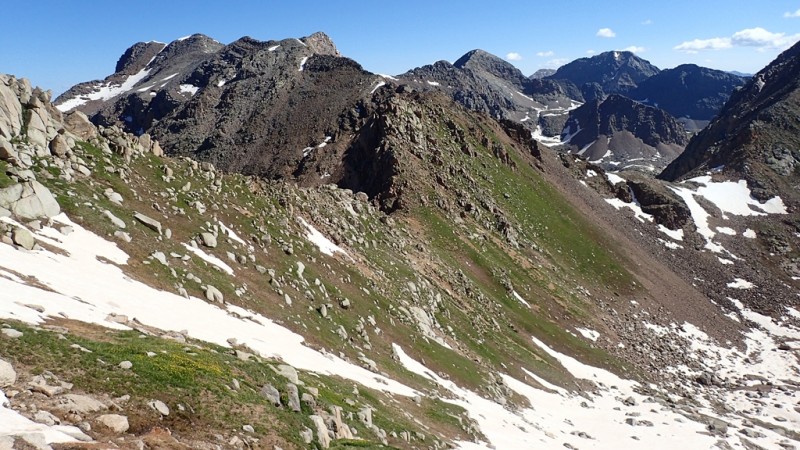
Day 4: Peak Twelve
In August of 2012, I was in Ruby Basin to climb Pk Fifteen and we also did Pk Eleven & Glacier Pt from Ruby (by going over Twin Thumbs Pass). On our return from the latter two peaks, we went up Pk Twelve, with little time to spend on the summit since clouds were building & dumping all around us.
2012
2016
On Tuesday, July 5th, Greg and I left camp sometime around 8am to hike up Peak Twelve. I thought it would be a good day trip from our camp and a nice return to a nice peak towered by some great 13ers all around. I wanted to do Pk Five & Six, but the thought of going up into the upper basin again wasn't as appealing. Plus, nothing wrong with an easier day!
Pilgrim crossing the creek as Cooper suggests
Out of treeline -- the peaks on N side of Noname Basin on the horizon
Minor sections of snow on the route to the saddle of Pk Twelve & Monitor
More video of the wonderful Weminuche views.....
Labels & part of approach & route on Pk Fifteen
Greg coming up the last part of the summit ridge to Pk Twelve
We spent close to an hour on the summit, enjoying the phenomenal weather and views. It took us about 3 hours to summit from our camp in Noname, and the descent was probably around 2 hours. Following Cooper's description and our own intuition to get through the trees made for a good outing. The "trail" through the trees from the valley floor is sporadic, but I don't think it's too hard to make it up as you go. And the walk under the big E face of Monitor is special!
Day 5: Knife Point
Spectacular!! What else is there to say about this peak we looked at every day from camp?! With such an aesthetic looking peak staring us down day to day, we thought that we must stand on top before the end of our trip!
Making waves
on a sea of texture
Coming up the slopes beneath Pk Ten
Hoping for a weakness....
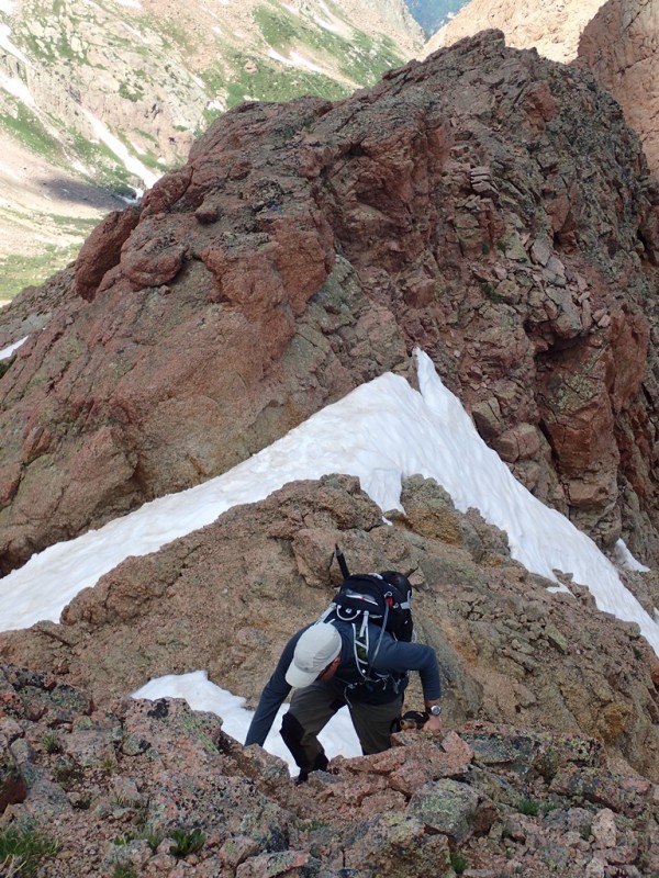
....and we found it 3rd ~4th class crux
Working through the down-sloping kitty litter crux
Above & beyond the crux
After the crux, we weaved our way through some grassy benches until we got on the open steep tundra slopes above. Steep, but manageable until the saddle. The last couple hundred feet to the saddle was grungy scree so it slowed progress a little.
From the saddle of Pk Ten & Knife Point, we contoured around to the eastern side of the mountain.
The traverse from the saddle to the E slopes of Knife Point
Mark coming up the E slopes, making some easy moves
Sunlight Basin
Sunlight Peak (14,059')
Still waiting for those goats to show up....
Up is the only way to go now
Another good day to be on a summit in the San Juan Mountains!
Mount Eolus (14,083')
It's too bad we have to descend.....
Sunlight Lake
Contemplating the descent from the saddle
Down climbing the crux
A couple hours later, or maybe three hours, we were back in camp. It was our last climbing day in the basin, and it was a good one. We sat around, wondering what the fuck a marmot would do with a SPOT, and curious as to why we didn't have any goat visitors -- probably too busy in Chicago Basin.
Through most of the trip, we didn't see many other people. The first few days there were campers farther up the first tier meadow, but we didn't see them on any of the peaks we were on.
We (Greg & I) saw people in Ruby Basin, and as it turned out it was Andrew Hamilton and his friends doing some kind of 6 day Wemi blitz of some of the hardest peaks in there! We also (probably) saw them in the Jagged notch on the day we hiked Knife Point.
While our trip didn't knock out the peaks like we 'dreamed' of before going in, it was still a trip that I'll be thinking of for years to come, just dreaming of the next time I can go back in there.
Another sun sets on a great trip...
Thanks for reading,
Darin
Estimated routes & campsite
Thumbnails for uploaded photos (click to open slideshow):
Loved the disclaimer. Reminds me of a line from Blazing Saddles "buildings burned, children beaten, women molested and cattle raped"
Also with my HDADD more pictures than words works much better.
Congrats on an awesome trip to some sweet peaks. Very jealous of your weather, there was a ground strike on the Jagged Ridge as we repelled in soiled hiking gear. A return trip for Knife Point and afew others is certainly going to happen! Thanks for sharing.
you never know who you might run into in the Wemi! 7/15/2016 6:26pm
Glad I got to spend a few minutes with you in Durango man. Looks like you all had an excellent trip. Good to meet you as well Greg. Well done to all! Nice report Darin!
Dillon, I'll be honest...when I walked into the train depot, and I saw you in line, I laughed to myself because that being our second in-person meeting, it of course had to happen on a Wemi outing! Plus, I couldn't think of your name! "Don't I know you?"
Nancy it was nice to see you too, and I swear my hands were clean. ;)
Thanks to my partners for adding to the bank of memories! Ricky, you're a great partner to have on a peak like Jagged...I hope we can try a couple more of those harder cents together!
...accounting of this area. What a wonderful area of the Weminuche. Congrats on your summits and getting to enjoy a few days in the wilderness!
(PS: at least you did not have a porcupine eat the straps off your backpack, too!)
Caution: The information contained in this report may not be accurate and should not be the only resource used in preparation for your climb. Failure to have the necessary experience, physical conditioning, supplies or equipment can result in injury or death. 14ers.com and the author(s) of this report provide no warranties, either express or implied, that the information provided is accurate or reliable. By using the information provided, you agree to indemnify and hold harmless 14ers.com and the report author(s) with respect to any claims and demands against them, including any attorney fees and expenses. Please read the 14ers.com Safety and Disclaimer pages for more information.
Please respect private property: 14ers.com supports the rights of private landowners to determine how and by whom their land will be used. In Colorado, it is your responsibility to determine if land is private and to obtain the appropriate permission before entering the property.