Download Agreement, Release, and Acknowledgement of Risk:
You (the person requesting this file download) fully understand mountain climbing ("Activity") involves risks and dangers of serious bodily injury, including permanent disability, paralysis, and death ("Risks") and you fully accept and assume all such risks and all responsibility for losses, costs, and damages you incur as a result of your participation in this Activity.
You acknowledge that information in the file you have chosen to download may not be accurate and may contain errors. You agree to assume all risks when using this information and agree to release and discharge 14ers.com, 14ers Inc. and the author(s) of such information (collectively, the "Released Parties").
You hereby discharge the Released Parties from all damages, actions, claims and liabilities of any nature, specifically including, but not limited to, damages, actions, claims and liabilities arising from or related to the negligence of the Released Parties. You further agree to indemnify, hold harmless and defend 14ers.com, 14ers Inc. and each of the other Released Parties from and against any loss, damage, liability and expense, including costs and attorney fees, incurred by 14ers.com, 14ers Inc. or any of the other Released Parties as a result of you using information provided on the 14ers.com or 14ers Inc. websites.
You have read this agreement, fully understand its terms and intend it to be a complete and unconditional release of all liability to the greatest extent allowed by law and agree that if any portion of this agreement is held to be invalid the balance, notwithstanding, shall continue in full force and effect.
By clicking "OK" you agree to these terms. If you DO NOT agree, click "Cancel"...
12.4 miles
4,700 feet of elev. gain
8 hours total
5 hours of moving time
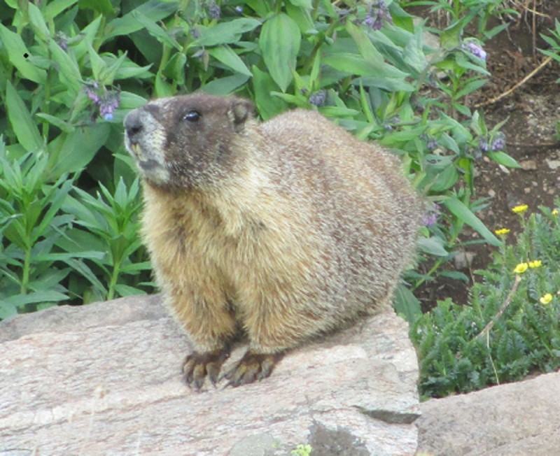
Say Cheese!
While people who view this trip report will likely see it under Pettingell, there is a enough of those floating around, so instead I'll briefly cover Pettingell and try to focus on the moderately important beta for hiking Bethel as well. Overall, I thought it was a easier day regarding the statistics, probably due to the majority of the hike being an approach or mileage on nice roads or bike paths. Pettingell almost felt too easy, and Bethel, albeit steep, can be tackle by fully implementing the rest step. I also apologize for the abstruse diction; I've lately been reading too many old tomes and have taken some words that stood out and put them in here.
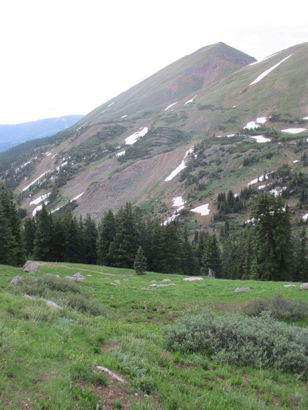
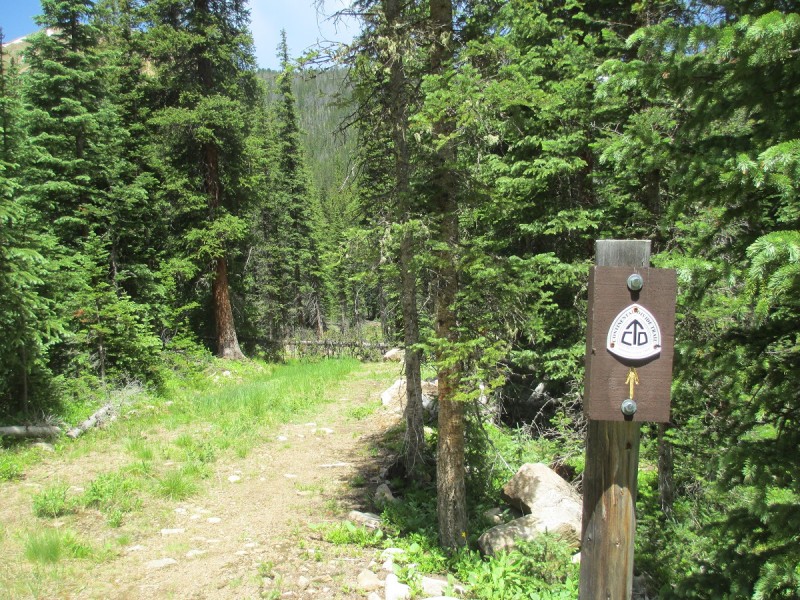
I started at 4:50, in the half empty Herman Gulch parking lot . Getting out of the car, I wrapped up the tin foil to my egg and ham quesadilla and finished the last of my tea. Getting out my headlamp, I ambled over to the latrines to discover that they were marked off with caution tape. No big deal, since porta-potties were placed adjacent, except those were filled to the brim. Off to the forest instead! For the day, I had the intention of hiking a contrived loop of Pettingell and Bethel, in the hopes that it will one of many intermediate steps to comfortably handling longer and more demanding days. The hike up to Herman Lake was pretty uneventful, yet peaceful, as it probably always is before sunrise, being well and worn.
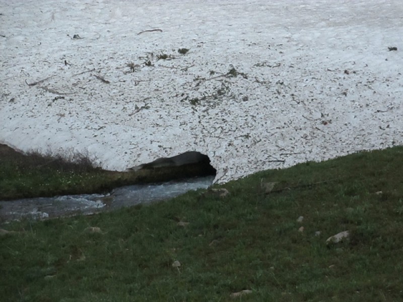
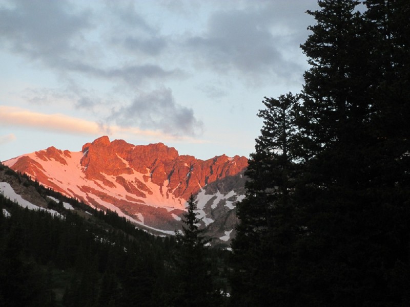
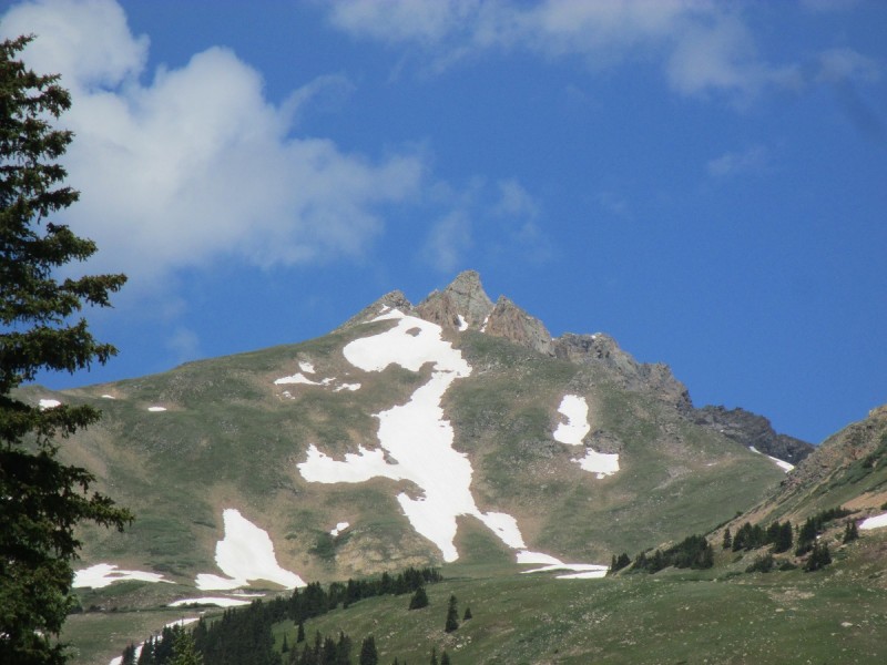
Interesting Snow TunnelX-treme Alpenglow
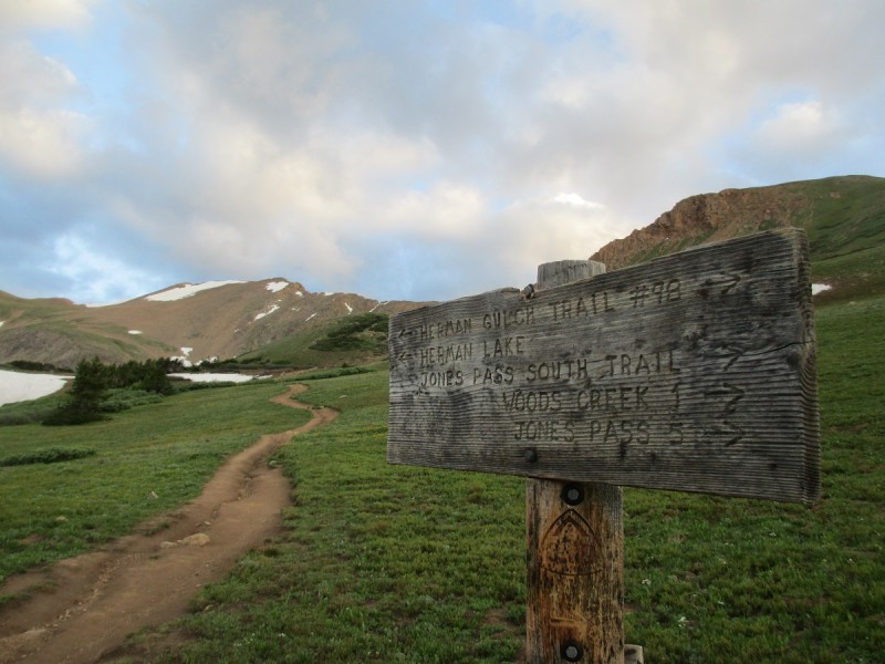
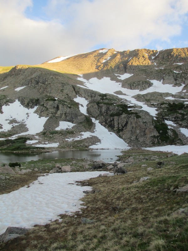
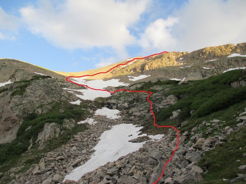
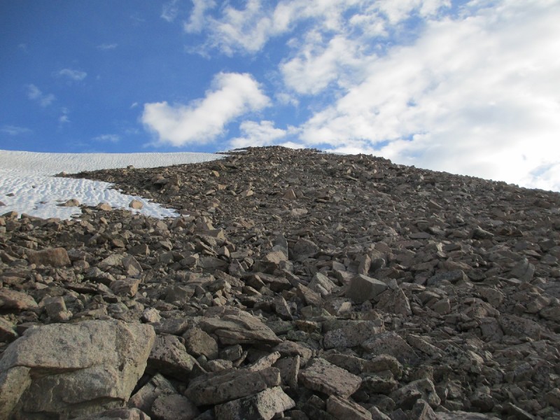
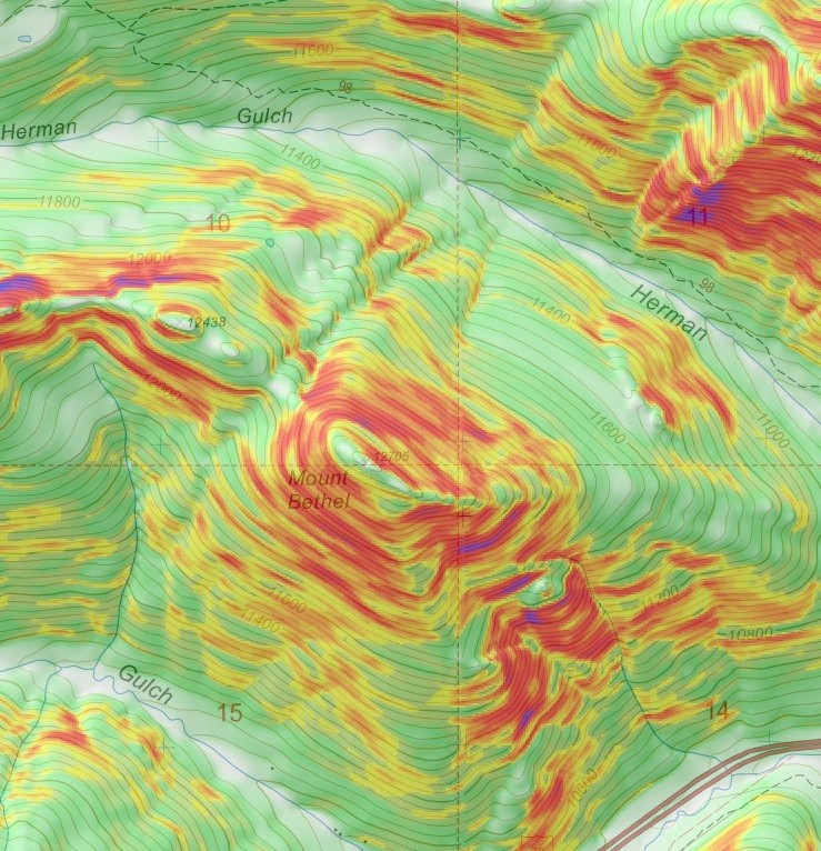
A bit further than 2.5 miles in, there is a prominent trail that branches to the south (toward the creek). This trail will be the turnoff point for Bethel (39.721, -105.8836). Once at Herman Lake, I took the right turn and skirted around the lake basin and to the right of snowfield that descends into the lake, staying high up, where there seemed to be less painful options for sidehilling. Once out of the lake basin, I peregrinated to the south (left) of the broad ramp to avoid the upper snowfield. There appears to be a slight trail and a few cairns marking the way, but it was honestly difficult to keep track of it, so I settled to finding my own way up to the saddle. To be frank, I was surprised how close the summit is after the saddle, as reaching the top is anticlimactic. From the trailhead, Pettingell took 2 hours and 40 minutes to get to the top.
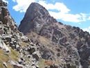
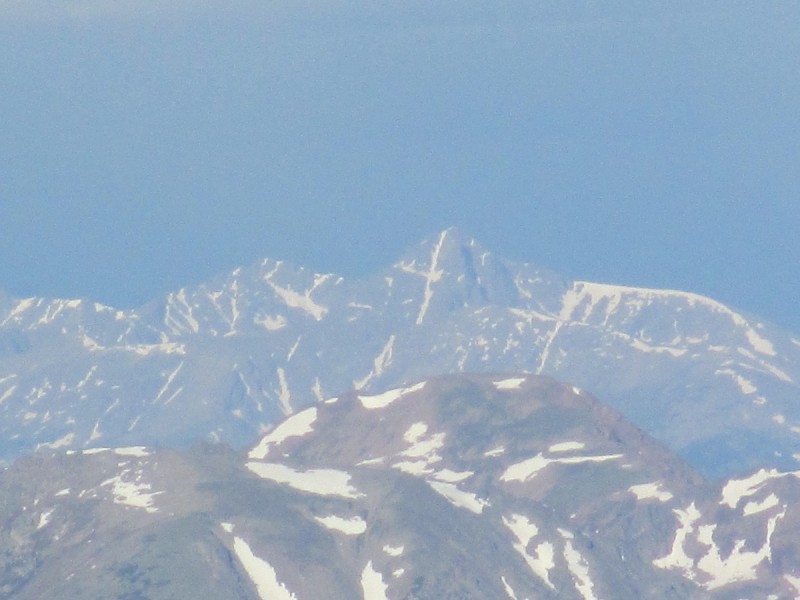
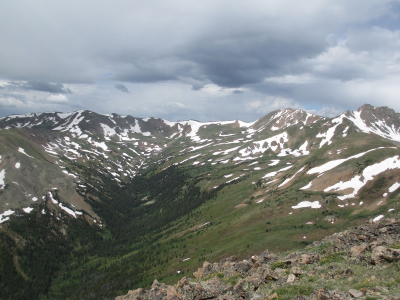
Preview of the route to Mount BethelJunction of Herman Gulch and Continental Divide TrailThe Citadel and the snow crossing #2Herman Lake along with the ramp. After exiting the lake basin, stay to the left sideAn outlined picture of what line I took and where I crossedCrossing the snowfieldLooking back at Bethel, with Torreys peeking outA closer look, with the route outlinedFinal ascent to PettingellLooking North from the summit down into Bobtail CreekRestore the Gore (With special guest appearance by the Williams Fork Mountains)Holy Cross
I descended back the way I came, saying hello to several hikers making there way to the lake. Once at the turnoff I mentioned earlier, I followed it to a campsite. From the looks here, crossing the creek is deep, swift, and improbable. I found if you head up the creek a bit, there are various locations to cross that have a predilection for large rocks and tame terrain.
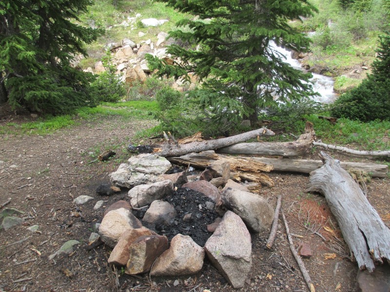
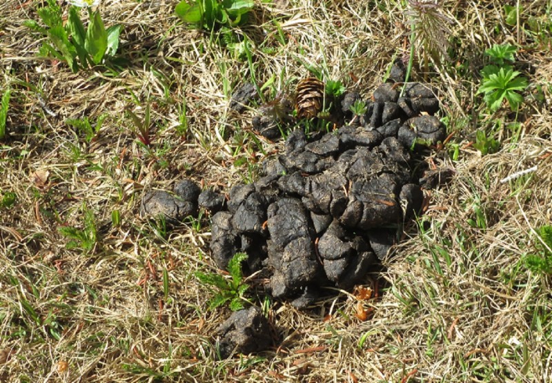
The campsite at the end of the side trailNowhere to cross here; Head upstream insteadBlack Bear scat?
Whenever you look at contour lines, there is only one conspicuous weakness in the otherwise sheer-sloped Bethel. By avoiding the direct approach and rather making your way to the ridge before the final ascent, you'll walk away from this day with your calves intact.
Pretty obvious to see which way is best
My route angled up toward Bethel, southeast, above the steep talus that prevents a direct approach to the saddle and below the long undulating ridge that connects Bethel and the Citadel. Once I reached the final segment to the top of Bethel, it started sleeting, paired with heavy gusts of wind. In all fairness, at this point, I cheated because I took advantage of the one thing I endeavor to avoid on hikes: The Internet. I might as well strip away my summit for the day, but I took a peek at the lightning map to see if now was a good time to bail off the ridge. Thankfully, there was no sign of lightning, both from what I could see and from the online map, so I forged up the final uphill for the day, wind pushing me onward. I have to admit, the summit view is the epitome of contradiction: To the north, a primitive world; To the south, a polluted one. From Pettingell, Bethel took me 3 hours, with a lot of that time trying to fix ski poles and switching between 4 combinations layers, because the weather decided to switch what it was doing every twenty minutes.
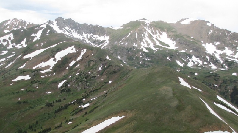
Head diagonally to the saddleThere already seems to be a trail that skirts the north slope, but I was unable to follow it on Google Earth once it enters tBehold: Mount BethelLooking at the ridge the connects to the Citadel. Pettingell is the rightmost pointBethel's level summitDry Gulch
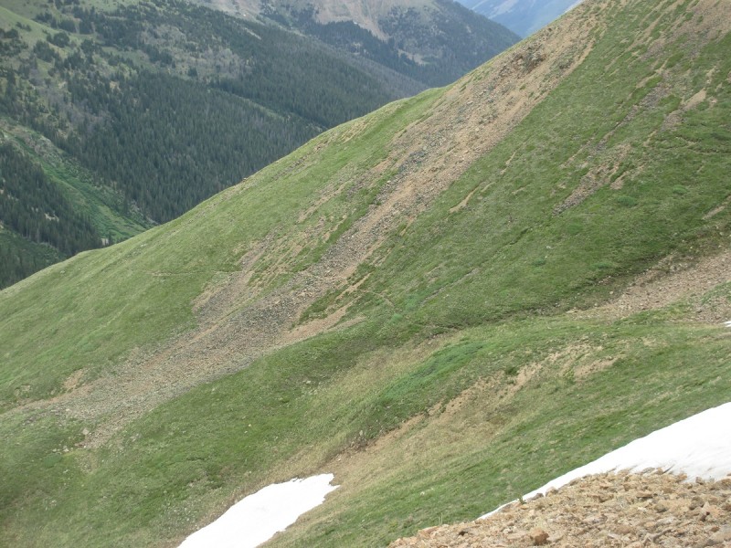
At this point, I was pretty bundled up, wearing my softshell, rain jacket, gloves, and beanie; Pretty cold for a July day. I was more than ready to get back into the protection of the hillside rather than revisiting the saddle to drop down into Dry Gulch the less steep way. From trip reports that I have viewed, to descend Bethel, people take the direct approach between the snow fences into Dry Gulch. If you decide to descend straight down, I strongly suggest ski poles to prevent...I believe the correct medical term is "obliteration to the knees". I also had to stop to tighten up the shoelaces on my Brooks Cascadias, as I always wear them loosely, something I have done throughout cross country and track. Switchbacking down the mountain, it emanated the cool big brother-you-never-see equivalent to the hogbacks, with its unrelenting slope, but with no scrub oak and as a trade off, a fall would produce quite a tumble. From here, the descent is pretty straightforward: Just go down.
Ground floor pleaseNew PerspectivesExactly why you need functioning ski poles and tightened lacesI guess the Citadel comes with a drink-serving dinosaur
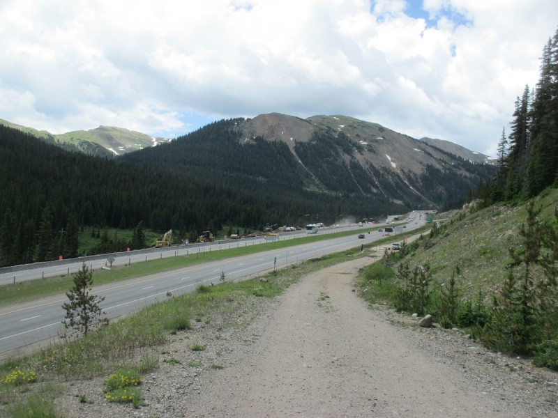
Once at Dry Creek, I was amenable to the gentleness of the road and cruised my way west, down the dirt road to Exit 216, aka Loveland Pass. From here, I walked east along the asphalt road bordering Loveland Valley to the Baker/Loveland Trail #60, a smooth asphalt path along Clear Creek that circulates back to Herman Gulch. Although being the CreekRunner, my knees were pretty agitated, no thanks to the worthless pair of duct taped, asymmetrical BD Expedition ski poles that were basically broken from the very first time I started using them in October. Nonetheless, I did manage to break into a light jog and after a while, my body relaxed and could sustain an acceptable pace all the way to the junction with the Continental Divide Trail. I returned to confront a jammed parking lot, and to end on a high note, I stepped in a big pile of gum that definitely wasn't there when I started.
Looking back at BethelNot the most scenic section, but at least it's flatNext, you are upgraded with pavementIt's honestly really niceThere should be markings for the CD as it intersects with the bike path. Oddly enough, there is only signage on one side.
My GPS Tracks on Google Maps (made from a .GPX file upload):
Jay: It definitely doesn't quite fit the bill as an aesthetic nor classic route, but there is pleasant route finding on Bethel and a unique descent between the fences. If I had more time to plan out the route instead throwing it together, I would have probably would have to add in the east ridge, the one you wrote a report on, and also look into adding in the Citadel to Bethel segment.
Tempelton: On high peaks, I am an easy mark for staring at clouds and looking at the shapes they make, but since it was overcast, I had to make due by imagining things out of snow! :roll:
Caution: The information contained in this report may not be accurate and should not be the only resource used in preparation for your climb. Failure to have the necessary experience, physical conditioning, supplies or equipment can result in injury or death. 14ers.com and the author(s) of this report provide no warranties, either express or implied, that the information provided is accurate or reliable. By using the information provided, you agree to indemnify and hold harmless 14ers.com and the report author(s) with respect to any claims and demands against them, including any attorney fees and expenses. Please read the 14ers.com Safety and Disclaimer pages for more information.
Please respect private property: 14ers.com supports the rights of private landowners to determine how and by whom their land will be used. In Colorado, it is your responsibility to determine if land is private and to obtain the appropriate permission before entering the property.


 The bike path is the last turnout to Loveland before I-70 East")
 Displacement: 0")