Download Agreement, Release, and Acknowledgement of Risk:
You (the person requesting this file download) fully understand mountain climbing ("Activity") involves risks and dangers of serious bodily injury, including permanent disability, paralysis, and death ("Risks") and you fully accept and assume all such risks and all responsibility for losses, costs, and damages you incur as a result of your participation in this Activity.
You acknowledge that information in the file you have chosen to download may not be accurate and may contain errors. You agree to assume all risks when using this information and agree to release and discharge 14ers.com, 14ers Inc. and the author(s) of such information (collectively, the "Released Parties").
You hereby discharge the Released Parties from all damages, actions, claims and liabilities of any nature, specifically including, but not limited to, damages, actions, claims and liabilities arising from or related to the negligence of the Released Parties. You further agree to indemnify, hold harmless and defend 14ers.com, 14ers Inc. and each of the other Released Parties from and against any loss, damage, liability and expense, including costs and attorney fees, incurred by 14ers.com, 14ers Inc. or any of the other Released Parties as a result of you using information provided on the 14ers.com or 14ers Inc. websites.
You have read this agreement, fully understand its terms and intend it to be a complete and unconditional release of all liability to the greatest extent allowed by law and agree that if any portion of this agreement is held to be invalid the balance, notwithstanding, shall continue in full force and effect.
By clicking "OK" you agree to these terms. If you DO NOT agree, click "Cancel"...
The NE Couloir on Arkansas has been on my ski list for a loooong time but I'm a bit embarrassed to say that I've never skied this line, even though it's in my home zone. Either I would run out of time in the Spring ski season or the couloir would not have continuous snow from the summit. Well, this year I made a point to put it at the top of the spreadsheet. So, when the recent storm snow settled down, I did a bit of research and found out it was in from the summit. Instead of climbing the couloir, we decided to climb the standard, north ridge which is a fairly simply hike. The couloir, however, is a steep snow climb and exceeds 50 degrees in angle at the top. If you decide to climb and/or ski it, be aware that it's a no-fall zone at the top and a fall could be your last. It's as simple as that. If you've skied Dead Dog Couloir on Torreys Peak, this couloir is much more difficult. Dead Dog has about a D12 rating on Dawson's "D System" and I would say this line is D15.
Ratings are a bit subjective but here's a list for further comparison: D19: Pyramid Peak - Landry Line D15: Mt. Arkansas - Northeast Couloir D13: Little Bear Peak - Hourglass D13: Challenger Point - Kirk Couloir D12: Grays Peak - Lost Rat Couloir D12: Kit Carson Peak - Outward Bound Couloir D12: Torreys Peak - Dead Dog Couloir D11: Torreys Peak - Emperor Couloir D11: Blanca Peak - Northwest Face D11: Mt. of the Holy Cross - Cross Couloir D11: Quandary Peak - North Gully aka Quandary Couloir D8: Quandary Peak - South Gully aka Cristo Couloir D8: Mt. Blue Sky - North Face Moderate (looker-right) D8: Missouri Mountain - North Face Couloirs D6: Mt. Elbert - Box Creek Couloirs
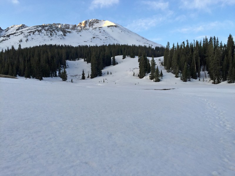
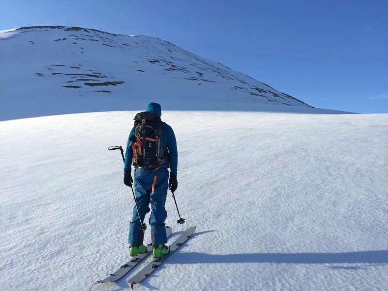
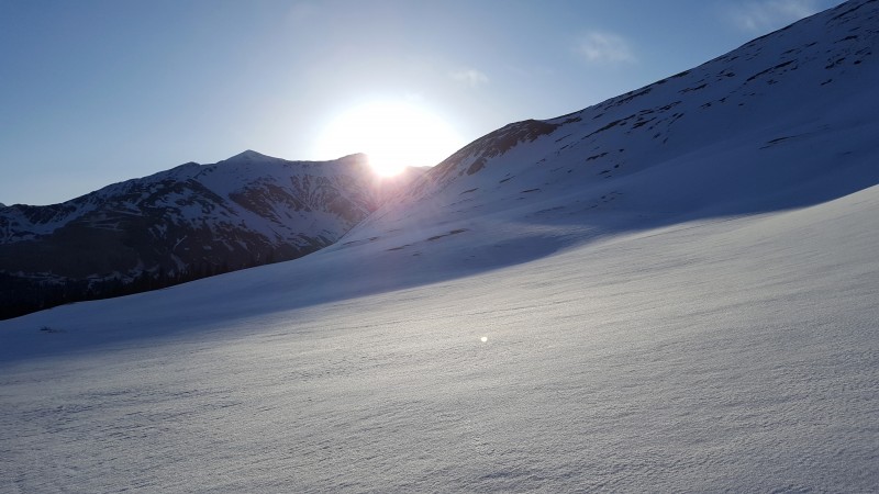
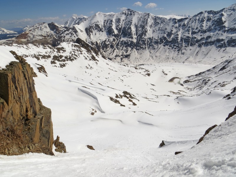
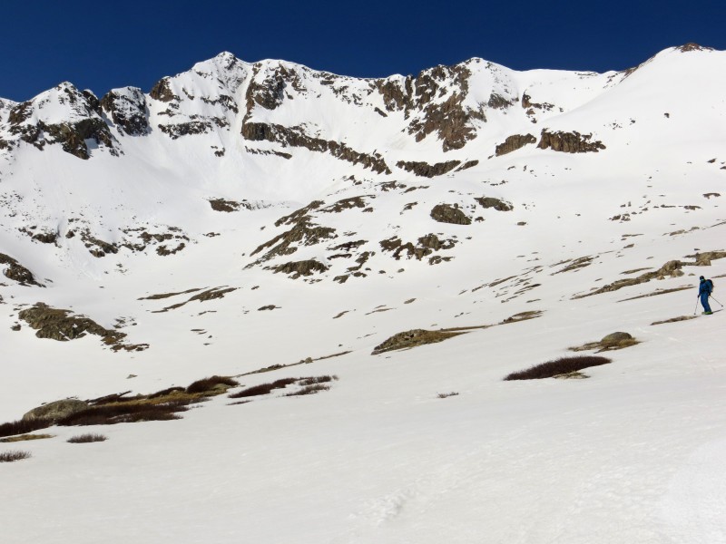
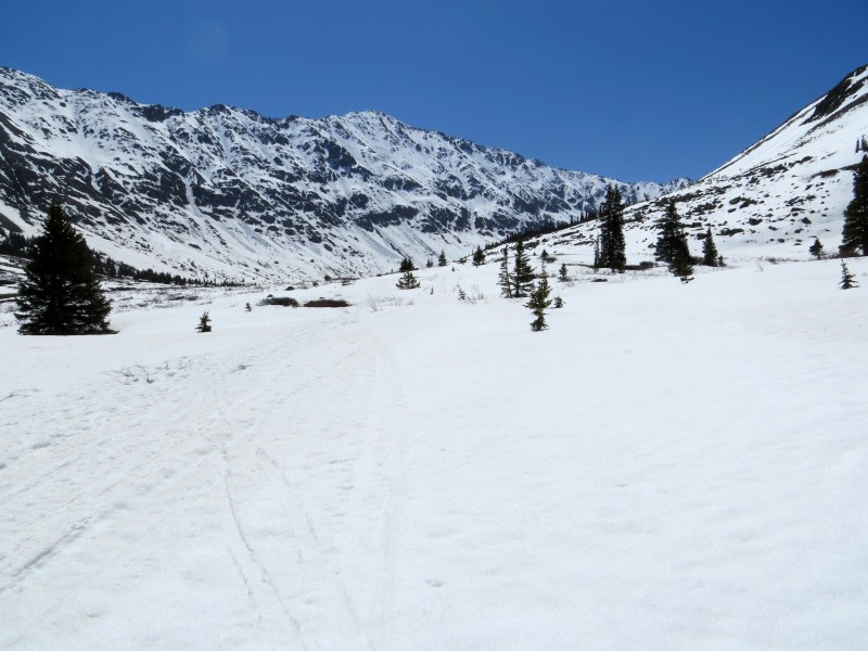
We skinned from the truck to the base of the ridge before booting up hard snow to reach the ridge crest.
Starting up the standard, North Ridge route
Finally, we get some warmth.
(Photo by Alex)
Alex getting closer to the ridge crest and the heat
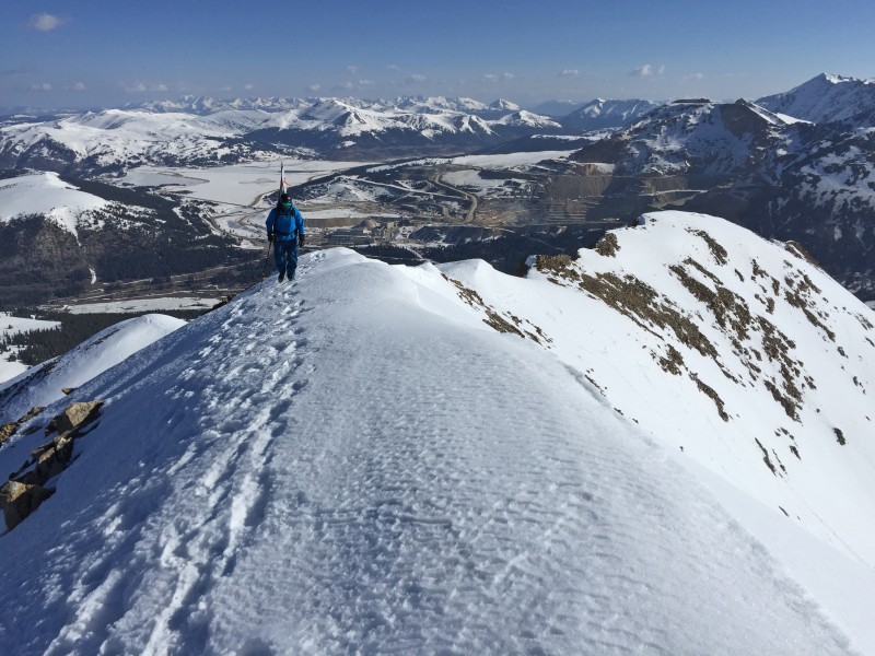
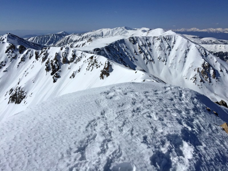
On the narrowing ridge with a splendid view of the northern Sawatch. (Photo by Alex)
Alex on the ridge
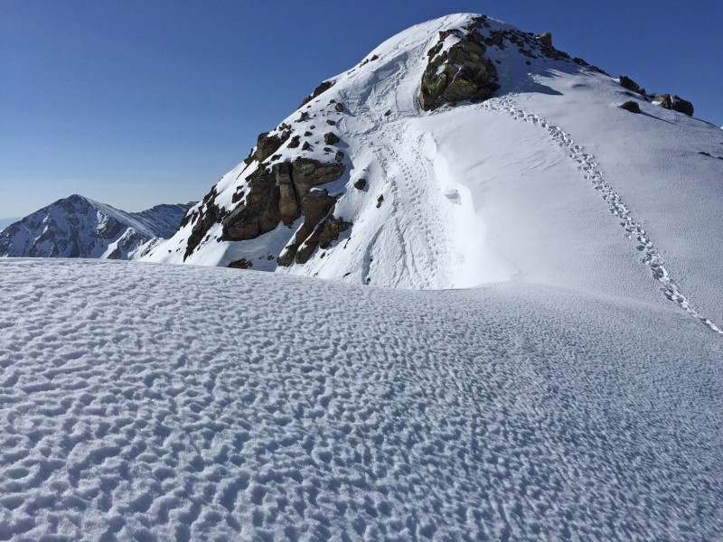
There was a good boot pack along the summit ridge. This is not the summit!
Just before the crux of the ridge, we dropped to the right and followed a solid bootpack around the difficulties before regaining the ridge.
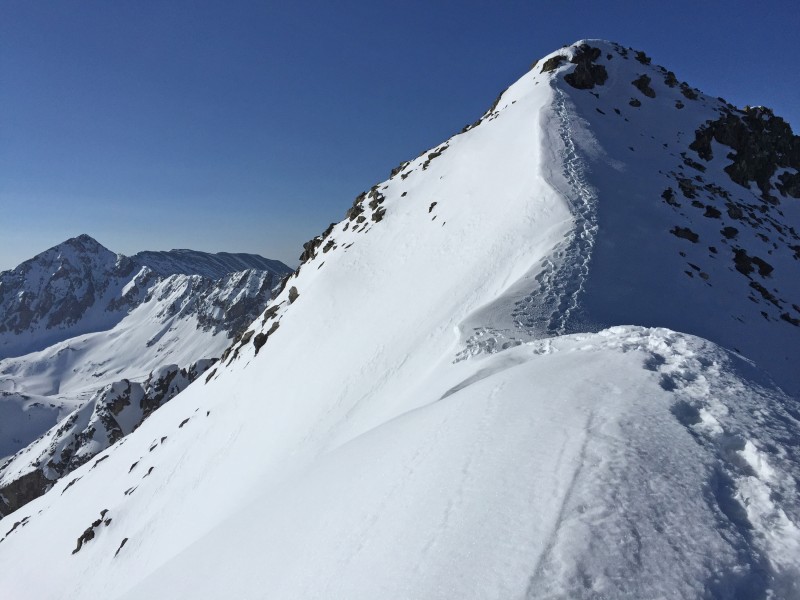
On the ridge with summit in view. We dropped to the right to bypass the next crux of the ridge, seen on the right.
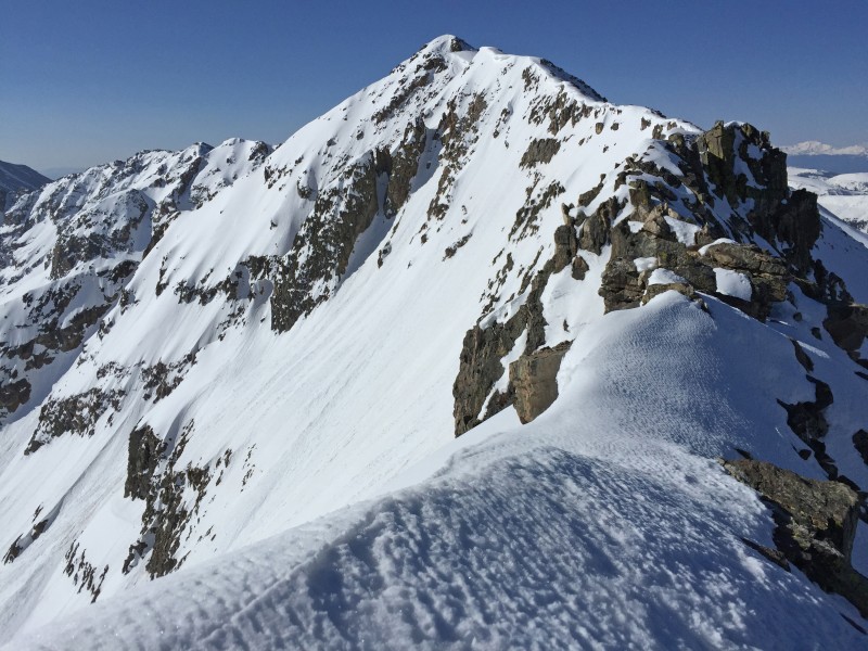
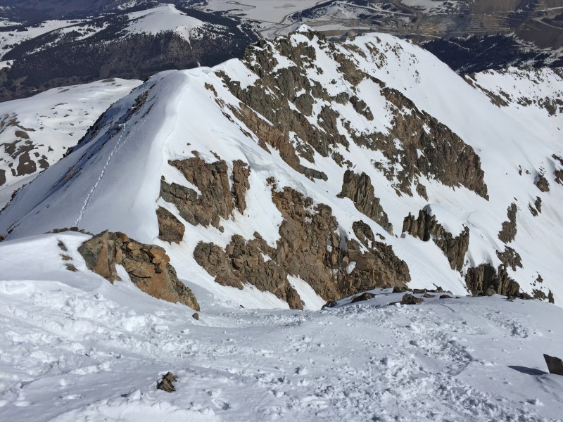
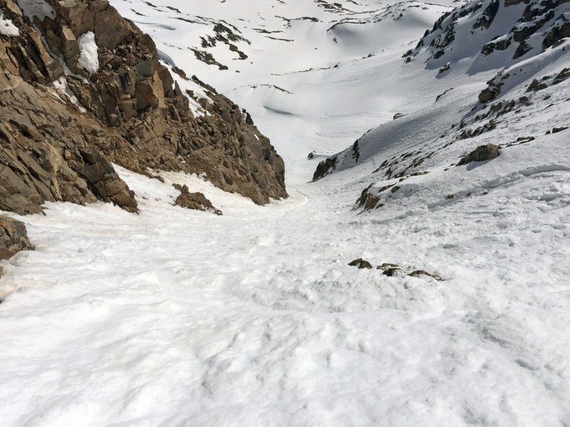
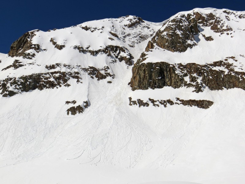
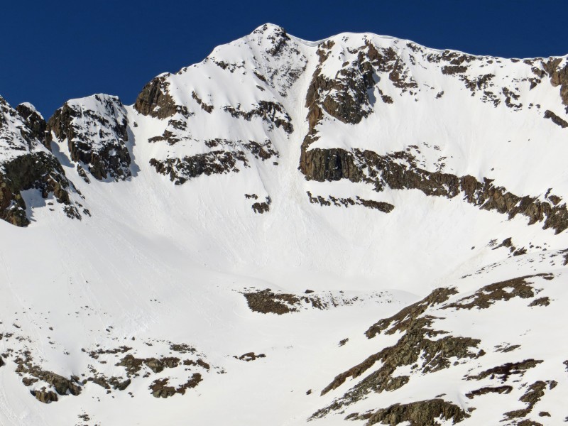
Looking at the final summit pitch, with the NE couloir down the left. It's continous snow!
On the summit
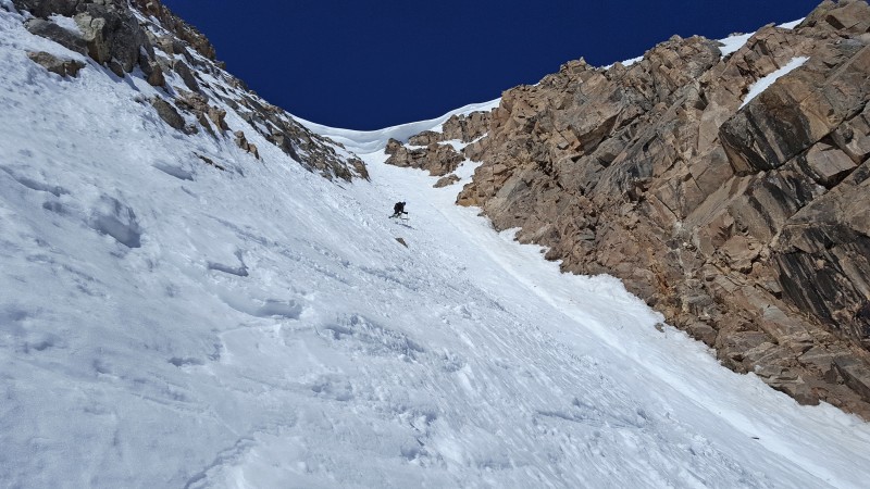
Skiing the Northeast ("Moonshine") Couloir
Down we go!
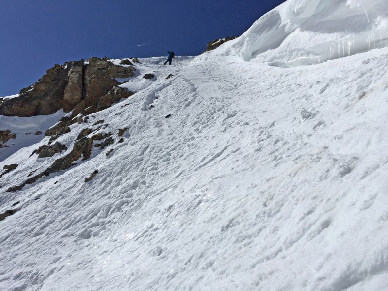
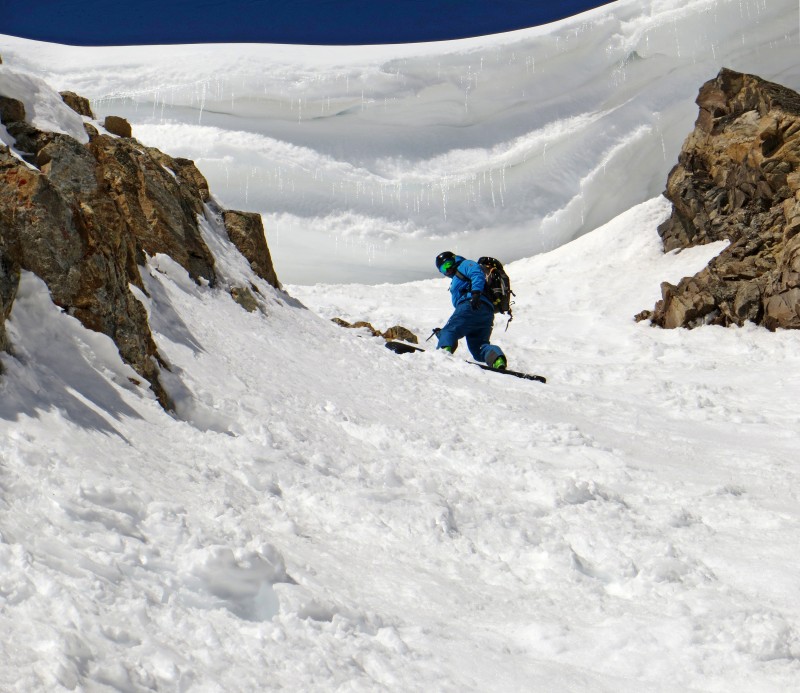
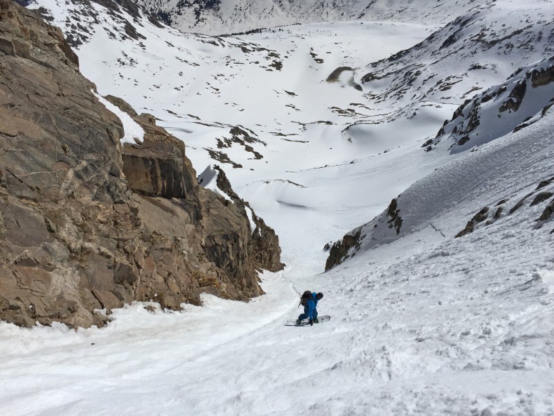
As seen in the following photo, previous skiers had side-slipped the steep pitch which made for a slick, firm entry into the couloir. It was no problem on skis but it made the entry much more difficult for snowboarding.
After I skied into the top, I made a quick turn under the cornice so I could get shots of Alex in the entry
Under the cornice, looking down the couloir. Korn!
The strong sun and lack of wind in the couloir made the center and skier-left side like butter. Alex riding the couloir...
Nice
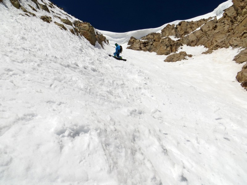
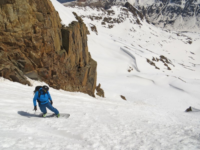
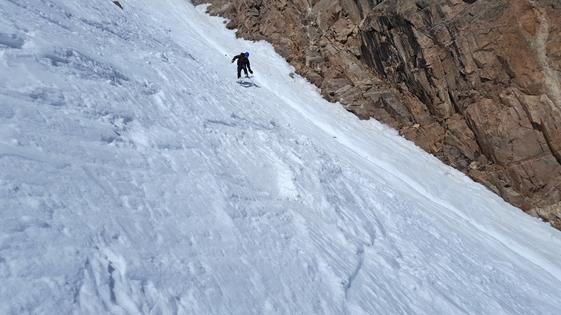
Yup, still steep. Probably around 45-47 degrees in this section.
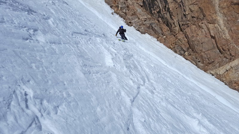
Less steep
My turn! Big powder days aside, steep lines like this are my favorite type of skiing. I enjoy the thrill of a no-fall line where I have to ski it like a mountaineer. Commence jump-turning...
(Photo by Alex)
(Photo by Alex)
(Photo by Alex)
(Photo by Alex)
(Photo by Alex)
(Photo by Alex)
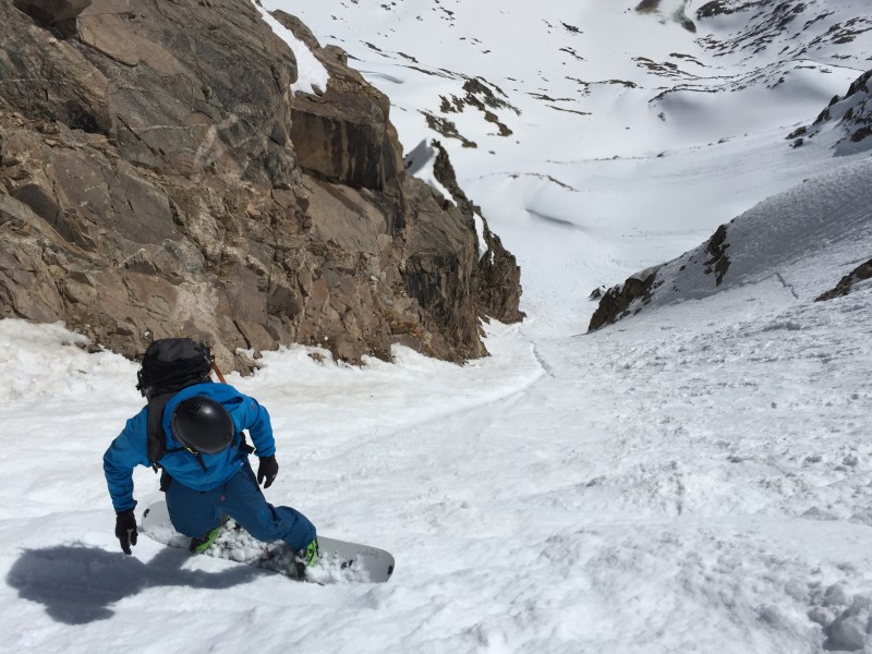
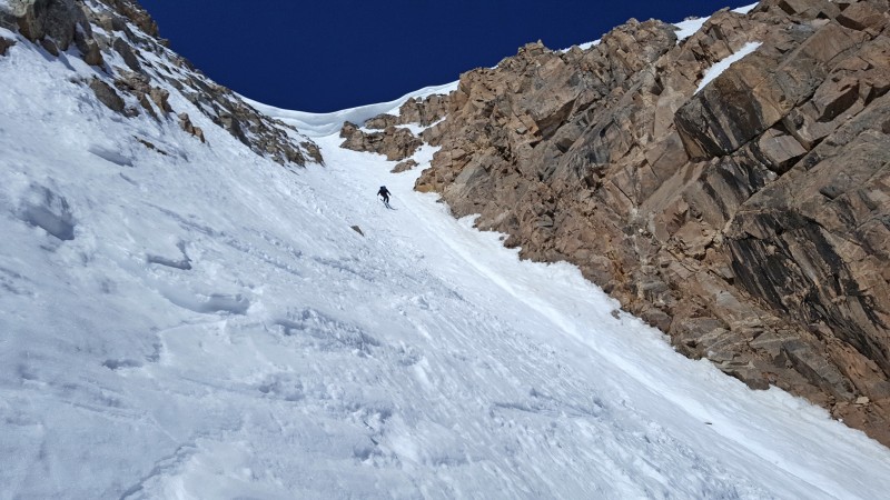
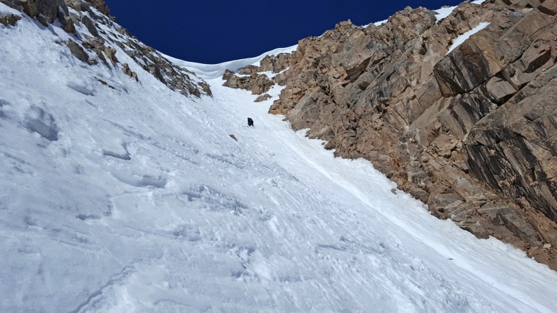
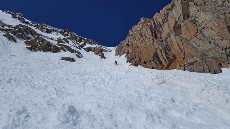
Exiting the couloir
Near 12,700', looking back on the exit
As you can see in the photos, there was a small runnel in the center of the couloir, but it was no problem turning on or over it.
After taking a bunch of pics, we traversed along the north side of the basin before dropping north and exiting northwest to the highway.
Looking back on the exit, with 14er Mt. Democrat in view
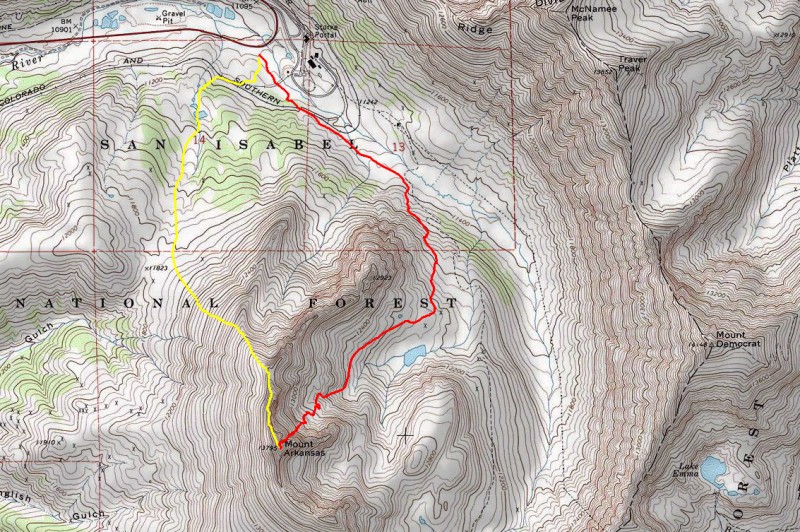
My GPS Tracks on Google Maps (made from a .GPX file upload):
Love that line, never skied it, but there's a cool picture of it in Fritz's book. Put it on the list of things that I might do at some point. Nice pics Bill!
Great line! Congrats Bill, and thanks for ratings comparisons as well.
p.s. Given this beta, we skied Moonshine today on Memorial Day. Great, steep line indeed, but wished snow conditions were better. Lots of avy debris and the runnel in the middle. Entrance actually wasn't as bad as expected. Will try to hit it earlier in the season in powder conditions next time. Definitely a worthy objective, and the access cannot be easier. Cornice is still there, as big as ever! :)
Thanks for another awesome day in the hills Bill...good write up too. My 2 cents on the line: I would say that the 30 feet from the summit to the top of the couloir was significantly scarier than any other line ive ridden. Its steep, off camber and as Bill said, absolutely no fall terrain. Once in the couloir, it was great steep turns. Pretty surreal being under that bus sized cornice too! Mayuary continues!
Bill, Glad you guys skied/rode it safely in great conditions! What's next?
Caution: The information contained in this report may not be accurate and should not be the only resource used in preparation for your climb. Failure to have the necessary experience, physical conditioning, supplies or equipment can result in injury or death. 14ers.com and the author(s) of this report provide no warranties, either express or implied, that the information provided is accurate or reliable. By using the information provided, you agree to indemnify and hold harmless 14ers.com and the report author(s) with respect to any claims and demands against them, including any attorney fees and expenses. Please read the 14ers.com Safety and Disclaimer pages for more information.
Please respect private property: 14ers.com supports the rights of private landowners to determine how and by whom their land will be used. In Colorado, it is your responsibility to determine if land is private and to obtain the appropriate permission before entering the property.
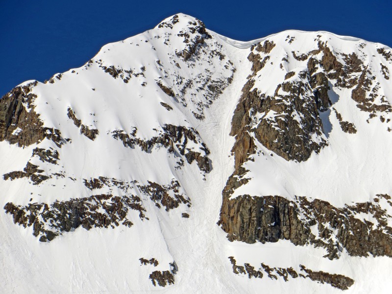


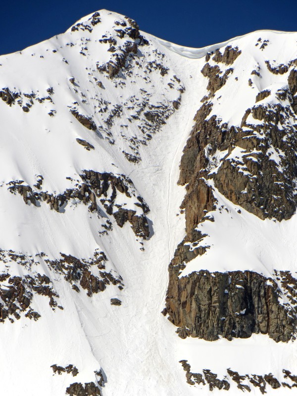

 Arkansas' Northeast Couloir")
 Starting up the standard, North Ridge route")
 Finally, we get some warmth.")
 (Photo by Alex)")
")
 Alex getting closer to the ridge crest and the heat")
 On the narrowing ridge with a splendid view of the northern Sawatch. (Photo by Alex)")
")
 Alex on the ridge")
 There was a good boot pack along the summit ridge. This is not the summit!")
 On the ridge with summit in view. We dropped to the right to bypass the next crux of the ridge, seen on the right.")
 Looking at the final summit pitch, with the NE couloir down the left. It's continous snow!")
 On the summit")
 Down we go!")
 After I skied into the top, I made a quick turn under the cornice so I could get shots of Alex in the entry")
 Under the cornice, looking down the couloir. Korn!")
 Nice")
")
")
 Yup, still steep. Probably around 45-47 degrees in this section.")
")
")
 Less steep")
 (Photo by Alex)")
 (Photo by Alex)")
 (Photo by Alex)")
 (Photo by Alex)")
 (Photo by Alex)")
 (Photo by Alex)")
 Exiting the couloir")
 Near 12,700', looking back on the exit")
")
")
")
")
 Looking back on the exit, with 14er Mt. Democrat in view")
")


