Download Agreement, Release, and Acknowledgement of Risk:
You (the person requesting this file download) fully understand mountain climbing ("Activity") involves risks and dangers of serious bodily injury, including permanent disability, paralysis, and death ("Risks") and you fully accept and assume all such risks and all responsibility for losses, costs, and damages you incur as a result of your participation in this Activity.
You acknowledge that information in the file you have chosen to download may not be accurate and may contain errors. You agree to assume all risks when using this information and agree to release and discharge 14ers.com, 14ers Inc. and the author(s) of such information (collectively, the "Released Parties").
You hereby discharge the Released Parties from all damages, actions, claims and liabilities of any nature, specifically including, but not limited to, damages, actions, claims and liabilities arising from or related to the negligence of the Released Parties. You further agree to indemnify, hold harmless and defend 14ers.com, 14ers Inc. and each of the other Released Parties from and against any loss, damage, liability and expense, including costs and attorney fees, incurred by 14ers.com, 14ers Inc. or any of the other Released Parties as a result of you using information provided on the 14ers.com or 14ers Inc. websites.
You have read this agreement, fully understand its terms and intend it to be a complete and unconditional release of all liability to the greatest extent allowed by law and agree that if any portion of this agreement is held to be invalid the balance, notwithstanding, shall continue in full force and effect.
By clicking "OK" you agree to these terms. If you DO NOT agree, click "Cancel"...
The first ascent of another possible "highest unclimbed peak in Colorado".
Our main objective was Curecanti Needle on Friday, but since we were driving down from Louisville on Thursday, we had some extra time which we decided to use making an armed reconnaissance of the mysterious ranked summit 9300, a peak in the Little Soap Park quad, about 9 miles north of US 50 at the west end of Blue Mesa reservoir. All we knew about the peak was that there were no known ascents and that it was capped by a summit tower which appeared to be at least 100' feet high and would be composed of the garbage basalt conglomerate that makes unnerving outings of so many otherwise appealing Colorado summits. Our plan was to drive to the Commissary campground about 1 mile west of and 1400' below the peak and start the approach by around two which would give us about five hours to investigate the climbing possibilities. We brought a moderate sized rack, a single 8.5 mm 62 meter rope but no bolts or pins, enough for moderate free climbing but not for an aid siege as we would only have time for the former.
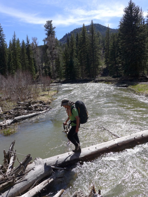
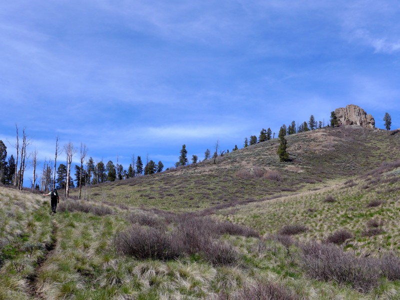
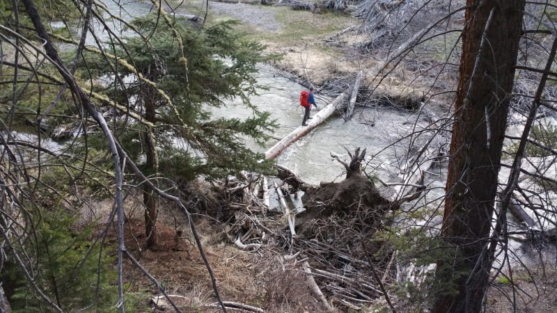
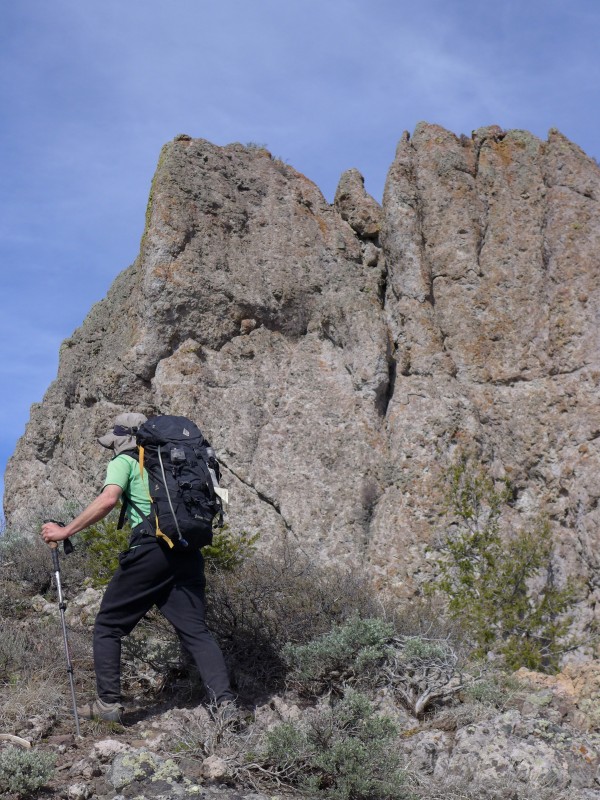
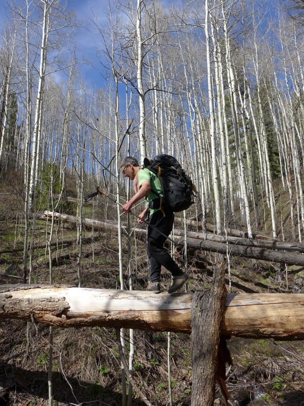
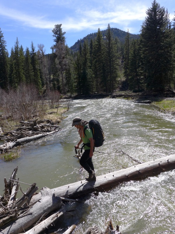
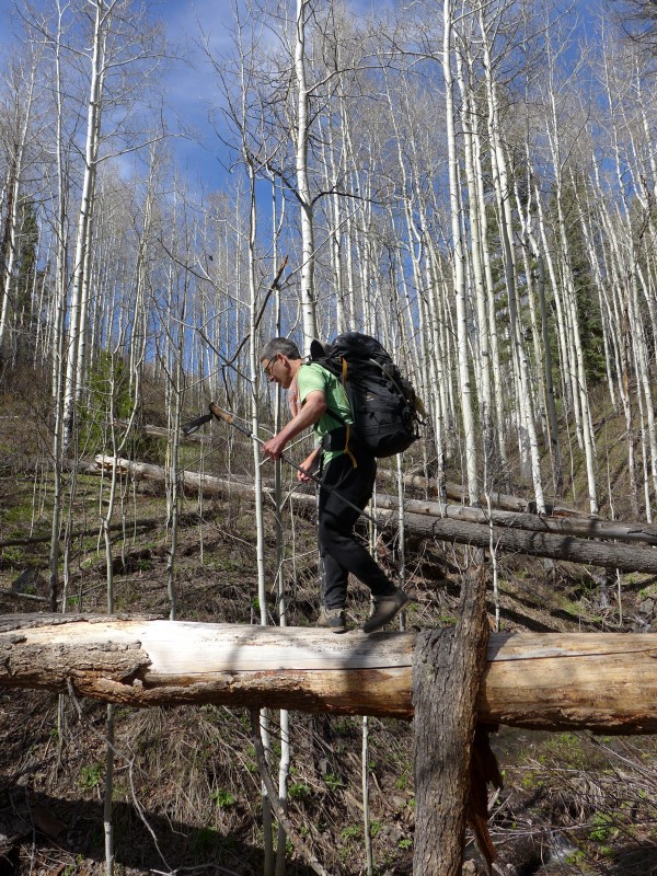
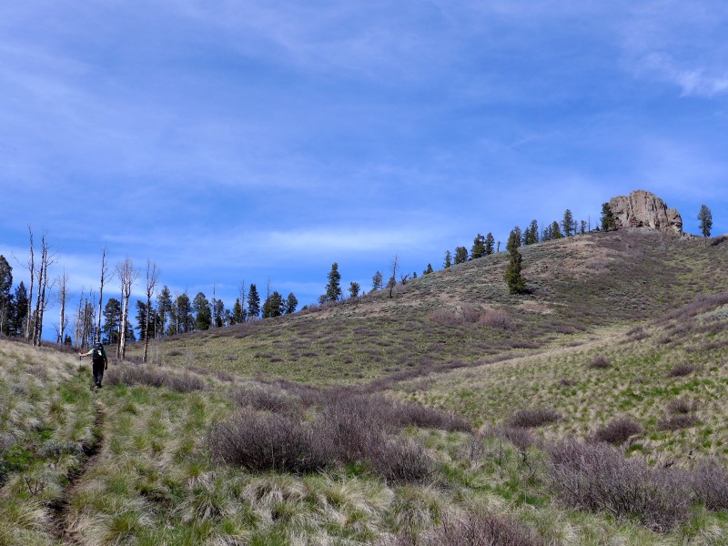
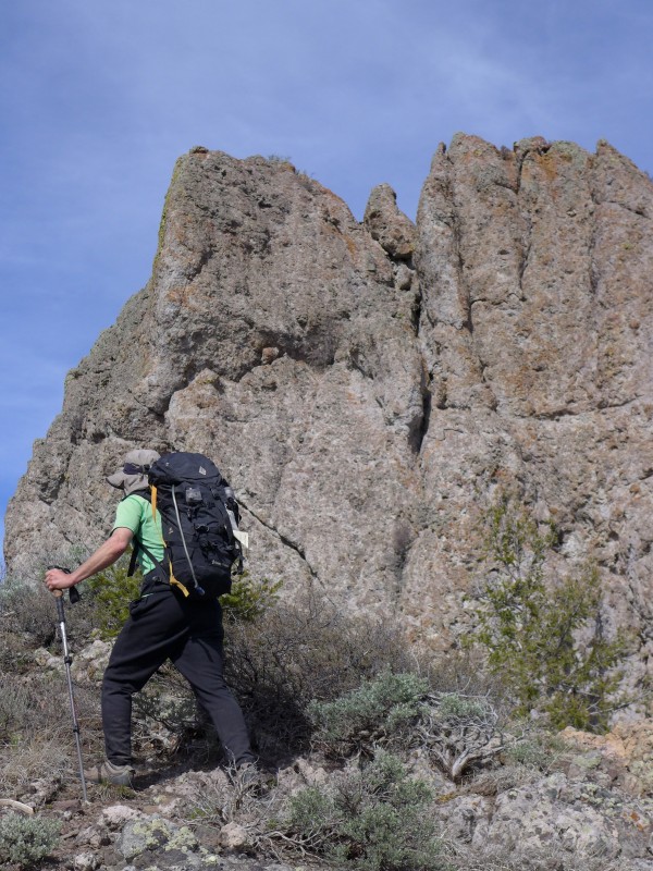
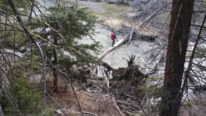
Between one thing and another we were about an hour behind schedule when we encountered a locked Forest Service gate two miles south of our intended parking spot. Starting much further away than we'd planned jeopardized our already tight timeline but as this point, everything started breaking our way. We walked north up the road for about a mile and a half, then saw that the easiest looking terrain in the entire area angled from the road directly to the peak and even appeared to have an unexpected trail through much of it. The only catch would be crossing the creek but here too we caught a break as an almost tailor made log jam got us across with dry feet. As the summit pinnacle came into better view, our hopes waned then waxed, as from a distance it appeared vertical and featureless but as we got closer, weaknesses started to appear and it began to seem shorter than we'd thought. The diminished height turned out to be an illusion caused by a false summit 50' to the west which obscured the bottom third of the summit spire, but otherwise, the west face offered some promising chimney lines. The first full view of the tower, from the false summit, revealed more good luck as the tower sides dropped away to the north and south, making the west side by far the shortest and eliminating the need for a time-consuming circumnavigation/inspection of the other three sides of the tower. (The approach ended up taking about 3.5 miles, 1600' vertical and almost two hours.)
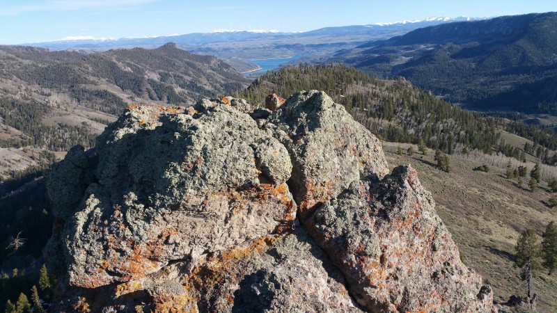
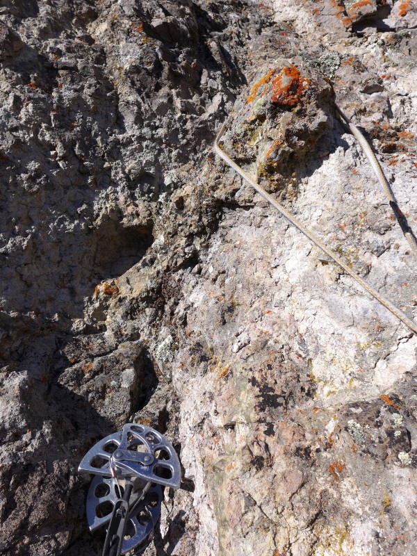
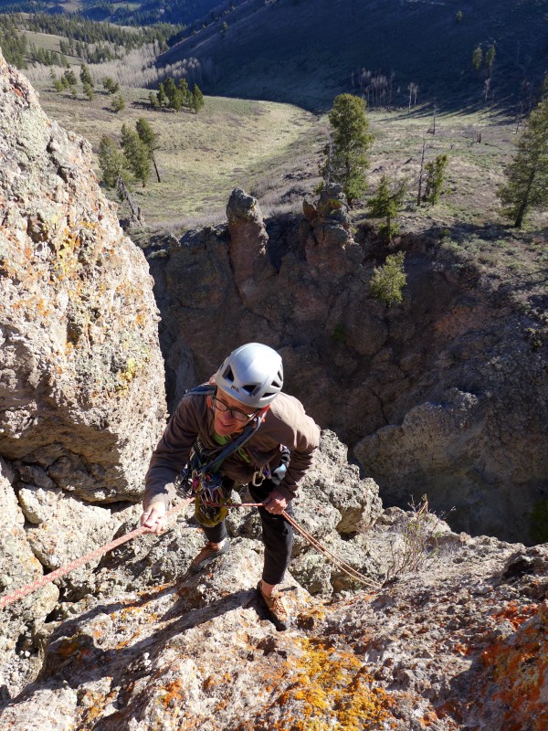
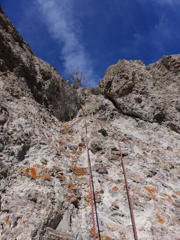
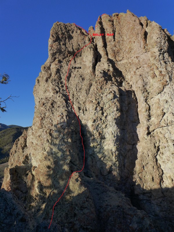
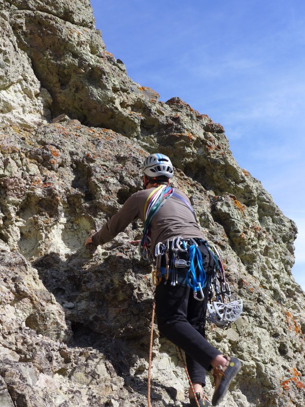
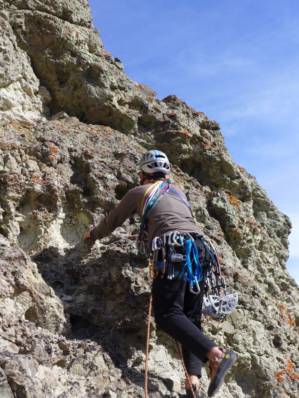
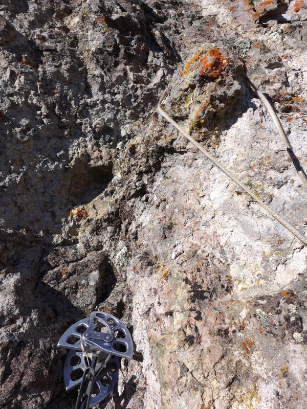
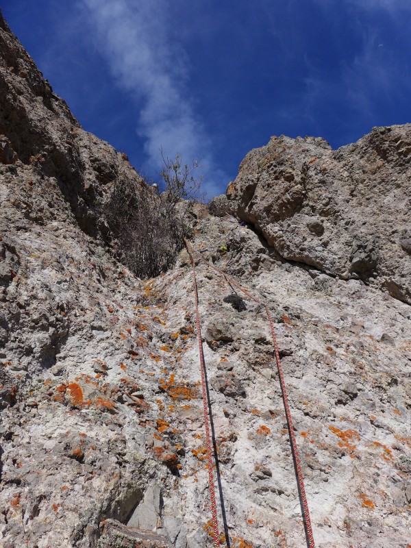
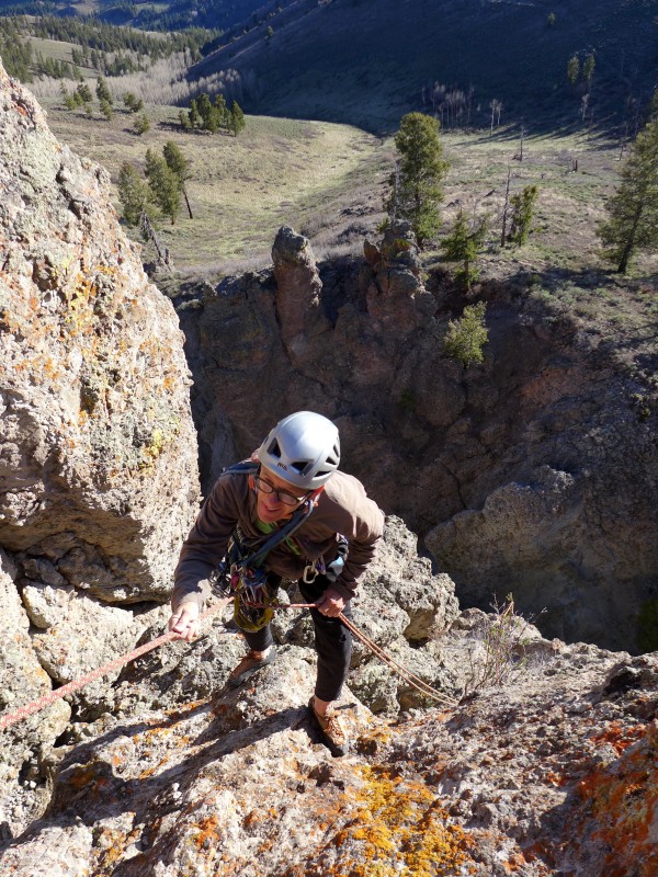
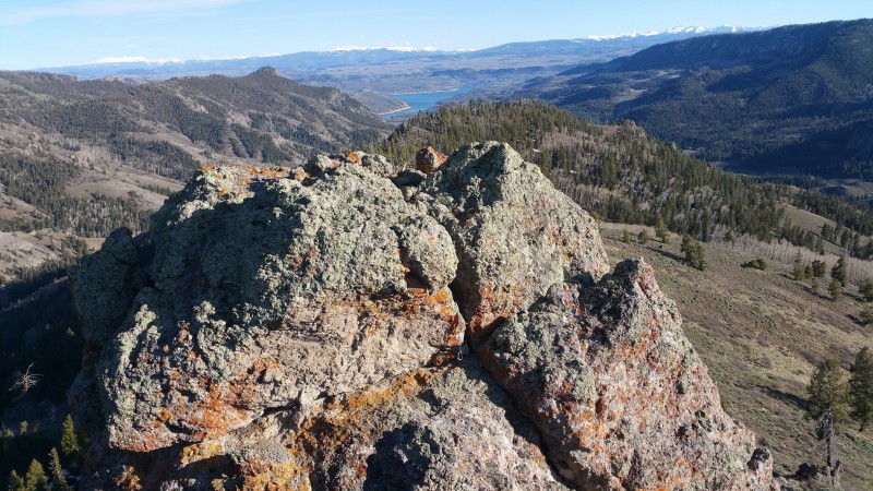
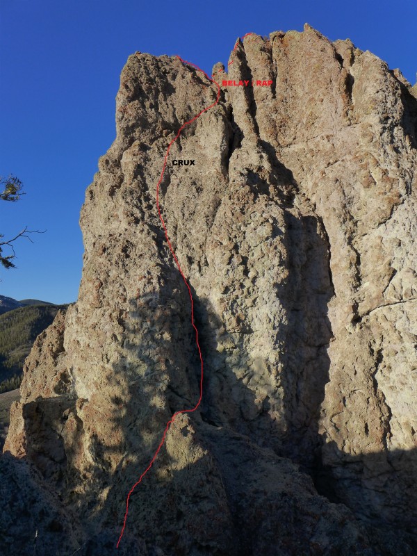
Our route started at the saddle between the false summit and the main summit pinnacle. The first 15' was class four scrambling on very poor rock. It then traversed around a pillar at class two and into a 20' long, 5.0ish chimney on slightly better rock with a couple of decent pieces in the thin hands range. Above the chimney was 30-40' of easy slabbing with little to no pro on somewhat solid rock. At this point there were good #3 and #5 Camalot placements. Above this spot, the apparent crux loomed, as the rock steepened, deteriorated and appeared to often little to no protection. The climbing turned out to be technically easy, ~5.4, but with a 20' run out on very questionable gear and every hold having to be triple checked, it felt harder. (Afterward, we discussed how the American rating system really didn't do this climb justice and that something like the British E system would be more suitable.) We'd been using our single 60 meter rope as a double; consequently, despite having moved the belay up 20', we ran out of rope and had to belay just short of the summit ridge. We couldn't tell which of two points, one north and one south of the belay, was higher so we visited both; from the belay, the north summit was third class and south about 5.2. From the summits, we were still unable to determine which was higher but left a register on the north summit. We'd made good enough time that we were able to linger on top for a couple of minutes and enjoy the splitter weather, crystalline skies and views of the nearby ruggedness of Soap Park and the distant snowcaps of the La Garitas and Lake City peaks.
To rappel, we wrapped two strands of 5mm cord around a big pillar next to the belay. From here a full 30 meter rap made it to the ledge at the start of the chimney where it was possible to downclimb easy class 3 to the south. This ended in a steep, very loose "class two" gulley about 30' below the start of the climb.
The climb took about two hours saddle to saddle. We thought it was about 5.4 R/X and 130' but climbed harder because of the suspect rock.
Placements I remember: #2 Friend, #2 Camalot, ???, #3 Camalot, #5 Camalot, .5 TriCam, #4 Camalot, draped sling, #1 Camalot, #5 Rock, #1 Camalot, #6 Camalot.
We made it back to the car comfortably before dark and found a decent camping spot by the creek, near a corral south of Soap Creek Campground, around 38.5444,-107.3143.
This climb was very satisfying, even more so the next morning when, after having driven to Pioneer Lookout Point, the trailhead for the Curecanti approach, we discovered that the needle was closed until July 15th for raptors. We didn't do the peak we had expected to but did the one we had not; so it goes.
All photos by Dougald MacDonald except where noted.
Fortuitous log crossing Gratuitous log crossing Bonus trail The start, every hold suspect Bomber gear protecting 20' crux runout Crux Starting the rapel Looking south from north summit over Blue Mesa Res. towards Lake City (photo by dhgold) Photo by dhgold View from the false summit
My GPS Tracks on Google Maps (made from a .GPX file upload):
Another great report, Dave. Funny, I looked at this peak I think in 2014, the rock seemed too weak and the crux too long for a solo ascent (as you know, there's a potential for a nasty drop off to the side). I briefly considered returning, but I wondered about the pro. Your report, however, jogged my memory that it had been raining steadily when I checked it out, drizzling throughout the day. I suspect that might have affected my assessment, I was able to easily peel off damp fist-sized chunks of "rock." Obviously more solid when dry. Great job in knocking this one off.
Russian roulette with four bullets in the chamber 5/16/2016 7:00pm
Tom,
Soloing this one in the rain would have been well beyond bold, more like suicidal. In dry conditions we peeled off many fist-sized chunks. There is enough choss there that a hard rain would cause rock fall. Nonetheless, with a rope, a fun outing for choss aficionados.
Awesome report and pictures Dave! I always look over at that peak when we are rolling along Hwy 50. Looks really fun & hard. Nice job getting across Soap River, I mean Creek. The size of that creek in rather intimidating this time of year. Cheers! jp
Caution: The information contained in this report may not be accurate and should not be the only resource used in preparation for your climb. Failure to have the necessary experience, physical conditioning, supplies or equipment can result in injury or death. 14ers.com and the author(s) of this report provide no warranties, either express or implied, that the information provided is accurate or reliable. By using the information provided, you agree to indemnify and hold harmless 14ers.com and the report author(s) with respect to any claims and demands against them, including any attorney fees and expenses. Please read the 14ers.com Safety and Disclaimer pages for more information.
Please respect private property: 14ers.com supports the rights of private landowners to determine how and by whom their land will be used. In Colorado, it is your responsibility to determine if land is private and to obtain the appropriate permission before entering the property.




 Download GPX file used in this map