Download Agreement, Release, and Acknowledgement of Risk:
You (the person requesting this file download) fully understand mountain climbing ("Activity") involves risks and dangers of serious bodily injury, including permanent disability, paralysis, and death ("Risks") and you fully accept and assume all such risks and all responsibility for losses, costs, and damages you incur as a result of your participation in this Activity.
You acknowledge that information in the file you have chosen to download may not be accurate and may contain errors. You agree to assume all risks when using this information and agree to release and discharge 14ers.com, 14ers Inc. and the author(s) of such information (collectively, the "Released Parties").
You hereby discharge the Released Parties from all damages, actions, claims and liabilities of any nature, specifically including, but not limited to, damages, actions, claims and liabilities arising from or related to the negligence of the Released Parties. You further agree to indemnify, hold harmless and defend 14ers.com, 14ers Inc. and each of the other Released Parties from and against any loss, damage, liability and expense, including costs and attorney fees, incurred by 14ers.com, 14ers Inc. or any of the other Released Parties as a result of you using information provided on the 14ers.com or 14ers Inc. websites.
You have read this agreement, fully understand its terms and intend it to be a complete and unconditional release of all liability to the greatest extent allowed by law and agree that if any portion of this agreement is held to be invalid the balance, notwithstanding, shall continue in full force and effect.
By clicking "OK" you agree to these terms. If you DO NOT agree, click "Cancel"...
summit elevation: 5,735 ft
starting elevation : 1,171 ft
gain : 4,564 ft
ascent time : 2:20
mileage : unknown but probably < 8 total
I had originally planned to climb Mount Ngauruhoe (Mt Doom) and write about that, but the weather didn't cooperate due to a big storm. New Zealand can be rainy most days of the year. So I managed to do a lot of amazing things beyond hiking up mountains, but only got some minor hill summits in, and with an extra day in Queenstown, Ben Lomond is a good (and free) option, if you're done throwing money away on a quick adrenaline rush like bungee. Despite its reputation as the adventure capital, once you're done jumping off or out of things, it's a rather dull and pricey town (very similar to Aspen, even with its surroundings, $11 beers, plus a big lake).
With weather not really a concern and due to the low elevation, I set out after lunch at 1pm for a hike with about 4600ft elevation gain.
The trail is easily accessed from downtown near the base of the gondola and ascends steeply and consistently. Similar to Bear Peak but over twice as long, or Mt Washington in terms of grade and feel.
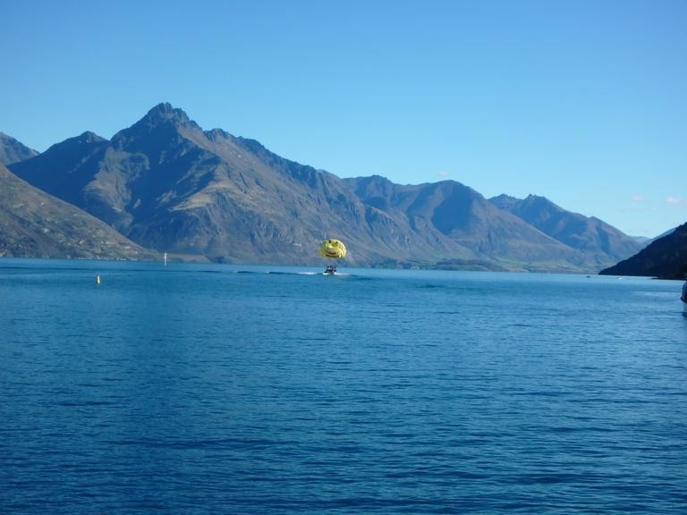
Parasailers on the lake (that's another mountain in the background):
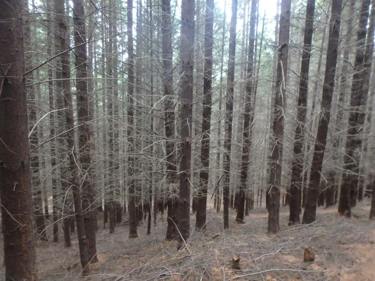
What looks like beetle kill is actually due to a non-native plant eradication program. Douglas fir and other conifers were planted in New Zealand during colonization, and are now being killed by herbicide. Through this forested area there are also a bunch of ziplines and mountain bike trails as the hikers trail passes through. Although there are switchbacks, it's still pretty steep. I top out at the top of the gondola complex in about 30 minutes. Alpine luge and paragliding rides take off from here.
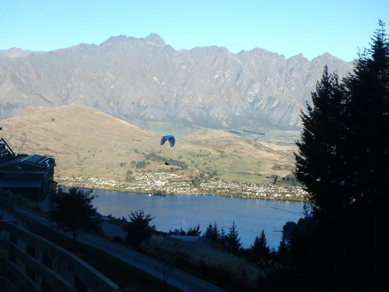
I see a little silhoutetto of a man...
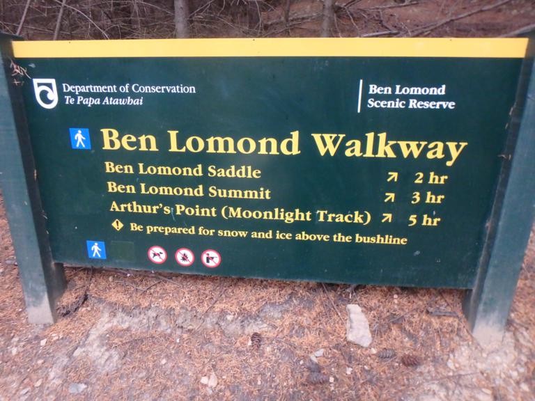
Trail signage in New Zealand typically gives hike times, not distances. Some will also give the distance. If you hike in CO a lot, you should be able to cut these listed times in half, as I did.
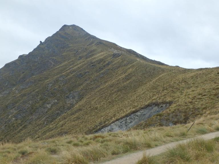
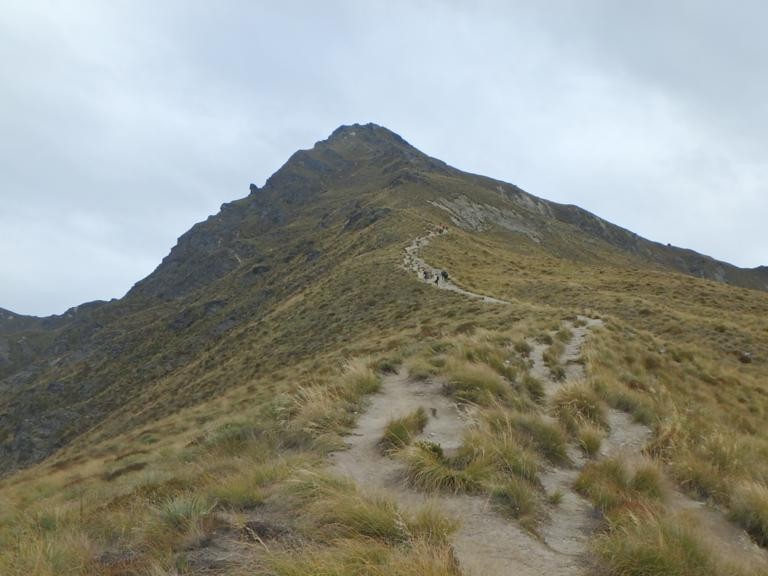
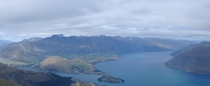
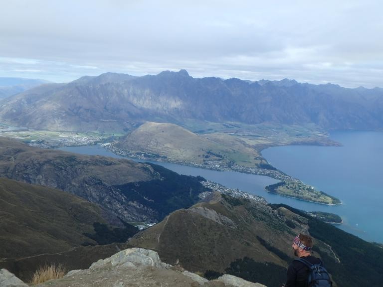
The summit is easily seen from town and throughout the hike, as there's not much treeline (or bushline, as they call it)
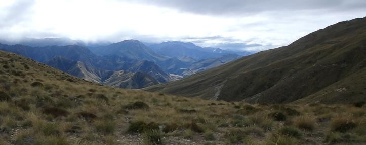
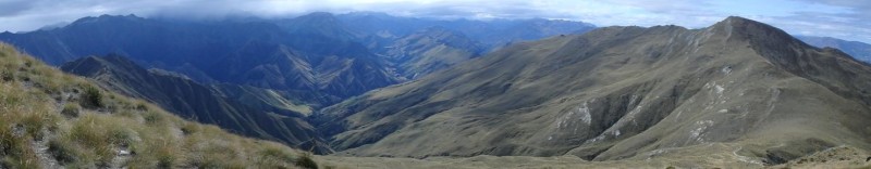
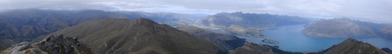
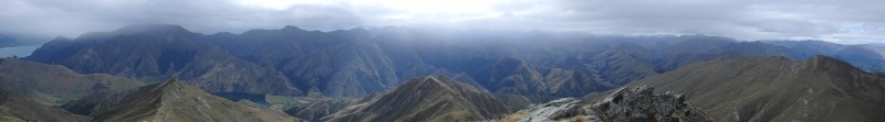
Up to the saddle, the hike is fairly dull (but a workout), just going steadily up grassy slopes of snow tussock, with the same backdrop of the lake and town. Then once at the saddle, the views to the back side are much more dramatic. Unfortunately a weather system was moving in on the horizon during my ascent, so I didn't get the best view of the high peaks on the horizon.
The last stretch up from the saddle to the summit is a bit longer than it looks. Despite it not being rocky, it still had a bit of an alpine feel of a much higher peak.
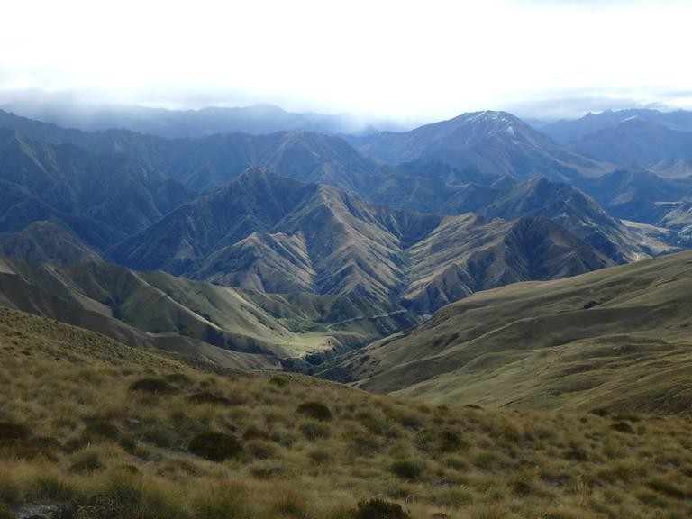
The summit had quite a few people on it, and one of those disks identifying the other peaks. Some summit views. The rugged peaks beyond the lake are the Remarkables and there's a ski area on those, despite the area looking like a desert in fall.
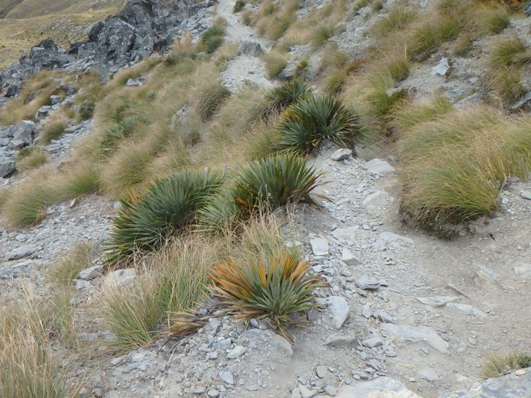
some of the vegetation (the grass is called snow tussock and is the 'tundra grass' of that area):
I saw this mountain goat on the way down (one from the Alps, not North American species) but he went away from me:
On the descent I took a different trail - the One Mile trail, for a bit of variety. It was more interesting, passing a bit more rainforest, waterfalls, and a creek with trout. The descent was steep, despite the well maintained trails all over, there are hardly any switchbacks, and I got blisters and a toe knuckle cut. I'm used to steep grades over short distances and some vertical, but this was persistent for hours.
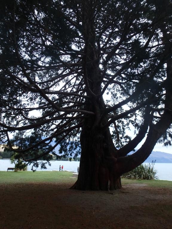
Huge hemlocks as I popped out by the lakeshore park:
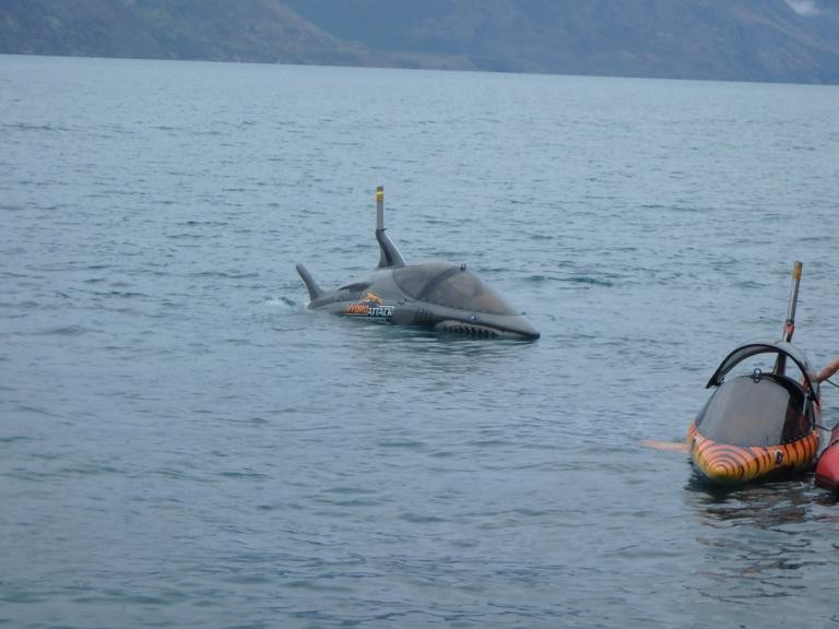
And you can ride in one of these speedy HydroAttack submersibles for $130 or so - they dive and jump like sharks.
some last pictures taken on other days:
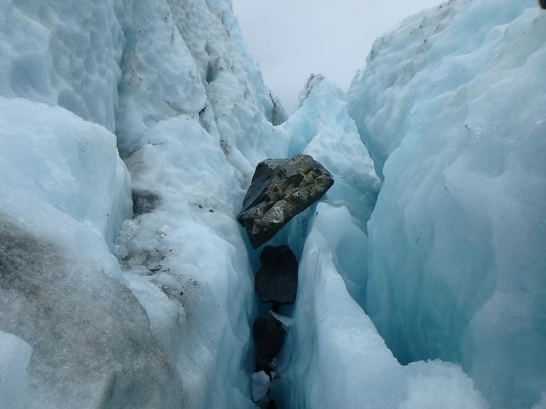
This is an example of a glacier actually picking up and moving a large boulder down a mountain:
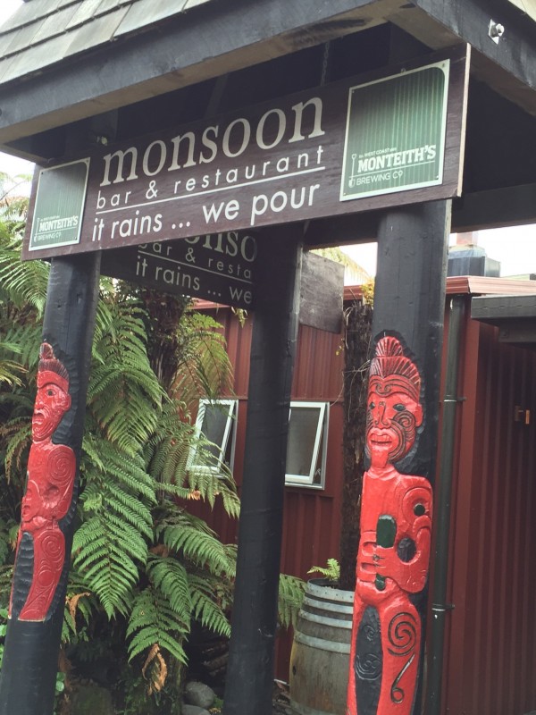
Fitting name for a bar in Franz Josef (and it does rain a lot, especially in the rainforest).
There's also an Eddyline Brewery location in Nelson with the same beers as Buena Vista (same brewery, different location).
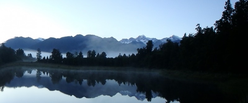
Obligatory Mt. Cook and Tasman picture. Unfortunately that's as close as I got. I ended up spending most of my time around the coastal areas.
Thumbnails for uploaded photos (click to open slideshow):
agreed that everything costs mucho money out there but theres ton of free, cool shit to do. and you found one here (the remarkables caught my eye also but no time...)
I thought Queenstown was pretty rad and Glenorchy up the road, even radder. make it up there?
cool report, brings back good memories and some bad, like the damn times to things on the signs instead of distances...
lastly, you try that Monteiths cider? I dont drink that stuff here in the states but down there I was really digging it haha
I didn't get up to Glenorchy but got some recommendations. Guess the rain and wandering town it got old quick - mainly seemed so much like the US. I got out to Doubtful Sound and kayaked out there and it was awesome scenery. I spent a good bit of time in and on the water and in caves (the stuff that was different from CO).
I don't like cider, didn't try Monteiths cider but some Brits seemed to like it. There was a big storm that washed a bunch of apples into the sea. I got into a lot of debates about beer (and wine) with Kiwis, Brits, Germans, and Belgians. I was taunted by all the hops I drove past but didn't find them in most of the beers
Caution: The information contained in this report may not be accurate and should not be the only resource used in preparation for your climb. Failure to have the necessary experience, physical conditioning, supplies or equipment can result in injury or death. 14ers.com and the author(s) of this report provide no warranties, either express or implied, that the information provided is accurate or reliable. By using the information provided, you agree to indemnify and hold harmless 14ers.com and the report author(s) with respect to any claims and demands against them, including any attorney fees and expenses. Please read the 14ers.com Safety and Disclaimer pages for more information.
Please respect private property: 14ers.com supports the rights of private landowners to determine how and by whom their land will be used. In Colorado, it is your responsibility to determine if land is private and to obtain the appropriate permission before entering the property.


")
")
")
")
")
")
")
")
")
")
")
")
")
")
")
")
")
")
")
")
")
")
")
")
")


