Download Agreement, Release, and Acknowledgement of Risk:
You (the person requesting this file download) fully understand mountain climbing ("Activity") involves risks and dangers of serious bodily injury, including permanent disability, paralysis, and death ("Risks") and you fully accept and assume all such risks and all responsibility for losses, costs, and damages you incur as a result of your participation in this Activity.
You acknowledge that information in the file you have chosen to download may not be accurate and may contain errors. You agree to assume all risks when using this information and agree to release and discharge 14ers.com, 14ers Inc. and the author(s) of such information (collectively, the "Released Parties").
You hereby discharge the Released Parties from all damages, actions, claims and liabilities of any nature, specifically including, but not limited to, damages, actions, claims and liabilities arising from or related to the negligence of the Released Parties. You further agree to indemnify, hold harmless and defend 14ers.com, 14ers Inc. and each of the other Released Parties from and against any loss, damage, liability and expense, including costs and attorney fees, incurred by 14ers.com, 14ers Inc. or any of the other Released Parties as a result of you using information provided on the 14ers.com or 14ers Inc. websites.
You have read this agreement, fully understand its terms and intend it to be a complete and unconditional release of all liability to the greatest extent allowed by law and agree that if any portion of this agreement is held to be invalid the balance, notwithstanding, shall continue in full force and effect.
By clicking "OK" you agree to these terms. If you DO NOT agree, click "Cancel"...
March 19, 2016
~14.2 Miles, ~6,900 Gain (would be less with better navigation)
TH: Cottonwood Creek (2WD)
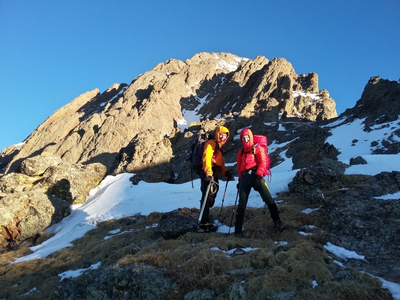
Last minute winter surprises are always welcoming as I wasn't expecting to complete any more winter 14ers this year. Our original plan in the Elks had to be adjusted due to deteriorating conditions so we settled on the Crestone Traverse. Amy, Jomah and I made our rendezvous at the Cottonwood Creek trailhead Friday afternoon for our early departure of 2:00 AM.
We all attempted to get to bed early for the early alarm which only came a few hours later. We packed, grabbed quick bite to eat and started up the Cottonwood Creek trail at 2:00 AM.
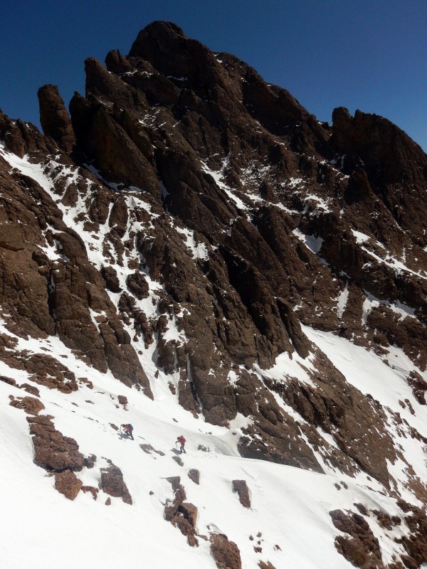
As we neared the fork in the drainage for Cottonwood Lake, the snow firmness was slowly deteriorating. Still being pitch black, we knew we didn't want to struggle with the infamous slabs further along the creek or wallow in our snowshoes. We departed the trail ~10,400 and climbed up the steep northern, south facing slopes of the Cottonwood drainage. A few slabs and some boulder fields slowed us down but it wasn't as nightmarish as some other parties have experienced.
Despite not feeling as if we were gaining ground, we quickly reached ~11,300 where a minor cliff and some wallowing in soft snow somewhat disheartened our choice to leave the trail early. Fortunately, we quickly bypassed the cliff and found the established trench. Hopes were high since we still hadn't donned our snowshoes. Due to the steepness of the drainage leading to Cottonwood Lake and lack of snow, we failed to find our way onward efficiently. A little trail-breaking, now with snowshoes, and some circumnavigating, we were back on track.
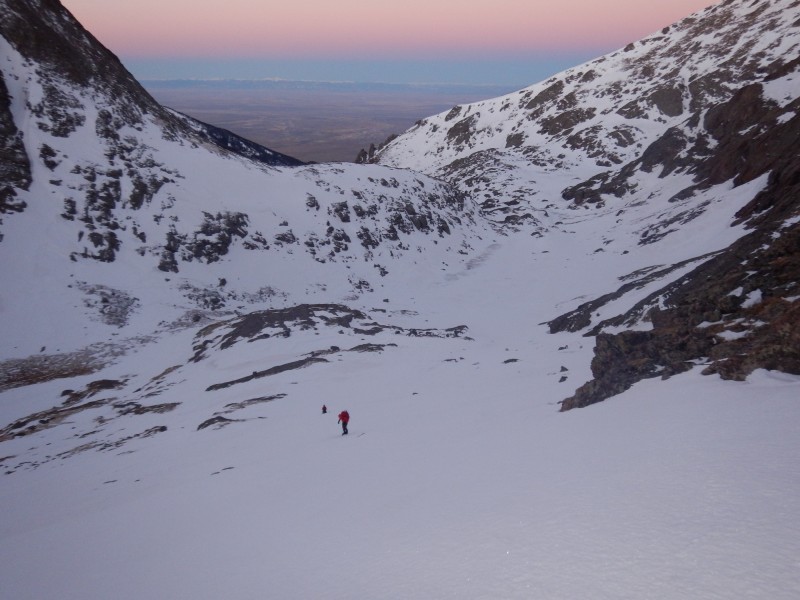
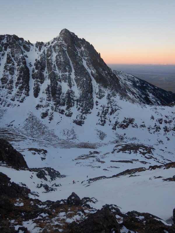
The snow higher in the basin was enjoyably firm where we decided to stash our snowshoes near a boulder near our exit from the Red Gully off Crestone Peak. We continued up the basin, hiked past Cottonwood Lake and started up a near perfect condition snow slope to intercept the standard route on the Crestone Needle. We easily bypassed the climb to Broken Hand Pass.
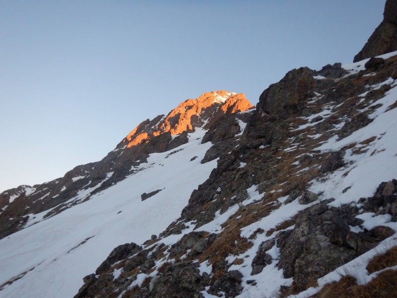
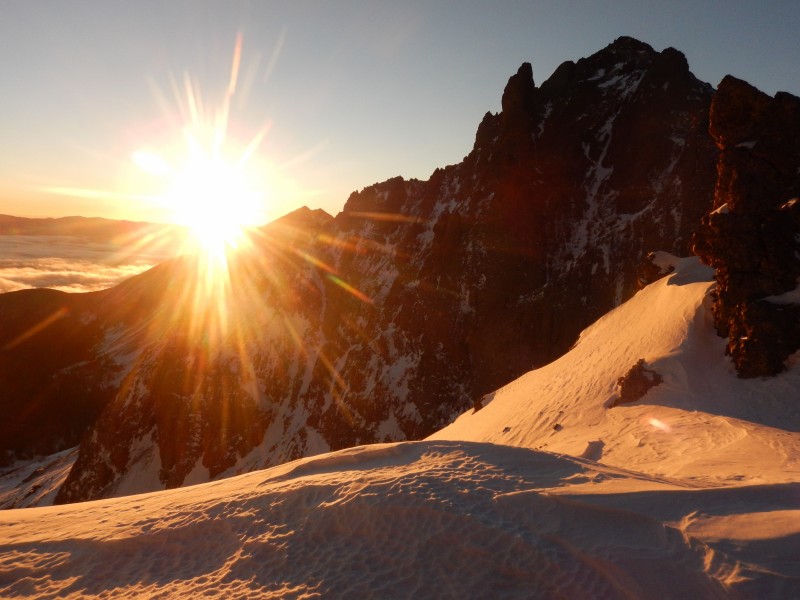
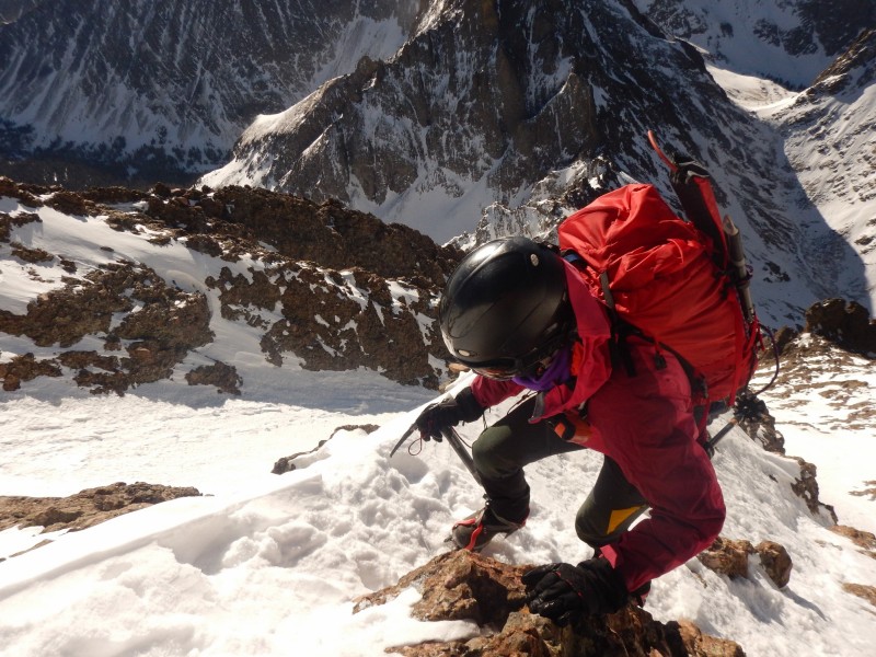
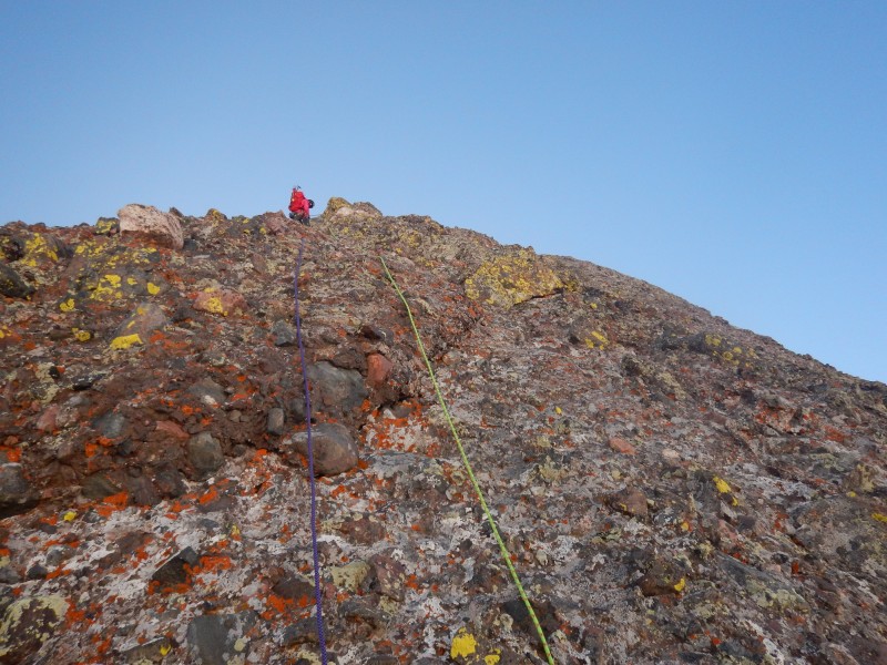
Pink and purple skies led to a welcome sunrise as we neared the base of the couloir leading to the summit of the Needle. Good crampon snow further guided us to the summit where we arrived at 9:00 AM. A frigid gale stripped our heat away and our stay on the summit was short.
Morning light.
Alpenglow on the Needle.
Ascending up the Needle. Crestolita behind.
Sunrise over Broken Hand.
Crestone Needle! (Photo by Jomah)
Welcomed sun.
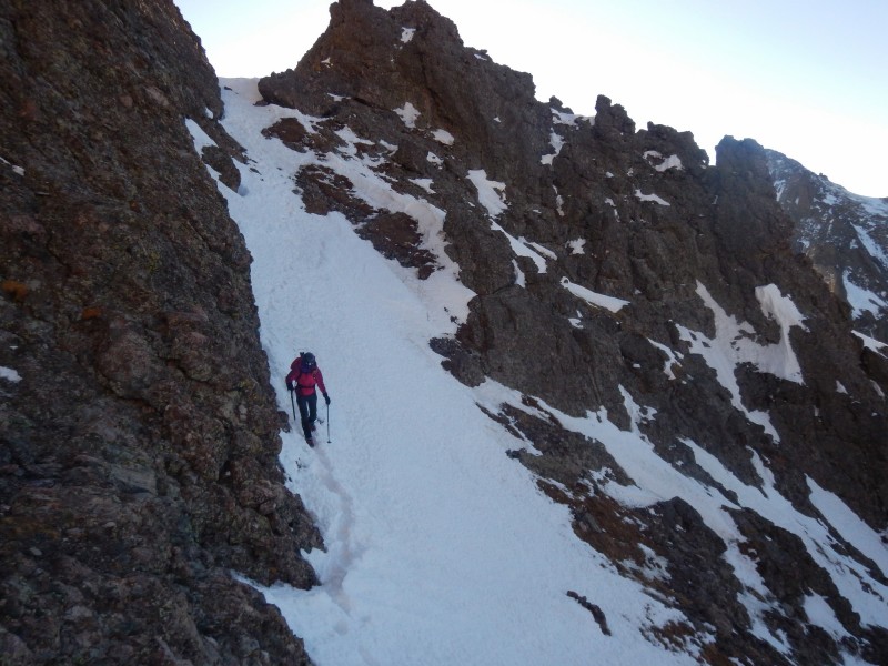
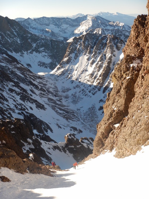
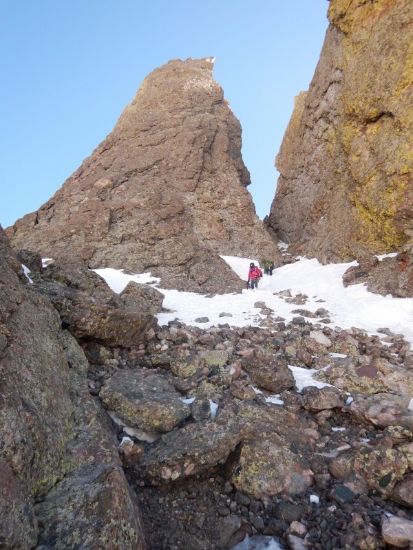
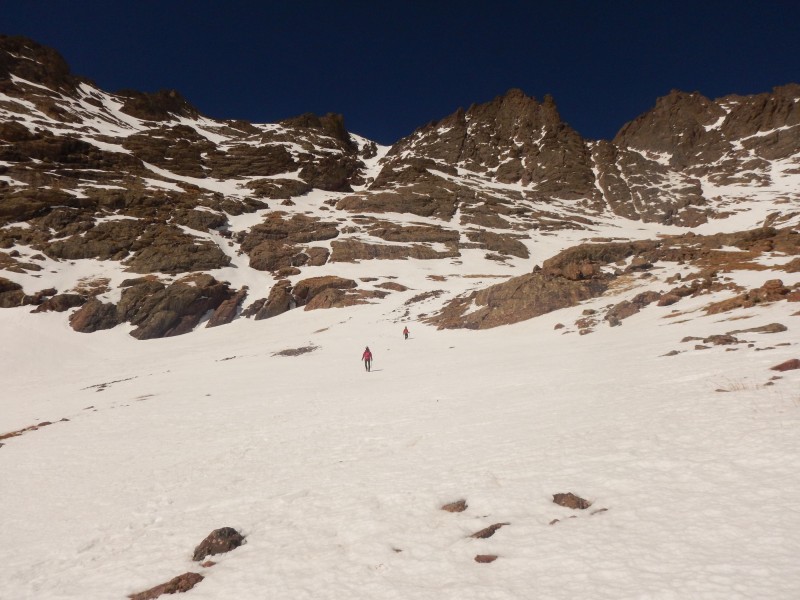
En-route to the couloir.
En-route to the couloir.
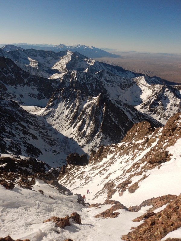
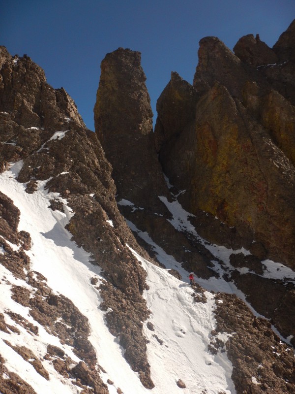
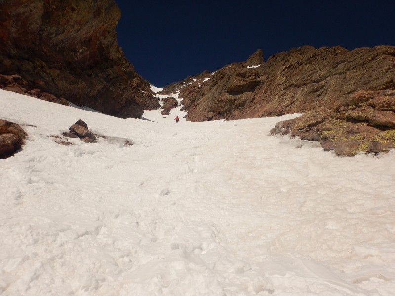
Couloir up the Needle.
Couloir up the Needle.
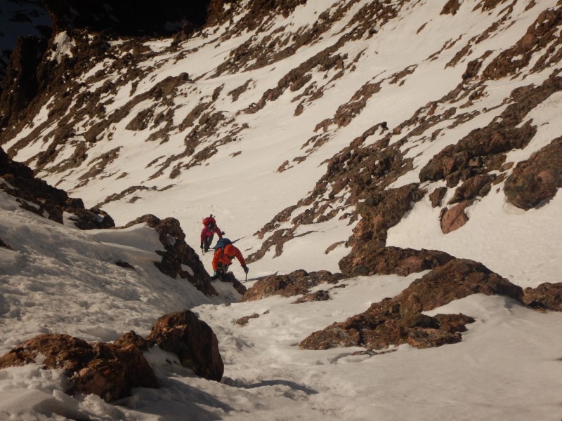
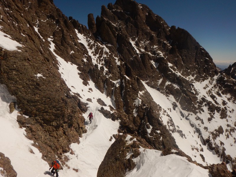
Snow climbing high on the Needle.
Snow climbing high on the Needle.
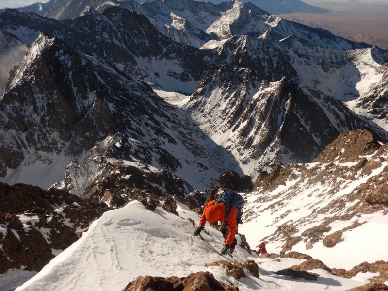
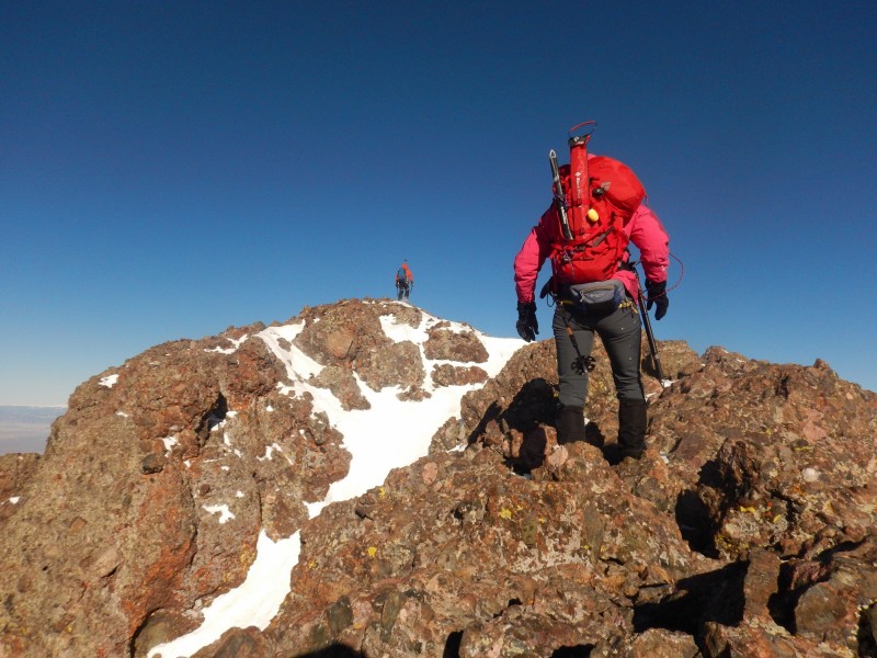
Nearing the summit.
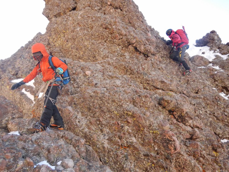
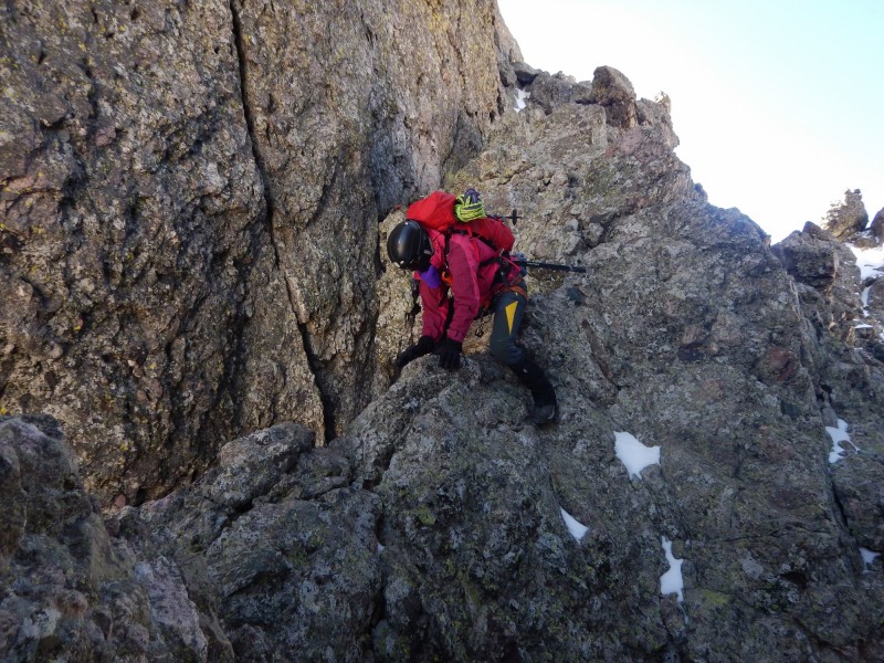
Fun climbing.
Final push up the Needle.
Summit of the Needle. (Photo by Jomah)
By far the crux of the day was reaching the rappel anchor and the rappel off the Needle. Wind gusts easily exceeded 30 MPH. Without shame, I crab walked on all fours to the anchor. The gusts could have easily knocked us off our feet. We promptly uncoiled our two 30M ropes for the 90 foot rappel.
Rap off the Needle.
Naturally, the wind made the rope toss difficult. I started down on rappel first where I enjoyed removing several knots. It's a pastime of mine. About two thirds of the way down the rappel, a wind gust swept me off my feet, however, I knew I wasn't going to fall far since a well-tied knot would have quickly been eaten by my rappel device. Still, the wind did not inspire confidence.
Rap off the Needle. (Photo by Amy)
Gaining some stability on my knees, I continued to remove knots in the rope and welcomed the end of the rappel. I held the end of the ropes to avoid further rope tangle and provide a fireman's belay for Amy and Jomah as they rapped. The class 3 conglomerate slabs below the rappel were dry so we decided to take off our crampons. Since we were in the shade, we had a hard time staying warm.
Slabs after the rap.
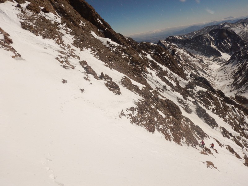
With some snow further down, I put my crampons back on where snow covered ledges further guided us downwards to the gully at the Black Gendarme. Icy in spots, that gully led us to the end of the technical difficulties of the traverse.
Snow covered ledges after the rappel.
Hello, White Rock.
More ledges.
Knife Ridge thing.
Black Gendarme.
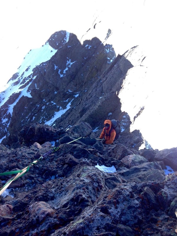
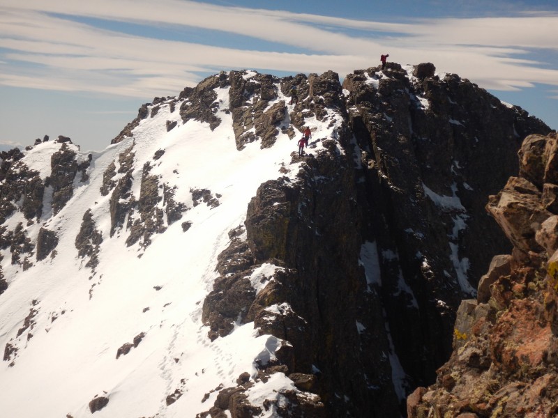
Now, the most physically demanding portion of the traverse commenced. We re-welcomed the sun and took a break out of the wind to refuel. Since I had never done the traverse, I was glad to have Amy and Jomah lead the way though the gullies and ledges to the Black Gendarme. Both Amy and Jomah had never done the traverse from Needle to Peak which then contributed to a minor navigational hick-up 2/3rds of the way across the traverse.
Traversing away from the Black Gendarme.
Traversing.
Love the Needle.
Snow traversing.
Due to snow cover, we missed a traverse across a gully and lost 300 feet down the gully before we discovered our mistake. Softening snow made the fire burn hot in our legs as we re-ascended up the snow to get back on course. Soon, we were back on track where we intercepted another party climbing up the Red Gully.
Final snow ridge to gain the Red Gully.
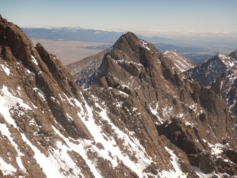
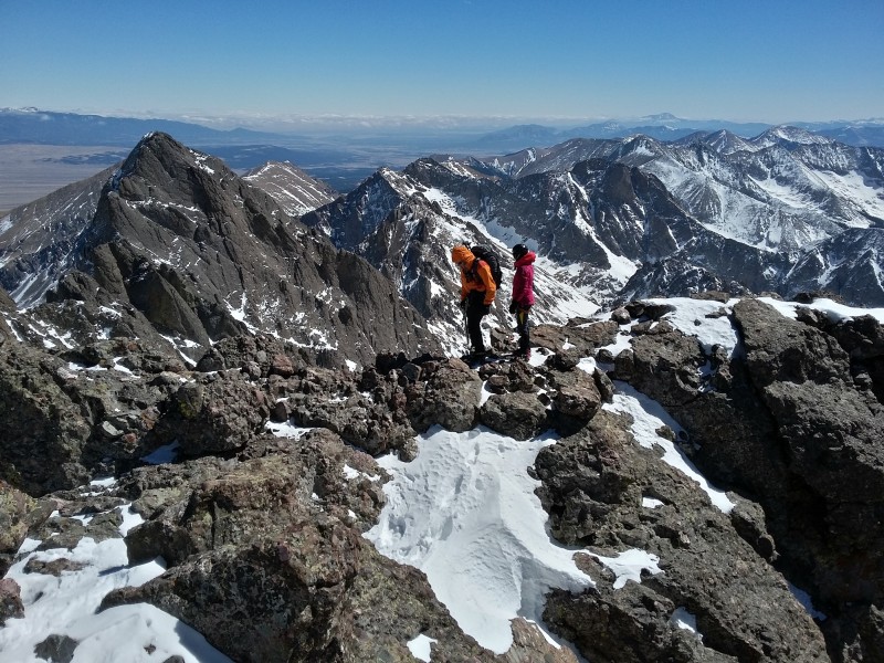
Soft but stable snow sucked our energy as we made the final 400 foot climb up the Red Gully. A fun snow traverse intermixed with rock up the final ridge to the summit provided enjoyable climbing where we arrived on the summit of the Peak at 1:30 PM. We were all glad the wind had subsided and thoroughly enjoyed our sojourn on the summit. Since I had never climbed East Crestone, I made a quick side excursion.
Red Gully on the Peak.
Red Gully on the Peak.
Snow scramble to the summit.
The Needle.
Summit of the Peak. (Photo by Jomah)
Descending off the Peak. Taken from East Crestone.
Descending off the Peak. Taken from East Crestone.
Enjoyable bucket steps led us back to our snowshoes where we had to wear them for a majority of the hike out. Instead of following our steep ascent track back to the main trail, we decided to follow the established trench. I'm not sure which way is better; the verdict is still out. It was a painful slog down Cottonwood Creek in softening snow. Finally around 9,800, we were able to remove our snowshoes and welcomed light feet back to the trailhead, arriving at 6:10 PM. What a fantastic day with fun, solid partners. It was one of the more memorable winter outings I have had in a while.
Needle on the descent.
Red Gully.
Nearing the snowshoes.
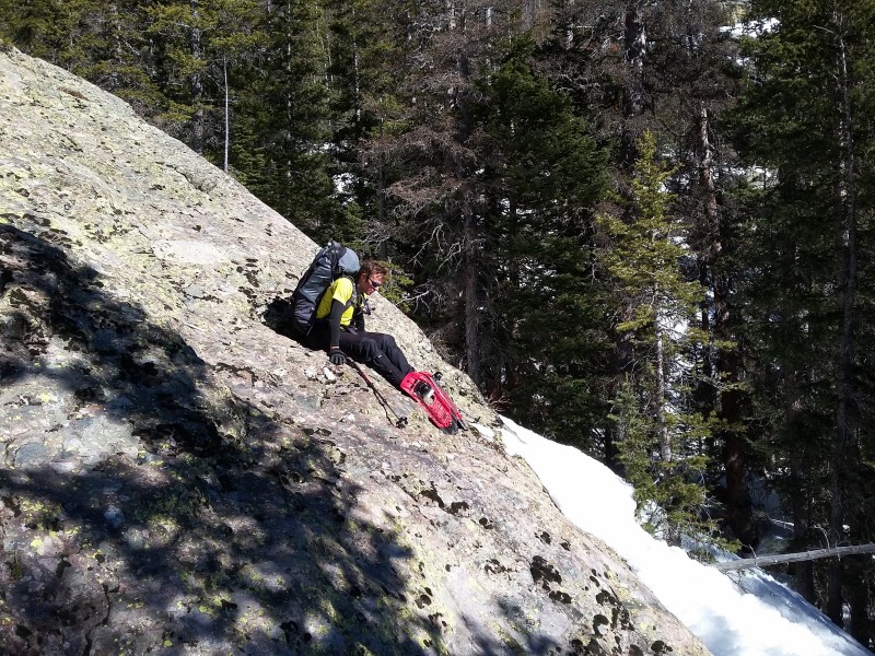
Slabs on the descent. Snowshoeing done correctly. (Photo by Jomah)
Thumbnails for uploaded photos (click to open slideshow):
"we missed a traverse across a gully and lost 300 feet down the gully before we discovered our mistake"
When I initially looked at your map, I was thinking you had to avoid a large snow patch or something. Oops!
Very Nice Trip Report! Great photographs too. Love the shots of the snow climbing & traverse. Thanks for putting this together. Fantastic work with getting two of the tougher 14er summits, and one of the Great Traverses. Truly inspiring and impressive feat. Grand, remarkable accomplishment :!:
Straight Ballin'. Making an extremely tough route look super easy :!:
Congrats on a great day. Sunrise Over Broken Hand - love the light in that photo!
Caution: The information contained in this report may not be accurate and should not be the only resource used in preparation for your climb. Failure to have the necessary experience, physical conditioning, supplies or equipment can result in injury or death. 14ers.com and the author(s) of this report provide no warranties, either express or implied, that the information provided is accurate or reliable. By using the information provided, you agree to indemnify and hold harmless 14ers.com and the report author(s) with respect to any claims and demands against them, including any attorney fees and expenses. Please read the 14ers.com Safety and Disclaimer pages for more information.
Please respect private property: 14ers.com supports the rights of private landowners to determine how and by whom their land will be used. In Colorado, it is your responsibility to determine if land is private and to obtain the appropriate permission before entering the property.