| Report Type | Full |
| Peak(s) |
Mt. Lady Washington - 13,277 feet Prospect Mountain - 8900 |
| Date Posted | 12/31/2015 |
| Date Climbed | 12/31/2015 |
| Author | andrewrose |
| In this valley of dying stars. |
|---|
|
Another year in Rocky Mountain National Park. 2015 was not looking good. A late season 2014 mountain bike crash left me with a shoulder injury, and when the year started I couldn't ride, carry a pack, or climb. I had to do something, and I did something I've never (willingly) done before. Put on a pair of running shoes and went around the block. Thus, most of the winter was spent lapping the block and running repeats of Bear Peak with the goal of maintaining some sort of fitness. But of course the mountains were calling! 3/10/15- Mount Lady Washington loop. The goal of the day was the 11,909 foot Pine Ridge, at the end of the finger of land extending NNE from MLW. It felt like the drive up wasn't worth it just for this, so I decided to make it a day and repeat MLW. It's right there.  Increasingly good views and one of the most iconic peaks in the state.
 Pine Ridge from MLW. I took the east slope up from Chasm Junction, and the North Ridge down to Granite Pass. I ascended the Granite Pass HP and Battle Mountain before hiking over to Pine Ridge.
 MLW from Pine Ridge. I descended through Jim's Grove to pick up the trail, and took all the short cuts on the way back to the car. A promising outing, as I felt quite good over the day.
3/18/15- Signal Mountain. A purposeful winter outing was in order, while it still was winter. I decided to repeat this peak though I'd just done it in November. 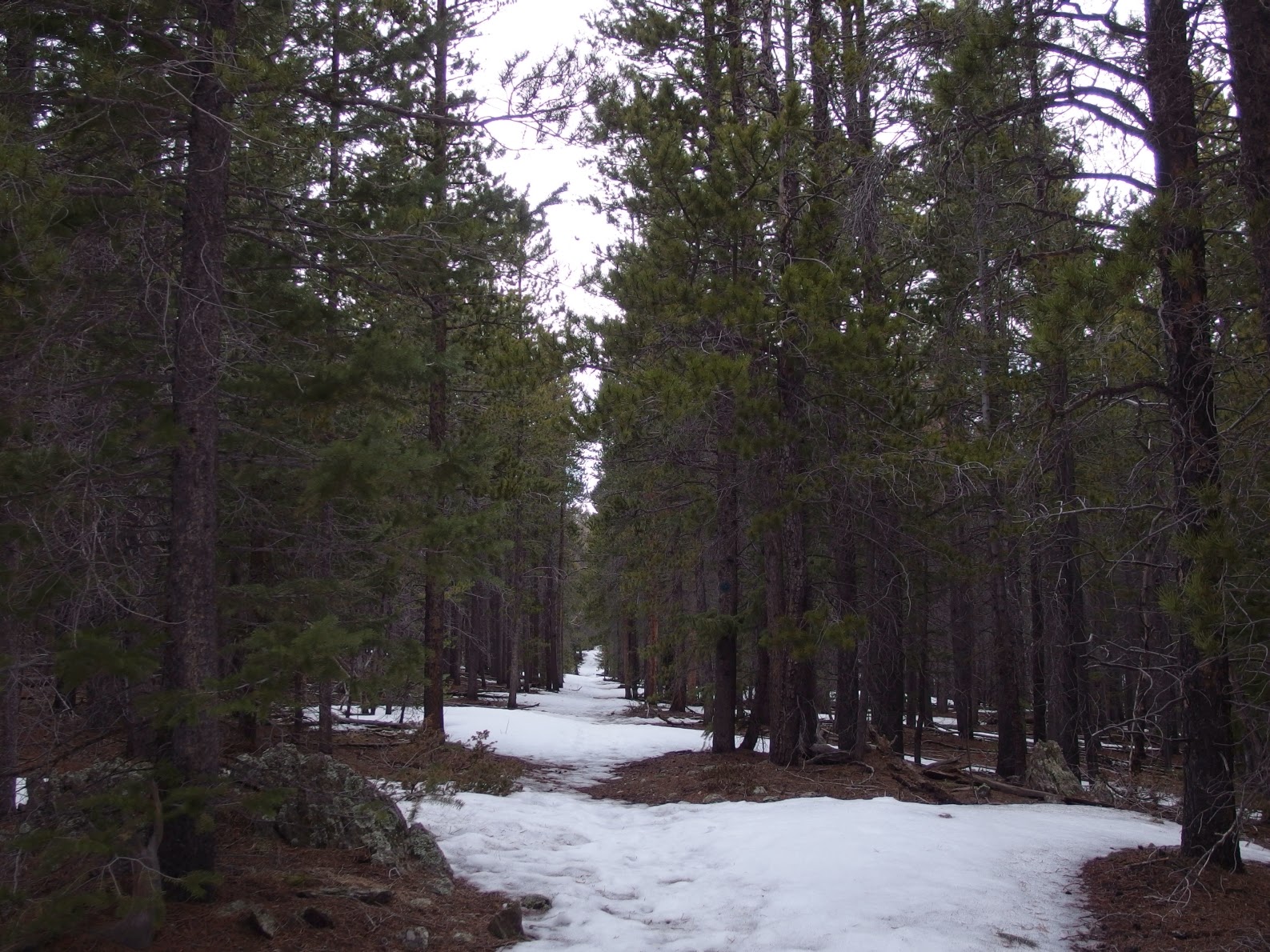 At first I was regretting the snowshoes strapped to my back. The trail was well put in and easy to travel thus far.
 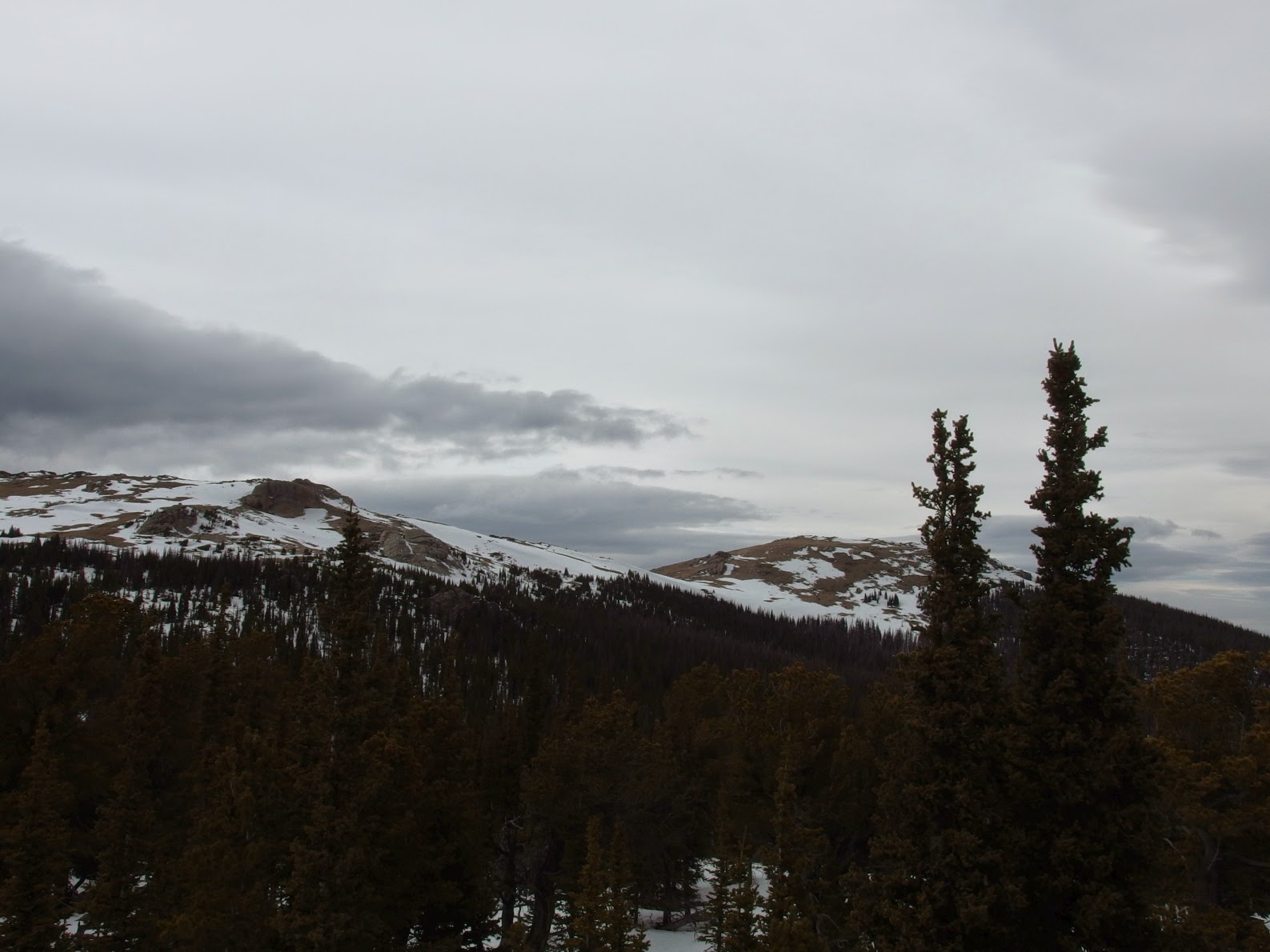 But things fell apart and I fell in love with snowshoes all over again. Though a unsettling moment occurred when I heard a whoomp and had a twenty five by twenty five foot clearing settle as I stood in it. At least it was on a flat.
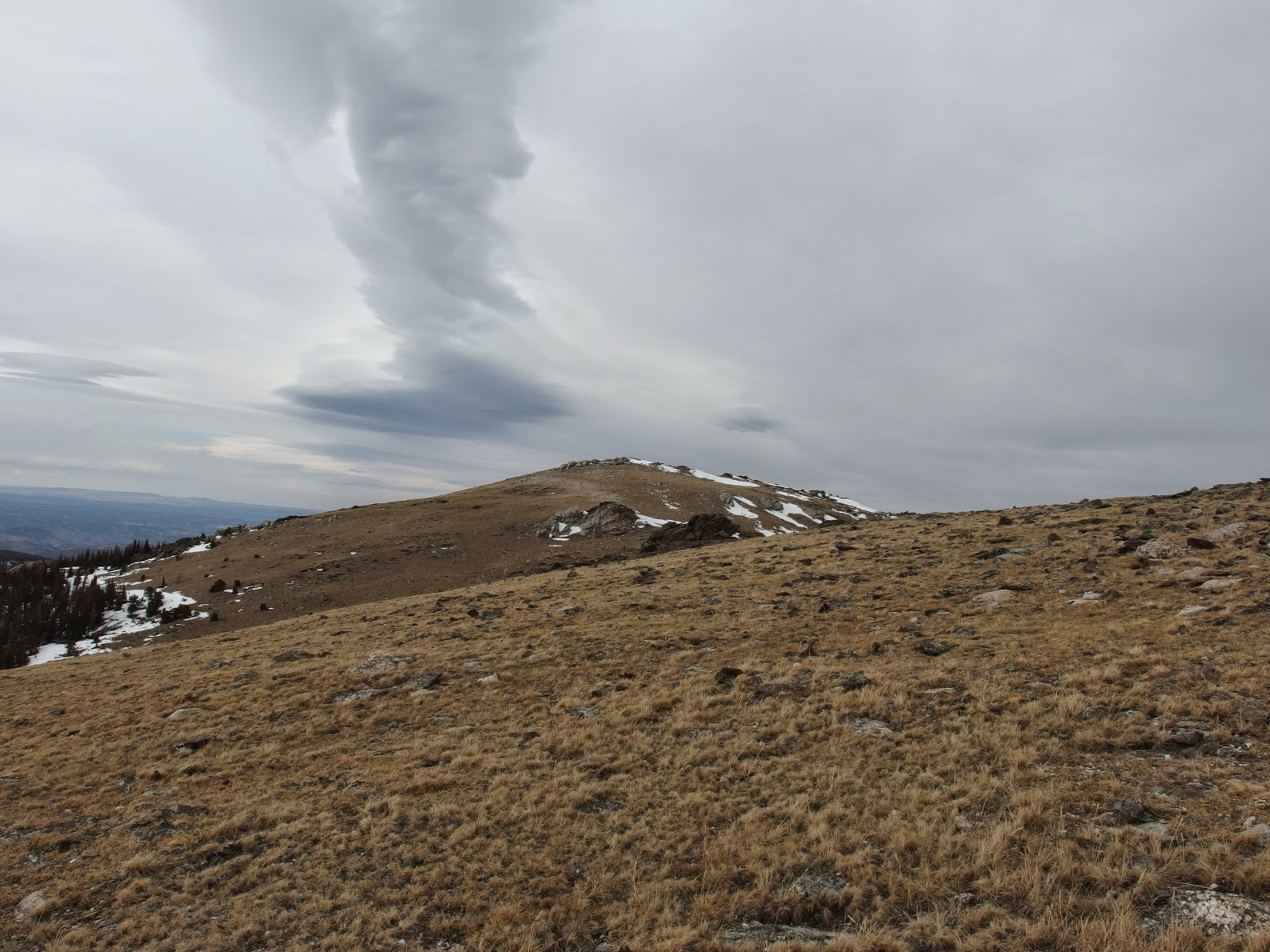 Wind scoured tundra. I'd see alot of great summit registers this year, and this was the first.
6/2/15- Mummy Mountain. I've been up Mummy several times now, and again feel this is a good early season peak. Distance and elevation gain come together on a avy safe route that provides some great views, and can be made more difficult by adding on Hagues.  But more snow than last year, owing to the rainy May.
 Princes of RMNP, kings of Colorado.
 To and from.
 6/9/15- Powell Peak via Andrews Glacier.  Reflections...
 It's over there somewhere. Somewhere along the way I realized this would be my last ranked 13er in the park, with just a few unranked points above 13k left to go.
 Some joy was had in this, and the great views and weather helped to inspire.
 I met Tom and Marian at Andrews Pass. They had come over from Flattop via Otis. I've rarely seen people off the major trails. It was nice to talk and have them inadvertently pose for this photo, look for the two black dots near the top of the glacier.
7/1/15- 300th named destination in RMNP. Though I wasn't looking forward to the longer drives to the west side the year would bring, the snow had largely melted and I was ready to go. With plenty of time to plan, I'd made lists of destinations I felt I could reasonably string together in a day, and designated some of these largely below tree line, for bad weather days, or largely above tree line, for nice days. Peak bagging or destination bagging at its finest. The weather prediction for this day wasn't great, but I'd get the points above tree line out of the way early.  By the time dawn broke, I'd climbed Trail Ridge and Fall River Pass Mountain.
 I hit Marmot Point and stood in the alpenglow. The morning was perfect and I was feeling strong.
I got back in the car and drove to Milner Pass. A short jaunt up the trail and I'd seen Poudre Lake Spires, and then a short distance farther on to visit the 10940 foot unranked Sheep Rock.  Which provided this great view of Poudre Lake and the start of the Poudre River Basin.
 The elk were out in the early morning, and I moved the car to the Poudre River Th.  The basin was beautiful, but the well defined trail on the topo turned out to be cross country travel, which is to say a trail at times, and nothing at other times. There was alot of melt water coming off the Specimen group, and my feet were wet almost immediately.
 Up next was Nutcracker Peak. But even as I got closer to the peak, I was making a huge mistake this day. I'd been out for five hours and hadn't eaten a single thing.
 Treed in. I wasn't too happy at this point, and tried to eat as much food as I could. The mosquitoes were out, and I had a rain jacket on so they couldn't bite me. I considered heading back, but I'd have to come all the way back for Confluence, so onward.
 Another summit with unspectacular views, but a great register, a veritable whos who of Colorado Mountaineering. Roach, Roach, Kirk, Kirk, Knapp and more. I was feeling pretty low at this point, thanks guys for the inspiration to keep going.
 Beauty in the basin.
I was dragging back to the car, alternating between despair and nausea. I was fighting back tears or crying every time I hit a rise in the trail and didn't see my car on the other side. I told myself I could only look at my feet for the rest of the day. I didn't finish strong, but I finished. And lesson learned, one you'd think I'd know well by now- pay attention to nutrition! 7/9/15- Knobs.  I saw these points pop up on LOJ. The weather on my days off this week was not good, but I could visit these points and Chaos Canyon Cascades and a few lakes before work.
  What's the difference between a waterfall and cascades? No idea. Some of the waterfalls in the park are less impressive than some of the cascades.
I visited Mills Lake, The Loch, Lake Haiyaha, Nymph Lake, and (of course) Bear Lake. I planned to add on Dream Lake, but by the time I got close, there were so many people there running the trail wasn't going to be possible.  Longs always captures the eye and the imagination, and even more so on this day. Just a few hours earlier another Andrew broke a fifteen year old record on the Colorado 14ers. Thank you for the inspiration Andrew!
7/15/15- Lake Irene, Jackstraw Mountain, Timber Lake, Julian Lake, Long Meadows, and Gray Jay Mountain. Continuing the already established theme of the year, Lake Irene was visited in darkness. A peaceful few moments were had at the lake that must see a whole bunch of people. Farther on, the Timber Creek Trail provided some challenge due to a landslide.  Jackstraw Mountain was a fun one, with ample animal trails to choose to get to near the top. The true summit is very flat and it was difficult to establish a high point. Several contenders were visited before heading back down and picking up the trail to Timber Lake.
  Things were still socked in, but the views got better as I moved above the lake to visit Julian Lake. I surprised two moose along the way and gave them a wide berth.
 Not much better on the other side of the saddle.
 But things cleared up.
 And continued to get better.
  I headed down to Long Meadows, again sticking to animal trails.
 Another treed in summit at Gray Jay Mountain.
 I'd guess Julian Lake sees few people. Every approach is long and arduous. But what a lake. 7/23/15- Chasm Lake, The Loft, Meeker, SE Longs, Ships Prow, and Glacier Ridge. I got a message from a friend asking for some hike suggestions in RMNP, as she'd be spending the week at the "Shit show of Glacier Basin campground". Her words, not mine. I suggested we meet at the Longs th and go to Chasm Lake. We'd split there, and she'd head back to make her 9am conference call. I'd hit some of the obscure high points above and be in Boulder by 2 for work. We arrived at Chasm Lake in time for the alpenglow light show. It was more than worth it to get up early and share sunrise with a friend.  Onward. There was some snow in the Loft Route, so I made my way up the rock on the left. The route was quite fun, with some interesting movement. I popped out at the top and Meeker looked so close. I'd planned to add it on maybe at the end. But it was so close!
 Meeker Ridge, Lookout, and Horsetooth. I'd been to the summit of Meeker via Horse Creek before, and found that method to be more difficult overall.
  Meeker from SE Longs.
 A different perspective on Chasm Lake, where we'd sat and talked about life two and half hours earlier.
Up next were two intimidating points near The Loft. These points are briefly touched upon in Fosters book, with Glacier Ridge not given a specific location and "all aspects are technical". She chooses the SW closed contour loop near The Loft as Ships Prow Tower, and again states it is technical only. LOJ has some different information, and a confidence inspiring trip report:  Hopefully that clears it up a bit.
 First I visited Ships Prow Tower.  I'd agree with third or third+ here. Either way, it's airy. I went back down and worked up toward the saddle between the two high points.
  I exited right onto a reasonable looking route, and found myself on the summit of Glacier Ridge in short order.
  Ships Prow Tower from Glacier Ridge. The register hadn't been signed since 2012, and I left the name of a friend fallen to breast cancer in it. She lost her battle on July 22, 2010, and every year on or around July 22nd I make sure to do something fun and honor her memory. This day was for you Liberty. After I was diagnosed with cancer, she was the first young person I met who'd been through it, and she helped me immensely.
  I down climbed this route, the side you see from The Loft. The feet were bigger, but the hands were smaller, and there was one big step down. No rope was needed, though there is a sling at the top and you might want one if you venture here.
 The rest of the way back to the car was uneventful, and I got to work in time. By the time my professional day started, I'd already been awake for twelve hours, visited an alpine lake, climbed three 13ers and a unranked 14er. I'd laughed with a friend and cried in the memory of a friend. My heart had grown bigger. 7/29/15- Ni-Chebe-Chii 3. Of all the special places in this special place, the Never Summer Range stands out in my mind. I have had some of my longest and hardest days here, have had solid looking hand and foot holds pull off the wall, and have climbed some truly spectacular pieces of rock. Since I am working from Fosters list, and she included some peaks and lakes that aren't in RMNP, they were on my list. This specifically being Bowen Lake, Bowen Mountain, and Blue Lake. I can see including them, as they are a natural extension to the part of the range that is in RMNP, and the most obvious route to get to them starts in RMNP. But my train of thought was that if we include the lakes below, then why not include the peaks above? Bowen Lake and Bowen Pass are mentioned in her book, but Blue Ridge, Cascade Mountain, Ruby Mountain, and Ruby Lake are not. Thus, I set out to ring the bowl. I slept at the th in the back of the car to get an earlier start, but I didn't sleep very well, so the plan didn't quite work.  But Bowen Lake was pure beauty in the morning.
 Bowen Mountain. The idea that I'd soon enough be 'over there' was something to wrap my head around. It looked pretty far away.
 Cascade Mountain and Ruby Mountain were okay, but Ruby Lake was a treasure. And between it and the Bowen Pass trail lie a field of wildflowers of every color of the rainbow.
  Bowen Mountain offers a great view of the entire Never Summer Range that actually is in RMNP, and a sign of things to come for later in the year.
I went out to Mineral Point, another unranked and largely treed in summit. From there I headed down via animal trails and bushwhacking to eventually find Blue Lake.  The uncomfortable night of sleep jammed in the back of a Ford Focus hatchback proved to be worth it (not that there was any doubt in my mind!).
8/11/15- Green Mountain, Nisa Mountain, Mount Patterson, Granite Falls, Big Meadows, Bushwhack Hill, Chickaree Lake, Coyote Valley Trail (aka bushwhacking the west side). This was one of those days. A 70% chance of thunderstorms predicted after 1. I'd be above treeline early and back to safety long before anything happened. Every other year a prediction this bad would've kept me at home. But I had a goal for this year. Again, a start in the dark. Green Mountain had another great register, but is visited just a few times a year. You can't see much from the summit. Actually, it's pretty good if you like looking at trees. If not, you can't see much. I headed east to Big Meadows, and then steadily gained some elevation.  Big Meadows from somewhere.
Nisa Mountain is a unranked high point that sees similar visitation to Green Mountain, and holds similar views, though I could see Mount Patterson from it.  The views from Mount Patterson were alot better, and you can see a whole lot of RMNP from there. Memories...
 I found this out there somewhere. You can see my backpack at the bottom of the photo. I stood it on end and it was up to my waist (for reference I am 5'10"). I am glad I didn't meet the beast it once belonged to, as I probably would have pissed my pants. It was pretty cool to look at the vascular structure. Crazy to think these are grown in a single year only to be discarded. I'd estimated it at 25-30 lbs.
  Granite Falls was okay, and the wildflower laden trail was pretty nice.
 I went by Big Meadows again on the way to Bushwhack Hill. I took a wrong turn but eventually figured it out and found world peace at the summit. Another interesting register on a ranked peak, with lots of great names in it. And great views of lots of trees, if that is your thing. I was feeling pretty low again, and was relatively close to the th. I'd planned to hit Chickaree Lake, but wasn't feeling it. But I'd have to come all the way back here just for that if not. I stood up, and my legs led me through some more bushwhacking, eventually popping out at a campsite (I found a turd and a wadded up piece of tp on the ground, the first sign of humanity in hours), and taking the Onahu Trail down for a short time before some more bushwhacking led me to this lake.  I was naked and in up past my knees when it started to rain. Ah well.
 Back at the car, I drove to the Coyote Valley Trail and ran it in the rain before making the long drive back home. It was a short out and back with some interesting informational signs along the trail. The people I saw looked at me like I was nuts. If only they knew what I'd been up to earlier! 8/18/15- Ni-Chebe-Chii 4. This day would see me finish off the southern end of the range within RMNP, as well as a few outliers in Fosters book. Seven 12000+ foot peaks, one mountain pass, and one high lake would comprise 20+ miles of hiking with over 8000 feet of elevation gain to come. I started at Bowen/Baker th and took the Baker trail to Grand Ditch Road, then stayed on the road for a bit before crossing over and making my way up into the drainage between Baker Mountain and Green Knoll. Wild raspberries were plentiful, and I ate heavily before doing some light bushwhacking and talus hopping to arrive at the base of Green Knoll.  The ridge between Green Knoll and Stratus was some fun third class, and this range is also unique in RMNP for the amount of mining remnants to be found. There was a shaft right near the summit of Green Knoll.
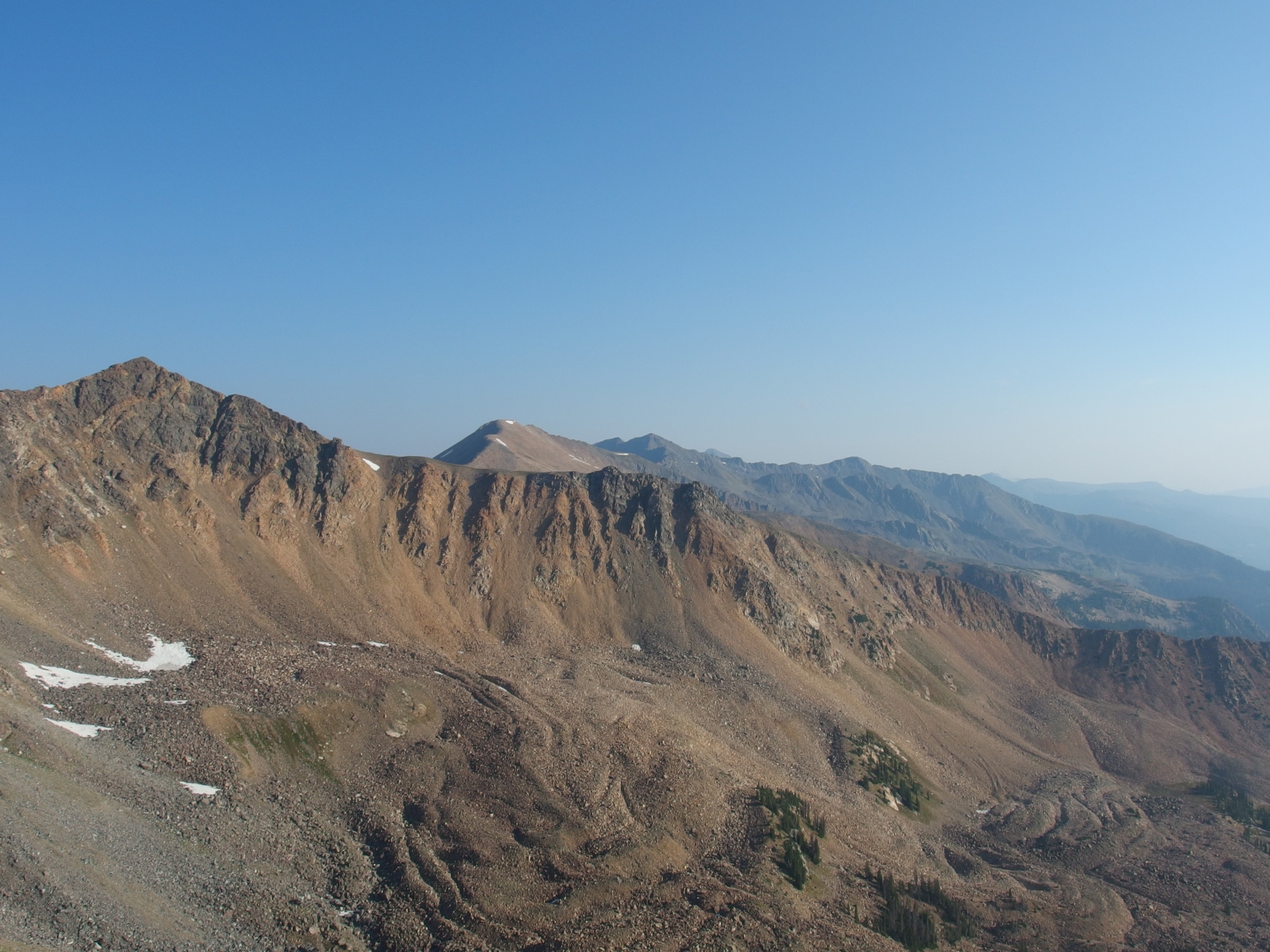 Never summer.
 From Stratus, I could see some goals for later in the day. Again, they looked remarkably far away. But to focus on the matter at hand...
 Baker Mountain came with some second and avoidable third class on a mix of solid rock and the loose talus that this part of the range is known for. From here, I started on a descending contour to arrive at Baker Pass, but eventually just cut down a gully to some more solid ground.
  Baker Pass. I was looking south to the peaks ahead. I felt a little down at this point, but made a goal. It was 11:31. I would stand on Never Summer Peak by 2:31. I found the thin trail to Parika Lake, and scared a moose, the first of four I'd see over the day.
 Parika Lake and Never Summer Peak. After visiting the lake, I headed almost directly up Paprika Peak. The register had been placed just last year by the Kirks the day after the Never Summers 100k. Awesome.
 Parika Peak from Paprika Peak.
  The least helpful sign I found all year.
 Farview Mountain and Never Summer Peak from Parika Peak. It was a short jaunt to Farview, and then a bit of gain to Never Summer.
  I hit the summit of Never Summer at 2:34. Close enough for me! This unranked peak offered some great views all around, and it was pretty fun to run down the trail to the lake. Ten hours in and I'd yet to see a single person, though I finally met someone a little bit below the lake. And two more moose who stared at me as I tried to startle them into moving off the trail. I arrived back at the th in day light and had a nice drive back home. It's always a bit of a shock to come back to civilization after spending a whole day in wilderness.
8/27/15- North Inlet Basin- Water. The longest drive thus far, completely through RMNP and into Grand Lake on the other side. The requisite thunderstorms were predicted in the afternoon, and there were just too many named places to 'easily' visit them all in a day, thus I decided to split things up and do the lower and waterier places over a day, and then get up to the higher lakes and peaks above on another day. I started in darkness from the th, which runs along some private property where they keep beautiful white horses who look like demons from hell complete with glowing eyes when lit by headlamp. I hiked through Summerland Park before ascending the 9723 foot ranked Cascade Falls Point. The register was placed (as they often are) by Mike Garrett in 2002, and had seen the likes of Dale, Pomranka, Martin, and the most recent ascent (in 2013) Knapp. I was honored to add my name to that list. Again, thank you for the inspiration.  Cascade Falls was next, then I briefly got lost while heading to War Dance Falls...
 There was a thin trail the whole way up, which took me to
 the pretty and secluded Bench Lake. I had a nice snack here and took my shoes off and lounged for a bit. But not for too long, as there was still plenty of ground to cover.
I passed North Inlet Falls and switch backed up to Lake Nokoni.  Clouds were starting to build, but I'd essentially remain below treeline for the rest of the day. I headed NNW over a saddle and descended through some forest and talus to visit Pettingell Lake.
 Truly one of the most secluded lakes in the park, with no trail to it, and the one way distance being 11.1 miles. Clouds continued to build and a few raindrops were felt as I headed back up to the saddle and Lake Nokoni. I took the trail most of the way back down before cutting off SW to visit Lake Solitude, a small pond in the North Inlet drainage.
  Lake Solitude. I followed some animal trails back in the general direction of the trail. I had about nine miles to cover from here to get back to the car.
  Wild raspberries were growing abundantly, and what I didn't eat on the way up, I ate on the way down.
 I narrowly beat the sunset back to the car, and drove home satisfied, with nearly 24 miles and 7400 feet of gain on the day. 9/10/15- North Inlet Basin- Earth. The week before I'd went up Flattop, intending to hit some of the lakes and peaks in the center of the park. But every step hurt, so much so that I turned back around 6 miles in, and went to see the doctor that afternoon. She diagnosed me with an overuse injury, and recommended a week of rest. I felt a whole lot better after that, and was ready to return to Grand Lake for a big day.  It took me 3.5 hours to get to Lake Nokoni, and then another half an hour to get to Lake Nanita. My next goal was Lake Catherine, which wins the award for the single most secluded lake in RMNP. To put it this way, if you wanted to visit just this lake, you'd have to do almost a marathon in distance with 6000 feet of gain and some time spent off trail. Which is about ten miles and 1000 feet more gain than it takes to do Longs Peak.
 The first glimpses were tantalizing. How many people have ever seen this lake, let alone stood at it, dipped a hand in the water, drank from it?
 I wanted to just sit here all day and relax. But those peaks above were calling...
I headed back up to the saddle between Catherine and Nanita. From here I planned to take the gully up to the saddle between Ptarmigans Beak and Andrews Peak, but spied a better and more solid third class route that was vague reminiscent of The Arrowhead.  It spit me out pretty close to the summit, and it was just a short walk over to this peak.
  I took the grassy ramps up, as seen from Andrews Peak. I didn't feel great going up Andrews, but just took my time and got there. Great registers again on these two.
 Andrews Peak. The former superfluously large cairn had been blown or knocked over. The new one was nice and simpler.
 From here it was simply trying not to gain or loose elevation as I headed toward Ptarmigan Mountain.  It came easily enough, but there was one more high point in the area I wanted to visit: the 12220 foot Ptarmigan Towers high point.
  All the way right here. It was listed as third class on LOJ, but how to get there? A small cairn seemed to mark something, but the down climb was more than third class. I couldn't take the ridge over. I'd just about given up on it, when I saw a possibility. I followed the line from above. It looked like it would work. It wasn't glamorous, but a descent down a loose dirt and scree filled gully brought me to an ascent up a grass, thistle, and rock filled gully. It took me an hour to go to the point and get back.
 Up and down this...
 to get to here. Note Longs in the background. I'd seen two people all day, and only because I stopped to have a snack. Why aren't there people lined up to climb these unranked and obscure 12ers that have no trail to the top?
I finished the water I had and mined some snow before setting off to Mount Cairns, which as I'd see in a few weeks, looks impressive from below. But from this side it's such a weak highpoint I had to use GPS to verify I was indeed in the right place.  Mount Cairns. It didn't even have a cairn on it!
I ran out of snow before I hit Mount Enentah, unique because the Alva B. Adams tunnel runs directly under it.  Another good summit for the tree lover in you.
From here I descended west, and eventually broke north to cover some steep and somewhat sketchy ground before arriving back in Summerland Park. I finally found some water and filled up. I barely beat sunset back to the car, and did the two hour drive home in darkness. And joy of joys, got stuck on 36 behind someone who slowed down to 25 mph for every. single. curve. (there's a whole lot of them) I just wanted to go to sleep! This day ended with 23+ miles, 8000 feet of elevation gain, and eight new destinations visited. 9/16/15- East Inlet Basin. It had been awhile since I'd had the pleasure of the company of DanR. A inflexible work schedule on my part keeps it from happening too often. We met in Lyons when it was still dark and started the long drive up. The forecast for the day wasn't great- predicted afternoon showers, but no thunderstorms- but the set up was perfect in my mind. Basically take the trail up, visiting the lakes along the way, then gain altitude to visit the peaks above before dropping back to the trail. Simple, right? Over the day we'd visit Ten Lake Park as well as Paradise Park, both in the middle of no where, heavily forested, and without any real trails. We talked through the darkness and hit Lone Pine Lake early. Onward!  Lake Verna, swirling clouds, a bit of rain.
 Spirit Lake.
 The creatively named Fourth Lake. If you're counting, it's the fourth lake up in the basin.
 The maintained trail ends at Lake Verna, but a well put in unofficial trail continues up the drainage until you get past Fourth Lake, where it becomes a bit indistinct at times. We were working through some talus to get up to the also creatively named Fifth Lake, with Dan in the lead. We topped out a point and then started to drop down. Without even seeing the lake, I let out some sort of excited exclamation. Dan turned back with an ear to ear grin. This was going to be a very special place, and the photos I have don't do it justice.  All I can say is that it gave me the utmost pleasure to sit on a rock next to the lake with a good friend, talking and watching the low clouds swirling in the bowl around us, smashing into Isolation Peak (my first 13er in RMNP), and generally feeling as though everything was right with the world.
 A shot of the drainage from above and several years ago.
We gained altitude, saw a whole bunch of Bighorn, and reached the 12250 foot Fleur De Lis.  The views just did not stop. Aiguille De Fleur pictured, and Ptarmigan Mountain, Andrews Peak, and Ptarmigans Beak in the background.
 The other side of Isolation, in case you've wondered what it looks like.
 We continued toward Mount Craig, opting to take the fun scramble over the 11902 foot point along the way.  Dan on this point.
 Mount Craig holds some views. Again cool to see the other side of peaks normally viewed/climbed from the east.
 Ten Lake Park was spectacularly beautiful from above.
 Dan and the immensity of Paradise Park.
We dropped down and the going got tough. We were able to find a few animal trails here and there, and worked down past rocky cliffs, through, over, and around thick growth to eventually meet Paradise Creek and a thin and poorly maintained unofficial trail along it. But the up wasn't done, as Mount Wescott beckoned. The forest was so thick we could only catch occasional glimpses to let us know we were going in the right direction. Bushwhacking, talus hopping, and up to third class movement prevented easy access to this 10421 foot unranked peak.  The view here was a bit better than at some of the lower peaks I'd see this year. But still. Must like trees. The register was interesting- along with the usual suspects, it contained the signature of none other than Troy Tulowitski. Maybe he was secretly climbing unranked peaks in Colorado when he played for the Rockies. No one had signed the register since 2013.
We headed back into the bushwhacking madness the way we'd come up. Eventually we got to the official trail. I took a second to kiss the ground before we changed socks and ate some food. We saw a few people as we headed back to the car, the only ones we'd seen all day. It was a pleasure to have such great company on a day like this. 21+ miles and 7500+ feet of gain. 9/22 and 9/23/15- Roaring Fork. This was the single longest drive I'd do all year. All the way around Lake Granby to arrive at the Roaring Fork Th. Thanks to Steve Knapp for some beta and for this excellent trip report. I wish I'd remembered some of the key points a bit better! Anyway, my plan was to make the long drive out, hike all day, sleep at the th, hike all day, and drive home. That way I'd only have to do this drive once. Day one worked out well, I got to the th shortly after sunrise, and started up. The trail climbs steeply at first before leveling out somewhat. I planned to ring the bowl in the same direction as Steve and Brian had, counter clockwise, for the same reason, to get the most technically difficult stuff out of the way early while I was still fresh.  I found some late season raspberries near the top of Mount Irving Hale and got a good view of the rest of the day.
 Hiamovi Tower provided some fun scrambling and route finding. I totally forgot all about the cairns Steve mentioned and just went for it. Things got too difficult and I traversed around to bump into one. From here the route to the tiny summit was a bit more obvious. One the way down I rebuilt or added some cairns as necessary. Then I headed to Hiamovi Mountain.
  Hiamovi Mountain from Hiamovi Tower. The ridge between the two wasn't too bad at all.
 Hiamovi Tower from Hiamovi Mountain. I headed toward Watanga Mountain over talus and encountered some third class before obtaining the summit.
 Mount Adams from Watanga Mountain. After the third class and route finding, this looked like it would be a pretty simple walk over. BUT. There was Adams Lake to visit first. I had it in my head that it was the next lake after Watanga Mountain. I made a sketchy and loose descent, refilled water, taped feet, and ate when I decided to look at the topo to see how high the points to my left were. Wait, there aren't any points to the north of the lake on the topo. Where was I?
  At the wrong place! Arg. Well, I'd just dropped down to the wrong lake. Clearly it was too high, not the right shape, and not big enough to be Adams Lake. Doh. I simply went up and over to arrive at Adams Lake.
 The real Adams Lake. It was nice and peaceful.
  Mount Adams was pretty easy, a broad summit at 12121 feet. I could look forward to Roaring Peak and Twin Peaks, the last summits of the day.
 Roaring Peak held the only summit register I'd find all day. Twin Peaks wasn't too difficult, just more gain. I dropped down from here to head to Watanga Lake.
 The lake. I met a bowhunter near the lake, the first and only person I'd see this day. I lost the trail, but picked it up soon enough, and headed down in earnest. The night came and my headlamp came out. I got back to the car thirteen hours and eleven minutes after I'd left it. I got my stuff ready for the next day, ate dinner, messaged my wife, and bedded down for the night. I was out by ten, but woke up a few times. Even so, I felt very well rested when the alarm went off at 6am. Eight whole hours of sleep! Every other day had seen me get somewhere between three and six. I felt great!
A quick breakfast was had before I set out along the Knight Ridge trail with the intent of summitting the Knight Ridge hp and Mount Acoma. My legs felt surprisingly good for doing something like 20 miles and 9000 feet of gain the day before, but my feet were killing me. I was seriously hurting and thinking about turning back, but knew things would get better as I went on. Aching feet or not, the morning was warm, the sun was out, the trees and brush around me were in full color, there was the sweet smell of autumnal decay in the air, and I'd seen two moose within fifty feet of the trail head. Things were perfect.  Lake Granby and color!
 Knight Ridge high point and Mount Acoma. My plan was to head up until I was around 10500 feet, and then contour west and loose elevation to gain the summit. I've done this before with great success. The forest was relatively open and movement was pretty easy. Some rock was encountered and easily avoided.
 All was going well until my GPS started telling me I was lower than I thought I was. After I'd put in a big effort, I looked at it again to discover I was now around 11300 and not quite where I wanted to be. Down I went, and I was finally able to spot the peak.  Mount Acoma. Some trees, some views.
 I headed down, following a drainage and animal trails. Eventually I spied a sawn log on one of those trails, and realized there were orange blazes tied to the trees. I was on some trail, and took it.  Near the Knight Ridge trail.
 I finally popped out on the trail and headed back to the car. At the trail head, I saw the first and only person I'd seen this day. Another bow hunter, this one who'd gotten lucky and had an elk. I felt great as I drove home, elevated and happy in a way I rarely am. Yet it was good to get home and see the person I love. Over these two days I covered 33+ miles and a bit under 14000 feet of gain. Hard work and reward. Experience over things. I came to Roaring Fork as one person, and left after two incredible days as another. 9/29/15- The ________ Mountain Group. You can probably figure this one out. It's the only place in RMNP that access is forbidden year round. Despite that, it still gets some attention. It seems the previous preferred method was to simply take The Crater trail later in the day, after tourists had left, and just go for. But as of last year, the trail has been closed. I talked to a NPS employee this year and he seemed to imply that this was permanent, and that the trail was being taken out. You can't make a trail disappear, but it would probably be a good idea to not park here. However, the Poudre River th is close, and there are a ton of animal trails in the area. Trails or not, it's only a few hundred feet of foresty bushwhacking to escape above treeline.  Great views in the early morning. Possibly on purpose or maybe by coincidence, I'd worn all tan clothing and my pack happens to be forest green.
 Beauty.
 ______ Peak.
 North ________ Mountain and ________ Mountain.
 Rock reminiscent of the Never Summers.
  Down Forest Canyon.
 Nearing _______ Mountain.
 _______ Lake and a touch of rain.
 10/13/15- Ni-Chebe-Chii 5 and 400th named destination. A big day ahead- my initial estimate was 16 hours. With 11ish hours of sunlight, I knew I'd be out there for awhile in the darkness. I just hoped I'd be able to keep it together well enough. I started from the Colorado River th and took the Red Mountain trail to Grand Ditch. From here it was a short downhill before going up into Hitchens Gulch. I'd head up to Never Summer Peak (referred to in Fosters book as Jiffy Pop Peak) to start the day. It took me three hours and thirty minutes to summit the first peak of the day, remarkably quicker than my day here last year.  Lead Mountain from Never Summer Peak. The ridge between the two provided some very fun third class scrambling.
  Great views of Mahler, Tepee, and Richthofen.
 Hart Ridge was planned for later in the day.
  Lead Mountain and more... I headed south to Hart Ridge. It was good to be on some second class terrain for the time being.
 From Hart Ridge, I planned to head to the 12098 foot Lone Ranger. Again, not technically in RMNP, but again a logical extension to the range.
 From here I could see the way forward. I'd stick to the trail down toward the Silver Creek th, but break off and stay at around 11000 feet to ring the bowl and then head back up toward the 12400 foot closed loop between Lead and Tepee. This worked just fine, but I found myself facing a very exposed and intimidating fourth class ridge traverse to continue north. I didn't stop once in this area to take a photo, and breathed a sigh of relief when I finally got to more solid ground.
 The ridge. I gained altitude towards Tepee Mountain, which has two distinct summits. The west summit is third class and lies directly on the continental divide. The east summit is slightly higher, and goes at fourth class.
 West from East.
 East from West.
I was planning to continue on toward Richthofen, but had run out of water awhile ago. And I was feeling it. I'd done alot of big days on not much sleep this year, but this day hit me hard. Fortunately, I could head back toward Lead Mountain and bail into Skeleton Gulch. I could find water, and essentially it would all be downhill from this point on.  Head back to the lowest point, turn left.
  Down into Skeleton Gulch as the sun was leaving us. I made it back to Grand Ditch by 6. It was obvious I'd be making at least some of the return hike in darkness, but how much? Last year I visited Little Yellowstone Canyon, but walked right by the Little Yellowstone high point. I could take Grand Ditch Road to the Poudre Pass trail, and that would be my 400th named destination. Plus, it would be a long drive and a short day just to get this point. And I wanted that summit. I was going to get it.
 Lit by unnatural light, but I made it. Maybe it has a view, maybe it doesn't. It was dark and I couldn't tell.
 I couldn't remember how far I had to go from here. The sign I'd seen in the early morning darkness said 6.something or 7.something. Not that it mattered at this point. I'd simply do the best I could. I even managed to jog some of the downhills and flats along the way. I finally hit the car at 9:06pm, sixteen hours and thirty four minutes after I'd left it. I didn't see a single person the entire day. It was cold but I didn't turn the heat on, as I didn't want to get comfortable and fall asleep driving home. I shivered the entire way, but I made it. And I did it. Getting closer to the end, getting closer to myself. This day meant alot to me. 22ish miles and 7800 feet of gain later and I was more whole as a person than I was when I started. Amen. 11/3/15- Mount Eleanor. It wasn't quite winter, but this was the first time I had to break out the boots and traction this fall.  Snowy intersections. After leaving the Flattop trail, I didn't see a single sign of humanity until I made it back to the same place. I climbed Sprague Mountain again, and checked out the imposing Hayden Spire.
 On the list for next year.
 At Mount Eleanor. This 12380 foot unranked summit lies almost directly in the center of the park, 9.5 miles from Bear Lake and 7.5 miles (but with more gain) from Milner Pass. I wanted to continue on to Nakai, but postholing here took a lot of time. Back it was.
 Summits and snow.
 Last light and Longs Peak.
 12/9/15- Lily Lake, Lily Mountain, Rams Horn Mountain, and Prospect Mountain. Lily Mountain was something I'd been saving for a possible last, but I've definitively decided on something else. This would be a nice easier day, and the weather was predicted to be warm. Of course warmth in winter often comes with wind, and I'd feel it over the day.  Neon sunrise from the Lily Mountain trail. I followed this up a little bit past the hard left turn before breaking off to head to Rams Horn Mountain.
 No trails on the topo, but a nice social trail that wasn't under snow in places.
 Rams Horn Mountain. I turned around and headed toward Lily.
  Twin Sisters from Lily. It was super windy up here and I was blown over while crouching. In stark contrast to some of the registers I've seen this year, this one was placed in August 2015, and was nearly full. Just a few weeks before, I found a register on one of the Boulder County high points that had been in place since 1975 and was less than half full.
 I took the public access trail up Prospect Mountain, and found a few possibilities for a summit. Back at the car, I had a drive home in sunlight. That hasn't happened much this year.
12/31/15- Looking backward. As I sit on the couch in relative comfort writing this, I look back on these days and smile. In some ways, it's hard to comprehend, "I actually did that?". Less than three months ago I spent a day hiking, and spent more time hiking that day than I am typically awake on any given day. I've visited hundreds of peaks now, numerous lakes and waterfalls, in darkness and in light. Through nights so dark I could see satellites in orbit, days so bright that the scenery looked unreal. I've cried and experienced moments of overwhelming joy. I've kept going when I didn't feel well and thought I couldn't, and turned back from injury or weather. 2016 should bring an end to this project. By this time next year I hope to have visited every single one of the 500-some named destinations in and around RMNP. What a feeling it will be to stand on the last summit and see everything around me, to know all the hard work, early wake ups, training, driving, sacrifice. I'm looking forward with happiness. Thank you for reading. For more information, please visit hikingrmnp.org. |
| Comments or Questions | |||||||||||||||||||||
|---|---|---|---|---|---|---|---|---|---|---|---|---|---|---|---|---|---|---|---|---|---|
|
Caution: The information contained in this report may not be accurate and should not be the only resource used in preparation for your climb. Failure to have the necessary experience, physical conditioning, supplies or equipment can result in injury or death. 14ers.com and the author(s) of this report provide no warranties, either express or implied, that the information provided is accurate or reliable. By using the information provided, you agree to indemnify and hold harmless 14ers.com and the report author(s) with respect to any claims and demands against them, including any attorney fees and expenses. Please read the 14ers.com Safety and Disclaimer pages for more information.
Please respect private property: 14ers.com supports the rights of private landowners to determine how and by whom their land will be used. In Colorado, it is your responsibility to determine if land is private and to obtain the appropriate permission before entering the property.