| Report Type | Full |
| Peak(s) |
Mt. Sneffels - 14,155 feet |
| Date Posted | 04/03/2016 |
| Date Climbed | 06/15/2015 |
| Author | Tim A |
| Dreaming of Couloirs Part 2: Sneffles Climb/Glissade |
|---|
|
Again, I know this isn't recent info, but it might be of some help to parties ascending Sneffles this spring, particularly the footage of the V-notch when covered in snow. I've now reached the summit of 16 14ers, most of them by a snow route or in winter, and Sneffles remains my far and above favorite. Coming off a success on Huron on June 13 after weeks of inhospitable weather, I took Nathan (HighonThinAir) up on his offer to head down to the San Juan for a few days. My first trip to the Western Slope was a memorable drive for me, heading over Monarch Pass from Salida and passing through Gunnison, Montrose, and Ridgeway for the first time. The views for most of the drive were simply incredible: I now understood why all the CO natives fawn over the San Juan despite having RMNP and the Front Range right in their backyard. 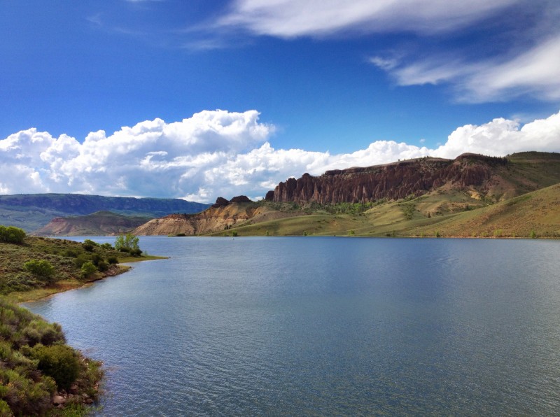 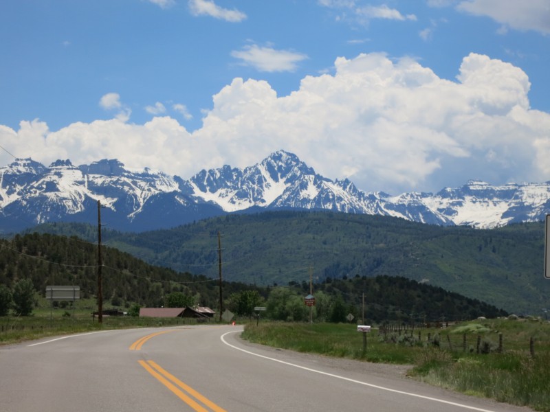 I met Nathan mid-afternoon on the 14th at the Hot Springs and we chatted about where to stash my car and where to camp for the evening. Ouray is an incredible town, unlike anything else in CO, but it lacks access to real good camping sites (in part no doubt because of the cliffs towering over the town on all sides). We ended up walking into a few bars asking random people where they thought someone could stash a car in town for the night. Naturally, there were numerous responses, but enough of them said we could safely park next to the San Juan Mountain Guides that I left my vehicle there and we rode in Nathan's 4WD up towards Yankee Boy Basin, pulling into the first campground a few miles up the road and setting up our tents. That left enough time to drive further up the road and watch the sunset over the cliffs and waterfalls. I resolved to get back here in the fall to catch the Aspens at peak. 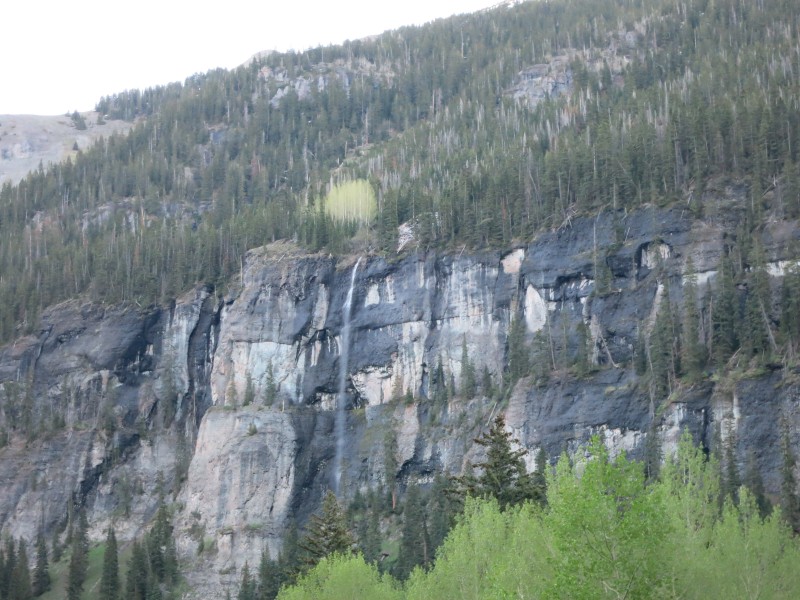  Headed to sleep to occasionally large rumbles coming from rockfall in the basin, we enjoyed a quiet and most importantly dry evening, and snoozed several times once the alarms began going off in the morning. I was a little sore from Huron two days prior and incredibly comfortable in my bag, but eventually hustled out, where we prepped our packs and then headed further up the road, taking the turn-off towards Yankee Boy Basin once past the mine. That road even to the lower TH is not 2WD at all: you want high clearance going for it. We arrived at the lower TH around 515am and found a pair of climbers breaking their camp (they slept in the lot) and the road closed to go any higher. Each of us braved the horrors of the "composting toilet" which I believe is now closed, and then took off up the road into the basin. There were several stream crossings to navigate, one of which Nathan slipped on and jammed his knee pretty good into a boulder he was attempting to hop onto (it had a sheet of black ice across it). Like the hero he is, he limped the rest of the way to the summit and down, but this injury would prevent us from tackling Redcloud/Sunshine the following day. 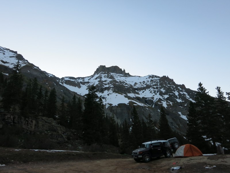 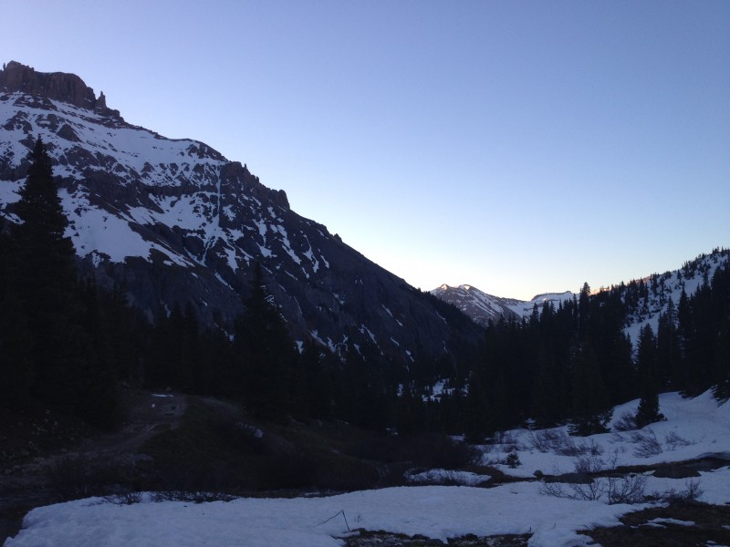 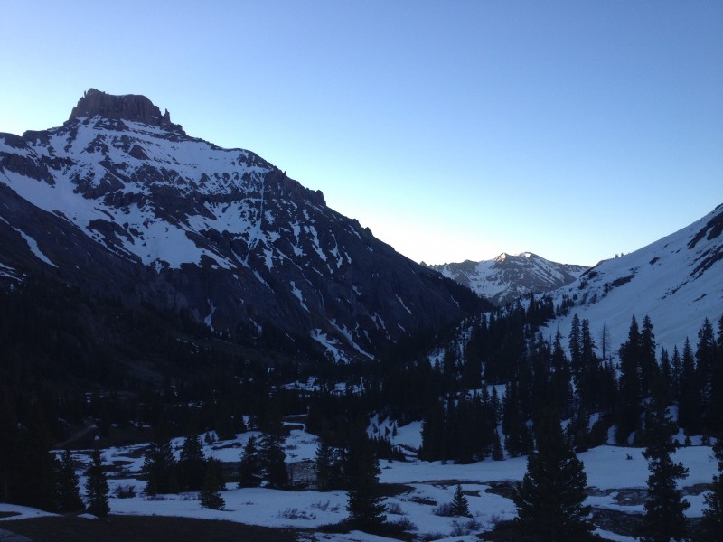 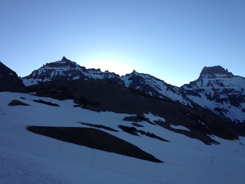 The road was dry for only a few paces, eventually coming to consistent snow which we'd stay on from there to the summit. Once on the snow, we took a direct line up high into the basin, cutting the switchbacks and taking note of the large avy debris sitting at the base of nearly every slope we could see. I marvelled at the amount of snow still covering everything in site, and was grateful to be present there. As forecast, there was a freeze the previous night, and the snow was very supportive during the hike in. 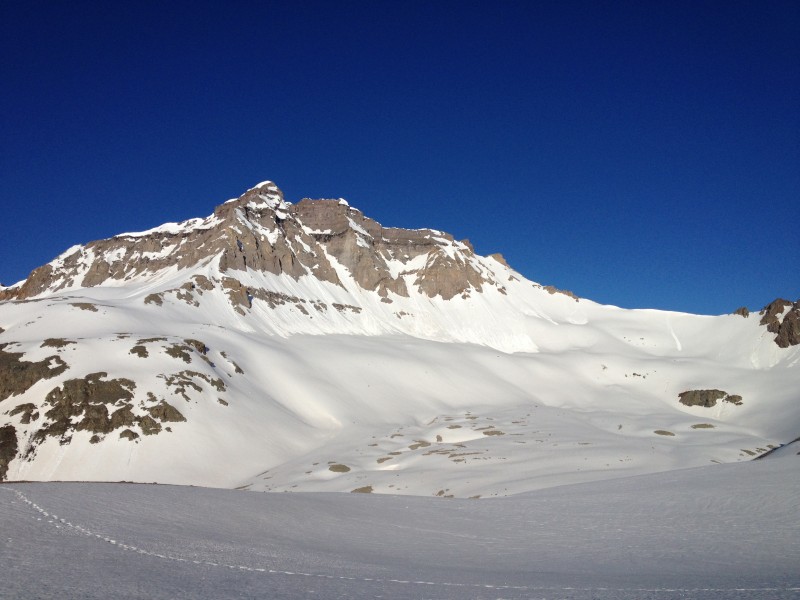 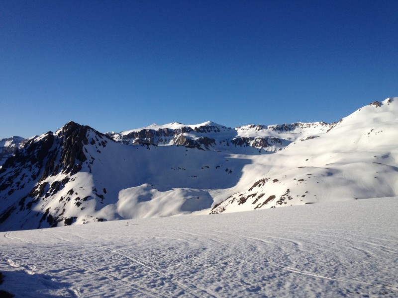 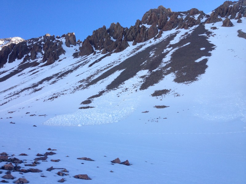 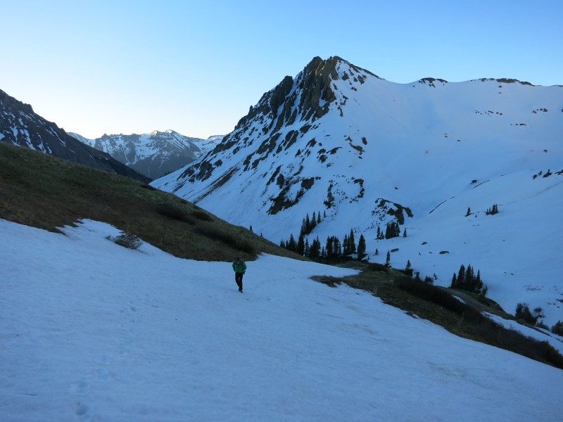 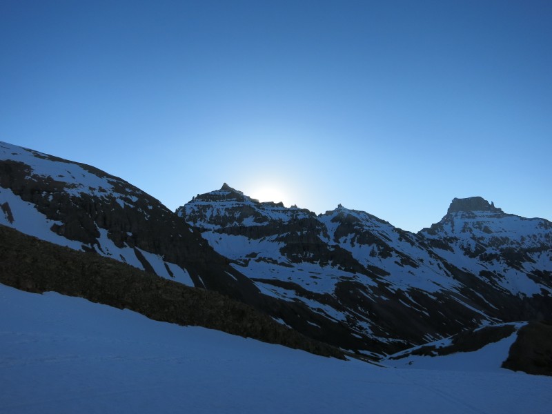 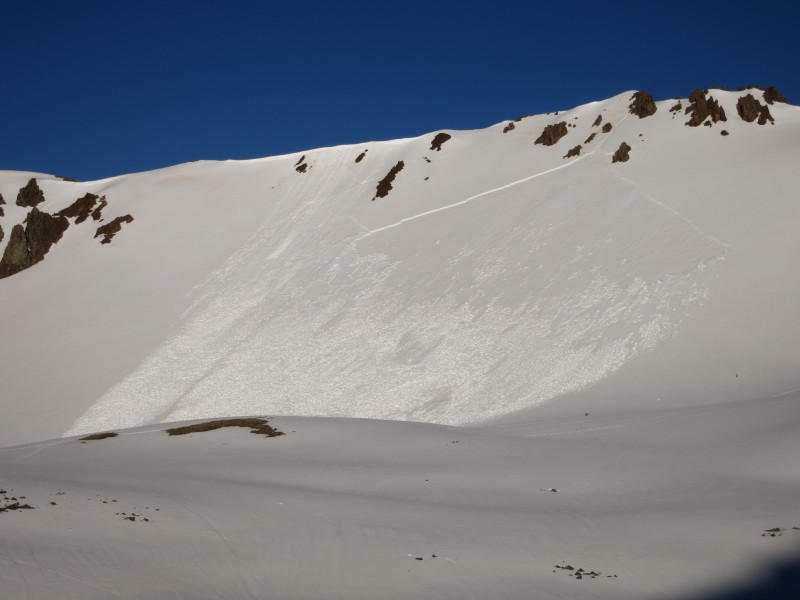  In seemingly no time, we came to the slope of loose rock and scree that comprises most people's experience of this mountain, and which leads me to the title of this report. We worked up to a few boulders, hopping over avy debris, strapped on crampons, and roared up the slope in about half an hour. Having seen pictures of this slope when dry, I don't know why anybody deals with it that way. 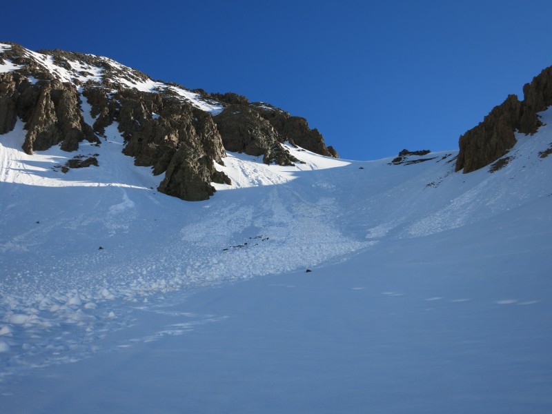 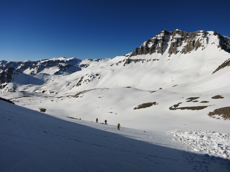 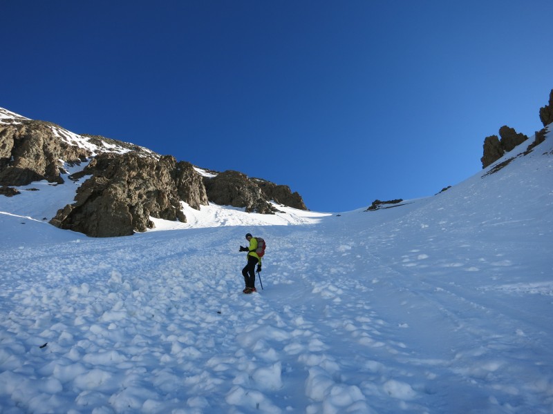 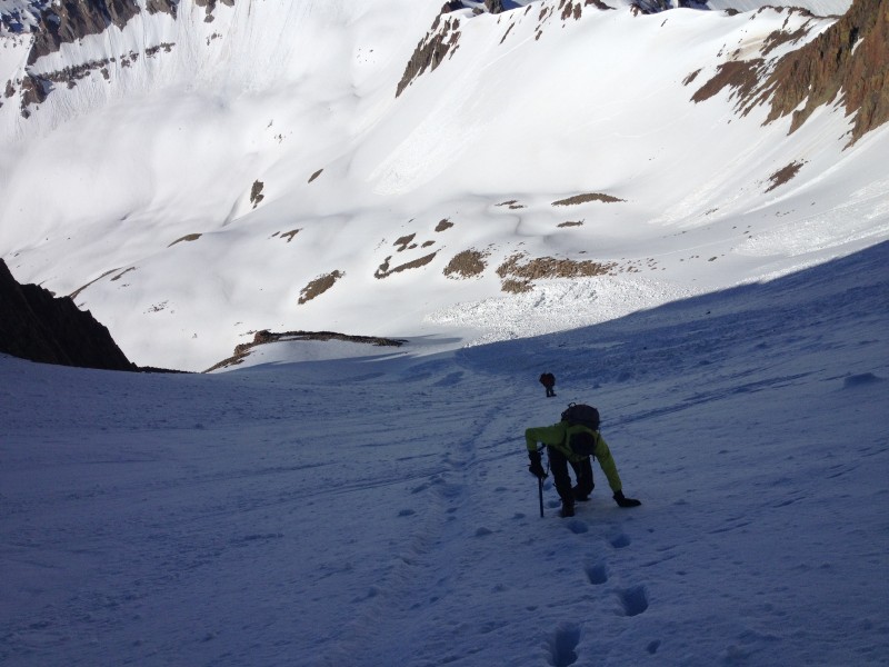 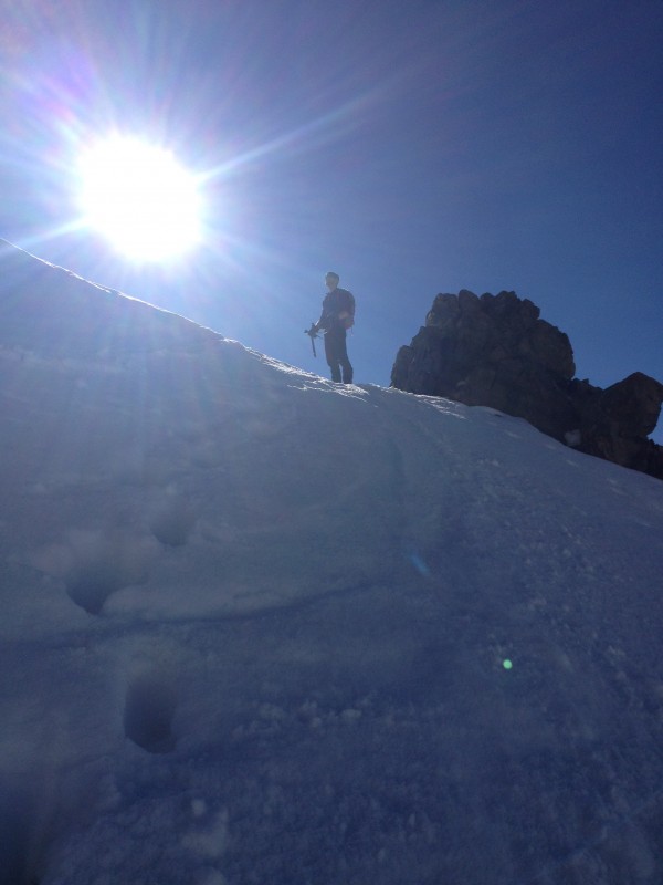 Once at the Col, we took a short break to snack and tighten crampons before entering the couloir, which again in summer looks like a nightmare of loose rock and delicate hiking, but in late spring is a simple and steep snowclimb of several hundred feet. 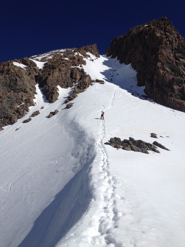 This couloir was the most exciting thing I did all summer, far more fun even than scrambling along Kelso Ridge or ascending an Elk couloir route a few days later. The constricted nature of the gully, the sea of 13ers falling away to the south, and the snow in every direction just felt magnificent. Nathan and I passed each other regularly in the couloir, though I ended up gaining the lead and maintaining it until the V-notch at the top of the gully.  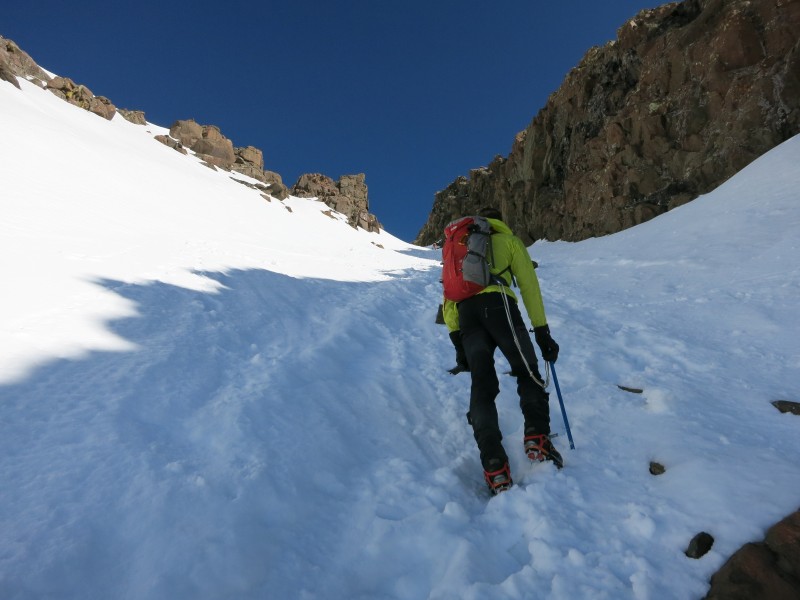 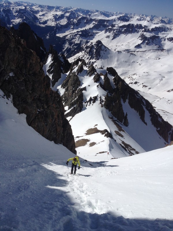 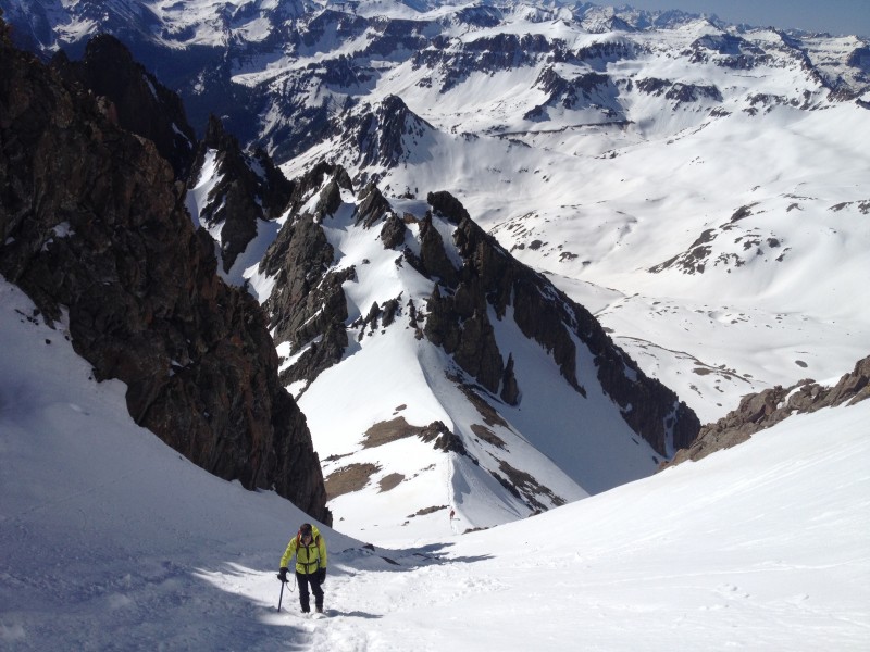 Once at the top of the gully and looking northward towards the open plains, I spied a group of climbers coming up the Snake Couloir into a treacherous looking exit to the summit including extremely steep snow and low fifth class rock creating an interesting looking mixed climb. They were unroped and many were using their shovels as a second ice tool. We chatted with this group on the summit, and it seemed to be put together by a familiar name from this website, Mike Shepherd. 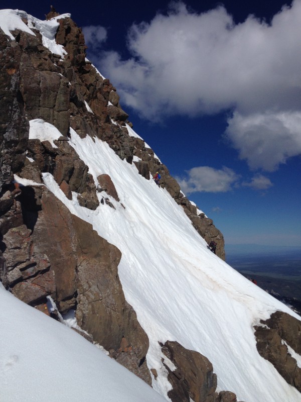  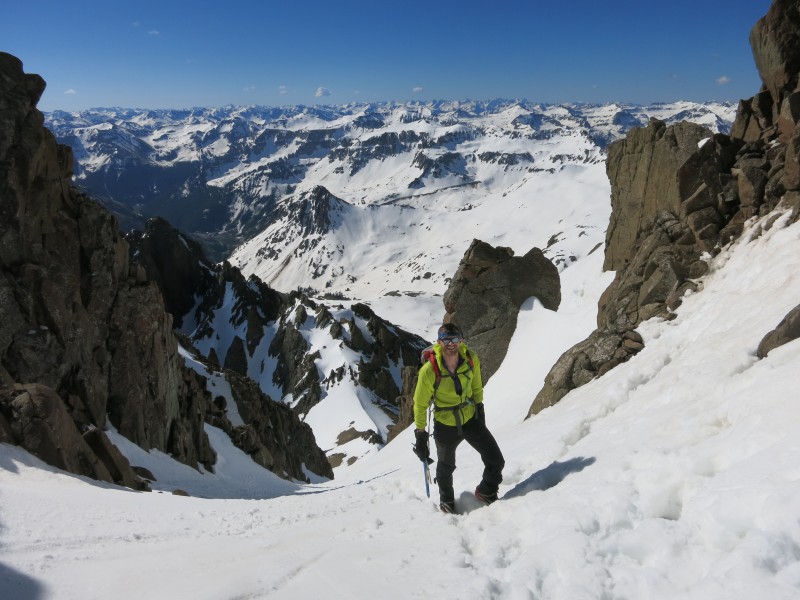 From the top of the gully, this site and Roach state that than an exposed 2nd class move through the "V" notch is all that remains before a little light scrambling to the summit. We found conditions considerably spicier, as the below video shows. This was my first time climbing class 3 in the alpine and with crampons on, and it was incredible. Fear and adrenaline give way to seriousness and clarity of motion and you make the required moves with a clear head. It's afterwards that I got a little shaky, fully aware that the consequences of a fall on those moves would likely have fatal consequences. Once the climb up to the "V" itself was done, the passing through it and facing up to the summit was that moment every climber recognizes as the "I'm going to make it" moment. Firm snow and some class 2 ledges gave way to incredible summit views. As with my summit views from Huron two days prior, building cumulus clouds cast glorious shadows over the range and offered better light conditions for summit photos than I usually get. These storms were building despite the 930am hour and despite it still not being monsoon season.  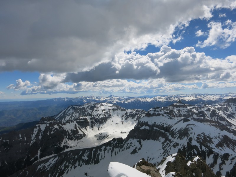 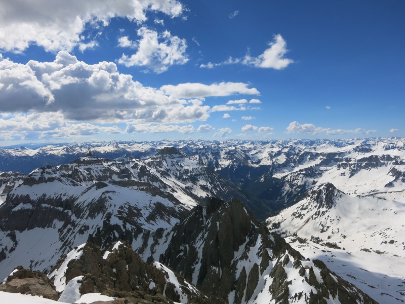  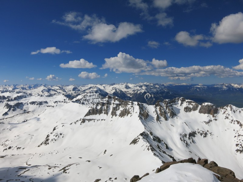 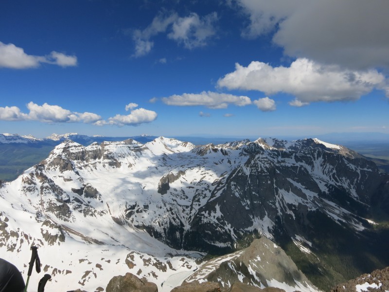 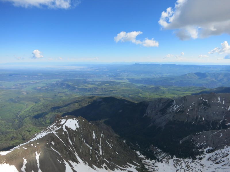 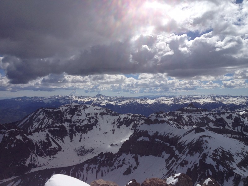 Nathan and I joined Mike Shepherd's group in descending the same route, which as the GoPro footage shows, was quite steep on the descent directly below the summit. Most of us faced in and kicked steps in the warming and softening snow, hurrying to get off the slope before the snow became unsupportive. We carefully worked our way back through the complexities of the upper slopes and made the correct crossover to the "V" notch, where we took turns heading down it. Building clouds over the summit became darker and hurried us along. The (albeit lengthy) video shows more of this footage, as I stopped taking pictures from here in a bid to get off the mountain before the weather opened up. While descending the "V," I opted to try to the class 2 ramp next to it, which we'd avoided on the ascent because the snow there looked very sketchy and unsupportive. I felt like giving it a go now, preferring to be closer to the flatter area at the top of the gully should I slip. I also made the decision to keep my axe tethered to me and in hand in case of a slip. This was a wise decision in hindsight. As I worked over to the ledge, a short rock bump separated me from rejoining the guys headed down the couloir, and I had a feeling that I was going to slip regardless of what I did, so I sat down and slowly crawled towards the slope. The snow, as expected, was too wet and gave way, and I began sliding down the couloir. I quickly arrested and was grateful the snow wasn't too soft to stop on, and worked my way over towards the bootpack of the couloir before facing out and beginning the descent. This fall can be found at 8:43 into the video at the top of this report. The descent down was pretty punchy, with the snow so wet on the surface that we had to make every effort to punch a step in with heel or risk sliding off our feet during the descent. The window for getting a route in like this during spring is very narrow and as close to dawn as you can manage. 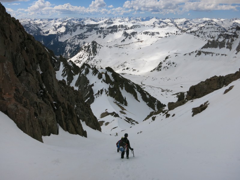 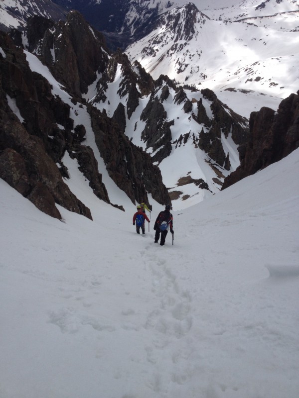 I actually passed the entire group on the descent, so confident was I in my plunge-stepping on wet snow and in a hurry to get away from impending storm from above. 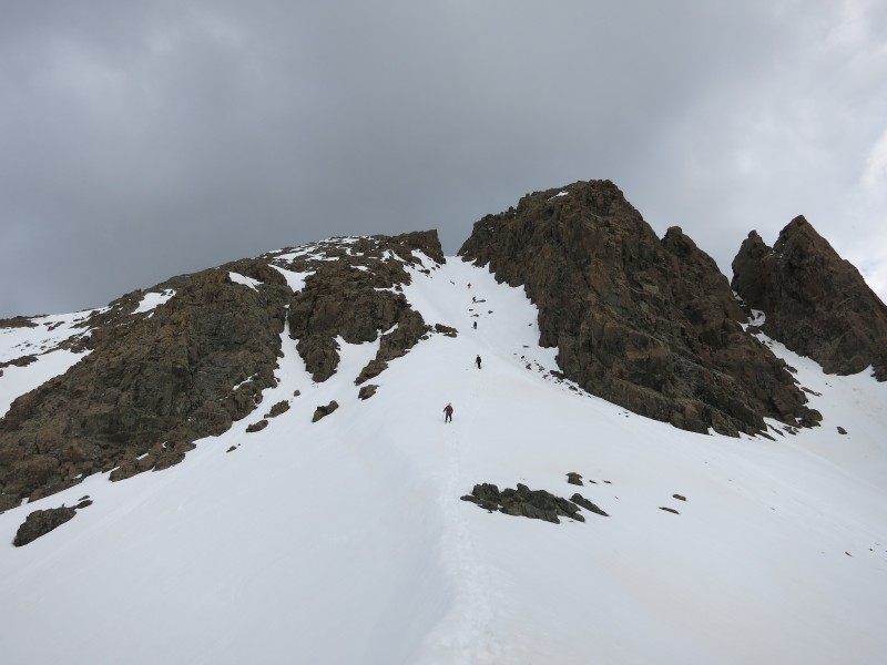 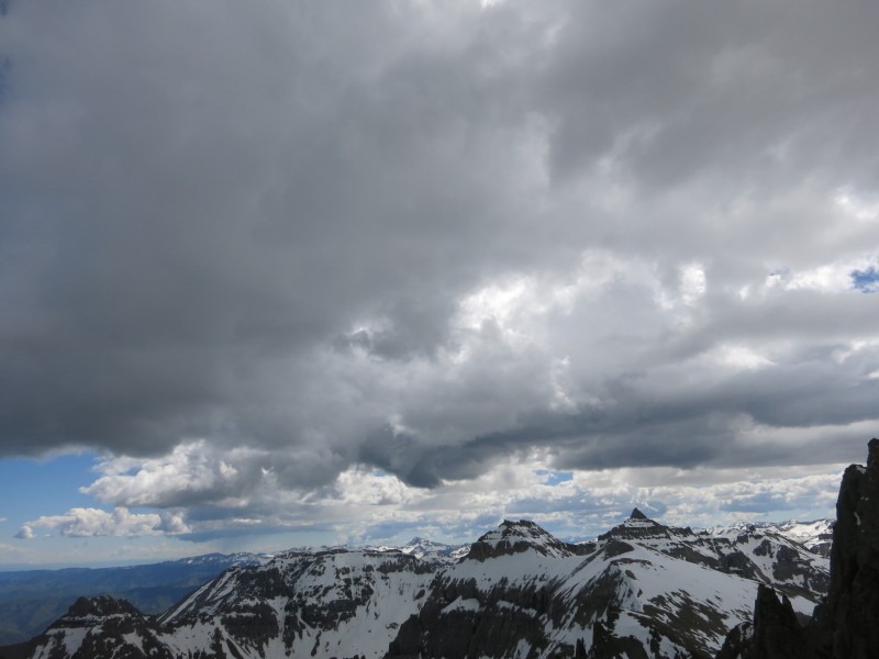 Once back at the col, Nathan and I bid Mike's group farewell as they were descending the other way to return to their TH, while we glissaded down the long slope back in Yankee Boy Basin. Again, a downclimb of the couloir followed by a downclimb of this slope on rotten loose rock sounds terrible. Snow so perfectly locks everything into place if you can catch it right. The full-video shows some of this glissade footage, which wasn't the most fun because of all the avy debris and the amazingly still pretty firm slope. Once down in the basin, we hiked out as snow and graupel blew in, the upper tips of the peaks hiding in the clouds. This was my first San Juan peak, and I committed after it to do each of the other San Juan peaks by a snow route (most of which aren't listed on this site, but can be found in Roach). In particular, next year I'd like to visit all 5 of the Lake City 14ers by their respective couloirs or snow-faces. Partners wanted. Full footage of going over the V-notch. Thumbnails for uploaded photos (click to open slideshow):
|
| Comments or Questions |
|---|
|
|
Caution: The information contained in this report may not be accurate and should not be the only resource used in preparation for your climb. Failure to have the necessary experience, physical conditioning, supplies or equipment can result in injury or death. 14ers.com and the author(s) of this report provide no warranties, either express or implied, that the information provided is accurate or reliable. By using the information provided, you agree to indemnify and hold harmless 14ers.com and the report author(s) with respect to any claims and demands against them, including any attorney fees and expenses. Please read the 14ers.com Safety and Disclaimer pages for more information.
Please respect private property: 14ers.com supports the rights of private landowners to determine how and by whom their land will be used. In Colorado, it is your responsibility to determine if land is private and to obtain the appropriate permission before entering the property.

