Download Agreement, Release, and Acknowledgement of Risk:
You (the person requesting this file download) fully understand mountain climbing ("Activity") involves risks and dangers of serious bodily injury, including permanent disability, paralysis, and death ("Risks") and you fully accept and assume all such risks and all responsibility for losses, costs, and damages you incur as a result of your participation in this Activity.
You acknowledge that information in the file you have chosen to download may not be accurate and may contain errors. You agree to assume all risks when using this information and agree to release and discharge 14ers.com, 14ers Inc. and the author(s) of such information (collectively, the "Released Parties").
You hereby discharge the Released Parties from all damages, actions, claims and liabilities of any nature, specifically including, but not limited to, damages, actions, claims and liabilities arising from or related to the negligence of the Released Parties. You further agree to indemnify, hold harmless and defend 14ers.com, 14ers Inc. and each of the other Released Parties from and against any loss, damage, liability and expense, including costs and attorney fees, incurred by 14ers.com, 14ers Inc. or any of the other Released Parties as a result of you using information provided on the 14ers.com or 14ers Inc. websites.
You have read this agreement, fully understand its terms and intend it to be a complete and unconditional release of all liability to the greatest extent allowed by law and agree that if any portion of this agreement is held to be invalid the balance, notwithstanding, shall continue in full force and effect.
By clicking "OK" you agree to these terms. If you DO NOT agree, click "Cancel"...
Climbing Greenhorn Mountain can be a bit confusing. There are two main trails and three different trailheads typically used when climbing the mountain. In addition, there are a couple sites on the Internet with incorrect or confusing information regarding trailhead directions and hiking distances.
This trip report provides a single reference with accurate information about the three most popular routes up Greenhorn Mountain. The mountain has a lot to offer for those looking for a scenic and challenging hike close to Pueblo, Colorado. If you happen to notice any errors in this report or have any suggestions, please let me know.
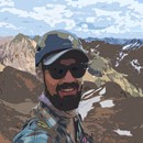
Greenhorn Mountain October 25th, 2015
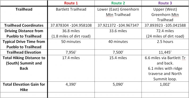
Greenhorn Mountain's south summit (37.88147 -105.01342), at 12,347', is the high point in the Wet Mountains, southwest of Pueblo, Colorado. Below is a comparison of the three main routes. A more detailed description of each route is provided too.
Comparison of Greenhorn Mountain Routes
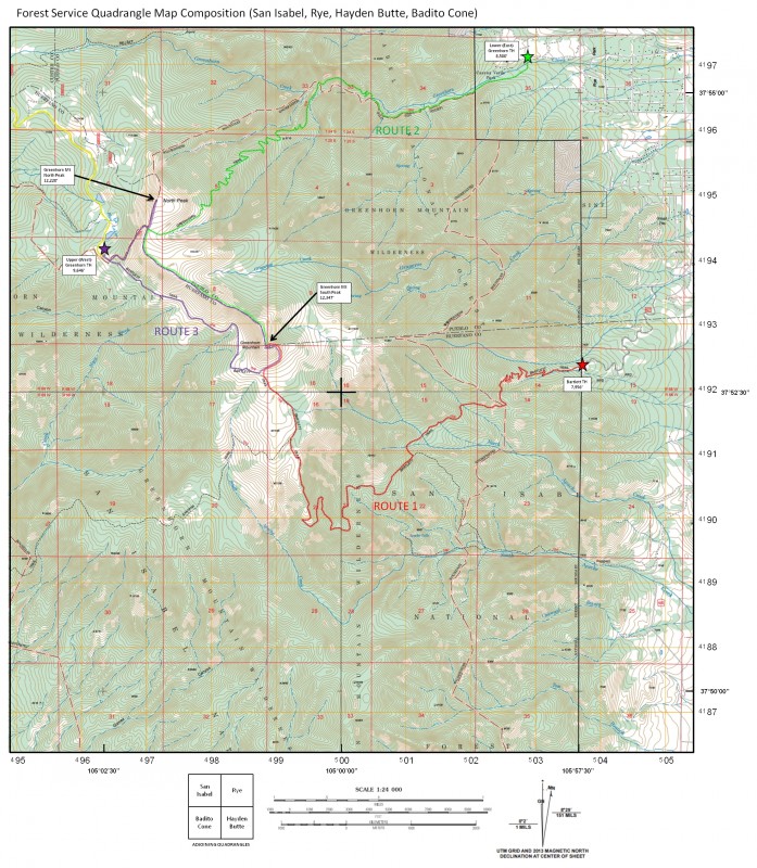
I created a composition of four, 7.5-Minute Quad Topo maps showing the routes and trailheads. Links to the individual quad maps can be found at:
Getting to the Trailhead: From Pueblo, CO take I-25 south for 23 miles. Take exit 74, near Colorado City and follow State Highway 165 west for 8.2 miles to the town of Rye. Turn left onto Main Street then after about 0.1 miles take a left (south) on Boulder Ave. Follow Boulder Ave. for 0.8 miles, turn left (east) on Granger Rd, then take your first left (south) onto Hunter Rd. Follow Hunter road for 0.6 miles and turn right (west) onto Baxter Rd. Follow Baxter Rd. for 0.6 miles and turn left (south) onto Bartlett Trail Road. Follow Bartlett Trail Road (dirt road) for 1.8 miles to the trailhead.
Hiking the Trail: The Bartlett trail climbs roughly 4,390' of elevation and covers over 17 miles out and back. Be ready for a long day. I climbed this route on 25 October 2015. There was just a bit of snow near the top with a perfect weather day. The trail is very peaceful, with an abundance of solitude. I did not see another person the entire hike.
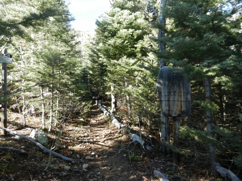
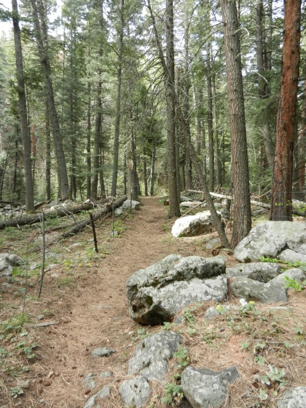
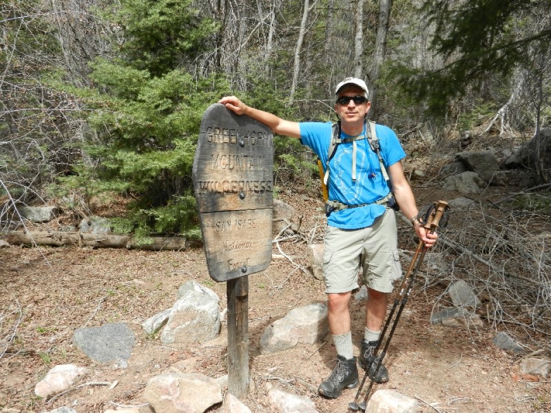
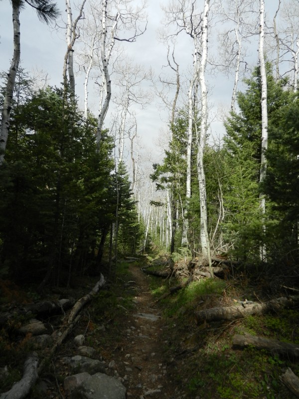
The trail begins by climbing west and somewhat south through aspen and conifers as you enter the Greenhorn Wilderness.
Greenhorn Mountain Wilderness Boundary
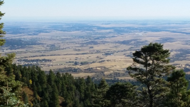
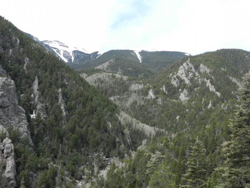
The Forest Service no longer maintains the trail but it remains easy to follow until treeline at which point the summit is visible and "dead reckoning" navigation to the summit is straightforward. Gaps in the trees reveal excellent views of the Huerfeno Valley as you climb west across Greenhorn Mountain's southern drainages.
Huerfano Valley as Seen from the Bartlett Trail
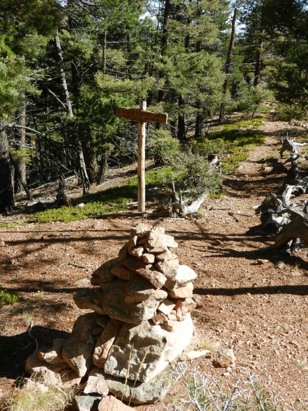
At 3.25 miles from the trailhead and just after crossing North Apache Creek, you will reach the South Apache Trail junction (37.86645 -104.98685). This "T" junction is at 9,440' and marked by a large cairn.
South Apache Trail Junction
In the photo, the South Apache Trail leads east away from the camera while the Bartlett Trail runs back to the trailhead along viewer's left and towards the summit to viewer's right.
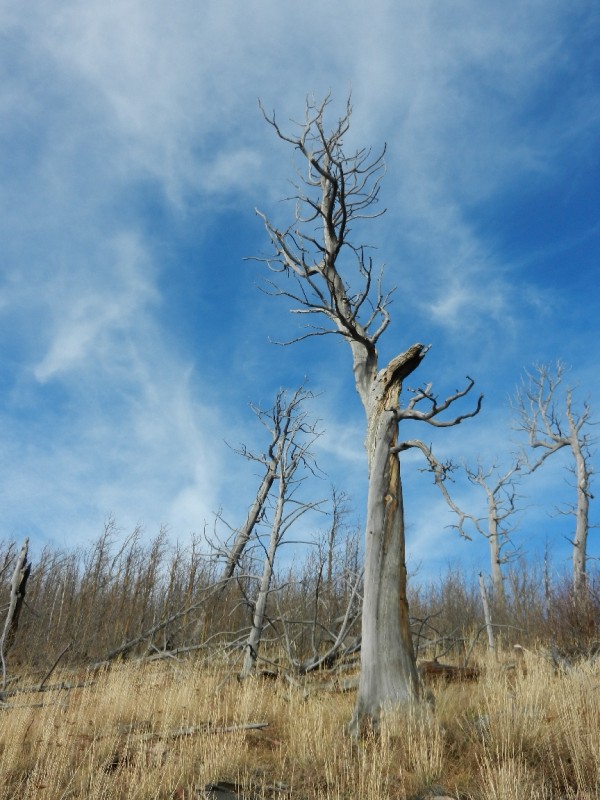
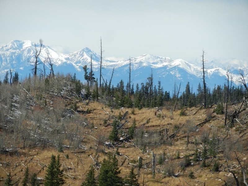
After about six miles the trail steepness eases up as it begins to turn north towards the summit. You'll pass through pockets of dead and downed trees, results of fire damage, as inspiring views of the Sangre de Cristo Mountains become visible.
Trees Showing Signs of a Previous Burn
Sangre de Cristo Mountains
At this point, the trail also starts to disappear. Fortunately, the rounded, rocky summit is now visible and the terrain easy to cover. Just head towards the summit and enjoy the stroll. Pay close attention to your surroundings here. You'll have to find your way back to this point on the way back. Identify a couple memorable landmarks that will help you reconnect with the trail on your return trip. A GPS with tracking capability is very helpful for getting back to the established trail.
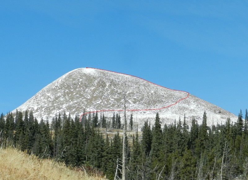
Greenhorn's Summit Dome
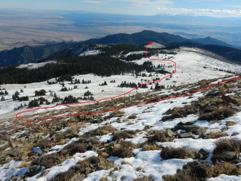
At 8 miles in, right before beginning the final steep, half-mile push to the summit, the Bartlett Trail actually turns left (37.87717 -105.01171) skirting the summit. Continue forward towards the summit cone. Many people avoid the difficult, direct approach to the summit by making a counter-clockwise, ascending traverse to gain the east ridge which has a more gentle slope to the summit.
Route Up the Summit Cone
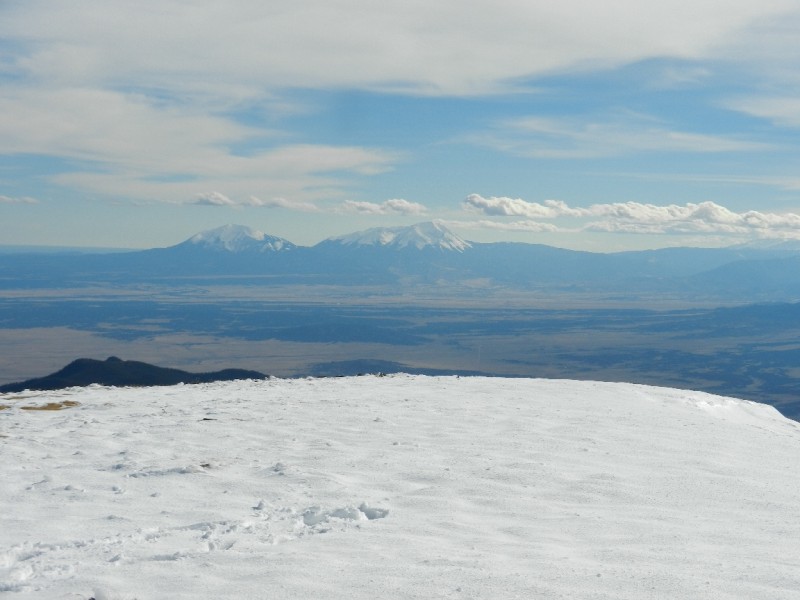
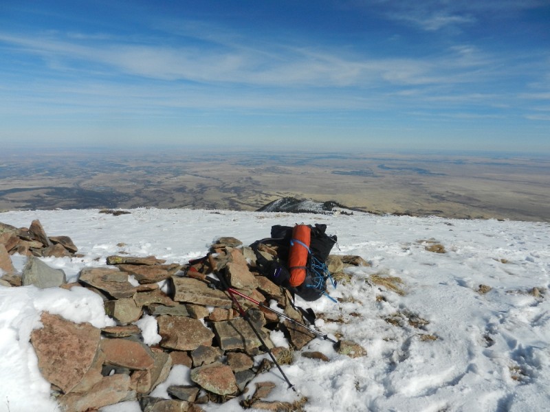
Once on the summit, soak in the views of the Sangre de Cristo Mountains, the Spanish Peaks, and the Huerfano Valley.
Spanish Peaks from the Summit of Greenhorn Mountain
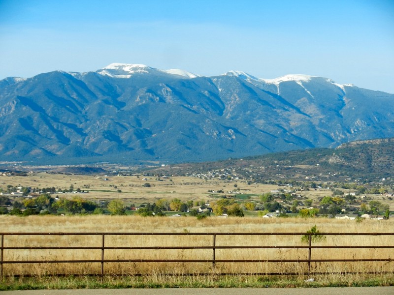
Huerfano Valley from the Summit of Greenhorn Mountain
Route Leading Back from Summit to the Established Trail
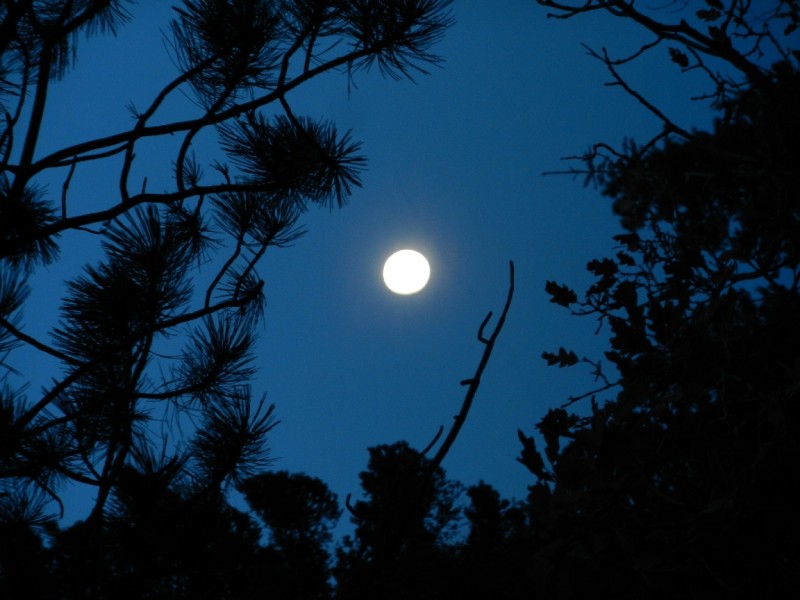
My climb to the summit and back took me roughly 12 hours. The bright, full moon in a clear sky lit my way for the last mile as I returned to the trailhead.
Getting to the Trailhead: From Pueblo, CO take I-25 south for 23 miles. Take exit 74, near Colorado City and follow State Highway 165 west for 8.2 miles to the town of Rye. Turn left onto Main Street. Follow Main Street for 0.4 miles where it turns into Park Road. Continue on Park Road for 0.5 miles and turn right on Cuerna Verde Road. Drive 1.8 miles to the end of Cuerna Verde Road where it ends at the Lower (East) Greenhorn Mountain Trailhead (37.921372 -104.967347). The trailhead is marked by a sign with questionable spelling...
Lower (East) "Green Horn" Mountain Trailhead
Hiking the Trail: I attempted this trail on 18 May 2014 with my snowshoes strapped to my pack for the first half of the trail. After about 4 miles from the trailhead and around 10,100', the northern exposure sections of the trail became too much work in the deep snow (even with the snowshoes) and I decided to turn around. The following description is a combination of information gained on my partial climb and from information posted online by others.
The Greenhorn Trail starts off by immediately crossing Greenhorn Creek on an excellent bridge. Barbed wire fences funnel you along on a good trail.
Greenhorn Mountain Trail
After about 2 miles and at 8,280' you'll cross Greenhorn Creek again.
Creek Crossing About 2 Miles from the Trailhead
As the trail continues its relentless climb, Greenhorn's prominent avalanche chute leading up to the North Summit is clearly visible. According to the topo map, the trail stays south of the chute. I did not make it that far up the trail, but I believe the trail actually cuts back and forth across the chute. Google Earth images appear to show the trail crossing the chute.
Looking West towards Greenhorn Mountian
The rocky trail continues along the walls of the Greenhorn Creek gorge offering cool views of the water below.
Greenhron Mountain Trail
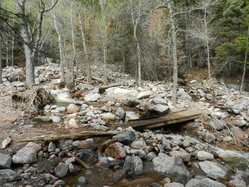
The trail descends slightly as you approach another crossing of Greenhorn Creek at 2.6 miles in and 8,800'. Depending on the time of year, this creek crossing can be difficult. On May 18th, the water was flowing pretty high. I managed to make a successful landing after a flying leap across the narrowest gap I could find. The crossing on my return later in the day was even sketchier.
Greenhorn Creek Crossing 2.6 Miles from the Trailhead
This creek crossing marks the start of the Greenhorn Wilderness area.
At the Greenhorn Mountain Wilderness Boundary
After the crossing the, the trail is relatively flat for a while as it contours a slope with sunny southwest exposure. At 3 miles (9,100') from the trailhead, you'll start collecting some serious elevation gain as the trail steepens. Here, the trail is often on a northern exposure. And, for my hike the trail began to be snow packed.
Snow on Greenhorn Mountain Trail
Finally, at about 4 miles in (10,100') I called it quits and turned back, too much soft snow on steep slopes. The hike facing downhill was just as beautiful as when facing uphill.
Beautiful Greenhorn Mountain Trail
Had I been able to continue up the trail, I would have reached the beginning of the avalanche chute around 4.6 miles. The trail continues to climb and breaks out of the trees around 5.4 miles (11,600').
The trail heads for a low point on the ridge (37.897790 -105.033988) just south of the North Summit. This point on the ridge is almost exactly 6 miles from the trailhead and at 12,040'. From here, it's a short, quarter-mile to the 12,220' North Summit (37.90159 -105.03202).
The traverse along the ridge to the South Peak (33.88147 -105.01342), the high point at 12,347' is roughly 2 miles.
Getting to the Trailhead: The drive to this trailhead is much longer than the other two. The Forest Service typically opens the Orphir Creek Road around Memorial Day. If you are planning on hiking this route shortly after Memorial Day, it's a good idea to contact the San Isabel Forest Service (719-553-1400) to verify the road is open.
From Pueblo, CO take I-25 south for 23 miles. Take exit 74, near Colorado City and follow State Highway 165 west for 24.8 miles. Turn left on Orphir Creek Road (FR 361). The intersection is located at a hairpin turn in the road (38.06644 -105.10423). Continue on the well maintained dirt road as it heads west then winds back south. After 8.1 miles from the State Highway 165 intersection, turn left onto FR364 which is Greenhorn Mountain Road (38.01720 -105.16610). Follow this road for 16.2 miles to the trailhead (37.893923 -105.041588). The trailhead is at 11,445' making this the easiest way to reach the summit of Greenhorn Mountain.
Hiking the Trail: Most people climbing from this trailhead make a loop that includes both the south and north summits. If you choose to hike the loop counterclockwise, head southeast along the road, which is also the Bartlett Trail. After about 1.5 miles of hiking and roughly 100' of elevation gain, you'll cross a rock slide area. Continue following the trail for about another mile. As the trail begins to wrap around the South Summit cone, leave the trail and continue another half-mile in an ascending traverse to the summit at 12,347' (37.88147 -105.01342).
From the summit, you can trace your route back to the trailhead. This is not a bad choice if wind and bad weather are a problem. If the day is clear, a more scenic option is to traverse the two-mile easy ridge trail to the North Summit at 12,220' (37.90159 -105.03202). To return to the trailhead, retrace your path off the North Summit for 0.3 miles to the Greenhorn Mountain Trail junction (37.891803 -105.034207). Descend the west slope of the ridge following the Greenhorn Mountain Trail in a southerly direction to a couple large switchbacks leading you back to the trailhead.
Greenhorn Mountain provides some of the best hiking in the Wet Mountains. If you end up climbing it from the east side, plan on a long but rewarding day.
I've included the gpx file for my 25 Oct 2015 climb of the Bartlett Trail.
My GPS Tracks on Google Maps (made from a .GPX file upload):
Brian thanks for your write up. Two years ago I tried driving to the upper Greenhorn Trailhead. The Forest Service said the road was open but when I got there, the gate was locked. I have it on my list to hike that loop from the upper TH.
Did I speak with you in the Oil Well Flats area near Canon City yesterday ? I was on a mountain bike, you had just come off hiking a ridge and mentioned all the bear sign ?? If not, I swear it was your twin.
mtgirl, unfortunately it wasn’t me. I wish i had been climbing yesterday. I haven’t been able to get out and climb since the Greenhorn hike and my mental health is suffering! Hope you had a good ride.
I’ve hiked up Greenhorn via the Lower Greenhorn Trailhead (your route 2). Great workout, and your route info will help others as the area and routes are a bit confusing. Get out and hike – your mental health is begging. :)
I summitted Greenhorn from via the Bartlett Trail today 5/3/2020. I found this page helpful when planning this run, so I'm putting the short write up I put on Alltrails here:
I summitted Greenhorn mountain via the Bartlett Trail today. The Bartlett Trail goes near the summit then contours around the summit cone of Greenhorn. I don't know why it's not listed on alltrails. The trail gets faint in the meadows near treeline, but there are cairns and posts. I eventually lost the trail and angled to the east ridge of the summit cone. There were a few snow drifts, but all easily avoidable. I saw a herd of mountain goats on the final pitch. It's practically summer up there!
I descended directly down the south slopes on loose, steep rock. I saw some cairns and another faint trail leading back to the Bartlett trail. I would go up this way if I do it again. I was able to see the trail through the meadows back to into the trees. I even put up a post that had blown over and built a few small cairns.
As others have said, there are quite a few blowdowns and the trail is overgrown in some spots. However, there is excellent singletrack to be found, and the blowdowns abate above 9500'. None of the blowdowns are overly obstructive either.
I did find a tick on my leg after I stopped to get water so check frequently.
I hiked Greenhorn Mountain from the Bartlett trailhead on 7/4. Beautiful weather. Didn't see another person on the entire hike.
This trip report was accurate, but I wanted to provide a condition update. The trail is pretty well maintained on the lower sections. There are blowdowns at various points but only a few need scrambling to get past. Between 10,000 and 11,200 there is substantial grass and plant overgrowth and at some points the trail gets more difficult to follow.
The first view of the summit is at 11,300. The trail is visually faint once you get into the big meadow, but you can see the summit the entire way so hike towards it. The final climb is steep but secure. Despite all the scree, there is enough vegetation to keep the slope secure.
My distance matched up exactly with this trip report. 17.5 miles RT. 4562 feet of elevation gain and 7:42 total time (4:07 up, 0:13 at the summit, 3:22 down) at a moderate pace.
kkulling, congrats on the summit and thanks for providing trail conditions from the Bartlett TH.
Caution: The information contained in this report may not be accurate and should not be the only resource used in preparation for your climb. Failure to have the necessary experience, physical conditioning, supplies or equipment can result in injury or death. 14ers.com and the author(s) of this report provide no warranties, either express or implied, that the information provided is accurate or reliable. By using the information provided, you agree to indemnify and hold harmless 14ers.com and the report author(s) with respect to any claims and demands against them, including any attorney fees and expenses. Please read the 14ers.com Safety and Disclaimer pages for more information.
Please respect private property: 14ers.com supports the rights of private landowners to determine how and by whom their land will be used. In Colorado, it is your responsibility to determine if land is private and to obtain the appropriate permission before entering the property.


 Greenhorn Mountain October 25th, 2015")
 Topo Map of Routes on Greenhorn Mountain")
 Google Earth Image with Routes")
 Greenhorn Mountain Wilderness Boundary")
 Huerfano Valley as Seen from the Bartlett Trail")
 South Apache Trail Junction")
 Trees Showing Signs of a Previous Burn")
 Sangre de Cristo Mountains")
 Greenhorn's Summit Dome")
 Route Up the Summit Cone")
 Spanish Peaks from the Summit of Greenhorn Mountain")
 Huerfano Valley from the Summit of Greenhorn Mountain")
 Route Leading Back from Summit to the Established Trail")
 Full Moon Shining on the Bartlett Trail")
 Lower (East)")
 Greenhorn Mountain Trail")
 Creek Crossing About 2 Miles from the Trailhead")
 Looking West towards Greenhorn Mountian")
 Greenhron Mountain Trail")
 Greenhorn Creek Crossing 2.6 Miles from the Trailhead")
 At the Greenhorn Mountain Wilderness Boundary")
 Snow on Greenhorn Mountain Trail")
 Beautiful Greenhorn Mountain Trail")
 Comparison of Greenhorn Mountain Routes")