Download Agreement, Release, and Acknowledgement of Risk:
You (the person requesting this file download) fully understand mountain climbing ("Activity") involves risks and dangers of serious bodily injury, including permanent disability, paralysis, and death ("Risks") and you fully accept and assume all such risks and all responsibility for losses, costs, and damages you incur as a result of your participation in this Activity.
You acknowledge that information in the file you have chosen to download may not be accurate and may contain errors. You agree to assume all risks when using this information and agree to release and discharge 14ers.com, 14ers Inc. and the author(s) of such information (collectively, the "Released Parties").
You hereby discharge the Released Parties from all damages, actions, claims and liabilities of any nature, specifically including, but not limited to, damages, actions, claims and liabilities arising from or related to the negligence of the Released Parties. You further agree to indemnify, hold harmless and defend 14ers.com, 14ers Inc. and each of the other Released Parties from and against any loss, damage, liability and expense, including costs and attorney fees, incurred by 14ers.com, 14ers Inc. or any of the other Released Parties as a result of you using information provided on the 14ers.com or 14ers Inc. websites.
You have read this agreement, fully understand its terms and intend it to be a complete and unconditional release of all liability to the greatest extent allowed by law and agree that if any portion of this agreement is held to be invalid the balance, notwithstanding, shall continue in full force and effect.
By clicking "OK" you agree to these terms. If you DO NOT agree, click "Cancel"...
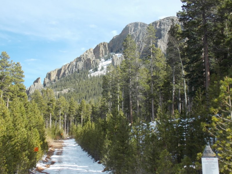
Trailhead: Twin Sisters TH across from Lily Lake on CO7
Route: Standard trail
Length: A little over 7 miles
Vertical: About 2600 feet
Partners: Solo
Note: I originally posted this as TS Mountain when it should have been TS Peaks. Thanks to 12ersRule for setting me straight!
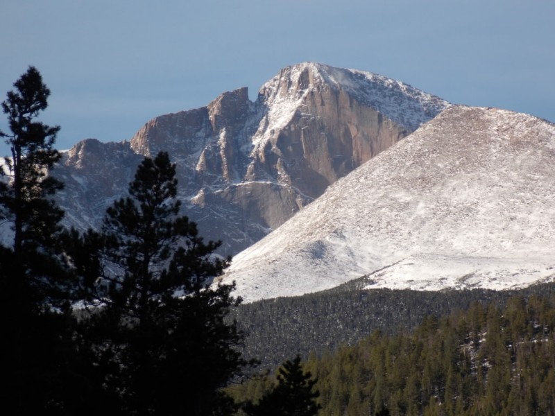
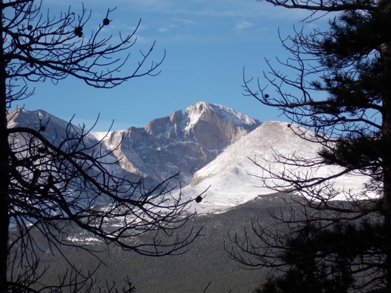
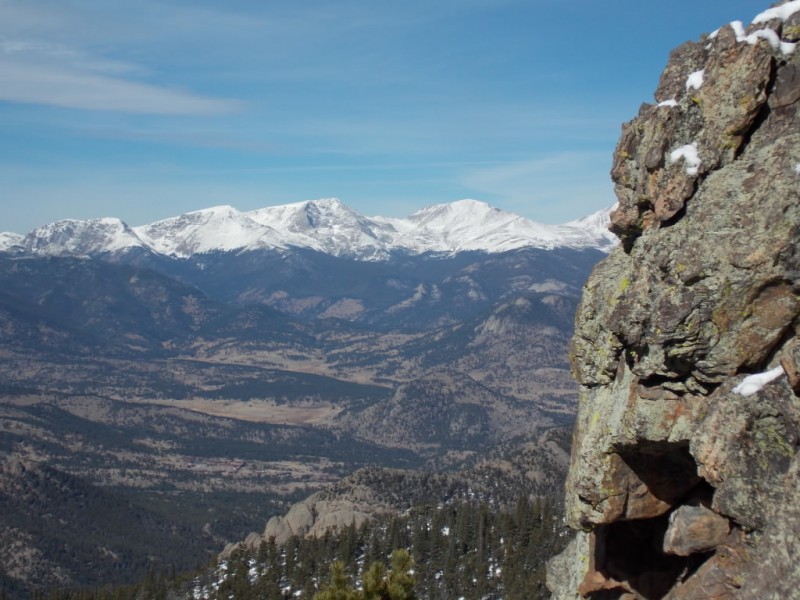
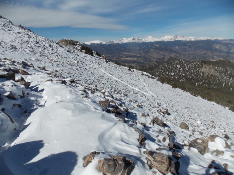
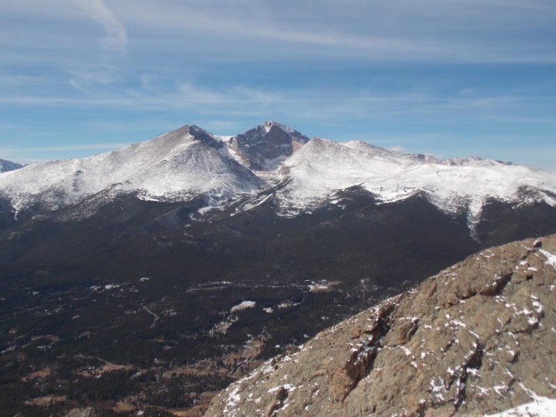
Some time back, 14ers.com member SenadR and I were heading to RMNP on CO7 and he mentioned that Twin Sisters Peak provided some excellent views of Longs Peak. He was not wrong.
Twin Sisters appears to be a pretty popular hike. Easy access, well maintained trail and stellar views make this a mountain that many people climb, I'm sure. Oddly enough, even though the weather was nothing short of fantastic (can you say "no wind at all"?), I saw less than a dozen other people on the trail the entire day.
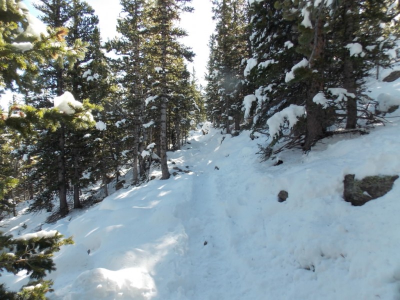
The road to the TH is closed for the season so that means you have to walk a whole half mile to the TH. But the view on the road isn't all that bad... Nearing the TH. The trail started out fairly clear. Then became a little icy.
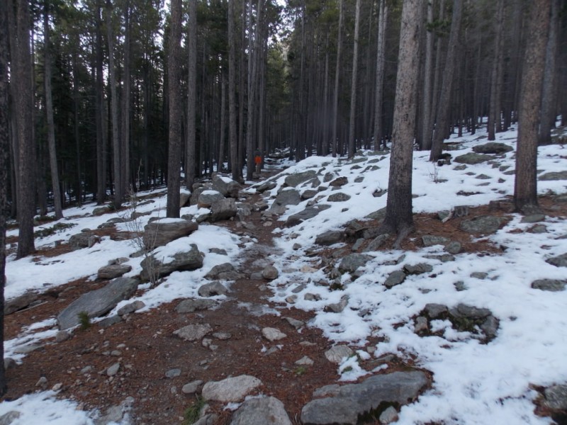
I wore spikes most of the way up and probably half the way down as warming temps turned the ice to slush.
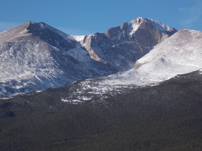
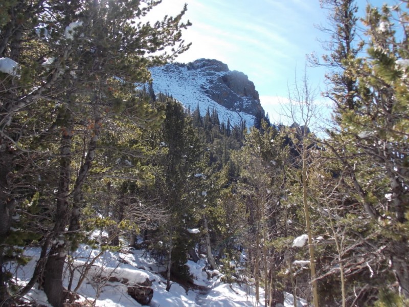
On the way up, I repeatedly stopped to take pictures of what many people consider Colorado's most beautiful mountain. What a mountain!
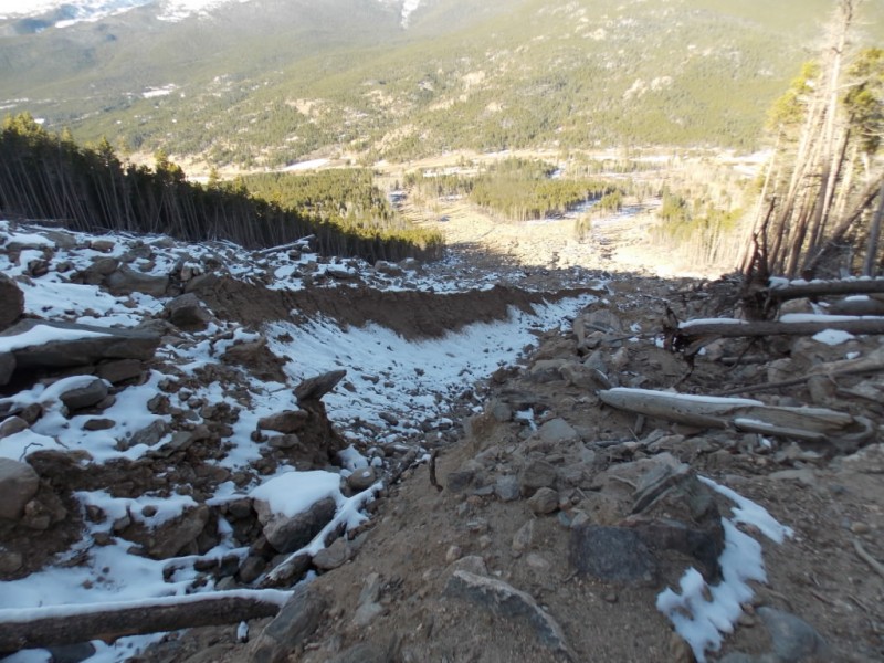
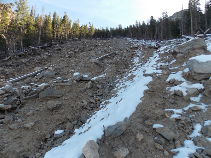
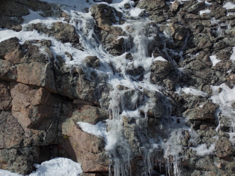
Most of you will remember the floods that hit Colorado a couple years back. I **think** it was during that time that the landslide on Twin Sisters occurred. I'm fairly sure that the trail criss-crossed this area. This area certainly shows Mother Nature's power. Looking up from where the trail crosses. Looking down
A short video
The trail was sporadic near the landslide and provided a couple more "up close" views of the slide area.
Nearing the top. The top of the slide.
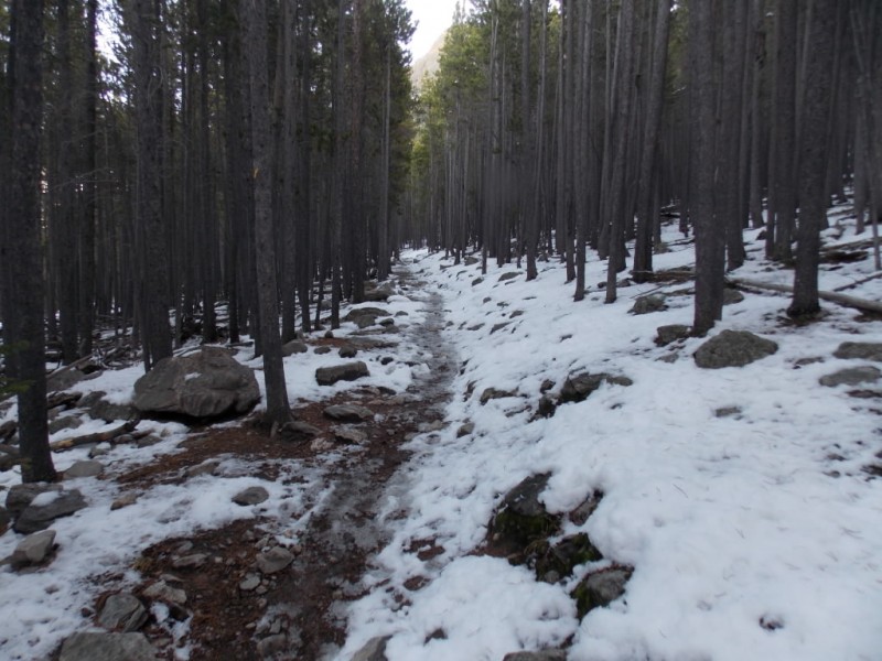
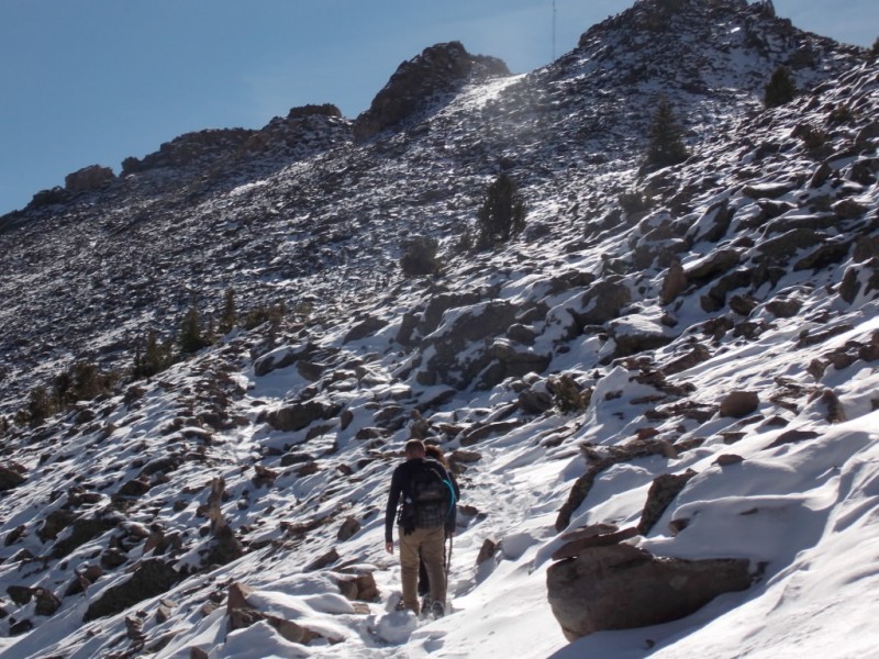
More snow as you gain elevation. And that mountain is still there... Some open areas on the way up. The snow varied from ankle deep to mid calf the rest of the way.
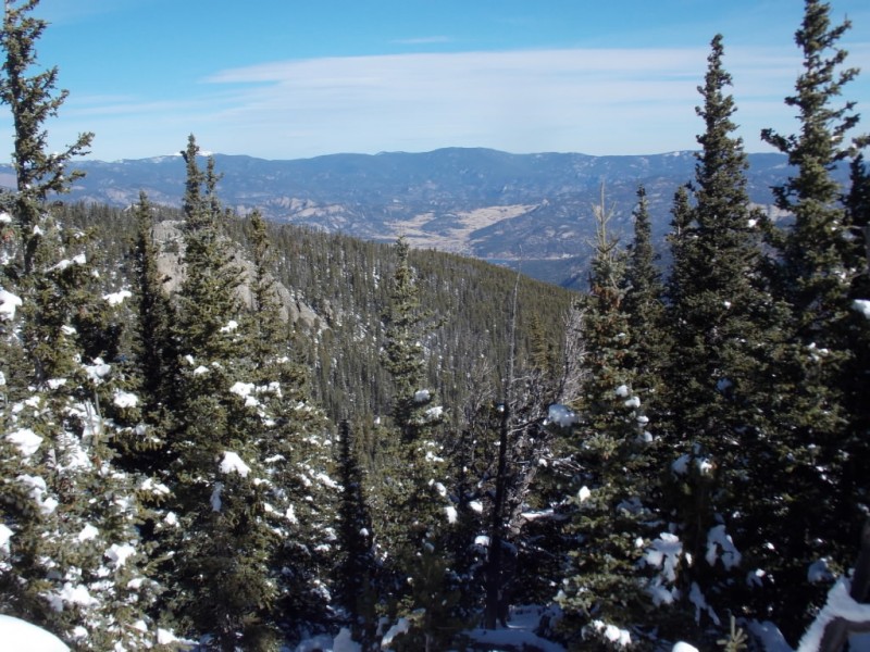
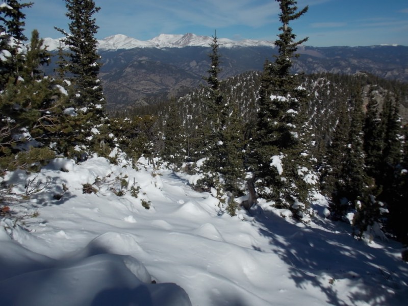
Nearing treeline, the views really started opening up.
Looking north. Looking northwest The Mummy Range ??
Another short vid taken in this area.
Breaking treeline, the rest of the route becomes apparent. I passed this couple and met them later on the summit
Note: If you happen to see this report, please PM me as I have some pictures of you on the summit. It sure was nice chatting with you!
Nearing the saddle, looking back down. Mother Nature's art. What I think was an old weather station? On the summit and a view of Guess What...
And a short 360 vid from the summit.
This was a fun, fun day, but I guess they all are when we live where we do.
Thanks for taking the time to read this and please be careful out there.
Thumbnails for uploaded photos (click to open slideshow):
I did Twin Sisters for the second time over the summer and enjoyed visiting
them again through your nice photos. The views of Longs and Meeker are
really spectacular. I wonder if RMNP (and/or the Forest
Service) has any plans to rework the trails by the slide area? The social
trails that have developed are certainly passable, but they don’t look
particularly sustainable (at least to my untrained eye).
Twin Sisters was the first mountain I climbed in Colorado and I love to go back and do it every spring. I remember that first year I was to afraid to climb the eastern summit (the one without a trail or radio tower). I like to return and remember those innocent days! I believe Twin Sisters Mountain is reached by a ridge off the eastern summit and is a little more scrambly. Always nice to revisit this great place, in person, or in a trip report! :D
Dave - No worries - I honestly do appreciate the correction.
Brian - I agree. I had to zoom in some to get the diamond from TS and from MLW, I almost had to zoom out to get it all in frame.
MathGuy - I do hope the FS (who I think has that portion of the trail) does do something with the social trails. It was a little hard for me to tell with the snow but I have a feeling it will get pretty torn up if something isn’t done fairly soon.
CtLee - I did do the eastern summit and took a relatively hard line up - at least as hard a line as I could find. Sure is a fun mountain - one that I wish I had started as an annual tradition rather than Bierstadt. But that’s another story.... :)
Nice report, Jay! Hadn’t really seen the slide area up close. I may finally give these a go this winter. Can’t beat the views of Longs and the easy access. Oh and Mummy Range indeed, CCY and Fairchild, L to R. Hope you’re doing great!
I just HAVE to spend more time in RMNP. Such a beautiful place that I have avoided for decades for no good reason. I appreciate the confirmation on the Mummy Range. Gotta get back up there soon.
I was just up there myself a couple of weeks ago! It definitely looks much different in the snow, especially that shot right after you came out above treeline. Thanks for sharing!
PmReyn2010 – Snow can make a mountain look completely different, can’t it? Another reason I love the seasons in Colorado.
Ryan – That is the first landslide area I’ve been up close and personal with. Something else, eh? Thanks for your compliment – coming from you, that means a lot.
Halfpint – Memories are good. In the end, that’s all we have. Sincere thanks for your post.
Saw the big gash it left across the valley when I came down Longs last year and this past summer, but thought the trail climbed up to the summits farther on the northwest side. I didn’t realize the T–S trail actually crossed the slide area. Great shots of it, Jay!
Yeah – I believe SenadR had told me that the slide wiped out a chunk of the trail when he pointed out Twin Sisters to me. There were signs at the TH warning of trail damage due to the slide. The pictures really don’t do it justice. The size and scope of that thing is something else.
The Park Service is planning to fix the trail in the landslide area, but I don’t think they have decided on a final plan yet. One of the issues is that rebuilding it across the slide is unlikely to work, because that slide will probably continue to erode. The Park Service has responsibility for the entire trail, even though part of it is on National Forest land. (There may be some kind of funding arrangement with that, but I don’t know for sure.)
Dave – That’s interesting the the NPS has responsibility for the whole trail. And I do see it will be a problem trying to rebuild it over that slide area. I would guess a bit of serious moisture and it would become loose. Thanks for your thoughts.
Caution: The information contained in this report may not be accurate and should not be the only resource used in preparation for your climb. Failure to have the necessary experience, physical conditioning, supplies or equipment can result in injury or death. 14ers.com and the author(s) of this report provide no warranties, either express or implied, that the information provided is accurate or reliable. By using the information provided, you agree to indemnify and hold harmless 14ers.com and the report author(s) with respect to any claims and demands against them, including any attorney fees and expenses. Please read the 14ers.com Safety and Disclaimer pages for more information.
Please respect private property: 14ers.com supports the rights of private landowners to determine how and by whom their land will be used. In Colorado, it is your responsibility to determine if land is private and to obtain the appropriate permission before entering the property.