| Report Type | Full |
| Peak(s) |
13151 |
| Date Posted | 11/08/2015 |
| Date Climbed | 10/10/2015 |
| Author | jdorje |
| Pt 13151 in the Sangres |
|---|
Located 0.75 miles WNW of Challenger Peak and 2.8 miles east of my house, Point 13,151 is a tricky location. With 251 feet of interpolated prominence, it is unranked and, probably deservedly, ignored. Still, being as it's basically in my back yard, I've been eyeing it for a while.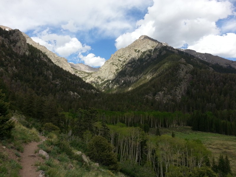  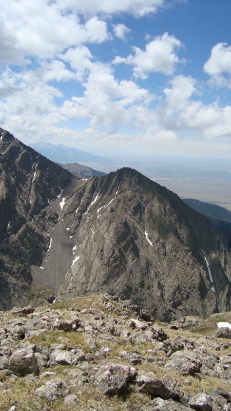 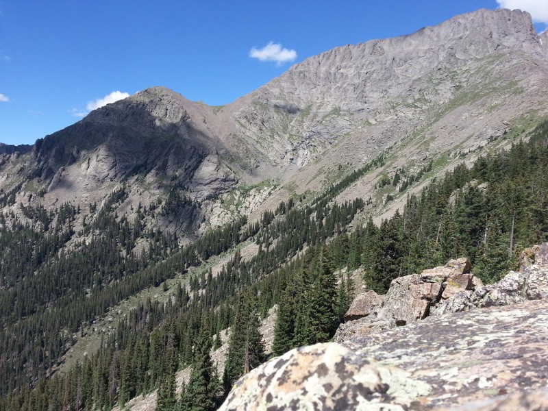 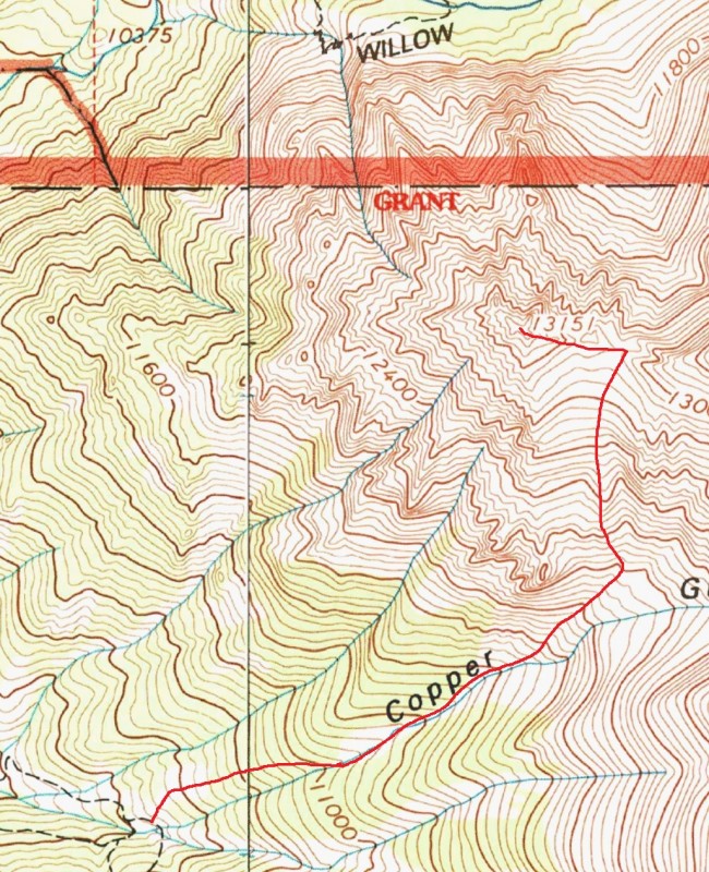 The point is pretty rugged. One option would be ascending to the saddle from Willow Lake (right around the campground area), but this is 1500 feet of steep scree in summer; I've been told this is a viable route to the summit of Challenger, but it doesn't sound fun in any season. It was from Pt 11883 on the southwest ridge of Challenger Point a couple of years ago that I spotted the correct line. From the upper mine complex at the top of the Copper Gulch trail, somewhere between 400 and 1000 feet of bushwhacking up the correct creek would bring me to the base of the gully visible in the picture. The gully must then be bypassed on the left (north) to ascend what looked like a headwall cliff face and gain the basin at the foot of Challenger's West face. From there it should be a relatively easy talus/scree slog up to the saddle. The crux would be bypassing this area; I studied it closely but the angle wasn't great to really find a good line through it.  Six pictures of beta is more than the norm I would say, but the majority of this hike (and I was expecting it to be a hike, not a climb) would be off trail along a route I've never heard tell of before. Too bad I couldn't ask the old miners about it. Copper GulchThe Copper Gulch trail begins on semi-private land in the Baca Grande residential area, heading up in an extremely efficient manner through pinion-juniper forest, across Willow Creek, and then through Aspen. There is a lower mine complex at 10,100' and an upper complex at 10,400'. I'm quite familiar with the trail, which is surprisingly well defined up to the lower mines.   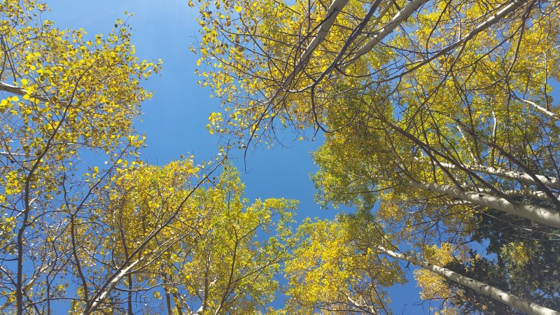 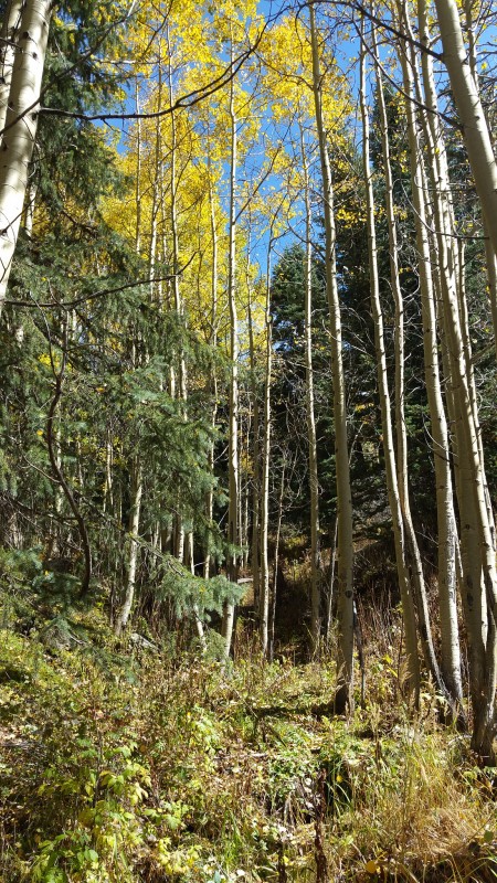 While the lower stretch of the trail is pretty boring, after about 9400' where it entered the Aspens it was quite pretty, even though they are a bit past their peak. Although there are several cabins and even mines along the side of the trail, the lower mine complex, right past a double creek crossing, is pretty unmistakable. From here to the upper mine the trail is harder to follow, although it pretty obviously follows the path of an old railroad and can always be picked up again. I've been to the upper mine complex once before, and was unable to find any trail beyond that point. BushwhackFrom the top of the trail, I knew bushwhacking must ensue. I was quite reliant on the GPS here to make sure I took the correct gully - cutting left too soon would take me up underneath the gnarly south face of 13151, and missing the cutoff would have me headed up toward Challenger's SW ridge. Stopping every few minutes to check my location is probably why I took considerably more pictures than normal. As it happens, the end of the trail right above the upper mine complex is almost exactly the point to cut uphill. I initially angled a bit left of the desired gully, to shorten the tedium by cutting through an open area visible on the topo map. Above this clearing is where the real bushwhacking began, as I tried to stay on top of the gentle ridge just north of the creek. The woods in this area were not dense, but large sections of deadfall slowed progress. Soon the ridge steepened and curved off to the left, and I headed straight up the gully itself. 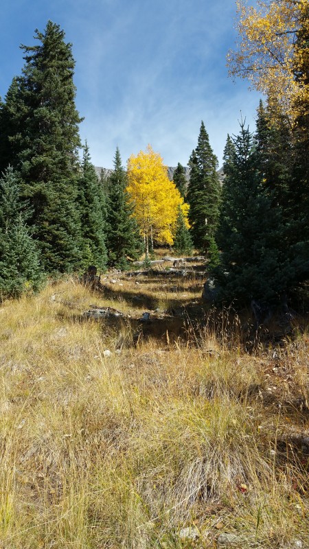 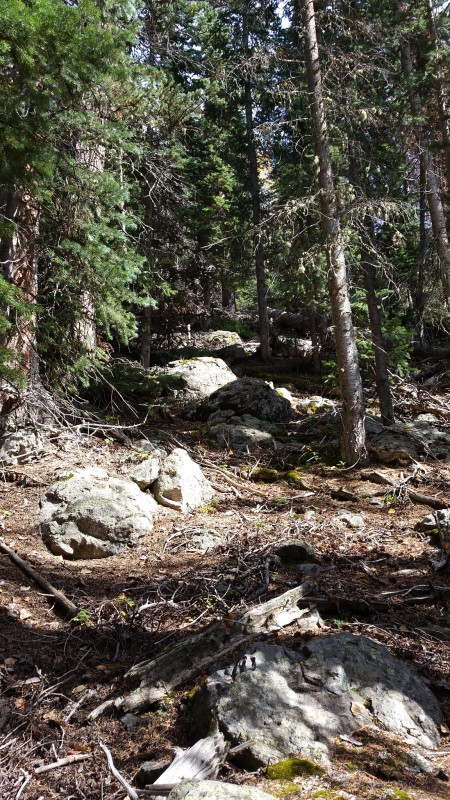 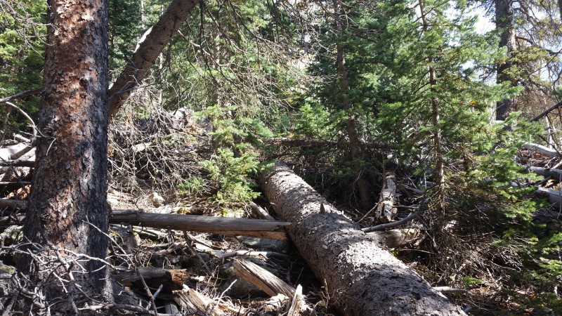 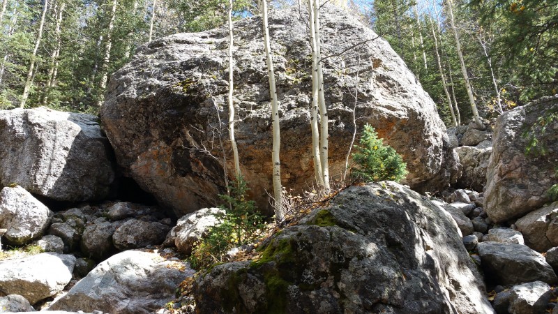 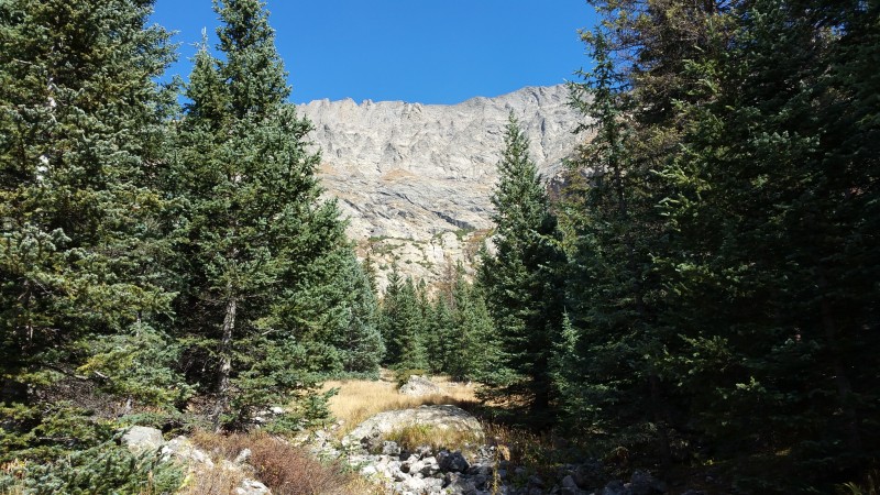 I had seen signs of great violence already along the gulch. In one area hundreds of downed trees were piled up, while right above that an avalanche chute ran the entire length down from point 11883. At the point where I reentered the gulch, it was obvious that a large amount of water flowed through at times. A fun section of boulder hopping ensued, as I ascended the steep creek. At times the creek would split, or a waterfall area would force me to detour. Although this was a large creek area, it was completely dry at this time. I was reminded that this small creek (gulch) drained the entire west face of Challenger - which by this time of year was almost entirely snow free. It wasn't long before the slope became gentler, and I entered another open area below the headwall. The Headwall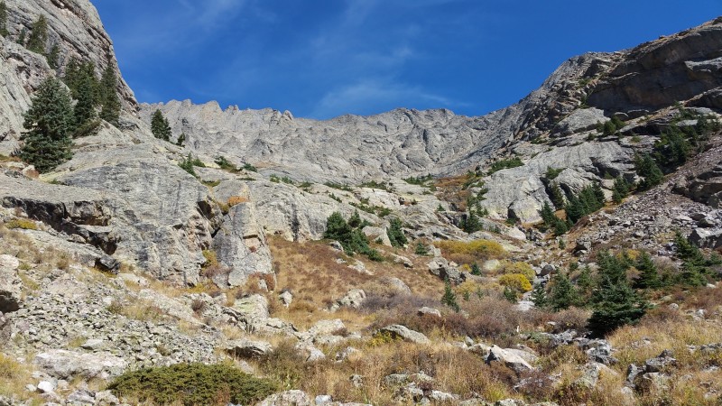 I was now faced with that obstacle: the headwall. Now, a headwall is a specific glacial formation, and I really have no idea if this cliff technically qualifies, but this is how I thought of it as I studied it. It's difficult to see in the picture, but the cliff is about 200 feet high and right in the foreground; the background is the much steeper 1500-2000 foot cliff that is the west face of Challenger. Although in the picture it appears there is a bushy bypass to the right (south) side, this would take me out of the way and be terrain I'd have to recross above the headwall. I stuck to my original plan and attempted to bypass it on the left (north) side. In studying again the picture taken from 11883, I'm unable to pick out the line I took, but it involved walking up a steep grass gully almost directly north before finding a bushy ledge to traverse east on. I took careful note as I knew I'd have to descend the exact same way.  I'm fairly sure the topo map is incorrect here. On the USGS map, a pair of gullies is shown, with the "creek" flowing down the southern gully. The terrain here is complicated, but there was a significant amount of water flowing down what I believe was the northern gully. This water all dried up before reaching the boulder-strewn gulch below, however. The saddleDirectly above the headwall, another flat expanse loomed. Off in a corner was the last, very sad, patch of snow remaining. This sole patch of snow is the last surviving remnant of the normally permanent snow patch at the base of Challenger's west face. 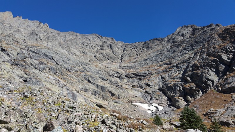 From above the headwall, it was a talus and scree hop up almost 1000 feet to the saddle. At first I found this easy enough, but as it continued curving around in between the steep cliff walls to either side, the tedium increased. By the end of the day, I concluded this slope embodied all the worst characteristics of both Challenger's north slope and Kit Carson's south gully. Still, the ascent was easy enough, with expansive views opening up behind me, and the cliffy terrain on either side was incredible in its rugged conglomerate formations. 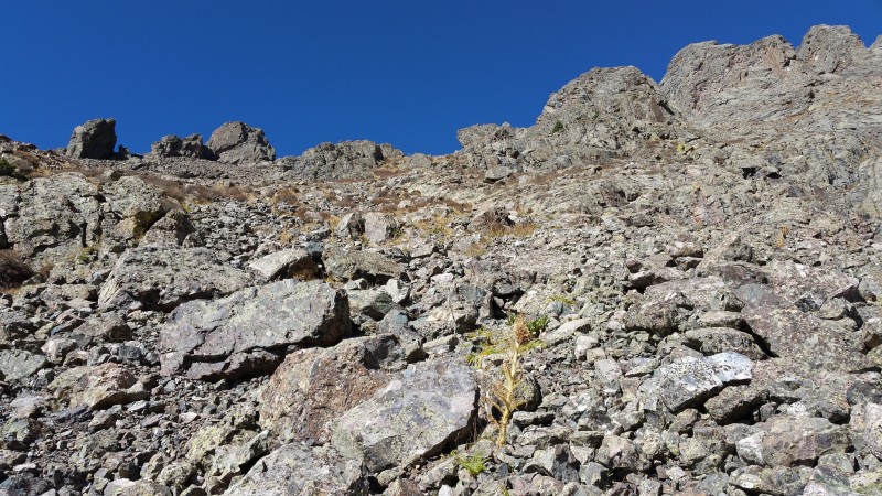 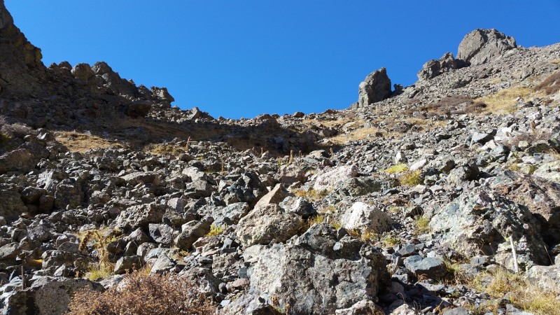 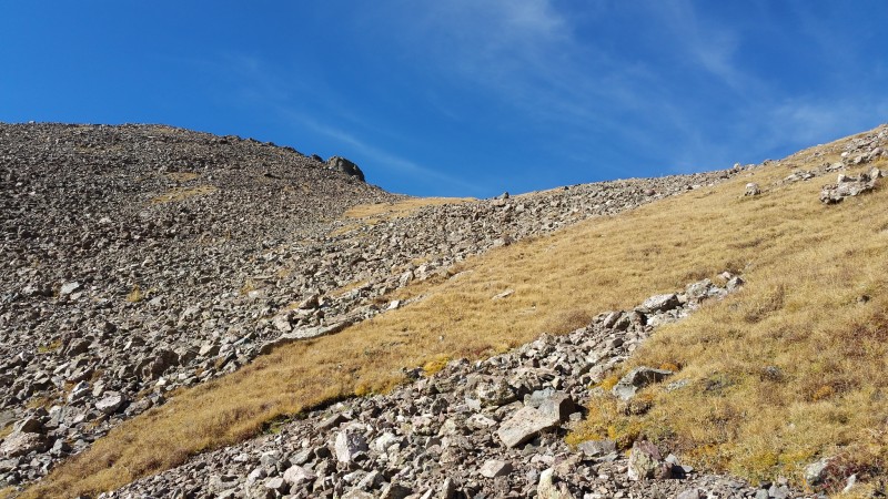 Near the saddle, the steep talus gave way to gentler tundra. It was a welcome change. The saddle itself was a gentle location, offering great views of Challenger - which, of course, was really the feature of the day. 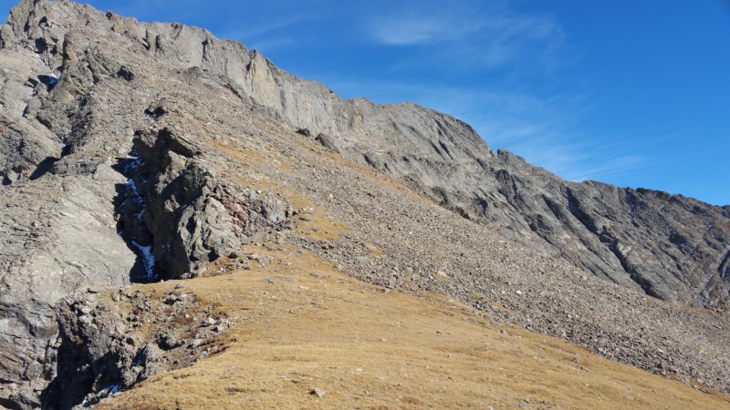 SummitFrom the saddle, the 250-foot ascent to the summit was straightforward. The ridge was a little windier than it looked from a distance, with significant exposure on the north side. The south side remained gentle, however, and it was a short walk to the top. Though I knew daylight was limited, I relaxed for about thirty minutes and enjoyed the tranquility of the day, while also taking an uncharacteristic number of pictures. Unfortunately I forgot to bring a summit register jar to leave on the summit. 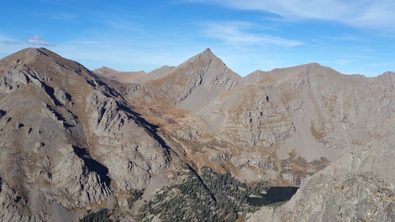 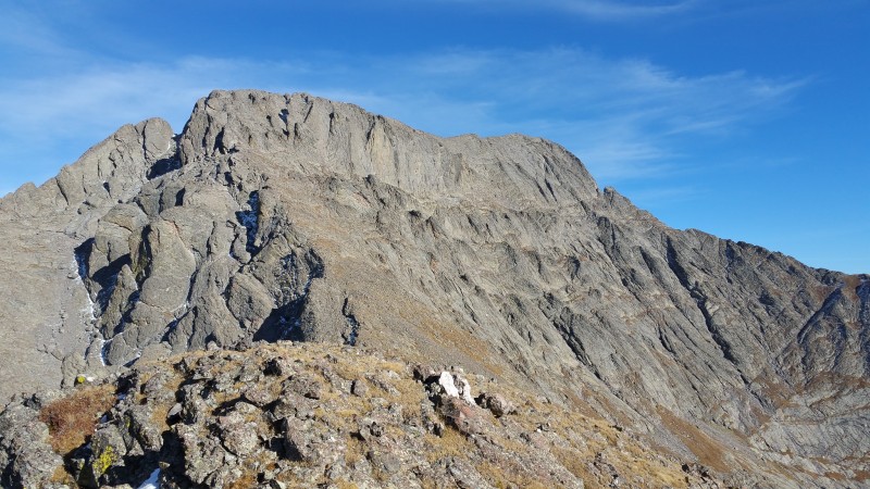  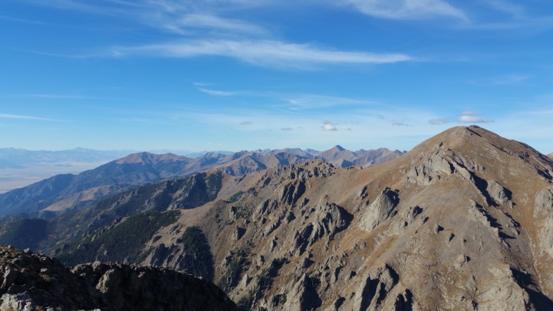  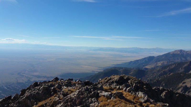 DescentWhile on the summit, a few strange things happened. Twice I heard a dog barking. I picked up half a dozen wireless signals, but was unable to connect to any of them. Something that sounded like a bird (maybe an insect) buzzed right over my head, but when I looked around I couldn't find anything. Finally I figured I couldn't delay my descent any longer. I really wasn't looking forward to either the talus hopping, the route finding through the ledges around the headwall, or the bushwhacking beneath. Little did I know it was going to be much worse than expected. Just below the saddle, I took a wrong step and hyperextended my wrong knee. Ligaments were fine and there was no swelling, but it troubled me significantly for the next couple of hours...right as I was entering the annoying section of the descent. As a result, covering the talus slope took twice as long as it should. At almost exactly the same time, my GPS completely lost signal, leaving me with only memory (and, technically, a map) to find the correct route through the crux and the forest. 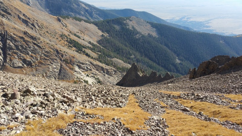 The lack of GPS may have been a blessing, though. I had no trouble finding the ledge system around the headwall, or descending down the boulder-strewn upper gully. When the boulders ran out I cut to the right, and stuck with open fields all the way down to the perfect spot right above the upper mine. This time I kept high in the decent from upper mine to lower, and avoided any further bushwhacking. Darkness fell just before I reached the trailhead. Thumbnails for uploaded photos (click to open slideshow):  From Willow Creek Trail")
 From the West")
 From Pt13546")
 From Unranked Pt11883")
")
 The crux")
 Challenger and 13151 from low on the trail")
 One of the mines - 13151 in the background")
 Aspens in bloom")
 Sort of still a trail")
 The good")
 The bad")
 The ugly")
 Boulder-hopping up the creek")
 First sight of Challenger's W Face")
 Headwall")
 Ledge above the headwall - looking down on the descent")
 Looking up at the summit of Challenger")
 Talus and scree")
 More talus and scree")
 Saddle in sight")
 Challenger from the saddle")
 Adams, 13546, 13580, Fluted, and Willow Lake")
 Challenger - again")
 Crestone")
 Rito Alto and the northern Sangres")
 Pt11883 and the Blanca Group")
 Gibson, Ouray, Antora, San Luis")
 Talus descent")
|
| Comments or Questions | ||||||
|---|---|---|---|---|---|---|
|
Caution: The information contained in this report may not be accurate and should not be the only resource used in preparation for your climb. Failure to have the necessary experience, physical conditioning, supplies or equipment can result in injury or death. 14ers.com and the author(s) of this report provide no warranties, either express or implied, that the information provided is accurate or reliable. By using the information provided, you agree to indemnify and hold harmless 14ers.com and the report author(s) with respect to any claims and demands against them, including any attorney fees and expenses. Please read the 14ers.com Safety and Disclaimer pages for more information.
Please respect private property: 14ers.com supports the rights of private landowners to determine how and by whom their land will be used. In Colorado, it is your responsibility to determine if land is private and to obtain the appropriate permission before entering the property.