| Report Type | Full |
| Peak(s) |
Mount Whitney - 14495 |
| Date Posted | 10/01/2015 |
| Modified | 10/03/2015 |
| Date Climbed | 09/26/2015 |
| Author | painless4u2 |
| Mt. Whitney via the John Muir Trail |
|---|
 Since moving to California and after climbing all 58 of Colorado's 14ers, it was natural to look in my new backyard's playground: the Sierra Nevada. And not just the Sierra, but it's crown jewel, Mt. Whitney. But what approach? Since I dislike the notion of lotteries and such (required if you use the Whitney Portal in any direction) and enjoy extended backpacking trips, a search of various reports online revealed an intriguing route to Whitney's "backside". We would spend six days backpacking from Onion Valley (Kearsarge Pass) to Horseshoe Meadows (Cottonwood Lakes) with a spur to Mount Whitney along the way. This would allow for a simple backcountry permit (easy) and involve about 66 miles over 6 days, meaning 10-12 mile days, mostly along the John Muir Trail (JMT) and the Pacific Crest Trail (PCT). Going in late September would hopefully allow for few, if any, storms, mosquitoes, or crowds. At 61 years of age and living in a new place, it was difficult (make that nearly impossible) to find someone to hike with from here. As I'm not into the solo-hiking thing, I called up my good friend Cody (from Texas), who has climbed several Colorado 14ers with me, to see if he was interested (he was). He wanted to bring a friend along as well (Thomas) who had climbed 6 or so 14ers with him. They would fly in to Vegas and we'd meet in Lone Pine, California. This would allow us to have 2 cars to do a car drop and shuttle to both trailheads. We decided to go north to south, mainly because I read that Kearsarge Pass was one of the easier ways to enter the high Sierra, and it allowed us to gradually acclimate for Whitney. Our itinerary: Day One: Drop car off at Horseshoe Meadows, drive to Onion Valley, ascend Kearsarge Pass, camp at Vidette Meadow. Day Two: From Vidette Meadow, ascend Forester Pass, camp at Tyndall Creek. Day Three: Leave Tyndall Creek, turn east at Crabtree Meadow junction to Guitar Lake and camp. Day Four: Summit Day. Go from Guitar Lake to Mt. Whitney, return to Guitar Lake, break camp, hike to lower Crabtree Meadow and camp at Whitney Creek. Day Five: Continue along PCT to Rock Creek junction, turn east toward New Army Pass and camp at Lower Soldier Lake. Day Six: Leave LSL, gain New Army Pass, and descend toward Cottonwood Lakes and Horseshoe Meadow. Drive to Onion Valley and retrieve car, return to Lone Pine. Eat massive quantities of "real" food. As the JMT and PCT routes have been thoroughly described, it would not serve to repeat much of our hike description. However, there are a few details that might be worthwhile in knowing and perhaps be beneficial to some wishing to hike this route. The hike up Kearsarge Pass was pretty hot, even in late September, so be prepared with plenty of water and electrolytes. I used Sketch Labs and Clif Shot drink powder for electrolyes. After years of using a hydration bladder, for this trip I used 2, 1-liter Gaterade bottles instead. This allowed me to better monitor how much water I had, made refilling easier (didn't have to remove and empty pack to access the bladder). I filled one with just water and the other with the electrolytes, something not possible with one reservoir. There is water available much of the way. Some people we met carried only one liter of water, refilling frequently, but reducing their carry weight. I chose to carry 2 liters as I drink quite a bit and don't like to stop a lot. This worked well, especially for climbing Mt. Whitney, as there is no water available above the tarns around Guitar Lake. I have gradually tried to go lighter over the years, so this year I purchased a ULA Catalyst backpack (48 oz). I removed the hand straps and inner hydration sleeve saving even more weight. The Gaterade bottles fit on the shoulder strap loops nicely, making them easily available and act as a counter-weight to the backpack. This backpack proved remarkably comfortable, light, very roomy and durable. Highly recommended. I did slightly modify the hip belt by velcro-ing a small cushion at the back. This was from an old backpack and weighed next to nothing but added a little needed padding in this area. The 3 of us shared one 4-man tent, dividing it among us. This allowed lots of room each night but relatively little weight per person. You might consider bringing earplugs for this arrangement, as some snoring from tent-mates may occur. One item that didn't work for me was bringing a small (4 oz) fuel canister instead of my usual medium (7.76 oz) canister. Only boiling a cup of water for coffee at breakfast and about 3 cups of water for dinner ( 1 ¾ c for a Mountain House meal and 1 c for hot chocolate), I ran out of fuel after 3 ½ days. I had read where the small canister should last 6+ days for 1 person. NOT. For any trip lasting more than 3 days, I'll be bringing the larger one. Fortunately, my hiking partners had enough left for me to share, so the freeze-dried food could be prepared. Whew. My default breakfast has always been 2 packages of instant oatmeal (maple brown sugar), which requires more water and fuel. For this trip I brought Pro Bar "meal" to use as my breakfast. With the hot coffee, this worked well and are actually pretty tasty and have high calories-to-weight ratio. Other food brought: Mountain House meals (for 2, but I get hungry), Thomas bagels (pressed flat and individually packaged in baggies to keep them fresh), Justin peanut and almond butter packets, jerky, homemade trail mix (macadamia and cashew nuts, dark chocolate M&M's, dried blueberries), Via coffee packets, hot chocolate packets, and Clif Shot energy gels (2/day). For clothing, I brought one extra change of: merino wool t-shirt, smartwool socks, and synthetic briefs. Using liquid camp soap (responsibly, away from water source), I washed each days clothing in a collapsible "sink" at the end of the day, drying them out overnight. This kept the stink and dirt down and made for much more pleasant hiking. We encountered a lot of trail dust along the way which really worked its way into clothing and skin. Also brought: Icebreaker pull-over merino shirt (used for cold mornings and for sleeping in), merino thermal bottoms, Mont-Bell down puffy jacket (also used for a pillow stuffing), Marmot rain shell (also acted as windbreaker and/or additional layering), convertible pants, Ahnu eVent mid hiking boots, beanie (mainly used at night), cotton bandanna, Vivobarefoot Ultra camp shoes (7 oz), Manzella windstopper gloves, and a nice, new Tilley Air-flo hat. We each brought Ursacks with Opsak odor-proof liners. For every night but one (at Lower Soldier Lake) we used bear-proof lockers that were located at each camp. Fortunately, while we saw plenty of signs of them, we never encountered any bears. We did have a persistent squirrel at Guitar Lake, which managed to chew through a plastic bag of ours. We considered squirrel stew for dinner momentarily. Also brought along: a few toiletries, minimal first-aid, small camera (Canon s100), iphone (preloaded with topo maps), compass, map, knife, TP, baby wipes, small pack towel, cord, spork, Sawyer Mini-filter and backwash syringe, Snow Peak titanium pot (used to boil water and to fill Sawyer bag), Snow Peak stove, Bic lighter, wind-proof matches, plastic cup, whistle, sunglasses, Western Mountaineering down bag, NeoAir sleeping pad, flannel stuff sack (for pillow), Black Diamond Spot headlamp with extra lithium batteries (4 AAA), plastic trowel, pack cover, collapsible bucket (to haul water for camp use), and one Opsak for trash. A few words about the Sawyer Mini-filter: it works great, is cheap, light, small, fast, and bullet-proof. Never again will I use pumps, Steripens, Aquamira drops or tablets, iodine, etc. If you don't have one, get one, now. My total pack weight was under 35 pounds, not too bad for 6 days (and of course, got lighter each day). It took us 3 hours to summit Mt. Whitney from Guitar lake, and 2 hours to return to camp, for a 5 hour round trip. We left most of our supplies in camp and used our (lightened) backpacks as our summit bag, bringing rain jacket and puffy, food, water bottles, etc. It also took us 5 hours to hike from Lower Soldier Lake to Horseshoe Meadows Trailhead on our final day. This left us plenty of time to return to our stashed car and enjoy a good meal (or 3) in town. And speaking of good meals, we enjoyed some terrific food at Alabama Hills Cafe and Bakery in Lone Pine. Afterwards, we had a room at the Best Western in Lone Pine to clean up and get some rest for traveling home the next day. This motel was nice and had a really good (free) breakfast. It was booked solid, so reservations are a must. We never encountered rain, snow, bears, mosquitoes, blisters, or altitude sickness. It did get windy at Guitar Lake and rattled our tent pretty good all night. We stayed at a great spot at the northeast side of the lake, next to a huge boulder. If available, this is the best spot. Some camped above the lake on a shelf higher up near some small tarns, but the spaces are very limited and small. The trail is good as it switchbacks up toward Trail Crest, meeting the Portal route. Forester Pass is considered one of the "cruxes" of the JMT as it is high (13,180') and rugged. The south side is very steep, but has a good trail that switchbacks down toward Tyndall Creek. The least interesting and driest stretch along the PCT was at Guyot Flat. Guyot Creek was dry, so after leaving Whitney creek you may not encounter water until you reach Rock Creek, about 6.7 miles. Also, there are a couple of options toward the end, either over New Army Pass or through the Siberian Outpost to Cottonwood Pass. The former is considered much more scenic than the latter but requires more elevation gain (and loss). After the grind through Guyot Flat, one is hungry for better scenery and Lower Soldier Lake/New Army Pass delivers. We also had the entire lake to ourselves, making skinny dipping a little easier (unlike Guitar Lake!). Mt. Whitney is an iconic summit, highest in the lower 48 (14,495'), and very worthwhile. The views are stupendous. We really enjoyed gaining the summit from this approach as one is relatively "fresh" upon arriving at the top, while many of the people coming from the standard Portal route looked pretty toasted. Also, no poop bags were required from our direction, as we entered the Whitney Zone for only 5 hours after Guitar Lake. We did notice several poop bags left along the trail, a disturbing find. The JMT/PCT is also a wonderful slice of the Sierra. We met several people along the way, many with foreign accents. We also met the author, Eric Blehm, of The Last Season, a book about ranger Randy Morgenson who vanished near here and was never found. An interesting, but haunting read. If you enjoy extended backpacking, with 14er summits mixed in (you can also access Mt. Muir and Mt. Langley on this route, if desired), and amazing scenery most of the way, you would be hard pressed to find a better route. Here are some photos taken along the way. Hope you enjoy them. Thanks for reading!  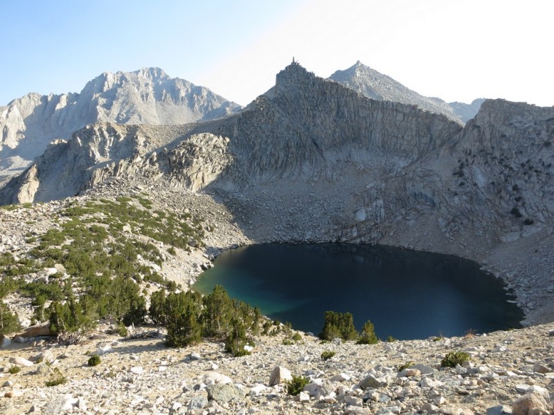 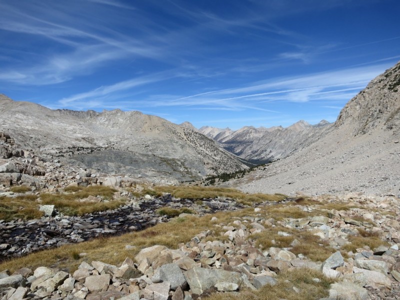  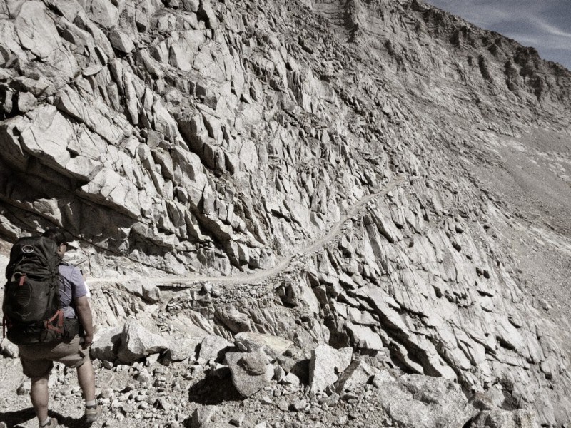 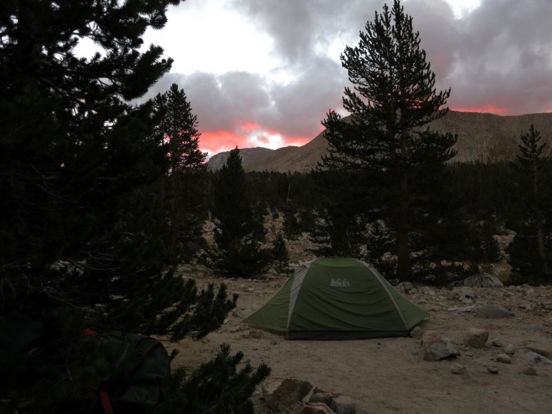 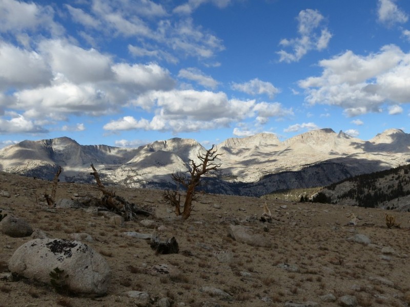 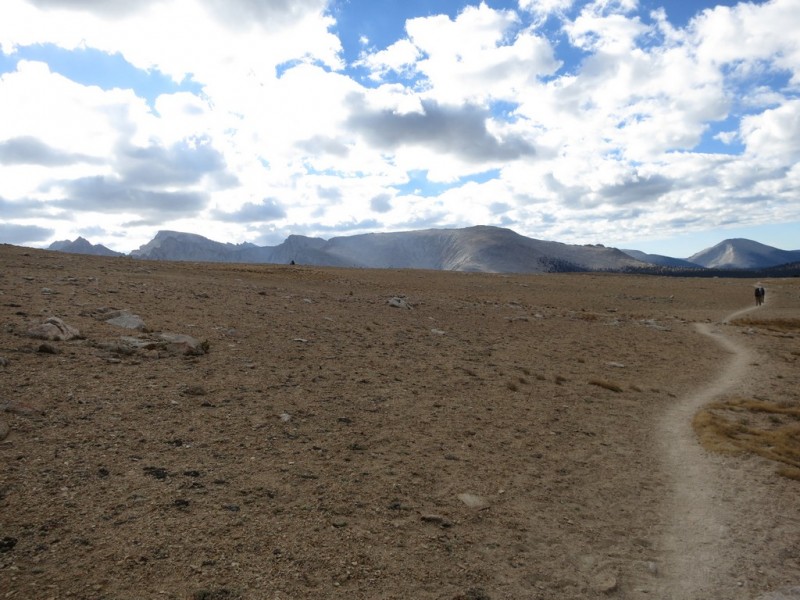 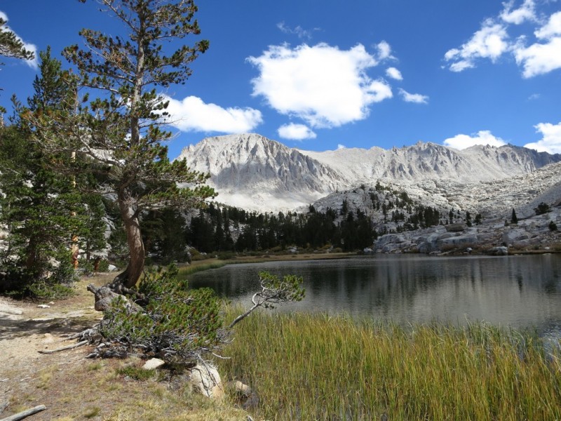 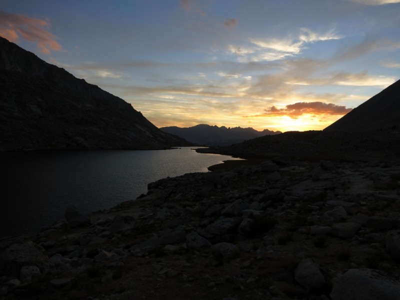 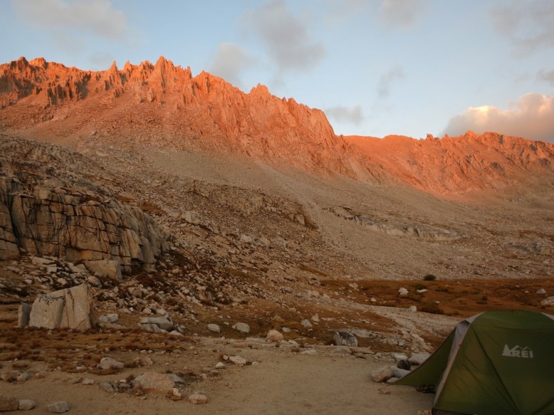  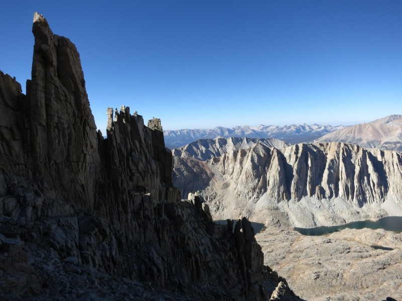 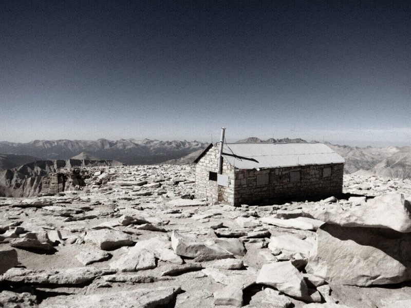 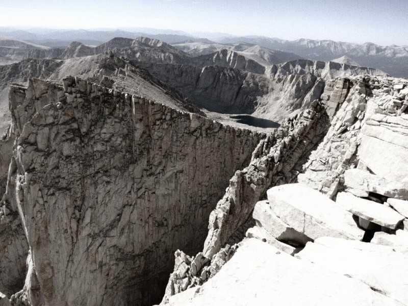 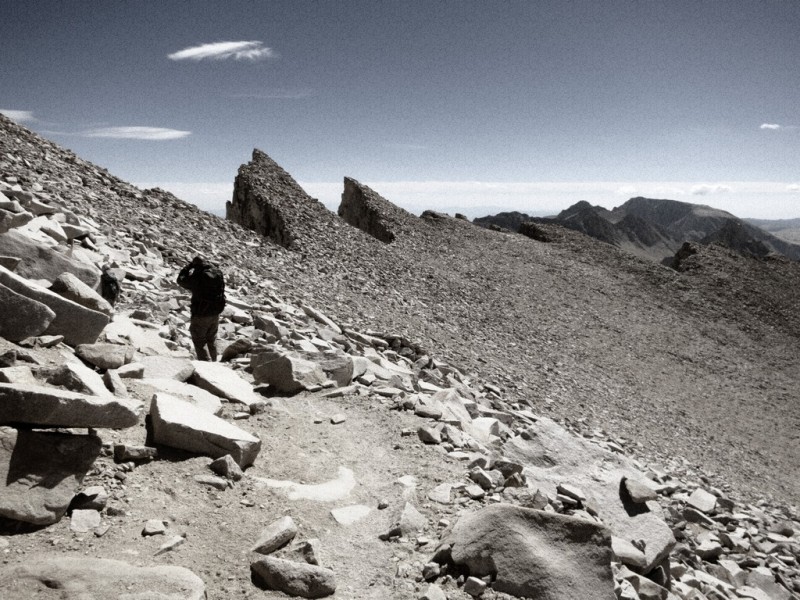  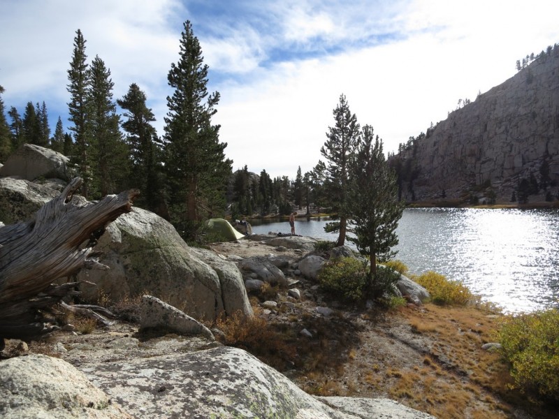   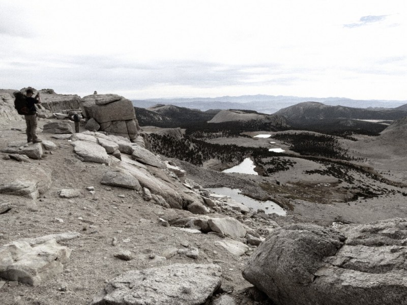 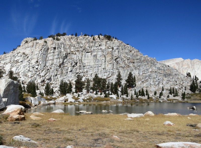 Thumbnails for uploaded photos (click to open slideshow):
|
| Comments or Questions | |||
|---|---|---|---|
|
Caution: The information contained in this report may not be accurate and should not be the only resource used in preparation for your climb. Failure to have the necessary experience, physical conditioning, supplies or equipment can result in injury or death. 14ers.com and the author(s) of this report provide no warranties, either express or implied, that the information provided is accurate or reliable. By using the information provided, you agree to indemnify and hold harmless 14ers.com and the report author(s) with respect to any claims and demands against them, including any attorney fees and expenses. Please read the 14ers.com Safety and Disclaimer pages for more information.
Please respect private property: 14ers.com supports the rights of private landowners to determine how and by whom their land will be used. In Colorado, it is your responsibility to determine if land is private and to obtain the appropriate permission before entering the property.


