| Report Type | Full |
| Peak(s) |
Columbia Point - 13,986 feet |
| Date Posted | 09/25/2015 |
| Date Climbed | 09/18/2015 |
| Author | arasca |
| Just Me and the Marmots: Columbia Point via SCLs |
|---|
|
I've used this site extensively and summited 13 of the official fourteeners, but this is my first trip report..... Which doesn't even include summiting a fourteener! I was traveling to Colorado for a friend's wedding and decided to fly in a few days early to do a brief backpacking trip and 14er climb, since I haven't been able to do one since moving away last fall. I wanted to do Crestone Peak, but a close friend climbed it earlier this month and strongly advised against climbing alone, which I was likely to be. I decided to stick with backpacking to South Colony Lakes since the weather was forecast to be amazing (and it was!), and originally thinking of climbing Humboldt. But I remembered how much I wanted to do Columbia Point after doing Challenger/Kit Carson in July 2014. Not a 14er, but it was the only 13er I wanted to climb more than about half of the 14ers. It also had a more interesting (and less-crowed) route through the bear's playground and would mean finishing off Kit Carson Mountain. I flew in Wednesday night and set out in a rental from Boulder early Thursday afternoon. I heard positive reports for the road conditions up to the trailhead, but those turned out to be conditions for a 4WD vehicle. So I parked at the lower trailhead and came to accept the extra 2.5 miles each way with camping gear in tow and the fact that I probably wouldn't have the energy to do a Humboldt/Columbia Pt. combo. But it was actually nice 2.5 miles since I didn't realize beforehand that the leaves would be changing. I made it to a campsite near the lower lake with just enough light to set up tent and make dinner. The wind howled all night, creating a lack of sleep.  I set out sometime during the 6am hour, filled up on water at the upper lake, and managed to catch an amazing sunrise on the Crestones as I began my trek up to the Humboldt saddle. After veering left at the saddle I had the mountains all to myself, not running into a single soul until my return near the upper lake. I almost turned back early because of some sketchy terrain up to point 13,290, but it turned out to be a simple case of difficult route-finding at a key spot. 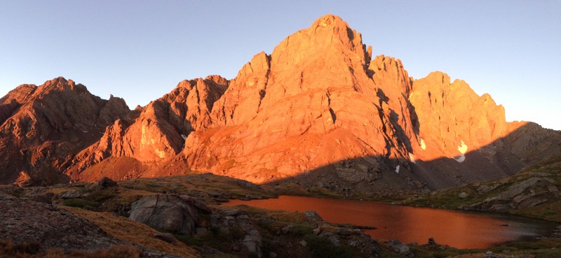 I could see the rest of the route from point 13,290, but the most tedious part lay right in front of me: a ridge blocking my path to the bear's playground. Like I heard in other reports, the ridge took about an hour to traverse each way, with the return being more worrisome in my exhausted state. I entered the bear's playground and stayed near the ridge, as recommended by various sources. This was actually much easier to climb than to descend.  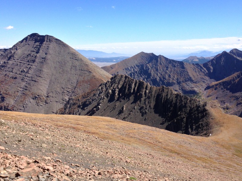 I couldn't find a well-defined trail once I got near the top of Obstruction Peak, so I improvised a bit further from the ridge than required on the way down to the saddle between Obstruction and Kitty Kat/Columbia, and for some reason I didn't learn from my mistake on my return. Though I'm still wondering if there was a much better option closer to the ridge. 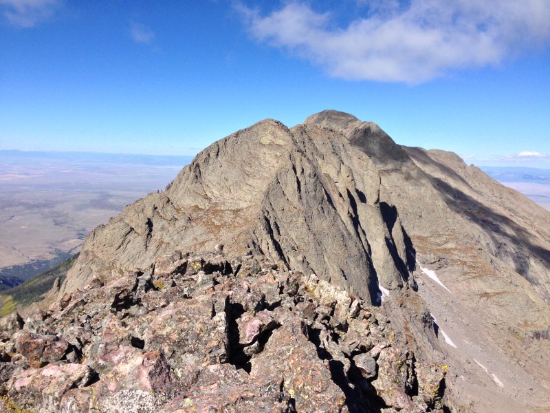  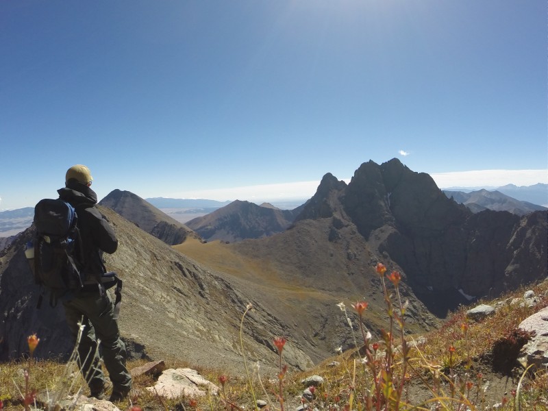 During the first half of the climb up Kitty Kat's east face I found a GPS lying on the ground, still intact and still managed to power on. I eventually found out it belonged to wineguy on 14ers.com and, after the device traveled with me back down the mountain and all the way back to Alexandria, VA, it eventually got sent back to wineguy and reunited with owner earlier today. Following a quick down and up from Kitty Kat Carson, I finally made it to Columbia Point! I made my summit sign hastily using Wikipedia, so the elevation differs from the plaque. Anyone know which has the correct elevation of Columbia Point? 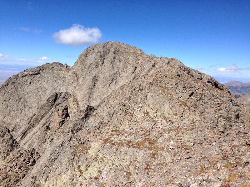 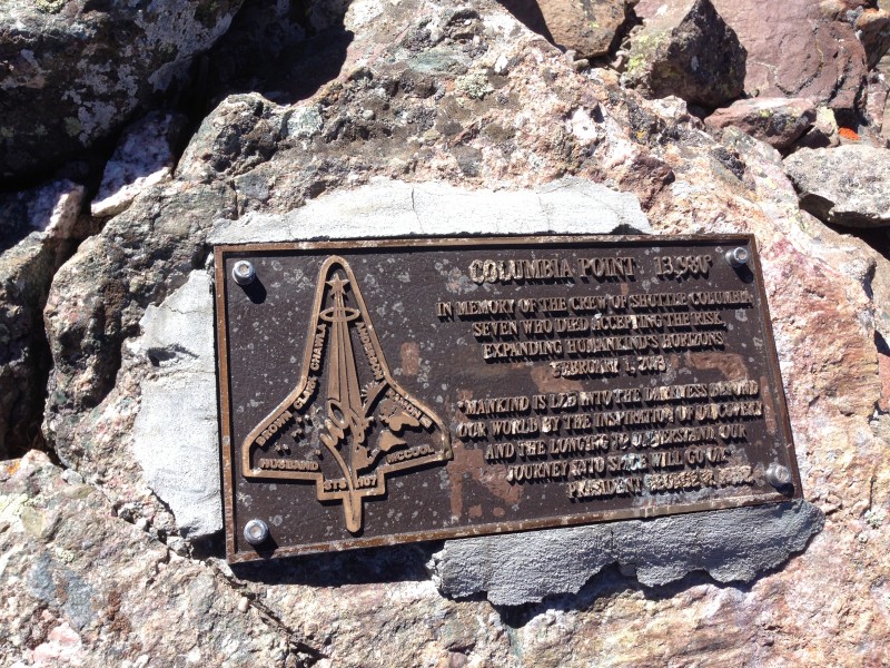 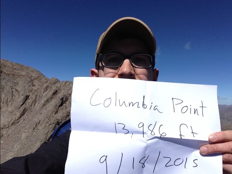 After a tiring hike back down to my tent, I managed to gather up enough strength to pack up and make the long hike to the car. I met two backpackers on my way down who had gotten lost trying to find their campsite after summiting Humboldt and were low on water. I shared some of my water and helped point them in the right direction at the main fork in the trail. By the time I made it to the upper parking lot it was too dark to continue on without my headlamp. Fortunately, about 1 mile from the car I heard someone driving down the road. It turned out to be someone on an ATV coming down from hunting. He stopped and asked it I needed a lift. So I had a fun ride on the back of an ATV on the remaining 4WD road. So a huge thanks to Rick for helping me out while hiking the rest of the way in the dark! Surprisingly enough, I had enough energy to make the non-stop drive back to Boulder that night, arriving at around 12:30am. That was exhausting but a lot of fun. Now that I have all the 13ers I was itching to do out of the way, hopefully I'll be able to summit a 14er again during my next trip back. Thumbnails for uploaded photos (click to open slideshow):
|
| Comments or Questions | ||||||
|---|---|---|---|---|---|---|
|
Caution: The information contained in this report may not be accurate and should not be the only resource used in preparation for your climb. Failure to have the necessary experience, physical conditioning, supplies or equipment can result in injury or death. 14ers.com and the author(s) of this report provide no warranties, either express or implied, that the information provided is accurate or reliable. By using the information provided, you agree to indemnify and hold harmless 14ers.com and the report author(s) with respect to any claims and demands against them, including any attorney fees and expenses. Please read the 14ers.com Safety and Disclaimer pages for more information.
Please respect private property: 14ers.com supports the rights of private landowners to determine how and by whom their land will be used. In Colorado, it is your responsibility to determine if land is private and to obtain the appropriate permission before entering the property.


