Download Agreement, Release, and Acknowledgement of Risk:
You (the person requesting this file download) fully understand mountain climbing ("Activity") involves risks and dangers of serious bodily injury, including permanent disability, paralysis, and death ("Risks") and you fully accept and assume all such risks and all responsibility for losses, costs, and damages you incur as a result of your participation in this Activity.
You acknowledge that information in the file you have chosen to download may not be accurate and may contain errors. You agree to assume all risks when using this information and agree to release and discharge 14ers.com, 14ers Inc. and the author(s) of such information (collectively, the "Released Parties").
You hereby discharge the Released Parties from all damages, actions, claims and liabilities of any nature, specifically including, but not limited to, damages, actions, claims and liabilities arising from or related to the negligence of the Released Parties. You further agree to indemnify, hold harmless and defend 14ers.com, 14ers Inc. and each of the other Released Parties from and against any loss, damage, liability and expense, including costs and attorney fees, incurred by 14ers.com, 14ers Inc. or any of the other Released Parties as a result of you using information provided on the 14ers.com or 14ers Inc. websites.
You have read this agreement, fully understand its terms and intend it to be a complete and unconditional release of all liability to the greatest extent allowed by law and agree that if any portion of this agreement is held to be invalid the balance, notwithstanding, shall continue in full force and effect.
By clicking "OK" you agree to these terms. If you DO NOT agree, click "Cancel"...
This TR is about California 14ers. And since this TR is, atypically, my second of the season, I'll keep the narrative brief apart from pertinent info and backstory.
Some Context
Over the past five years, I've managed a trip to California to tackle some roundup of peaks. This necessarily includes a roundup of friends: John (jf32); Nolan (ngoodnight); and Clark (Clark). This year, our trip occurred later than the previous years' mid-July trips. The later-season effect was particularly pronounced given the low snow year and the wholly receded (or irritatingly absent) glaciers involved with both routes. But lets not get ahead of ourselves.
Our targets were Middle Palisade (14,018') and Mount Sill (14,153' or 14,162', depending on your source). Both left from the same trailhead (at least for our purposes): just west of Big Pine from the Glacier Lodge TH. The former took the South Fork of the Big Pine Creek trail, whereas the latter took the North Fork. As with all California 14ers, do not be fooled into thinking these peaks are mere six mile, 3,000' vert days. Triple (Mid) or quadruple (Sill) that mileage and more than double the vert, and you'll have more accurate stats. And yet, the trails and approach for these both were surprisingly straightforward. Hmmm. Where would the other foot fall?
This report's focus will be Middle Palisade, one of a slew of California 14ers in a concentrated ridge crest just outside Big Pine, CA, in the middle of the Sierra Nevada mountains. Or for those of you unfamiliar with the Sierra Nevada topography, the Palisades are about forty miles north of Whitney and Williamson (obligatory reference). But since we also went after Mount Sill, I'll include some eye candy and overview.
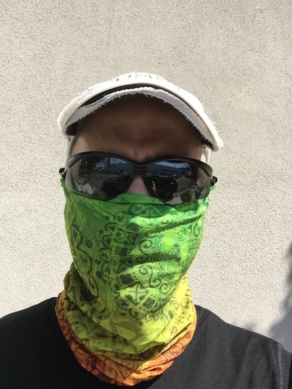
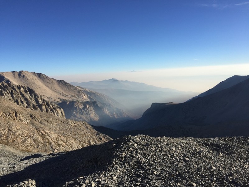
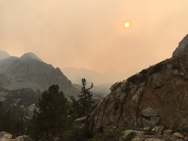
As "luck" would have it, several weeks before we were to undertake this outing, numerous fires cropped up all over California (par for the course, sadly), including the massive King's Canyon fire ... which was mere miles from our destination. Despite hoping for it to clear/be contained, we faced smoke-choked air and a Mad Max sky. Luckily, we came prepared.
Anti-smoke fashion device.
The Trailhead
From US 395 in Big Pine, take West Crocker Ave., which becomes Glacier Lodge Road. It's about a 10-15 minute drive to the end of the road. You lose all cell reception very quickly. Day hikers can park right at the gated trailhead; cruelly, overnight hikers need to park about 0.3 of a mile back at the overnight lot (an obvious right turn off). Overnight hikers need a permit. As you reach the gated end of the road, there is an immediate left turn. Ignore that turn (evidently some people foolishly start their hike to MidPal here, which results in bushwhacking and stream fording). The trailhead, be it for the South Fork or the North Fork of the Big Pine Creek, begins immediately after the gate.
Obvious trail split.
The former heads towards Middle Palisade and Norman Clyde Peak; the latter goes to Sill as well as the eastern approach to the Palisade Glacier (which also approaches North Palisade, Polemonium, and Starlight via the U-Notch or the V-Notch). The trail split occurs about 0.5 miles into the trail, just after the bridge crossing.
Middle Palisade
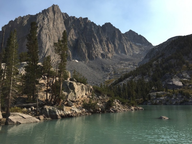
From the split, the South Fork trail is obvious. Your goal at this point is to surmount a decent headwall and follow the trail past Willow Lake and to Breinard Lake. This is where we camped, which is about five miles and 3,000' in. Some people continue on to Finger Lake, approximately 900' higher up, but we did not feel the need. There are plenty of makeshift campsites. By all accounts, any camping--or even passing through--involves mosquitoes. We were late-season enough that they were a non-factor.
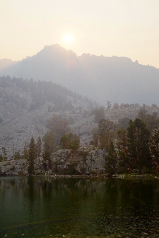
Of course, our mid-afternnon arrival at Breinard coincided with the smoke really settling in for the day.
Smoke at camp. (Photo credit: Clark.)
Actually, that's not true; the smoke got steadily heavier as we gained altitude from lunchtime onwards. Luckily, it dissipated some overnight and gave us a relatively clear window in the early morning.
From Breinard Lake, there is an established use trail up to Finger Lake. This trail turns a hard right about 15-20' before Breinard Lake and generally follows just to the left of the top of the ridge up until it reaches the top of the headwall. There are sufficient cairns to lead you over another headwall to arrive at Finger Lake.
"Morning" cairn.
John and I scouted the trail the night before, which was helpful in the morning dark. It took about 30 minutes to get to Finger Lake. From the top of the headwall just before Finger Lake, take a short descent to the bottom tip of Finger Lake and a quick stream crossing. Apart from glacier melt, this is your last opportunity for H20 until you're back here.
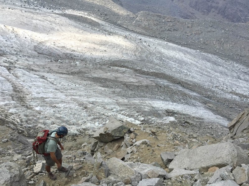
From Finger Lake, the trail peters out as you make your way up rock shoulders and towards a large moraine. There are some cairns, but they are scattershot, dispersed, unnecessary, and not methodical. Follow your keenly-honed route finding Spidey sense.
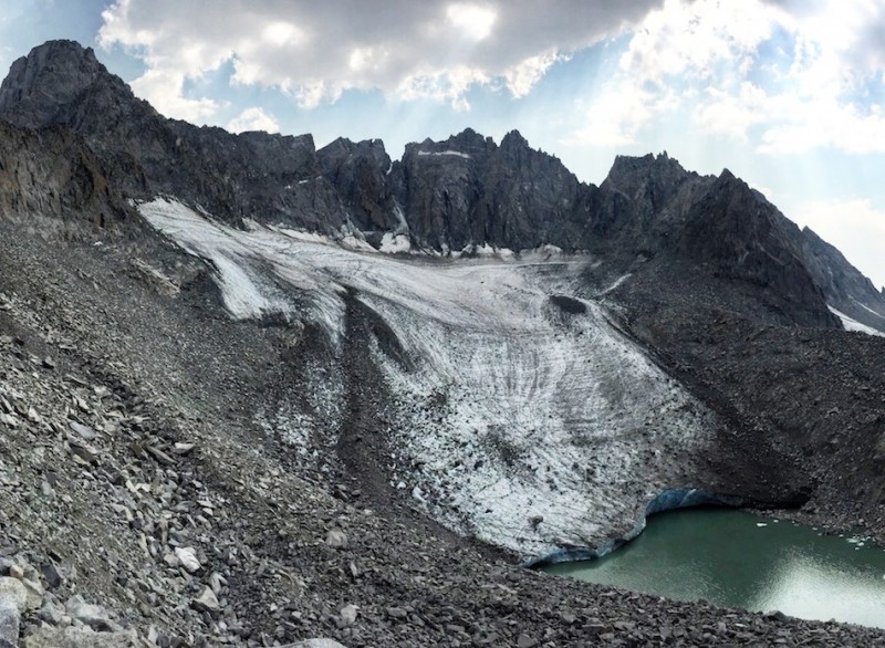
In early season, the moraine should run up against the Middle Palisade Glacier, which would be significantly large than what we encountered. In late season, especially after dry winters (as here), this glacier is irritatingly non-existent.
Approaching the melted out glacier.
This means rock-hopping. Lots of rock hopping.
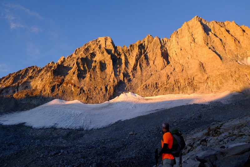
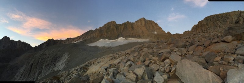
MidPal pano. Top out on the hill, take a hard left, and go to the moraine. Most years will have much more snow.
Actually, the MidPal glacier is split in two by a rock moraine that leads directly to the base of Middle Palisade (you can see both parts of the glacier in the above pictures, with the "left" glacier just barely peeking over the top of the moraine). This is your approach. In early season, you may need to cross the glacier and should come prepared accordingly. In late season, the glacier is much less reliable or existent. However, a good deal of the rock you see near the moraine is actually rock on top of ice. And the ice bridges tended to collapse with weight (startling), especially near the glacier's apron.
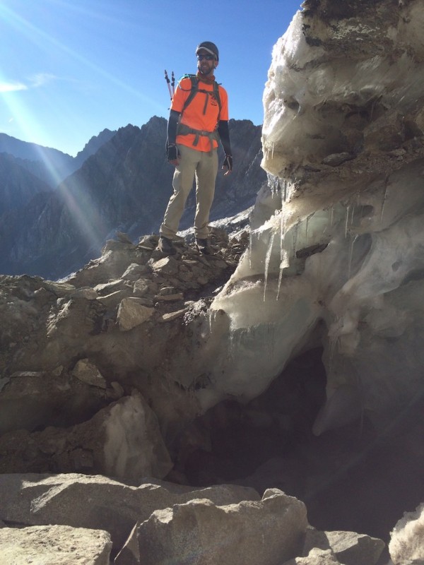
In low snow years, these ice bridges complicate the ledges route. (Photo credit: John.)
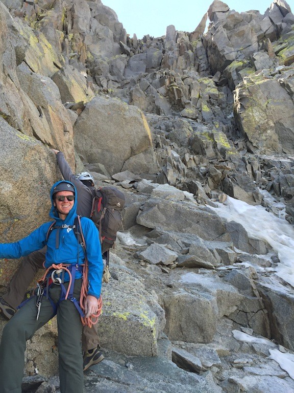
Another downside of late season assaults is that one of the route options is much more difficult to execute. Backing up: there are basically two approaches to start the climb. Both involve going up the rock moraine to the base of the climb.
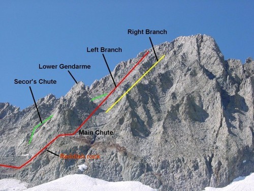
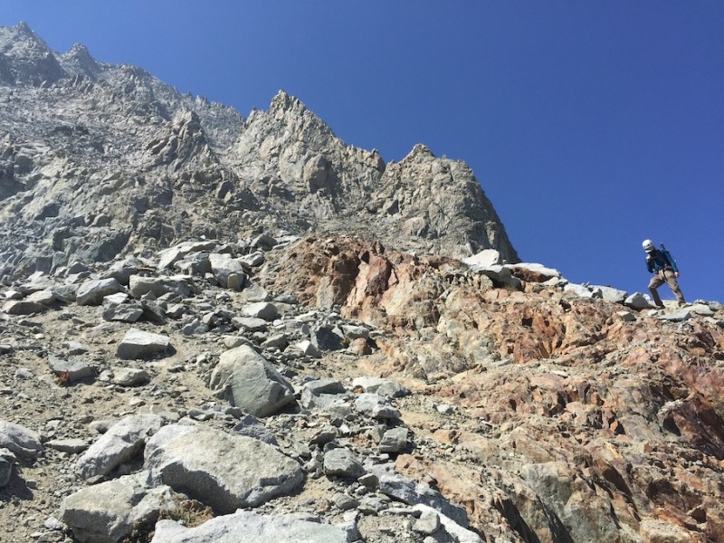
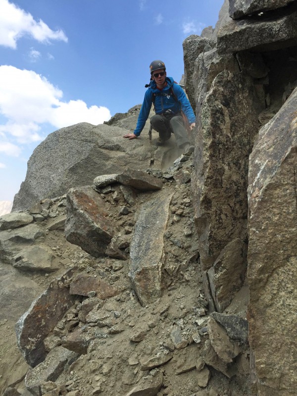
Contemplating options. At the very top of the rock moraine. Left to the ledges, right to the red gully and Main Chute.
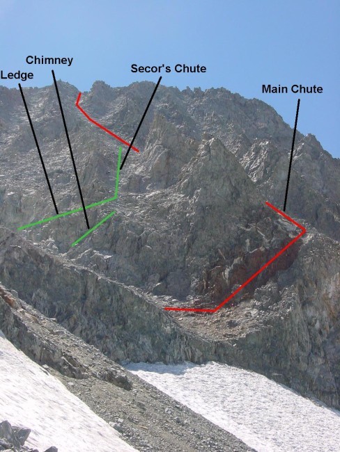
Here, the immediate climbs diverge. Evidently, the more solid and popular option is to take a hard left on the moraine, venture onto the left glacier, and find the "ledges," which provide class 3 and maybe class 4 access to the long scramble to the summit via Secor's Chute which ultimately merges with the Main Chute.
MidPal route, courtesy of Summitpost.
Another look at the route, again courtesy Summitpost. Because the ledges route was out, we took the red gully to the main ch
But in late season, getting to the base of the chute was not an option, between the embattled glacier, collapsing ice bridges, and well-separated bergschrund. Supposedly, the "ledges" are difficult to spot. Having no knowledge of this immediate ascent option, I'll punt opining on the effort of finding these ledges, or their difficulty save to say their access was not immediately apparent from our vantage point. I will say that the following route, our route up the Main Chute, was wholly reasonable. And it would have been unreasonable to venture on the glacier here to find those ledges.
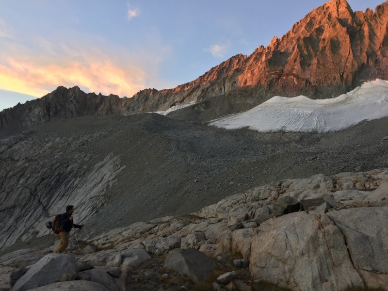
In any event, time was of the essence... Morning smoke invades.
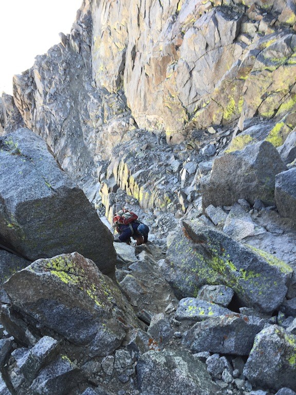
Unable to approach the ledges route, we went with what once had been the standard option, but which appears to have fallen out of favor: the Main Chute via the red rocks.
Here's a look at the red gully, taken on the descent. It is loose, but you can find solid options.
Access this way requires traversing right off the rock moraine and following an obvious gray-ish ramp immediately right of the similarly obvious red-tinted rocks.
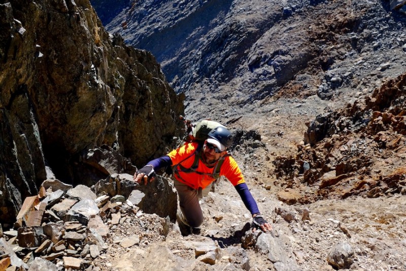
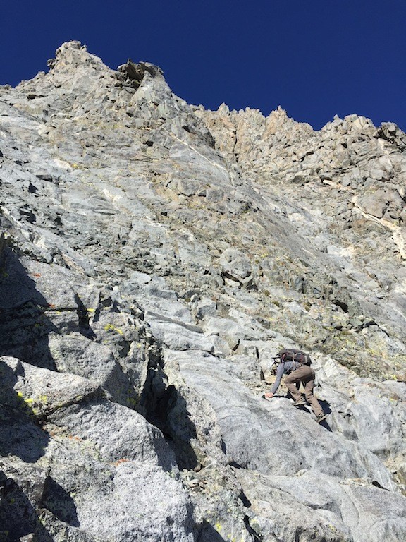
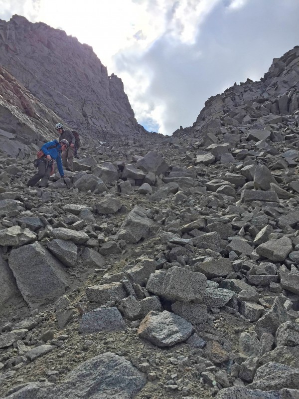
Ascending the red gully. (Photo credit: Clark.)
The big downside of this route is its immediate looseness. But its upside is that it does not require traversing collapsable ice bridges on an unsteady glacier. So, there's that. And it gets you there. And the looseness abates (kind of). In any event, this route eliminated the need to get on the glacier at this point in the season and in most times would reduce the need for crampons or an axe since the route does not require getting on a glacier. Regardless, the difficulty never exceeds Class 3, Colorado C3 or otherwise.
Once you surmount the red rock gully approach, the route is obvious and infinite. What i mean is that once you get into the Main Chute, everything goes.
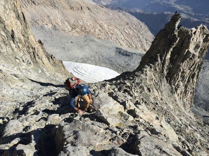
John climbing past the gendarme that splits the Main Chute and Secor's Chute.
Clark has options.
We ultimately took the "left chute," although the "right chute" would go just fine. Just as would a direct scramble to the summit. In short, follow your preference.
Nolan going up.
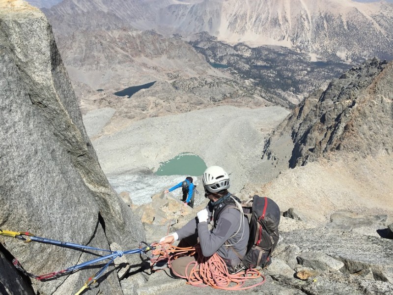
Near the summit ridge, looking down our ascent route. You can see the moraine and left glacier, from which the ledges route o
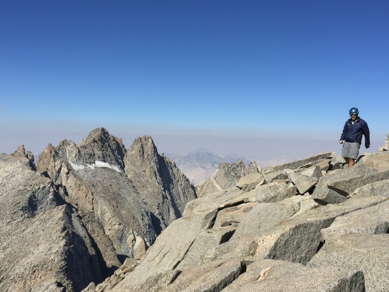
The summit itself is actually to the left of the left chute and isn't apparent until you're on top of the ridge.
Approaching the summit.
Summit group shot. (Photo credit: Clark's timer.)
The summit is ... small.
Summit showboating. (Photo half-credit: Clark.)
After you R&R and enjoy the views, climb down the ladder and escape the smoke.
Beginning the descent. Gendarme obvious below.
Clark with the entire route behind him.
MidPal is small.
Water break at Finger Lake.
Said smoke made for a lovely pack out.
Mid-afternoon on the way out. Beware the zombie apocalypse.
Back at the car, we debated whether to further abuse our lungs by going for Mount Sill or just get out of the area for cleaner air. We opted to stay.
Mount Sill
Mount Sill and the emaciated Palisade Glacier.
Paraphrasing John, any TR of Sill can boil down to the following: "Don't climb it." Without snow (and, as you can see, the snow was a'missin'!), this mountain is loose as all get out. At multiple instances, the ground literally disintegrates beneath you. The number of rockslides we set off was ... memorable. Progress required a lot of one-at-a-time moving. In all other respects, the less said about that the better.
In this year particularly, the glacier was almost totally desiccated, dirty with rocks, and wholly lacking in solid routes to the saddle or summit. Without snow, this mountain is a monster. But luckily, the nine-mile approach to camp was a lark.
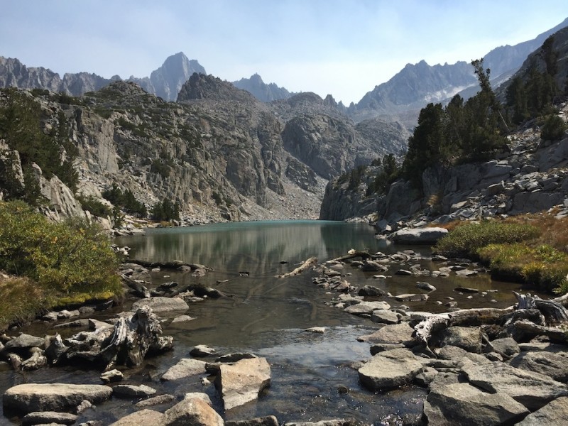
Temple Crag, a California technical climber's paradise, above the creatively-named Second Lake en route to our campsite b
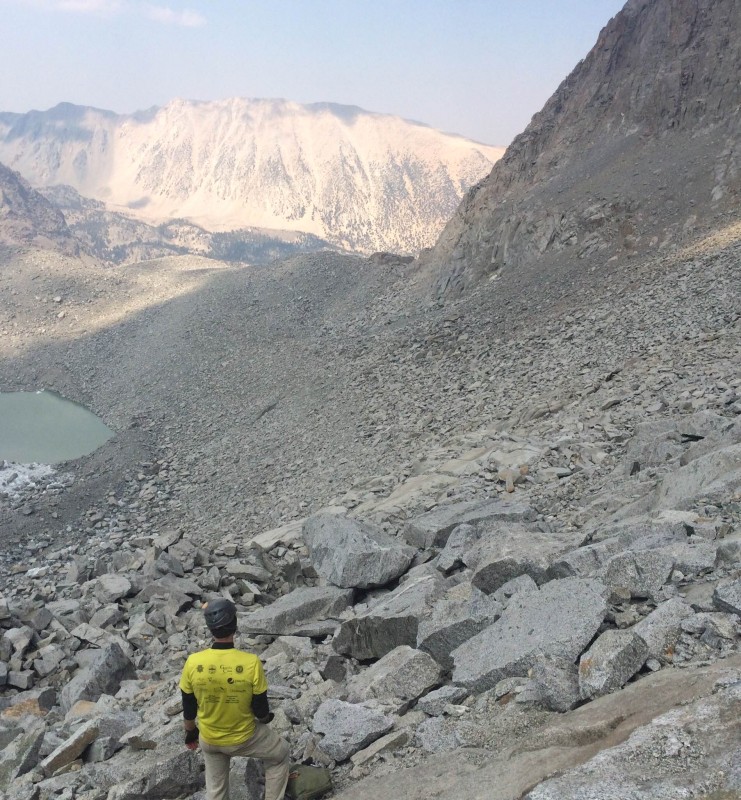
We camped in Sam Mack Meadow, which allowed for a reasonable morning wake-up call. It also had a beautiful, refreshing glacier-melt stream. The trail from Sam Mack Meadow was obvious and well-cairned. It leads you to the top of a moraine and an obvious overlook to the in-this-case-receded glacier.
From here, traverse all the way around the glacier to the base of the Mount Gayley-Mount Sill saddle, which provides an obvious weakness. Without snow, this is sh- ... terrible. I mean loose. Very crumbly, very loose.
Once at the saddle, proceed up Mount Sill's North Couloir route.
Looking down Sill's north couloir. Wholly melted out. Mount Gayley in the background.
Here, our party diverged. Two of us went up the Swiss Arete route (C5.7), while the other half went up the North Couloir and traversed the face (C3-4). The latter was loose, icy, and sketchy in parts; the former was firm, icy, and direct. Either way, apply route-finding judiciously.
Ascending the crux. The difficulties are entirely iced over. Obviously making them less difficult.
The rest of our party, topping out out the Swiss Arete. Nice job guys.
The summit is huge.
Sill's summit. Polemonium, North Palisade, and Starlight are in the background.
The down climb went fine, and we even were spared much smoke.
Here are some pictures:
Descending the crux. With the ice melted, ropes were not necessary.
Safely below the crux, with the entire scramble visible in the background.
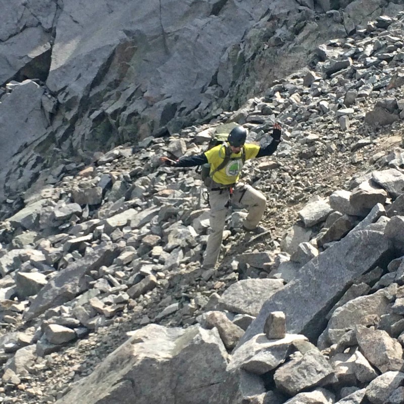
Scree surfing, the only way to go. (Photo credit: John.)
Loose mountain. I mean, rocks just slid on a whisper.
Clark descending the crud that leads from the glacier to the notch between Gayley and Sill. This descent option was better th
Descending the glacier. Again, the less said about this, the better. (See previous picture.)
That's a long way to go. (Photo credit: John.)
In short, like Middle Palisade, Sill is a Big Mountain: physical and with lots of vert. Like all Cali14ers. But at least these both have relatively straightforward trails.
Glacier overlook. Now just have to get back to camp. And pack up. And pack out nine miles. All in a day's "work.&quo
A note: neither peak has reliable cell phone coverage besides fake coverage. Not that it's necessary, and in fact its absence is quite nice, but I know this is relevant to many people.
As always, a shout out to Bill M. for hosting this site and particularly here for helping un-corrupt a few problematic pics.
Thanks for reading!
Thumbnails for uploaded photos (click to open slideshow):
...earned a medal in perseverance! Congrats on some very hard–earned summits!
The smoke looks thick – sad to see. Hope the area will get some moisture soon.
Looking good, all. :D
Excellent, detailed report, Joe. Especially enjoyed pics #27 (gorgeous) and #35– I haven’t yet seen this level of grace when hiking with you, JosephG! :lol:
Hope all is well with you, Nolan and John! Cheers! :D
Thanks for the report. I wish the pics I took of the area 20+ years ago were digital. There is a lot less snow on the Middle Pal glacier now. Oh, and the mosquitoes up there were ferocious.
Thanks for the comments and the reads everyone. 10/2/2015 9:24pm
Nolan - I mean, why would it not be? Also note that I did not call for a, ahem, "treasure hunt" in the penultimate pic.
John - Surfing. It’s been on my bucket list. Especially (more) scree.
Nancy - You sure? Because I’m pretty sure grace is the one constant on all my climbs.
Ryan - It was. We also found your Sill and friends TR quite useful. A healthy MidPal glacier will make your day enjoyable.
Ricky - I’m sure your pictures are fantastic, and I hope you can digitize them. The lack of snow was sad and sobering, but the dearth of mosquitoes was definitely welcome. Even so, the ones that remained were not shy.
Caution: The information contained in this report may not be accurate and should not be the only resource used in preparation for your climb. Failure to have the necessary experience, physical conditioning, supplies or equipment can result in injury or death. 14ers.com and the author(s) of this report provide no warranties, either express or implied, that the information provided is accurate or reliable. By using the information provided, you agree to indemnify and hold harmless 14ers.com and the report author(s) with respect to any claims and demands against them, including any attorney fees and expenses. Please read the 14ers.com Safety and Disclaimer pages for more information.
Please respect private property: 14ers.com supports the rights of private landowners to determine how and by whom their land will be used. In Colorado, it is your responsibility to determine if land is private and to obtain the appropriate permission before entering the property.