Download Agreement, Release, and Acknowledgement of Risk:
You (the person requesting this file download) fully understand mountain climbing ("Activity") involves risks and dangers of serious bodily injury, including permanent disability, paralysis, and death ("Risks") and you fully accept and assume all such risks and all responsibility for losses, costs, and damages you incur as a result of your participation in this Activity.
You acknowledge that information in the file you have chosen to download may not be accurate and may contain errors. You agree to assume all risks when using this information and agree to release and discharge 14ers.com, 14ers Inc. and the author(s) of such information (collectively, the "Released Parties").
You hereby discharge the Released Parties from all damages, actions, claims and liabilities of any nature, specifically including, but not limited to, damages, actions, claims and liabilities arising from or related to the negligence of the Released Parties. You further agree to indemnify, hold harmless and defend 14ers.com, 14ers Inc. and each of the other Released Parties from and against any loss, damage, liability and expense, including costs and attorney fees, incurred by 14ers.com, 14ers Inc. or any of the other Released Parties as a result of you using information provided on the 14ers.com or 14ers Inc. websites.
You have read this agreement, fully understand its terms and intend it to be a complete and unconditional release of all liability to the greatest extent allowed by law and agree that if any portion of this agreement is held to be invalid the balance, notwithstanding, shall continue in full force and effect.
By clicking "OK" you agree to these terms. If you DO NOT agree, click "Cancel"...
| Report Type |
Full |
| Peak(s) |
San Luis Peak - 14,023 feet
|
| Date Posted |
09/18/2015 |
| Date Climbed |
09/13/2015 |
| Author |
IntrepidXJ |
| San Luis Peak |
Saturday & Sunday, September 12-13, 2015
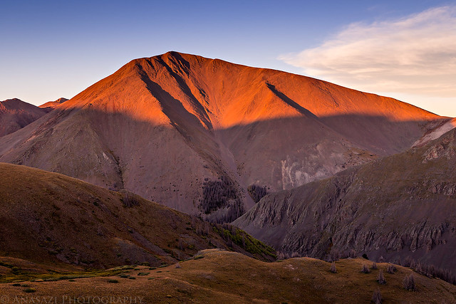
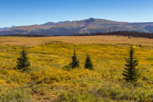
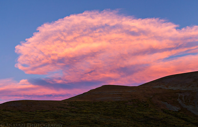
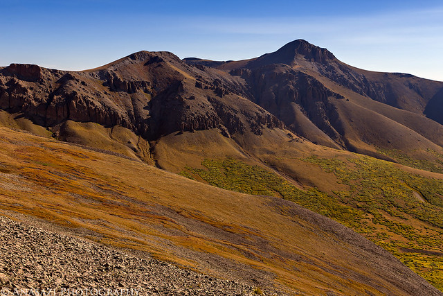
Sunset on San Luis Peak in the La Garita Mountains.
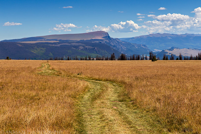
Since Diane needed to stay home this weekend to get some school work done, I was on my own and decided to climb my sixth and final new fourteener of the year. After looking over my maps I settled on hiking to the summit of San Luis Peak (14,014) in the La Garita Mountains near Creede. Instead of taking the standard route up Stewart Creek from the northeast, I chose to follow the Continental Divide Trail north of Creede to the south ridge. Not only is this route a little shorter, I also thought the views along the Continental Divide would be better. Plus, I had never really stopped in Creede before and thought this would be a good opportunity to check out the area.
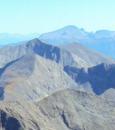
We spent Friday evening at a local concert so I slept in a little later than usual on Saturday morning before starting the drive to Creede. After passing through Lake City I visited two 12,000 foot summits along the Continental Divide near Slumgullion Pass and Spring Creek Pass. My first stop was a short hike to the Slumgullion Benchmark (12,210) above Lake San Cristobal. This was an easy hike along a ridge with great views of the nearby fourteeners including Uncompahgre Peak, Wetterhorn Peak, Redcloud Peak, Sunshine Peak, Red Mountain and also the Slumgullion Slide below.
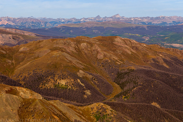
On a side note- While it was nice to finally have a weekend free from smoke and haze over Labor Day, the weather pattern had shifted and the sky was again filled with smoke from large wildfires, so the views this weekend were limited. The smoke and haze is clearly visible in most of my photos during this trip.
View across Rambouillet Park to Baldy Cinco (13,383) as I hiked up to the Slumgullion Benchmark.
Following the ridge to the summit.
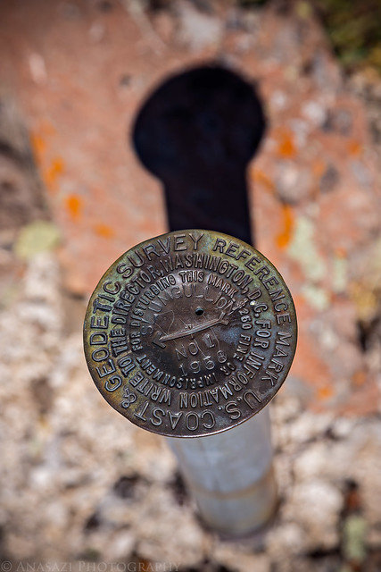
One of the three benchmarks I found on top.
After returning back to my Jeep below, I encountered a little traffic (herd of sheep) during the drive back to the highway and then drove up to Spring Creek Pass. There I followed the Continental Divide Trail across Jarosa Mesa to the top of 71 Mountain (12,305) which had similar views as Slumgullion since they weren't that far away from each other.
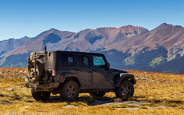
My Jeep on the summit of 71 Mountain along the Continental Divide. There is a road all the way to the top of this one.
Following the road across Jarosa Mesa back to Spring Creek Pass (10,898). Bristol Head (12,706) is the peak right in the middle.
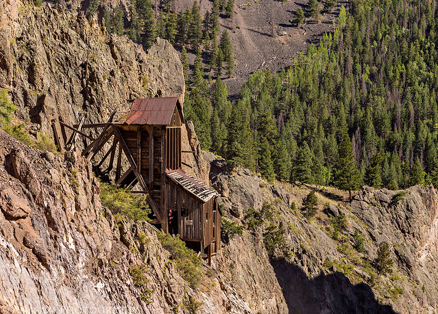
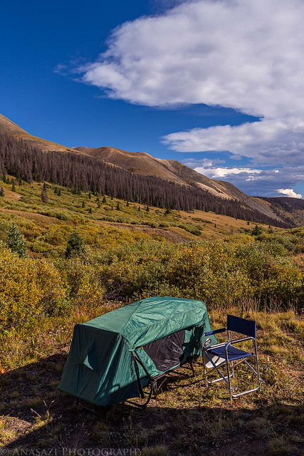
I returned back to the Silver Thread Scenic Byway and finished the drive to Creede where I had a very good burger at Kip's Grill for an early dinner. Then I drove up the canyon north of town that West Willow Creek flows through and saw all the mining ruins scattered around. I'd never stopped in Creede before and found out it's a pretty cool area that I'd like to return to and explore some more. After driving a few miles out of town I found a nice campsite near the unmarked trailhead and setup camp.
One of the many interesting mining ruins located near Creede.
My campsite near the trailhead along West Willow Creek below San Luis Pass.
After my camp was setup I climbed about 800 feet up to the saddle on the Continental Divide to photograph San Luis Peak at sunset. This was part of the reason I wanted to start hiking from here and camp nearby.
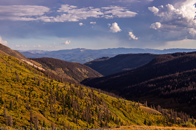
Late afternoon view over West Willow Creek with Beautiful Mountain (12,764) and Fisher Mountain (12,866) in the distance.
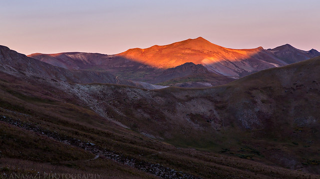
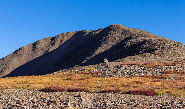
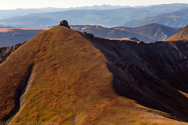
There was a nice view of San Luis Peak from the saddle.
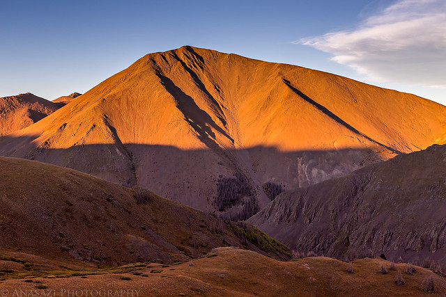
Warm evening light along the Continental Divide.
Sunset on San Luis Peak.
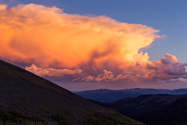
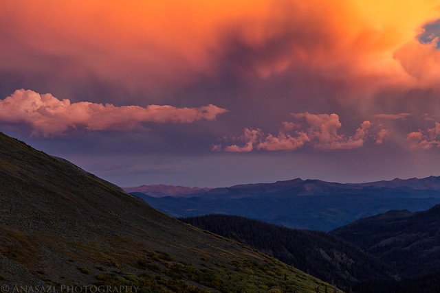
As I hiked back down to camp the sky exploded with color...
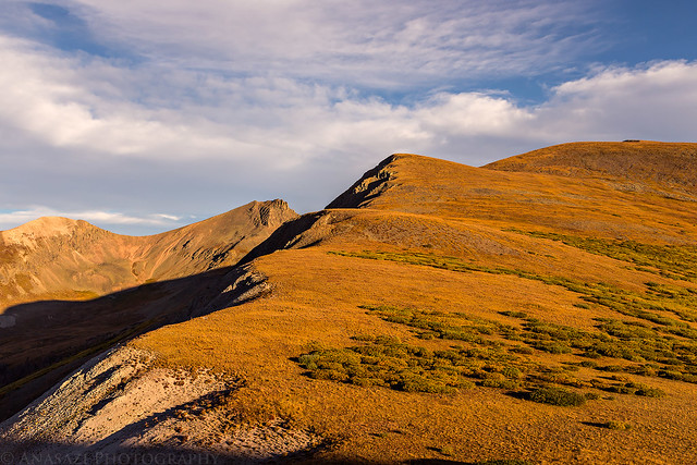
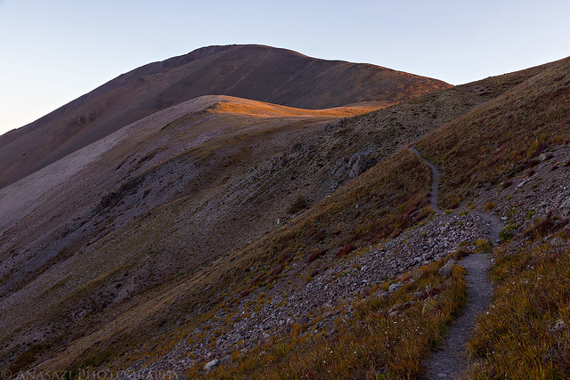
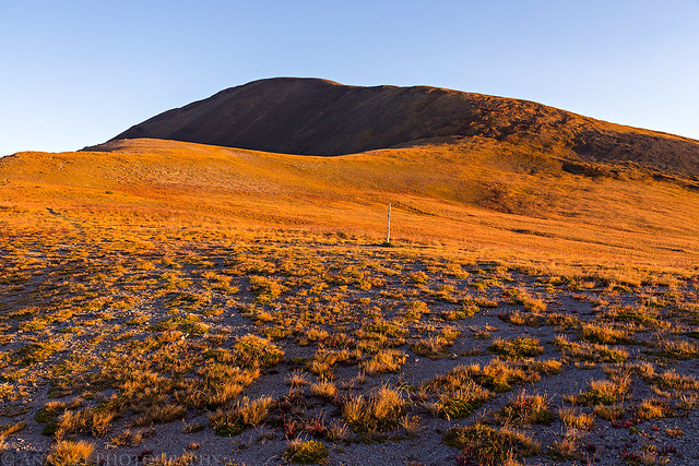
I tried to go to bed early, but that didn't work out too well. I didn't sleep good all night and ended up getting a later start than I normally prefer because I didn't want to get up when my alarm first went off. Instead of my normal 4:00am start, I didn't get moving until about 5:00am. Luckily, I wasn't worried about afternoon storms this weekend so it wasn't a big deal. When I started hiking, the stars above seemed very bright as I climbed back up to the saddle and joined the Continental Divide Trail on the other side. I even saw a couple of meteors streak across the sky which is always a treat. I watched the sunrise from the trail before reaching the third and final saddle and was making excellent time until I reached the long ridge leading to the summit of San Luis Peak where I slowed down quite a bit.
Sunrise as I hiked along the Continental Divide Trail.
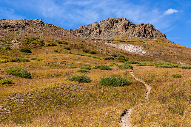
Following the trail to the pass below San Luis Peak.
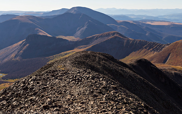
When I reached the intersection at the pass it was time to leave the Continental Divide Trail and follow the south ridge to the summit. I really slowed down as I climbed this ridge.
View of the actual summit after reaching the false summit.
The view down across Stewart Creek (the standard trail to the summit) with Mount Ouray (13,971) and Chipeta Mountain (12,850) dominating the horizon in the upper right.
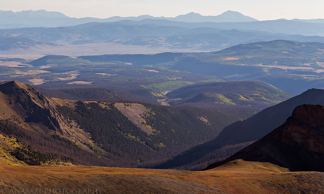
Hazy view with the standard San Luis Peak trail along the bottom of the frame.
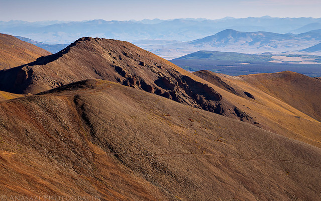
Stewart Peak (13,983) in the upper right. I'll have to come back for this one another time.
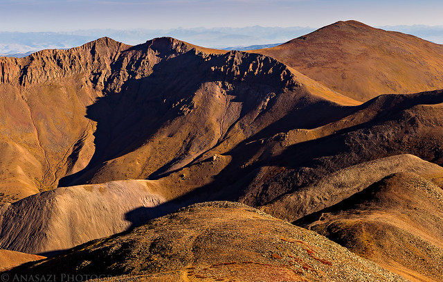
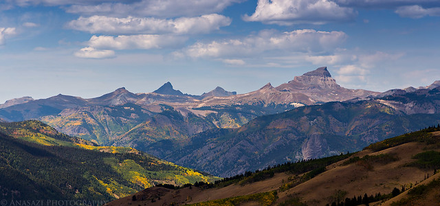
A smokey view from the summit with Wetterhorn Peak, Matterhorn Peak and Uncompahgre Peak on the horizon.
Hiking back down the ridge from the summit.
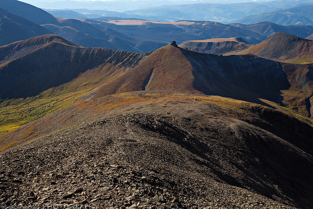
Unnamed 13155 on the other side of the pass.
Organ Mountain (13,801) on the other side of Cochetopa Creek.
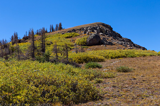
There were a few of these interesting hoodoos above the trail.

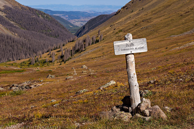
Back to the intersection with the Bondholder Trail.
The final climb to the top of the Continental Divide. My legs were pretty tired at this point but I just pushed through it with a few breaks and made it to the top. From the saddle it was all downhill back to camp.
One last mid-day shot of San Luis Peak before crossing back over the divide and losing sight of it.

On my drive back home I decided to quickly stop at the Windy Point Overlook above Lake City since I had never bothered to check it out before. There's a nice view of Wetterhorn, Matterhorn and Uncompahgre from here that would make a nice photo when the sky isn't full of smoke. You can see that the fall colors were already starting around Lake City.
>> San Luis Peak Photo Gallery
>> The Original Trip Report on ADVENTR.CO
|
Caution: The information contained in this report may not be accurate and should not be the only resource used in preparation for your climb. Failure to have the necessary experience, physical conditioning, supplies or equipment can result in injury or death. 14ers.com and the author(s) of this report provide no warranties, either express or implied, that the information provided is accurate or reliable. By using the information provided, you agree to indemnify and hold harmless 14ers.com and the report author(s) with respect to any claims and demands against them, including any attorney fees and expenses. Please read the 14ers.com Safety and Disclaimer pages for more information.
Please respect private property: 14ers.com supports the rights of private landowners to determine how and by whom their land will be used. In Colorado, it is your responsibility to determine if land is private and to obtain the appropriate permission before entering the property.