Download Agreement, Release, and Acknowledgement of Risk:
You (the person requesting this file download) fully understand mountain climbing ("Activity") involves risks and dangers of serious bodily injury, including permanent disability, paralysis, and death ("Risks") and you fully accept and assume all such risks and all responsibility for losses, costs, and damages you incur as a result of your participation in this Activity.
You acknowledge that information in the file you have chosen to download may not be accurate and may contain errors. You agree to assume all risks when using this information and agree to release and discharge 14ers.com, 14ers Inc. and the author(s) of such information (collectively, the "Released Parties").
You hereby discharge the Released Parties from all damages, actions, claims and liabilities of any nature, specifically including, but not limited to, damages, actions, claims and liabilities arising from or related to the negligence of the Released Parties. You further agree to indemnify, hold harmless and defend 14ers.com, 14ers Inc. and each of the other Released Parties from and against any loss, damage, liability and expense, including costs and attorney fees, incurred by 14ers.com, 14ers Inc. or any of the other Released Parties as a result of you using information provided on the 14ers.com or 14ers Inc. websites.
You have read this agreement, fully understand its terms and intend it to be a complete and unconditional release of all liability to the greatest extent allowed by law and agree that if any portion of this agreement is held to be invalid the balance, notwithstanding, shall continue in full force and effect.
By clicking "OK" you agree to these terms. If you DO NOT agree, click "Cancel"...
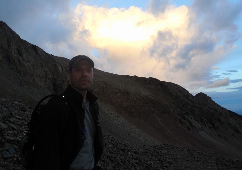
My last official 14er - Mount Wilson - could it be true!?!
My climbing buddy Steve and I met in Silverton and drove over Ophir Pass to Telluride. I'm not what you would call a 4WD person but it certainly provided a look at a beautiful area and one that I wouldn't have otherwise seen.
Ophir Pass
After clearing the pass, we grabbed dinner in Telluride and headed for the Rock of Ages TH for yet another night's stay in what I affectionately call, the rolling Holiday Inn - Steve's Chevy Tahoe.
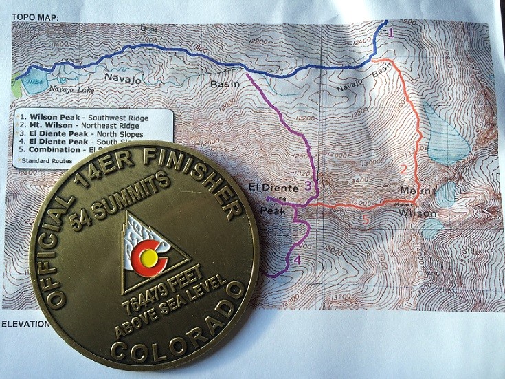
The talk over the night's last beer was whether to attempt Mount Wilson via the direct North Slopes route or go for the more lengthy and difficult El Diente - Mt. Wilson traverse. The weather forecast for Monday was mostly cloudy with a potential for rain. These weren't the conditions I'd want to be in on a sustained ridge, but we were hopeful that maybe the weather wouldn't be a factor.
It was lights out at 8:30 pm since we had a 4:30 am wake-up staring us in the face. Getting up at that hour we had no trouble being on the trail at 5:30 am - hiking under headlamps.
Through the darkness we could make out patches of stars in the sky and yet in other areas we could only see black - indicating clouds. A few drops fell on us as we headed out for the day - uh oh...
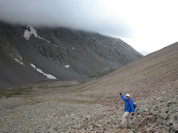
Steve at Sunrise before the Rock of Ages Saddle
We had thought we'd be on the Rock of Ages saddle in 2 hours (about a 4 mile hike from 10,300' to 13,100') but we got slowed down in the talus fields and didn't get to the saddle until 8:00 am.
Steve Approaching the Saddle
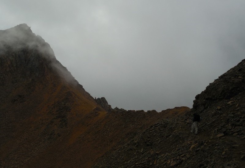
During the approach the question loomed in my mind whether we should attempt the standard route or go for the more challenging traverse. Ultimately, what we saw when we hit the saddle answered the question for us. The El Diente to Mount Wilson ridge, including both peaks, was entirely covered in low lying clouds. So the right decision seemed to be to try our luck with the North Slopes route.
We hoped that the weather would hold.
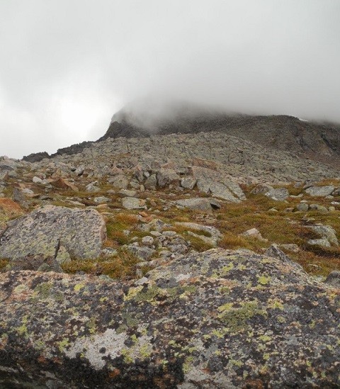
A look back at the Rock of Ages saddle shrouded in mist.
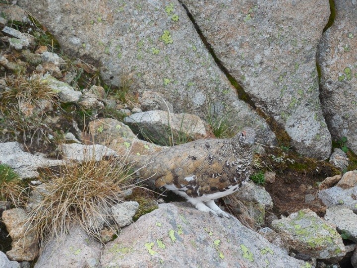
We crossed the creek in Navaho Basin and started our ascent. Not long into the climb we encountered a somewhat protected area that was filled with about a dozen ptarmigan. A place we later dubbed "Ptarmigan Town". Such docile animals. They seemed to be a sure sign of summer's end and a coming change of the seasons.
It was great being out in the mountains but we knew as we climbed higher the visibility would soon begin to decrease.
Still we took a moment to take in our surroundings.
We got high enough to be able to look down on the Rock of Ages saddle telling us we were at least above 13,100'. The clouds would come and go.
The trail had receded into a talus field and we had to navigate by following cairns. We were comforted by each cairn we saw helping us stay on the route - or so we thought!
We continued to follow the cairns amidst the clouds until the cairns ran out.
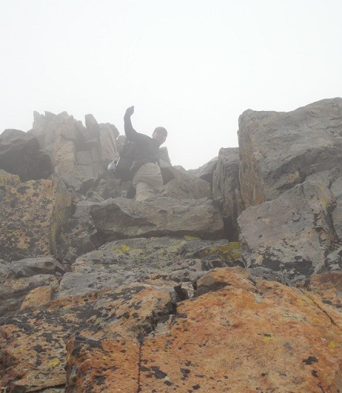
Just a little higher and we saw a notch that made us feel we were on the route as expected and close to the final push for the summit!
The standard North Slopes route takes you to a notch where you turn left, climb up over a Class 4 block and then shortly reach the summit. Turning left from the notch we climbed as high as we could go (50 feet?) and quickly topped out - no Class 4 block, no summit. Hmm...
Steve waited for me to reach him and when I did the weather cleared briefly and we saw higher ground just to the west of us. D'oh! I've seen mention in other trip reports of a "West Wilson", but we jokingly dubbed our false summit as "East Wilson"!
Steve heading up "East Wilson" (Note: Not a real thing!)
With nothing else to do we down-climbed "East Wilson" back to the notch.
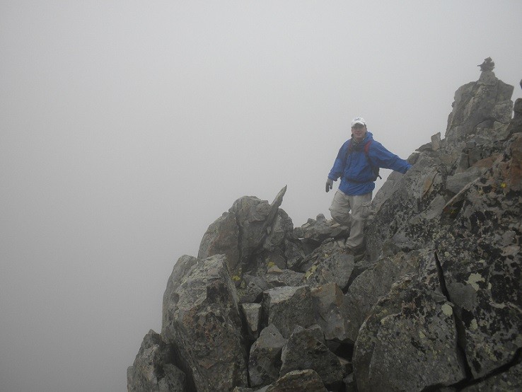
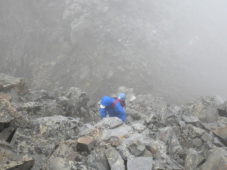
We were soon faced with climbing the top of a narrow / exposed ridge (not my preference), down climbing to our left for 50 feet or more only to have to re-gain the elevation through a series of Class 4 moves or by simply climbing up and laterally, again in Class 4 conditions to what we hoped would be Mount Wilson's summit. Never liking to give up hard won elevation, we chose the lateral / ascending Class 4 climbing.
Less than graceful...
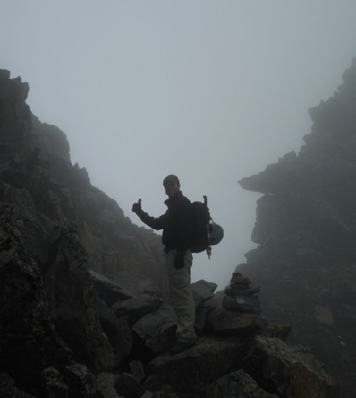
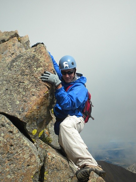
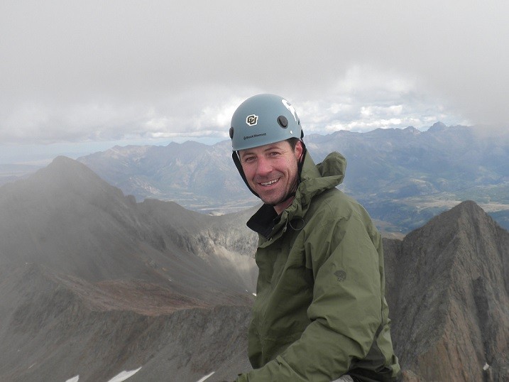
However brief, the climbing was exhilarating and as luck would have it we topped out after roughly 50 - 100 feet. At about 11:00 am, we had made it to the top of Mount Wilson and I was standing on peak #57! My last official 14er!!!
Shock and disbelief on my face.
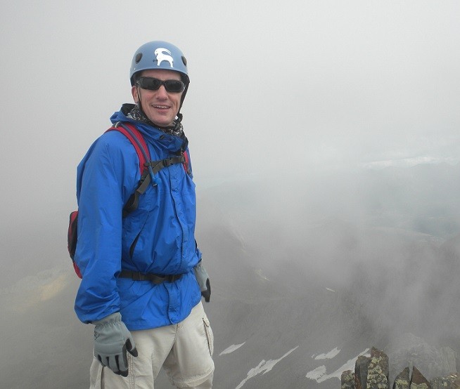
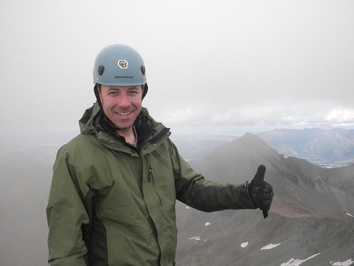
The misty clouds continued to swirl in the wind so we had to be a little patient to capture our obligatory summit photos.
Little did I know that Steve decided to make my last official 14er even more special by giving me an Official 14er Finisher Summit Marker! How thoughtful...
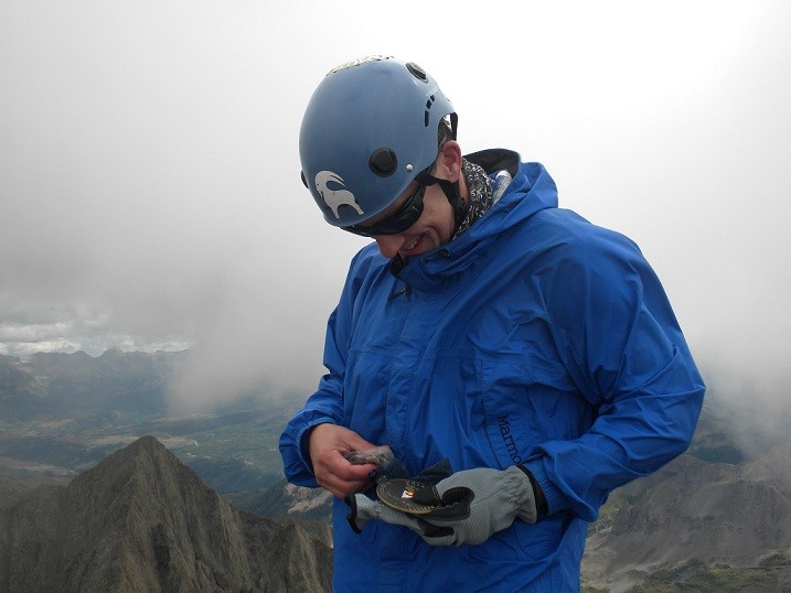
They say when you reach a summit you're only halfway completed and since it was so cold, windy and cloudy we didn't even stay on the summit to grab a bite to eat. There was a brief celebration, photos taken, then we reviewed our options for getting down and immediately got going.
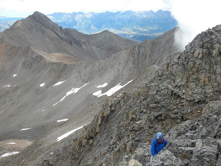
We down climbed into a gulley missing the Class 4 block quite by accident, but I wasn't too broken up about it since we'd had our climbing fun getting to the summit.
Once in the gulley we made a hard right to get to the Navaho Basin drainage.
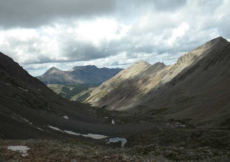
After a bit of route finding we dropped into the correct basin and started sliding down a screen field not unlike what you find on El Diente. The view was amazing, but the initial descent was steep and loose.
We got out of the unpleasant conditions, the clouds parted and our smiles returned.
We would have been happy for any mode of transportation that took us back over the Rock of Ages saddle. Regaining that elevation late in the day is always painful.
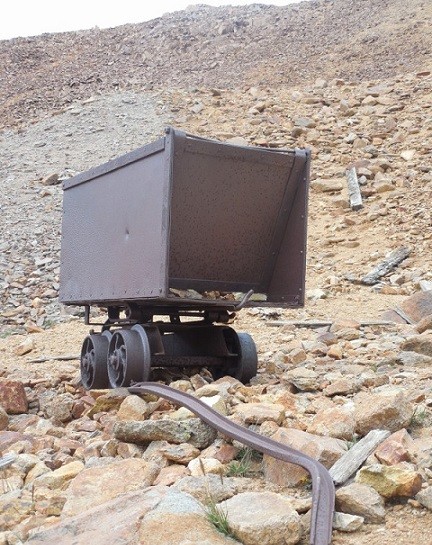
On the way out we briefly toured the abandoned mining house.
The remainder of the hike out was uneventful and we made it back to the trailhead at about 4:00 pm. In other words, a 10 ½ hour day.
Given the duration of our outing I was doubly glad we didn't attempt the El Diente - Mt. Wilson traverse. I can only imagine how long of a day it would have been if we had tried that - even in good weather!
So, in spite of missing out on the traverse my last official 14er was in the bag!
Now, it was time to head back over Ophir pass for dinner, a much needed shower and a good night's sleep for the next day I'd be hiking the 6 miles in to the Chicago Basin to go for my 58th and final 14er, North Eolus!
I was wondering how the weather was effecting these peaks? Looks like it wasn’t as bad as the forecast made it out to be! The snow is all gone I see, good to know, hopefully that will hold til the end of the month! I received some of the same weather on French Mountain that same day! The clouds were flying over the tops at probably 30 or 40 mph? We would get teased by some brief sunlight only to get slammed by some winds and rain for a while. The graupel, mixed with some sleet hit us on the summit ridge. As soon as we touched the summit, the clouds parted for some sunshine and things were fine all the way down to the basin.
I’m honored to have joined you on this milestone! Now that the 14ers are in the bag, let’s go for something a little taller. How about that 18,491 ft volcano in Mexico?
Caution: The information contained in this report may not be accurate and should not be the only resource used in preparation for your climb. Failure to have the necessary experience, physical conditioning, supplies or equipment can result in injury or death. 14ers.com and the author(s) of this report provide no warranties, either express or implied, that the information provided is accurate or reliable. By using the information provided, you agree to indemnify and hold harmless 14ers.com and the report author(s) with respect to any claims and demands against them, including any attorney fees and expenses. Please read the 14ers.com Safety and Disclaimer pages for more information.
Please respect private property: 14ers.com supports the rights of private landowners to determine how and by whom their land will be used. In Colorado, it is your responsibility to determine if land is private and to obtain the appropriate permission before entering the property.