Download Agreement, Release, and Acknowledgement of Risk:
You (the person requesting this file download) fully understand mountain climbing ("Activity") involves risks and dangers of serious bodily injury, including permanent disability, paralysis, and death ("Risks") and you fully accept and assume all such risks and all responsibility for losses, costs, and damages you incur as a result of your participation in this Activity.
You acknowledge that information in the file you have chosen to download may not be accurate and may contain errors. You agree to assume all risks when using this information and agree to release and discharge 14ers.com, 14ers Inc. and the author(s) of such information (collectively, the "Released Parties").
You hereby discharge the Released Parties from all damages, actions, claims and liabilities of any nature, specifically including, but not limited to, damages, actions, claims and liabilities arising from or related to the negligence of the Released Parties. You further agree to indemnify, hold harmless and defend 14ers.com, 14ers Inc. and each of the other Released Parties from and against any loss, damage, liability and expense, including costs and attorney fees, incurred by 14ers.com, 14ers Inc. or any of the other Released Parties as a result of you using information provided on the 14ers.com or 14ers Inc. websites.
You have read this agreement, fully understand its terms and intend it to be a complete and unconditional release of all liability to the greatest extent allowed by law and agree that if any portion of this agreement is held to be invalid the balance, notwithstanding, shall continue in full force and effect.
By clicking "OK" you agree to these terms. If you DO NOT agree, click "Cancel"...
What: Wolfs Head (12,163') When: September 6, 2015 Where: Big Sandy Trailhead (9,080') How: East Ridge (5.6) from camp in The Cirque of the Towers Who: Nick (eskermo), Eric, Clemence Numbers: ~19 miles, 4,500' vertical Sources: "Climbing and Hiking in the Wind River Mountains" by Joe Kelsey; Mountain Project; Steph Abegg's trip report
This trip report is written from the perspective of a relatively new and aspiring trad climber that first fell in love with the mountains by climbing 14ers and hiking around Boulder. I led zero pitches on this route, and felt completely dependent and in the hands of my two partners, who happen to be solid trad climbers. This was definitely stepping out of my comfort zone, as I usually feel competent and experienced enough to handle most terrain in the non-technical mountain climbing realm in which I spend most of my time.
My intention with this trip report is to: relay some more specific beta; give other mountain climbers/rock scramblers an insight into how mixing trad climbing with our favorite activity can be freaking awesome; and lastly, as a memento I can read in a few years and laugh hysterically at how much of a gaper I am.
We left Boulder Friday evening and settled on car camping in the Rock Springs, WY Wal-Mart parking lot. This wasn't my first, or even 15th time sleeping in random Wal-Mart parking lots across the West. However, it was my first time throwing a sleeping bag on a tarp in the nice, soft, lush grass a couple feet from the car. I knew the forecast was supposed to be dry, so I didn't bother with the tent. While sleeping 150 feet away from an entrance ramp to an 80 MPH interstate and tossing around in your bag with persistent 20-30 MPH winds may seem luxurious to some, I realized early Saturday morning that I should have put up the tent. Just in case you ever need to use the Wal-Mart in Rock Springs to crash for the night, be aware that the sprinkler system cuts on promptly at 5:30 AM. I set a PR for getting up and out of my sleeping bag that morning - a mind blowing 4.39 seconds. But I digress.
Day 1
Big Sandy Trailhead to camp in The Cirque of the Towers
~8.4 miles, 2,100' vertical climbed, 700' descended
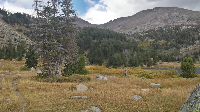
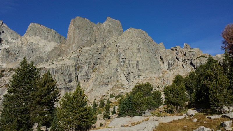
Early Saturday morning we continued up to the Big Sandy trailhead where we cooked and ate a bomb breakfast. It was absolutely packed there. We started up the trail toward Big Sandy Lake around 11:00 AM or so. This approach is gorgeous, mellow, and on an excellent trail. Upon arrival at Big Sandy Lake (9,690'), the views start opening up. Gnarly mountains hide around every corner. At the northwest corner of the lake, the trail splits to the left and begins the first steep climbing of the day. After switchbacking aggressively uphill for several hundred vertical feet, the trail levels off and descends slightly while the views toward Jackass Pass start to open up. Cross to the east side of the creek draining North Lake, and switchback up rocky terrain well above North Lake (10,105') before descending down to the north side of the lake. Traverse the marshy terrain north of the lake, locate a trail northwest of the lake heading uphill into the trees, and follow it.
At Big Sandy Lake, near its northwest corner. The patch of trees ahead is where the trail splits left and begins climbing ste
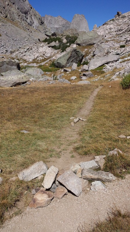
Prior to reaching Arrowhead Lake (10,420'), keep a close eye out for a trail branching off to the left. The main trail continues up and then descends a bit to the top of Jackass Pass. The trail to the left is a climbers trail that avoids the more difficult, loose terrain one encounters on the way to Jackass Pass. In turn, it saves you an estimated 300' of additional climbing. The shortcut spits you out on a gap southwest of Jackass Pass, which is closer to where you will probably want to camp if planning to climb in the Cirque. Although not the "standard route", this cutoff has become the main trail used by climbers from what I gather.
Well above North Lake, look for this junction. There was an arrow made of rocks pointing down the trail to the left. Take thi
Shortly thereafter, you will run into Arrowhead Lake. I took different routes on the way up and down, and we found it easiest to stay low and just to the west of the shoreline until at least halfway across the lake. There is an obvious scree gully climbing west from this point to gain a line of larger, more stable talus just below the flanks of War Bonnet Peak.
Looking down at Arrowhead Lake near the pass. The route follows the west side of the lake before shooting up some scree and t
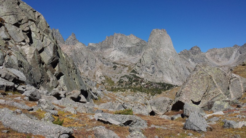
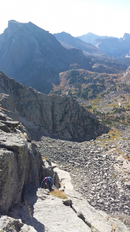
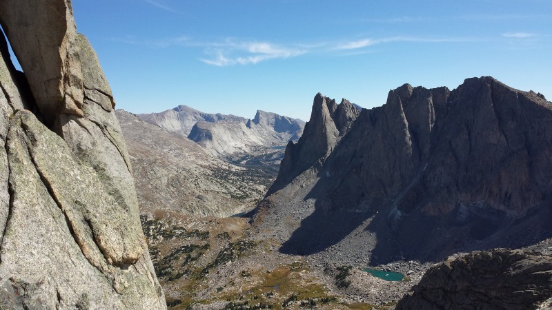
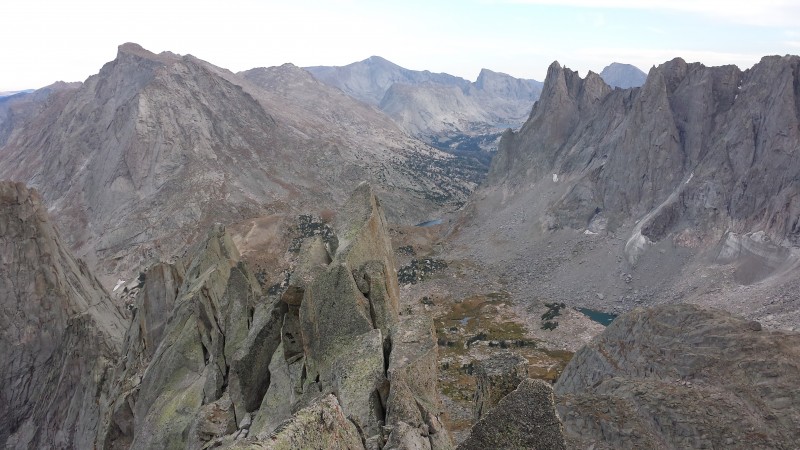
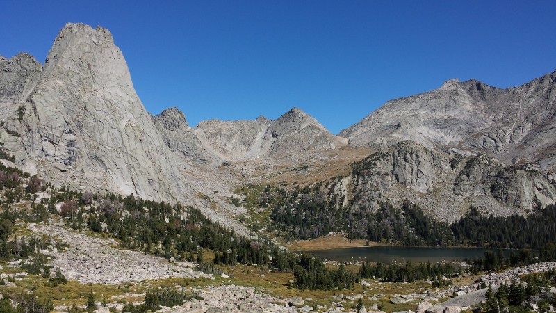
Squeeze through the giant boulders along the way, and arrive at the gap prepared to have your jaw drop.
Upon cresting the gap and starting the descent into the basin, this view will greet you. Wolfs Head center, with Pingora to t
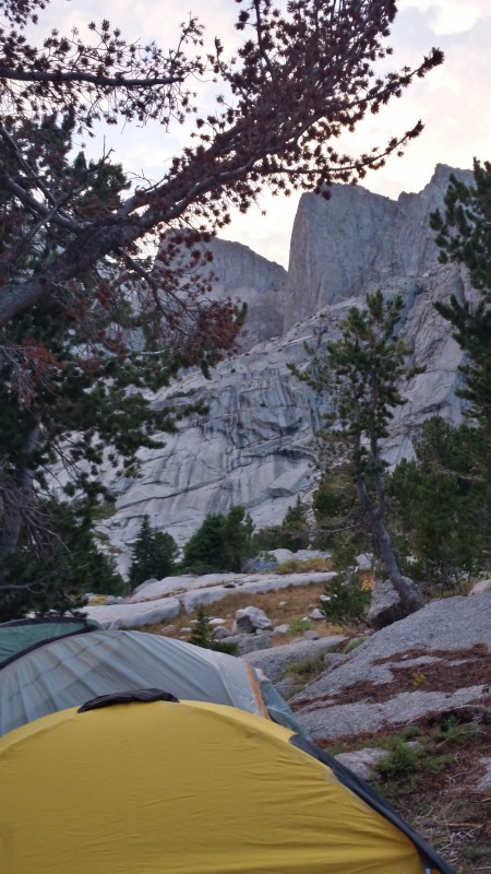
We descended to the northwest toward potential camp sites in the trees. We found a fairly flat area in the trees to set up three tents and cook dinner while enjoying a sweet sunset.
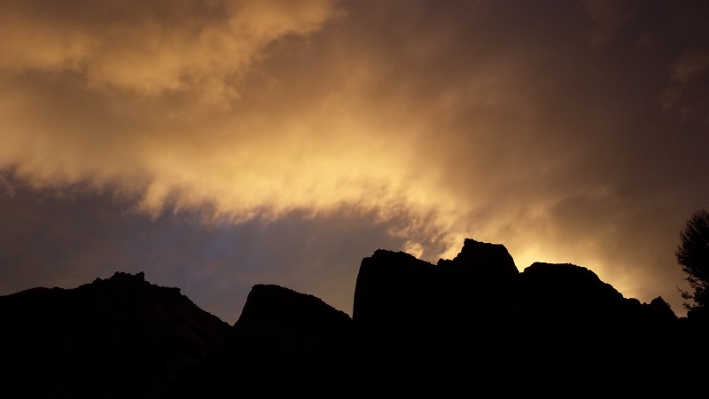
Sweet sunset in the Cirque from camp
Three tents in a row under the Towers
Day 2
Camp to Wolfs Head via its East Ridge route
~2.25 miles, 1,700' vertical climbed from camp, with a TON of climbing and scrambling
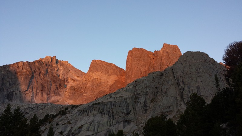
Morning alpenglow (L to R): Pylon Peak, South Watchtower, Watchtower
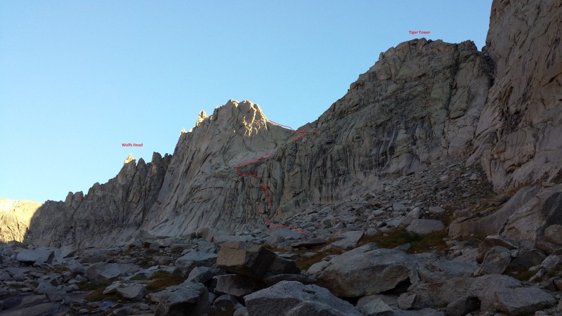
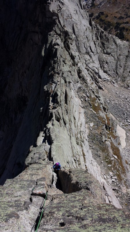
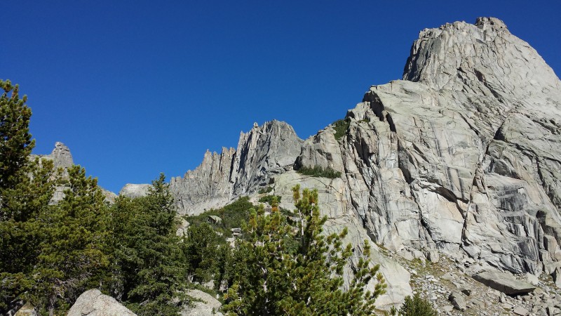
Already racked and packed in the morning, we downed a quick breakfast and started toward Wolfs Head around 6:30. A couple faint trails head northwest toward Cirque Lake, and eventually they braid out and it turns into an easy talus hop to the base of the climb. Photo 8 (below) shows a rough outline of the path we took to gain the Wolfs Head/Tiger Tower saddle. An alternate approach described in other trip reports, as well as Kelsey's book, climbs the gully that reaches the Tiger Tower/Pingora saddle (far right on Photo 8). This approach is supposedly 4th/low 5th class, but requires two 40' rappels off Tiger Tower to get to the Wolfs Head/Tiger Tower saddle. From what I gather, when dry and clear of snow (conditions we experienced), the Grassy Ledges may be the easier approach. I scrambled easily and comfortably the entire way to the saddle, while my partners roped up for a couple short, exposed sections. I've read this goes from anywhere between 4th class when the grass is dry to 5.4. I would definitely put it on the lower range of the scale, but I can see how much more sketchy this would be when wet. Under most conditions, and after reading and asking several others' opinions, it seems the Tiger Tower/Pingora saddle approach may be the most straightforward and more comfortable option. Let me know if your thoughts if you've done either of these!
The approach to the ridge. We took the grassy ledges route to the saddle between Tiger Tower and Wolfs Head, roughly followin
Looking down from a little way up the grassy ledges
Typical terrain on this part of the approach
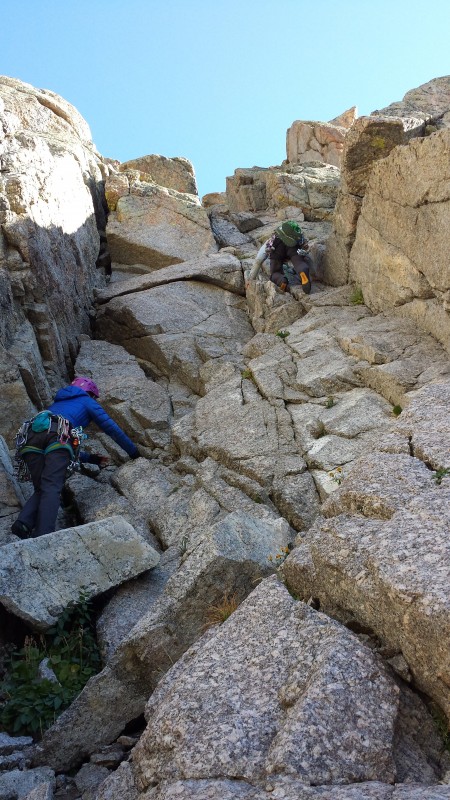
At the end of the grassy ledges section, the most obvious line to the top switches back to the east along some slabs before climbing straight up a short but fun gully to the Wolfs Head/Tiger Tower saddle.
Looking East toward Tiger Tower (front) and Pingora (back) from the point at which the grassy ledges switchback toward the sa
The last short scramble up to the saddle between Tiger Tower and Wolfs Head
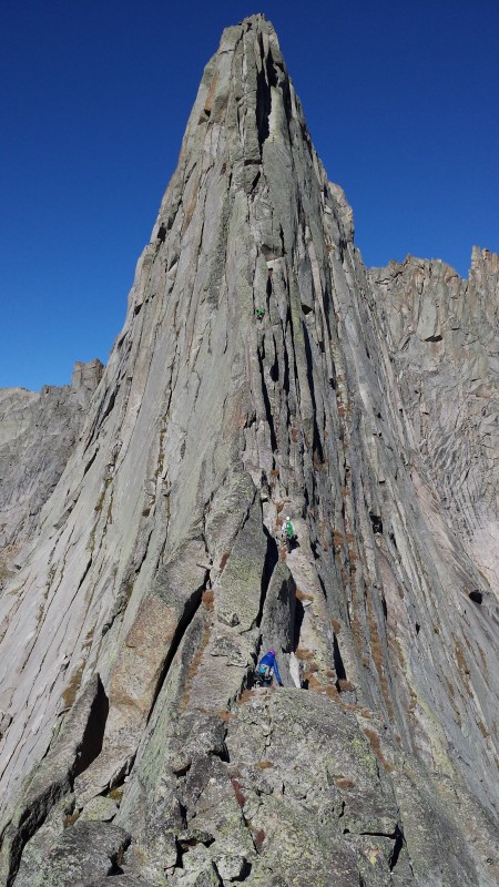
When you reach the saddle and peer to the left... well... I hope you took care of business before you left camp. Because you might lose bowel control when you look at the beautiful ridge staring you in the face. It is quite the sight to behold.
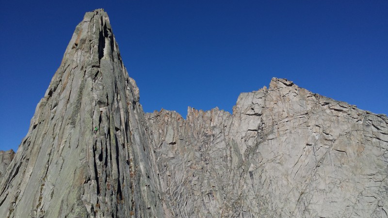
The East Ridge in all its glory. Just a tad of exposure.
Another perspective, with Bollinger Peak to the right.
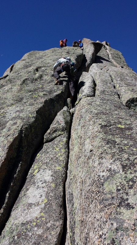
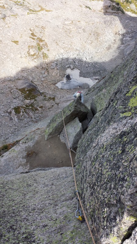
Eric took the sharp end of the (twin) rope first. The climb starts with a low angle, 3 foot wide ledge with incredible exposure. This part was pretty straightforward as long as you are cool with the airy-ness! The angle increases, along with the difficulty of the climbing. Clemence and I followed, one at a time, unclipping our respective strands from each piece of protection along the way.
Looking up the first pitch on the East Ridge
Looking down on the first pitch
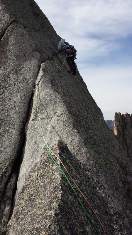
Next up was Clemence leading the second pitch. This felt like a continuation, although a tad more difficult, of the previous pitch. Just stay on top of the ridge and don't mind the drops.
Eric following up P2
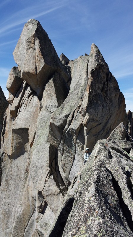
Darth Vader tower! Looking West toward our next pitch
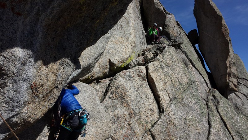
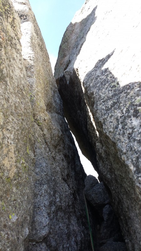
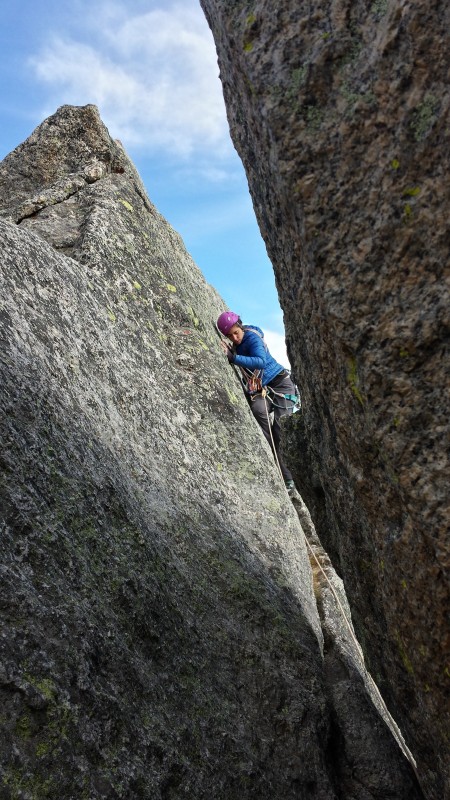
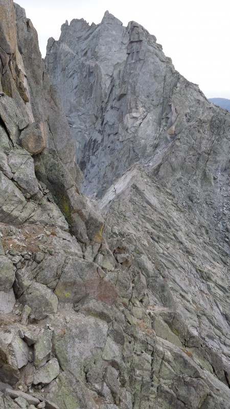
The third pitch involved traversing a little lower on the south side of the ridge. There was an awkward step-around move over a boulder that Eric led and protected nicely. The pitch then takes a turn to the right up through a little slot and into a tight squeeze which deposits you back onto the north side of the ridge, right before the Piton Traverse pitch. Eric set up a belay here.
Clemence finishing up part of the awkward traverse on P3
Looking back East on the views of Mitchell Peak
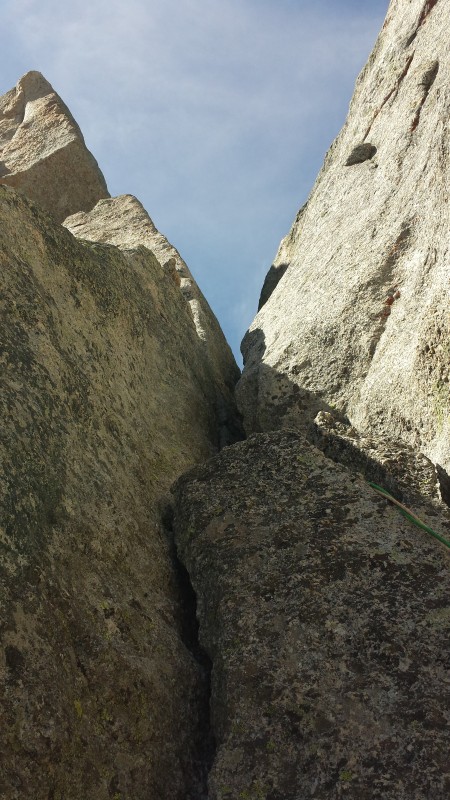
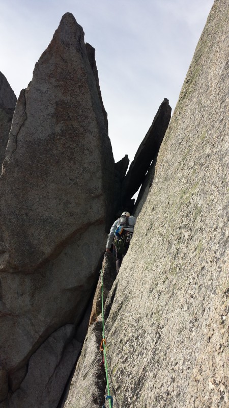
The slot/squeeze portion, leading back to the north side of the ridge, nearing the end of P3
Sweet little tunnel to squeeze through. Piton traverse belay just through the hole
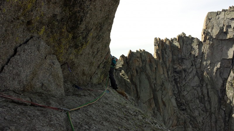
Our fourth pitch was the Piton Traverse. The remarkably exposed, super uncomfortable first portion of the pitch is protected by - you guessed it - a series of pitons. I recall 3 or 4 right off the bat, as well as a medium sized cam placement somewhere along the way. Most of the pitons looked to be in decent condition.
The Piton traverse
Following the traverse is a short but serious section of face climbing. I distinctly remember an insane shortage of any kind of positive holds, and thinking how heady that must have been for Clemence to lead it. The featureless climbing was reminiscent of the Direct Route on the 1st Flatiron, except significantly more steep, and on much less grippy-feeling rock.
Looking down from the belay at the end of P4. Just below Eric is the blank, close-to-featureless face portion
Pitch 5 was epic. Just look at that picture below! A short but sweet hand traverse on the north side of Tower 3 spits you back out onto the south side of the ridge just before Tower 4. Eric led by using the horizontal crack for his hands and smearing feet below on the featureless granite. The crack took many excellent cam placements... that were scary as hell for me to clean with one hand and nothing for feet. Imagining myself leading that pitch gives me the chills. Maybe one day.
Eric leading P5
Clemence getting to the belay at the end of P5
Our 6th pitch started on the South side of the ridge and traversed an extremely exposed ledge with blank hands until reaching a chimney. From there, we climbed through the chimney on easier terrain and popped out back onto the north side of the ridge once more, just before the summit block.
Eric leading the final crux pitch (our 6th pitch)
From here, it was a short scamper up to the summit. Several possibilities exist for the final couple moves, but we chose a steep and somewhat less exposed chimney/gully feature that went around 4th class/easy 5th. I scrambled quickly onto the summit while Eric gave Clemence a short belay up to the top.
Wolfs Head summit picture
The celebration was short-lived knowing we had a LONG way to go. Many rappels and loose downclimbs lay ahead, but not that much daylight remained. We coiled ropes and got ready for the second part of the Wolfs Head adventure - the descent!
Looking down at much of the descent route. The Wolfs Head/Overhanging Tower saddle is the low point at center
I'm not going to get into the details of the descent because, quite frankly, I wasn't entirely with it at this point. Eric led the charge with finding rappel stations, route finding, figuring out if one or two ropes were needed, etc. Thanks for stepping it up and staying tough while I was slowly fading! Long story short, we were able to combine at least one pair of rappels using our twin 60 meter ropes, and I recall at least 3 or 4 rappels up high before a long traverse toward the saddle. Just before the Wolfs Head/Overhanging Tower saddle was one more rappel. Apparently there are slings just before dropping off of the saddle that allow you to make one more rappel into the loose scree slope below.
At this point there was no more daylight and I was over the rappels. I just wanted to get the heck off that mountain, back down to camp where I could cook dinner, and go straight to sleep. Not having any food since breakfast around 6 AM, I needed to get down as fast as possible before I started tripping - both literally and figuratively. Without a headlamp (I was certain we'd finish well before sundown - HA!) and just a cell phone light, I scree surfed down a pretty loose, steep slope into the basin below. Staying to the right was the key here. At one point I ventured too far to the left and met some steeper slabs and cliffs that did not appear to offer a reasonable descent path. A little over an hour after leaving the saddle, I made it back to camp safely.
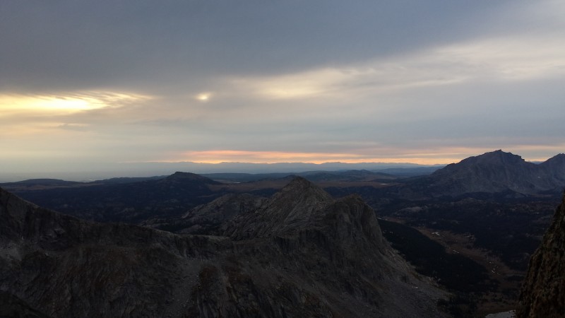
We even got to see the sunset on our descent
Day 3
Camp back to Big Sandy Trailhead
~8.4 miles, 700' vertical climbed, 2,100' descended
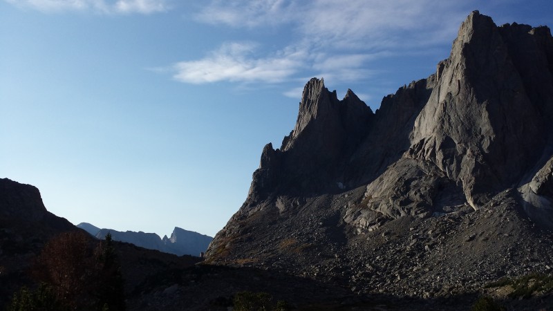
Early morning on War Bonnet Peak
We all slept really well that night, and took our time leaving in the morning. I walked around, taking a thousand pictures of the Cirque area in the beautiful early morning light. That place is something else. It's like Lone Eagle Cirque on steroids. Really, really good steroids. I can't wait to go back.
The hike out was quick and rather uneventful, but it sure was gorgeous.
A sweet look at the South Buttress of Pingora (right), Wolfs Head (center), Overhanging Tower (left)
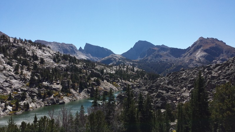
Pingora, Lonesome Lake, and Texas Pass
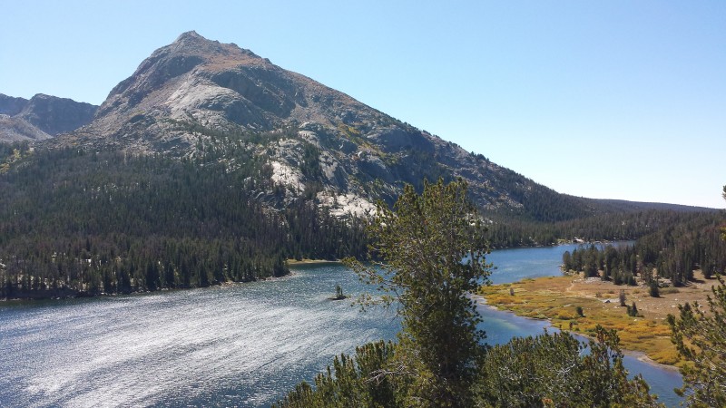
(L to R): Haystack Mountain, East Temple Peak, Temple Peak, and Schiestler Peak with North Lake below
Schiestler Peak above Big Sandy Lake
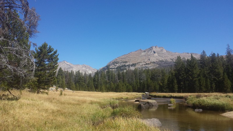
Big Sandy River
Reflections on the climb:
- The exposure on this climb is serious. Really serious. Like, super duper cereal. I love exposure and it doesn't phase me too much on high peaks or scrambling flatirons, but this climb freaked me out. In a good way.
- This climb is long. The descent will take at least a couple hours, if not longer. It is not trivial in any way, shape, or form. Mountain Project gives this a Grade IV rating, which I think is fair. However, if you are very efficient and competent, have the beta dialed, and are willing to scramble/simul-climb the approach and first couple pitches, I think you could blast through this in a reasonable amount of time.
- Expect route finding challenges. I can see one imagining this is similar to the Little Bear-Blanca traverse with zero route finding and simple climbing on top of the ridge the whole time. This ridge line is way more complex, and the route is not always obvious. There are many ups and downs, as well as movement from the north to the south side of the ridge, and viceversa.
- The Cirque is amazing. If you go there once, it'll keep bringing you back. I've been planning my next trip ever since the drive home from this one. There's got to be half a lifetime's worth of climbing to be done in the Cirque and nearby areas.
- I kept hearing about how bad the bugs were, and how wet and swampy the approaches could get in this part of Wyoming. We had zero issues with either. I think this could be attributed to 1. going so late in the season, and 2. the light snowpack in Wyoming that year melting out sooner than normal. My recommendation would be to wait until the end of summer to avoid the bugs and water.
- We passed a bunch of people that lamented how "crowded" the Cirque was. There were a fair number of campers and climbers in the area, but I think the term "crowded" has a different meaning in Wyoming. Camp sites were plentiful and there really wasn't any bumping elbows with others. From our camp site we could see one other tent. Most of the others must have been well hidden in the woods or farther down basin.
- The water from Lonesome Lake is not suitable for human consumption, even with filters. Be aware of that when planning. If climbing, you'll probably not want to descent that low anyway, but just a heads up. We filtered water around 10,400' out of the stream draining Cirque Lake and had no problems or weird tastes.
Personal reflections and takeaways:
- 5.6 traverses and slabs are hard. I don't care what the number says, and I don't care how good of a gym/sport climber you are. 5.6 is hard on traverses and slabs. Don't let the rating fool you.
- I was legitimately curious if this route was free-solo-able. Yeah right! Maybe if you're a freak of nature. It's been done, but I can't fathom not taking a rope and plenty of cams up there to do this in the future, no matter how comfortable I get with the route. While the approach to the ridge and perhaps our first two pitches could have been easily scrambled or simul-climbed, I can't imagine those crux 5.6 pitches unprotected. If you have done or do this free solo in the future, holler at me because I want to buy you a pint/roll you a fattie and hear all about it.
- One of my greatest aversions to technical alpine climbing is the ridiculous amount of extra weight and bulk required. Why the heck would I want to suffer packing in an extra 20 pounds of gear to climb something when I could leave that gear at home, just bring a helmet and approach shoes, and have a blast? Well, this singular climb changed my mindset on that idea. You know how taking the longer and more difficult route up a peak can be much more scenic, rewarding, and engaging than an "easier" route on the same mountain? Similarly, alpine climbing can be TOTALLY worth the extra weight and effort required to get you to those remarkable places that only a rope and protection could get you to reasonably.
- I have usually felt that I am well acclimated and feel comfortable at high elevation when climbing and scrambling peaks. However, with alpine climbing, you are up at elevation for a LOT longer time frame. I think this takes its toll on your body and your mind much more so when you're constantly thinking about your movement, protecting the climb, belaying, and all the other things you have to consider while climbing. I'm usually not that exhausted toward the tail end of a hike/climb, but after being at 12,000' for about 13 or so hours, it absolutely wiped me out. This is a whole 'nother level of acclimatization.
- Trad climbing can open up a whole new world of mountain climbing. It's an awesome learning experience that never ends, can always be done better and more efficiently, and will take you places that you just wouldn't or couldn't go to without those skills and gear. I'm stoked to continue learning and to continue integrating rock climbing with mountain climbing.
My GPS Tracks on Google Maps (made from a .GPX file upload):
Looks like you picked a good time of year to go. I made the mistake of being there at the end of July and while the scenery was epic so were the bugs. Looks like a cool climb but way out of my league!
That is a freakin gorgeous route. Great description and I'll be looking it up again later. We had plans for the Cirque traverse same time of year this past year and bailed to Yosemite due to forecasted winds and sleet. If you liked this route, check out Matthes Crest. Nice job.
Great pictures and narrative from a spectacular and very unique climb. Your writeup allowed me to re-live this route all over again from when we did it in August 2013 (no mosquitoes then either). We did the same approach via the grassy ledges, roping up at the first quasi-offwidth/awkward step. We had heard the approach was 'third class', but I would easily say there's obligatory 5.2ish moves on those steps--and the grass made it feel very sketchy indeed. Your description of the first head-on look at the ridge (loss of bowel control) made me laugh as I had the same general feeling! Climbing up the spine helped to shake off that feeling a bit, and the upper pitch felt like an easy fun flatiron pitch to me. Though I was really dreading it from what I'd read, the piton pitch wasn't that bad I thought--I'd say it's more like 5.4-5.5, but it's definitely a section where slabby flatiron experience really pays off! The hand traverse on the triangular tower (pic 25) was probably the most spectacular alpine rock position I've yet experienced, that's such a cool feature. The last tower traverse was without a doubt the most terrifying part of the climb for me, with HUGE exposure--but, like you say, in a good way. 8)
If you return to the Cirque you might want to put the South Buttress/K-crack route on Pingora on your tick list--that's also a phenomenal route that doesn't disappoint. Overall, I completely share your sentiment about the Cirque and the Winds in general--the range is a special place and an alpine climbing wonderland, and I can't wait to get back there for more objectives. Well done.
Nick! It was really nice running into you and your friends at Indian Creek, I hope you guys had a good time out there. Great write up and photos, I have heard so much about the Winds, but haven't had the chance to make it out there yet. One of these days... Friction slab is my weakness (well one of them), even if it's a 5.6 it can be a total mind f*ck. I often will crimp down on the smallest grain of rock just to have something to hold on to, nice work climbing them with so much exposure around you.
Caution: The information contained in this report may not be accurate and should not be the only resource used in preparation for your climb. Failure to have the necessary experience, physical conditioning, supplies or equipment can result in injury or death. 14ers.com and the author(s) of this report provide no warranties, either express or implied, that the information provided is accurate or reliable. By using the information provided, you agree to indemnify and hold harmless 14ers.com and the report author(s) with respect to any claims and demands against them, including any attorney fees and expenses. Please read the 14ers.com Safety and Disclaimer pages for more information.
Please respect private property: 14ers.com supports the rights of private landowners to determine how and by whom their land will be used. In Colorado, it is your responsibility to determine if land is private and to obtain the appropriate permission before entering the property.


 Ridge")