Download Agreement, Release, and Acknowledgement of Risk:
You (the person requesting this file download) fully understand mountain climbing ("Activity") involves risks and dangers of serious bodily injury, including permanent disability, paralysis, and death ("Risks") and you fully accept and assume all such risks and all responsibility for losses, costs, and damages you incur as a result of your participation in this Activity.
You acknowledge that information in the file you have chosen to download may not be accurate and may contain errors. You agree to assume all risks when using this information and agree to release and discharge 14ers.com, 14ers Inc. and the author(s) of such information (collectively, the "Released Parties").
You hereby discharge the Released Parties from all damages, actions, claims and liabilities of any nature, specifically including, but not limited to, damages, actions, claims and liabilities arising from or related to the negligence of the Released Parties. You further agree to indemnify, hold harmless and defend 14ers.com, 14ers Inc. and each of the other Released Parties from and against any loss, damage, liability and expense, including costs and attorney fees, incurred by 14ers.com, 14ers Inc. or any of the other Released Parties as a result of you using information provided on the 14ers.com or 14ers Inc. websites.
You have read this agreement, fully understand its terms and intend it to be a complete and unconditional release of all liability to the greatest extent allowed by law and agree that if any portion of this agreement is held to be invalid the balance, notwithstanding, shall continue in full force and effect.
By clicking "OK" you agree to these terms. If you DO NOT agree, click "Cancel"...
Day 1: Backpack to below Blue Lake (4 miles approx.)
Trail: Blue Lake Trailhead (Rawah Wilderness)
Day 2: Summit of two nearby peaks:
Clark Pk (Northeast ridge)
Cameron Pk. (West ridge)
Distance: 8 miles from and to camp (for both peaks)
Elevation gain: 3,935
Time: 7 hours
Elevation at camp: 10,500
Tired of I-70 and 285 and their traffic jams, this time we decided to go North, yes, the Rawah Wilderness! So many years in Colorado and still hadn't visited this area. Now we are hooked to it!
I haven't seen any trip reports describing these two peaks in one day, so I thought I would add our trip report and routes taken, along with some pictures. And a moose story below.
The Blue Lake and Hang Lake areas are closed to camping, so we just hiked the first 4 miles and camped there, about half a mile below Blue Lake.
Blue Lake Trailhead
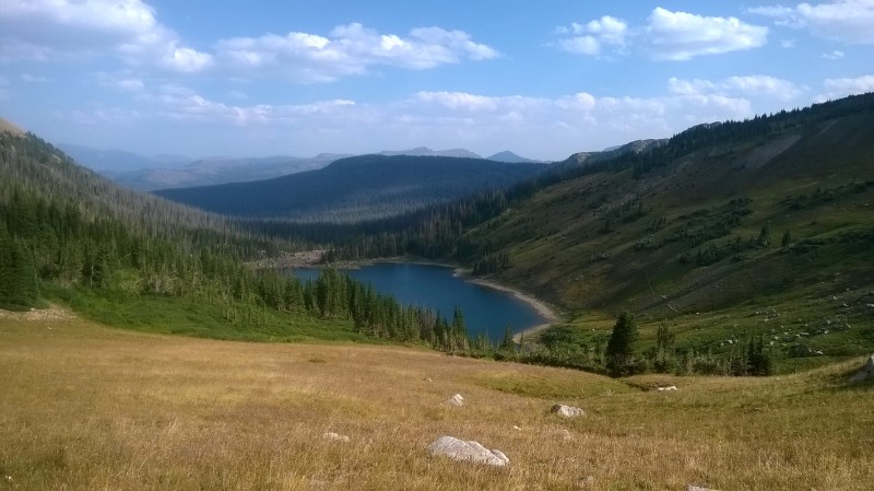
Blue Lake the night before the climb
Blue Lake and trail on the right side.
Notice the smoke from the wildfires
View from Blue Lake Pass (10,750)
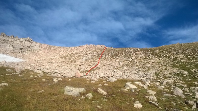
Once on the pass, we picked up a faint trail and followed it through some willows and up to the grassy slope. Our approximate route to the ridge in red in the picture.
Route we followed to the ridge
A closer look
We stayed on the left side of the ridge here
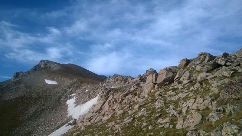
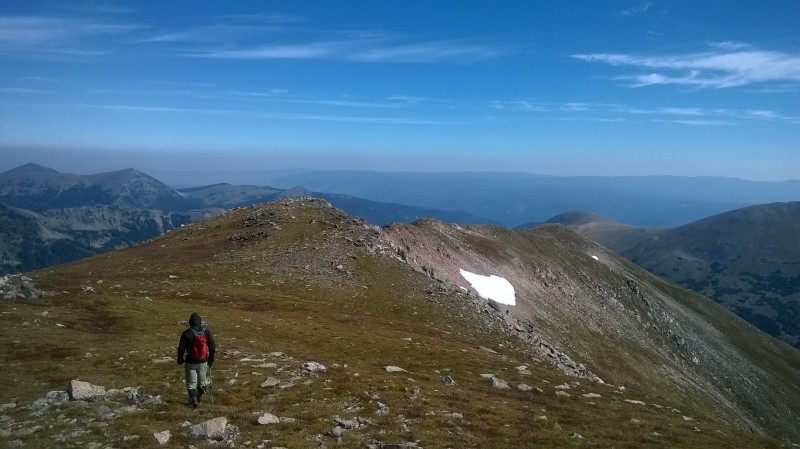
First part of the ridge
Ridge
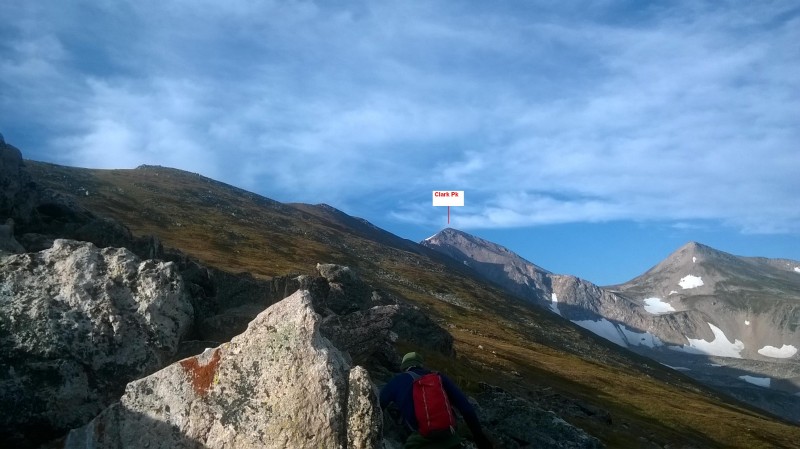
Went to the right side of the ridge on the next bump. Clark Pk. seems far away...
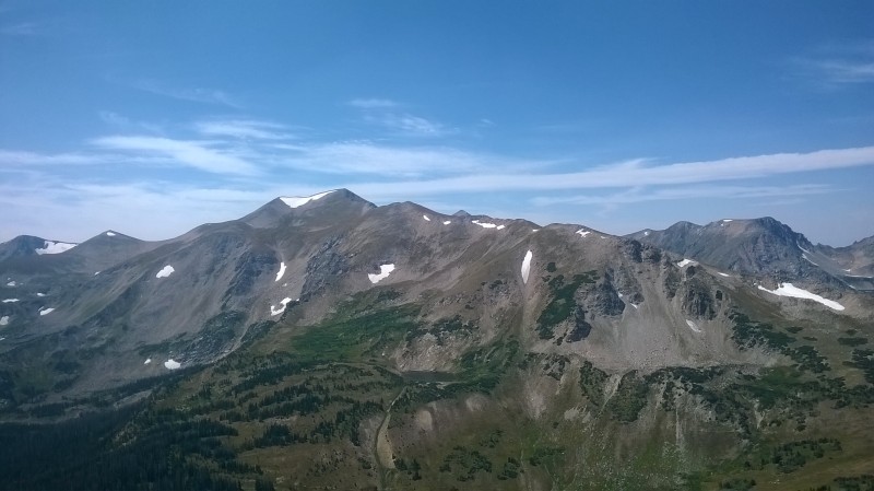
Clark Pk in the distance
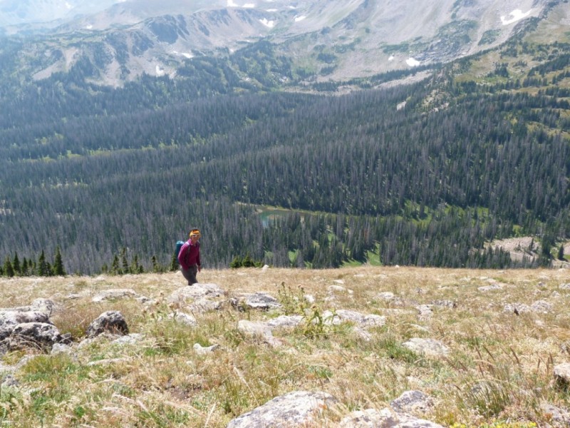
Tundra
These creatures know how to camouflage well...
Can you spot the 6 ptarmigans?
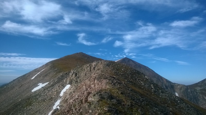
A look back to the ridge
Still far away...
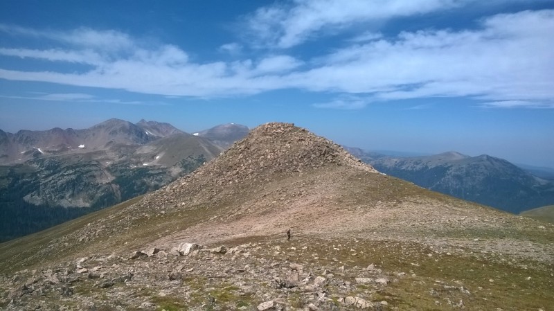
Point 12,561 in the distance
Looking back
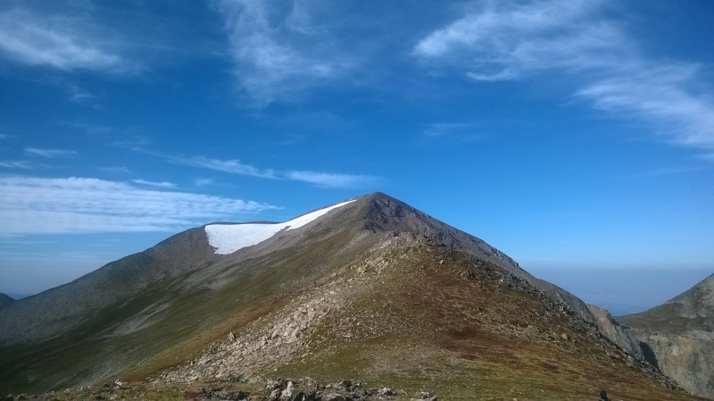
From point 12,561 looking at Clark Pk.
Final approach
Another look back
Final steps to the summit
You can see the smoke line here looking west.
Summit and views to the West
Windy summit
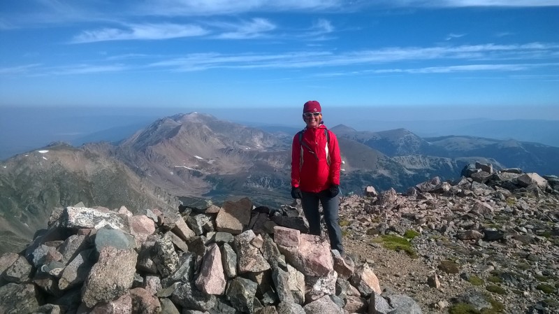
Summit pic
This is a funny picture I took zooming down on the patch of willows above Hang Lake. At that time I thought I had seen a moose down there, but it turned out to be a stump, oh well, too lazy to delete the picture. Then later when transferring the pictures to the computer there was a surprise on the upper part of the pic! Two bull moose laying on the creek... later we would see the rest of the family...
Upper side: Are those moose??
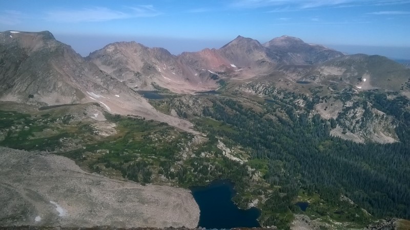
Hang Lake and Blue Lake down there. Also Cameron Pk.
Timber Lake and Island Lake in the distance
Down on the ridge again...
Our next goal: Cameron Pk. You can see the trail at the bottom of the pass going up. We followed a faint trail all the way to the saddle and then hiked the remaining ridge.
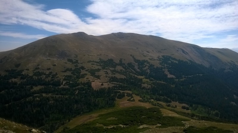
Cameron Pk.
Steep tundra
Saddle between point 12,054 and Cameron Pk
Final approach to summit
Clark Pk. in the distance
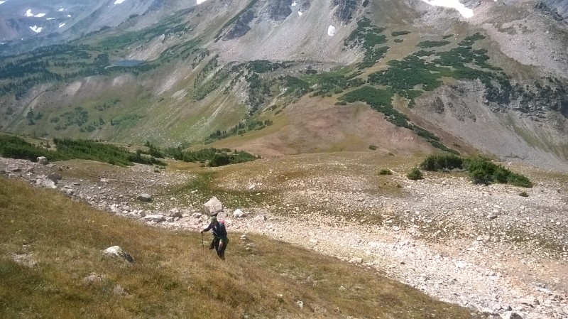
Route down from Cameron Pk.
We could almost see our tent below from Cameron Pk., so we took a slightly different descent, straight down. We aimed at the ponds seen in the picture, which were below Blue Lake and a little bit above our campsite. We had to be careful not to get cliffed out in some areas and then we ended up bushwhacking a little bit in the trees. We finally got to the ponds and then walked over our campsite.
We decided to spend the one more night there. It was probably around 8pm while having our supper sitting on a log when we spotted a mama moose and her little one. We took pictures of them zooming in and out. Peacefully eating those yummy willows...
Yummy willows
But our surprise was when they wanted to go by our tent and eat some other willows on the other side. Oops, we were in the way, so we thought we would give them as much room as they wanted. We fled our sitting spot in a hurry and watched them from another 50 yards away. They seemed to be focused on their eating goodies, not ours.
Wait, do we have to leave now?
And the little moose was so curious that he turned back and watched us closely, he did a flip or two and started to run in circles, what a show off! Mommy moose didn't seem to care, they finally ate what they wanted and moved on again. What a show for the night!
Baby moose
Gpx tracks below.
My GPS Tracks on Google Maps (made from a .GPX file upload):
Yeah, I was really impressed with the area around there too when I did Nokhu Crags a month ago. Just driving along Hwy 14 was so beautiful! I used to always come face to face with a moose or two in the Tetons, but have never seen one in CO. Must have been fun watching the little guy perform! Thanks for sharing your trip! :D
I think I was able to see Clark from South Diamond last fall – which is the only time I have been up in that area of CO. Your report makes me want to go back up there and spend some more time. Thanks for posting this. Cool moose... They can be a little scary up close, tho...
Caution: The information contained in this report may not be accurate and should not be the only resource used in preparation for your climb. Failure to have the necessary experience, physical conditioning, supplies or equipment can result in injury or death. 14ers.com and the author(s) of this report provide no warranties, either express or implied, that the information provided is accurate or reliable. By using the information provided, you agree to indemnify and hold harmless 14ers.com and the report author(s) with respect to any claims and demands against them, including any attorney fees and expenses. Please read the 14ers.com Safety and Disclaimer pages for more information.
Please respect private property: 14ers.com supports the rights of private landowners to determine how and by whom their land will be used. In Colorado, it is your responsibility to determine if land is private and to obtain the appropriate permission before entering the property.
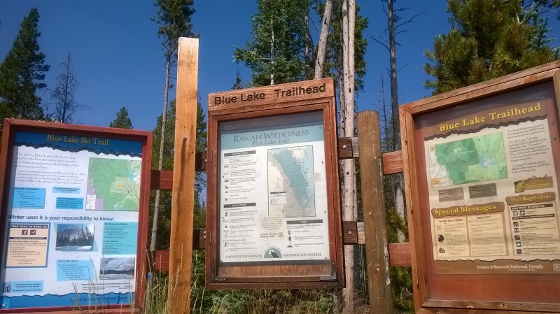


 Blue Lake Trailhead")
 Blue Lake the night before the climb")
 Blue Lake and trail on the right side.")
 View from Blue Lake Pass (10,750)")
 Route we followed to the ridge")
 A closer look")
 First part of the ridge")
 Ridge")
 Clark Pk in the distance")
 Tundra")
 Can you spot the 6 ptarmigans?")
 A look back to the ridge")
 Still far away...")
 Point 12,561 in the distance")
 Looking back")
 From point 12,561 looking at Clark Pk.")
 Final approach")
 Another look back")
 Final steps to the summit")
 Summit and views to the West")
 Windy summit")
 Summit pic")
 Upper side: Are those moose??")
 Hang Lake and Blue Lake down there. Also Cameron Pk.")
 Timber Lake and Island Lake in the distance")
 Down on the ridge again...")
 Cameron Pk.")
 Steep tundra")
 Saddle between point 12,054 and Cameron Pk")
 Final approach to summit")
 Clark Pk. in the distance")
 Route down from Cameron Pk.")
 Yummy willows")
 Wait, do we have to leave now?")
 Baby moose")


