| Report Type | Full |
| Peak(s) |
North Maroon Peak - 14,022 feet Mt. Massive - 14,427 feet |
| Date Posted | 09/07/2015 |
| Date Climbed | 09/02/2015 |
| Author | catcalliope |
| Additional Members | BenfromtheEast |
| North Maroon Peak |
|---|
|
North Maroon Peak (NE ridge) Hi everybody, feeling pretty privileged to contribute to the terrific mass of helpful trip reports on 14ers.com. I've spent two summers in Aspen and Snowmass before as a student at the music festival but just this month moved to Colorado for grad school and immediately left Denver and headed for the mountains. I was lucky enough to connect with BenfromtheEast a couple days before, and we arranged to meet up at the Bells on Wednesday the 2nd to see for ourselves how the car camping situation there was. It was very clearly marked that there was to be no car camping allowed in the Day Use lot, but the overflow lot was completely unsigned. At least for now, sleeping in the car there was no problem, other than for the massive rain/thunder storm that rolled through and soaked the valley (and, as we would discover, had left a bit of snow and ice waiting for us around 13900+ft and wet rocks the whole way up). It's definitely for a good reason though, as in the 10 minutes we were awake in the overflow lot that morning, we encountered a bear who slowly led the way up the road to the day use lot, where we left our cars for the day. Though the forecast was pretty good we wanted to get an early start, and so aimed to leave at 4am. Timings: 4:04am left the parking lot 5:00am arrived at the trail split for N. Maroon off of the trail towards Buckskin Pass 9:16am summit 9:40am depart the summit 2:01pm return to the trail split 3:04pm return to the parking lot Roundtrip: 11 hours on the dot but we probably could have easily shaved a good hour or more off on the way down if it hadn't been a perfect day in the mountains We burned our way up the trail towards Crater Lake and then up towards Buckskin Pass, finding the split without any trouble. It's cairned and significantly clearer than any of the little campsite offshoots that have come before. The trail up to the rock glacier is absolutely beautifully built! By the time we were crossing the boulder field it was beginning to light up just a little, and we aimed horizontal and a little bit up over the larger of the shoulders we could see across from us. We managed to pick up the trail close to the opposite side and as a whole had little problem crossing the boulder field; unfortunately the best advice I can give is just to not lose elevation and pay attention. 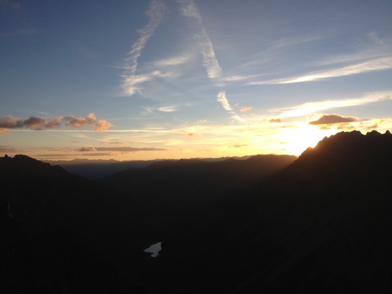 Gully 1 was pretty well trailed, the last night's rain made the scrambling on rocks more tricky but the dirt a little more solid (though untrustworthy). Gully 2 was more of the same, but as it got higher the trail became less defined and it was pretty choose-your-own-adventure. It's dirty and very steep so there's some danger but overall getting out isn't that bad. We gained the ridge left of the notch as in the very helpful route description. From here to the summit was scrambling over loose rock with some interjections of climbing on what for us included a lot of wet rocks, and occasionally snow and a rare patch of ice. As others have said, the trickiest part of the class 4 chimney is the bottom. Of particular attention to me was the wet and somewhat icy baseboard at the very bottom-- I was not all that excited about coming down onto that, though it probably would have been just fine. 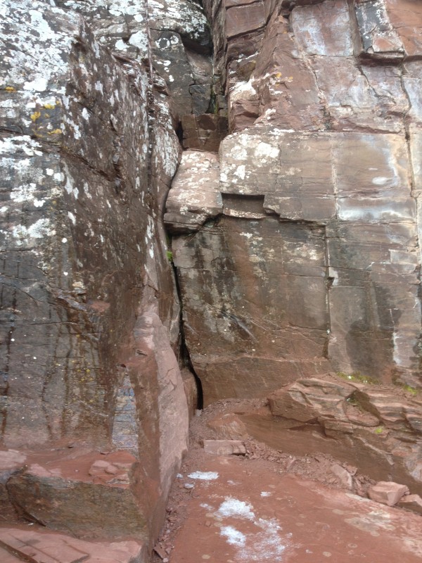 Some more routefinding and class 3 climbing later and we were on the summit and in the thick of big grey clouds. We saw the only other person of the day (until we were back on the Buckskin trail) on top of South Maroon; all day, the mountain was ours. Well, except for a pair of goats on the way up.  From the time we left the summit the day's weather only got better and better, as did our pictures. The valley was just perfectly beautiful and as the clouds broke up we took our time and enjoyed the views. We opted to check out the class 3 bypass to the chimney on the way down, and ordinarily I think it would be a pretty easy workaround. The crux of it is basically a set of four or so large stone blocks with a few small ledge steps on the way down, made much more difficult by the blocks themselves being slippery from water and covered with some loose grit. Going down, again the tricky part was the first move, which was to turn around and face inward on the outward-sloping blocks. Crucially for us, Ben found a terrific left hand-hold on the rock hidden by some moss that allowed a very solid two/three finger hold that made the move go cleanly. Be patient and feel around for it; I even had it pointed out to me and put my hand directly on it twice before I discovered the right spot. Maybe it was just because the rocks were a little wet but this was the trickiest part of the climb for me. We both agreed that there was the chimney/bypass and one other spot above this that were the two tricky climbing sections of the route; with good route finding there was nothing that felt outlandishly dangerous. We made some routefinding mistakes but stopped whenever we found something that seemed too difficult and usually a better route was within a few dozen yards. 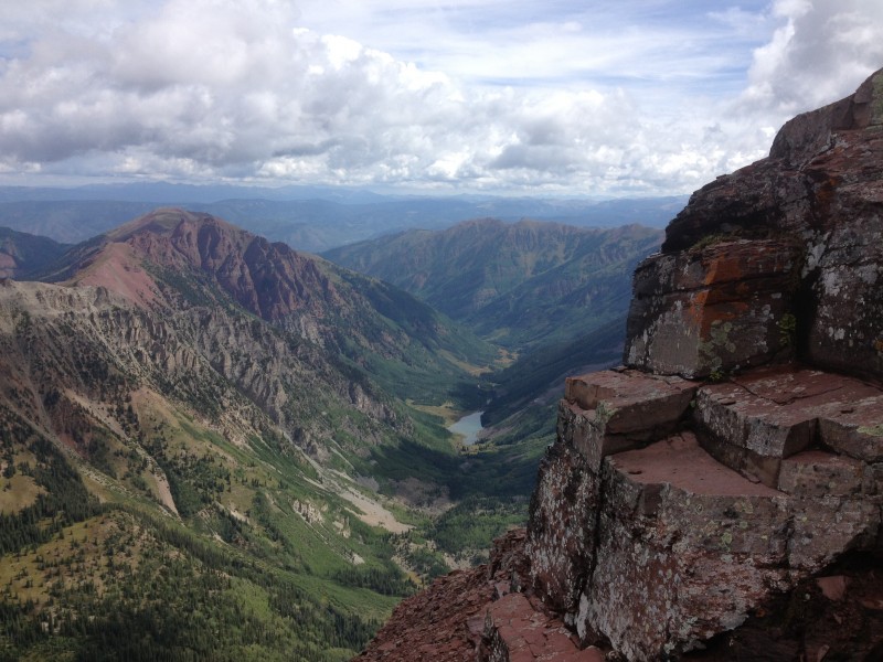  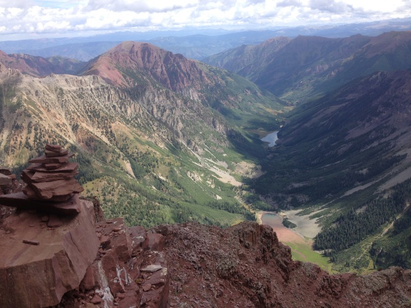 From here down was all beautiful views and very careful foot placement. The rocks were drying out but the Elk-typical crumbly sandstone and the dirt had just enough spots that could be slippery and muddy to require constant attention. Also, it's crazy steep. Fortunately, the weather was beautiful and only getting better, and so we had no pressure to go quickly and indulged ourselves in the gorgeous day, picking up all the views that we were partially denied on the summit itself. 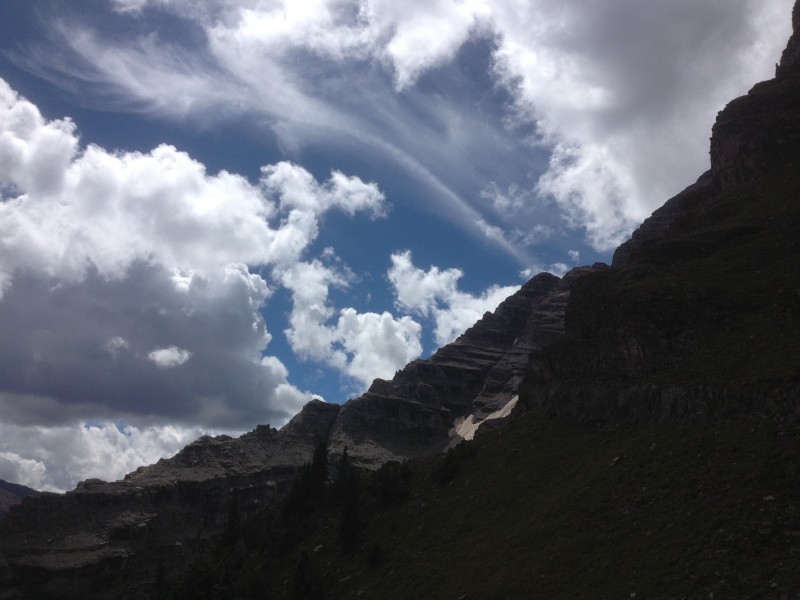 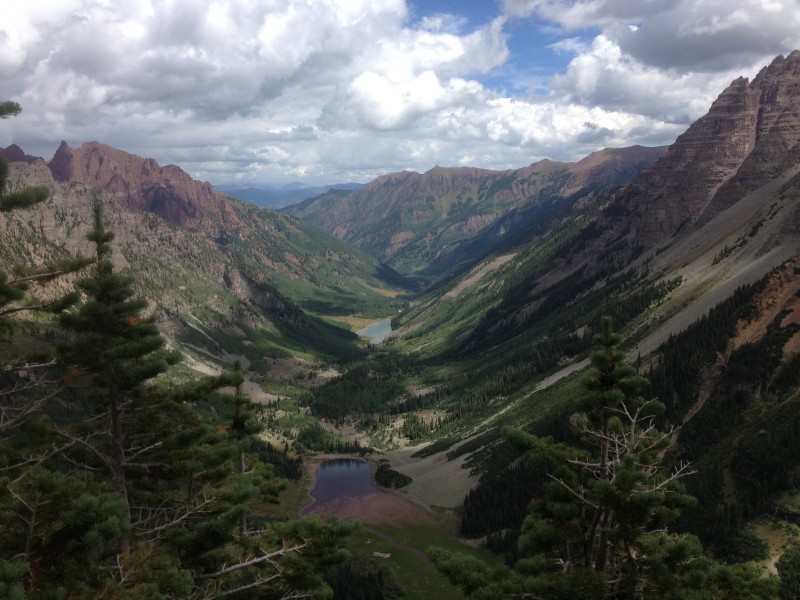 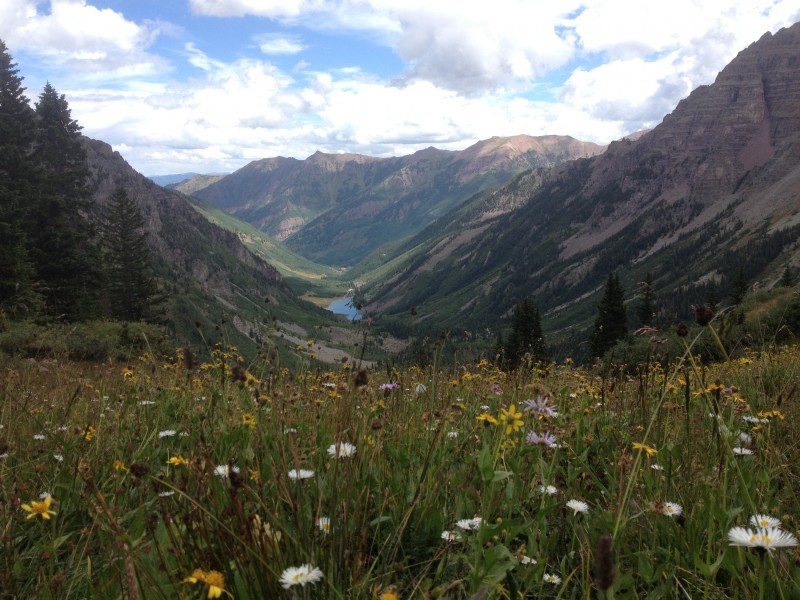 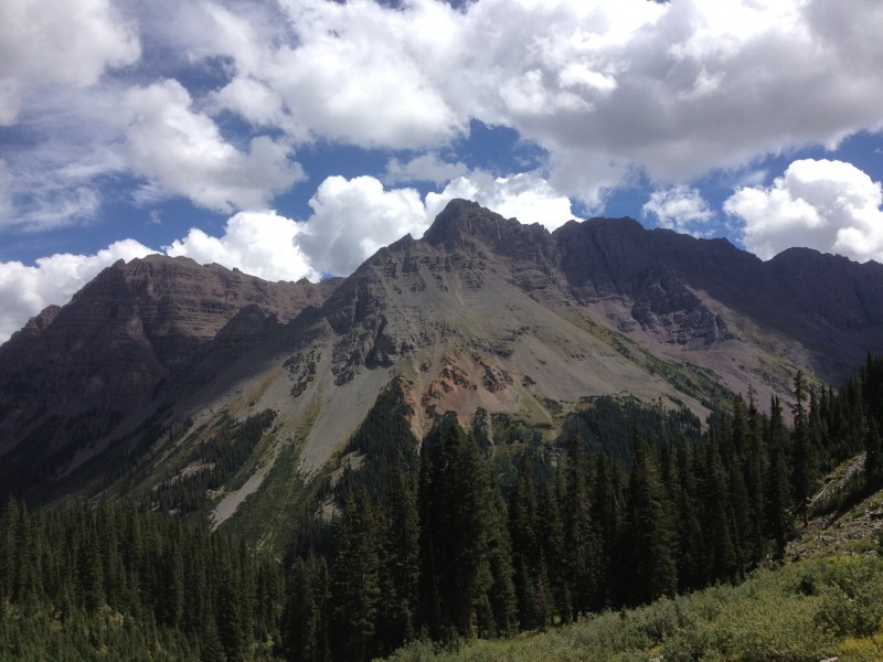 Close to the bottom I discovered that evidently quite a long time ago I had gotten a tear in my shorts that had grown like a surprised eye of Sauron and now stretched almost clean from the belt down the leg. RIP (pun intended) my faithful shorts. I can only imagine the mental and physical toll that watching this occur over the course of 5 hours must have had on poor Ben. 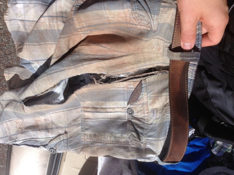 We parted ways at Maroon Lake, but hopefully not for too long! Good luck closing out the list this year, BenfromtheEast, it was a pleasure to hike with you! My plan from here was to knock off Massive from my list before heading back to Denver. As the weather forecast for Thursday was now predicting thunderstorms starting at 10 (ugh), I decided to do the Southwest Slopes route. But first, a stop at the Village Creperie in Aspen. It's a bit pricey but I think you'd be hard pressed to find a tastier and more filling meal for $20 than their boeuf bourguignon.  Here follows a brief summary of the SW slopes trip up Massive: the road is all right up to the junction, then unless you have REALLY good clearance and serious 4WD you're not going to make it to the trailhead. I got about .2 miles past the junction before I had to park. This trail is a cardio workout for sure, it's just up and up and up which is not a bad thing as I made it from car to summit in 2:53, summiting at 6:50. Weather looked okay so I picked up South Massive as well before heading down, got drizzled on as I reached the valley but at that point it was very okay. The valley on the way down was just hitting autumn colors, I imagine this weekend it will be totally golden. 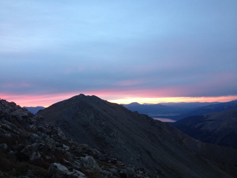 Summary: two incredible days in the mountains. The Maroon Bells wilderness is truly one of the most beautiful places on Earth and the North Maroon trail is a terrific way to see it and do a bunch of very fun climbing/scrambling. It definitely requires good climbing skills, steady feet on loose rock, and nonstop paying attention but on the whole it was not as bad as I was expecting. Hope people can find this report informative and helpful! Thumbnails for uploaded photos (click to open slideshow):
|
| Comments or Questions | |||
|---|---|---|---|
|
Caution: The information contained in this report may not be accurate and should not be the only resource used in preparation for your climb. Failure to have the necessary experience, physical conditioning, supplies or equipment can result in injury or death. 14ers.com and the author(s) of this report provide no warranties, either express or implied, that the information provided is accurate or reliable. By using the information provided, you agree to indemnify and hold harmless 14ers.com and the report author(s) with respect to any claims and demands against them, including any attorney fees and expenses. Please read the 14ers.com Safety and Disclaimer pages for more information.
Please respect private property: 14ers.com supports the rights of private landowners to determine how and by whom their land will be used. In Colorado, it is your responsibility to determine if land is private and to obtain the appropriate permission before entering the property.


