Download Agreement, Release, and Acknowledgement of Risk:
You (the person requesting this file download) fully understand mountain climbing ("Activity") involves risks and dangers of serious bodily injury, including permanent disability, paralysis, and death ("Risks") and you fully accept and assume all such risks and all responsibility for losses, costs, and damages you incur as a result of your participation in this Activity.
You acknowledge that information in the file you have chosen to download may not be accurate and may contain errors. You agree to assume all risks when using this information and agree to release and discharge 14ers.com, 14ers Inc. and the author(s) of such information (collectively, the "Released Parties").
You hereby discharge the Released Parties from all damages, actions, claims and liabilities of any nature, specifically including, but not limited to, damages, actions, claims and liabilities arising from or related to the negligence of the Released Parties. You further agree to indemnify, hold harmless and defend 14ers.com, 14ers Inc. and each of the other Released Parties from and against any loss, damage, liability and expense, including costs and attorney fees, incurred by 14ers.com, 14ers Inc. or any of the other Released Parties as a result of you using information provided on the 14ers.com or 14ers Inc. websites.
You have read this agreement, fully understand its terms and intend it to be a complete and unconditional release of all liability to the greatest extent allowed by law and agree that if any portion of this agreement is held to be invalid the balance, notwithstanding, shall continue in full force and effect.
By clicking "OK" you agree to these terms. If you DO NOT agree, click "Cancel"...
What: Ice Mountain (13,951') and North Apostle (13,860') When: August 29, 2015 Where: South Winfield Trailhead (10,600') How: Standard Routes - Northeast Ridge (Ice) and Southwest Ridge (North Apostle) Who: eskermo Numbers: ~9.5 miles, 3,500' vertical
Word on the street is the Three Apostles are fantastic spring snow climbs. This seems to be when most rational humans climb these peaks. Apparently, I'm not a rational human being.
With a stellar forecast for Saturday, I decided to take my sweet time in the morning. I started hearing people gathering at the South Winfield Trailhead (30 feet from my truck) around 6:30 or so, but I didn't wake up for another hour and didn't get on the trail until 8:20. It was a crisp morning with a bit of frost lingering on the trailside vegetation, reminding me that Fall isn't far away.
The first two trail junctions are obvious and well signed. Once you split off the Colorado Trail and head up the Apostle Basin trail, the path becomes more vague but is still relatively easy to follow.
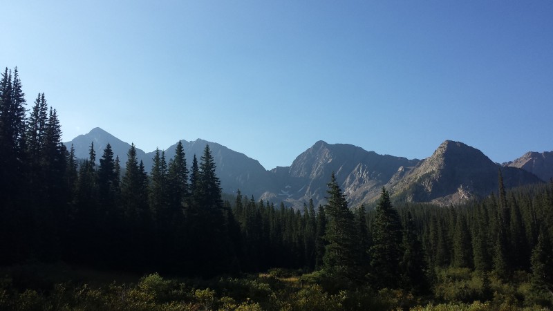
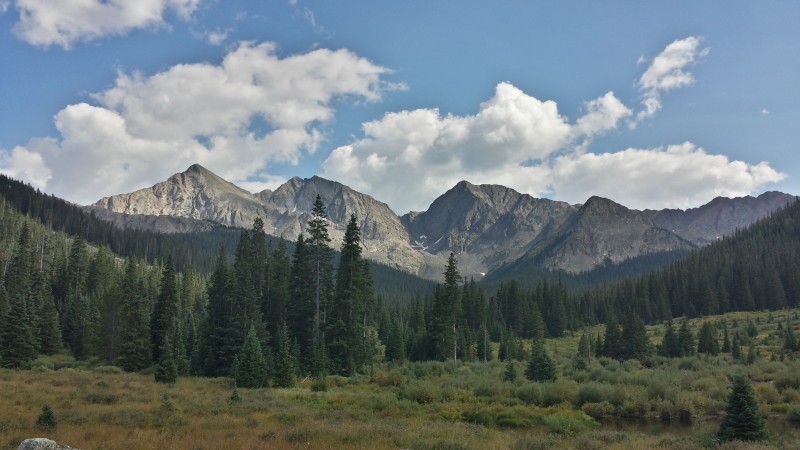
Early morning view of the Three Apostles
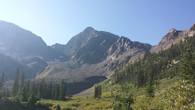
Upon busting out of the trees below the huge talus slopes guarding the approach toward the Apostles, the trail becomes very hard to follow. What appeared to be the "trail" seemed to veer off to southeast through (ew) willows. Ain't nobody got time for that. I chose a line due south that follows a mellow drainage with almost zero willow bashing required. I knew this wasn't "on route" but it looked like it would go. It did, and it wasn't too bad with pretty solid talus to climb up.
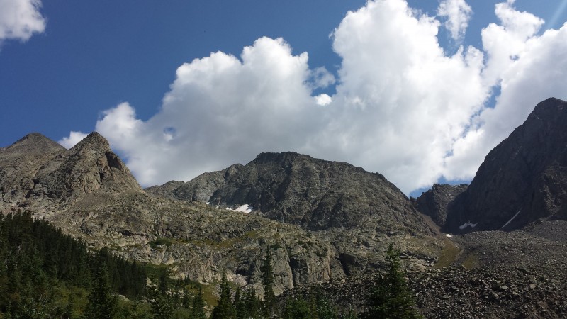
Approach goes up and to the 13,460' saddle left
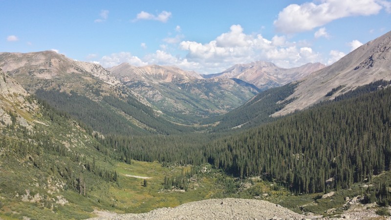
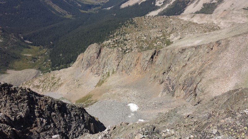
Looking down at the approach. Previous picture taken from the closest patch of trees near bottom center
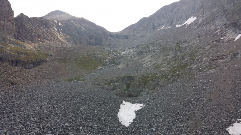
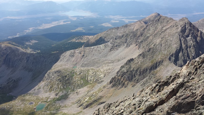
Somewhere around 11,800' or so, I encountered a small lingering snowfield, crossed it, and contoured east toward the main drainage coming down from the basin between North Apostle and Ice Mountain. I connected back up with the creek draining this basin around 12,000' and climbed uphill toward the 12,100'-ish tarn. The following picture shows the rest of the climb to the saddle from just above the tarn:
View of the climb to the saddle, taken near the 12,100' tarn
I took what appeared to be the path of least resistance, initially staying close to the stream on slabby terrain, and then finding the lowest angle, most stable-looking talus route I could find. This snaked a little to climber's right before making a hard turn left above some cliffs/steep sections.
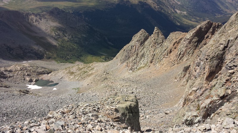
Looking down from near the 13,460' saddle between North Apostle and Ice. The tarn from which the previous picture was tak
Once above the cliff-y sections, there is plenty of talus hopping to go toward the saddle. This, in my opinion, is where the rock started to get really loose and crappy. I swore a big rock looked stable and like it couldn't move, but almost invariably it would shift on me. This was the story of the day on this peak - "oh that rock! I can definitely hop skip and jump across you without worrying abou--- OOUUUUCCCHHH!!!" It was just below the saddle that I ran into the only other person I would see until I was almost back to the car. He had just summitted North Apostle and Ice and warned me about the crap rock up high on Ice... oh goody!
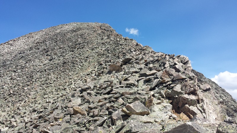
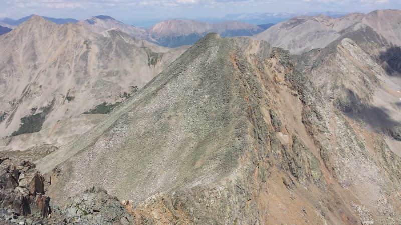
The 400' climb to the summit of North Apostle from the saddle
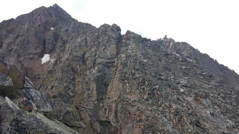
The 500' climb up Ice from the saddle
From the saddle, I dropped my pack and made the quick 400' talus hop up to the summit of North Apostle. Staying on or just left of the ridge crest the entire time provided pleasant, easy scrambling/talus hopping. I got to the summit at 12:30. I think it only took about 20 minutes roundtrip, not including my time on the summit. The rock quality on this stretch of the climb was not that poor, in my opinion.
North Apostle's summit, (L to R) La Plata, Huron, Elbert (shaded in the back), Mt. Hope, Quail Mountain
I returned to the saddle, picked up my pack and immediately started up Ice's Northwest Ridge. The initial part, shown in the picture below, was surprisingly solid and went quickly. That was all about to change.
(Mostly) solid, fun scrambling along the lower ridge to Ice
From the end of the lower part of the ridge, I angled down on relatively solid class 2+ terrain to climber's right to reach a notch. This is where things got a little more serious.
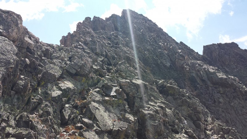
Just past the lower ridge portion, there is a notch that opens up on the ridge and things get much more serious Down in the first notch thingy, looking up at the remainder of the ridge
There were several steep gully-wall thingies to choose from which regain the ridge proper. The one I chose, which I believe was the farthest to climber's right, sucked. I'd grab a hold that looked decent and it would immediately start moving. I would raise a leg up and slowly weight what looked like a great ledge for a foot, and it would just crumble and fall out. There was a LOT of vegetation growing in and around that rock and everything just likes to pull out or crumble with any applied force. In hindsight, I really should have backed off and looked for other options (the one I found on the descent, right beside this pitch, was marginally better). Oh well, I'll spend more time looking for better routes next time I'm in a similar situation.
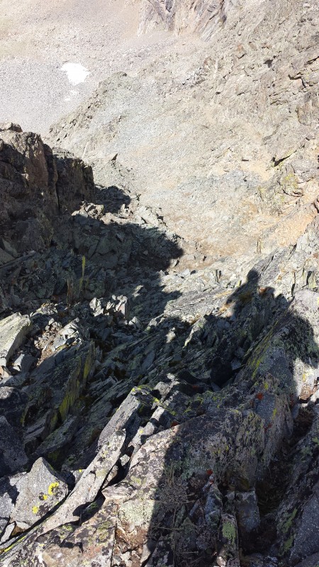
Looking down the sketchy, steep class 3/4 section I ascended. The notch is down below. Just to climbers left of the pitch in the previous photo was this pitch, which looked like it would be a slightly better opti
The remainder of the climb was straightforward in relation to the former difficulties. However, loose, rotten rock is a constant companion the entire way up, demanding constant attention with every move. Finally, at 1:20, I reached Ice Mountain's summit.
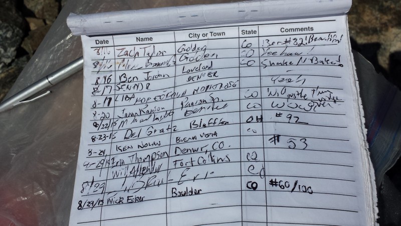
I love how many people I recognize on Centennial summit logs! Looking back at the ridge to North Apostle
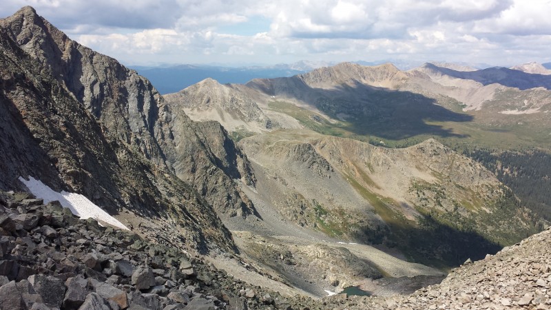
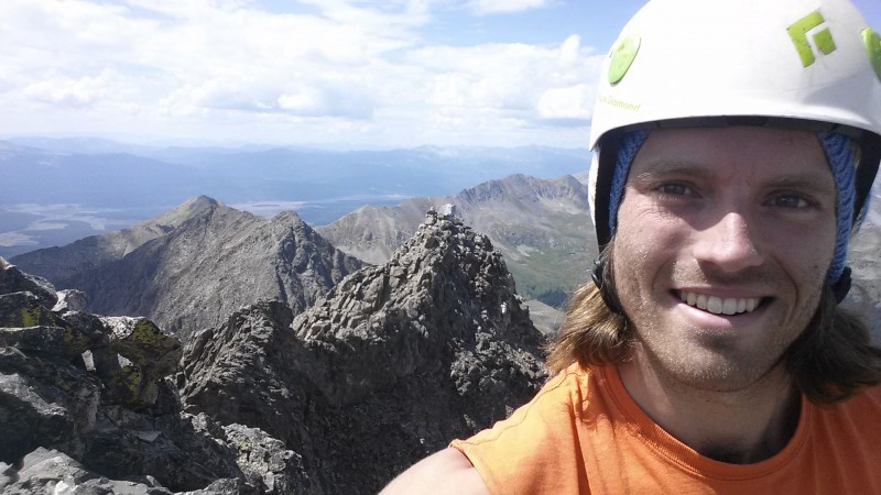
Looking down into Waterloo Gulch with Harvard and Columbia (L to R) in the background Ice Mountain selfie, West Apostle behind me Looking down Prospector Gulch with Taylor Park Reservoir behind and West Apostle on the right Ice Mountain summit views looking Northwest The descent from the summit of Ice
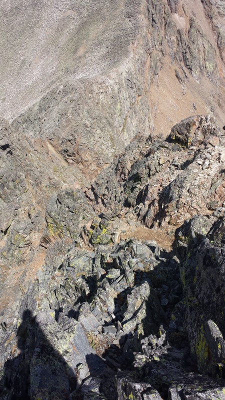
The downclimb was slow and equally sketchy. I found a slightly better pitch of class 3 rock to downclimb than the former pitch I took on the way up. This was closer to the ridge proper. From above it appeared there were at least one or two additional options that may have been more solid.
Looking back at the downclimb I did into the area right above the notch. This was better than the pitch I took on my way up,
Once back at the saddle, I was really starting to feel it. The downclimb seemed significantly more janky and loose than it did coming up. Downclimbing steep trails and talus very quickly is one of my strong points in mountaineering, but today it just wasn't happening. I slowed it down to full-attention, think-about-every-single-step-deliberately mode and the Apostle Massif still didn't want anything to do with it. Once I almost got my lower leg pinned under a giant teetering boulder, and another time I catapulted a rock into the air that made a direct hit on my ankle bone. Both incidents left me immobile for a few minutes, shouting/pouting at the rocks like a little baby, as if that would improve my situation.
Looking down the route from just below the 12,100' tarn
I tried to follow the "trail" on the way out, but didn't have too much luck. Instead of following the path I took up earlier, I continued down near the stream that drains the main basin, then traversed Northwest and North above the 12,100' tarn around a corner. From there, braided trail segments traverse down and right back into the willows toward my previous divergence with the Apostle Basin trail. The willows really weren't bad at all here and my feet stayed dry - no need to circumnavigate via my ascent route unless you just really want to!
Looking back up at the Apostles from terra firma
Shortly after getting back on the Apostle Basin trail, it became jumbled and confusing and I managed to lose it. I bushwhacked down the main stream's drainage, crossing the creek a couple dozen times before finally taking the plunge and soaking both feet. It was around that moment that I remembered the trail actually ascended a rounded shoulder just above the creek. I was in no mood for ascending a steep, loose, pine needle-ridden slope of suck for who-knows-how-many feet just to struggle to look for the trail again. My reward for this choice was drenched feet, scrapes and cuts galore all over every exposed portion of skin on my body, a bajillion creek crossings, and a gee golly good ole time. It eventually merged back up with the trail where the Apostle Basin creek merges with the creek draining Lake Ann. It was a short hike back to the trailhead from there.
One last look
Some final thoughts:
- Absolutely bring a helmet
- Some kind of gaiters would be helpful. I had to remove my shoes 6 times to clean all the dirt and scree out of them.
- Knowing what I know now about this mountain, I would not recommend doing this solo. I would have felt much better with a partner. This is not due to the difficulty or technicality of the peak, but simply just because the rock here is so questionable that I feel the likelihood of something bad happening is much higher than other comparable peaks.
- Best mountains I have climbed so far in the Sawatch, hands down. This basin and surrounding areas are spectacular.
- Don't climb it unless there's snow covering up all this garbage rock. Unless loose rock sufferfests are your thing. For serious.
Thumbnails for uploaded photos (click to open slideshow):
We must have crossed paths on our way up on Saturday afternoon. We camped at the basin and climbed Ice and North the next day, saw your signature from the day before! I totally agree with you, what a peak... definitely deserves to be a Centennial. Every rock moves, true! The last gulley (I think we took another one, not the one you show in the picture) was the most difficult part for us too. We never saw the chimney that is described in the route in 13ers.com either.
Congratulations on a well deserved climb!
Great TR, fun reading.
Like the take home points at the end.
I was up there a day prior to you, but turned around at the bottom of the scree/talus.
Wasn’t feelin’ it.
You just made my day, I’m rational :D Yay! Thanks!
Sounds like you made a bodily sacrifice up there. Congrats on completing the duo!
Brian – Good to hear from ya. I’m saving some easier/closer Centennials for the Winter/Spring, we need to plan on skiing a few with Charlie this coming season!
Aardvark – Thanks, glad I could help!
goingup – Thanks, it means a lot to hear that from one of my favorite trip reporters – your TRs, pictures, and dialogue always make my week.
Kitten – Congrats! I’m glad you made it up and down safely Sunday. Y’all weren’t the couple packing in as I was coming out, crossing paths in front of those couple tents on the west side of the trail? I think I managed to mumble something on the trail but I was probably still sulking about the creek bushwhack and having soaked feet :lol:
sunny1 – Well, let’s not get carried away here. Rational is subjective, I suppose, but at least you’re more rational than me. Which isn’t really saying much at all... I’ll be looking forward to hearing about your sweet, rational snow climb of these peaks in the Spring!
Caution: The information contained in this report may not be accurate and should not be the only resource used in preparation for your climb. Failure to have the necessary experience, physical conditioning, supplies or equipment can result in injury or death. 14ers.com and the author(s) of this report provide no warranties, either express or implied, that the information provided is accurate or reliable. By using the information provided, you agree to indemnify and hold harmless 14ers.com and the report author(s) with respect to any claims and demands against them, including any attorney fees and expenses. Please read the 14ers.com Safety and Disclaimer pages for more information.
Please respect private property: 14ers.com supports the rights of private landowners to determine how and by whom their land will be used. In Colorado, it is your responsibility to determine if land is private and to obtain the appropriate permission before entering the property.

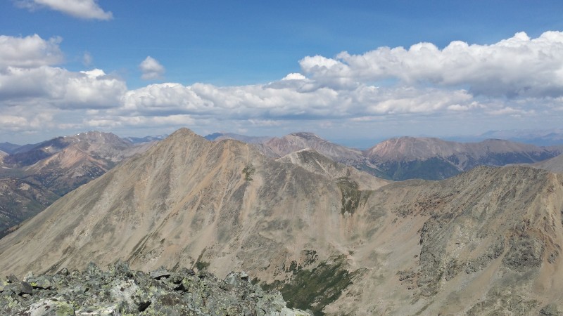


 From North Apostle's summit, looking over at Missouri, Belford, Oxford, Emerald, Iowa, and Harvard on the far right")