Download Agreement, Release, and Acknowledgement of Risk:
You (the person requesting this file download) fully understand mountain climbing ("Activity") involves risks and dangers of serious bodily injury, including permanent disability, paralysis, and death ("Risks") and you fully accept and assume all such risks and all responsibility for losses, costs, and damages you incur as a result of your participation in this Activity.
You acknowledge that information in the file you have chosen to download may not be accurate and may contain errors. You agree to assume all risks when using this information and agree to release and discharge 14ers.com, 14ers Inc. and the author(s) of such information (collectively, the "Released Parties").
You hereby discharge the Released Parties from all damages, actions, claims and liabilities of any nature, specifically including, but not limited to, damages, actions, claims and liabilities arising from or related to the negligence of the Released Parties. You further agree to indemnify, hold harmless and defend 14ers.com, 14ers Inc. and each of the other Released Parties from and against any loss, damage, liability and expense, including costs and attorney fees, incurred by 14ers.com, 14ers Inc. or any of the other Released Parties as a result of you using information provided on the 14ers.com or 14ers Inc. websites.
You have read this agreement, fully understand its terms and intend it to be a complete and unconditional release of all liability to the greatest extent allowed by law and agree that if any portion of this agreement is held to be invalid the balance, notwithstanding, shall continue in full force and effect.
By clicking "OK" you agree to these terms. If you DO NOT agree, click "Cancel"...
Triglav Summit elevation: 2864 m
Highpoint of Slovenia Trailhead: Aljaev Dom in the Vrata Valley
Ascent: Tominsek route to Triglavski Dom, East Ridge
Descent: East Ridge to Triglavski Dom, Prag route to Aljaev Dom
Elevation gain: 1950 m / 6400 ft
Round-trip distance: 14.5 km / 9.0 mi
Triglav is a mountain in the Julian Alps, an eastern sub-range of the greater Alps which stretch across several countries in central and southern Europe. Standing tall at 2864 m (or 9396 feet), it is the highest mountain of the country of Slovenia, and is depicted in the coat of arms on their flag.
The flag of Slovenia.
Don't know where Slovenia is? I've got you covered. Slovenia is a small country in southern Europe, situated directly to the east of northern Italy, south of Austria, and northwest of Croatia. The landscape nature of Slovenia is incredibly diverse for such a small country, consisting of a Mediterranean coastline, forested rolling hills, towering granite peaks, agricultural plains, and a few low-lying urban areas. Slovenia achieved independence in 1991 from Yugoslavia (Triglav was also the highest mountain in Yugoslavia) quickly and without the extensive war Croatia had to battle after its declaration of independence. Today, Slovenia enjoys being a member of the European Union, the Eurozone, NATO, and the general Western world with a quality of life comparable to Italy.
A quick note: some of the names of trails, etc. in this trip report will be somewhat butchered due to the trip report writer not being very friendly to most letters with a caron on them. In the Slovenian language, the letters C, S, and Z are written with a caron (as in ) when indicating hard pronunciation. C changes from "ts" to "ch," S changes from "s" to "sh," and Z changes from "z" to "zh."
I learned of Triglav's existence after research of the area. I used to know next to nothing about Slovenia, so I became curious and let the information flow. I visited the country last year and hiked two of its mountains - Storic and Stol - and knew I had to come back for Triglav. This year, I paid another visit to the country and decided to attempt Triglav along with it.
There are many ways to climb Triglav, and some are easier than others. However, for the final climb to the summit, one must be comfortable on extremely exposed terrain, although climbers are aided by metal cables and pegs.
To reach my starting point, I drove our rental car to the large parking lot for Aljaev Dom (a mountain hut), situated at the bottom of the Vrata Valley to the north of Triglav. A good road leads to this spot from the town of Mojstrana, located down valley. The night before the climb, Andy and I stayed in a wonderful "apartma" in an adjacent town called Dovje. While I climbed the mountain, he would explore the towns and do a couple smaller hikes.
A side note: I highly recommend staying at the apartma in Dovje. The place was very nice - affordable too - and there was a great restaurant a couple minutes' walk away with absolutely delicious local food.
3AM came way too quickly. Ah, just like summer mountain climbing in Colorado... Though, this was less of a weather worry, and more of wanting to be down in time to make a quick visit to Lake Bled before meeting some friends at the coast in the evening.
I drove from Dovje down the hill and across the main road into Mojstrana, then up the access road into Triglav National Park. The graded dirt road (paved in steep spots) continued up the valley to the large parking lot. I scarfed down a couple pastries, drank a bunch of water, and was on my way.
I started up the main hiking trail which follows the bottom of the Vrata Valley and soon reached the Tominsek trail junction. I turned left onto the trail and it gently brought me up into the forest. As I hiked along the trail, it began to gradually get steeper, and soon reached the point where the trail was less... trail-esque, and more like constructed steps. The exposure within the forest noticeably increased as well. It was a mere slope below treeline, but it was steep enough where it could definitely hurt to trip and fall in some places. Still dark out, I continued up on the steep trail until I arrived at the first rocky section.
I decided to put my helmet on at this point. I used the metal pegs to help me up the rocks, and was soon hiking again. The sky started to light up a little, and I could now see across to the towering peaks above the west flank of the Vrata Valley.
Looking across the Vrata Valley early in the morning.
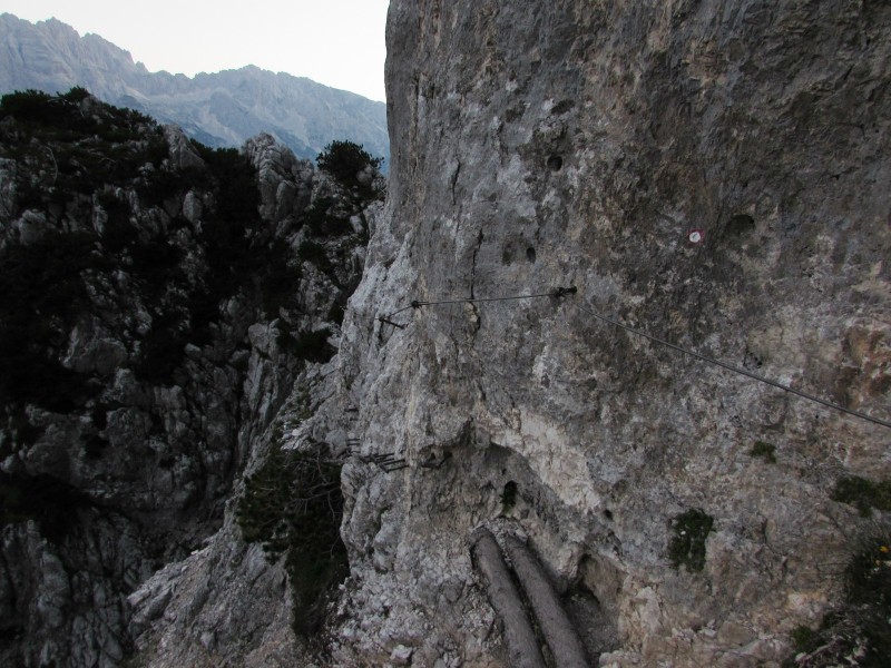
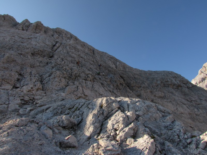
The trail carried me along the steep, green and white-colored walls of the valley. The overall experience consisted of a constant back-and-forth between hiking along ledges and climbing up class 3-to-4 sections of solid rock, aided by the metal cables and pegs.
A quick look back along the trail.
One part in particular was a full-on via ferrata, and was my first experience with one. I hung onto the metal cable while using my feet to traverse along the metal steps drilled into the rock. Directly below me? Air, followed by a steep scree slope, which led to more air. Far below was the green, forested bottom of the glacier-carved valley.
A look back at the via ferrata section.
After the via ferrata, I made my way up another aided climb. At this point, light began to shine on the summits of Triglav and the other surrounding high peaks. The Sun's morning rays glowed on the light granite surrounding the valley, making for some incredible sunrise colors. A small panoramic shot of the view across the valley can be found here.
Looking back down a steeper section of the route.
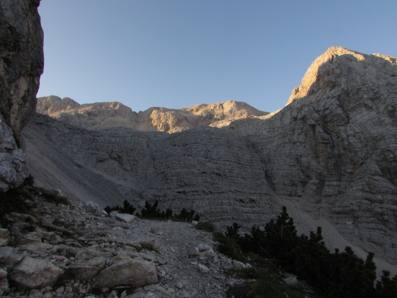
Up, across, up, across. The pattern continued for a bit longer, then the terrain eased a bit. The trail wandered through the uppermost reaches of krummholz before reaching the junction with the Prag route, which I used as my descent path later in the day. The Prag trail is also the most popular choice for climbers ascending Triglav from the Vrata Valley.
Looking down at the Prag trail from a smal clearing.
A somewhat airy section of trail.
Looking back along the trail. It can also be seen winding along the steep terrain in the background.
My first view of the upper terrain after coming around a corner. Triglav's summit is hidden by the point on the right.
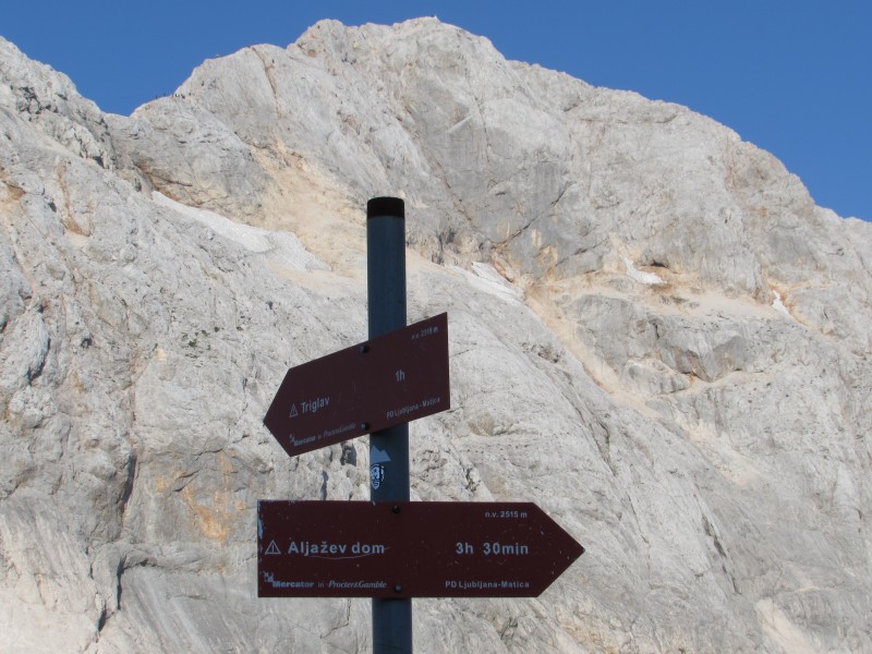
This was the halfway point. The junction sign indicated 2.5 hours up to Triglav's summit and 2.5 hours down to Aljaev Dom. After a short break, I continued up the trail, which now followed a steeper, slippery dirt and scree slope. The slippery slope was over before I knew it, and I turned right at the next junction. Turning left at this junction takes hikers to another hut - Dom Valentina Stanica - situated high on a saddle between two other mountains.
Starting up the scree trail toward the high plateau.
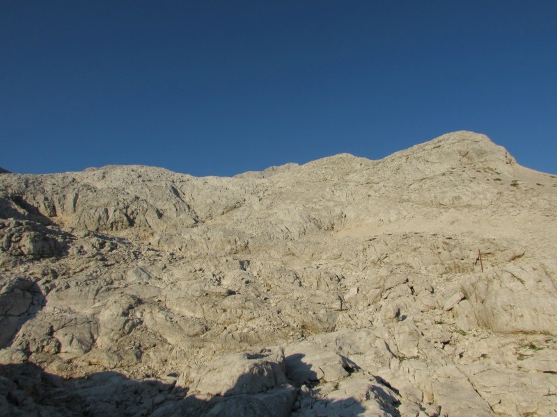
I turned to the right to continue making my way toward the summit of Triglav. The area resembled a moonscape. Large boulders and rocky platforms formed the landscape of the bowl. Parallel gash marks covered most of the rocky areas - certainly the work of glaciers. As I made my way through the bowl, I hopped over the glacier-carved shallow cracks in the rocks. I also passed by a few holes in the ground, most likely also created by glaciers during the last ice age.
Beginning to cross the high plateau. The terrain was much less steep, but much more rocky. Triglav's summit pokes up in t
Typical terrain on the plateau.
I reached a nice spot to stop, sit down, and take a break before continuing toward Triglavski Dom. For a snack, I ate some of the "biskvits" I bought at a Slovenian supermarket chain called Mercator. The biskvits were layered with a soft dough on top, a layer of chocolate on the bottom, and orange filling. They were quite good!
Still in complete awe of the surrounding landscape, I continued my way up the route. I soon reached the only area of climbing in the bowl, and waited for a family to finish descending the secured scrambling route before making my way up.
A look back - the route comes up from the lower left of the photo.
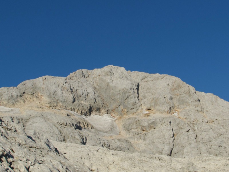
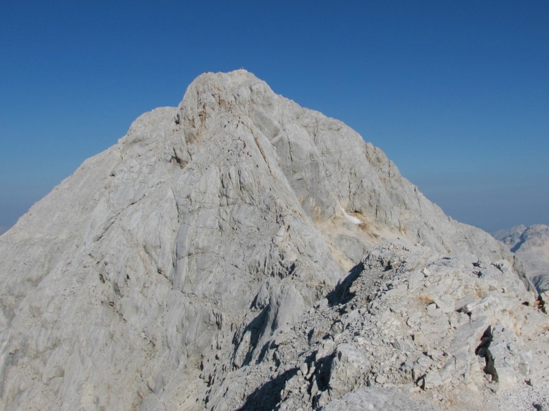
The summit of Triglav seen from the high plateau area.
The next objective: up and across this wall.
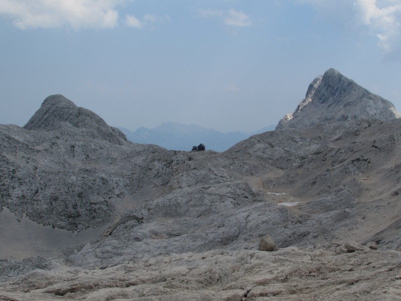
A quick walk along the trail after the bowl's scrambling section brought me around a corner and directly to Triglavski Dom. The hut is huge, resembling a real hotel sitting well above treeline, not far from sheer cliffs. On site are two helipads, a small chapel - which doubles as a shrine for world peace - and another small building, whose purpose I wasn't able to figure out. I took a picture of the hut and the surrounding area and continued on my way. The final and most fun part of the climb loomed ahead, and I was anxious to be on it! The red signs at the hut told me to expect approximately an hour more of climbing to get to the summit.
Triglavski Dom.
One hour? Is this country full of ultra marathoners?
A very brief descent, followed by a short ascent, brought me to the base of the first secured climbing section. Just before this spot, I came across two mountain goats native to the area. They are called Ibex in this area. Their fur coats aren't as thick as our mountain goats in Colorado; perhaps the Julian Alps are warmer than the Rockies in the winter too. Did I mention I began the hike wearing a t-shirt and was still comfortable - a little warm, actually? I usually get chilly pretty easily while hiking back home.
An Ibex.
After preparing myself for the imminent exposure and nearly non-stop cable-and-peg climbing, I began. The rock resembled that of Longs' homestretch: boot-polished granite, a result of the mountain's popularity. Extra care must be taken to avoid slipping on the footholds. The terrain quickly became airy as I climbed higher up this part of the route, which traversed across a small face on the ridge, then turning right upon reaching the southern ridge crest.
Approaching the start of the cables and pegs. "Zavarovana plezalna pot" means "secured climbing route."
The route crossing an exposed face.
More of the same greeted me around the corner. Fun! I negotiated the next section, carefully passing another climber who beckned me to overtake, and made my way up a slightly steeper section, which led to the more prominent of Triglav's two sub-summits: Mali Triglav. At this point, the view of the uppermost reaches of the mountain opened up completely. Imagine the way the final climbs of Capitol or Eolus come into view upon reaching K2 or the catwalk, respectively. Amazing. There was even a hint of a Grays/Torreys-type of atmosphere, with a small "conga line" having developed ahead, but still nothing like the actual Grays/Torreys conga lines (thankfully).
Climbing up to Mali Triglav.
The view to the summit opened up as I reached the sub-summit of Mali Triglav.
A cable to hang onto guided the way across a catwalk leading to the base of the final ascent. Similar to our catwalk on Eolus, only thinner, the exposure was dramatic but thrilling. After the catwalk section, the route quickly regained its vertical element. Many people were descending now, so progress was slowed as we maneuvered around each other, exchanging friendly greetings such as "dober dan" (good day), "zdravo" (hello), and "hvala" (thanks) when passing.
Making my way across the catwalk.
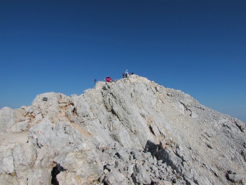
Almost there!
Before I knew it, I was eye-level with the summit, looking at the party that lied ahead. I walked up to the summit, feeling on top of the world. I was on Triglav! The weather was perfect: sunny with a light breeze, and only a little bit chilly on the summit. The sky was hazy, but the views of the surrounding peaks was still spectacular.
The view to the west from the summit.
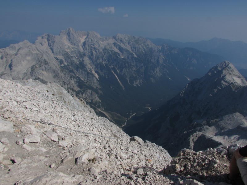
Looking back at the high plateau.
Looking north toward the Vrata Valley from the summit, over 6000 feet below.
I ate my summit snack and went to talk to the "sherpa" for a few minutes. He hauled up cases of Lasko beer, Fanta, and bottled water from Triglavski Dom early in the morning, plus a messenger bag filled with postcards and "diplomas." I bought a diploma for 1 Euro, and he filled it out and stamped it. He told me that the day before, there were two Americans to summit the peak. One from Washington, and another who is practically a Slovenian now; he was from Chicago and has lived in Slovenia for 15 years. I signed the register and set it back. The lady to pick it up next looked at the page and exclaimed "Ooh-sa? (as in USA) Is that you?" "Yeah, that's me!" "Ah! Bravo!" We proceeded to have a nice conversation; she asked me what all I had seen so far, where I was going next, etc.
Here is a shot of the register page I signed. Bohinj is a town from which another route leads up Triglav, and is also where the first ascent of Triglav began in 1778. Maribor is the 2nd largest city in Slovenia (after the capital of Ljubljana). It is located in the northeastern part of the country, surrounded by wine country.
A group of young guys brought a large Slovenian flag on their climb and were posing for pictures with it. They let me have a go as well. Holding the flag for a picture, I was reminded of how a Slovenian president once said - half-jokingly - that all true Slovenians climb Triglav at least once. Well... in that case, I will claim my Slovenian citizenship now, please!
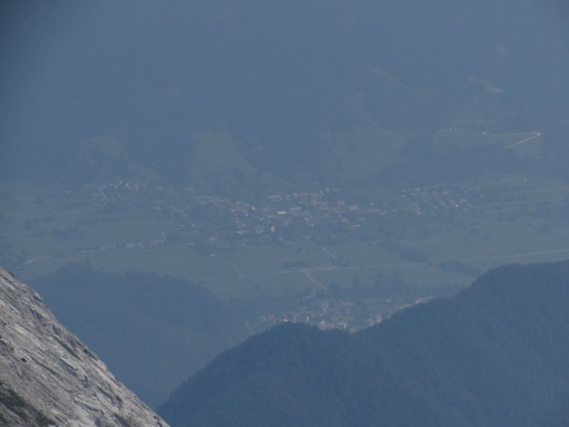
The small town of Dovje from the summit.
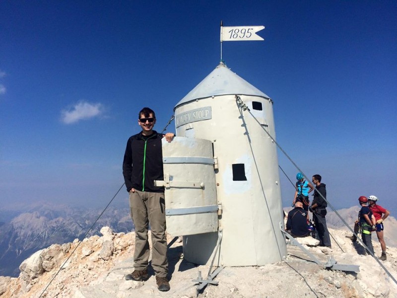
Summit picture with the tower!
I took a couple of panoramic photos on the summit from my phone. Here they are, for your viewing pleasure:
By the time I started my descent, I had spent over an hour on the summit, enjoying the mountain views and people-watching. I made my way back down the secured route leading to the catwalk, allowing climbers on the ascent to pass every so often. I continued back across the catwalk to the top of Mali Triglav, which was also the top of the steep and highly exposed section of route leading back down to the area around Triglavski Dom.
Shortly after starting the descent, I noticed a rock window with a nice view. You can see the view here.
About to start the descent: looking back toward Mali Triglav.
Heading down from the summit, along the cables.
These cables sure seem to lead directly into some sort of abyss.
Repeating the same descent pattern as before, I downclimbed my way through the cables and pegs, stopping every so often to take more pictures. I reached the base of the upper mountain and walked up to Triglavski Dom to take a quick break and examine the hut.
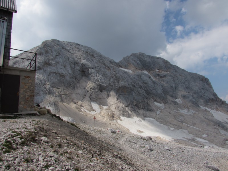
Looking back toward the summit from Triglavski Dom.
After leaving the hut, I began the descent back toward the bowl/plateau area, then down the cables section, then down again and across the shredded rocks. There were a few wildflowers sticking out from the cracks in this area.
Dom Valentina Staniča from below the plateau's scrambling section, but still high above the trail junction.
Some small wildflowers among the white rocks.
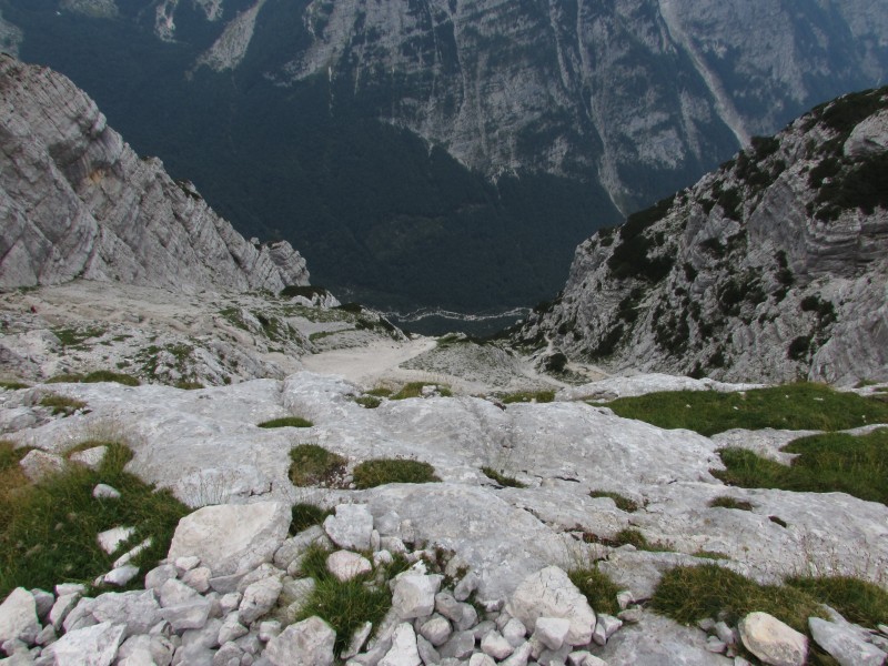
A quick descent on the slippery dirt section brought me back to the trail junction between the Prag and the Tominsek routes. I turned left and started down the trail. It brought me down some switchbacks through the uppermost reaches of krummholz and alpine grasses scattered amongst the rocky terrain. The Prag trail is recommended as the descent route for those who ascended different Vrara Valley routes - such as the Tominsek - due to having less climbing sections and a mellower grade. The most notable feature on the Prag trail is a 15m rock wall to negotiate. Of course, it has been made easier with carved steps, metal pegs, and cables.
Looking down the steep terrain traversed by the Prag route.
Looking up one of the few rocky sections along the Prag route. I thought this was the 15m wall until I reached the real one..
Before starting down the Prag route, I paused to just look at the scenery. I was in a spot where I could see from the summit all the way down to the valley floor. I tried to capture the view with a diagonal panorama (the only way it would fit!), which I suppose turned out okay, all things considered. Here is the photo.
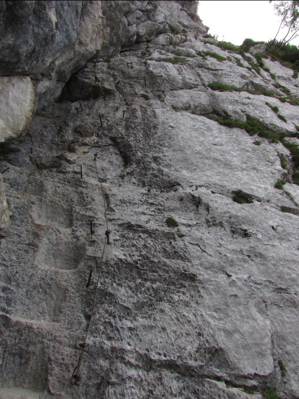
A decent amount of trail, including a couple of rocky sections with metal pegs, brought me to the top of the 15m wall. I turned to face in and began down the wall. Not being a rock climber, it was intimidating to look down and not see exactly where the bottom was (the wall had a curve). I soon stepped down onto level ground at the bottom of the wall, and continued on my way down the trail.
The 15m wall. Exhilarating!
Almost down.
As I made my way down the trail, the north face of Triglav (photo) began to show itself and tower above. The surrounding peaks also stood tall, rising dramatically from the valley floor (photo).
Some parts of the trail could certainly use some CFI work! A few trail sections were terribly eroded, now resembling shallow, slippery dirt and scree gullies. After a while of hiking down the steep trail, around switchbacks, and across steep slopes, I was at the final rocky, pegged section of trail. A few minutes later, I was back on the valley floor, approaching the creek. The area had several grazing cows (photo). I kept comparing the mountain to Capitol, and that part really sealed the deal.
After a brief break at the clear creek (photo), I started the final hike down the mellow trail. It brought me through forested area before reaching the bottom of the Tominsek trail. Around this point, I stopped to appreciate the gigantic, mile-high north face of Triglav. See it for yourself!
The north face of Triglav, from bottom to top.
Shortly after, I arrived back at the parking lot. I drove back down the road, out of the national park, and into Mojstrana. I pulled into the Mercator parking lot to meet Andy, and we were on our way. But first, we made a quick stop at a mountaineering museum on the edge of town, which had an exhibit on the Aljaev stolp on the summit. A little history for those interested:
The Aljaev stolp (Alja Tower) was constructed in 1895 to be a landmark and symbol of Slovenia and it's people, as well as the highest structure in the Slavic world. Throughout the second half of the 19th century and the first half of the 20th century, Triglav was located on the border between various empires controlling the area, including Italy, Austria-Hungary, and Germany. As a result, the Slovenians were highly protective of Triglav and their cultural identity as a whole.
Upon Slovenian independence from Yugoslavia in 1991, the Aljaev stolp and Triglav became truly Slovenian once again. In 1999, the Aljaev stolp was proclaimed as a site of national cultural importance for Slovenia.
One thing I learned about the Aljaev stolp is that it is tradition for first-time climbers of Triglav to bend over, with their head stuck inside the tower, and receive three whips to the bum with a climbing rope. Unfortunately, I didn't partake while I was on the summit (nobody told me!). However, if I am ever back for a second climb (I really would love to go back and try a different route - there are so many!), then I will make up for it then.
Climbing Triglav was an absolutely fantastic experience, and I would recommend it to anybody who would be comfortable on this kind of terrain. All exposed and steep climbing parts of its various popular routes are secured with cables and pegs, making it very accessible. Many people, mostly Slovenians, actually climb the peak as their first big undertaking.
I'll be back to Slovenia, I'll be back to the Julian Alps, and I'm sure I'll be back to Triglav some day. It's an incredible place.
And you can't spell "Slovenia" without LOVE.
Hvala!
~Tony
Thumbnails for uploaded photos (click to open slideshow):
It was a treat to view and read this report. I’ve heard about Slovenia’s natural beauty, but I was still blown away by the pictures and descriptions, and enjoyed learning more about the country. The enthusiasm Slovenians have for their highest peak is admirable. Congrats on reaching the summit of Triglev and thank you for sharing the report.
Also, can you explain the Clan PD column of the summit register?
My pleasure to share! I believe Clan PD refers to the Mountain Association of Slovenia. Members get some steep discounts on accommodation in mountain huts across the Alps, are eligible for insurance, etc.
Tony, thank you for posting this, Triglav is on my bucket list whenever I finally get more time for getting in shape and climb. Especially since I am so close to it. The only bad feeling about the route is that via ferrata is some sort of cheating on the mountain and I was glad that there is nothing like that on lets say Capitol. Anyways, it is beautiful and I am definately keeping it on my list..
Thanks for sharing Tony. I loved that shot you got of the mountain window and the information that you added made for an interesting read. Nice work on the climb and write up.
Some great pics – as the guy mentioned above – on the bucket list!
Caution: The information contained in this report may not be accurate and should not be the only resource used in preparation for your climb. Failure to have the necessary experience, physical conditioning, supplies or equipment can result in injury or death. 14ers.com and the author(s) of this report provide no warranties, either express or implied, that the information provided is accurate or reliable. By using the information provided, you agree to indemnify and hold harmless 14ers.com and the report author(s) with respect to any claims and demands against them, including any attorney fees and expenses. Please read the 14ers.com Safety and Disclaimer pages for more information.
Please respect private property: 14ers.com supports the rights of private landowners to determine how and by whom their land will be used. In Colorado, it is your responsibility to determine if land is private and to obtain the appropriate permission before entering the property.


 The flag of Slovenia.")
 Looking across the Vrata Valley early in the morning.")
 A quick look back along the trail.")
 A look back at the via ferrata section.")
 Looking back down a steeper section of the route.")
 Looking down at the Prag trail from a small clearing.")
 A somewhat airy section of trail.")
 Looking back along the trail. It can also be seen winding along the steep terrain in the background.")
 My first view of the upper terrain after coming around a corner. Triglav's summit is hidden by the point on the right.")
 Starting up the scree trail toward the high plateau.")
 Beginning to cross the high plateau. The terrain was much less steep, but much more rocky. Triglav's summit pokes up in t")
 Typical terrain on the plateau.")
 A look back - the route comes up from the lower left of the photo.")
 The summit of Triglav seen from the high plateau area.")
 The next objective: up and across this wall.")
 Triglavski Dom.")
 One hour? Is this country full of ultra marathoners?")
 An Ibex.")
 Approaching the start of the cables and pegs.")
 The route crossing an exposed face.")
 Climbing up to Mali Triglav.")
 The view to the summit opened up as I reached the sub-summit of Mali Triglav.")
 Making my way across the catwalk.")
 Almost there!")
 The view to the west from the summit.")
 Looking back at the high plateau.")
 Looking north toward the Vrata Valley from the summit, over 6000 feet below.")
 The small town of Dovje from the summit.")
 Summit picture with the tower!")
 About to start the descent: looking back toward Mali Triglav.")
 Heading down from the summit, along the cables.")
 These cables sure seem to lead directly into some sort of abyss.")
 Looking back toward the summit from Triglavski Dom.")
 Dom Valentina Staniča from below the plateau's scrambling section, but still high above the trail junction.")
 Some small wildflowers among the white rocks.")
 Looking down the steep terrain traversed by the Prag route.")
 Looking up one of the few rocky sections along the Prag route. I thought this was the 15m wall until I reached the real one..")
 The 15m wall. Exhilarating!")
 Almost down.")
 The north face of Triglav, from bottom to top.")