Download Agreement, Release, and Acknowledgement of Risk:
You (the person requesting this file download) fully understand mountain climbing ("Activity") involves risks and dangers of serious bodily injury, including permanent disability, paralysis, and death ("Risks") and you fully accept and assume all such risks and all responsibility for losses, costs, and damages you incur as a result of your participation in this Activity.
You acknowledge that information in the file you have chosen to download may not be accurate and may contain errors. You agree to assume all risks when using this information and agree to release and discharge 14ers.com, 14ers Inc. and the author(s) of such information (collectively, the "Released Parties").
You hereby discharge the Released Parties from all damages, actions, claims and liabilities of any nature, specifically including, but not limited to, damages, actions, claims and liabilities arising from or related to the negligence of the Released Parties. You further agree to indemnify, hold harmless and defend 14ers.com, 14ers Inc. and each of the other Released Parties from and against any loss, damage, liability and expense, including costs and attorney fees, incurred by 14ers.com, 14ers Inc. or any of the other Released Parties as a result of you using information provided on the 14ers.com or 14ers Inc. websites.
You have read this agreement, fully understand its terms and intend it to be a complete and unconditional release of all liability to the greatest extent allowed by law and agree that if any portion of this agreement is held to be invalid the balance, notwithstanding, shall continue in full force and effect.
By clicking "OK" you agree to these terms. If you DO NOT agree, click "Cancel"...
Mount of the Holy Cross (14,005')
Notch Mountain (13,237')
Trailhead: Half Moon (Tigiwon)
Distance: 15 miles
Elevation Gain: 5400'
Climbers: emgordon (Elliott) and MtnHub (Doug)
Introduction:
I had just completed a Notch/Halo Ridge/Mt. Holy Cross loop last year, one of my all-time favorite hikes, and wasn't planning to repeat it again this year. But when I was putting together a possible itinerary for this year's vacation, I saw a request for a partner to do the Halo Ridge by another 14ers.com climber. I wrote him saying I'd consider doing it again this summer if he would add Notch Mountain to it for a full loop.
Last year I climbed through the Notch alone and with some lingering ice and snow and I ended up ascending one of the western gullies because the traditional route up the face was too icy for me to attempt. I always wanted to go back there and give it another try under normal summer conditions.
He agreed to add Notch Mountain as well, so we made plans to do it on the first of August.
The Climb:
This loop puts you at a lightning risk for several hours since you are very exposed above 13,000' for half of the climb, so a perfect weather day is essential. We both wanted an early start to help assure this, so we planned to be on the trail by 0330.
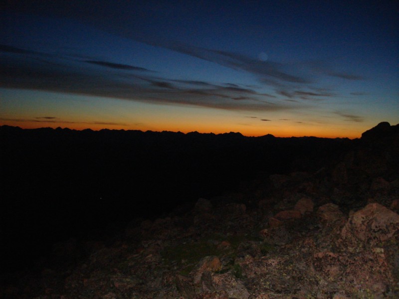
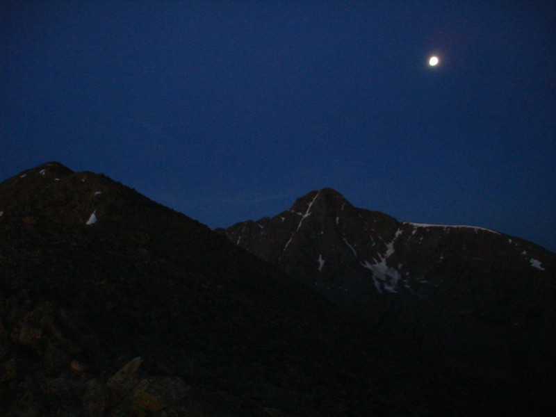
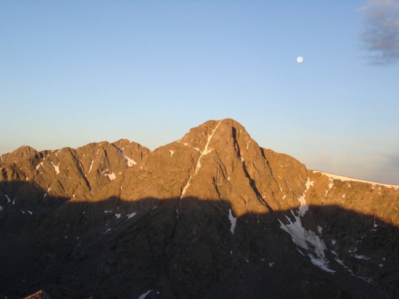
The sky was clear when we started and the full moon (a blue moon) was shining brightly. When we got above the trees at Half Moon Pass, the sky was just beginning to glow with pre-dawn light. I stopped to take a picture of the eastern horizon. Pre-dawn in the eastern sky -- from Halfmoon Pass.
(After I arrived back home and organized my pictures from my trip, I noticed something very puzzling. In the image above, there can be seen a faint outline of what appears to be the moon. I don't remember seeing this when I took the shot and it couldn't be the Earth's moon since it would be setting in the western skies at this time of day, as evidenced in the next shot. After posting the puzzle on the site, a couple of excellent photographers provided an explanation. It's most likely an orb from having the flash on when I took the image. Thanks to the knowledgeable mountaineers in our midst for clearing this up for me!) The blue moon setting over Holy Cross.
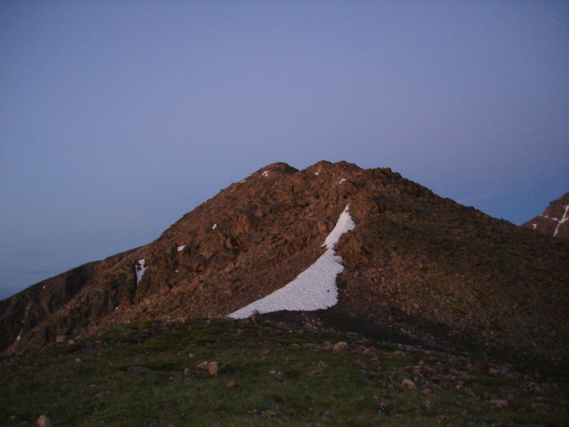
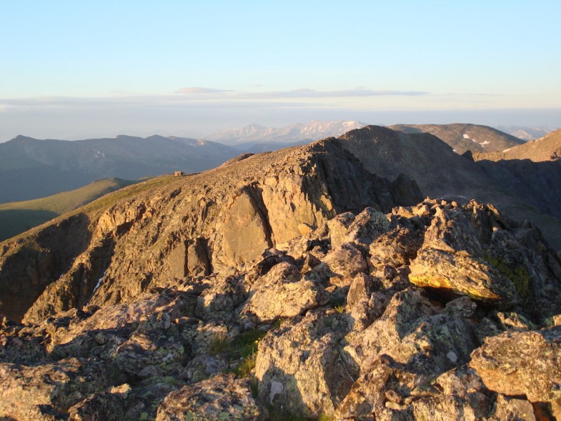
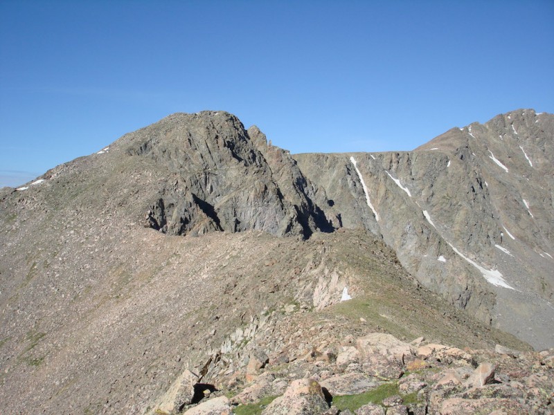
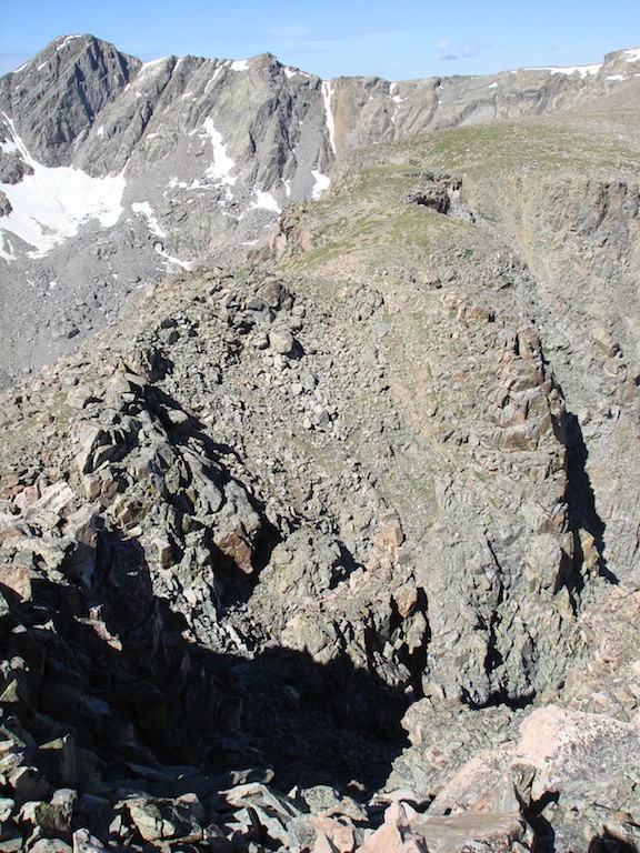
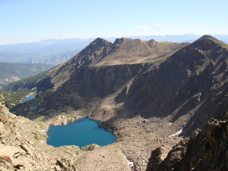
Since I have been here several times before, I took the lead when we got to the branch trail to Notch Mountain. Especially in the dark, it is fairly faint and difficult to see. After a short jaunt through the pines, it comes upon a boulder field. At this point you climb up the talus aiming for the ridge. Then it's just a simple matter of following the long ridge to the Notch summit. The Notch Mountain ridge. (Holy Cross can be seen at the far right margin.)
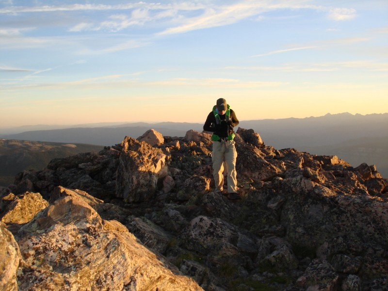
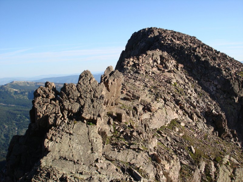
The ridge is a very long boulder/rock hop with only scattered remnants of a trail in a few places so it can be rather exhausting. We reach the summit just after 0600. The view across the valley of Mt. Holy Cross illuminated by the early sunlight is hard to beat! Elliott coming up to the Notch Mountain summit.
Mt. of the Holy Cross at dawn.
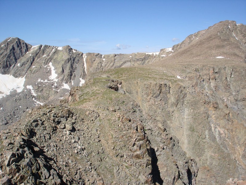
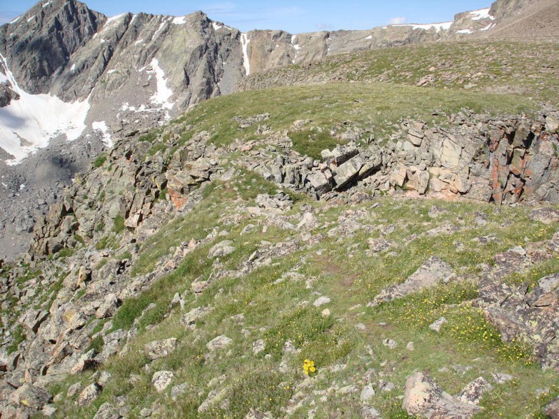
From the summit we can see across the huge notch in the mountain to the stone hut on the saddle on the other side. Crossing this is where I appreciate having another person along. Other people have reported it involving only C3 climbing and I'm curious to see how difficult this really is. Looking across the Notch (hut on the left).
We climb down the more gradual northern side of the Notch all the while closely studying the opposing rock face. Looking back across the Notch from the face.
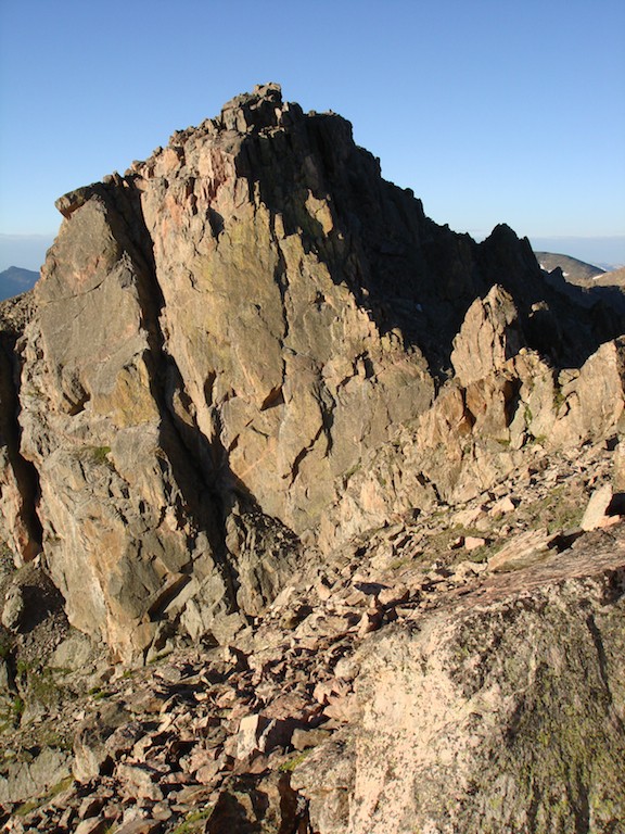
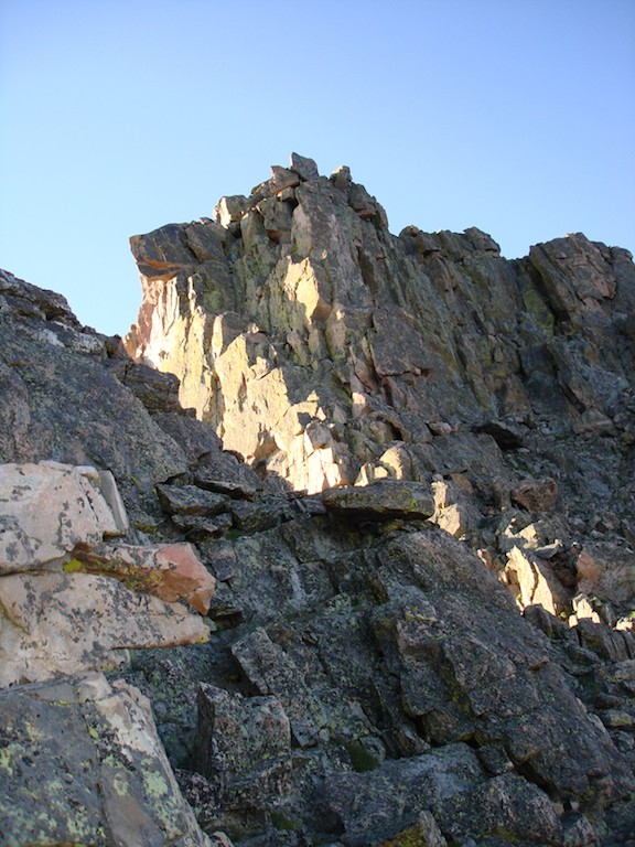
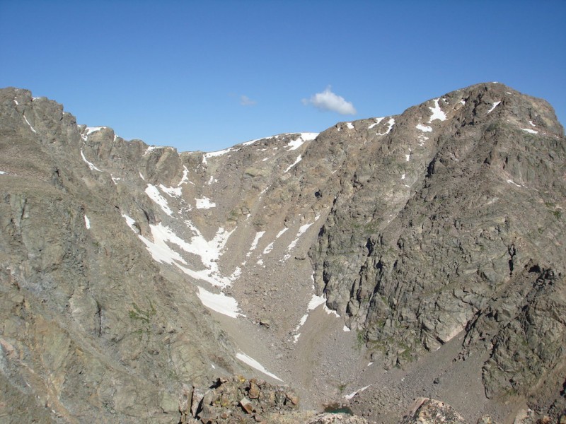
The route is supposed to follow the huge, blocky steps in the face right at the edge where it falls into shadow. Across the Notch -- the face we're planning to climb.
It looks pretty straightforward at least until it reaches a protruding rock overhang which we call the Horse Head. Then, from where we are at any rate, it is difficult to tell whether it has an exit to the top. A closer look at the Notch face.
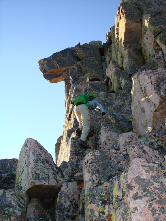
I let Elliott take the lead and he climbs up the steps without much difficulty. I follow him and am very pleased with the rock. Although the edge is quite exposed, the rock is solid and has good holds. Elliott climbing up to the "Horse Head" rock.
... almost to the Horse Head.
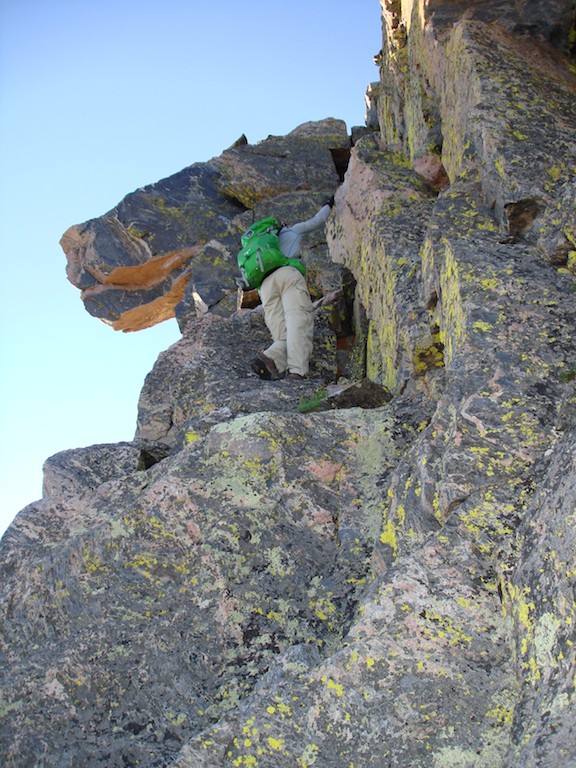
When he reaches the base of the Horse Head, there is a narrow crack that needs to be climbed. It is quite steep and sheer for the most part. Elliott has a little trouble at first but eventually makes it up to a shallow cavity. I make a couple of attempts but can't quite flex my knee enough to reach a foothold. I still have some stiffness because of arthritis.
When Elliott offers his hand to grasp, it is just enough to pull me up and over the narrow ledge. Climbing to the top is then very doable. Maybe I still don't recognize the difference between C3 and C4 moves, but I cannot think that the moves we did under the Horse Head was anything less than C4, and maybe even low C5. If we had to downclimb this section it would have been extremely difficult if not impossible without a rope.
We boulder-hop down the last slope to the stone hut to take a longer break. Elliott then tells me his ankle is giving him a little trouble and he doesn't think it would be wise to continue on the Halo Ridge. Since we've only come about a third of the way, this is probably a smart thing to do. He returns to the parking lot by the easy trail down the eastern side of Notch Mountain to the Fall Creek Trail.
I plan to continue finishing the entire loop however. I spot other hikers ahead of me so at least I will have some company if I get into any kind of trouble.
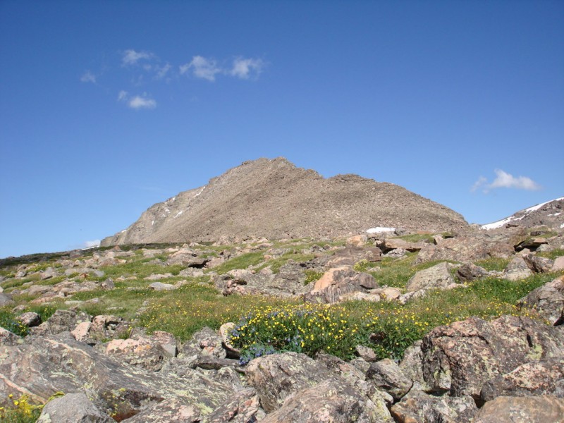
The Halo Ridge is one of my favorite places on earth and I relish the views on either side. They have become very familiar to me by now but it's not something I will ever get tired of. I could repeat this loop every year!
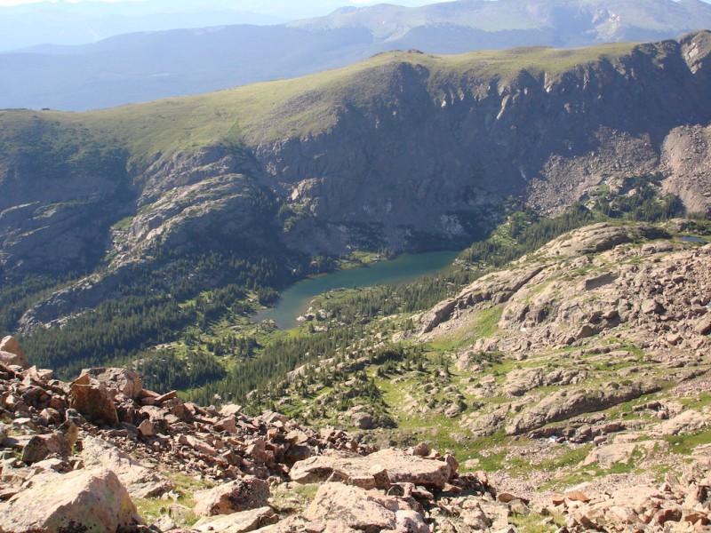
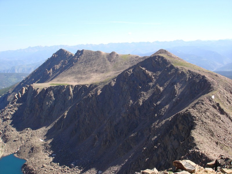
I continue along the high ridge following the crest, even to Pt.12,831. Lake Constantine -- what a beautiful setting!
The Halo Ridge from Pt. 13,248'
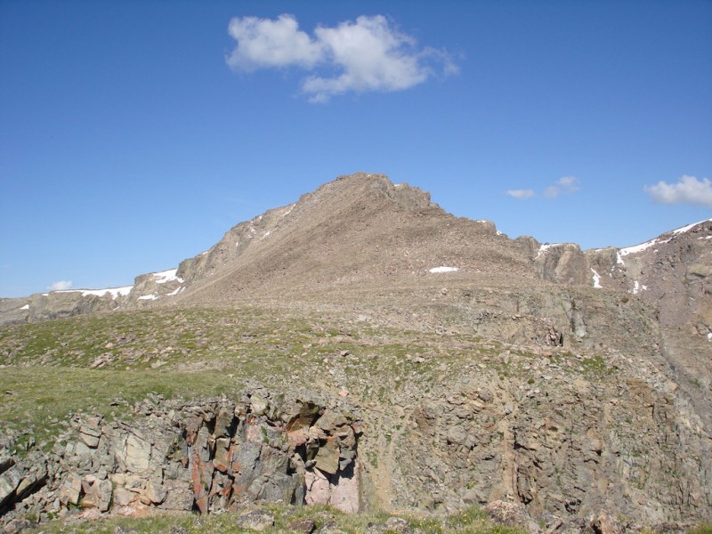
Looking back from midway on the Halo Ridge: Notch Mt, the hut, and Pt 13,248'
Holy Cross Ridge
Mt. Holy Cross from Halo Ridge.
The catwalk along Halo Ridge.
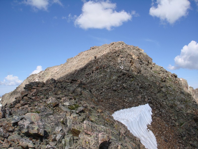
Pt. 13,831'
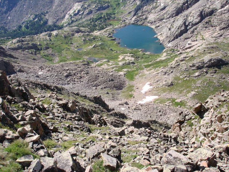
Lower Tuhare Lake
Bowl of Tears
Pt. 13,831'
Mt. Holy Cross from the saddle of Pt. 13,831'
Since it is a Saturday, the Holy Cross summit is a busy place. When I finally reach the top, I eat something quickly but don't linger.
The descent is long but I savor every moment. I love this place!
Thumbnails for uploaded photos (click to open slideshow):
I was wondering if you guys did it that day. I looked over to see if I could see anyone coming up Halo but I was on top of HCR very early. That was a beautiful day. Glad you had a good repeat!
Though none of the shots of me are very flattering! It was fun hiking with you and I did not regret going down having to pass through so many meadows in full bloom.
@ Jon – Yeah, I LOVE this loop! I could probably do it every year and not get bored with it. Nice job in the Crestones too! You had some really excellent shots of the Needle and Peak.
@ emgordon – I don’t know, I think the ones of you going up to the Head were pretty good! You got me through the tough spot anyway. Thanks! Glad you got back safely!
My twins and I did this route earlier this summer and loved it. Despite the long hike and boulder hopping that turned some off to this route, we thought it was fantastic; especially the notch. Rather than climbing to the horse head as you did, we continued around to the right and climbed a chimney that was class 3 (much more our speed). Thanks for the great pictures, particularly that of the Bowl of Tears. Timing/sun angle/my camera didn’t do it the justice you did in image 22. Great work!
@ sunny1: Yeah, one of my favorite places! It never gets old, and I already have another person interested in doing it next year! Ha! Twist my arm!
@ glenmiz: Thanks! Would be interested in the chimney you found to climb up. Don’t think I’m wanting to climb up the Head again. Was it just in one of the loose gullies going up from the west side?
Caution: The information contained in this report may not be accurate and should not be the only resource used in preparation for your climb. Failure to have the necessary experience, physical conditioning, supplies or equipment can result in injury or death. 14ers.com and the author(s) of this report provide no warranties, either express or implied, that the information provided is accurate or reliable. By using the information provided, you agree to indemnify and hold harmless 14ers.com and the report author(s) with respect to any claims and demands against them, including any attorney fees and expenses. Please read the 14ers.com Safety and Disclaimer pages for more information.
Please respect private property: 14ers.com supports the rights of private landowners to determine how and by whom their land will be used. In Colorado, it is your responsibility to determine if land is private and to obtain the appropriate permission before entering the property.
")