| Report Type | Full |
| Peak(s) |
Apache Peak - 13,450 feet Navajo Peak - 13,419 feet "Dicker`s Peck" - 13,177 feet |
| Date Posted | 08/16/2015 |
| Modified | 08/17/2015 |
| Date Climbed | 08/01/2015 |
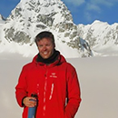
| Author | speth |
| Additional Members | lajohn, Mountain Trash |
| Lake Isabelle 13er Trifecta |
|---|
|
I've probably climbed in the Brainard Lake area of the Indian Peaks Wilderness more than anywhere else in Colorado. Shoshoni Peak was the first mountain I summited, in 2010, and I've been lured back to the basin, and the entrance fee from American Land and Leisure, more times than I can or care to tally. When I was first cutting my teeth with the mountaineering game, I spent a lot of time researching the Indian Peaks. After climbing a few peaks and looking into more mountains in the area, the name "Dicker's Peck" kept appearing. Apart from being a really funny name for a peak, I mostly ignored it on account of Dicking Around being a class 5 climb that I was woefully unprepared to attempt. Fast forward five years, and Ol' Tricky Dickey came back on the radar. A few of us had had a conversation earlier in the summer about attempting the Kasparov Traverse from Shoshoni to Apache, and the thought came around to possibly having a grand slam on the basin with a large daytrip of Shoshoni to Apache, to Dickers Peck, to Navajo and down. The early and impressive monsoon and El Niño weather washed those plans away, but the thought of hitting all three 13ers looming above Lake Isabelle lingered. And so we went. Adam and I met up with John in the parking lot of the Boulder Safeway shortly after 5:00am on a Saturday. We made our way to Ward, paid the fee at the entrance station (with the lady at the gate noting, "There've been people getting in and walking around since 4:30, y'all are some dedicated mother****ers!") and snagged the last spot in the Long Lake parking lot at 6:15. The parking situation in the area is a bigger hassle now than it's been in the past - they used to tolerate parking on the sides of the roads, but now if you're not there before sun-up, you get an extra mile walk from the overflow at Brainard. We high-fived at our good luck, divvied up the gear (this meant Adam lugging up a trad rack, and John and I trading off with a beefcake rope and other random flotsam and jetsam), and we were on he trail at 6:45. The first few miles went quickly, and we made good conversation and couldn't help but whistling this Hall and Oates music that had been playing in the car on the drive up. We got up to Lake Isabelle and it was almost dry - I looked this up after-the-fact and apparently they drain the lake annually; first time I've ever witnessed it. We stopped at the glacier lake and had a snack, and noted that there were a lot of people heading up Queen's Way for Apache. I'm still baffled that there was decent couloir climbing still available on the first day of August, but I suppose it's a testament to the incredible amount of late season snow we received.  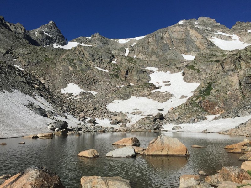 We turned north and stayed with the trail that goes to the base of Isabelle Glacier. This was a situation where you had to pick your poison; the standard trail throws you way out of the way and requires more boulder hopping on the tundra, but a direct approach sends you straight up a choss-fest for several hundred feet. With extra gear on our backs and the sun beating down, I think the easier path was the one of least resistance. After traversing under Queen's Way and Apache Couloir, we started to pick our way up through the ledges and towards the summit. In this area, you begin to spot some of the wreckage from Airplane Gully that's been avalanched down over the past 70 years. At this point, we started to slow down quite a bit in the hot sun, the crumbling terrain and the occasional stream coming down from Navajo Snowfield. I had climbed this route before, and it's monotonous and crumbling for the duration. The ledges cut at the mountain at an angle where it's impossible to see the summit, and you gauge your progress on the height of the surrounding hills. 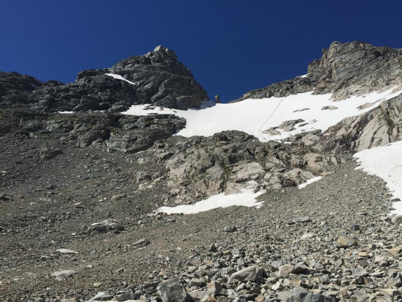 Eventually we topped out at the saddle between Apache and it's southern sub-summit and made quick work to the top. We were greeted with awesome views of Longs, Lone Eagle, Lake Grandby and the Flat Tops, and down into the Gores, Sawatch and other various Front Range peaks. Kasparov is wholly visible from the Apache summit, but it's not a great vantage point because of the overlapping rockbands that make the towers and pinnacles difficult to differentiate. We traded summit pictures with another team that had climbed up Queen's Way and headed south to the Apache-Navajo saddle to meet up with Richie. 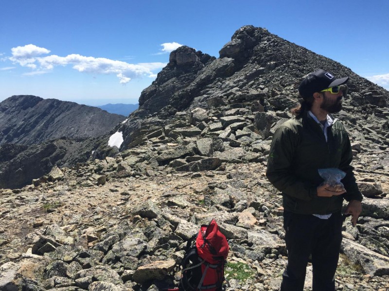 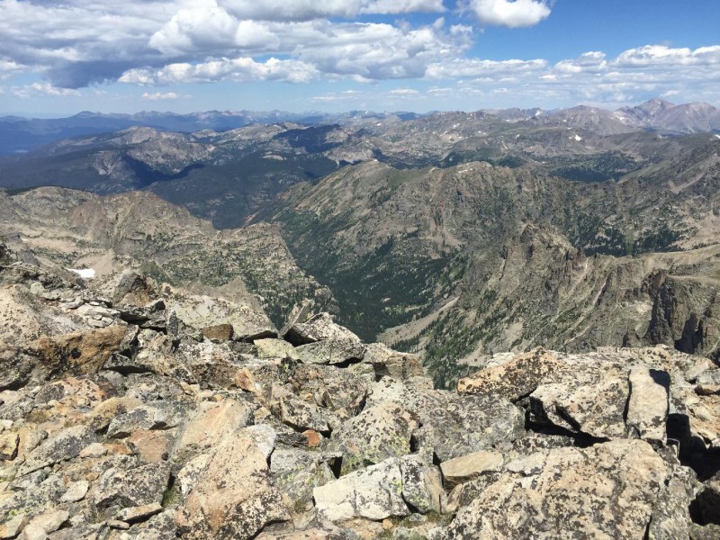 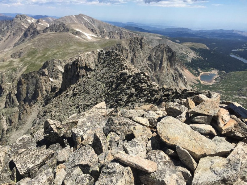 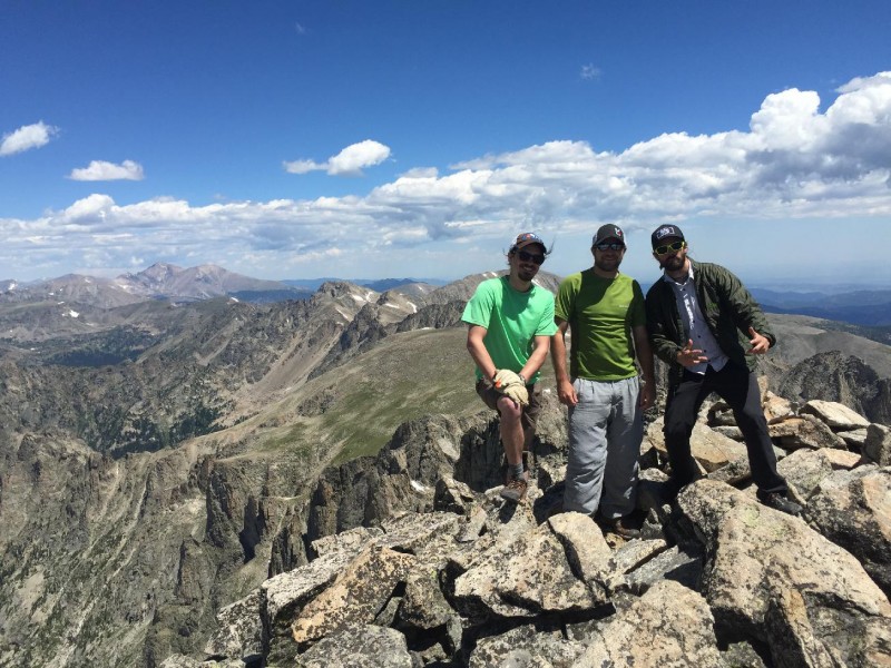 Dropping down several hundred feet, we set up camp, harnessed up and flaked the rope on the northwestern edge of the platform. Dicking Around goes at 5.5 for 70 or 80 feet, with an upclimb, right traverse to the south and finishing with a climb up an exposed and airy corner with a lot of nothing separating the top of the Peck from the bottom of Wheeler Basin. I belayed Adam up the pinnacle while John grabbed a bite to eat and a few photos. 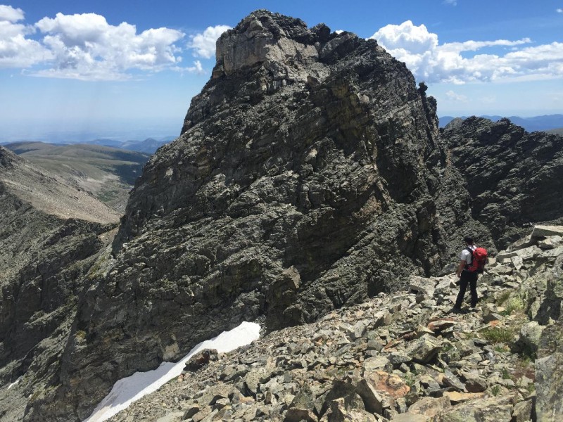 The wind started to pick up and the clouds moved in quickly, and I had to lock the belay and throw on a jacket and gloves to stay warm. John layered up and stuffed his hands in his pockets to get rid of chilly fingers. Adam set a #3 and #4 Camalot and a handful of stoppers as backup and was up and set in a short amount of time. I dropped off to get a few photos and a bite to eat as well, and John seconded up the route in just a few minutes. Adam tossed the roped and I followed up, cleaning as I went. 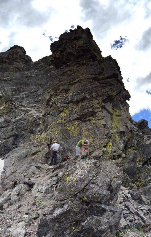 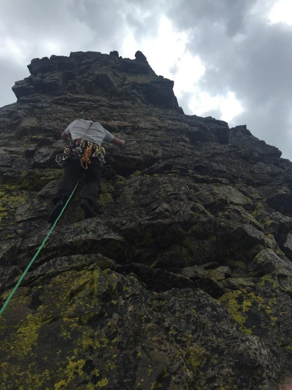 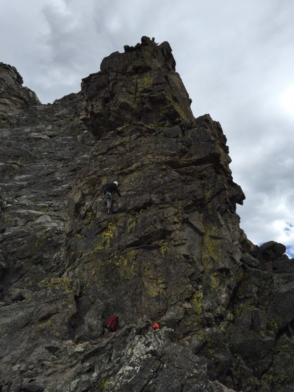 As soon as I was off the ground and starting the right traverse, several marmots appeared from their accursed lairs to descend on our defenseless packs stashed at the bottom of the climb. Adam and John both started yelling loudly and threw some water over my head and down on the weaselly intruders, and they eventually scampered off. I topped out, now out of the wind tunnel and overheated from the additional layers and the sun's breakout from the cloud cover. Adam and John were locked off into a mess of tat, 2 pitons and a permanently wedged nut. I added an additional piece of webbing onto the pitons and stopper, and donated a beefy Omega Pacific ring to the weathered and skinny ones already around. After setting up the rap and getting a quick group photo, I swung out and over a lip and made my way to the ground. 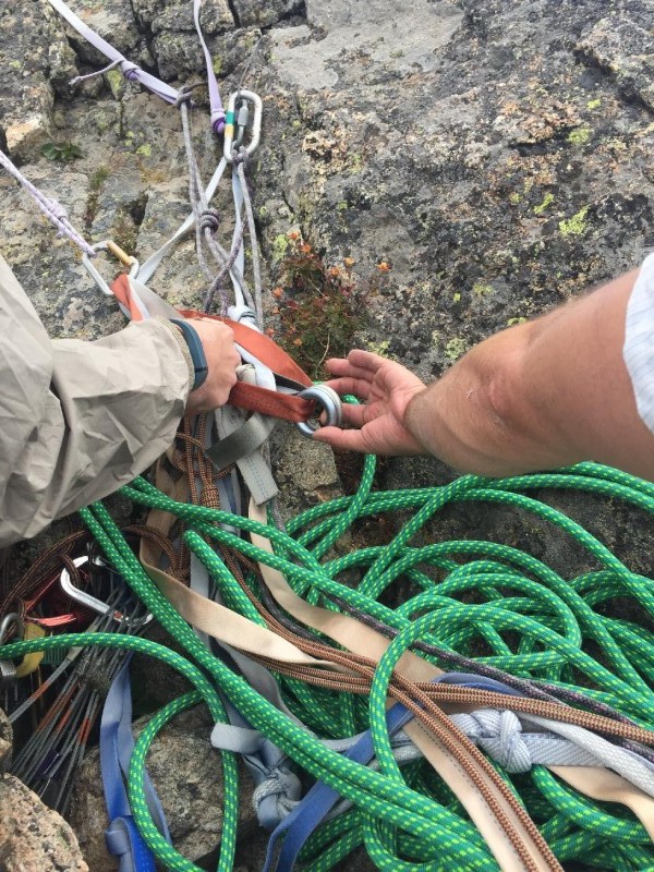 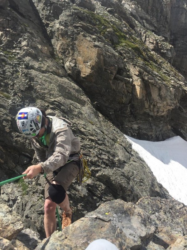 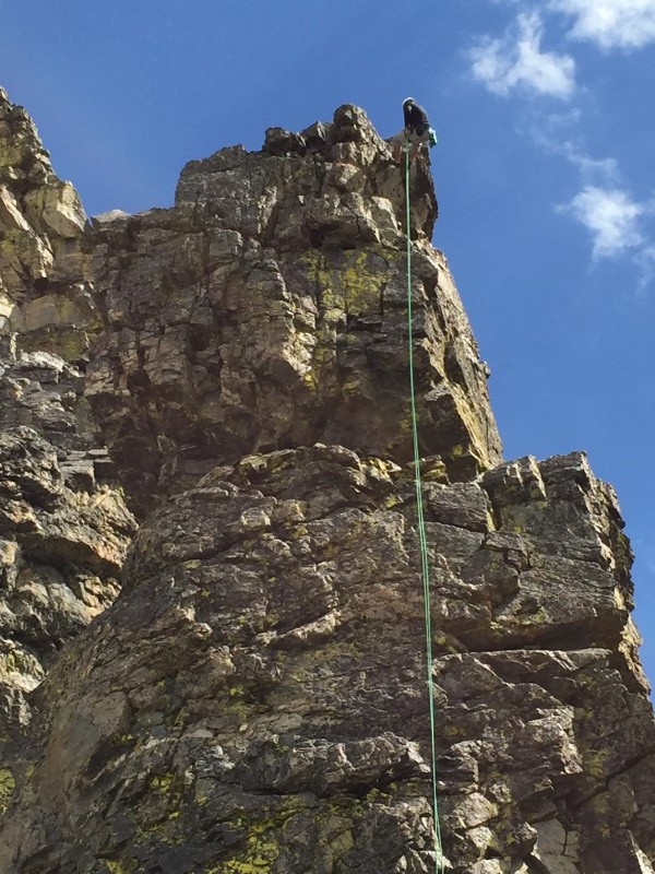 John came down after and Adam finished out. The very top of the route has an overhang that turns the rappel into a free-hang for 20 feet, and Adam caught a few knuckles coming over. He made it down safe, bandaged up his fingers and we were set. The rope jammed a bit on the pull, but we freed it up in less than a minute and were on our way. We traversed around the north side of Ricardo and turned right up a ramp for a few hundred feet. The ramp ended at the top of a steep gully going down into Wheeler, and we U-turned left and entered a steep chimney towards Navajo's summit. We scrambled up quickly and exited the chimney, leaving 50 feet of more climbing between us and the top. Adam chose a slabby, direct climb to the top, John went up a ridge far off to the right, and I split the difference on a fun off-width chimney in the middle. 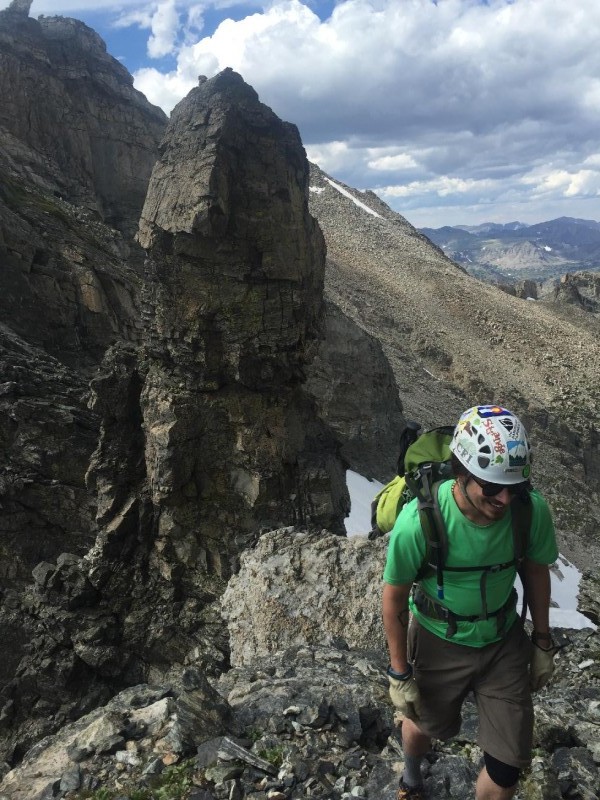 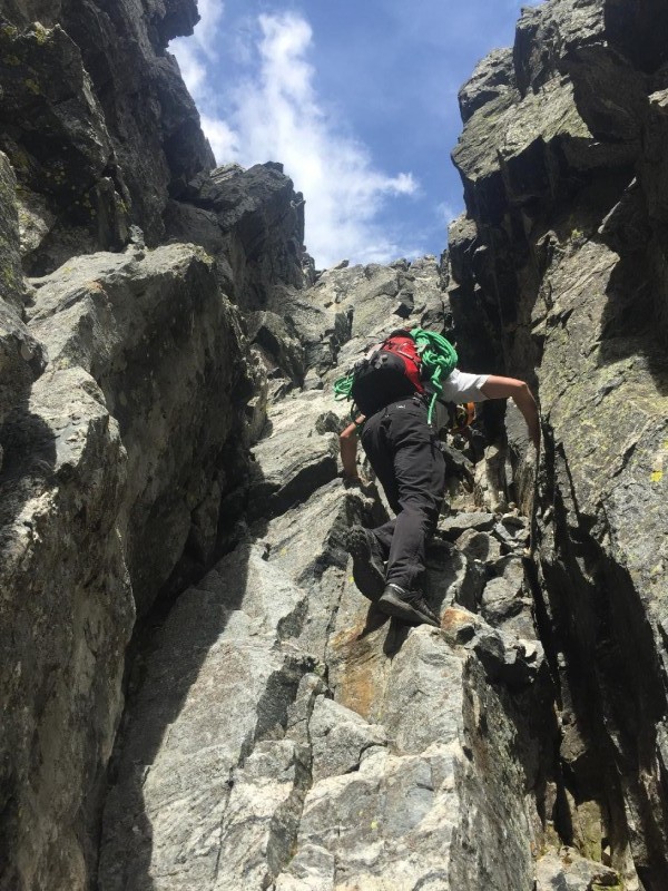  Five minutes later, and we were all on the top, whooping and high-fiving and enjoying the summit and the basin with no one around. We took in the views of the cities below, the backside of Green Mountain and the plains, and the forbidden fruit of Kiowa, Arikaree and Albion within the North Boulder Creek watershed. This was my third summit of both Apache and Navajo, and I can say I've finally climbed all three 13ers around Lake Isabelle.  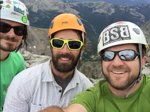 I sent a quick message to Apple letting her know we were on the summit and heading down, and then we bailed off the east ridge, down through a chimney, and down towards the top of Airplane Gully. I remembered this being tricky to spot, and the proper exit is the second gully, not the first. 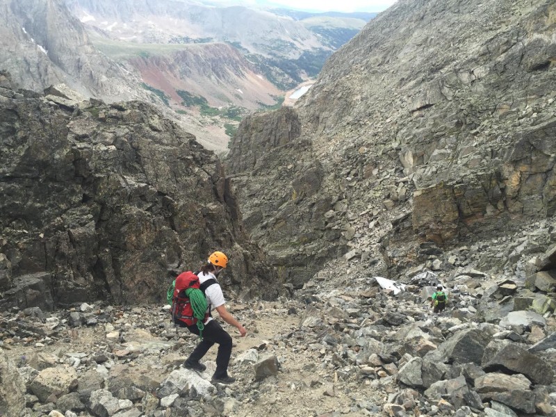 We headed down through the mild talus and stumbled upon the bulk of the plane's fuselage in just a few minutes. There were also other random pieces of engine, wing and hydraulic parts around. It's still amazing to me that a lot of the metal is in "good" condition after being out in the weather for so long. We were in a somber mood and tread lightly and quickly. 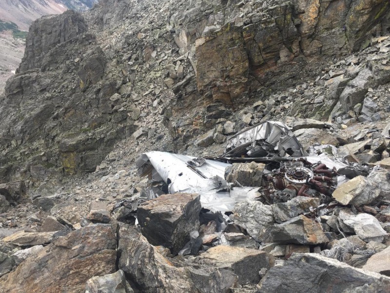 The remainder of the way down the gully and down to the glacier lake was a knee-buster, and we stayed quiet and focused for a majority of the way back to the trail-proper. We had to stop several times to empty the rocks out of our shoes. The mood lightened when we got back to the trail, and we knew it was just a matter of time and pounding out the remaining miles on solid earth until we made it back to the car. After a short drive back to Boulder, we wrapped up the day with a beer and enormous burgers at Southern Sun. 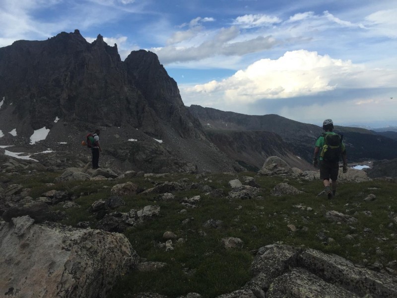 This was an excellent day out and a solid first alpine climb for Adam, John and I. I'm looking forward to spending more money here for parking. Thumbnails for uploaded photos (click to open slideshow):
|
| Comments or Questions | ||||||||||||||||||||||||
|---|---|---|---|---|---|---|---|---|---|---|---|---|---|---|---|---|---|---|---|---|---|---|---|---|
|
Caution: The information contained in this report may not be accurate and should not be the only resource used in preparation for your climb. Failure to have the necessary experience, physical conditioning, supplies or equipment can result in injury or death. 14ers.com and the author(s) of this report provide no warranties, either express or implied, that the information provided is accurate or reliable. By using the information provided, you agree to indemnify and hold harmless 14ers.com and the report author(s) with respect to any claims and demands against them, including any attorney fees and expenses. Please read the 14ers.com Safety and Disclaimer pages for more information.
Please respect private property: 14ers.com supports the rights of private landowners to determine how and by whom their land will be used. In Colorado, it is your responsibility to determine if land is private and to obtain the appropriate permission before entering the property.