Download Agreement, Release, and Acknowledgement of Risk:
You (the person requesting this file download) fully understand mountain climbing ("Activity") involves risks and dangers of serious bodily injury, including permanent disability, paralysis, and death ("Risks") and you fully accept and assume all such risks and all responsibility for losses, costs, and damages you incur as a result of your participation in this Activity.
You acknowledge that information in the file you have chosen to download may not be accurate and may contain errors. You agree to assume all risks when using this information and agree to release and discharge 14ers.com, 14ers Inc. and the author(s) of such information (collectively, the "Released Parties").
You hereby discharge the Released Parties from all damages, actions, claims and liabilities of any nature, specifically including, but not limited to, damages, actions, claims and liabilities arising from or related to the negligence of the Released Parties. You further agree to indemnify, hold harmless and defend 14ers.com, 14ers Inc. and each of the other Released Parties from and against any loss, damage, liability and expense, including costs and attorney fees, incurred by 14ers.com, 14ers Inc. or any of the other Released Parties as a result of you using information provided on the 14ers.com or 14ers Inc. websites.
You have read this agreement, fully understand its terms and intend it to be a complete and unconditional release of all liability to the greatest extent allowed by law and agree that if any portion of this agreement is held to be invalid the balance, notwithstanding, shall continue in full force and effect.
By clicking "OK" you agree to these terms. If you DO NOT agree, click "Cancel"...
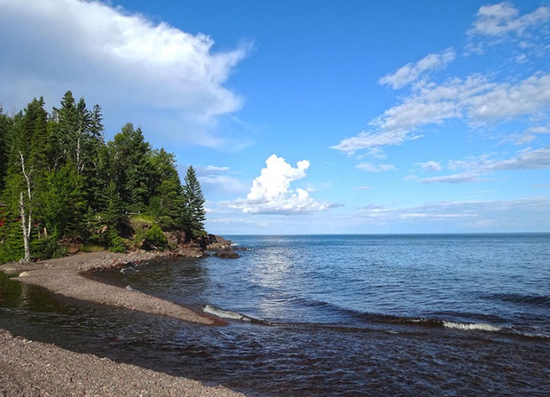
Chasing after these state highpoints has been more than I would have imagined. It has taken my wife and me to places that we would most likely never have come to see. Driving around Lake Superior is one such place. Wow...it has been really beautiful.
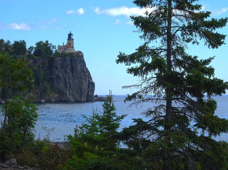
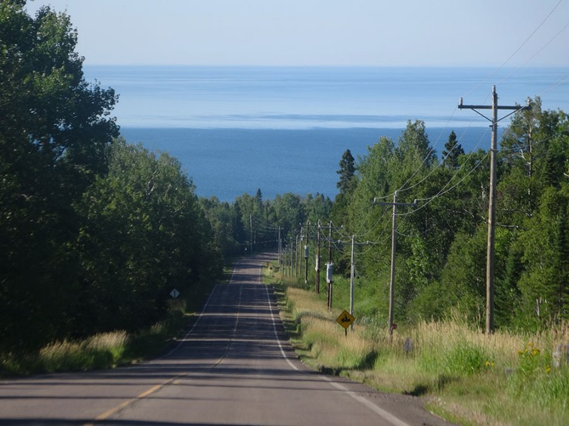
Going for the Minnesota state highpoint took us up the northern shore of Lake Superior past Split Rock lighthouse. This whole trip that has taken us along Lake Michigan, Lake Huron, and Lake Superior has seemed more like we've been traveling along the shores of an ocean, instead of inland lakes!
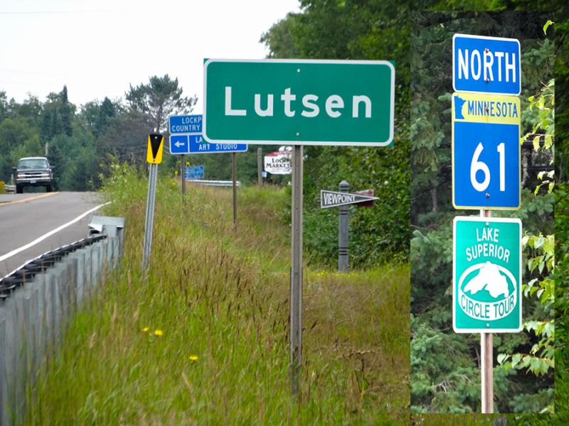
Our drive to the Minnesota state highpoint took us up state Hwy 61 from Duluth, MN to Lutsen, MN which is about 90 miles north of Duluth.
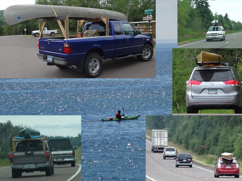
It appears that the recreation of choice up here is canoeing and kayaking. We saw the watercrafts in roof racks like we see snow skis and snowboards back home in Colorado!
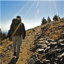
I had read on SummitPoint that this state highpoint involves a 3 � mile hike to the summit. That was going to be a 7 mile round trip. Therefore, it wouldn't make sense for me to leave my wife in the car at the trailhead on this one. We found a hotel room at The Mountain Inn, which is up close to the Lutsen Ski area. My plan was to start hiking the next morning at first light so I could make it back in time for the breakfast that was included with the room rate.
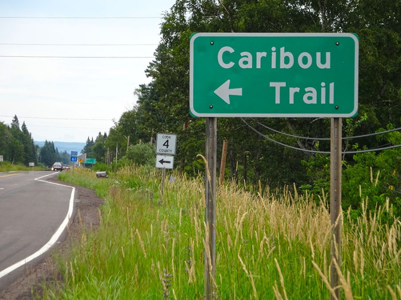
The evening before my climb, we drove through Lutsen, (which had only about 6 buildings along Hwy 61) to find the road which I was to drive in tomorrows' early morning dark. The road is Cook County Road 4, (also known as the Caribou Trail) and is only about a mile beyond Lutsen.
Just after the left turn (north) on County Rd 4, it was nice to see a sign listing Eagle Mountain. It said it was 21 miles away.
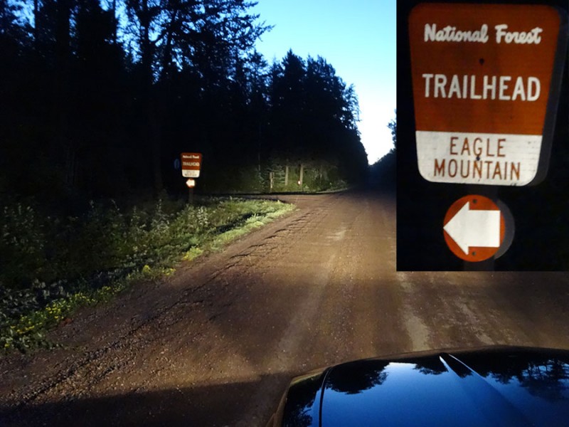
The next morning, I was on my way driving about 4:45am in the dark. I had read that it was 18 miles up to the "T" in the road where I was to turn right (east) on Forest Road 170. As it turned out, it was only 17.1 miles to this turn. The road was marked as Forest Road 170, but there was also a street sign, and the name of this road is called THE GRADE.
The sign showed that the trailhead to Eagle Mountain was 4 miles. That turned out to be correct which ended up making it 21 miles from my turn off of Hwy 61 onto the Caribou Trail. The trailhead was well marked. It's a left turn (north) into the parking lot.
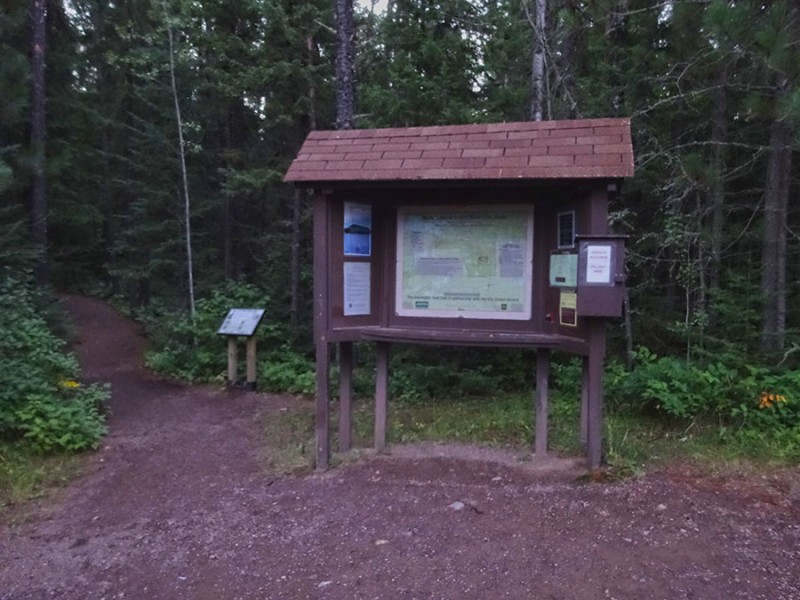
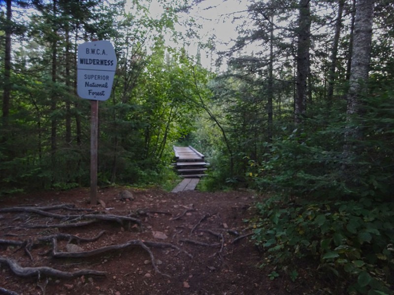
It was a moonless night, and that forest was dark. So I took my time getting my pack together and allowed for a little more skylight to appear. The trailhead is well marked with this kiosk. And since the trail takes you into a wilderness area, there is a sign-in box. I was on my way hiking at 5:40am.
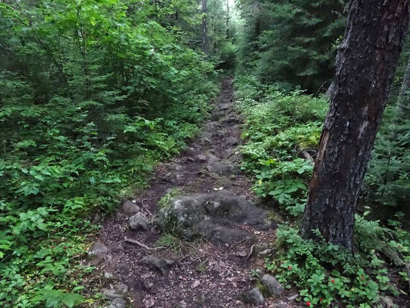
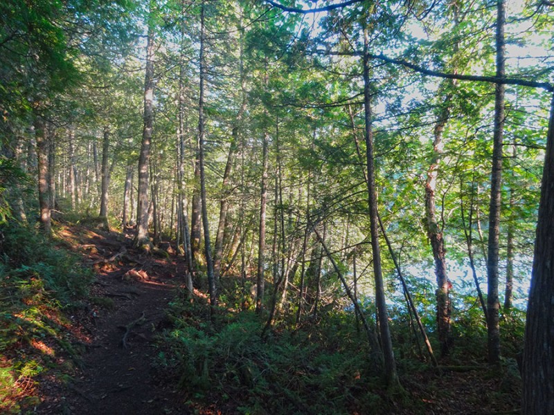
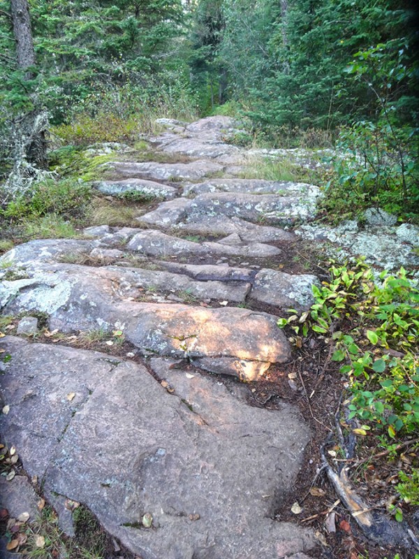
Staying on trail was not a problem as the trail is well defined. However, it wasn't just a flat dirt trail. It was surprisingly rocky which slowed me down a bit from my normal pace.
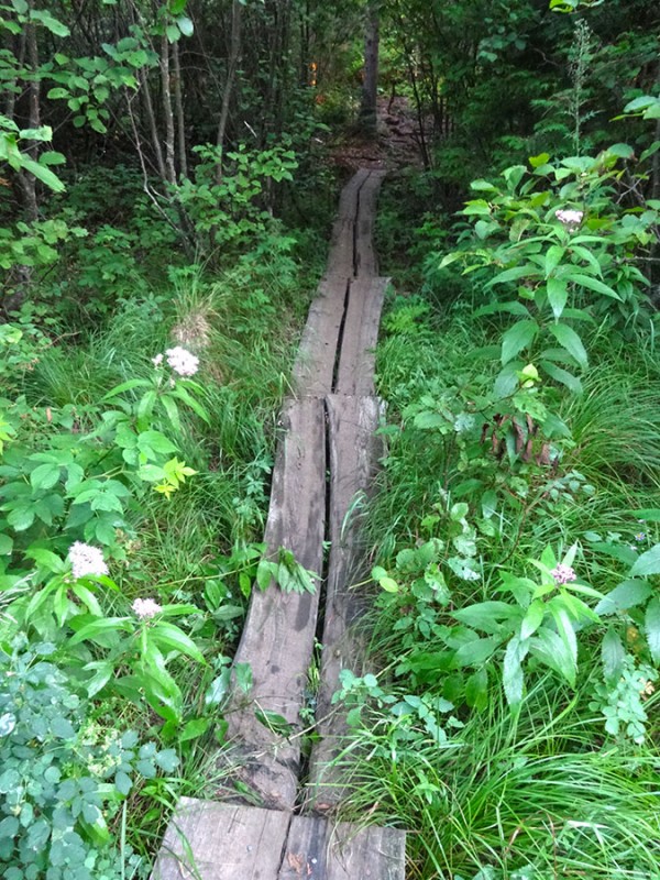
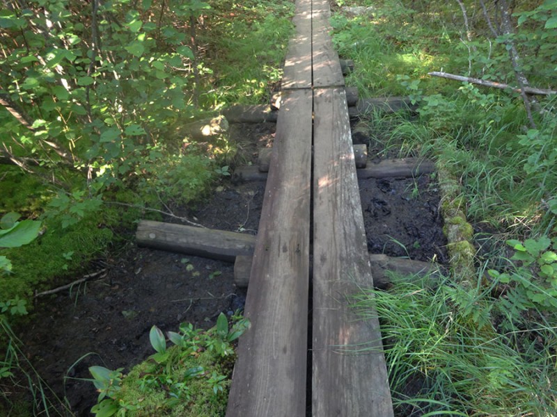
And it was nice to see that where the trail passes through marshes and bogs, there was a raised plank boardwalk. It turned out that there were about 5 sets of these, and never once was it required to step into a sink hole.
At exactly 1 mile in, is the B.W.C.A. wilderness boundary marker. For some reason I already knew what BW stood for....boundary waters. However, I didn't know what the C & A stood for. (We don't have these in Colorado). I didn't find out until a later Google search what the C and A stood for. Now I know: Boundary Waters Canoe Area.
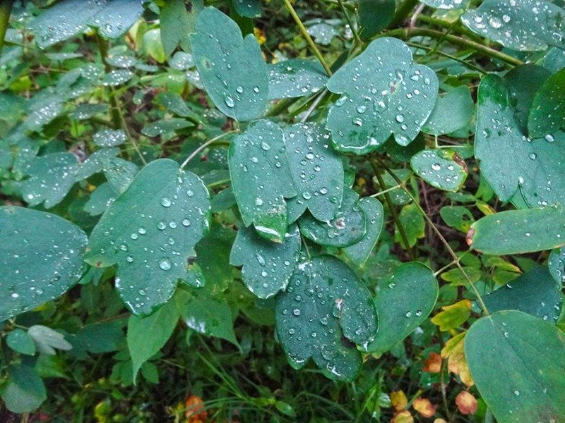
It felt surprisingly warm and humid to me this morning. In climbing mountains back home in Colorado, (in the summer) I am use to pre-sunrise starts where the temperature is in the 30's or 40's. Here it was a balmy and muggy 63 degrees. And there was dew on all of the foliage.
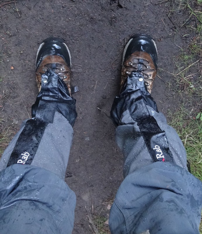
I had brought and worn my gaiters to ward of the ticks however, I soon came to appreciate them for this other unexpected reason.
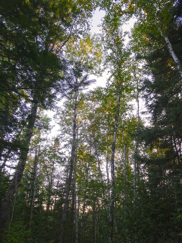
Back home in Colorado, an alpine starts brings the anticipation of sunrise on the surrounding peaks. Here, the first rays of sunlight grace the high tops of the trees.
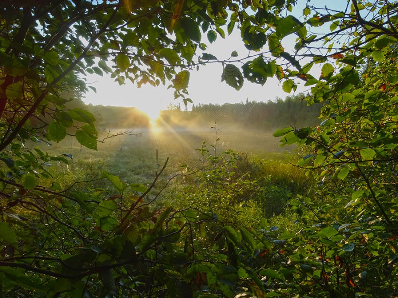
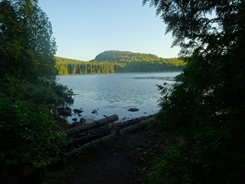
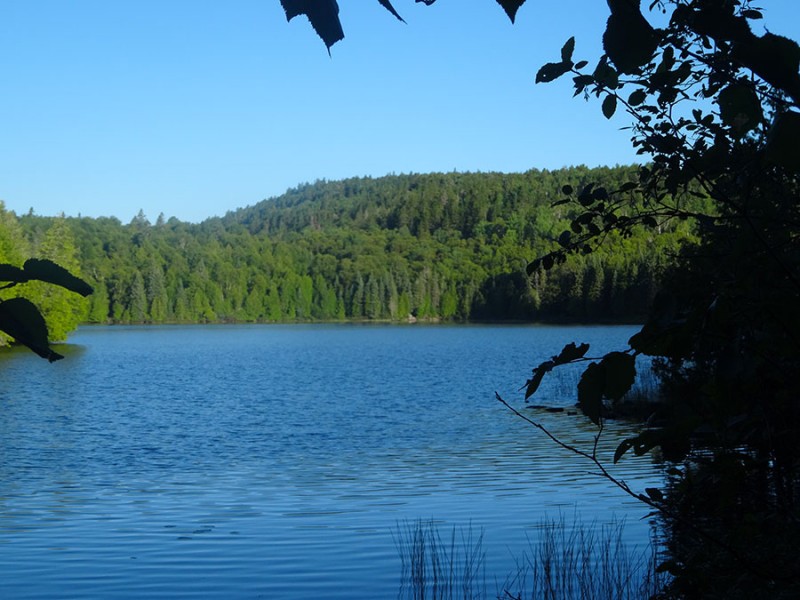
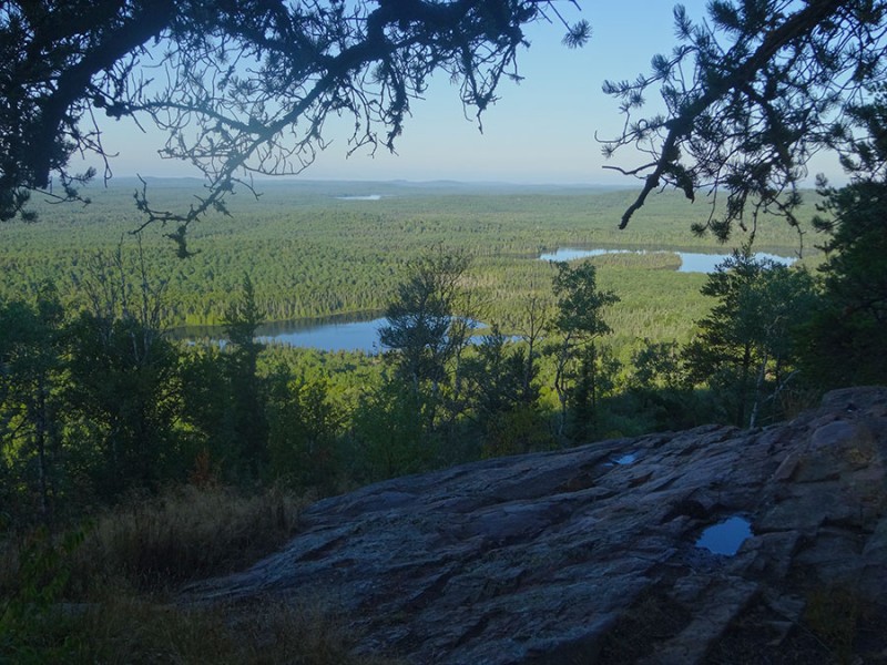
And then comes this...BAM! An opening through the thick forest to one of the many serene lakes. Minnesota is known as the land of 10,000 lakes. In fact, I learned that Minnesota is home to 11,842 lakes that are 10 acres in size or more!
The other thing I was amazed with was the forests. The forests are thick, and green, and go on for miles and miles and miles.
This hike is a peaceful stroll up and into Superior National Forest. Since I was solo, I found myself listening to the quiet of nature and the morning wake-up calls from the local birds. I was even blessed to hear the call of a loon. That was amazing actually to be graced with this creature piercing the silence with it's magical sound. It reminded me of the 1981 film I had watched with Katharine Hepburn and Jane and Henry Fonda where there was the distinct scene of them seeing a pair of loons on the lake while they were out canoeing.
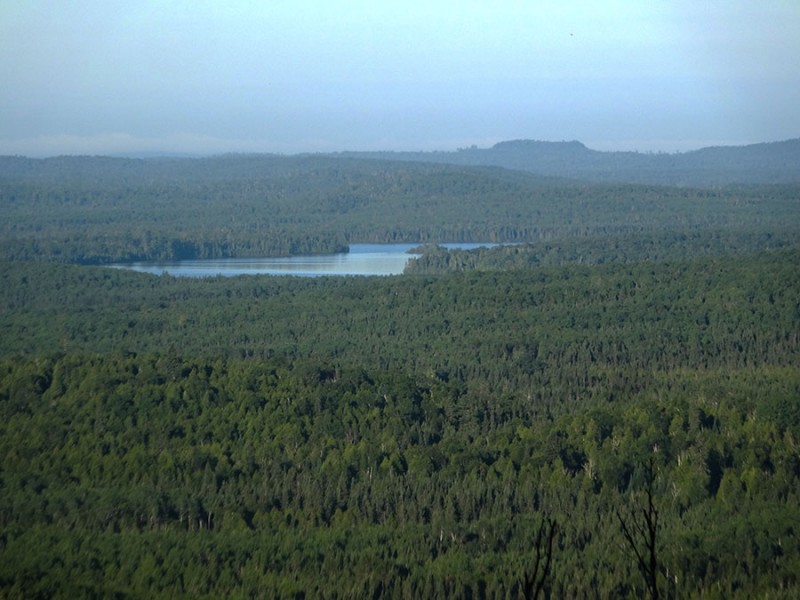
At 2.4 miles I arrived at Whale Lake; probably the home of the loon I had heard.
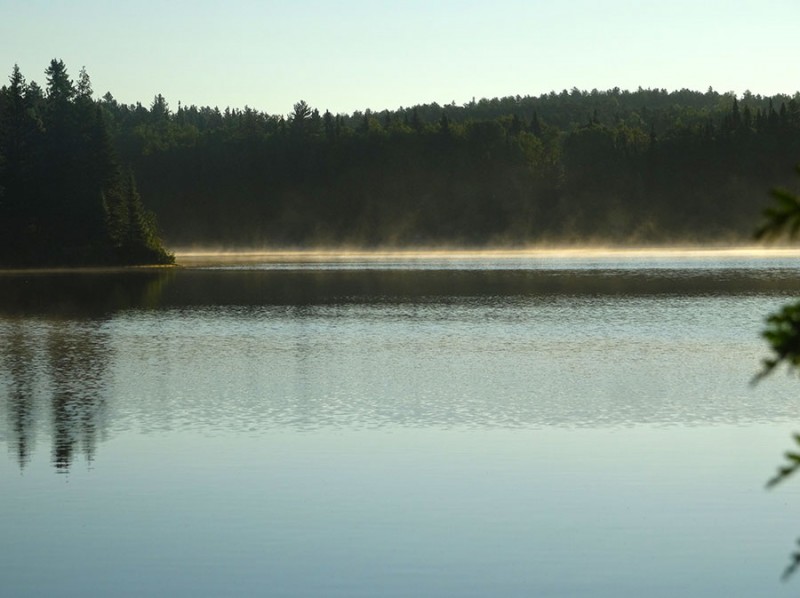
To see the mist flowing like a ghost over the water caught my attention. I've seen scenes like this in movies but not with my own eyes, in the wild. What can I say? To be in this wilderness area, away from man and mechanical machines was a moment to embrace.
To be in such a pristine and natural setting was absolutely mesmerizing.
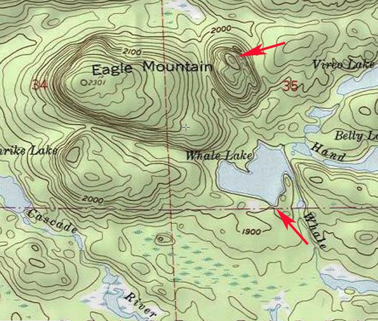
Some people have thought that the view across Whale Lake (picture 19) allows you to view Eagle Mountain. It's doesn't. That is a little peak to the east of Eagle Mountain. See this map here. (The summit of Eagle Mountain is further to the northwest out of view.)
During my hike back out, I went around the south end of Whale Lake to see if there is a view of Eagle Mountain across the lake. There isn't. I believe the actual summit is out of view behind what you can see here.
The trail goes underneath the southwest side of Whale Lake to the left.
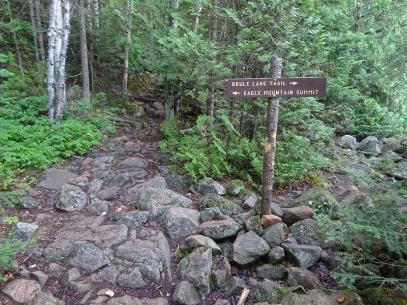
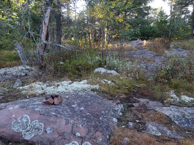
After getting around most of the lake, the trail started to curve back to the right and I was starting to get suspicious that this trail was a sucker trail. You know how some lakes have a ring trail going around the lake that fisherman often form? However, within a few more steps after thinking that, I came upon this sign. Nice...very comforting to know I was not off route in an unknown territory.
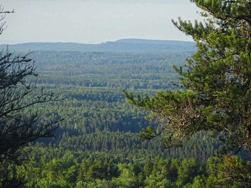
From Whale Lake, the trail heads west, northwest and starts to climb. There is a 400 vertical foot gain from Whale Lake at 1,900 feet, to the summit at 2,301. The trail is still obvious and defined along this traverse around the mountain. The thick forest prevents any views until you come upon this!
There are several openings through the trees where some views can be had.
Forests and lakes,...this is northern Minnesota!
This trail traverses along this west edge of the mountain where these views continue and the trail crosses over these rocky surfaces.
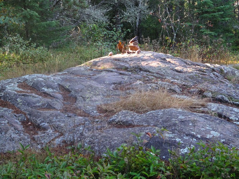
Just continue heading north, across the boulders, and then the trail will come back into view on the other side. It starts to feel like you are going beyond what would be the highest point of the mountain, off to your right, but not to worry....you'll soon come upon several carins marking the right turn back to the east. Turn right at the carins.
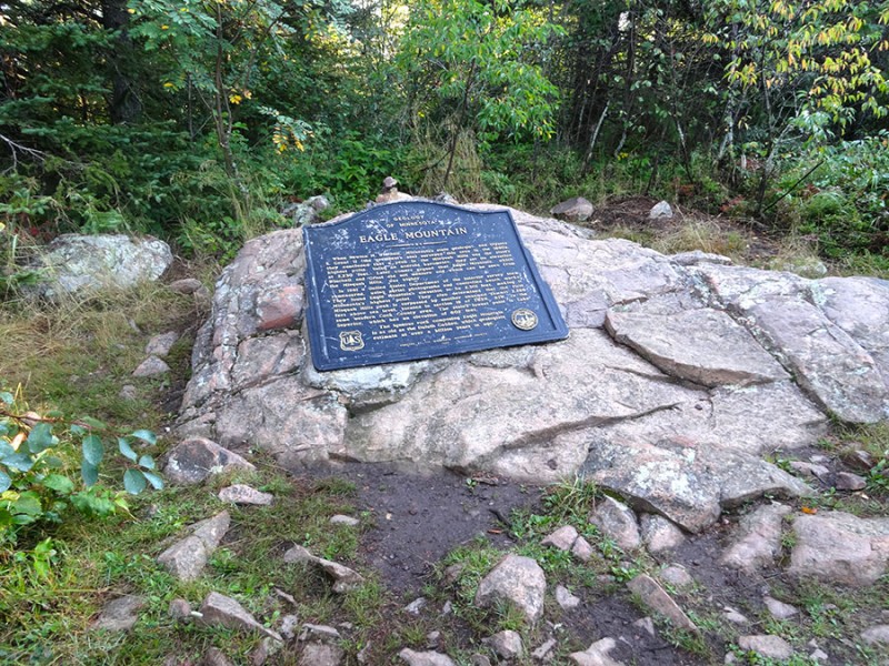
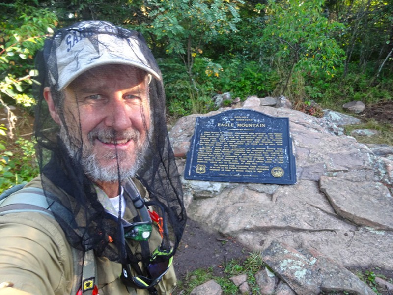
The hike to the east is short. Within a few hundred yards you will come upon a dead-end at the obvious summit plaque at Eagle Mountain. I arrived here at 7:09a, which surprised me that I made it here in only 1.5 � hours.
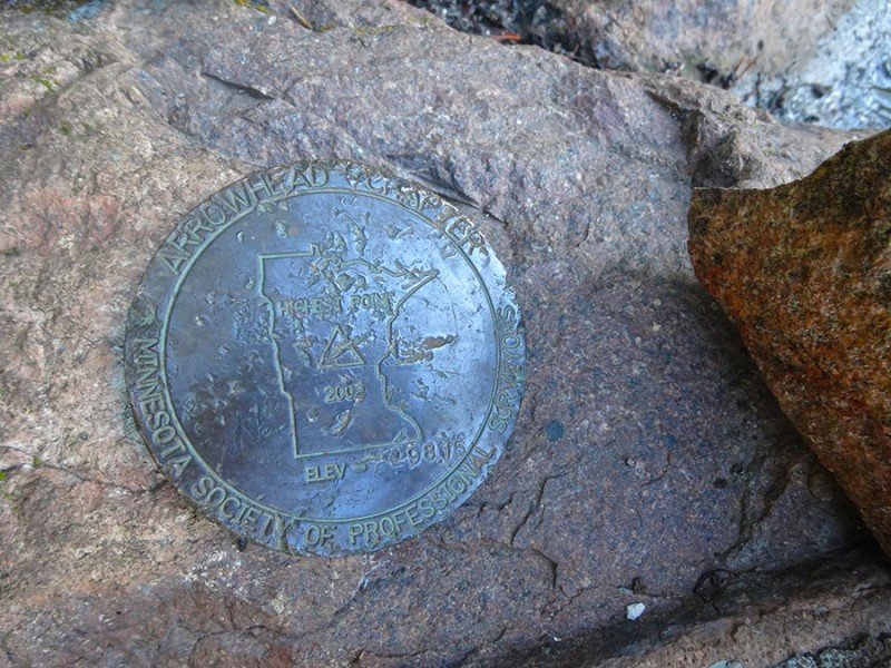
And just behind the plaque was a USGS summit marker.
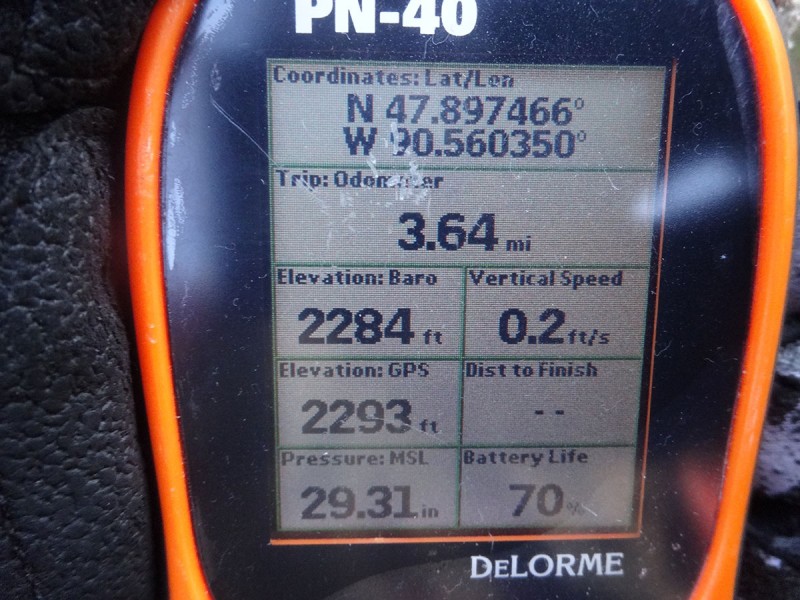
The mileage stated on SummitPost was 3 � miles. My GPS showed that it was 3.64 miles which makes for a 7 � mile round trip hike.
Once again to prove I was here, I took the infamous summit selfie to document my 21st state highpoint. Now, I came prepared. I had heard of the notorious Minnesota mosquitoes. They weren't as bad on the summit as they were down near the lakes and marshes.
This turned out to be a wonderful solo outing. It was such a peaceful, and enjoyable hike, in a serene and magical setting. There is something about hiking into our country's true wilderness areas. However, the solo trek without seeing another human was not to be. I passed two solo hikers during my hike out. And then at the trailhead, a car of five showed up to make it a total of seven others. Kind of a bummer to see them. I guess this state highpointing is becoming quite the popular activity.
The drive back down to Lake Superior once again made me think I was approaching the ocean.
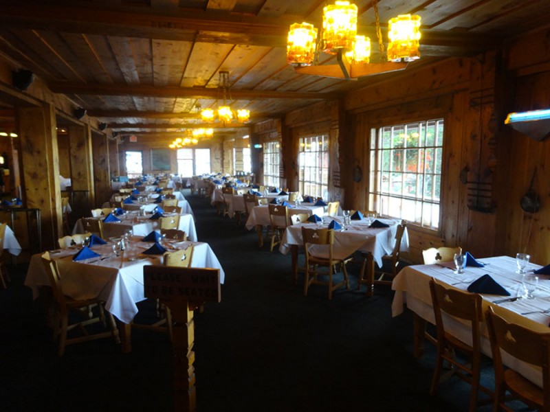
I made it back in time to take my wife to breakfast at the Lutsen Resort. This picture was taken in their dining room the afternoon before when they were closed.
I was so thankful to have had this opportunity to take my wife to this wonderful part of our country. We stayed a second night in our hotel because we didn't want to leave. We wanted to enjoy this lakeside paradise a little longer. What's not to like about sitting seaside with the woman you love, enjoying a refreshing beverage, listening to the seagulls? In fact, not only did we hear the calls of the seagulls, but sitting in these Adriondack chairs we had a bald eagle fly right over the top of us! We couldn't believe it!
And then to top it all off...we were given one of the longtime signs of God talking to His people....hmmmm.
And God said, "This is the sign of the covenant I am making between me and you and every living creature with you, a covenant for all generations to come: I have set my rainbow in the clouds, and it will be the sign of the covenant between me and the earth. Whenever I bring clouds over the earth and the rainbow appears in the clouds, I will remember my covenant between me and you and all living creatures of every kind. Genesis 9:12-15
Thumbnails for uploaded photos (click to open slideshow):
I am happy to see how much you enjoyed your trip to Minnie–so–ta! Nothing quite like those northern lakes at dawn, with the mist, and no sound except the loons "singing"! I’ve only run one Marathon...but it was on 26 miles of that Lake Superior coastline!
Canoeing was my passion before I got into hiking / climbing. Back in the day took 5 different week–long trips to the BWCA, plus a bunch of Michigan rivers. Something about being 3 days away from civilization with an entire lake that my group and I get to "own" while out in the BWCA. Truly amazing. Glad you got the HP and at least got to see the BWCA.
I lived in Minnesota for 23 years and visited this highpoint twice. Loved your write–up and the photos. The ’north shore’ of Lake Superior was (and still is) one of our favorite spots. Thanks for posting and for the verse at the end. Appropriate.
Thanks for the report Britt, I hope to travel along side your footprints someday.
Thats one of the things that made the 14ers so fun for me. They took me places in Colorado I never would have seen.
I’d like seeing the little nook and crany places across America. What great way to do it.
Thanks for the nice TR Britt. I grew up on the Iron Range of MN, about 60 miles north of Duluth. I spent a fair amount of time as a kid along the North Shore of Superior in places like Lutsen and Grand Marais but I wasn’t a hiker then so I never would have thought to hike Eagle Mountain. I don’t get back to MN very often anymore but this could be a good excuse to get back.
Caution: The information contained in this report may not be accurate and should not be the only resource used in preparation for your climb. Failure to have the necessary experience, physical conditioning, supplies or equipment can result in injury or death. 14ers.com and the author(s) of this report provide no warranties, either express or implied, that the information provided is accurate or reliable. By using the information provided, you agree to indemnify and hold harmless 14ers.com and the report author(s) with respect to any claims and demands against them, including any attorney fees and expenses. Please read the 14ers.com Safety and Disclaimer pages for more information.
Please respect private property: 14ers.com supports the rights of private landowners to determine how and by whom their land will be used. In Colorado, it is your responsibility to determine if land is private and to obtain the appropriate permission before entering the property.


")