Download Agreement, Release, and Acknowledgement of Risk:
You (the person requesting this file download) fully understand mountain climbing ("Activity") involves risks and dangers of serious bodily injury, including permanent disability, paralysis, and death ("Risks") and you fully accept and assume all such risks and all responsibility for losses, costs, and damages you incur as a result of your participation in this Activity.
You acknowledge that information in the file you have chosen to download may not be accurate and may contain errors. You agree to assume all risks when using this information and agree to release and discharge 14ers.com, 14ers Inc. and the author(s) of such information (collectively, the "Released Parties").
You hereby discharge the Released Parties from all damages, actions, claims and liabilities of any nature, specifically including, but not limited to, damages, actions, claims and liabilities arising from or related to the negligence of the Released Parties. You further agree to indemnify, hold harmless and defend 14ers.com, 14ers Inc. and each of the other Released Parties from and against any loss, damage, liability and expense, including costs and attorney fees, incurred by 14ers.com, 14ers Inc. or any of the other Released Parties as a result of you using information provided on the 14ers.com or 14ers Inc. websites.
You have read this agreement, fully understand its terms and intend it to be a complete and unconditional release of all liability to the greatest extent allowed by law and agree that if any portion of this agreement is held to be invalid the balance, notwithstanding, shall continue in full force and effect.
By clicking "OK" you agree to these terms. If you DO NOT agree, click "Cancel"...
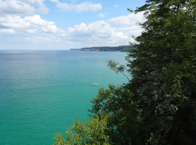
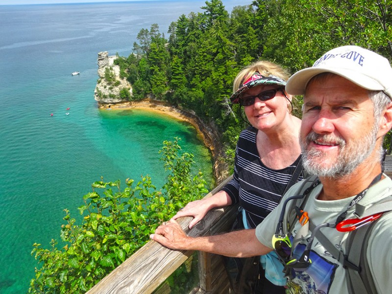
Mackinac Island within Lake Huron was stupendous. But so was our time at Munising, Michigan on the south shore of Lake Superior. I had no idea that it would look like a tropical island!
My wife and I took a shipwreck boat tour in the morning, and then drove out to the Pictured Rocks National Lakeshore. This was Miner's Castle. Beautiful place!
I mean, why not enjoy some of the sights as we drive across Michigan to our next state highpoint?
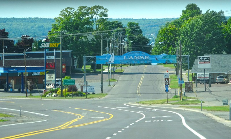
The Michigan state highpoint is northeast of the town of L'Anse, Michigan. So, if you can make it to here, the rest of this trip report can help you with the rest of the directions.
As you drive into L'Anse from the south on Hwy 41, you will veer off of 41 under the town sign.
You are now going due north on Broad Street. Follow it down until you reach Main Street. Turn right here and reset your odometer.
You are now going to stay on this road for 16.2 miles. It will change names from Main Street to Skanee Road. It looks the same as the rest of the Upper Peninsula...nothing but trees on both sides of the road!
I kept seeing bumper stickers about "Yoopers." I finally had to ask one of our waitresses...what is a "Yooper?" Those who live in the Upper Peninsula, (the top half of Michigan above Lake Michigan) are called Yoopers. Get it? The first two letters of Upper Peninsula are UP. So the local slang for the locals is Da Yoopers. Ah...it all made sense now.
Driving out on Skanee Road I only found one spot through the trees where there was a view of (what I believe) was Mt. Arvon off in the distance.
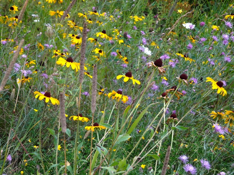
The wild flowers along this road where looking great this August day.
Once you get to 16.2 miles, you will come to Roland Lake Road. I read online that this road's name had been changed from Roland Lake Road to Church Road. However, the street sign didn't reflect that change. You will turn right/south here at this Zion Lutheran Church. (There is also a blue diamond sign saying to turn right here.
The directions from SummitPost.org say to drive south here on this Roland Lake Road for 2.9 miles. This road is a nice gravel road and any sedan or 2 wheel car should be fine on this.
At the end of this road you come to a "T" in the road where you will find another of these blue diamond signs pointing the way.
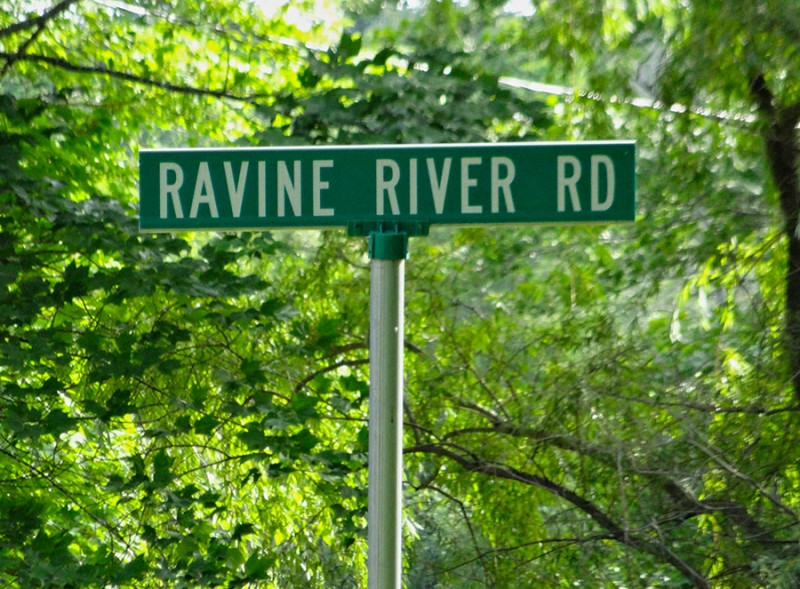
The name of this road is Ravine River Road. Turn right/south.
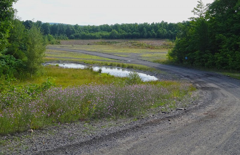
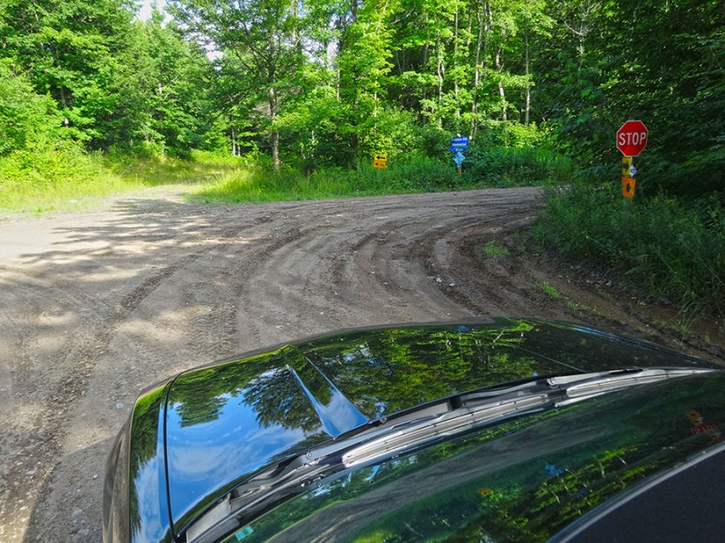
You will go south on Ravine River Road for 6.1 miles where you will soon be crossing through this gravel pit.
Again, there are more signs marking the way.
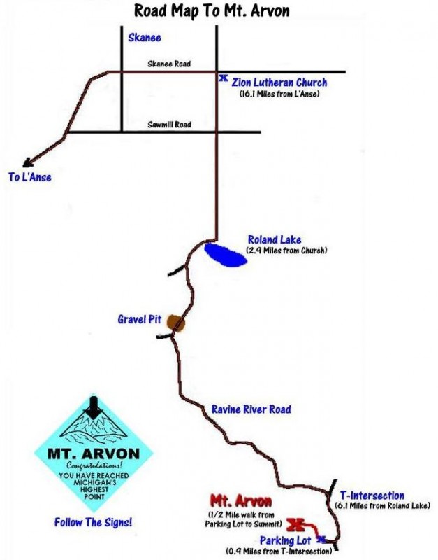
I found this drawing/map online that was very helpful.
FIND THIS MAP!
You will soon be back into the trees and driving curvy roads which can make you question the directions at times. Just stay on the main road that seems to make the most sense.
The above map lists the mileage I mentioned earlier as 2.9 miles to Roland Lake and then 6.1 miles to the next "T" intersection. My mileage was a bit higher by a tenth or two. Again, you will find the blue diamonds and arrows for Mt. Arvon. Turn right here at this "T" in the road.
After the "T", that map I showed in picture 14 says it's now only .9 mile to the trail head. Ummm....not what I found as the trees thicken and the road steepens.
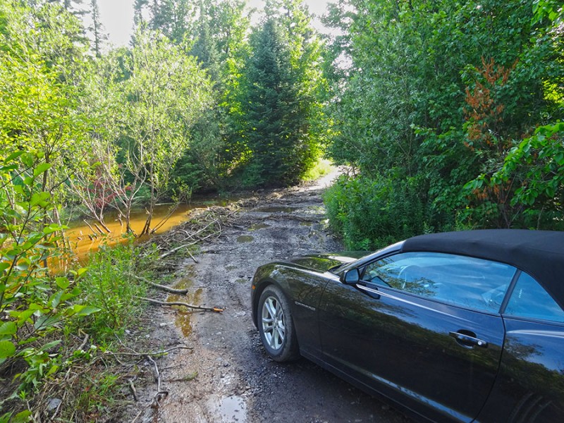
It had rained the day before which had left it's mark on this road. I chose to drive out here on this late evening, as it had been sunny all day. This is not a road I'd want to drive in a sedan during or right after a heavy rain.
My rental car with a very low clearance soon found the crux of this climb!
While we made it through this mud bog, the low front bumper rubber spoiler didn't fair to well Those tree branches, that I am sure someone put down to get through the mud, took it's toll and ripped that piece of rubber right off. It's still there in the mud! Opps!
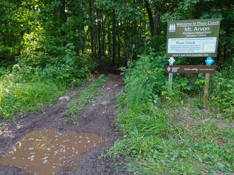
Now about the rest of the directions and that map mileage that said it was .9 mile. That would have made the total mileage from the Zion Church to the trailhead to be 9.9 miles. (2.9 + 6.1 + .9 = 9.9). However, I kept driving and driving and going up and up, and several times I thought I may have missed a turn or something. However, we eventually got to the very end of the road at 11.3 miles. Not what I was expecting. So, that was 1.4 miles further! However, we made it and found a totally empty parking lot. This was a surprise and a difference from my last two summits in Illinois and Wisconsin.
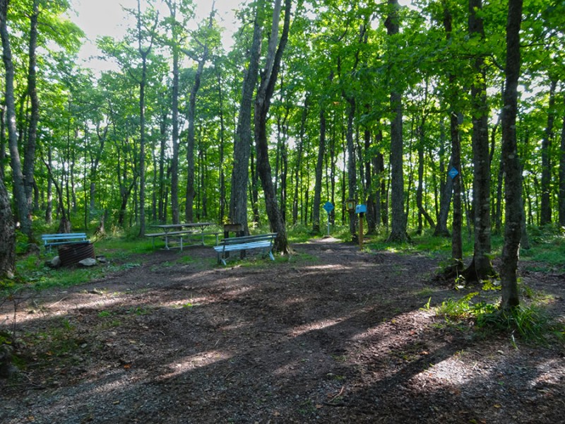
The trailhead to the summit was marked and obvious with this sign.
On SummitPost.org, that website mentioned that there would be a hike from the parking lot of ¼ mile to the summit. That map in picture 14 says it's 1/2 mile. That wasn't correct either.
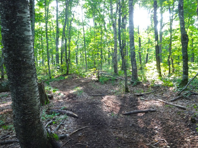
From the trailhead sign, it was only about 50-75 yards into the trees to the summit marker.
This was the last of those nice blue diamond directional signs.
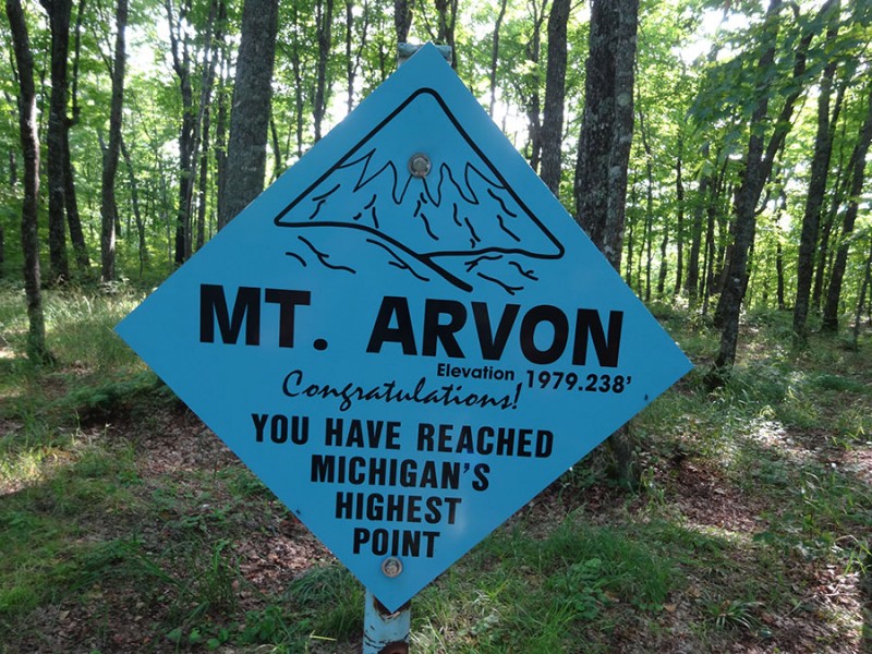
And there was the ever so familiar USGS summit marker saying I had made it to the actual highpoint.
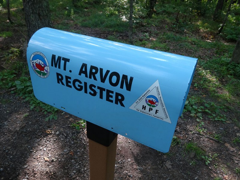
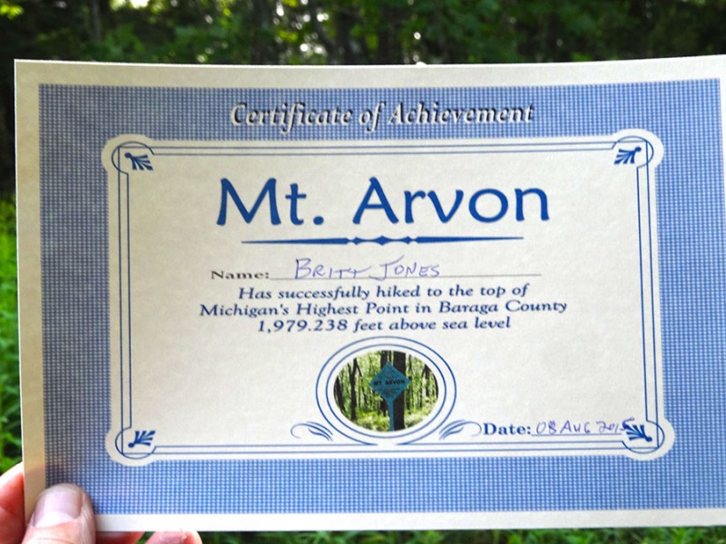
And another summit mailbox...time to sign in for my 20th state highpoint.
It was 6:14pm and I was the 13th person to sign in this day. This was quite a bit less than the on Charles Mound and Timms Hill.
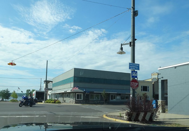
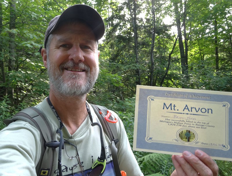
Now a funny thing....when I checked into the Hilltop Motel back in L'Anse...there was a summit certificate in the rack of pamphlets for the local attractions. I grabbed one and brought it up the mountain with me!
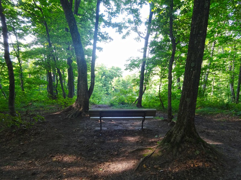
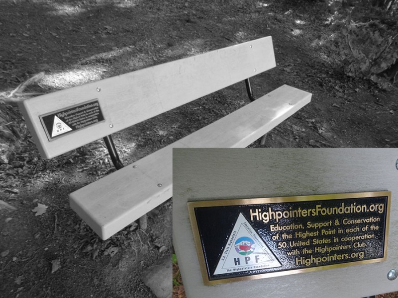
Now, when you are on the actual summit of Mt. Arvon, it is engulfed in trees. However, there are some little blue diamond makers labeled "view." Follow them to the north. Over there about a 100 yards is a small break in the trees. And sitting there is the Highpoint Foundations summit bench.
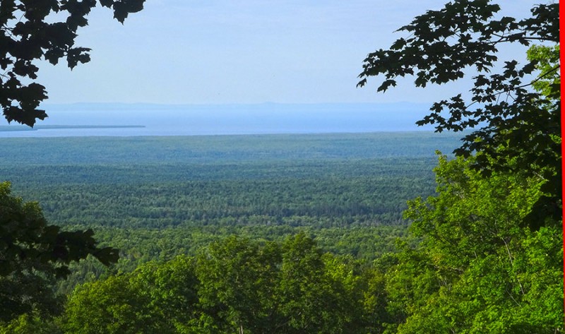
And looking out beyond the trees in a nice view to Lake Superior.
I've learned some interesting facts about Lake Superior on this trip....like:
It's the largest fresh water lake in the world.
This lake is 350 miles from east-west and 160 miles north-south.
There is 1,800 miles of coast line which is enough to go from Duluth, MN all the way to Miami.
The deepest spot is 1,333 feet deep.
There is enough water in this lake to not only fill the grand canyon, but to spill over and fill the entire U.S. five feet deep in water!
Yup....Lake Superior earns it's name. And it's been a great trip to come see her. And I probably never would have done so without this crazy highpoint goal!
Thumbnails for uploaded photos (click to open slideshow):
Was hoping you’d hit Arvon. Love the UP of Michigan. Munising and Pictured Rocks Nat’l Lakeshore is a lot of fun. Some great cliffs to dive off if you like water surface temps in the low 60’s.
I think you can also get a certificate if you crossed the U.P. at night without hitting a deer.
Lived in Michigan for 42 years and never climbed Arvon, drove thru Lan’se countless times while in college at MTU. For roughly 10 of those years Mt. Curwood was thought to be the highpoint (surveyed one foot shorter in ’82).
Yoopers secretly want to make da U.P. it’s own state. If that happens you’d have to climb some hill in troll–land (the lower peninsula).
Saw your Mackinaw Island photo in your other TR – I was there 6 mos. ago in winter (too lazy to upload the photo). Glad you had a fun trip.
Nice TR. I lived in MI for 27 years, and also never made it to Mt. Arvon. Seeing your pics makes me miss having all of that water so easily accessible to go boating, yaking, fishing, etc.
As with the last two posts, I was also a Michigander (born and raised in the mighty city of "Blissfield") and went to school at Michigan Tech just up the road in Houghton. I drove by the Mt. Arvon area at least a 100 times but never made it to the top! I do plan to do so some day on a return trip though. As "Wish I lived in CO" stated, I grew up as a kid believing Mt. Curwood was the highpoint... Which I believe is a bit more "remote".
By the way, I think all those blue diamonds are new! I’ve heard from others years ago that finding the high point was a challenge and folks would drive around in the woods for hours trying to find it. At the time, the locals couldn’t figure out why people would want to go there. I guess now they’ve embraced it! LOL
Brings back memories of when my son was young. He loves lighthouses, so we spent plenty of summer vacation time in Michigan, home of 120 lighthouses. Along the way, we made it to Pictured Rocks and Munising, but not Mt. Arvon. The road to Crisp Point Lighthouse was similarly sloppy and 19 miles long. Watch out for those Yooper Trooper speed traps, got caught more than once!
Brings back memories of when my son was young. He loves lighthouses, so we spent plenty of summer vacation time in Michigan, home of 120 lighthouses. Along the way, we made it to Pictured Rocks and Munising, but not Mt. Arvon. The road to Crisp Point Lighthouse was similarly sloppy and 19 miles long. Watch out for those Yooper Trooper speed traps, got caught more than once!
Born in "The Soo" (Sault Ste. Marie), grew up in DeTour – hence the 14ers.com username. I certify that this TR demonstrates proper appreciation of the U.P. and its natural beauty, especially Lake Superior. And our satellite territory, Mackinac Island.
Here’s another Lake Superior fact I tell anyone who pretends to listen: One–tenth of the fresh water in the world! It’s a truly magnificent inland sea.
nice report – I hit up Mt Arvon in June – also was disappointed to see there was no "1/4 mile trail" and it was a drive up the whole way, and the mountain doesn’t look like the picture on the signs. So I ended up hiking up and down the road a bit. Quite the detour on those roads. I didn’t know about the certificates. Looks like you had a lot muddier road to Arvon but I encountered very muddy trails in Pictured Rocks and Porcupine Mountains. Also love the pasties – Muldoon’s was my favorite.
Caution: The information contained in this report may not be accurate and should not be the only resource used in preparation for your climb. Failure to have the necessary experience, physical conditioning, supplies or equipment can result in injury or death. 14ers.com and the author(s) of this report provide no warranties, either express or implied, that the information provided is accurate or reliable. By using the information provided, you agree to indemnify and hold harmless 14ers.com and the report author(s) with respect to any claims and demands against them, including any attorney fees and expenses. Please read the 14ers.com Safety and Disclaimer pages for more information.
Please respect private property: 14ers.com supports the rights of private landowners to determine how and by whom their land will be used. In Colorado, it is your responsibility to determine if land is private and to obtain the appropriate permission before entering the property.