Download Agreement, Release, and Acknowledgement of Risk:
You (the person requesting this file download) fully understand mountain climbing ("Activity") involves risks and dangers of serious bodily injury, including permanent disability, paralysis, and death ("Risks") and you fully accept and assume all such risks and all responsibility for losses, costs, and damages you incur as a result of your participation in this Activity.
You acknowledge that information in the file you have chosen to download may not be accurate and may contain errors. You agree to assume all risks when using this information and agree to release and discharge 14ers.com, 14ers Inc. and the author(s) of such information (collectively, the "Released Parties").
You hereby discharge the Released Parties from all damages, actions, claims and liabilities of any nature, specifically including, but not limited to, damages, actions, claims and liabilities arising from or related to the negligence of the Released Parties. You further agree to indemnify, hold harmless and defend 14ers.com, 14ers Inc. and each of the other Released Parties from and against any loss, damage, liability and expense, including costs and attorney fees, incurred by 14ers.com, 14ers Inc. or any of the other Released Parties as a result of you using information provided on the 14ers.com or 14ers Inc. websites.
You have read this agreement, fully understand its terms and intend it to be a complete and unconditional release of all liability to the greatest extent allowed by law and agree that if any portion of this agreement is held to be invalid the balance, notwithstanding, shall continue in full force and effect.
By clicking "OK" you agree to these terms. If you DO NOT agree, click "Cancel"...
Sunday, 02 August, 2015
Trailhead: Timms Hill Parking Lot
Route: due north 1/4 mile (probably less) north up the trail
Partners: solo (but wife was in the car)
Total Distance: less than 1/2 mile round trip
Total Elevation Gain: 140 feet
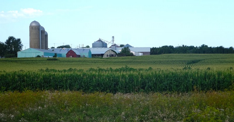
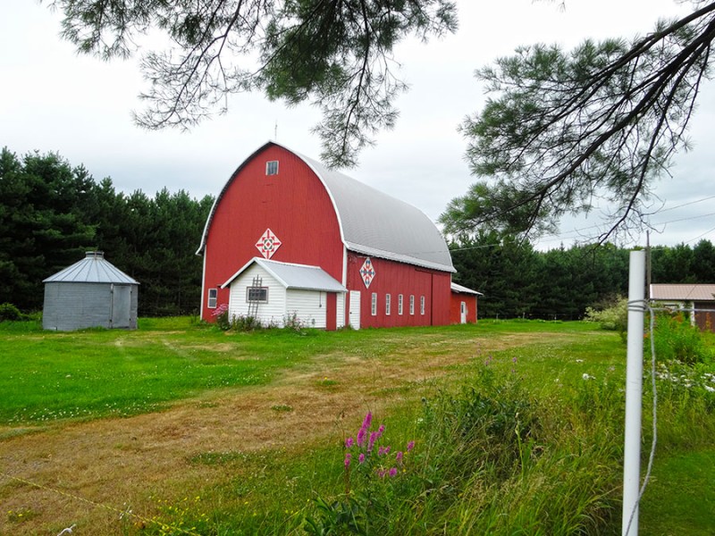
Driving across the mid-west region has always brought to my mind...farmland. These country farms bring images of wholesome, hard working, iconic American people working the land to produce a crop or raise animals. This trip across western Illinois and Wisconsin, as my wife and I were driving to Mackinac Island, reinforced those images. Wisconsin farmland Wisconsin barn
Well....until I came across this! What the hell? I've seen scarecrows and understand their intended purpose, but I have never seen one of these and have no clue what the point is. who dat fishin'?
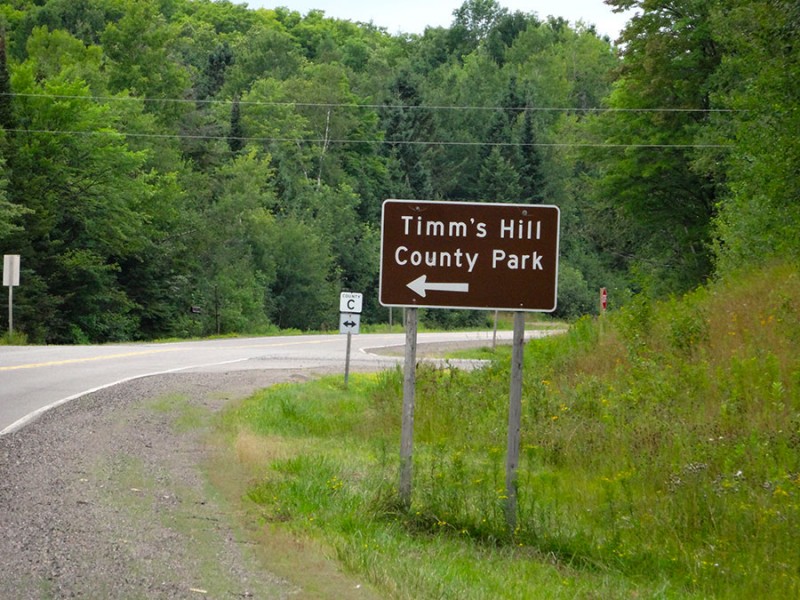
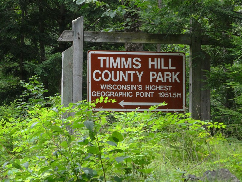
Anyhow...our drive took us north up I-39/US 51 from Wausau, WI almost to Tomahawk, WI. We turned left on Wisconsin Hwy 86 heading east towards Ogema. The Wisconsin state highpoint is in the Timm's Hill County Park which is about halfway between Spirit and Ogema, WI. The turn south on County Rd C is well marked with this sign.
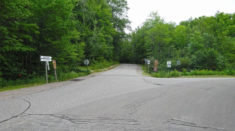
Along your drive is a left turn (Ring School Road) that you don't take. Keep going straight until you reach this fork.
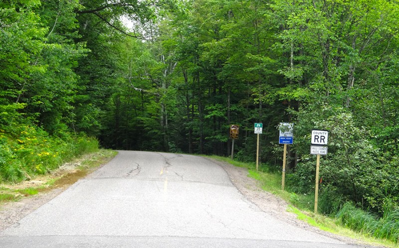
The County Rd C goes to the right, and you want to take the road going straight which now becomes the County RR road.
About a mile further down the road, the turn to the trailhead is well signed.
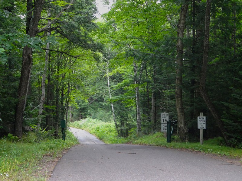
This little one way/one lane road is paved all the way.
It's a pretty thick forest area back in here.
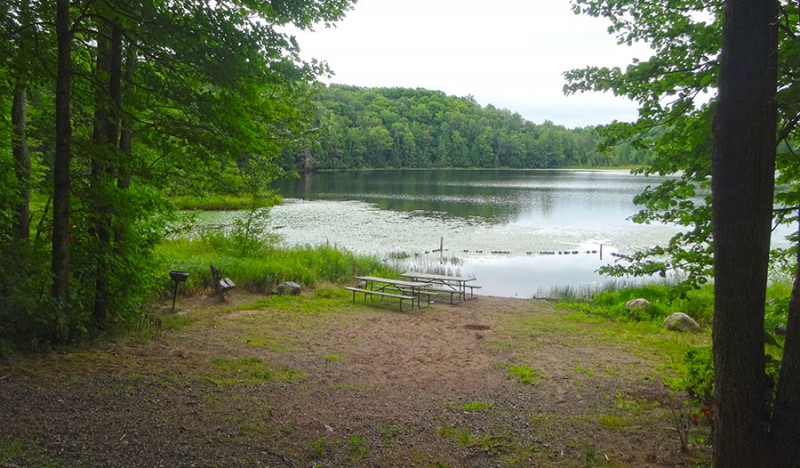
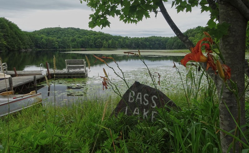
With the exception of this one open picnic area on the edge of Bass Lake. Bass Lake
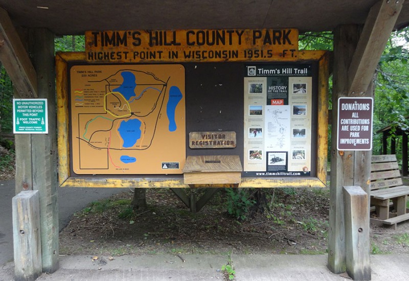
Soon you will arrive at the parking lot and the trailhead for Timms Hill. While it's a nice paved parking lot, with a covered picnic area, and has a nice informational sign here, I didn't seem to see any bathrooms or outhouses anywhere. Just a FYI if you've been driving for a long distance! trailhead sign
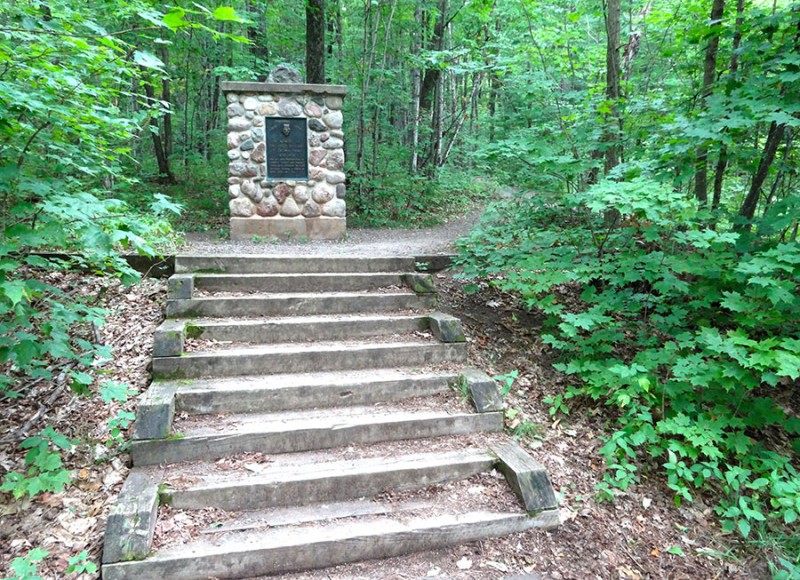
Just beyond and to the left of the big informational sign, are these steps for the trail. trailhead
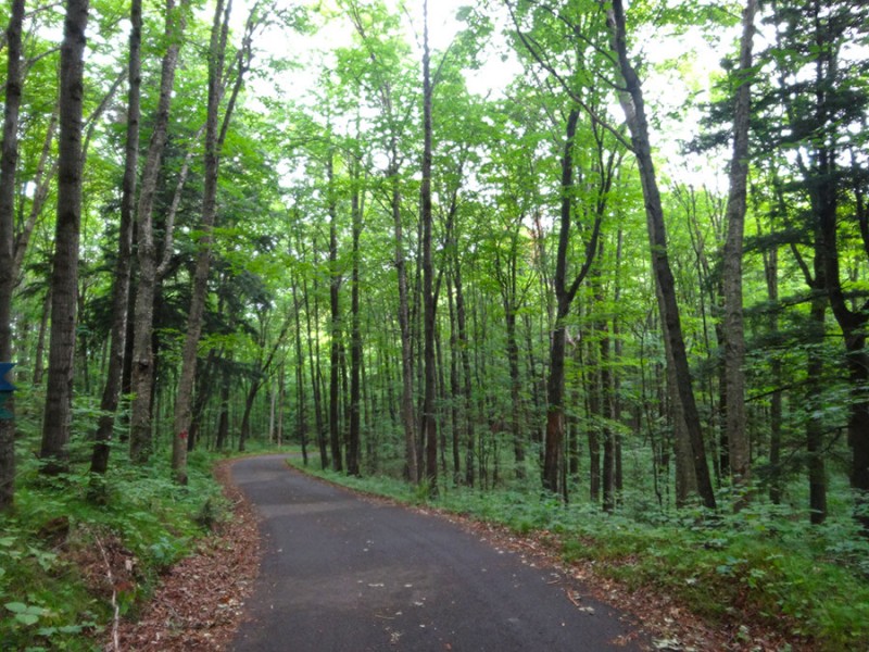
The hike through the forest is suppose to be 1/4 mile. It didn't seem like it was that long. There was a little bit (140 feet) of elevation gain and the trail is very obvious in summer. very defined trail
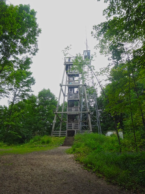
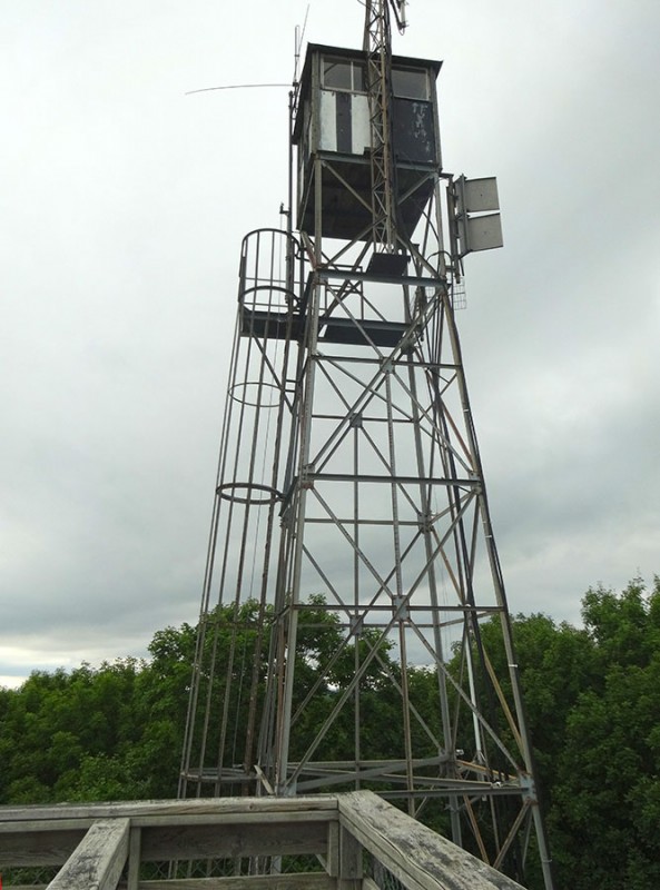
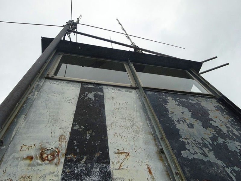
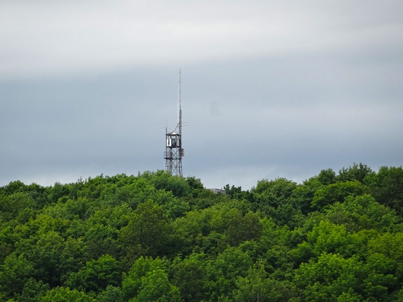
And before I knew it I was there. The two summit towers. summit towers
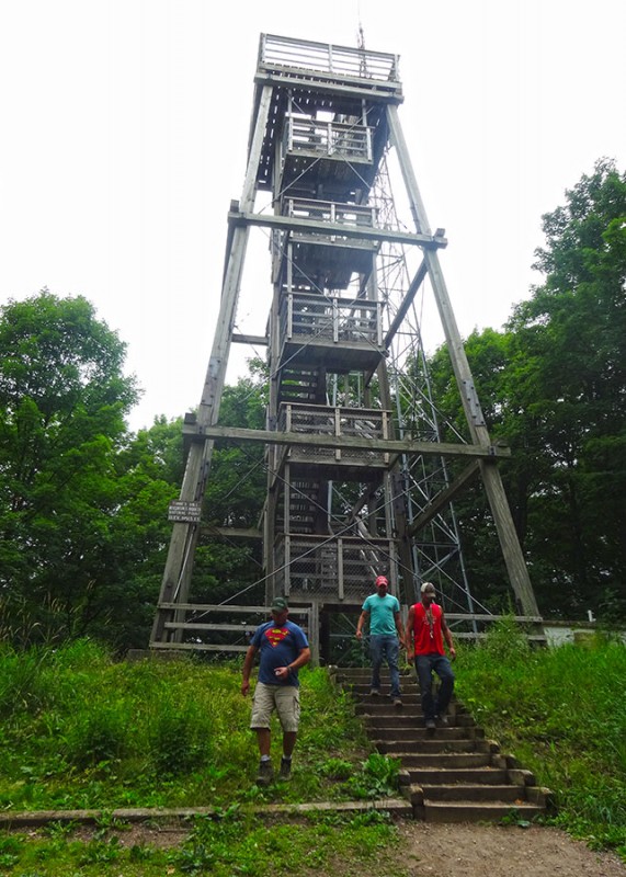
Once again, I wasn't alone. There was a half a dozen others claiming their summit check mark.
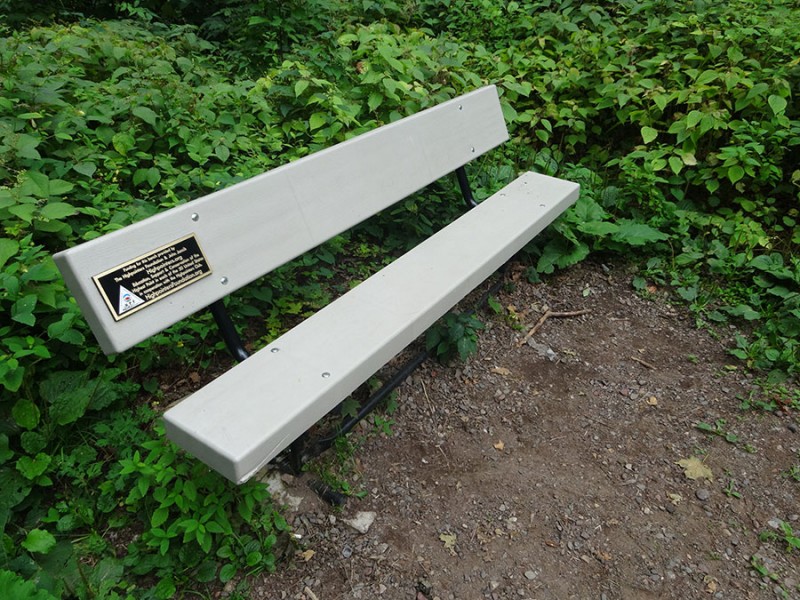
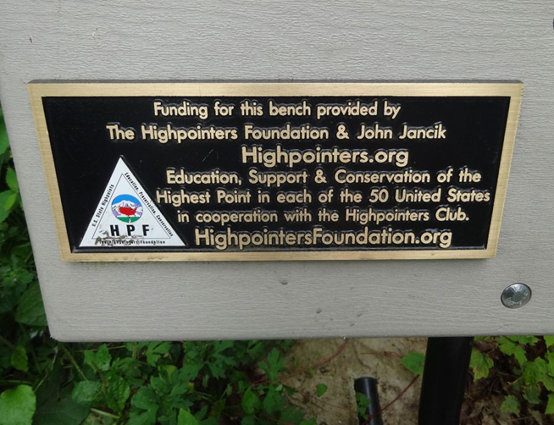
And once again, there was another highpointers.org summit bench on this state highpoint.
On this summit, the summit register was in a mailbox with bumper stickers from The Highpointers Foundation. Which at the time, I didn't realize was the actually name for the highpoints.org organization.
I did my duty and scratched in my name for my 19th state highpoint. Maybe I cheated as I hadn't yet climbed the steps up to the top of the tower yet. I don't know if the ground is the highpoint or the top of the tower. Didn't matter....I was going to the top. summit register
It was 88 steps up to make it up the wooden tower. steps up wooden tower
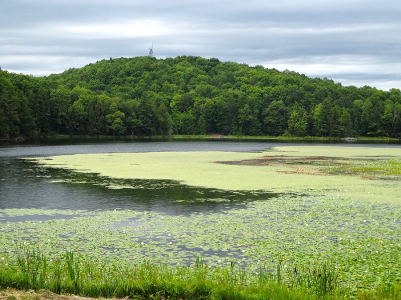
There was a nice view back over Bass Lake. Bass Lake view from tower
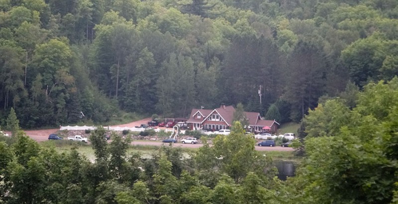
Look at the surroundings here....nothing but trees! Who would have thought that there would be a coffee shop/restaurant out here in the boonies? Hill of Beans coffee shop across Bass Lake
Back to the east it didn't look so nice.
It didn't matter I had a job to do. There was another tower to climb...and I wasn't going to give up until I reached the highpoint.
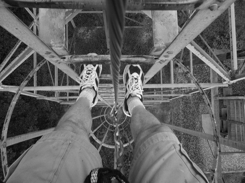
I had read on SummitPost about bringing a harness to climb it to protect it. I did that. I brought my harness with two daisy chains and two carbiners.
Even though I didn't really feel I needed the pro since it was just climbing a ladder, I used it since I had it. The climb went quick and I was up on the platform in no time.
It was certainly higher than the wooden tower.
But, the box on top of this steel tower was off limits. So, I guess this is the official highpoint. I once heard that if you go as high as is legally allowed (not breaking any laws or trespassing) then you've achieved the highpoint.
The views to the north show a nice Wisconsin farm.
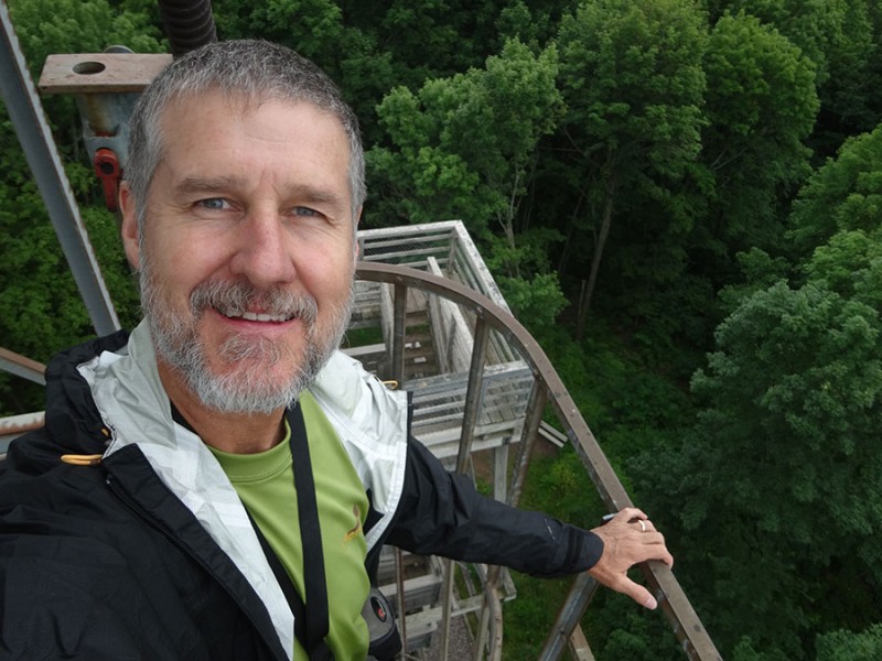
Okay...before heading back down to my wife who was patiently waiting in the car, I took the obligatory selfie to prove I was actually here. my 19th state highpoint
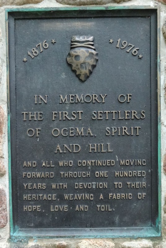
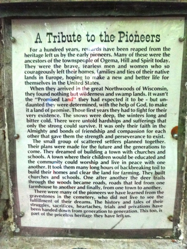
Back at the trailhead was this tribute on the back of that stone trailhead marker. I thought this was a compelling read.
On the drive out, I turned right on the RR to head back to Bass Lake.
You can clearly see the steel summit tower sticking up on the hill over the lake.
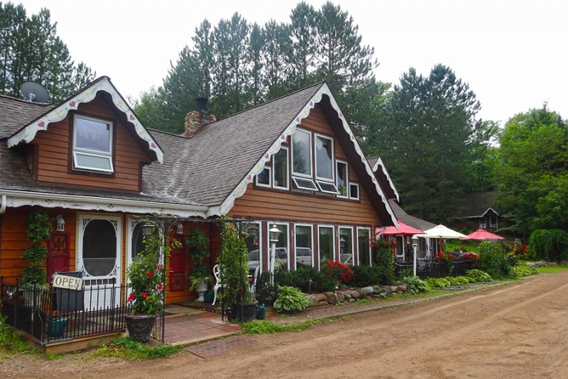
I wanted to stop at the Hill of Beans coffee shop... Hill of Beans coffee shop
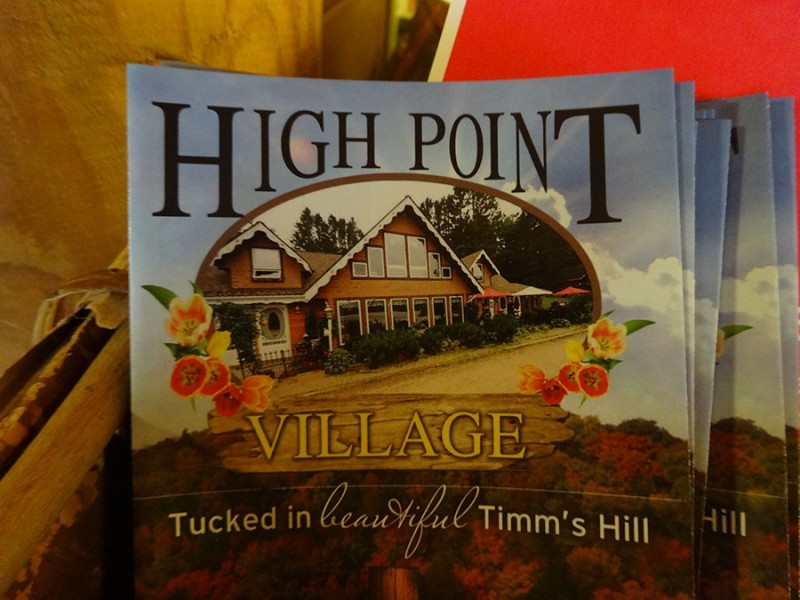
for a coffee which had this pamphlet inside. I thought this was a fitting name and made me all the more glad I stopped in since I am into highpointing now. I guess, I can now say after 19 of 'em, that I really am going after the state highpoint.
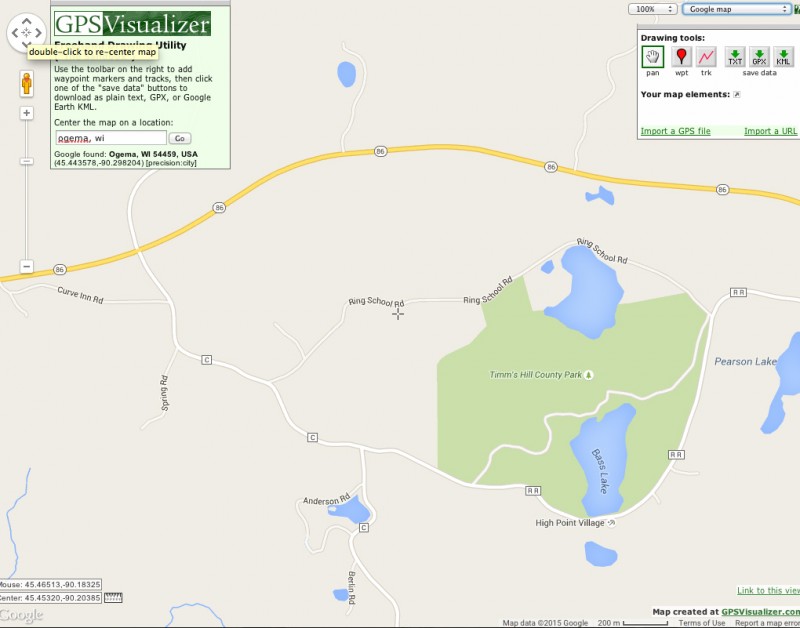
I can honestly say that I have enjoyed this crazy scavenger hunt of going around the US to tag these high points. It has taken me to some quaint little places that I never would have explored otherwise. map to Timms Hill
Thumbnails for uploaded photos (click to open slideshow):
Nope….we didn’t drive up along the coast of Lake Michigan and so we never went through Green Bay. We had a highpoint to go get! Maybe next time.
Caution: The information contained in this report may not be accurate and should not be the only resource used in preparation for your climb. Failure to have the necessary experience, physical conditioning, supplies or equipment can result in injury or death. 14ers.com and the author(s) of this report provide no warranties, either express or implied, that the information provided is accurate or reliable. By using the information provided, you agree to indemnify and hold harmless 14ers.com and the report author(s) with respect to any claims and demands against them, including any attorney fees and expenses. Please read the 14ers.com Safety and Disclaimer pages for more information.
Please respect private property: 14ers.com supports the rights of private landowners to determine how and by whom their land will be used. In Colorado, it is your responsibility to determine if land is private and to obtain the appropriate permission before entering the property.