Download Agreement, Release, and Acknowledgement of Risk:
You (the person requesting this file download) fully understand mountain climbing ("Activity") involves risks and dangers of serious bodily injury, including permanent disability, paralysis, and death ("Risks") and you fully accept and assume all such risks and all responsibility for losses, costs, and damages you incur as a result of your participation in this Activity.
You acknowledge that information in the file you have chosen to download may not be accurate and may contain errors. You agree to assume all risks when using this information and agree to release and discharge 14ers.com, 14ers Inc. and the author(s) of such information (collectively, the "Released Parties").
You hereby discharge the Released Parties from all damages, actions, claims and liabilities of any nature, specifically including, but not limited to, damages, actions, claims and liabilities arising from or related to the negligence of the Released Parties. You further agree to indemnify, hold harmless and defend 14ers.com, 14ers Inc. and each of the other Released Parties from and against any loss, damage, liability and expense, including costs and attorney fees, incurred by 14ers.com, 14ers Inc. or any of the other Released Parties as a result of you using information provided on the 14ers.com or 14ers Inc. websites.
You have read this agreement, fully understand its terms and intend it to be a complete and unconditional release of all liability to the greatest extent allowed by law and agree that if any portion of this agreement is held to be invalid the balance, notwithstanding, shall continue in full force and effect.
By clicking "OK" you agree to these terms. If you DO NOT agree, click "Cancel"...
Saturday, 01 August, 2015
Trailhead: 688 W Charles Mound Road, Scales Mound, IL
Route: due north 1 1/4 miles north up the Wuebbel property road
Partners: solo (but wife was in the car)
Total Distance: 1.25 miles (one-way)
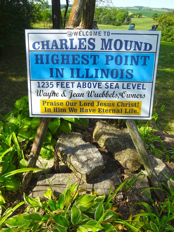
Total Elevation Gain: 255 feet Charles Mound summit sign
If you are wanting to climb the Illinois State Highpoint...
The first thing you should know is that it is on private land.
The second thing you need to know is that you can only climb during the first weekend of June, July, August and September.
The third thing you need to know is that you can only climb during daylight hours.
For me, this trip originated around my wife's goal/bucket list item....going to Mackinac Island in the Upper Peninsula of Michigan. So, we planned this trip around our 28th wedding anniversary which was going to be August 1st, 2015. As I researched some of the state high points in the area, I learned that we can only climb the Illinois State Highpoint 8 days out of the year. Guess what? Our anniversary date happened to be one of them! Let the planning begin!
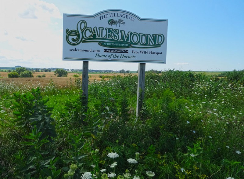
We flew from Denver to Chicago where we rented a car, and then hightailed it the 2 1/2 hours north west to Scales Mound, IL. This Illinois State Highpoint is only a mile and a half from this tiny little town. Getting very close!
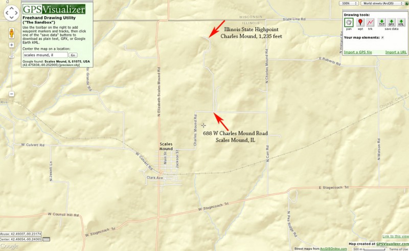
(For orientation purposes, you can see the map I included at the end of this trip report.) However, we just put into our GPS (iPhone) the address of 688 West Charles Mound Road, Scales Mound, Illinois, and it took us right there. Since we were driving from the east (originating in Chicago) and didn't need to go through Scales Mound. So, if you use a GPS, just use the above address and it should take you right to the property.
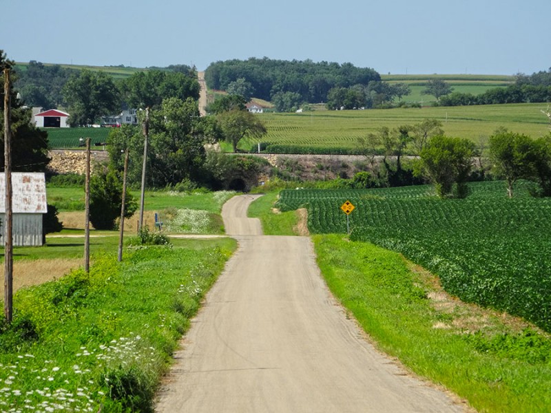
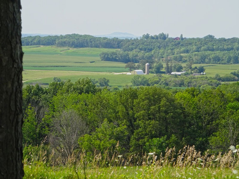
The drive through the rural farmland is beautiful. Everything was so lush and green during our trip. We are not in Chicago anymore!
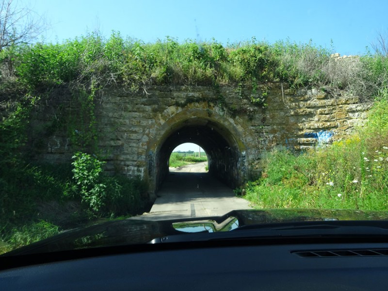
Our route even took us under a stone arch bridge that was barely wide enough for a mid-size car. Your tractor won't fit in here!
As mentioned, we didn't go through Scales Mound, it was a bit to our west. We came up W Carr Rd to this set of signs, where we turned left or west on W Charles Mound Rd. turn here
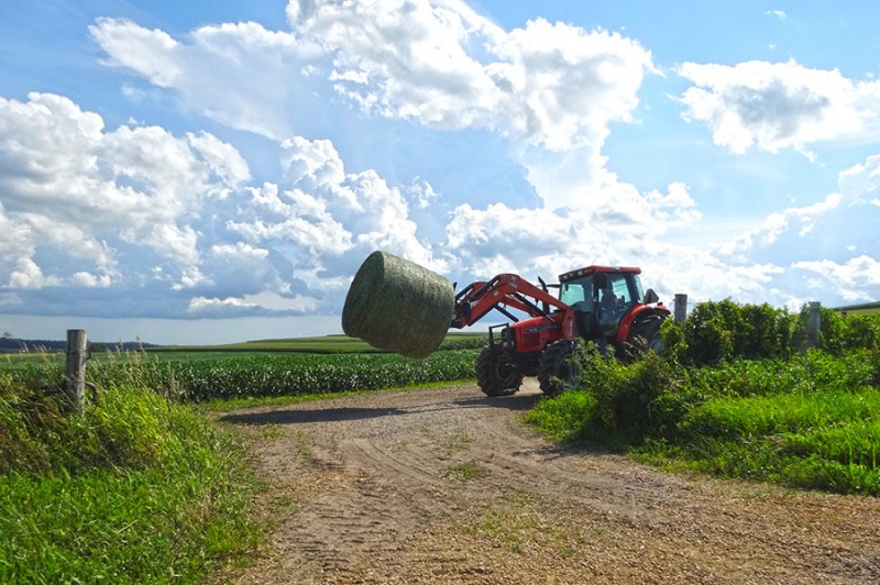
This is farming country and we saw one of the neighbors harvesting some hay for the coming winter.
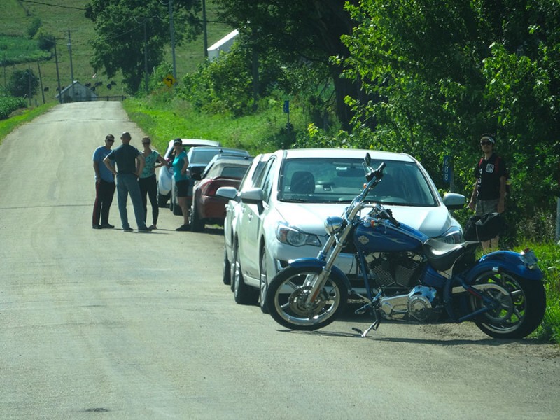
Very soon, the GPS said we were there, and it was very obvious! Since there are only eight climbing days a year on this peak, the crowds are insured. I won't be alone
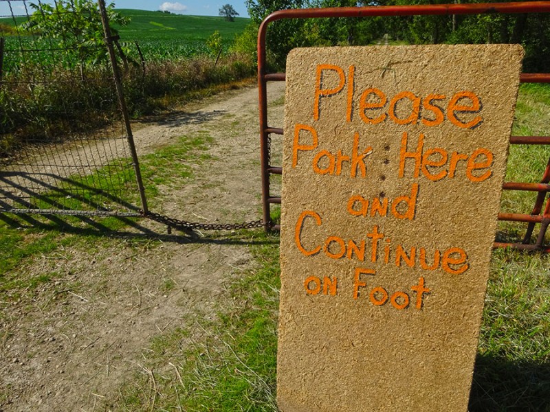
The request of the owners is to park down here at the main road and not to enter their gate onto their land with your vehicle. Walk from here please
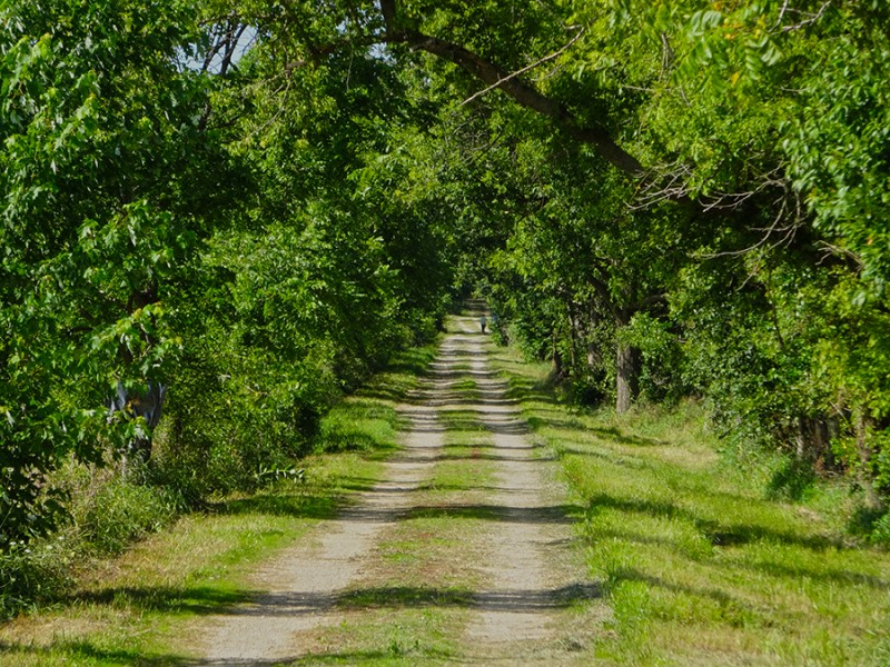
The 1 1/4 mile hike starts off under a beautiful canopy of big, lush trees. Tree covered road
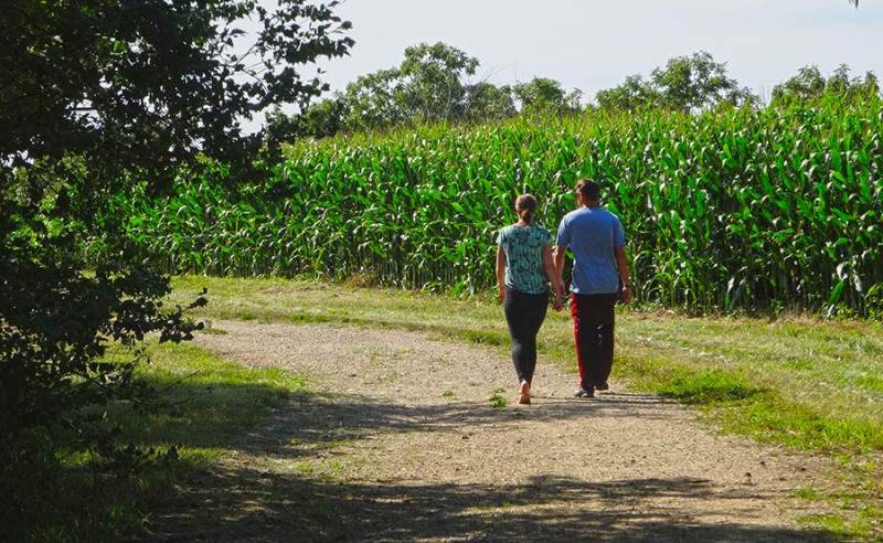
Around 3/4 of a mile, the property opens up into some corn fields, and this is where I happened upon another couple of high pointers from New York state who were com in'...
Going up
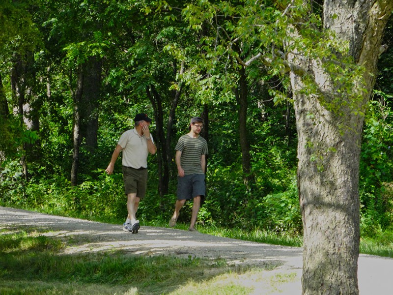
And then I passed a couple more folks who were goin'...
Going down
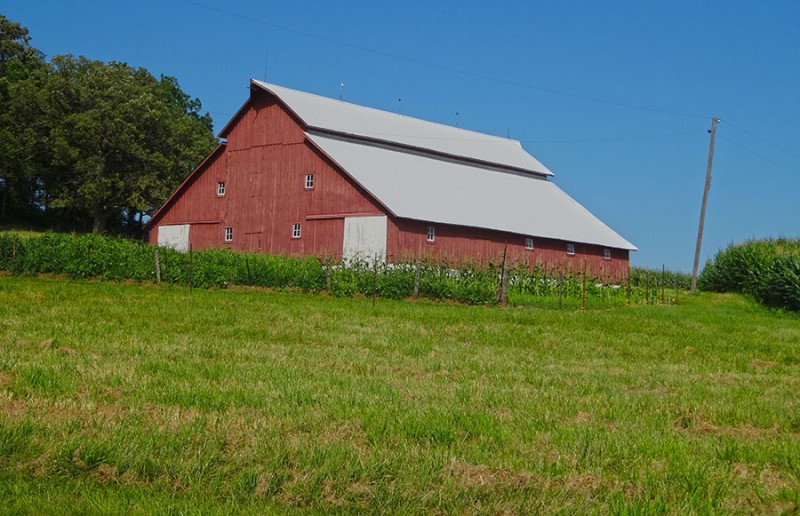
And what farm in the mid-west doesn't have a big red barn?
Mid-west barn
It was up here where I ran into Wayne...the property owner. During my correspondence back and forth with Jean, I learned that these owners were fellow believers in Jesus Christ and were involved in ministry. So, I had asked if I could come meet them. I was happy to run into Wayne down here near the barn where we had a chance to visit. Wayne Wuebbels
Some other "climbers" came up to chat with Wayne, and so I departed so Wayne could visit with them. It was back to the business at hand. A short ways beyond the barn, does the hill crest and the highpoint comes into view on the right side of the road. There it is!
While I was reading the arrival sign, the New Yorkers were over signing the summit register and taking in the views from the summit. Arrival!
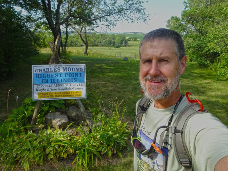
The Wuebbels have a strong faith and are willing to share it with others. Summit sign
After the New Yorkers finished their business and departed, I moseyed over and found the true summit marker. USGS summit marker
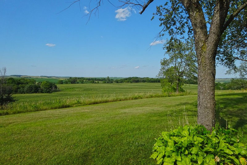
Looking up, there were some views to be had. They weren't to steep to cause nose bleed, but delightful all the same.
Views!
I think that is Wisconsin just over there! More vews!
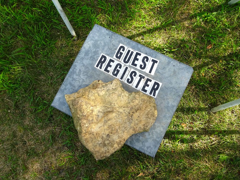
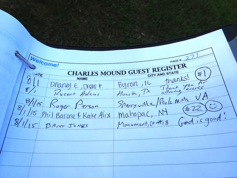
Underneath the rock was the summit register. It was time to do my duty and claim this bad boy. Time to sign in
Yep...it's official...I get a check mark! I was the 64th person to sign in today....but I certainly wasn't the last. My 18th state highpoint
From my email correspondence, I had been given permission to come up to the house and meet Jean. Jean Wuebbels
We had a lovely conversation about their lives, the property, and their ministry involvement in Kenya. And then she showed me the coffee cup collection! People use to bring all sorts of gifts until they suggested people just bring a coffee mug from their state. This was only one shelf full....there were many more. And I found out that the only state that they don't have a coffee mug from is Louisiana. Come on Louisiana, get with it and help the Wuebbels to "finish". coffee mugs from various visitors
So after our visit, it was time to get back down off of "the mound" and back to my wife who so patiently waited for me at the car. But first...evidence that I truly made the summit! No sand bagging here! summit selfie!
During my descent off of this mountain, I passed 11 more people, which made it to at least 75 summiteers by the time I was to leave. I was amazed to learn from Jean that one of the days back in June they had over 200 people come to "highpoint" that day. I had no idea how popular this crazy sport is! passing more climbers
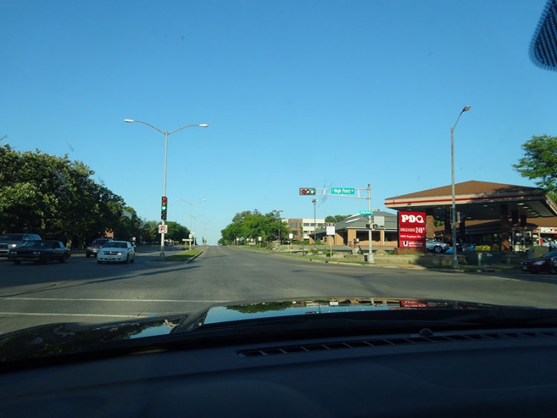
For me and my wife, we drove on up to Madison, WI to spend the night. As we get into to town we see this: in Madison, WI
Can you believe it? We really are involved it a crazy sport! More than we knew! can you believe it?
map of Scales Mound and Charles Mound
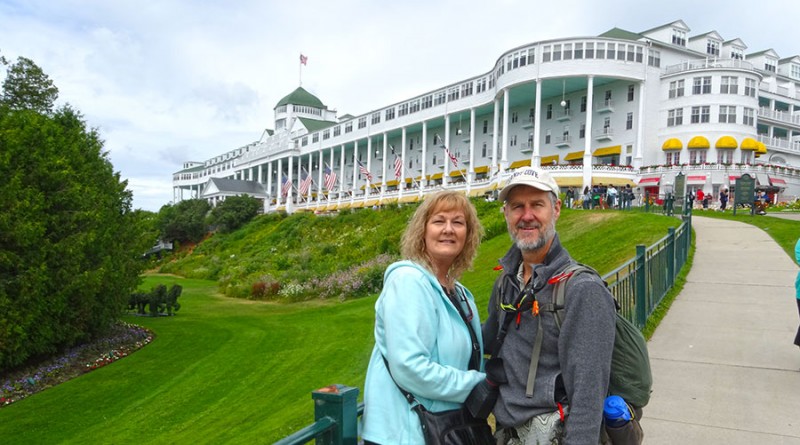
And about that bucket list item for my wife....we made it to Mackinac Island and the Grand Hotel. She made her summit. It was lovely.
Thumbnails for uploaded photos (click to open slideshow):
As always, I love your trip reports and the stories you tell that go with them. I think I’m going to have to get some more state highpoints in eventually!
A fun report. We visited here a few years ago on my quest to hit all 50. It was insanely hot and humid. We were soaked with sweat from just being outside.
Caution: The information contained in this report may not be accurate and should not be the only resource used in preparation for your climb. Failure to have the necessary experience, physical conditioning, supplies or equipment can result in injury or death. 14ers.com and the author(s) of this report provide no warranties, either express or implied, that the information provided is accurate or reliable. By using the information provided, you agree to indemnify and hold harmless 14ers.com and the report author(s) with respect to any claims and demands against them, including any attorney fees and expenses. Please read the 14ers.com Safety and Disclaimer pages for more information.
Please respect private property: 14ers.com supports the rights of private landowners to determine how and by whom their land will be used. In Colorado, it is your responsibility to determine if land is private and to obtain the appropriate permission before entering the property.