Download Agreement, Release, and Acknowledgement of Risk:
You (the person requesting this file download) fully understand mountain climbing ("Activity") involves risks and dangers of serious bodily injury, including permanent disability, paralysis, and death ("Risks") and you fully accept and assume all such risks and all responsibility for losses, costs, and damages you incur as a result of your participation in this Activity.
You acknowledge that information in the file you have chosen to download may not be accurate and may contain errors. You agree to assume all risks when using this information and agree to release and discharge 14ers.com, 14ers Inc. and the author(s) of such information (collectively, the "Released Parties").
You hereby discharge the Released Parties from all damages, actions, claims and liabilities of any nature, specifically including, but not limited to, damages, actions, claims and liabilities arising from or related to the negligence of the Released Parties. You further agree to indemnify, hold harmless and defend 14ers.com, 14ers Inc. and each of the other Released Parties from and against any loss, damage, liability and expense, including costs and attorney fees, incurred by 14ers.com, 14ers Inc. or any of the other Released Parties as a result of you using information provided on the 14ers.com or 14ers Inc. websites.
You have read this agreement, fully understand its terms and intend it to be a complete and unconditional release of all liability to the greatest extent allowed by law and agree that if any portion of this agreement is held to be invalid the balance, notwithstanding, shall continue in full force and effect.
By clicking "OK" you agree to these terms. If you DO NOT agree, click "Cancel"...
**** WARNING! **** ABSOLUTELY NO 14ER CONTENT! ****
Now that most people have stopped reading, I'll continue.
**** WARNING! **** ABSOLUTELY NO 13ER CONTENT! ****
And now for the remaining 16 people...
Seems like lots of members have been asking for some easy Front Range scrambling routes lately. So I revisited this old chestnut last weekend with an eye to presenting it as a fun ridge run with some spiciness.
One way to reach Tenmile Peak is from the Mt. Royal trail up and over Peak 1. Instead, I started at the confluence of Miner's Creek and the Colorado Trail. This TH is 3.2 miles up Miner's Creek Road (1000), measuring from the bike path south of Frisco. The road is easy for the first 2 miles, until it reaches a fairly steep and rough uphill that will stop most cute-utes ("crossovers" (gag), AWD cars, whatever). Beyond this, it mellows out again, but then gets progressively more rock-strewn up to the TH. Trucks/SUVs with decent clearance will have no problem if using some care.
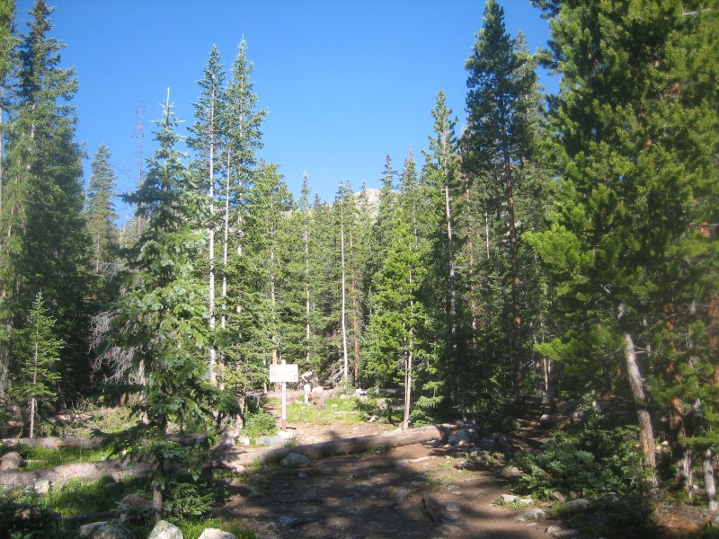
Trailhead
From the TH, I headed due west on the CT. After a mellow half-mile, the CT takes a hard turn to the south and wanders through an open area. To the west, the Tenmile ridge can be seen through the trees.
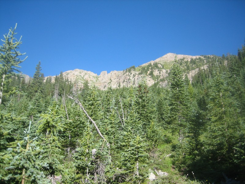
I left the trail at this point, and bushwhacked through random trees and undergrowth up the small drainage directly towards the ridge. Once the drainage widened and things started getting steep and chossy, I headed right/NW to a small saddle on the east ridge of Tenmile Peak. At this point, it's a mostly-straight shot up the ridge - mixed in with the talus and tundra is some greenery to slow you down but treeline is reached quickly. Things start getting fun here, with some class 3 and minor exposure on the spine of the ridge or 2+ on the south side.
Start of east ridge
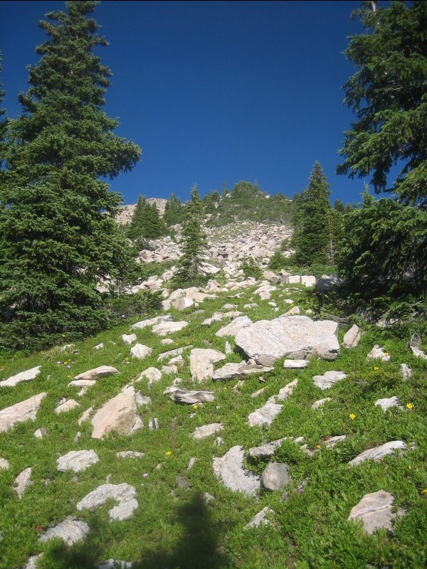
Above treeline
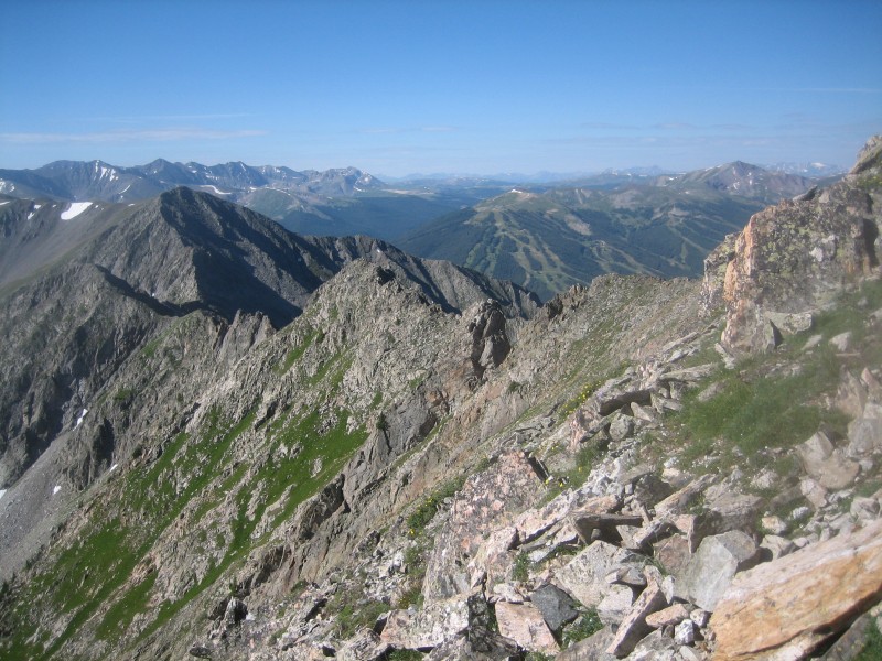
View of Peaks 3 and 4 from the east ridge of Tenmile Pk
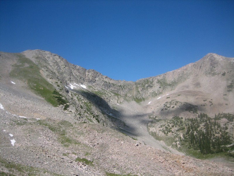
From Tenmile Peak, the fun continues south along the ridge. After a short romp, the ridge is interrupted by a deep notch followed by a sheer tower. I made my way to the bottom of the notch via solid rock, then traversed right around the bottom of the tower on mixed dirt and rock. I stayed close to the bottom of the tower and scrambled a gully back up to the ridge, crossing over to the east side and moving to the left of another tower on the way.
Heading down into the notch
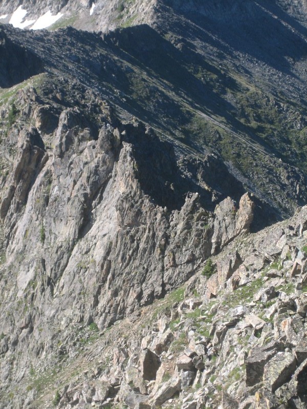
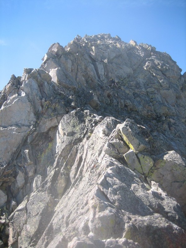
For the next section, a route can be taken directly on the ridge by surmounting a few small towers (which can be avoided just to the east of the ridge). Soon, a feature known as "The Dragon" is reached.
The Dragon from afar - note climber just behind the "head"
And near
There were a few Supermen in front of me going directly over this beast (class 4-5), but there's a cheater ramp that I took around the west side of the Dragon's neck. Lots of gravel and scree, but with plenty of grips on the Dragon's lower body, this gulch descends a bit and climbs back up on great tundra/talus to regain the ridge after the difficulties. From here it's an easy scramble up to the summit of Peak 3.
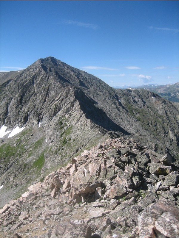
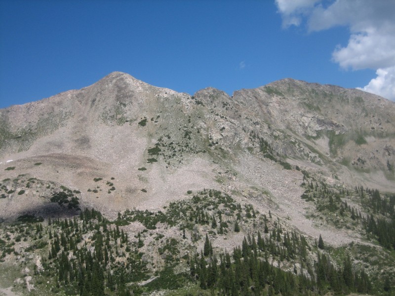
Peak 4 from 3
At the beginning of the next section of fun, looking back to Peak 3
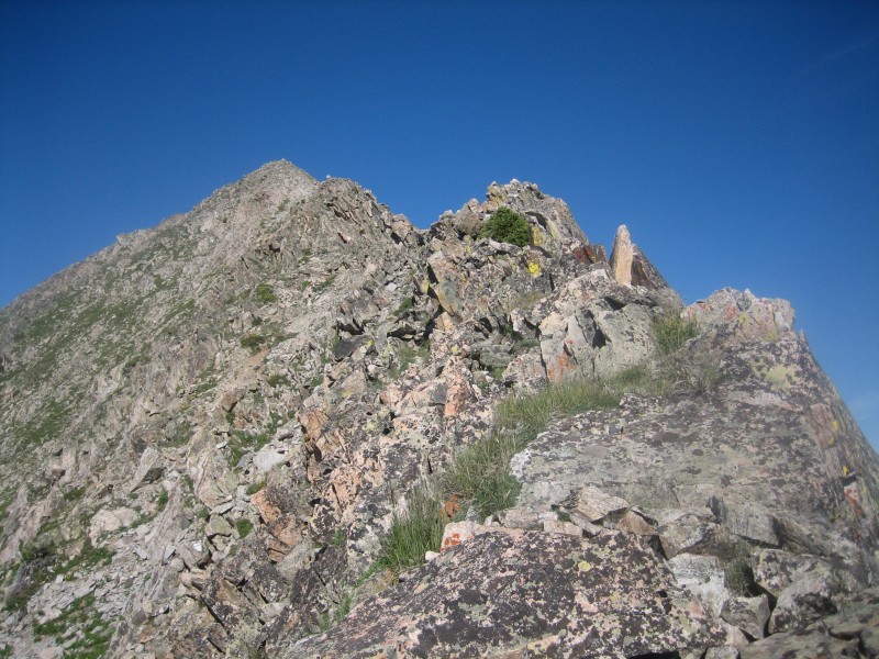
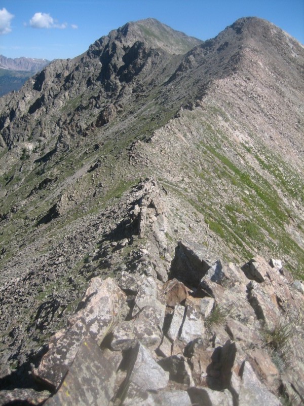
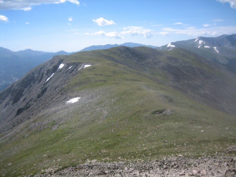
The ridge from the Peak 3 saddle was the best part of the route IMO. Starting with more class 2, it got progressively steeper and wilder. But once it started getting serious, it was good and solid, with several different options for passage - directly on the knife-edgy ridgetop (but with manageable exposure), slabby joy on the east side or Class 4ish smoother rock on the west side.
Partway up the knife-edge - true summit is hidden
The ridge direct looked pretty scary about 50' above the last picture. So I traversed over to the angled crack (see climber at the bottom of it) and worked up that way instead, loving the nice solid handholds and non-extreme exposure again. At the top of the crack, it was just plain ole pick-your-line talus and choss to the summit of Peak 4.
The contrast between the north side of Peak 4 (previous picture) and the south side was amazing.
Looking to Peak 5
The walk over to "Peak" (really just a bump) 5 was a nice no-brainer after the mental energy usage prior. From there, I talus hopped down the east slope of the ridge until meeting up with the CT again. After that, it's a simple stroll north alongside the ridge and back to the TH.
Parting shots of the ridge: Peak 4 and 3
Peak 3 and Tenmile
Thumbnails for uploaded photos (click to open slideshow):
Was thinking about doing something like this sometime, but didn’t necessarily want to go from Peak 10 all the way to Ten Mile and back (even with the bus). Thanks for posting.
Might have "only" made 4 of them, but you did the best part! The ridge up 4 was especially enjoyable :D
I will repeat the ridge someday, and may opt for this reduced scope version instead of messing with the bus shuttle again.
...about 1.5 miles and 2300’. (Whole route is ~6/3200)
Caution: The information contained in this report may not be accurate and should not be the only resource used in preparation for your climb. Failure to have the necessary experience, physical conditioning, supplies or equipment can result in injury or death. 14ers.com and the author(s) of this report provide no warranties, either express or implied, that the information provided is accurate or reliable. By using the information provided, you agree to indemnify and hold harmless 14ers.com and the report author(s) with respect to any claims and demands against them, including any attorney fees and expenses. Please read the 14ers.com Safety and Disclaimer pages for more information.
Please respect private property: 14ers.com supports the rights of private landowners to determine how and by whom their land will be used. In Colorado, it is your responsibility to determine if land is private and to obtain the appropriate permission before entering the property.