Download Agreement, Release, and Acknowledgement of Risk:
You (the person requesting this file download) fully understand mountain climbing ("Activity") involves risks and dangers of serious bodily injury, including permanent disability, paralysis, and death ("Risks") and you fully accept and assume all such risks and all responsibility for losses, costs, and damages you incur as a result of your participation in this Activity.
You acknowledge that information in the file you have chosen to download may not be accurate and may contain errors. You agree to assume all risks when using this information and agree to release and discharge 14ers.com, 14ers Inc. and the author(s) of such information (collectively, the "Released Parties").
You hereby discharge the Released Parties from all damages, actions, claims and liabilities of any nature, specifically including, but not limited to, damages, actions, claims and liabilities arising from or related to the negligence of the Released Parties. You further agree to indemnify, hold harmless and defend 14ers.com, 14ers Inc. and each of the other Released Parties from and against any loss, damage, liability and expense, including costs and attorney fees, incurred by 14ers.com, 14ers Inc. or any of the other Released Parties as a result of you using information provided on the 14ers.com or 14ers Inc. websites.
You have read this agreement, fully understand its terms and intend it to be a complete and unconditional release of all liability to the greatest extent allowed by law and agree that if any portion of this agreement is held to be invalid the balance, notwithstanding, shall continue in full force and effect.
By clicking "OK" you agree to these terms. If you DO NOT agree, click "Cancel"...
Monday, 27 July, 2015
Trailhead: High Point Bison Ranch
Route: I-80 to Pine Bluff, NE, Hwy 164, and some dirt roads
Partners: solo (I know, I know....I usually don't go solo!)
Total Elevation: -1 foot (stepping out of the vehicle)
Going after the state high points has become quite the fun scavenger hunt! Just prior to this trip, I was climbing Gannett Peak, the Wyoming State Highpoint, with Shaun Wulff, Roger Wendell, and Mark Zimmer in the Wind River Range. That trip was a huge success. You can read the TR here:
After coming out of the Winds, the drive from Pinedale to Laramie was 5 hours alone, and it got late. So I spent the night with Shaun and his family there in Laramie. The next morning I would be driving back home to Colorado Springs.... with a detour! I wanted to get the Nebraska state highpoint on the way. (This was a repeat attempt for me. I was unsuccessful on my first try. Back in April, 2013, I tried to get Panorama Point, but it was right after a big snow storm. Even though I was in a 4x4, I was turned back on a unplowed snowy road. Argh!)
This return trip to Wyoming was now my opportunity for a repeat attempt...without snow!
Shortly after 8am, I found myself east bound on I-80, driving the posted speed limit of 80mph , and the outside air temperature was 80 degrees! Interstate 80 east of Cheyenne, WY
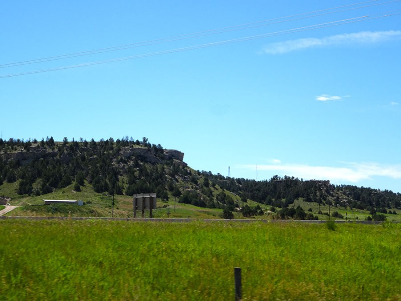
Sometime after 9am I was in Pine Bluffs in the lower right corner of Nebraska in Pine Bluffs. I think this may be where the name comes from...pines on a bluff. pines on a bluff!
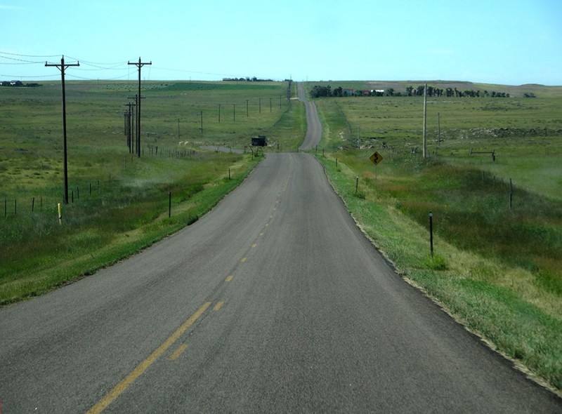
Since I was coming from Laramie, my route to Panorama Point was to take Hwy 164 south out of Pine Bluffs. You've got to exit off of I-80 at exit 401, go north under the freeway to 8th Street where you turn right/east, and then turn right/south on Beech Ave/Hwy 164. Highway 164, heading south out of Pine Bluffs is paved
After a little over nine miles, there is a turn left/east on County Road 203. This road takes you into Nebraska after a jog south and then a job back east. Road 203 takes you from Wyoming into Nebraska
Once in Nebraska, the County Rd 203 becomes County Rd 6. Soon, you come to a turn. Turn south. (There is no turn north.) This road is also dirt, but as you can see here, they seem to keep it maintained. I passed a guy on a road grader working on it. County Road 5 heading south
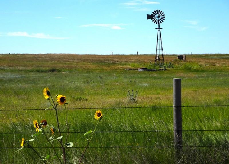
All of the usually scenery for cowland came into view... Windmill and sunflowers in Nebraska
Until this! I know that the wind blows harshly from west to east across Cheyenne, Wyoming. Looks like somebody decided to take advantage of it. Modern day windmills!
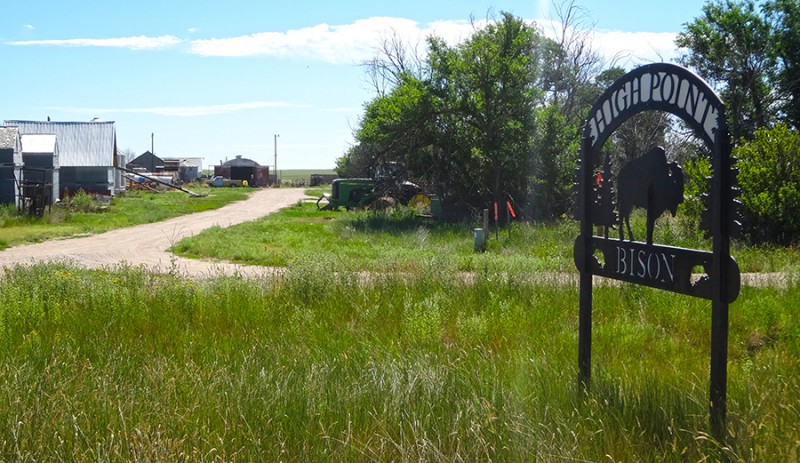
After about 2 miles, the private property for this state highpoint arrives on the right (west) side of County Road 5, Here is the sign at the entrance. Entrance
The sign explains the "High Point Bison." I thought the name was going to be Panorama Point. But the sign calls it High Point Bison. I am not sure if this was the name of the ranch or the name of the highpoint. And I'm not sure if the animals are named bison or buffalo. All these uncertainties! notes on bison
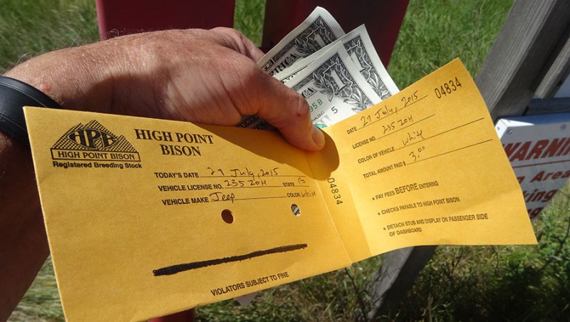
Regardless, the request of the land owners is to pay a $3.00 entrance fee. I obliged as I didn't want to be considered as a poacher. fork it over!
The westbound road crossed over a "cattle" guard...or in this case a "bison" guard. Even thought, I never saw a singe bison...or buffalo, or antelope, or goats on this property. bison guard
The short drive is 1.3 miles from the gate to the highpoint. We are required to drive, not hike. (Just the opposite from my next highpoint (Illinois) where you are required to hike up the property, not drive.) the road turns north
At the turn from west to north, the sign makes it very obvious what to do. there's the name! Panorama Point
Once heading back north, the highpoint appears off in the distance. I don't seem to be blocked by any bison! success is in view!
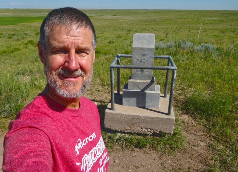
There is a stone marker so you know you have arrived. Time for the selfie to prove I made it. #17!
The views are "stupendous" as the vertical drop down off of this summit is staggering! Views!
I maintained my composure and went back to the task at hand... summit register in the desk drawer
Since this highpoint had something to sign, I did my duty and scratched in the notebook. I'm in!
For those than are interested, there is a special offer for those who brave the elements, and have successfully made this summit. call for your certificate
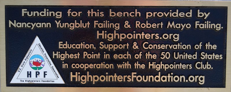
As I have now found on numerous state highpoints, there is a bench to sit and take a rest upon. Highpointers bench
If there isn't a history placard at the summit, then occasionally there is a plaque put on the bench as is the case here.
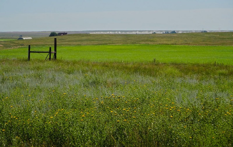
After completing this hard fought for summit, I returned to the property entrance and turn south on County Road 5. After a short ways I found this sign for what I can only assume is the landowners homestead. Ranch entrance south of the highpoint entrance
I didn't get to see or meet the landowners to tell them a hearty "thank you" for allowing the high pointing public to visit their land and where we can check off another state highpoint. And I didn't get to see any bison/buffalo to marvel at these unique creatures...even through there was a fence to keep them in...or is it keeping them out? electric fence
However, there was evidence that those bison had at one time visited this HIGHPOINT BASIN. evidence of bison!
This photo was on summitpost.org. It shows a drawing of a map, that I actually found to be quite useful.
If you have read any of my past trip reports, you may have noticed that I will occasionally end the report with a quote from the Bible. Well, how about this one which is a question from Genesis 37:15
a man found him wandering around in the fields and asked him, "What are you looking for?"
In this case, my answer would be..."the state highpoint!"
Thumbnails for uploaded photos (click to open slideshow):
Steve Climber and I saw bison when we went in March! Here’s our trip report in blog form:
http://freshairfortcollins.com/calling–your–bluff–a–grassland–day–trip–adventure/
...is that a dead squirrel, an empty can of Busch, and a prescription bottle? Do people just leave random items in there?
Great TR, looks like a fun little detour!
Caution: The information contained in this report may not be accurate and should not be the only resource used in preparation for your climb. Failure to have the necessary experience, physical conditioning, supplies or equipment can result in injury or death. 14ers.com and the author(s) of this report provide no warranties, either express or implied, that the information provided is accurate or reliable. By using the information provided, you agree to indemnify and hold harmless 14ers.com and the report author(s) with respect to any claims and demands against them, including any attorney fees and expenses. Please read the 14ers.com Safety and Disclaimer pages for more information.
Please respect private property: 14ers.com supports the rights of private landowners to determine how and by whom their land will be used. In Colorado, it is your responsibility to determine if land is private and to obtain the appropriate permission before entering the property.
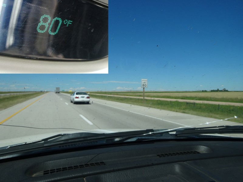


 Interstate 80 east of Cheyenne, WY")
 pines on a bluff!")
 Highway 164, heading south out of Pine Bluffs is paved")
 Road 203 takes you from Wyoming into Nebraska")
 County Road 5 heading south")
 Windmill and sunflowers in Nebraska")
 Modern day windmills!")
 Entrance")
 notes on bison")
 fork it over!")
 bison guard")
 the road turns north")
 there's the name! Panorama Point")
 success is in view!")
 #17!")
 Views!")
 summit register in the desk drawer")
 I'm in!")
 call for your certificate")
 Highpointers bench")
")
")
 Ranch entrance south of the highpoint entrance")
 electric fence")
 evidence of bison!")
")