Download Agreement, Release, and Acknowledgement of Risk:
You (the person requesting this file download) fully understand mountain climbing ("Activity") involves risks and dangers of serious bodily injury, including permanent disability, paralysis, and death ("Risks") and you fully accept and assume all such risks and all responsibility for losses, costs, and damages you incur as a result of your participation in this Activity.
You acknowledge that information in the file you have chosen to download may not be accurate and may contain errors. You agree to assume all risks when using this information and agree to release and discharge 14ers.com, 14ers Inc. and the author(s) of such information (collectively, the "Released Parties").
You hereby discharge the Released Parties from all damages, actions, claims and liabilities of any nature, specifically including, but not limited to, damages, actions, claims and liabilities arising from or related to the negligence of the Released Parties. You further agree to indemnify, hold harmless and defend 14ers.com, 14ers Inc. and each of the other Released Parties from and against any loss, damage, liability and expense, including costs and attorney fees, incurred by 14ers.com, 14ers Inc. or any of the other Released Parties as a result of you using information provided on the 14ers.com or 14ers Inc. websites.
You have read this agreement, fully understand its terms and intend it to be a complete and unconditional release of all liability to the greatest extent allowed by law and agree that if any portion of this agreement is held to be invalid the balance, notwithstanding, shall continue in full force and effect.
By clicking "OK" you agree to these terms. If you DO NOT agree, click "Cancel"...
Unlike my previous TRs, this will be short on narrative and longer on visuals. I owed my friend Zac a long-overdue trip to Idaho. And luckily, he suggested Mt. Borah as a solid objective for the visit. Knowing next-to-nothing about Idaho, I readily agreed. Now for the research portion of this undertaking... (details omitted).
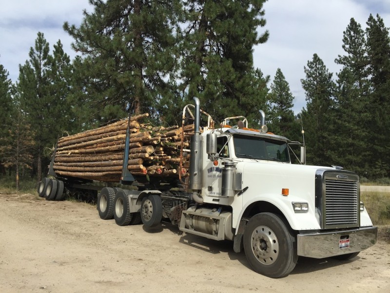
Random Idaho logging truck for flavor. It's rural out there.
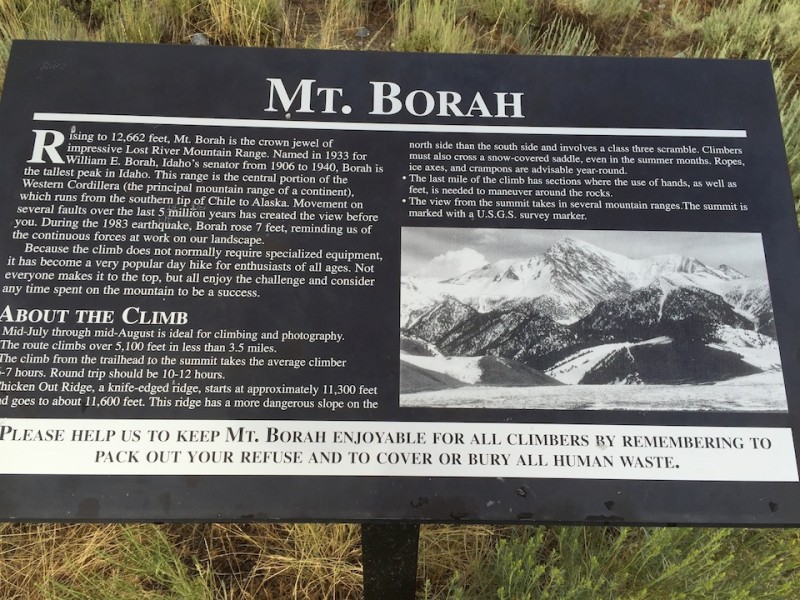
Mt. Borah (or "Borah Peak," as non-Idahoans would refer to it) is Idaho's state high point, standing proud and tall at ... less than 13,000'. 12,662' to be exact. Or maybe 12,666' if you believe suspect sources. At any rate, not more than 12,670'. Definitely. For now.
Expository short cut.
After a failed attempt at Parks Peak, 10,208', the day before (weather), Zac and I were keen to succeed on Borah. Our self-worth obviously depended upon it.
Parks Peak. Impressive in principle.
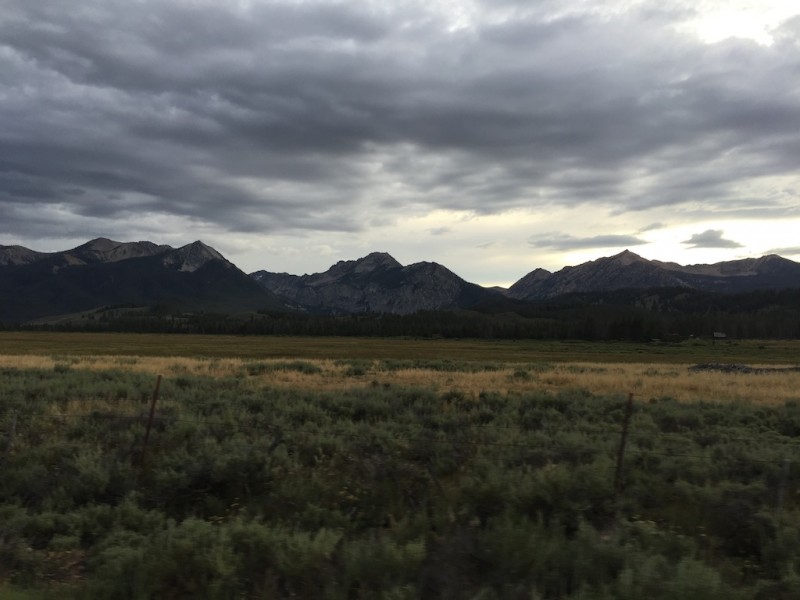
We got to Borah with more than enough time to set up camp and enjoy some R&R under a quickly-clearing sky. The weather just might cooperate!
Borah the night before. Skies clearing...
Campfire.
A few specs on Borah: the route requires approximately 5,400' of elevation gain over right around four miles. I'm bad at math, but that's a little steeper than your standard Sawatch. Also makes for a rough wake-up call.
Sunrise!
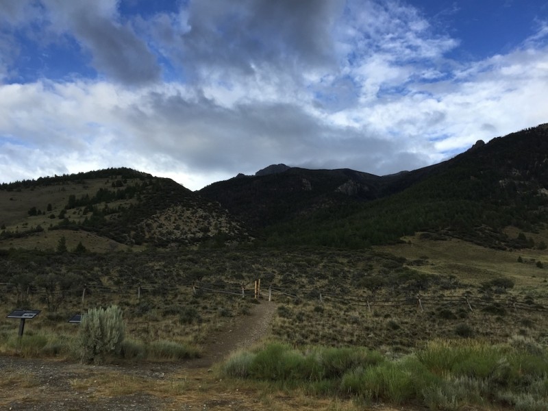
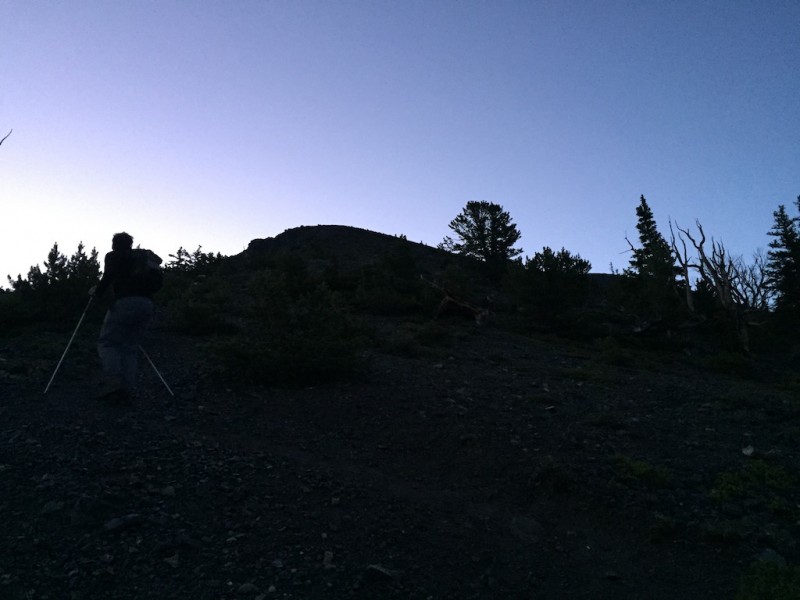
After a few hours in the dark, let's shed some light on this situation, yes?
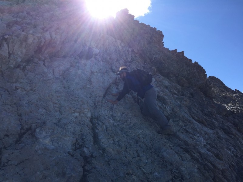
Zac and I cruised up the first 3,500' in around 90 minutes. Well, Zac cruised; I rest-stepped, sweated, and suffered (he's been running; I've been ... not).
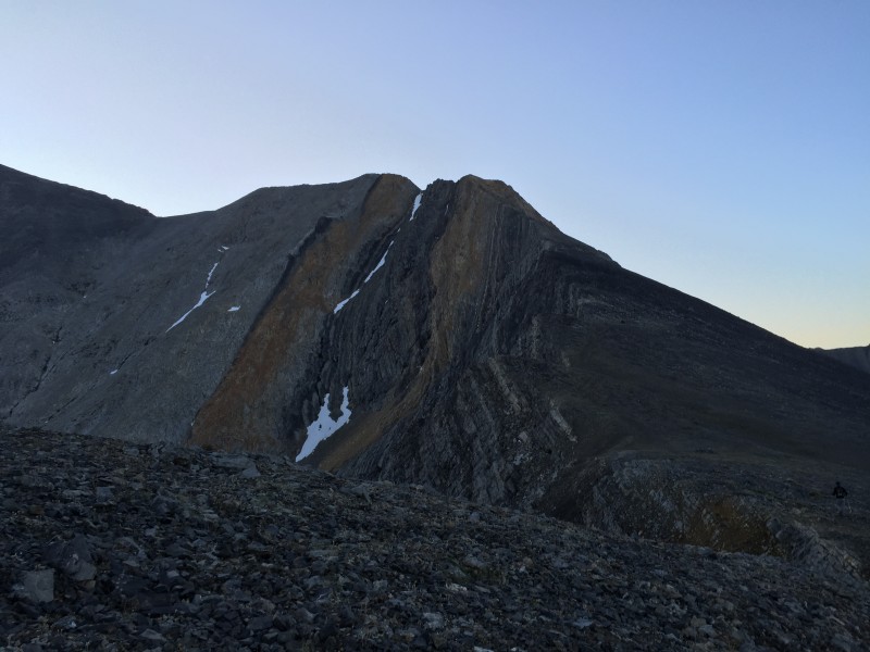
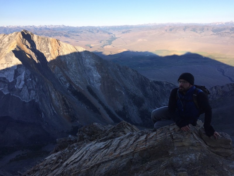
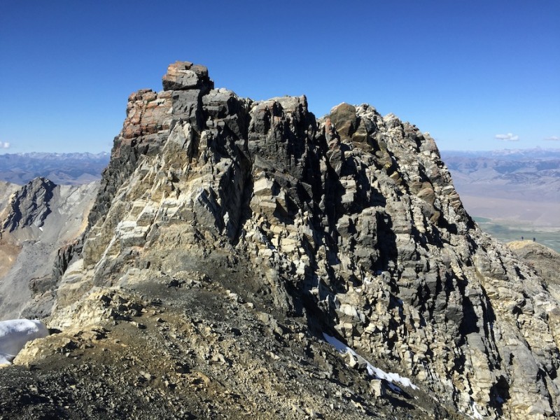
Big Picture. The route to Chicken Out Ridge, the "dangerous snow crossing," and the final push to the summit (out
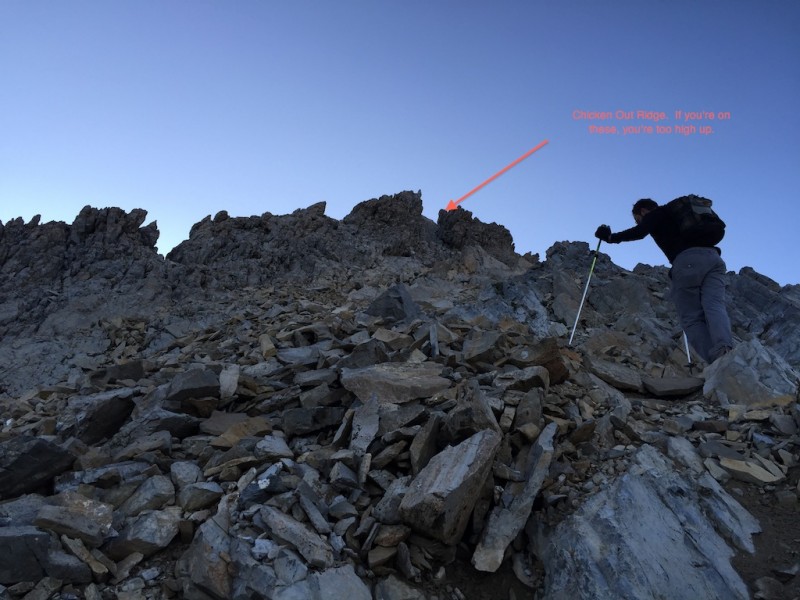
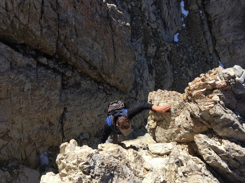
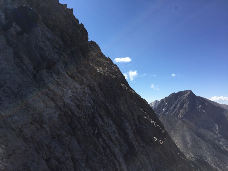
After a brief refuel, we continued the last of the cruiser trial until we ran head-first into the beginning of "Chicken Out Ridge."
About to hit Chicken Out Ridge.
Early on Chicken Out Ridge, but past the immediate difficulties, which relent quickly. Misleading perspective.
Now, Chicken Out Ridge is, frankly, not as big a deal as it's made out to be. Especially for anyone who has dealt with rotten Elks rock, the Sangre's Crestone conglomerate, or just plain floated up the Wilsons. But I digress. We must contextualize Chicken Out Ridge. Evidently, "state high pointing" is a big deal. Indeed, I was asked multiple times if I was a "high pointer" (I am not). But for those thinking Borah would just be a class 1 jaunt to the summit, Chicken Out Ridge presents a formidable challenge, especially for the uninitiated. And, par for the course, we encountered several people ill-prepared for Chicken Out Ridge. Luckily, the rock is very sturdy, especially where you need it to be. Still, it helps to pay attention, and the average hiker shouldn't underestimate it. But I narrate too much. Pictures!
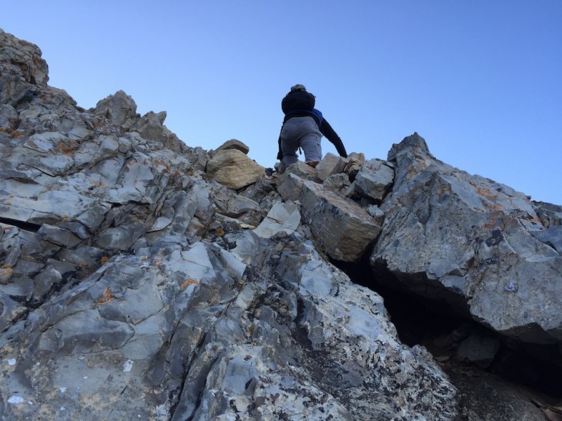
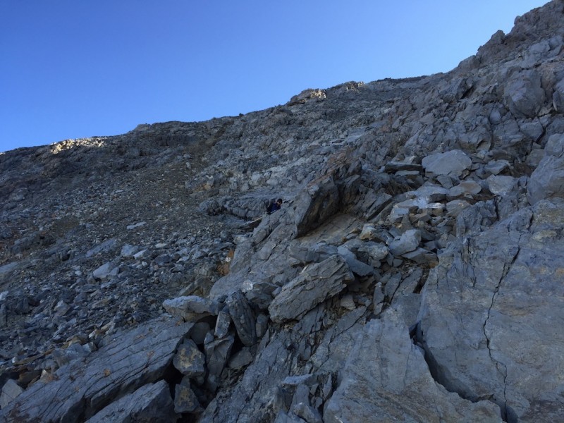
Gentle climbing on Chicken Out Ridge.
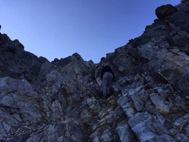
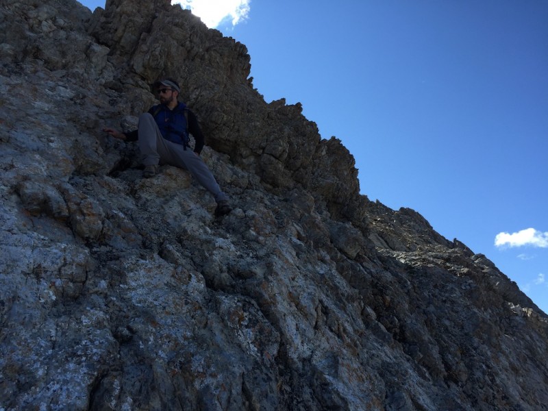
After following a defined use trail on the west side of COR, we got to climb a lovely rock ladder to regain the ridge and fac
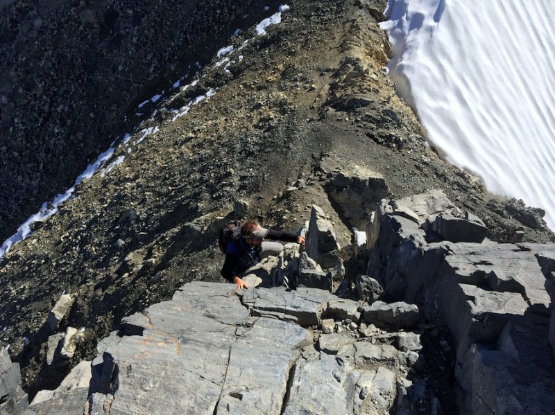
Down climbing the crux: a 30' rock tower. If you made it past the initial difficulties, this poses no problem. (So ...
Remaining route to the summit. Easy, loose class 2. But don't forget the vert you've already worked into your legs.
Pretty self-explanatory.
In the shadow of Borah.
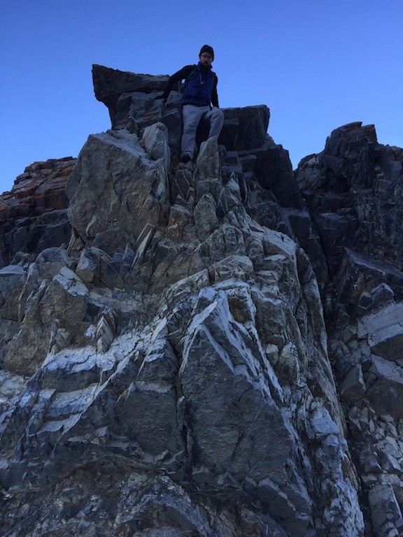
On to Borah's summit! Based on the lighting, this was probably taken on our descent.
Final push to the summit. Grunt grunt grunt.
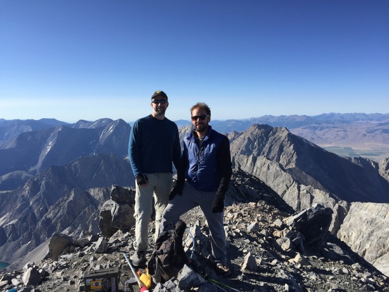
The summit was quite nice, and we enjoyed the views for a good half hour even though we shivered violently for a good portion of that time. It had taken us less than four hours to top out, and we were feeling the effects of the early morning, the sweaty backs, and the only-barely-warming sunlight. Still, there are few finer feelings than enjoying a summer summit under bluebird skies with nowhere to be but present.
Yup. We're on the summit.
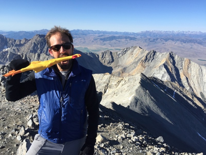
What the? Who put a (frozen) chicken on the summit? These Idahoans clearly have a strange humor.
The time, of course, came to descend, and we made quick work back down to the Borah-Chicken Out Ridge saddle. The crux awaited.
Approaching the crux tower on the descent. This is the "knife edge."
Re-ascending the crux. In the background is the (melted out) "knife edge."
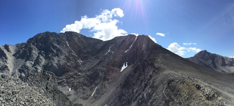
The scramble back across Chicken Out Ridge was enjoyable and punctuated by brief encounters and conversations with ascending hikers. It felt good to know we'd missed the masses and could head down without facing any bottlenecks. Since I did not take any more pics of the scramble on the descent, here's some panorama eye candy.
Borah pano. Summit on left, Chicken Out on right. Crux immediately right of small snow patch.
Shortly enough, we returned to the beginning of Chicken Out Ridge, and what I considered the biggest difficulties of the day, such as they were (apart from the descent's impact on the knees). Zac and I made quick work of it, and we soon were back on mindless trail.
Beginning the down climb off Chicken Out Ridge.
A taste of exposure. Sorry for the framing. Sun was obviously not cooperative with proper framing vis-a-vis falling.
Almost off COR.
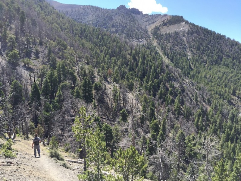
The descent is short in distance but steep in elevation; thus it is time consuming. Except for Zac, whose runner legs let him take off a bit. Of course, the descent angle taunts you with clear views to the valley below.
You have to descend the 5,400', too. Le sigh.
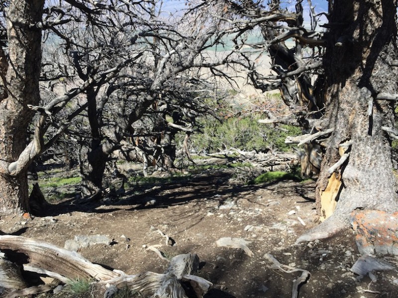
Lower trail through scrubby trees.
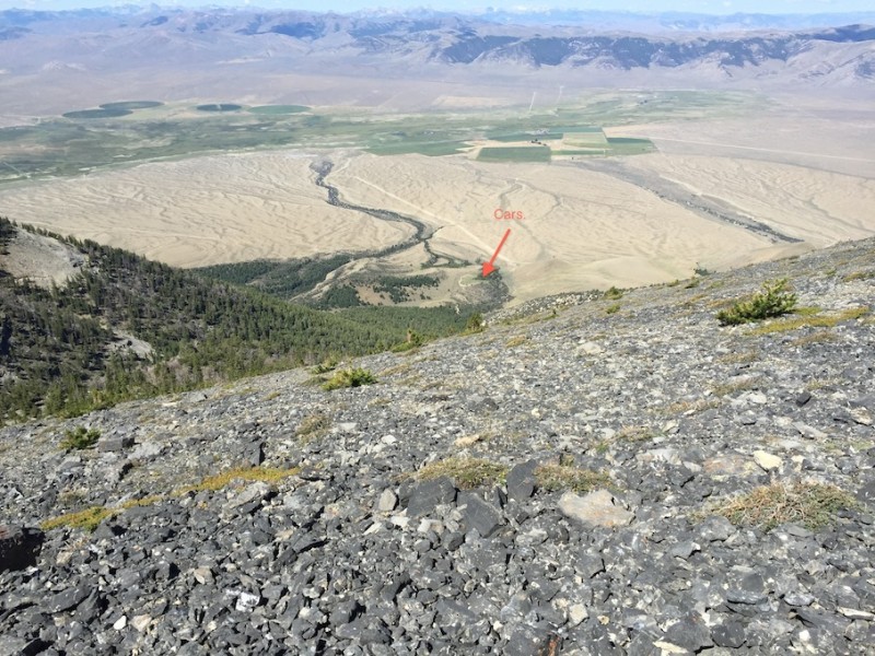
Glad we surmounted this trail in the dark. Views are nice now, though.
Why does this remind me of the final stretch of the Lake Como road? The cars still seem so far away, but the valley's wi
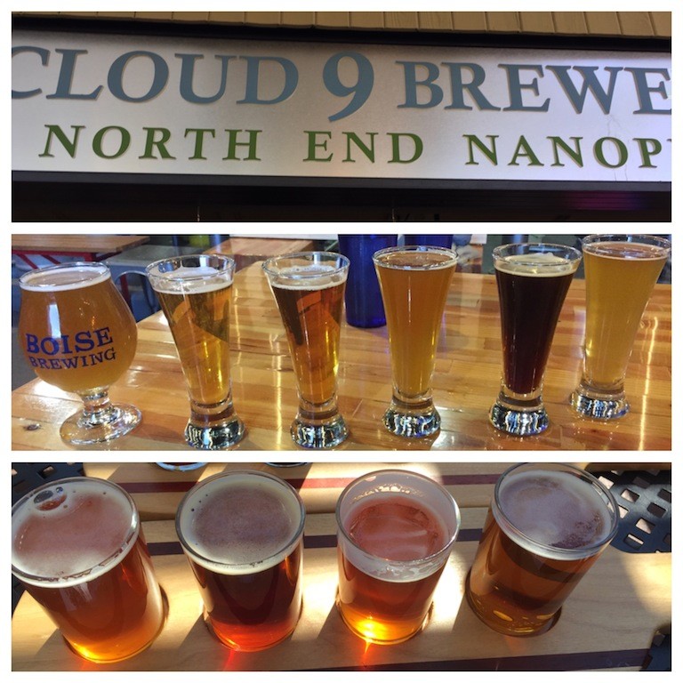
Of course, we made it back to Boise that night and, with the help of a bike and a bit of motivation, managed to visit a few breweries.
Adventure complete. So, in conclusion: 12ers are great, but I'm not sure they "rule." And RIP my GPS, which tragically passed from frequent use and general under-reliance. As a rule, Idaho's mountain's are vaguely described and present nice rugged backcountry challenges. Borah is, of course, an exception. Pretty nice to explore another state's mountains.
Thanks for reading!
Thumbnails for uploaded photos (click to open slideshow):
Nice report. I grew up in Idaho but have been working and climbing in Colorado for the last three years. I’ve probably climbed over 30 of the 14ers including Elbert a couple of times. Strangely though, I have not climbed Borah. Your photos have inspired me to put it on the list. Thanks for showing us a bit of Idaho.
We found with Chicken Out Ridge there are multiple lines. Some nearer or on top, others on the sides. So whatever way you go, if you don’t like it, there are likely other options.
Glad it’s intact after Borah. It doesn’t look like a gimme. I know you’re not a state high pointer, but did you know that Borah is also one of 57 Ultra Prominent peaks in the contiguous 48 states?
Glad you decided to write it up and post! Enjoyed the pics, prose and humor, as usual.
Also glad you got it, it’s a feather in your cap.
Definitely can’t have soggy, sagging self esteem :shock:
It’s great to see peaks outside of CO’s borders.
Congrats on a successful outing! :D
Kevin, Dave, Doug - Borah was quite picturesque and a worthwhile hike. Plus you’re pretty much guaranteed a brief tour of Idaho to get there.
jblyth - I would rank them in order of Highland Hollow, Cloud 9, and then Boise Brewery a little further behind.
12ers Dave - I did not know that. But I do believe it. I shudder to think what would have happened absent that bike ride. Thanks for the info!
Ian - I believe it. It looked like a veritable playground at times.
Nancy - Thanks! Wasn’t after any feathers, but I now have an Epic Tale of Self-Esteem.
Brian - Thanks! Pics are one of the best reasons to post these things.
Caution: The information contained in this report may not be accurate and should not be the only resource used in preparation for your climb. Failure to have the necessary experience, physical conditioning, supplies or equipment can result in injury or death. 14ers.com and the author(s) of this report provide no warranties, either express or implied, that the information provided is accurate or reliable. By using the information provided, you agree to indemnify and hold harmless 14ers.com and the report author(s) with respect to any claims and demands against them, including any attorney fees and expenses. Please read the 14ers.com Safety and Disclaimer pages for more information.
Please respect private property: 14ers.com supports the rights of private landowners to determine how and by whom their land will be used. In Colorado, it is your responsibility to determine if land is private and to obtain the appropriate permission before entering the property.