Download Agreement, Release, and Acknowledgement of Risk:
You (the person requesting this file download) fully understand mountain climbing ("Activity") involves risks and dangers of serious bodily injury, including permanent disability, paralysis, and death ("Risks") and you fully accept and assume all such risks and all responsibility for losses, costs, and damages you incur as a result of your participation in this Activity.
You acknowledge that information in the file you have chosen to download may not be accurate and may contain errors. You agree to assume all risks when using this information and agree to release and discharge 14ers.com, 14ers Inc. and the author(s) of such information (collectively, the "Released Parties").
You hereby discharge the Released Parties from all damages, actions, claims and liabilities of any nature, specifically including, but not limited to, damages, actions, claims and liabilities arising from or related to the negligence of the Released Parties. You further agree to indemnify, hold harmless and defend 14ers.com, 14ers Inc. and each of the other Released Parties from and against any loss, damage, liability and expense, including costs and attorney fees, incurred by 14ers.com, 14ers Inc. or any of the other Released Parties as a result of you using information provided on the 14ers.com or 14ers Inc. websites.
You have read this agreement, fully understand its terms and intend it to be a complete and unconditional release of all liability to the greatest extent allowed by law and agree that if any portion of this agreement is held to be invalid the balance, notwithstanding, shall continue in full force and effect.
By clicking "OK" you agree to these terms. If you DO NOT agree, click "Cancel"...
Gannett Peak--13,804 Gannett Peak as seen from Bonney Pass
Hiking dates:
Thursday, 23 July, 2015--10 miles, 6 hours (approach)
Friday, 24 July, 2015--6 miles, 4 hours (approach)
Saturday, 25 July, 2015--10 miles, 14 hours (climb), plus 4 miles, 2 hours (hike out)
Sunday 26 July, 2015--12 miles, 6.5 hours (hike out)
Total Time: 4 days (hiking) plus 2 days (driving)
Trailhead: Elkhart Park
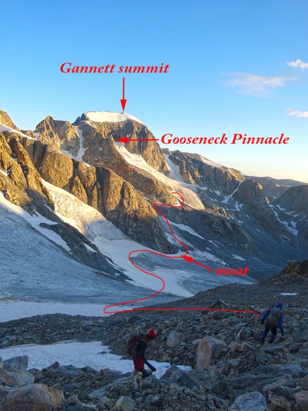
Route: Pole Creek trail->Seneca Lake trail->Indian Pass trail, Titcomb Lakes trail, up & over Bonney Pass, under Gooseneck Pinnacle ridge, then up past Gooseneck Pinnacle, to the Continental Divide, turn right and take ridge to summit.
Trip Length: 42 miles
Elevation Start: 9,400 feet Elevation Summit: 13,804,
Total Elevation: 9,050 vertical feet (according to SummitPost)
In 2014, I had this state highpoint on the calendar to climb with two other partners. It seemed that God had other plans for me. Just a few days before the trip with Paul Perea and Michael Shiffmacher, I severely injured my ankle and had to back out. I was so disappointed and bummed. But I've come to realize, I wasn't prepared in 2014.
Fast forward to this year (2015).
After climbing the Colorado ranked 14ers, and then the unranked 14ers, and then the "Centennials" in Colorado, I latched onto the goal of climbing the U.S. state highpoints. In this quest, I knew I would need to climb Mount Rainier in Washington, a glaciated peak. So this winter (January through April) I took the CMC HAMS (High Altitude Mountaineer School) class to learn crevasse rescue and roped travel skills. Gannett Peak also has glaciers and crevasses, and so these newly learned skills would also bring some peace of mind for this mountain.
I prefer not to hike alone. In fact, the CMC has a requirement for all club hikes to have a minimum of four people. I knew that finding partners for this endeavor would be difficult. It's the most remote state highpoint in the country involving either a 42 mile (west approach) or a 50 mile (east approach) round trip on foot, and so I really didn't want to do this alone! So, not only did I respond to a Gannett Peak post on 14ers.com, but I actually started praying for partners.
Out of the blue, I received a PM from straight_up (Shaun Wulff) in April. He wanted to climb with me and especially, join me for Gannett. I immediately said yes and we set the dates for late July. Now a really cool thing happened. While I was climbing Rainier in June, and was in Camp Muir on my ascent, get this....I ran into Shaun! He was on his way down from the summit and taking a break in Camp Muir. While I was talking with some other people in camp, he recognized me from my pictures on 14ers and came over and introduced himself. BAM! I now knew that if Shaun just climbed Rainier, he would be a capable partner for Gannett. What a comfort!
Also out of the blue, came my other two partners. One of my HAMS instructors, Debbie Markham, told me about Roger Wendell was going for Gannett this July. I had climbed with Roger twice before, and so I called him. Roger agreed that he and his partner Mark, would shift their schedule so we could join forces. And so as it turned out, I didn't find partners, they came to me. I guess you could say, those prayers for partners were answered.
I drove from Colorado to Laramie, WY where I met up with Shaun so we could carpool the remaining 5 hours drive up I-80 and US 191 to Pinedale, WY. From here we headed northeast out the Fremont Lake Rd, (which turns into Skyline Dr or 740 road) to the Elkhart Park trailhead. Note, this road is paved all the way. No 4WD drive needed in summer to reach this trailhead. We camped in the Trails End campground as Roger and Mark had arrived earlier to secure us a spot.
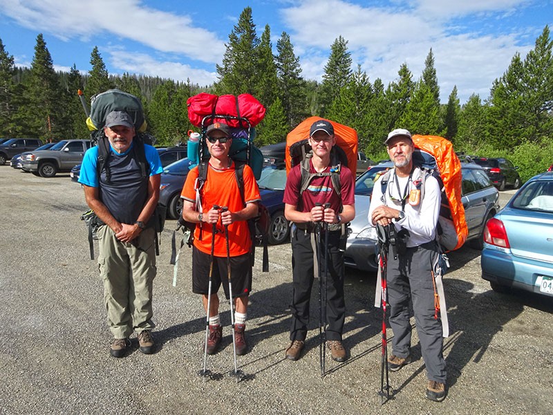
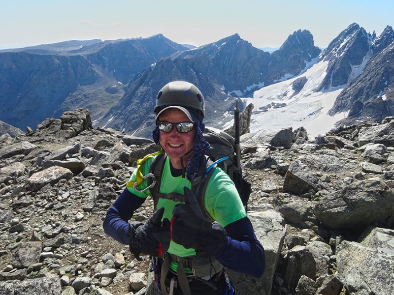
Since we Shaun and I didn't arrive until almost midnight, we all agreed not to rush the next morning. We aimed for a leisurely start. No alpine start needed. So we ended up with boots on trail at 9:24am. At the TH...Roger Wendell, Shaun Wulff, Mark Zimmer, Britt Jones
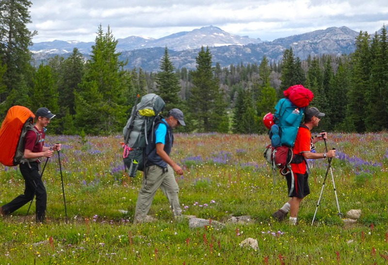
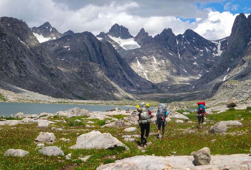
We started out on the Pole Creek trail. The wildflowers were out in full force. Follow the leader thru the wildflowers
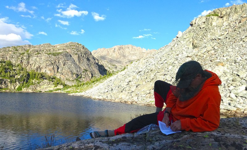
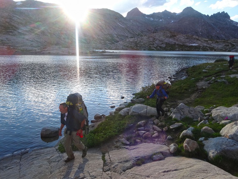
Our route would take us past a junction to Miller Lake, up to a beautiful overlook at Photographers Point which is about 4.5 miles in. Then on the Seneca Lakes trail past Barbara Lake, Hobbs Lake, Seneca Lake to Little Seneca Lake. This was our goal to camp here at 10 miles in. Shaun reading some scripture at Little Seneca Lake camp
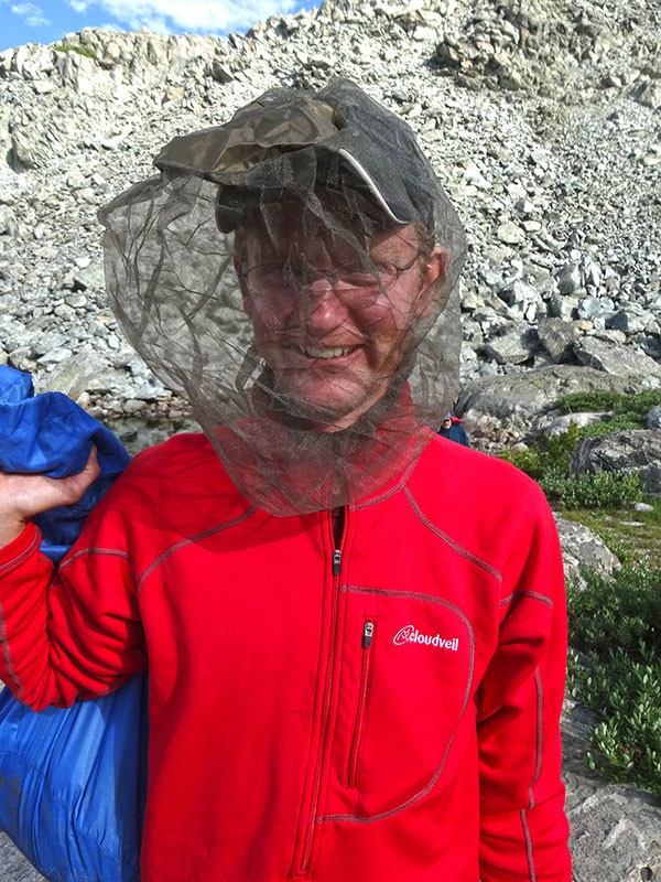
We had heard the horror stories of the voracious mosquitoes that are here in the Bridger Wilderness. We came prepared! Mark donning his MOSQUITO BARRIER UNIT!
The goal for our second approach day was to get to the upper Titcomb Lake at 11,600. This was going to only be a 6 mile day. So, we really took our time getting out of camp this Friday morning. That was nice to enjoy a relaxing morning in the backcountry.
We didn't start hiking until 10am. Once around the Little Seneca Lake, we took the Indian Pass trail.
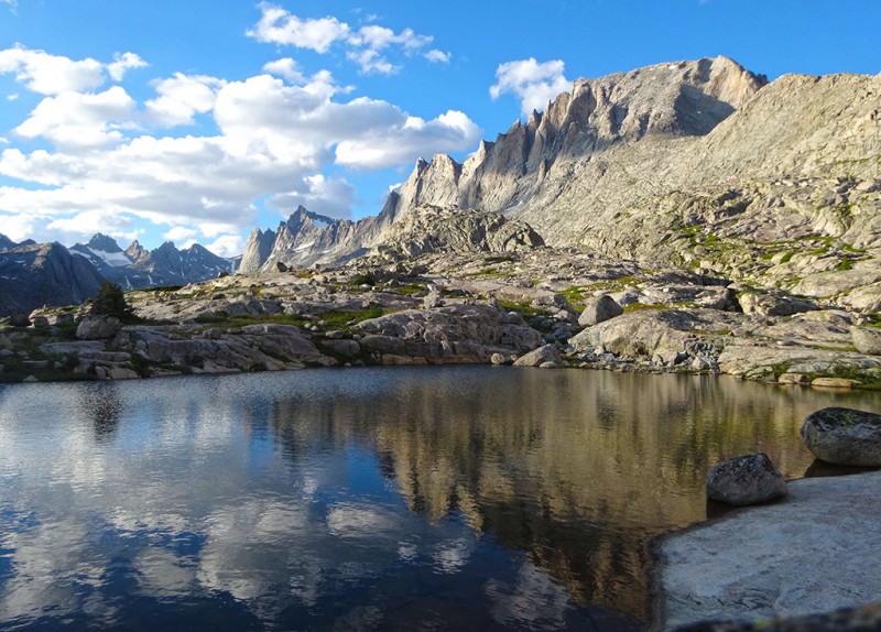
During my research of this mountain, I learned there are two main routes. One from the east (Dubois, WY) and one from the west (Pinedale, WY). The pictures of the scenic lakes sold me on west side. Island Lake at 12 miles in was absolutely stunning! Island Lake
After circling around the east end of Island Lake, we took the Titcomb Basin Trail due north where we paralleled the Titcomb Lakes. The wildflowers never let up. And what can I say? This basin is totally enchanting as we were surrounded by high peaks above and the lakes below. Hiking among the wildflowers in Titcomb Lakes Basin
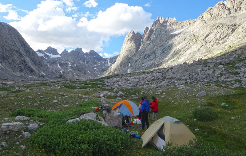
We hiked up above the second large lake in about 4 hours time for a total mileage of 6 easy miles this day. This allowed us to set up camp early in the day so we had plenty of time to rest up before for our middle of the night summit attempt. High camp at 11,600 feet
I came to learn that Shaun loves cold. He likes snow in winter, and swimming in icy, high alpine lakes. I couldn't believe he packed in his swimming goggles! I kept telling him..."you are a wild man!" Shaun loves the cold water
For me....I don't like being cold. Winter camping I tolerate, but swimming in a icy alpine lake...
can you hear my George Bush imitation voice? "Not gonna do it; wouldn't be prudent." Me...not so much
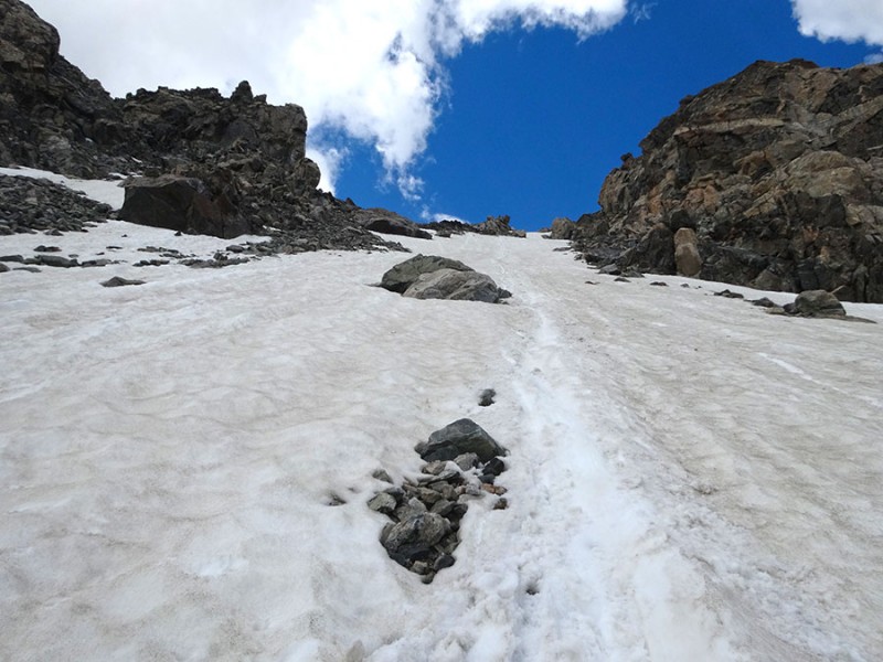
After setting up camp, some swimming/bathing, and enjoying our dehydrated dinners, I wanted to hike up the basin to scout our route. We were planning to get up at 2am and start our summit bid at 3am. That would mean negotiating a unfamiliar route in a completely moonless night. I wanted to make absolutely sure I knew exactly where Bonney Pass was. I was unsure if the pass may have been around the bend to the right in the back of the basin. Shaun and Mark went with me to explore and I laid down waypoints along the way in my GPS. From using my map and GPS in the daylight, we now knew exactly where Bonney Pass was. Getting a bearing on Bonney
I was glad we did our pre-dark reconnaissance. While the photo above makes the route look tame, once up in the back of the basin everything turned into a maze of rocky crags. We had to keep turning off our headlamps to locate that white strip of snow which was our target. Once at the foot of the steep Bonney Pass ramp, Roger declared that he wasn't feeling good, had no strength or energy to do this climb, and stated that he was calling it. He had to return to camp and that this CMC trip will now cease as a CMC climb. If we chose to continue on, we were on our own and that is was no longer a CMC sponsored climb. I felt so sorry and disappointed for Roger after he had put so much effort and had come so far.
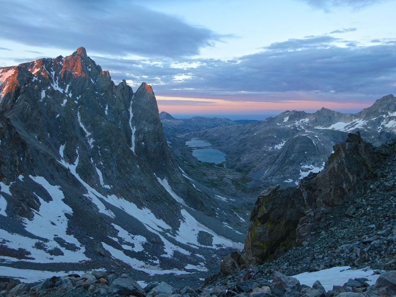
Shaun, Mark, and I were now a three-some. After we had made it halfway up to Bonney Pass, we got our first rays of sunlight on the high peaks and this wonderful view back down at the Titcomb Lakes. Looking back at Titcomb Lakes Basin
After reaching the top of the pass, we were now treated to our first glimpse of Gannett. What a glorious feeling to now have our goal in sight! However, I was disappointed to see there was no snow on the north side of Bonney Pass. So we removed our crampons to head down towards the Dinwoody Glacier.
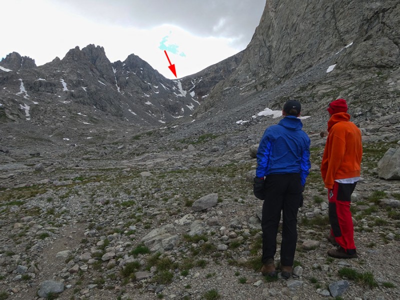
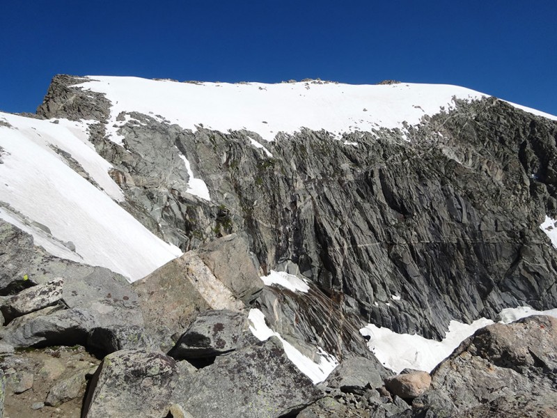
I have heard that some people have gotten into trouble by taking the wrong route by turning up to soon. So I've drawn in a guide on the photo to help. If you look on a map, there are three rock ribs between Bonney Pass and Gannet Peak. The first one you will naturally bypass. The second one has the huge moat at the bottom. The third one has the Gooseneck Pinnacle. The route to Gannett Peak--13,804 feet
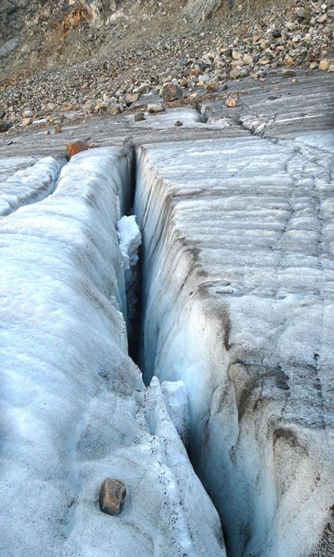
While this mountain isn't a Mount Rainier, it is still a mountain with glaciers and crevasses! crevasse on the Dinwoody Glacier
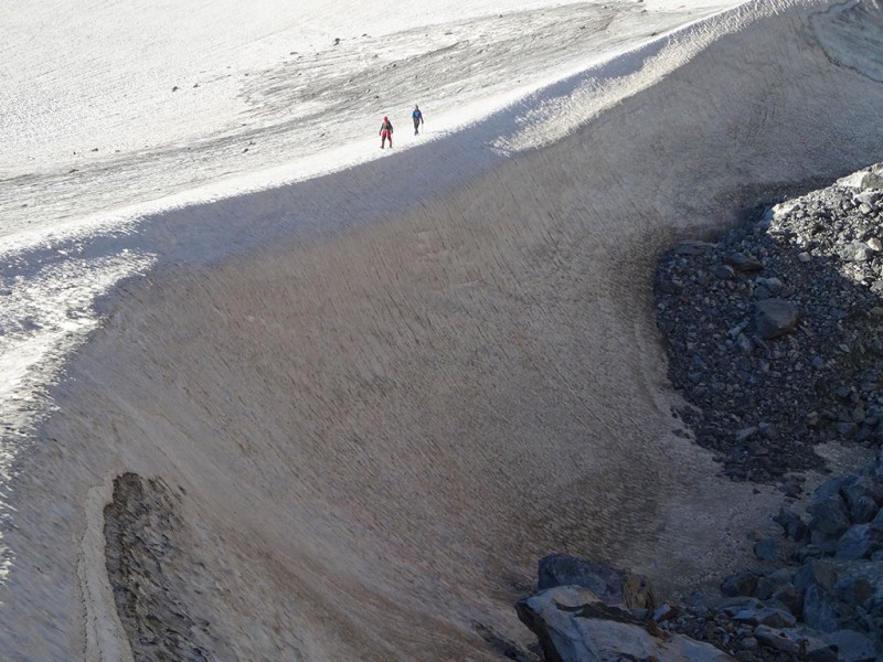
From a distance the moat at the bottom of the second rock rib doesn't look like much. Does this photo put it into perspective? This is your low spot (11,600 ft) that you descend to after coming off of Bonney Pass (12,800 ft) giving you a 1,200 foot loss of elevation that you'll have to re-climb. Shaun & Mark hiking around moat under second rock rib
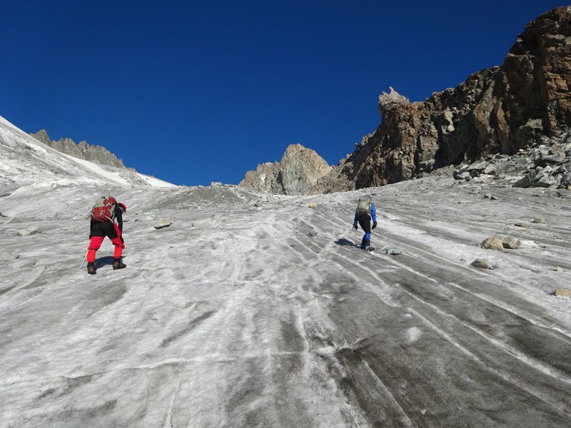
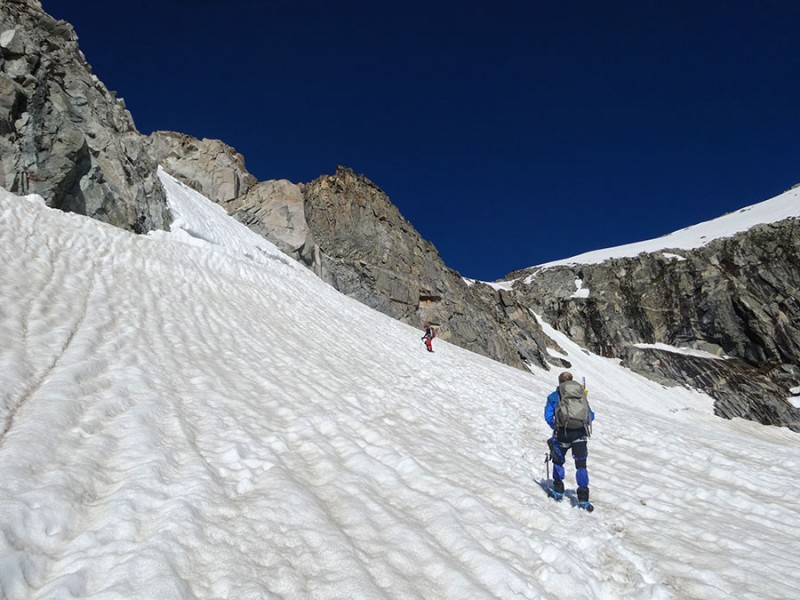
After rounding the moat, you actually have a choice of routes over to the Gooseneck Pinnacle rib. You could traverse directly over to the low spot on the Gooseneck Pinnacle rib, or you could do what we did and turn left. We headed up maybe 150 feet on this gray ice (to keep our crampons on) and then turned back right to gain the small strip of snow to round the Gooseneck Pinnacle rib. (go back up to see image #13) DO NOT CONTINUE UP THIS GLACIER BETWEEN THE GOOSENECK PINNACLE AND THE MOAT! That is where people get into trouble on more difficult terrain! Traversing glacier over to Gooseneck Pinnacle rib
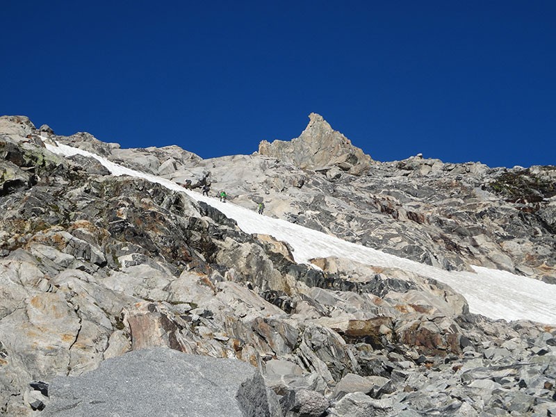
Once rounding the bottom of the Gooseneck Pinnacle rib we unfortunately ran out of snow and took off our crampons. We ascended a couple hundred feet, aiming directly for the Gooseneck Pinnacle rock, when we saw 4 guys on this snow ramp. So instead of staying on the Gooseneck Pinnacle rock, we made our way over to the snow to join them. Directly under the Gooseneck Pinnacle (see the 4 climbers?)
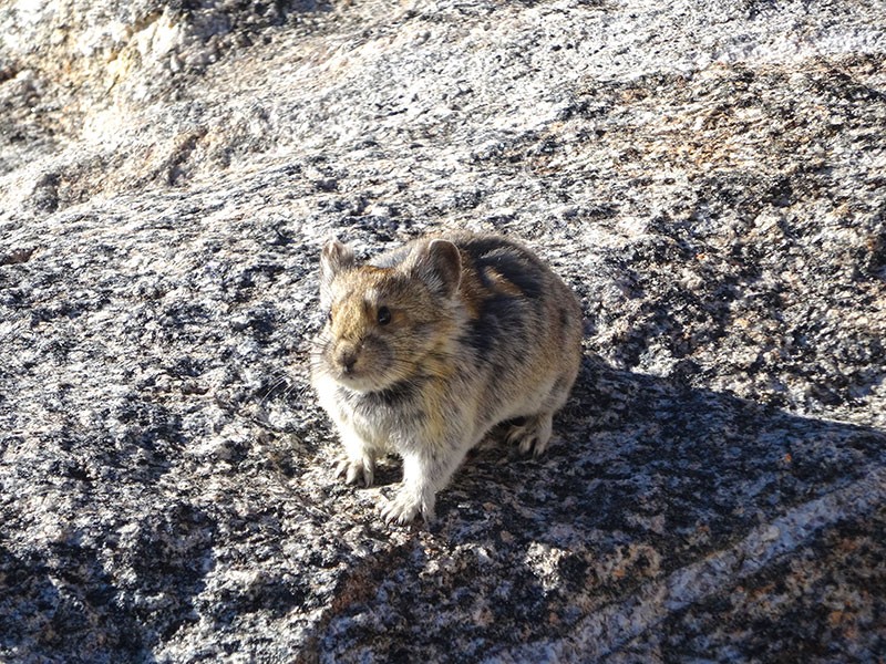
The snow slope was short lived and we soon once again had to remove the crampons. While taking off the crampon, this friendly little guy came up and introduced himself. Actually I think he was a resident beggar. But I've never had one come up so close and stay so long. A cute little pika
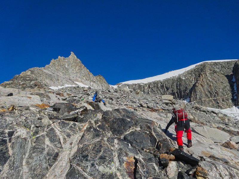
Back on the rock, the route aims directly for the Gooseneck Pinnacle. Up closer to the pinnacle, the route will take you underneath it to the right Mark & Shaun are natural scramblers
Instead of heading all the way to the base of the pinnacle on rock, we put the crampons back on and made a beeline for the bergschrund. If you have researched climbing Gannett Peak, then you no doubt have heard of the bergschrund. I actually thought it was going to be at the bottom of the Gooseneck Pinnacle rock rib. It isn't. It's at 12,800 feet. When I didn't find it down I guessed, it was going to be at the snow slope closer to Gannett's summit block (above Mark's head). Instead, the bergschrund is where Shaun is heading, the snow ramp between Gannett's summit block and the Gooseneck Pinnacle. The bergschrund comes into our sights
The question everyone asks...."is the snow bridge in?" Shaun taking the risk of crossing the snow bridge
The bridge held for Shaun. Then Mark crossed it. Then I crossed it. Awesome! If it wasn't in, I don't know what we would have done. This is what it looked off to the right of the snow bridge. I guess it might have been possible to cross the bridge at that end. Who knows? Bergschrund to the right of the snow bridge
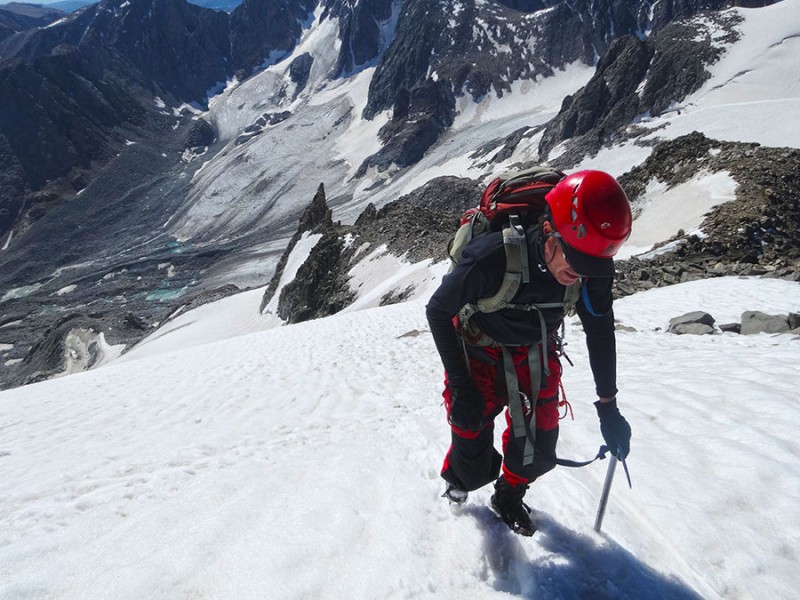
Once above the bergschrund, the snow slope is steep! This turned out to be the steepest snow of the day. There were places our feet were slipping out of the snow and sliding back down, even though we were wearing crampons. The steepest snow slope is above the bergschrund
Mark was all smiles as we made it to the top of this snow slope, even though it meant we have to once again remove the crampons. Mark is elated to have that slope done
From the top of the snow slope above the bergschrund, and over to the actual summit block, we had a melted out rocky ridge. We had to put back on the crampons on last time, on the mass of snow on top of the Gannett summit block. (Note the cliffs below the snow mass.) One the left edge, you can see two climbers climbing up the steep snow. Gannett's summit and cliffs (see the 2 climbers left edge of snowfield?)
Shaun is seen here climbing up the large mass of snow on Gannett's summit block. It was steep, but not quite as steep as above the bergschrund. Remember the cliffs from the previous photo? Those are below Shaun here. That's what I was concentrating on during this final push for the summit. An uncontrolled fall without being able to self-arrest with your axe would not end pretty! Shaun climbing up the final summit block Britt & Mark on the Continental Divide Mark & Shaun also enjoying the easier slope angles
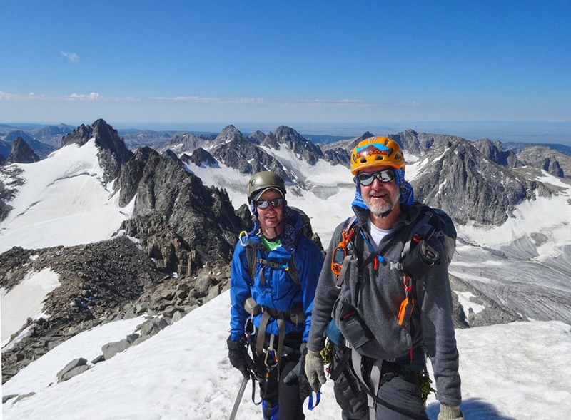
At 10:45am, after 7 3/4 hours all three of made it to the top of Gannett Peak (13,804). We were some happy campers! Or, I should say climbers. Three happy climbers on Wyoming's state highpoint!
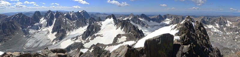
This has got to be one of the prettiest mountain ranges in North America! Magnificent view of the Wind River Range!
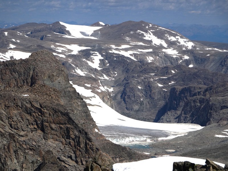
Looking to the northeast is another glacier. Can you see how deep the snow and ice is next to that lake? I bet that has to be 100-200 feet thick! Gannett Glacier
After enjoying a good 45 minutes on the summit with blue bird skies and no wind, we started our long trek back to our high camp. We knew the snow was softening and it was going to take a long time to get back. So down we go.
The return was mostly uneventful, except for back at the bergschrund. As I was crossing it....BAM! I stepped clean through the bridge! As I pulled my leg out, I looked down into the hole. I could see through the snow bridge into the bergschrund! And then three more steps...BAM! It happened again!!! Holes punched through!
I hollered back up to Mark and Shaun and told them to sit down and scoot across the bridge to spread out their weight and not to walk it. Mark & Shaun approaching a bridge on it's last leg!
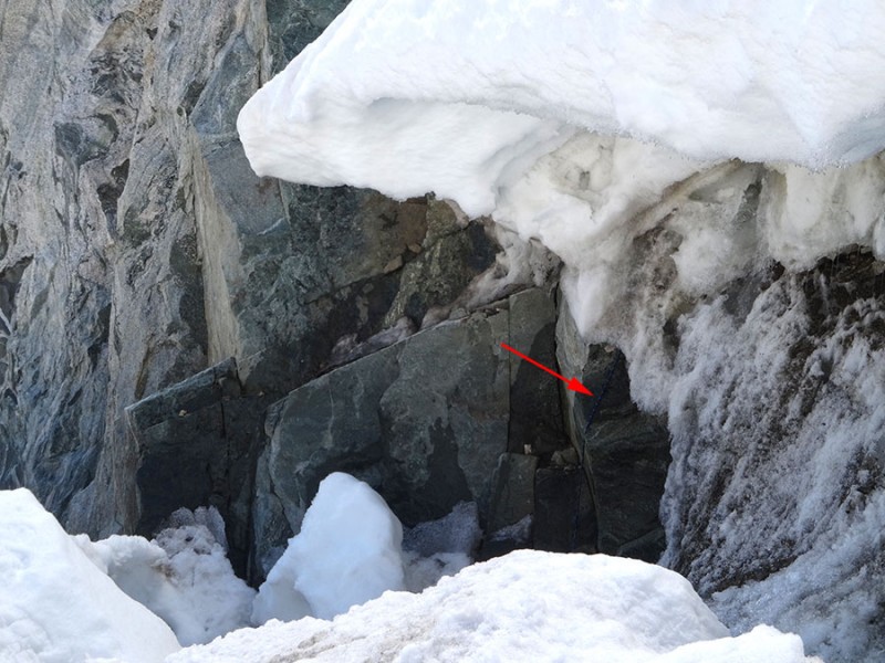
Mark and Shaun made it across without punching through or breaking the bridge down! However, Shaun got glissading and had to do a true self-arrest! (That's why we practice isn't it Shaun?) Now, for those going to do this climb, if the snow bridge has already collapsed, I had found out there is a anchor and a rope on the left side. I found it up above the bergschrund. Arrow marks the anchor and start of the rope
However, it runs underneath the snow. I found where it comes out down inside the bergschrund. But I don't see how it's going to help anyone since it's under 10 feet of snow. So, this takes me back to the picture I took on the right side of the snow bridge. You might go check out that side and see if there isn't a way up and over the bergschrund close to the rock. From what I could see climbing the rock on the left side of the snow bridge would be very difficult without a new rope being strung on the top of the snow. Arrow marks the rope
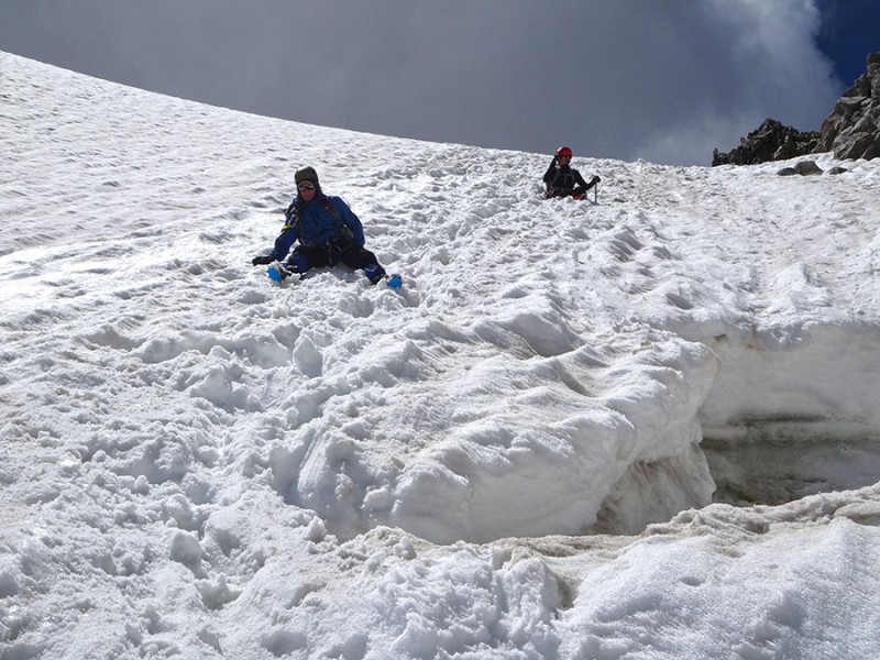
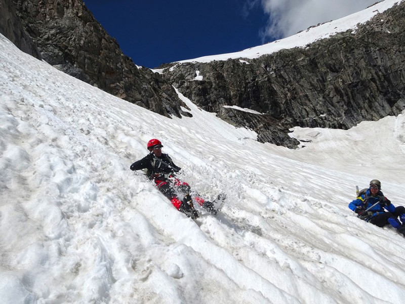
That unexpected glissade got Shaun's juices going, and then he wanted to do some more glissading! Shaun's enjoying some glissading
Once back to the south side of Bonney Pass, we got another opportunity to glissade again. This time it was a much longer run of maybe 800 feet. Loads of fun! Britt's butt track
Once back in the Titcomb Lakes Basin, we met up again with Roger. He had strolled (barefooted) up valley about a half mile from our high camp and was waiting for us. So, after a 14 hour day, we made it back to camp at 5pm. We decided to go ahead and pack up camp and start our hike out. Roger leads the way out of the Titcomb Lakes Basin
To shorten our final day we hiked back 4 of the 16 miles to Island Lake. We made it just before dark in time to set up camp, cook dinner...and for Shaun, another dip in the lake. Sunday's hike out started at 8:45am and was largely uneventful, with the exception of an appearance of some of the locals. Momma and baby moose up close!
What can I say? This Bridger Wilderness in the Bridger-Teton National Forest is pristine, spectacular, about as close to how God must have designed it, as you can get. I am so grateful that we were allowed to experience this very remote place where very few people get to see. If is definitely a place worthy of the effort to visit. In the beginning God created the heavens and the earth.
Footnote: I got a text today from Mark Zimmer from the summit of Granite Peak in Montana! Mark and Roger successfully summited Montana's State Highpoint. So Roger's week didn't turn out so bad after all.
Thumbnails for uploaded photos (click to open slideshow):
Unreal trip Britt. Pictures look incredible. That range looks like Gores and Weminuche combined – times 2. Good thinking on the head bug net and yes, alpine lake dips are an incredibly refreshing experience.
Nice green GoLite by the way :D. Too bad they aren’t around anymore...
Good to see you made it up to Gannett this year! Great report as well. It’s tough to take a bad picture in that area, simply stunning!
Caution: The information contained in this report may not be accurate and should not be the only resource used in preparation for your climb. Failure to have the necessary experience, physical conditioning, supplies or equipment can result in injury or death. 14ers.com and the author(s) of this report provide no warranties, either express or implied, that the information provided is accurate or reliable. By using the information provided, you agree to indemnify and hold harmless 14ers.com and the report author(s) with respect to any claims and demands against them, including any attorney fees and expenses. Please read the 14ers.com Safety and Disclaimer pages for more information.
Please respect private property: 14ers.com supports the rights of private landowners to determine how and by whom their land will be used. In Colorado, it is your responsibility to determine if land is private and to obtain the appropriate permission before entering the property.