Download Agreement, Release, and Acknowledgement of Risk:
You (the person requesting this file download) fully understand mountain climbing ("Activity") involves risks and dangers of serious bodily injury, including permanent disability, paralysis, and death ("Risks") and you fully accept and assume all such risks and all responsibility for losses, costs, and damages you incur as a result of your participation in this Activity.
You acknowledge that information in the file you have chosen to download may not be accurate and may contain errors. You agree to assume all risks when using this information and agree to release and discharge 14ers.com, 14ers Inc. and the author(s) of such information (collectively, the "Released Parties").
You hereby discharge the Released Parties from all damages, actions, claims and liabilities of any nature, specifically including, but not limited to, damages, actions, claims and liabilities arising from or related to the negligence of the Released Parties. You further agree to indemnify, hold harmless and defend 14ers.com, 14ers Inc. and each of the other Released Parties from and against any loss, damage, liability and expense, including costs and attorney fees, incurred by 14ers.com, 14ers Inc. or any of the other Released Parties as a result of you using information provided on the 14ers.com or 14ers Inc. websites.
You have read this agreement, fully understand its terms and intend it to be a complete and unconditional release of all liability to the greatest extent allowed by law and agree that if any portion of this agreement is held to be invalid the balance, notwithstanding, shall continue in full force and effect.
By clicking "OK" you agree to these terms. If you DO NOT agree, click "Cancel"...
TH to Top of Glacier - 30 mins
Top of Glacier to James - 1 hr 35 mins
James to Bancroft - 1 hr 35 mins
Bancroft back to top of traverse - 1 hr
Top of traverse to to Top of Glacier - 1 hr 25 mins
Top of Glacier to TH - 30 mins
Introduction
There are a dozen trip reports already out there for James Peak, so I don't know if this is going to be of much use. But I've found most of the reports about climbing in snow conditions, or climbing the entire traverse to Berthoud Pass. For those of us peasants who are just looking for easyish summer hikes, this is intended to give a little more information on a James/Bancroft combo and what to expect.
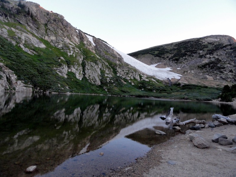
St Mary's Glacier
There are different ways to get up, but a popular route is up through St Mary's Glacier. The glacier is an easy and popular hike. Parking costs $5 and fills up fast (so get there early). It's definitely doable to get up the glacier without traction, but trekking poles and micro-spikes made it easier.
View of St Mary's Lake/Glacier at sunrise
James Peak
Once I got up the glacier, the way up to James Peak was a breeze. I lost the trail a few times, but it wasn't hard at all to find the way up to James, since it was a straight shot. The first mile is on flat terrain, and then there is a steeper incline toward the top.
Trail towards James Peak
Easy gentle hike
Almost to the top
At the Summit Looking at the Indian Peaks
Traverse to Bancroft
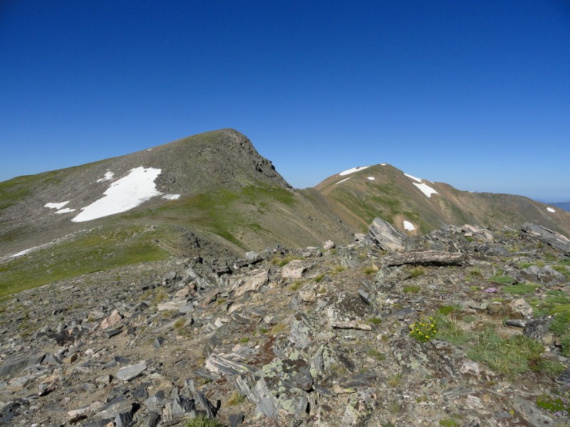
The weather was holding up perfectly on the top of James, so I decided to head over to Bancroft. I've seen some pictures of this terrain in a few trip reports, and wasn't sure if I wanted to climb it. I generally try to avoid class 3 climbing, especially if there is some exposure. So the initial plan was to hike down a little bit to at least see the lake, and then head back up.
As I got going in the traverse, I realized that it was actually fairly easy and a doable climb. There were a couple sections that were a little hairy, but as long as you picked the right route, it's not difficult at all.
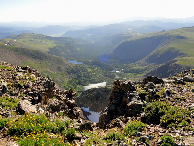
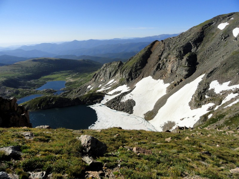
Here are a few pictures of the awesome view from the traverse of Ice Lake:
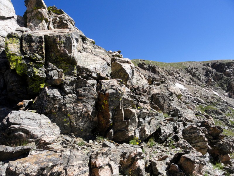
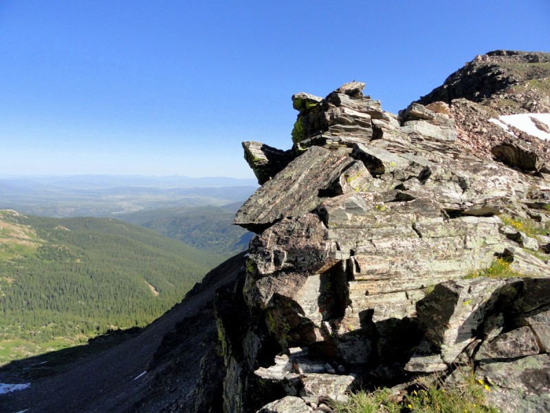
And here are a few pictures of the traverse itself. The pictures look worse than it actually is:
The rock seemed pretty stable, but there were definitely a few loose parts. As long as you take your time and evaluate your options, this is definitely doable. There were a few huge boulders the size of a refrigerator that I was a little bit leery of. There was nothing to indicate they were unstable; I've just read too many stories of people having close calls with massive boulders giving way and almost crushing them.
Mt Bancroft
The rest of the way up Mt Bancroft was steep, but an easy hike. Near the top, there was a little bit of class 2 climbing, but nothing too difficult. I debated going on to Parry Peak, but I knew I was too tired and the way back would be long.
Steep, but easy hike after the scrambleLooking back towards James Peak after the traverse Almost to the top of BancroftView from Bancroft
The Way Back
Nothing too eventful on the way back. There are other ways to get back, but I decided to go ahead and retrace my steps over the James/Bancroft traverse, and just stay a bit south rather than reascend James Peak.
St Mary's Glacier
Conclusion
This is a very nice hike from a popular trailhead. James Peak was an easy one to do, but the hike to Bancroft was what I felt really made this hike great. Note that this hike is almost entirely above treeline, so because very careful of lightning. (It could be a long way to get back while above treeline).
Thumbnails for uploaded photos (click to open slideshow):
Caution: The information contained in this report may not be accurate and should not be the only resource used in preparation for your climb. Failure to have the necessary experience, physical conditioning, supplies or equipment can result in injury or death. 14ers.com and the author(s) of this report provide no warranties, either express or implied, that the information provided is accurate or reliable. By using the information provided, you agree to indemnify and hold harmless 14ers.com and the report author(s) with respect to any claims and demands against them, including any attorney fees and expenses. Please read the 14ers.com Safety and Disclaimer pages for more information.
Please respect private property: 14ers.com supports the rights of private landowners to determine how and by whom their land will be used. In Colorado, it is your responsibility to determine if land is private and to obtain the appropriate permission before entering the property.


 View of St Mary's Lake/Glacier at sunrise")
 Trail towards James Peak")
 Easy gentle hike")
 Almost to the top")
 At the Summit Looking at the Indian Peaks")
 Onwards to Bancroft")
")
")
")
")
")
 Steep, but easy hike after the scramble")
 Looking back towards James Peak after the traverse")
 Almost to the top of Bancroft")
 View from Bancroft")
")
")
")
 St Mary's Glacier")


