| Report Type | Full |
| Peak(s) |
Blanca Peak - 14,350 feet Ellingwood Point - 14,057 feet |
| Date Posted | 07/26/2015 |
| Date Climbed | 07/24/2015 |
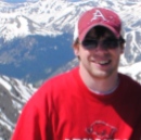
| Author | youngk2844 |
| Blanca and Ellingwood in a Single Day is BEARable! |
|---|
|
Recent trip reports indicated a bear has been very active around Lake Como. The last photo in this trip report BEARs evidence that this is indeed true. Having read many stories about the bear, I decided to climb Blanca Peak and Ellingwood Point in a single day to avoid camping at the lake and to avoid a heavy pack while climbing up (and back down) the Lake Como Approach road. This road is long, steep, and full of unstable rock. It's a real BEAR of a road. Thursday after work, I safely drove my Subaru Outback up the approach road. I was BEARly able to make it up to 8,500'. At least that would save me about a mile off the roundtrip distance. There are plenty of pull-out spots along the road. I made it just in time for a spectacular sunset before crawling into the Subaru for a few hours of sleep.   My watch alarm went off at 2 am and I was off hiking just before 3 am. I figured it was about eight miles and 6,000' of elevation to summit both peaks and I wanted to make sure I was off the peaks before noon. I'm a moderate hiker (at age 50) and the 3 am start gave me plenty of time to reach the summit of Blanca by 10:30. The night before, I had stripped my pack down to just the BEAR essentials. This included only 1.5 liters of water (bring a filter). There's not much access to water until you reach Lake Como but if you leave early, you're hiking in the cool morning before the sun comes up. Between Lake Como and the slopes of Blanca and Ellingwood, there are plenty of places to filter water. As I hiked towards Lake Como I passed a couple old mining cabins.  I was impressed with the ruggedness of the road.  I reached Lake Como at dawn I didn't see the bear but I did see plenty of fish jumping.  After Lake Como the steepness of the trail levels out a bit as it winds through a series of small lakes and pools. This is probably the most beautiful section of the hike.  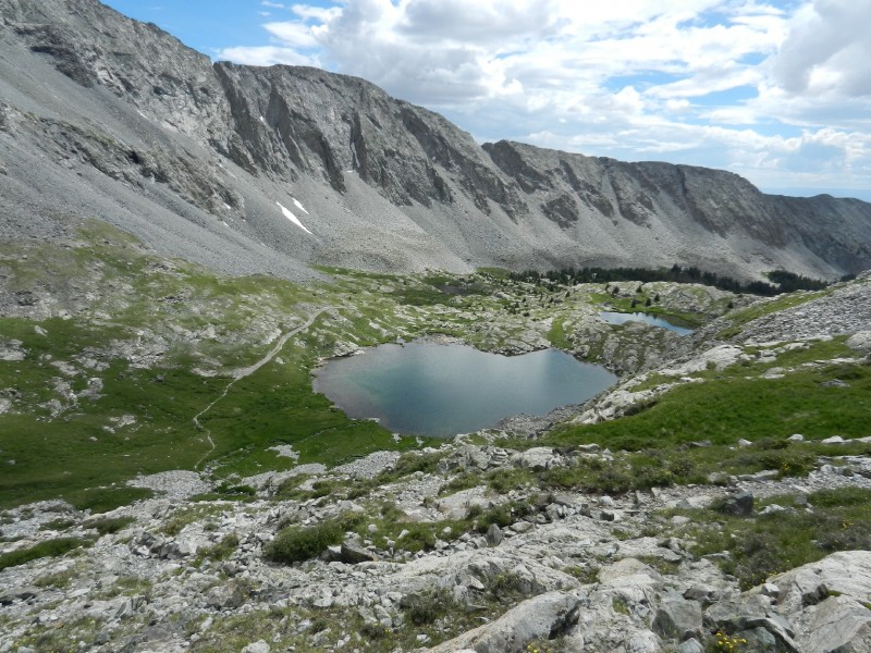 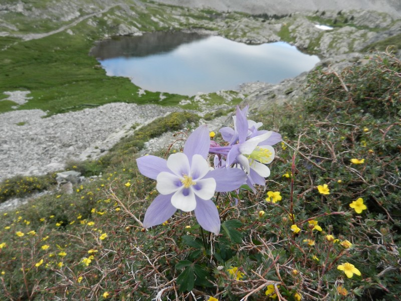 In my opinion, there's really no "best" order in which to summit the two peaks. It's personal preference. So, after Crater Lake, I BEARed right towards Blanca Peak and began climbing the rocky slopes. The trail becomes hard to follow and the rock cairns marking the way up aren't always easy to spot. Head for a spot on the saddle closer to Blanca marked by a tall cairn. On the way up, you do get a good view of Ellingwood and the connecting ridge.  I reached the summit of Blanca at 10:30 am and had a great time talking with Jen, Kendra, and several other new climbing friends. The weather was excellent and holding so we all took our time on the summit.  Kendra even did a balancing act for us.   Kendra, Jen, and I left the summit of Blanca at 11:20 and began BEARing down on Ellingwood Point. The others were right behind. 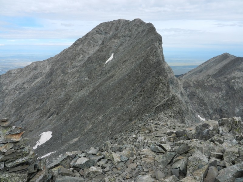 The traverse is straight forward. You'll have to drop off the ridge to climbers left after passing the low spot in the saddle. Take your time when you get to the gulley below the notch in the ridge and look for the cairns. The easier path angles down a bit as you make your way across the gulley. Being the slowest hiker amongst the "youngsters", I was last to reach Ellingwood Point at 12:45 pm. Up until now, the sun had been mostly hidden behind a, mercifully cool, overcast sky. On Ellingwood, the sun came out and began BEARing down on us. I could BEAR it no longer and had to start de-layering. To my emBEARassment, Jen took a photo of me right as I was BEARing my nipple. The shot would have been much better if Iron Nipple had been in the background... 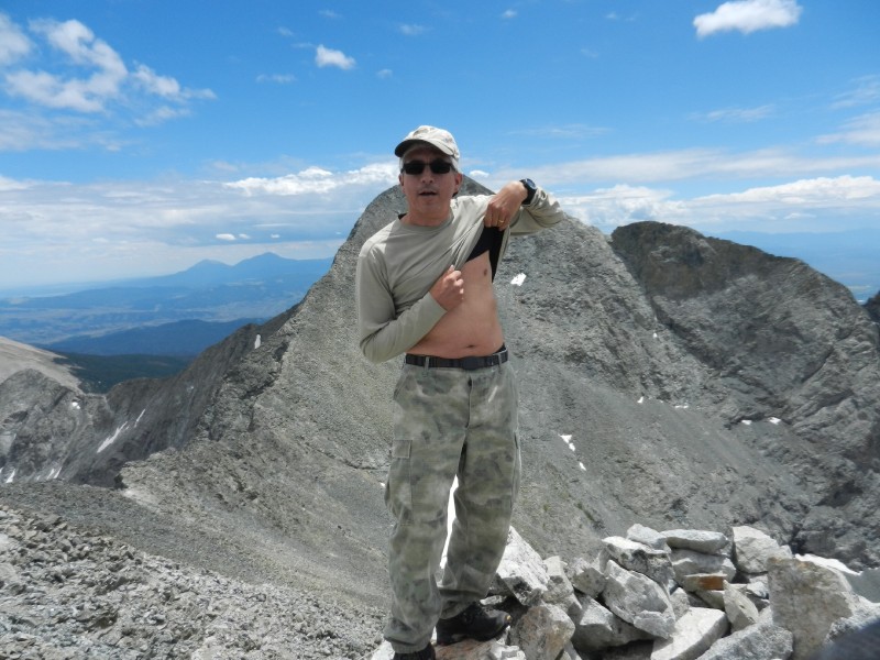 The weather was really looking good and we all spent a fun amount of time on Ellingwood talking and eating more food which, of course, included Gummy BEARs. Finally, at about 1:15 pm, I left the summit and started heading down slope in a south-easterly direction to complete the final leg of the "two-peak-traverse-triangle". Supposedly, there are cairns to help guide you down but I was unable to find them. You can pick your own line since most of the down-hill slope is visible and relatively easy to hike. There are a few small rock ribs poking out through the talus. Following these ribs down slope will give you an occasional break from the shifting talus. Once off the talus the lakes and small pools were calling hot feet for a quick soak. Others had a higher tolerance to the cold water and soaked more than just feet.  It was about 4:45 pm when we returned to Lake Como and the skies were finally starting to swell with rain clouds. This is unusually late in the afternoon for the rain to hit. Normally, you'd want to be well off the high ground before noon to be safe. We totally lucked out with the weather and took our time (while keeping an eye to the sky constantly). So, the group of guys I hiked off the peak with had a basecamp at Lake Como. When we got to their camp we found that the bear had tore into their hanging bag of food making off with a big Elk sausage and some other stuff. 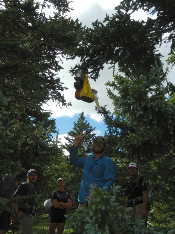 Evidently, the bear was just BEARly able to reach the sack and hooked a claw into it, ripping it open. The bear was kind enough to leave these guys enough food to make it through the night. As it turns out, these guys are members of the COTD Expedition team. COTD stands for Climb Out of The Darkness. The purpose of the expedition is to help raise awareness for mental health issues in the state of Colorado and throughout the country. The mountaineering goal of the expedition is to climb all 54 Colorado 14ers in 10 weeks. This is an impressive goal and for a great cause. Dan, Matt, Seth, Aaron, and the fifth guy (dang! I almost remembered all five names. Sorry.) it was great fun climbing and talking with you good luck on the final summits! You can learn more about this expedition at: http://cotdexpedition.wix.com/cotd Now, on to other matters that BEAR mentioning. Hopefully, this trip report has made it clear there is a BEAR around Lake Como that likes to eat Cheetos and elk sausage. Please do the bear (and yourself) a favor by practicing extreme, clean camping if you're spending a night around the lake. Unfortunately, this bear seems to be totally addicted to salty, human food and it will get your food or anything that smells remotely like human food if given the chance. Jen, Kendra and I left Lake Como at about 5:15 pm and started the hike down the approach road. Trekking poles are really helpful on this road. To me, hiking down the approach road was more dangerous than hiking off of Ellingwood. Take your time and watch your footing. Jen and Kendra had their jeep (named Dozer) parked about a mile higher up the road from where I parked my Subaru and they were kind enough to give me a ride down. Thanks! I was back at my Subaru by 8:50 pm. I really took my time on this hike and could have easily pushed harder. I would say 3 am to 6 pm is a very reasonable time estimate if you're parked around 8,500' on the approach road. It's a long day but summiting Blanca and Ellingwood in a single day is definitely BEARable. Thumbnails for uploaded photos (click to open slideshow): ")
")
")
")
")
")
")
")
")
")
")
")
")
")
")
")
|
| Comments or Questions | ||||||
|---|---|---|---|---|---|---|
|
Caution: The information contained in this report may not be accurate and should not be the only resource used in preparation for your climb. Failure to have the necessary experience, physical conditioning, supplies or equipment can result in injury or death. 14ers.com and the author(s) of this report provide no warranties, either express or implied, that the information provided is accurate or reliable. By using the information provided, you agree to indemnify and hold harmless 14ers.com and the report author(s) with respect to any claims and demands against them, including any attorney fees and expenses. Please read the 14ers.com Safety and Disclaimer pages for more information.
Please respect private property: 14ers.com supports the rights of private landowners to determine how and by whom their land will be used. In Colorado, it is your responsibility to determine if land is private and to obtain the appropriate permission before entering the property.