Download Agreement, Release, and Acknowledgement of Risk:
You (the person requesting this file download) fully understand mountain climbing ("Activity") involves risks and dangers of serious bodily injury, including permanent disability, paralysis, and death ("Risks") and you fully accept and assume all such risks and all responsibility for losses, costs, and damages you incur as a result of your participation in this Activity.
You acknowledge that information in the file you have chosen to download may not be accurate and may contain errors. You agree to assume all risks when using this information and agree to release and discharge 14ers.com, 14ers Inc. and the author(s) of such information (collectively, the "Released Parties").
You hereby discharge the Released Parties from all damages, actions, claims and liabilities of any nature, specifically including, but not limited to, damages, actions, claims and liabilities arising from or related to the negligence of the Released Parties. You further agree to indemnify, hold harmless and defend 14ers.com, 14ers Inc. and each of the other Released Parties from and against any loss, damage, liability and expense, including costs and attorney fees, incurred by 14ers.com, 14ers Inc. or any of the other Released Parties as a result of you using information provided on the 14ers.com or 14ers Inc. websites.
You have read this agreement, fully understand its terms and intend it to be a complete and unconditional release of all liability to the greatest extent allowed by law and agree that if any portion of this agreement is held to be invalid the balance, notwithstanding, shall continue in full force and effect.
By clicking "OK" you agree to these terms. If you DO NOT agree, click "Cancel"...
Sawtooth is a cool little mountain in Indian Peaks Wilderness. It's only 12,304ft but they named a beer after it and it looks cool. The east ridge is mostly class 2 with a few easy scrambles, there is a little exposure at times and you can find plenty of class 3/4 stuff on the east face after ascending the ridge. The approach starts at the Coney Flats Trailhead, if you have a quad or rock crawler, you can easily get to the parking lot, otherwise the long approach will need to start at Beaver Reservoir and head down Coney Flats 4x4 road or from the Mt. Adubon trail starting at Mitchell Lake in Brainerd. If coming from Beaver, there is a hiker cut-off along the 4x4 road that will save you some time. A stock SUV can get near this hiker cut-off but I wouldn't advise going further without a crawler.
I parked about 2.3 miles from Coney Flats Trailhead and hiked along the road and through the cut-off. At the trailhead, head up the Buchannan Pass trail.
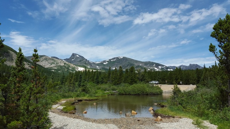
Coney Flats Trailhead
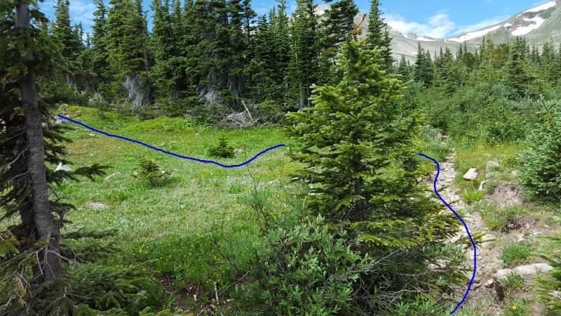
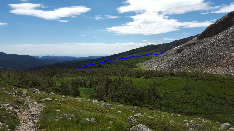
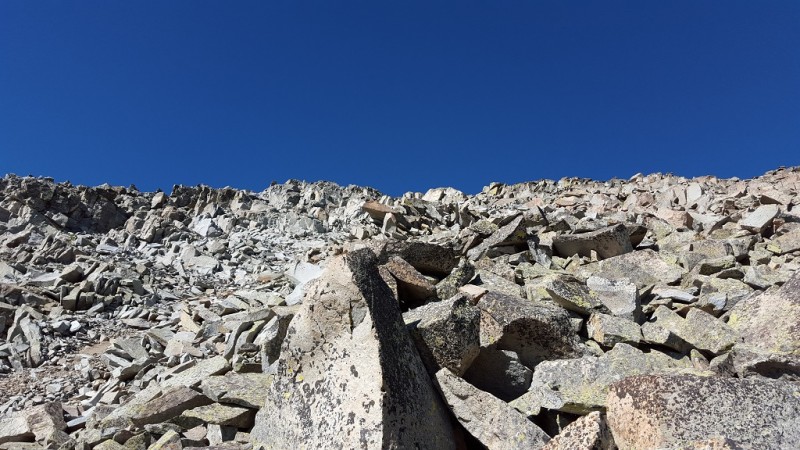
Continue down the trail for approx. 1.5 miles, you will leave the trail just before you start to see the willow covered slopes that lead to the east ridge. If you see two steel culverts, you've gone just a bit too far, if you leave the trail after that you will be bushwacking through willows.
Leave the trail to find a path to east ridge
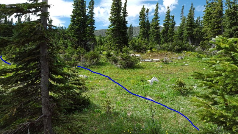
Work your way up to the grassy/willow covered slopes and start heading towards the first rocky section on the crest of the ridge.
Navigate the willows First obstacle, flat rock formation
The view of the start of the route coming down from Buchanan Pass.
Looking back along the approach to east ridge
Head towards a flat rock formation with large talus beneath it, climb over it.
Climb over first rock formation
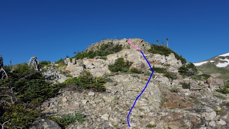
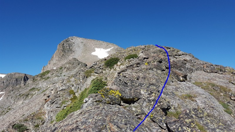
You will now continue on the ridge towards some rock towers, avoid the first staying just below it to the South (left) and head towards the base of the second one.
Stay beneath first rock tower Head towards second rock tower
Climb over these rocks.
Climb over second tower
Once over these rocks, continue on the ridge on easy terrain.
Continue along ridge
A look back from the top of the second rock tower
Looking back from atop 2nd tower
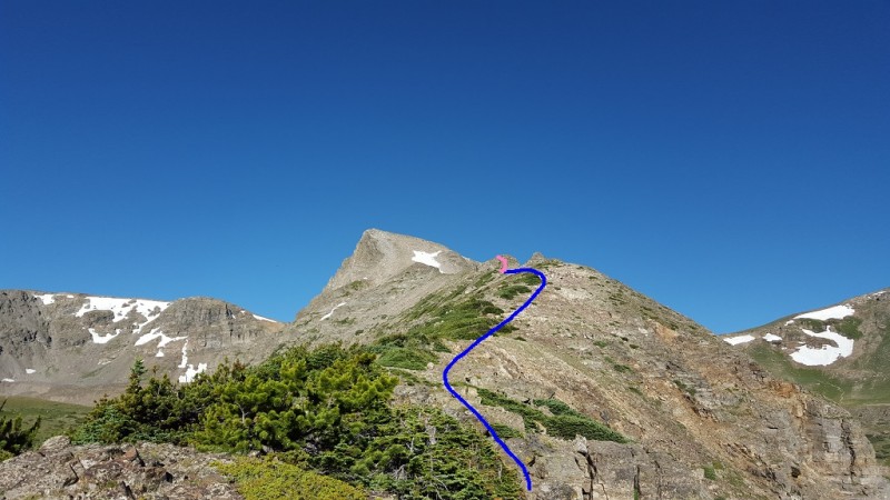
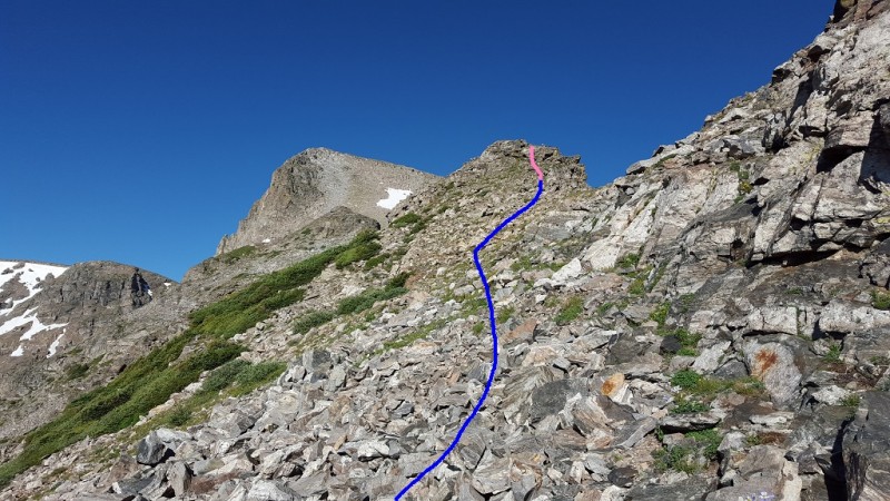
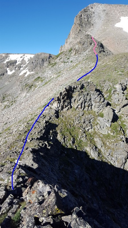
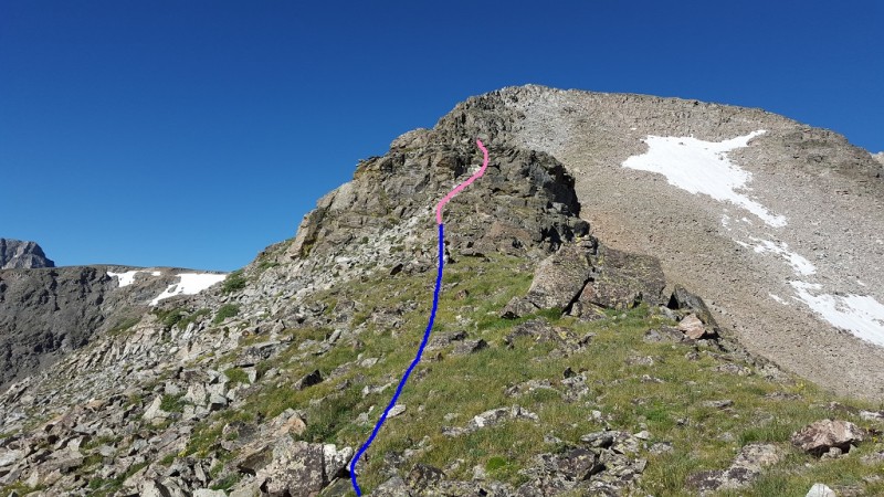
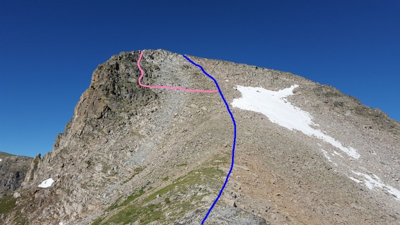
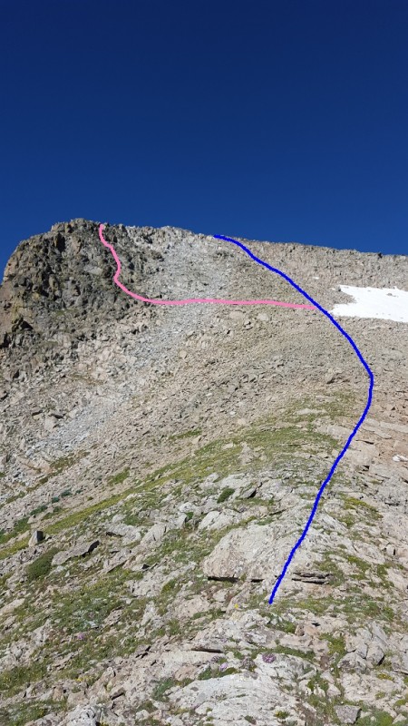
Continue along the ridge, staying just below the crest to avoid the exposed crest and head towards the base of the final rock tower.
Head towards final tower
Climb over this final rock tower
Climb over final tower
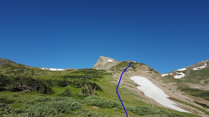
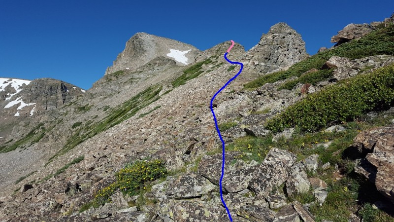
The rest of the route up the Sawtooth's east face is clear now. You can stick to the right on difficult class 2 terrain, the talus is mostly solid. Another option is to cross the loose gully to find grassy ledges with solid rock outcroppings. This area could be kept at easy class 3 or you could probably find some more challenging moves here also.
Head up east face Fun looking terrain to the left
Another look at the loose gully and the solid rock on the other side
Solid rock across a loose gully
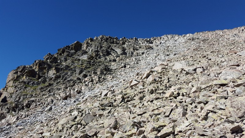
A look at the steep class 2 talus that will take you to the summit
Class 2 talus climb
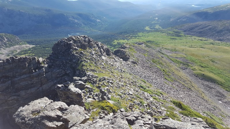
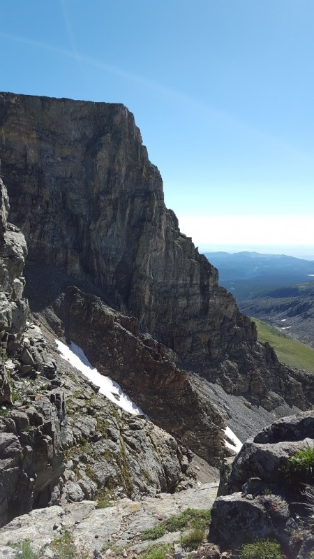
From the summit, it's easiest to head north to the Buchanan Pass trail for the descent, but first I recommend hiking down to the south just a little bit so you can catch a glimpse of what really makes the Sawtooth, its dramatic north face.
Sawtooth's north face
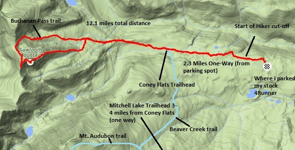
Here is a summary of the area with distances, my GPS track is in red with descent down Buchanan Pass trail.
Distances are approximate
Distances are approximate
My GPS Tracks on Google Maps (made from a .GPX file upload):
I had been looking at this area of the IPW for a while. This looks like a great hike––thanks for sharing!
Caution: The information contained in this report may not be accurate and should not be the only resource used in preparation for your climb. Failure to have the necessary experience, physical conditioning, supplies or equipment can result in injury or death. 14ers.com and the author(s) of this report provide no warranties, either express or implied, that the information provided is accurate or reliable. By using the information provided, you agree to indemnify and hold harmless 14ers.com and the report author(s) with respect to any claims and demands against them, including any attorney fees and expenses. Please read the 14ers.com Safety and Disclaimer pages for more information.
Please respect private property: 14ers.com supports the rights of private landowners to determine how and by whom their land will be used. In Colorado, it is your responsibility to determine if land is private and to obtain the appropriate permission before entering the property.