| Report Type | Full |
| Peak(s) |
Uncompahgre Peak - 14,318 feet |
| Date Posted | 07/24/2015 |
| Date Climbed | 07/20/2015 |
| Author | huffy13 |
| My New Favorite Peak- Uncompahgre Rocks |
|---|
|
I hadn't gotten a summit in almost a year and I have really been getting impatient since hiking up high was not feasible back in early June when my wife and I planned on hiking Greenhorn Mountain and West Spanish Peak, mainly because of lots of snow up high and weather was still questionable the week we went. We ended up taking the Cog Railway to Pike's Peak summit, which was beautiful (but still had tons of snow and we couldn't really enjoy the summit since we could only stay at the gift shop and the observation platform) and hiked for several hours around Garden of the Gods. I really enjoyed that, and it did suffice for a little while. My brother came down home for his 20 class reunion and decided to stay with us for another week afterwards and he mentioned that he wanted to get another shot at Uncompahgre Peak. He attempted it back in his college days, but poor planning along with being a 21 year old college student in Lake City led to a failed futile effort. We planned to just head to Lake City on Sunday, July 19th after his reunion ended and stay a few days and get a summit or two. We stayed at Elkhorn RV Resort and Campground in Lake City. (Great place to tent or RV camp, great people and good, clean facilities.) We arrived at the camp at about 8:30 pm and quickly set up camp before it got too dark, crashed by about 10:00 and set the alarm for 4:45 am Monday morning. We left the camp and arrived at the trailhead right at 6:20 and hit the trail at 6:30 after a very rough 4 miles up the Nellie Creek Road...more on that later. 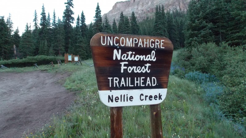 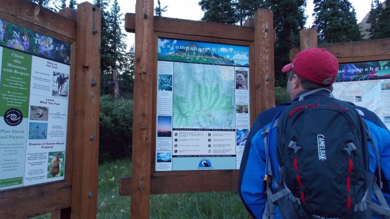  Not very far in to the hike Uncompahgre begins to peek through the trees. 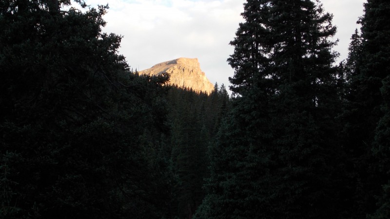 Bambi stood up on a slope and watched us hike for about 10 minutes. 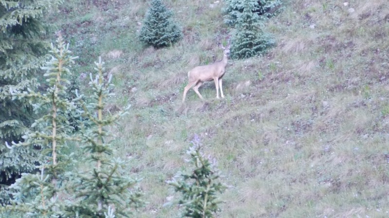 The trail is very well defined and well maintained throughout...one of the better trails I've been on, especially until you begin to get right around 14,000 ft. Uncompahgre looks amazing throughout the hike, it is really a beautiful mountain. 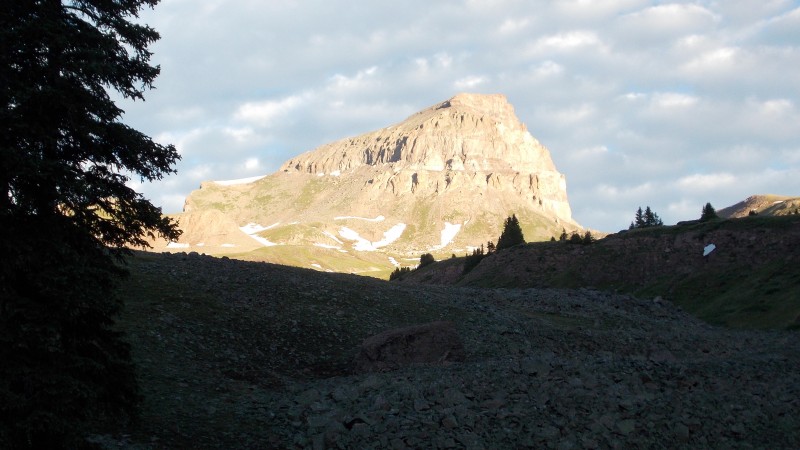 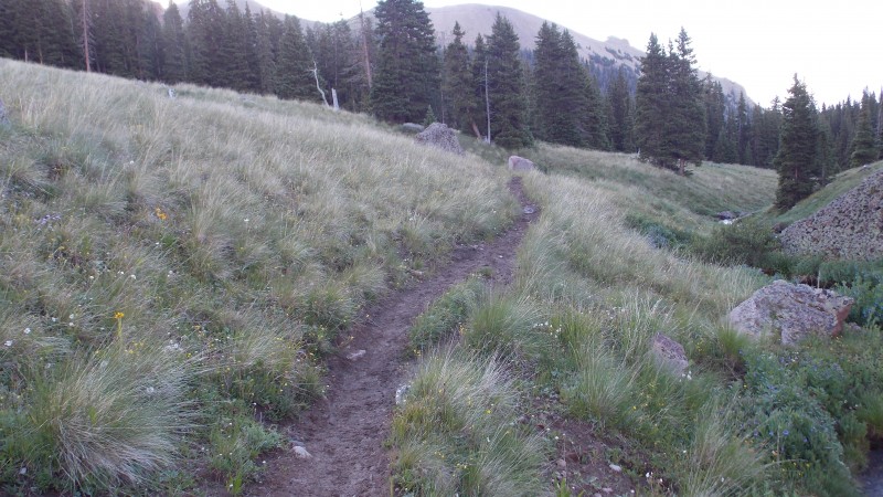 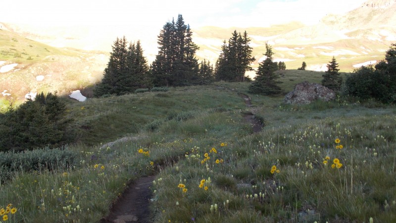 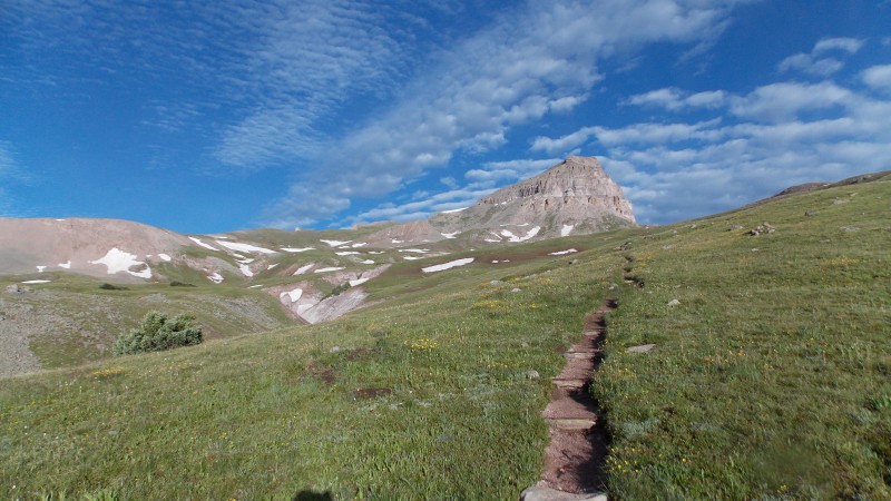 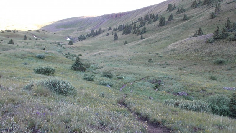  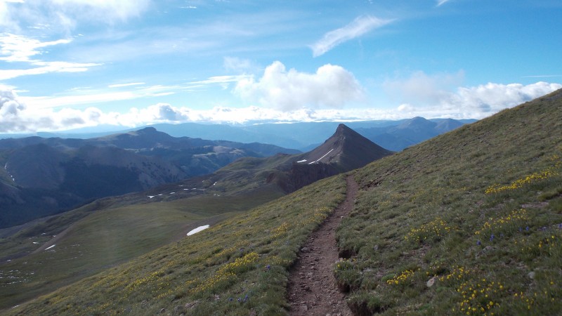 We did have to cross one small snowfield that was across the trail, but it was only about 50-60 ft wide and wasn't bad at all. 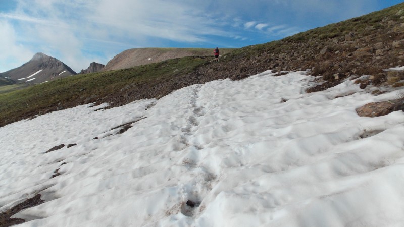 Nellie Creek is along the trail quite a while and makes for some great ambiance, scenery and sounds.  There is a sign that keeps you going the right way just as you reach treeline. 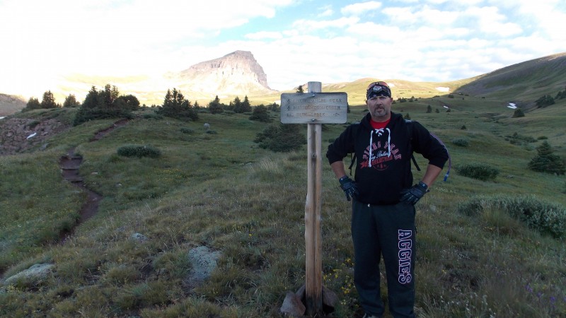 The views really begin to spread out as you reach the upper slopes close to the ridge at about 13,000 to 13,200 ft.  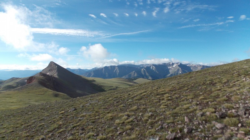 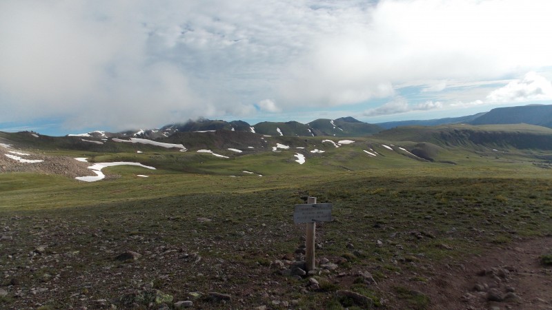 This is where Wetterhorn and Matterhorn Peaks first make their appearance on this trip. Quite impressive looking peaks!  The ridge was guarded by a magical and majestic bull marmot...protecting hikers with his ever-watchful gaze and his awe-inspiring call...  There are some nice gullies that drop off near the trail down into the gulch to the SW of the ridge. It really shows just what kind of exposure you can find if you get too far off trail. But views were amazing! 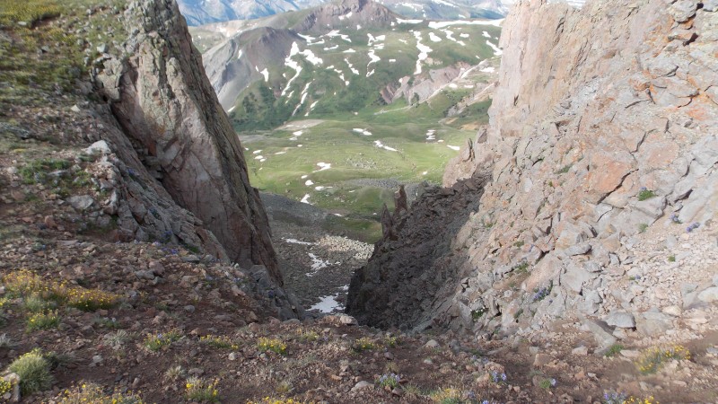 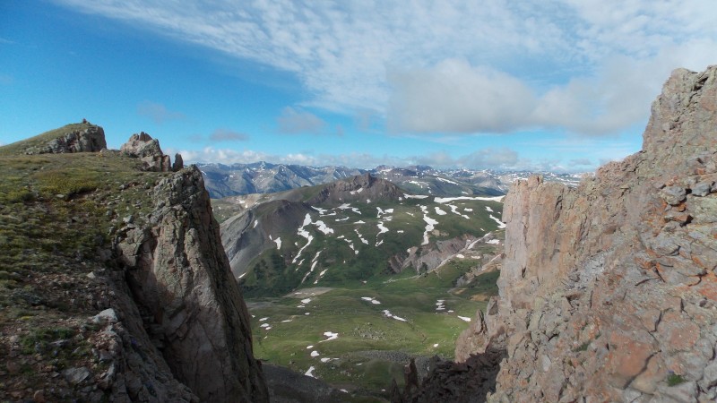  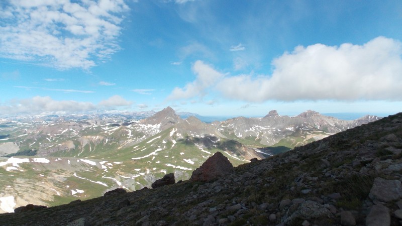 The ridge is very gentle and before you know it you are making the approach to the rocky, slightly steeper summit push. The most challenging parts of this hike are found in the last 600-700 ft of elevation gain.  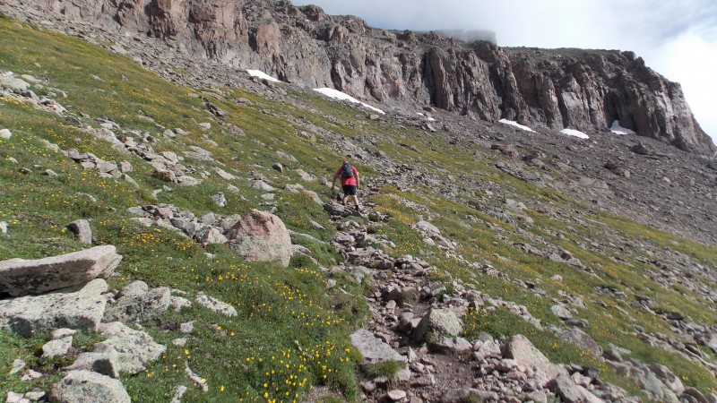 There is one slightly more difficult section that may worry some inexperienced hikers, it's a short, but fun scramble for about 5 minutes just as you wrap around to the W side of the peak. It's steeper and rocky, requires hands and good balance, but it is actually fun and doesn't last long at all. If it was a long stretch I would call it easy class 3 type stuff, but it's such a short section that I think it would be a stretch to call it class 3....the descent down this section does require care and caution. 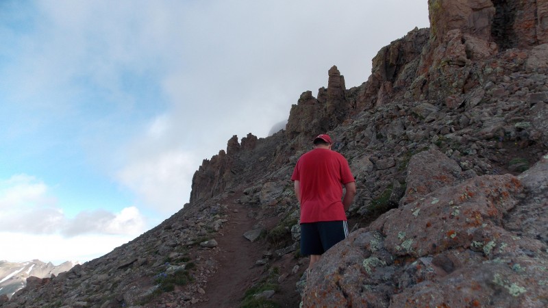 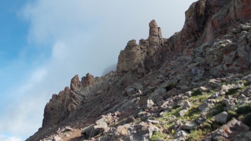 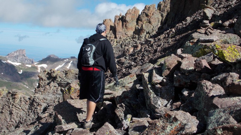 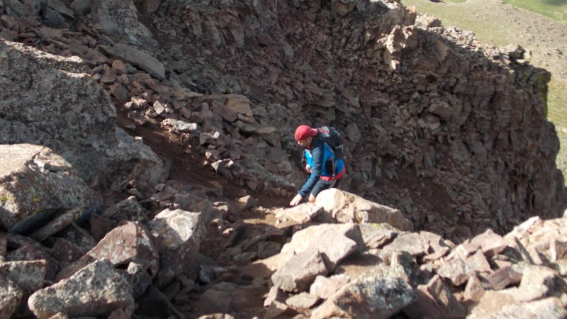 Once you get past this short challenge the rest of the hike is pretty easy all the way to the summit...it's just rocky. 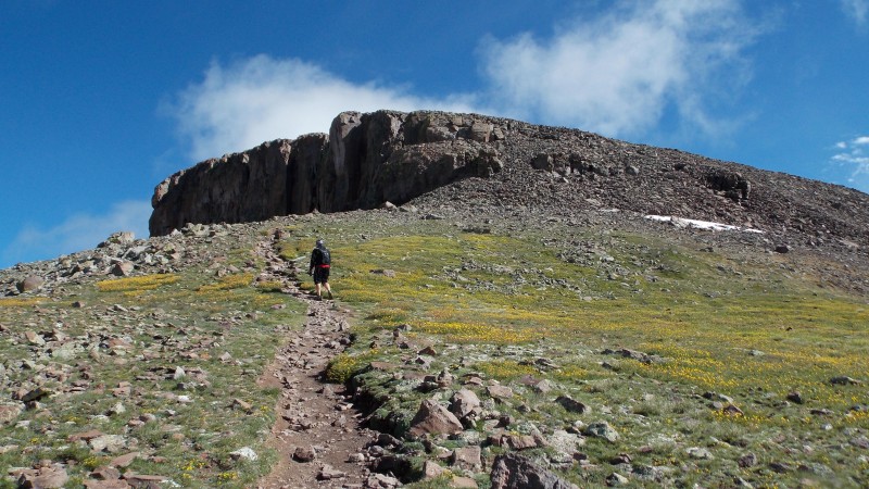 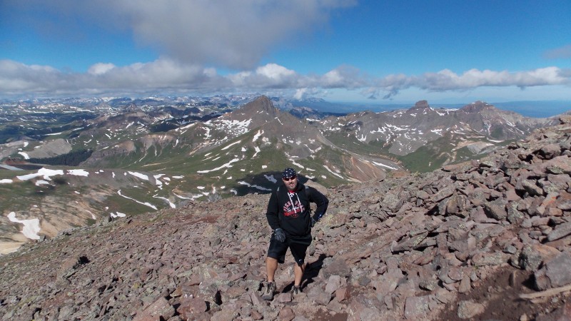 Before you know it you are standing on the summit...VICTORY!!! We made the summit right at 10:30 am. About 4 hours on the ascent. Pictures do not do justice to this magnificent peak...a great one! The only issue was that the clouds were hovering kind of low and blocked the view to many surrounding peaks. But still my new favorite.  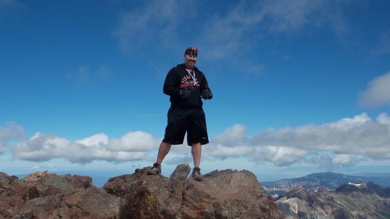 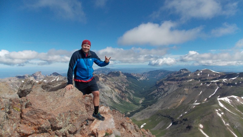 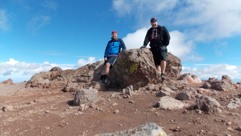  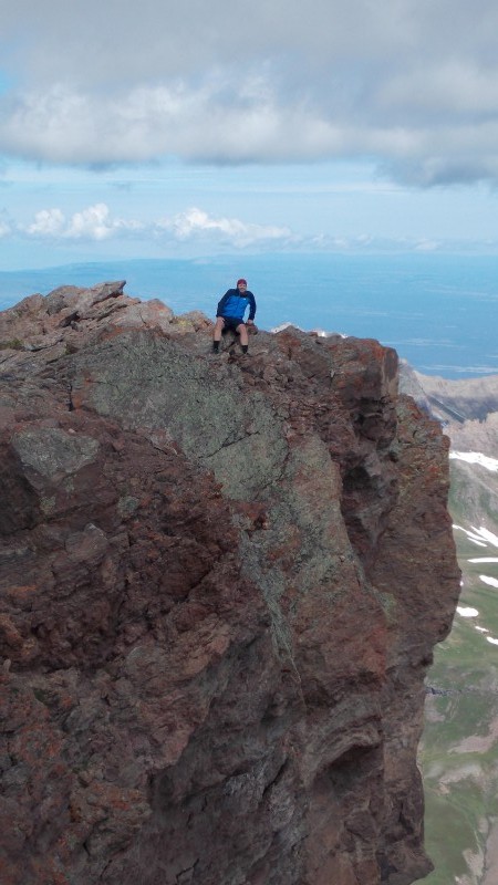  We lingered for about 45 minutes on the summit, about 10-12 other people showed up right after us, the clouds were getting thicker, so we headed down after a short visit with the other folks...the descent was uneventful, we did however see a lazy red fox that was just chilling in one of the windbreaks just below the summit at about 14,100 ft. 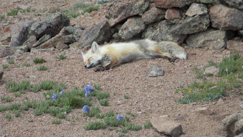 Our original plan was to bag Redcloud and Sunshine Peaks the next day, but dark clouds to the west early and a cold, howling wind (plus sore legs from our Uncompahgre hike) kept us from proceeding past the 13,200 ft ridge. Still a great trip, a great town and a great peak. As usual, my thoughts and insights and advice on this hike and the different things that go along with it: First off, Nellie Creek Road is 4 miles of rough, slow and white-knuckle driving. The creek was running slightly high and my Blazer did just fine, but it has a lift, narrow wheel base and big tires and I still worried in a few places if I was going to bottom out or high-center. Don't attempt this road unless you have good clearance and 4WD, it's a must in my opinion. This trail and hike, however are relatively easy, the trail is clear and gentle most of the time and the views are some of the greatest I've seen. Beginning hikers could do the hike up to close to 13,800 ft. The only part I would be concerned with on the hike itself would be the steep, rocky gully that you must ascend and descend on Uncompahgre's west side. It's not all that long, but it is rocky, somewhat loose and it is pretty steep...extra caution is needed in this section. Exposure throughout the hike is minimal unless you approach one of the gullies that drop off the south ridge, the summit itself is where the most exposure occurs, but the summit is so large that you don't even have to feel it...the north, east and southeast sides of the summit are sheer drop-offs and you definitely don't want to horse around too close to the edges. But, some of the coolest summit shots can be had if you just get at the right angles. If you can make it all the way to the upper TH, the hike is fun and easy-ish and this is definitely a peak that you must do if you have been thinking about it. My season is already over this year...with my son moving to Oklahoma Panhandle State University in a couple of weeks and his baseball season starting, my daughters and their tennis season starting in 4 weeks, along with work schedules, family events and church duties, I don't see myself being able to fit in another big hike this year. That's alright though, the mountains will still be there and Uncompahgre Peak was a great one to get under my belt. Thumbnails for uploaded photos (click to open slideshow):
|
| Comments or Questions | ||||||||||||
|---|---|---|---|---|---|---|---|---|---|---|---|---|
|
Caution: The information contained in this report may not be accurate and should not be the only resource used in preparation for your climb. Failure to have the necessary experience, physical conditioning, supplies or equipment can result in injury or death. 14ers.com and the author(s) of this report provide no warranties, either express or implied, that the information provided is accurate or reliable. By using the information provided, you agree to indemnify and hold harmless 14ers.com and the report author(s) with respect to any claims and demands against them, including any attorney fees and expenses. Please read the 14ers.com Safety and Disclaimer pages for more information.
Please respect private property: 14ers.com supports the rights of private landowners to determine how and by whom their land will be used. In Colorado, it is your responsibility to determine if land is private and to obtain the appropriate permission before entering the property.


