| Report Type | Full |
| Peak(s) |
Kilimanjaro - 19341 |
| Date Posted | 07/23/2015 |
| Modified | 01/10/2016 |
| Date Climbed | 06/30/2015 |
| Author | pmreyn2010 |
| Pole, Pole, Kama Kobe! |
|---|
|
Where: Mt. Kilimanjaro Route: Machame (Ascent), Mweka (Descent) Distance: ~38 miles Vertical: ~14,000' Team Members: Sarah, Meg, Bo, Spencer, and Paul (pmreyn2010) Dates of Climb: June 25, 2015 (Summit June 30) - July 1, 2015 Pre-Climb If you had told me 5 years ago that I would be climbing Kilimanjaro this summer, I would not have believed you. I've always enjoyed hiking and spending time in the mountains, but it wasn't until the fall of 2011 that I climbed my first 14er, Mt. Elbert. Ever since then, I've had a constantly growing interest and love of spending time on Colorado's peaks. It took me a while to get started since most of my friends have no interest in hiking (it took me over a year to get back out & climb my second 14er), but I loved reading up on other people's experiences and thinking ahead as to what goals I would set for myself in the future in the mountains. As I started climbing more 14ers, I began doing more research into some peaks around the world, and Kilimanjaro was one that grabbed my attention right away. The peak itself is located in northern Tanzania, which is also home to some incredible wildlife. I figured that it may not be a bad idea to do a climb of Kilimanjaro and while I'm there, go on a safari. The idea took hold of me and it became something of an obsession over the following couple of years. My main problem became trying to find some trekking partners"most of my friends did not want to do it, and those who were interested were not in a position to commit to an expedition at that time. I took a Spanish teaching position at Aspen High School in August 2012, where I met one of my friends and former colleagues, Sarah. During my 2 years in Aspen, we both talked about wanting to do Kilimanjaro on different occasions, about friends who had done it in the past, about what route would be good"we even entered the "Team Grape Nuts" sweepstakes last year"but the trip never came to fruition. Fast forward to the summer of 2014, when I accepted a teaching position back on the front range and left Aspen, I shot Sarah a text, asking if she'd be interested in going the following summer, and she said yes! She also said that her friend Bo (who also used to teach in Aspen) would be interested as well, as well as her friend Meg, and so we were set! The ball was rolling. The first thing we did was figure out which company we wanted to go with. After a bit of research, we chose Zara Tours. Zara seemed to have a good reputation with generally positive reviews. My friend Lauren and her husband had climbed Kilimanjaro with Zara a couple of years ago and had only good things to say about the company. Zara was always quick to respond to any questions we had, and although every so often there was a miscommunication (e.g. when I paid my final deposit, I received confirmation for my own separate climb... completely different than the rest of my group's!), they were always quick to rectify any errors that came up. In regards to the route we chose, we were deciding between the Machame and the Lemosho, and chose the Machame in the end... I don't remember if there was a reason we chose it other than we liked what we had heard about the route itself. The Lemosho does meet up with the Machame route before you get up to the Lava Tower (on Day 3 of the Machame)... After talking to my guides, one of the pros of doing the Lemosho is that it is definitely quieter at camps on the first couple of days... more on that later. As we entered 2015, I tried to be conscious of getting as much cardio in as possible. Fairly simple, but it was my approach to training for this climb. I ran, walked, hiked, and biked whenever I was able to... I tried to just get outside and move as much as I possibly could. In March, we looked at airlines, and while there are definitely a number of airlines that fly in and out of Kilimanjaro (JRO) (KLM, Ethiopian, Qatar, Turkish, Precision, Condor, and Kenya), only two of them seemed convenient and on the cheaper side: KLM & Ethiopian. We decided to go with Delta & KLM, which would take us from Denver through Detroit & Amsterdam to Kilimanjaro. We chose this route for a few different reasons, but mainly, it provided us with minimal, brief transfers, and got us to our destination quickly. (Ethiopian & United, while a bit cheaper than KLM & Delta, would've gotten us to D.C. at midnight, and we would've had a 10 hour layover to kill there... not much fun). As departure date grew closer, I tried to read up as much as I could on other people's experiences (Fleetmack had written a great trip report which was particularly useful since he climbed with Zara via the Machame), and I reached out to different 14ers.com community members with gear questions (kushrocks) and with questions about their previous Kili climbs (AWright, nickaa, and bmcqueen) - My colleague Pam also has some high altitude experience and was able to give me some great pointers. Thanks to all for your advice; it is greatly appreciated. On March 14, I summited Quandary Peak as my first 'calendar winter' ascent. I thought that would bode extremely well for my training for Kilimanjaro, since it was an awesome bluebird day (with better conditions than when I had climbed in the fall!), right at the end of winter no less... but then we had one of the wettest springs in recent memory. Throughout the month of May, I did numerous hikes around the Boulder area. My most common routine on the weekends would be going up Bear Peak with a pack loaded up with water. I'd do shorter hikes around Chautauqua and the Flatirons some evenings, but because it was so stormy, I was not able to do much with altitude. I did a consult with my doctor, who gave me both the Typhoid & Hepatitus A vaccines. He also prescribed doxycycline hyclate for malaria prevention. I also had asked him about Diamox for the altitude (in addition to several other people), but once I found out that Diamox contained sulfa, I was not going to be able to take it whether I wanted to or not, since I am allergic to it. This proved to be a bit of a psychological factor for me later on, as all of my teammates were taking it during the climb. I also tried to accumulate gear gradually over the final few months before departure (and bought my last piece of gear the week before departure). In regards to clothing, I took Asolo Fugitive GTX boots, hiking pants, wool socks & liners, synthetic underwear, a merino wool base layer, synthetic shirts (short & long sleeves), a fleece jacket, a down jacket, running shoes for time at camp, and then Gore-Tex shells for rain. Trekking poles were also very useful, especially for the descent! Basically, if you follow the recommended packing lists provided by any outfitter or guide, you'll be in good shape. Once I hit the end of the school year, I tried to get outdoors as much as possible. I spent a decent amount of time hiking in the Boulder area again, but also made it up to RMNP, hung out on top of Pikes Peak for a couple of hours, and did repeat climbs of Quandary and Bierstadt. Before I knew it, it was time to go! June 23, 2015 (Tuesday) I took the SkyRide to DIA and arrived around 8 a.m. I met up with my teammates at the gate. Meg was taking a flight to Atlanta & then on to Amsterdam from there, but the rest of us were going through Detroit. The Detroit folk were delayed by close to an hour (we ended up leaving around 12:50 instead of 11:50, which gave us a tighter connection in Detroit). I wasn't concerned we'd miss our flight to Amsterdam, but rather that our luggage might not make it through. The flight to Detroit passed by quickly with no events, aside from a kid doing the pee pee dance for a few minutes next to me while waiting for the bathroom to open up. The Detroit airport is very easy to transfer through, and the flight to Amsterdam was smooth and relatively painless. The folks sitting on my left had funnily enough also come from Denver; they were going on a 12 day safari in Tanzania! Hope they enjoyed it! June 24, 2015 (Wednesday) The Amsterdam airport has changed from the descriptions I had read about it. Evidently they used to do security screenings right in front of the gate (the body scanner was still at ours, unattended), but I guess that has changed within the past few months. It was easy to find our gate and after a couple of hours we boarded our KLM Flight bound for Tanzania! I was sitting in the Delta Comfort+ sections of the Economy cabin on the first two legs of the journey, and in the Economy Comfort section of the KLM flight. For those of you fellow tall people out there who are considering this journey, you should think about spending a bit more to sit up in this section on KLM. This flight was not nearly as full as its Delta counterparts, and because of this, they let passengers spread throughout the space in the front of the cabin... I had my own window & aisle seat, and the woman across from me was passed out across the four center seats for most of the flight. KLM's service was excellent. They were always coming through the cabin with snacks, meals, drinks, and water... I wouldn't hesitate to fly with them again in the future. The journey down to Africa was pretty cool, as you could see different geographic features when there were breaks in the clouds, like the Greek coastline or part of the Sahara desert. I tried staying awake for most of the flight, since I wanted to get as much sleep as possible that night. 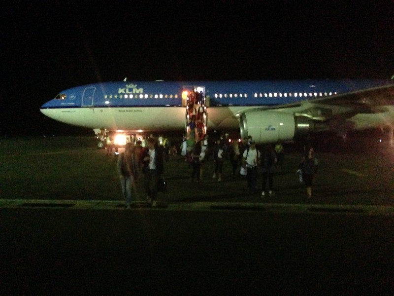 We arrived at the Kilimanjaro Airport at 7:50 in the evening. Getting the visa was relatively quick, with Zara representatives meeting us immediately after entering the airport, and we grabbed our bags (everybody's arrived!), loaded up into the bus quickly, and headed off towards Moshi around 9. En route from the airport, our driver pointed out a sign that indicated where the turnoff for the Machame route was. That was when we all saw the mountain for the first time. The moonlight was reflecting off of the glaciers and you could just barely see the outline of Kibo against the night sky. It was an awesome moment; a sign of great things to come. We arrived at the Springlands Hotel around 10 and checked in. It's definitely a nice setup. If you ever travel with Zara, you will more than likely be staying at the Springlands... it's down a rough dirt road which our driver told us would give us an "African massage" due to its numerous potholes and bumps. The Springlands Hotel is enclosed by a fence and has a great courtyard to sit outside and have some food or drinks. After a quick cheese sandwich they offered us upon arrival, it was off to bed at 11. 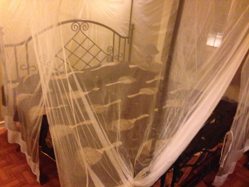 June 25, 2015 (Thursday) We all woke up relatively early to grab breakfast and then make sure our gear was in order. Once we had everything packed away, we met back out in the courtyard and met up with our guide, Sylvester. He sat us down and went over the logistics of the trip. He really emphasized the importance of the team and working together to achieve our goal. We also found out we would be climbing with Spencer, a guy from California, so we were going to be a group of 5. Once the vans were loaded up, we were off by 9:30 that morning to the Machame Gate. The drive to the trailhead took about an hour. Funnily enough, this was the only time that we could actually see the entire peak from the base during our trip. In between our climb & safari and after the safari, the peak was clouded in. Driving to the trailhead and looking out the window at Kili definitely made the prospect of climbing it seem daunting, as it towered over 2,800' Moshi. 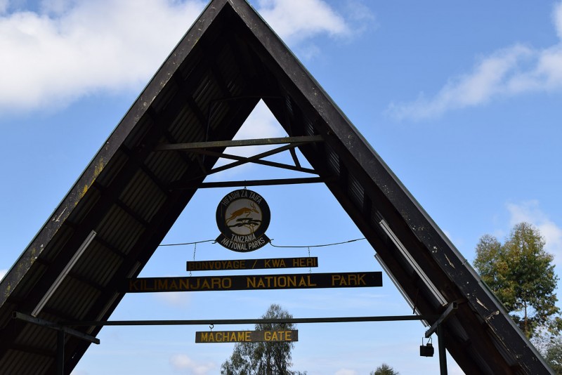 Once we were at the Machame Gate, we had to register with the park rangers. Then we played the waiting game while Sylvester sorted things out with the porters, and waited for the permit. There were blue monkeys running around the lunch pavilion where some groups were eating their boxed lunches. These guys were definitely not afraid of humans and waited patiently until someone would put down a banana or a package of cookies... and seconds later, the food would be gone! 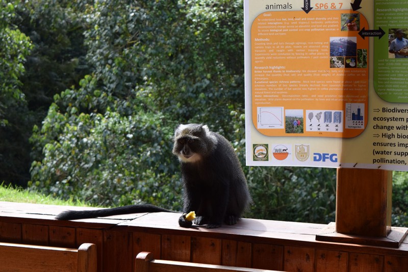 We started hiking up around 12:30 or so, the first stretch of trail being a 4WD road for just about 2 miles. The trail this first day wove through the forest at the base of the mountain. We saw a few more monkeys and could hear some bird calls throughout the jungle on our way up. This first stretch of trail also got us more accustomed to the idea of the "Pole, Pole" pacing (in Swahili 'Slowly, Slowly'). Our assistant guide Ali was fairly adamant about this, because neither he nor Sylvester wanted us to gain too much altitude too quickly. To reinforce this, Ali helped us come up with our team name, "Kobe," which means "Turtle." "Pole, Pole, Kama Kobe!" (Slowly, Slowly, Like A Turtle!) quickly became one of our team slogans, in addition to "Twende Juu!" (Let's Go Up!) Once you get up the 4WD stretch of path, you have roughly another 4.5 miles on a narrower, steeper trail that continues its way up through the jungle. We stopped around 2:10 for lunch in the forest. We ate a boxed lunch that included a "meat" burger of sorts, a small banana, peanuts, an orange (which did not have the same bright color we're used to here), fruit punch, and pound cake. The forest definitely gave us some awesome scenery to take in... the trunks of some of the trees were gnarly and massive. It was way different from anything we have here in CO. Every so often on the trail there was a break in the trees and you could see that the forest stretched on for miles in both directions around the base of the mountain.  On our way up, we encountered a bunch of different groups from all around the world, a good number from the United Kingdom, some from Germany, others from Switzerland, and a few from the USA. As we hiked up, I struck up a conversation with Ali, and asked him which route was his favorite to climb. He said that each route is special to him in its own way, but that he really likes the Machame for how much time he gets to spend on the mountain while climbing it. One thing I have to say here, and can't say enough, is that the porters are awesome. These guys were carrying up our tents, food, etc., and they were passing us in great numbers on the trail. Granted, I know that they are used to doing the climb, but it was still impressive to see them move. These guys definitely lack adequate gear though, especially for the higher altitudes, so if you go, try to give them any spare gear you may have lying around. 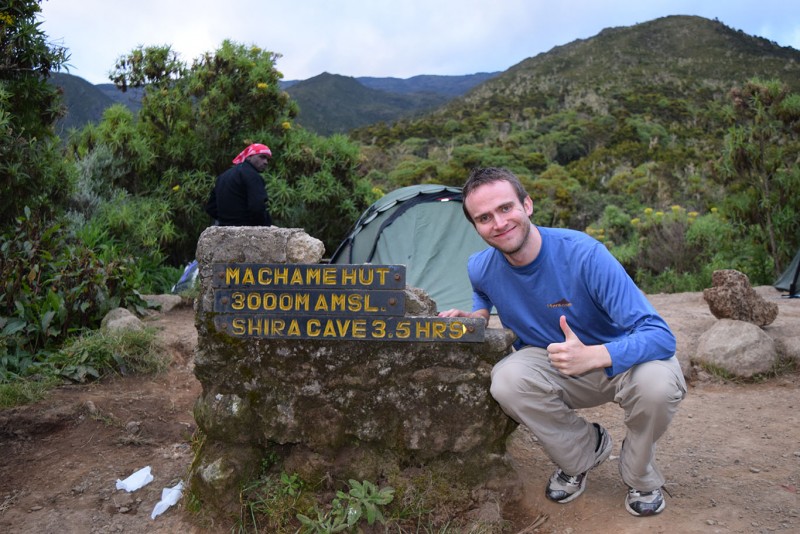 We arrived at camp around 5:45 that evening at the Machame Huts, with an elevation around 9,850' feet. One thing you have to do at each camp is register, so you'll write your name in the registration book, along with the name of your guide, where you're from, and other pieces of information. After having a bit of time to get settled in, we were called to have some popcorn and tea. Afterwards, we had some soup, and just when we thought that that was our dinner (we were pretty full), we were brought potatoes, meat, and other foods by our waiter, John. If you travel with Zara, know that you will not go hungry. 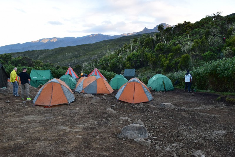 That evening, I discovered what happens if you drink a ton of water during the day... you will have to go to the bathroom. A lot. I had to get myself up several times throughout the night, which became a routine throughout the week, but I guess it's better than getting dehydrated! June 26, 2015 (Friday) Everybody on the team was up around 7:30 this morning. Our breakfast consisted of porridge, coffee/tea/chocolate "energy drink," sausage, eggs, and fruit. When we arrived at camp, we had seen these pretty massive black birds the night before and wondered what they were. As camp was getting packed up, more of these birds showed up. When we asked the guides about them, they told us that they were white-necked ravens, and that we'd be seeing them all the way up the mountain (these 'ravens' are way bigger than the ones we have in the U.S.) They were true scavengers; looking for any scraps of food left behind at each camp. They were a bit on the creepy side, as you could hear their wings making loud rustling sounds as they flew past your tent. I dubbed them the "velociravens," as they would move in for their targets quickly & silently. 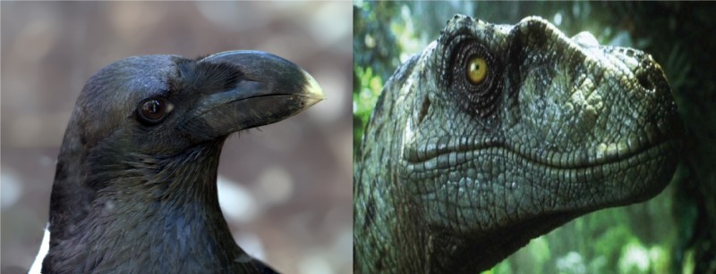 We left the camp at Machame Huts around 9 a.m. The trail today was steeper than the previous day's, but we knew we were in for a short day. One thing I loved about climbing Kili was the distinct zones of vegetation. We were no longer hiking through forests with giant trees, but shorter plants, trees, and other flowers were present alongside the trail. This day Sarah & I struck up a lengthy conversation with Ali in Spanish, since he was able to speak the language himself. Many guides are able to speak Swahili, English, and another language, since there are clients who come in from all over the world to climb the mountain. He did say that he had not worked with many people from Spain, so he wanted to practice with us - he was great! 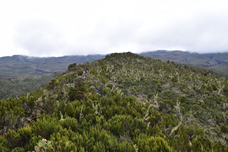 The climb today was sandwiched between two layers of clouds. There was one layer that was covering our route from the previous day, and another that we were climbing up into. Some parts of the trail took us over and around boulders and different rock formations. 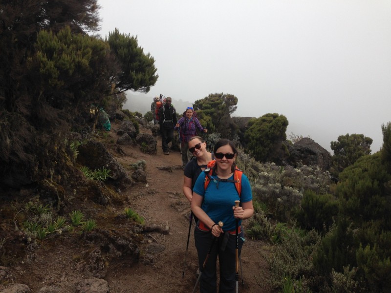 Once we arrived at the Shira Caves Campsite, we were at an elevation of around 12,500' (we had gained about 2,650' feet that day over the course of 3.5 miles). We arrived at camp around 1 p.m., had lunch, and explored the campsite a bit.  Since the clouds had rolled in, we hung out in the dining tent with our guides playing Uno (which Sylvester & Ali both got into quite a bit!) As we were hanging out inside, we discovered (thanks to a fellow trekker visiting our camp), that the clouds had given way to some awesome views of Kibo with its glaciers. (Side note: For those of you who are not familiar, Kilimanjaro is comprised of three volcanic cones: Shira, Mawenzi, and Kibo. Kibo is where you reach the highest point of Kilimanjaro (Uhuru Peak); Shira and Mawenzi flank Kibo on either side). 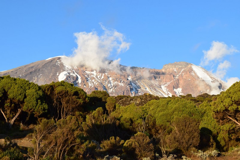  The one thing I will say about having to use the restroom in the middle of the night with the moon out is that you are given some awesome views on your way to/from the toilet! I should have brought a tripod... June 27, 2015 (Saturday) We woke up to some awesome views this morning. During breakfast, Sylvester told us that a couple that had arrived at Shira Caves last night ended up descending in the morning. Hearing this was a good reminder that altitude can affect anybody at any time. Saturday was definitely going to be a longer day than Friday, because we were going up to the Lava Tower to have lunch (at slightly over than 15,000'), and then we were going to descend to the Barranco Huts, which were just over 12,900'. The trail this morning started out relatively easy. It was a gradual ascent; in that regard, easier than the previous day's climbs. The vegetation started thinning out, and we were passing through fields of volcanic rock. 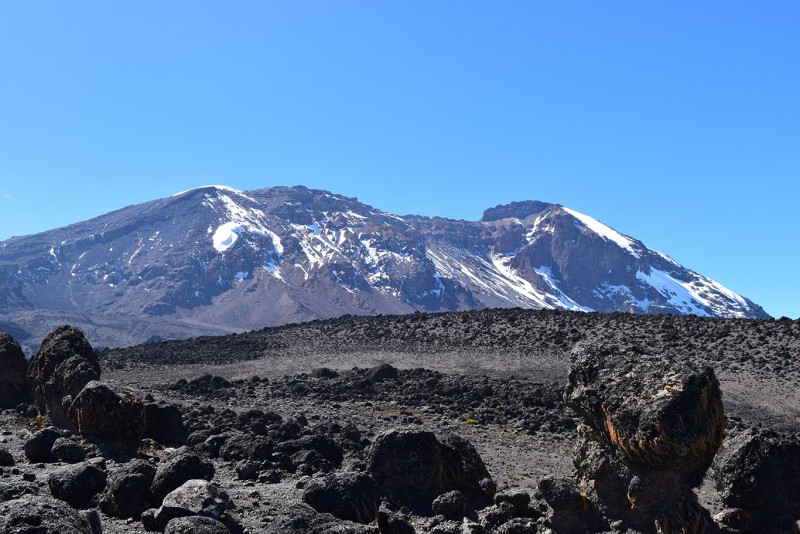 The one thing Meg, Sarah, & I were keeping our eye on was Sarah's altimeter, since we all wanted to know when we would be surpassing Mt. Elbert's height, since that was our previous personal high. It was a cool moment to know that we were above Elbert, yet still considerably below the summit of Kilimanjaro. It was around this point that we could see the junction of the Machame route with the Lemosho. It was on the final stretch up to the Lava Tower that we saw one of the Brits overcome by the altitude (perhaps it had something to do with asthma?) She was sitting on the side of the trail with a guide and friends taking deep breaths... I was happy to see her later looking in much better shape as she arrived at Lava Tower, but no doubt that had to have been a scary moment for her and her team. As we climbed up towards Lava Tower, a couple of team members were definitely feeling the altitude a bit, but we all pushed through and made it up around 12:30 p.m. It was very cool hitting the 15,000' mark, and we spent over 2 hours up there (part of the time eating lunch), which was great for acclimatizing. It was a bit windy up there (since the Lava Tower formed a bit of a tunnel with the slopes of Kibo), but we were given some great views.  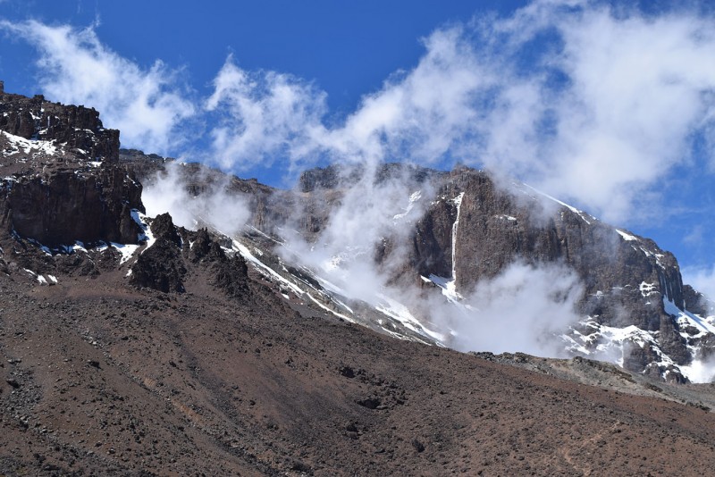  After lunch, we descended for over 2 hours to get to the Barranco Huts. As we descended, we had some awesome views of Kibo, and the vegetation became more plentiful once again. 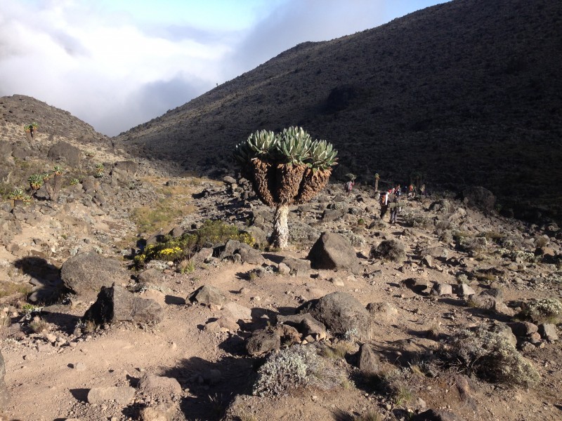 This campsite was probably my favorite one on the whole trek, since it was right in the middle of the Barranco Valley. The clouds rolled in once again after we reached camp around 5:15 p.m., but not before we got a quick look around at our surroundings. 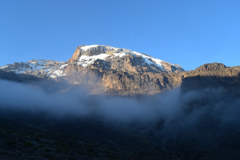  The total distance for the day was about 6.7 miles. June 28, 2015 (Sunday) When we woke up this morning, a large group of British trekkers were already leaving camp. Since they were doing the 6 day climb, they had a fairly long day ahead of them from the Barranco Huts to the Barafu Huts (aka Base Camp). Since we took the extra day, we were going to be stopping at the Karanga Valley Campsite, about 3.2 miles away. 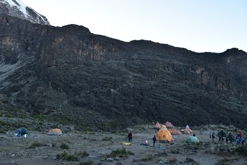 The Barranco Wall was by far the most fun part of the Machame route. It requires some basic scrambling at different points, but because of this, is radically different than most other parts of the climb. One woman in a trekking group ahead of us froze up at one point on the wall, her friend said because of a fear of heights. Fortunately, she recomposed herself, and was in much better spirits when we met up with her higher on the wall. 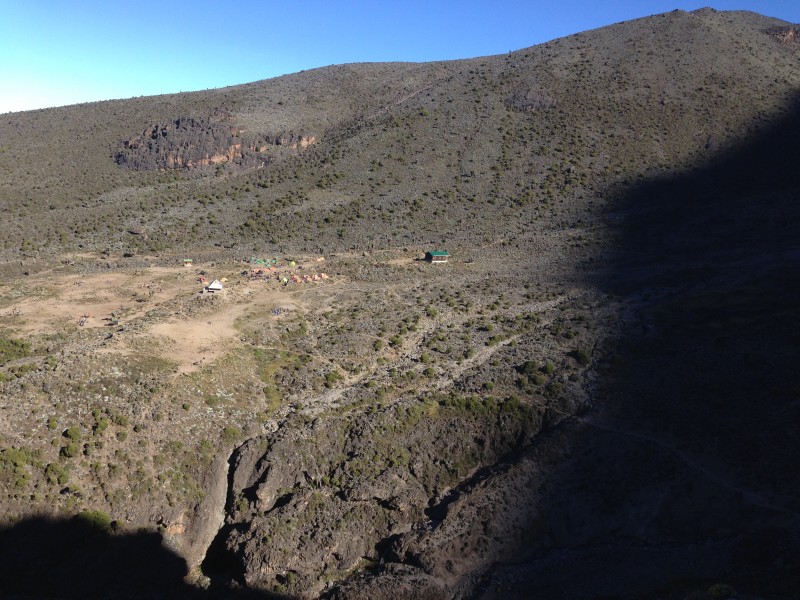 You gain around 700' or so as you work your way up the wall, and you hit sunlight right as you top out. We took a breather at the top and celebrated a bit. 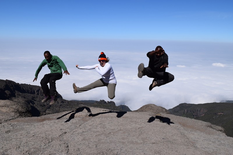 This day definitely has the most up & down of any day on the mountain, as once you ascend the Barranco Wall, you have to descend via a desert slope towards your next camp, and ultimately, you keep going down into a greener, more fertile Karanga Valley. 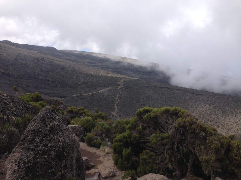 Once you cross the stream in the valley, you have to climb up a fairly steep path to the Karanga Valley Campsite (it only takes 20 minutes or so to reach camp from that point). While it was fairly barren, it actually was another favorite campsite of mine because it was relatively quiet in comparison to many of the other camps we stayed at, since numerous groups choose the 6-day option and pass over this camp (which is only 160 feet or so higher than the one in Barranco). We arrived at the camp in early afternoon, and because it was a short day once again, we hung out and played Uno for a while in the dining tent with our guides. June 29, 2015 (Monday) The day started out on a cool note when, upon getting out of our tents, you could see part of the shadow of the mountain being cast out in front of us.  The trail heads out of Karanga camp to the NE, and it is definitely more barren than any trail from the previous days, with boulders and rocks all over the place. Our guides continued to teach us Swahili as we ascended, and we had several basic interactions with the porters to pass the time. "Habari za asubuhi?" (How are you this morning?) "Nzuri sana!" (Very good!) After cresting a point at 14,600', we took a short break. 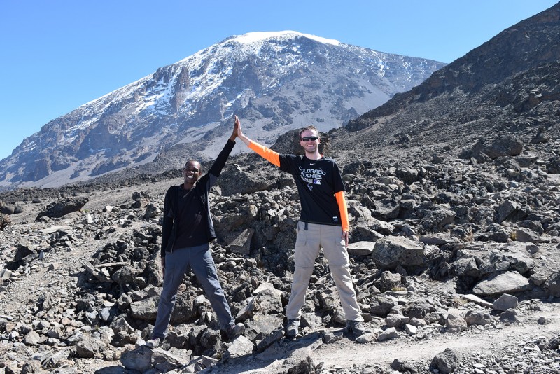  From this point forward, the trail descends a short ways into a valley, but you can now see where it is you're going: Barafu Huts. This was to be our "base camp" as the guides called it before we made our summit push. To get there, we had to cut across the valley and up a short cliff-face (only a couple of brief spots to scramble).  In total, we had ascended just over 2.1 miles and gained over 2000' in elevation; we arrived right around noon. The camp is around 15,300' and is located on a narrow ridge. "Barafu" does mean "Ice" in English, which was a great name, since it was constantly windy and cold at this camp. It was absolutely my least favorite of all the camps, not because of the wind or the exposure, but because of the number of people packed together. When we arrived at the camp, it was chaotic. The large British group that was a day ahead of us had just descended alongside other groups who were sitting down to eat lunch, the 7 day trekkers had just arrived at camp, and a few porters from the next set of 6 day trekkers had already arrived and were setting things up. Our group's tents were not even next to one another; they were mixed in with other groups. We ate lunch and Sylvester told us that we had to try to sleep, since we would be leaving camp at 12 a.m. that evening. Let me just say that ear plugs are not a bad investment for this particular camp! I did get a few hours of shut eye and woke up to have dinner. It was after dinner that Sylvester and Ali gave us a pep talk and told us what to expect for that night's summit push. After they left the dining tent, a couple of my group mates commented that I looked really nervous"and I was! After coming all that way, I was definitely nervous to see how my body would handle the high altitudes. I was lucky to have the encouragement of my teammates who steered me away from psyching myself out. 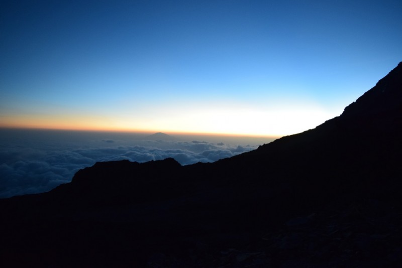 One thing I will say to future climbers is that, even if you bring earplugs, be prepared to not get much sleep the night before you summit, depending on your proximity to other people. Our tent was right next door to these two guys from the U.K., who were very spirited in their conversation, and felt the need to share with us "UGHHH! I'M SOOOOO TIRED!" at various times throughout the evening, among other interesting topics. June 30, 2015 (Tuesday) We 'woke' back up around 11 p.m., replenished our water, and drank some tea before heading out. We left camp just before midnight, and started our ascent up the ridge out of Barafu. The winds initially were still going full force, but they died down the higher up we got, once we were off of the ridge. The trail on the way up was filled with switchbacks and loose rocks & scree, so for parts of the trail, when you would take a few steps forward, you'd end up sliding back a bit. Sylvester was leading us up this evening, and he led Ali & our other assistant guide for the evening Cipi in singing us songs all the way up. These guys were awesome in checking in with everyone every 10-15 minutes and making sure everyone was still doing okay. Sylvester kept a very steady, slow pace to ensure that everyone would be able to continue the climb without issue. After a number of hours, as I looked up, I noticed a strange looking shape silhouetted by the night sky on the ridge up above. As we climbed towards it, Sylvester said that it was the sign marking Stella Point. We topped out right around 6:30, just as the sun was coming up! It was a great moment to just stand there and take in where we were. 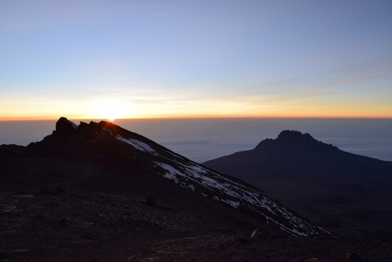 At this point, the guides took us the remaining 40 minutes up to Uhuru Peak, where we went at slightly different paces. Spencer & I went with Ali in the front, with Meg just behind us, and Sarah & Bo just behind her. As we climbed, we could see some people being led down by guides on either side of them; they were in pretty terrible shape. Topping out on Uhuru Peak was incredible, as it was the culmination of years of dreaming, planning, and preparation. Ali shook our hands and gave us a hug, and it was an amazing moment to just stand there for a few minutes and look out, taking everything in from the Roof of Africa. I summited Uhuru (Freedom) Peak around 7:10 a.m. on June 30, 2015. 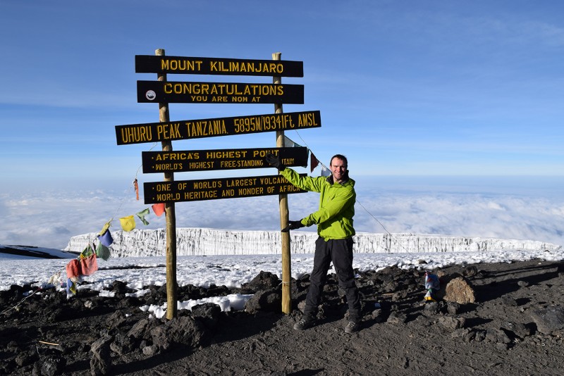 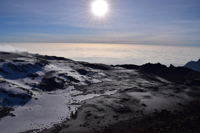 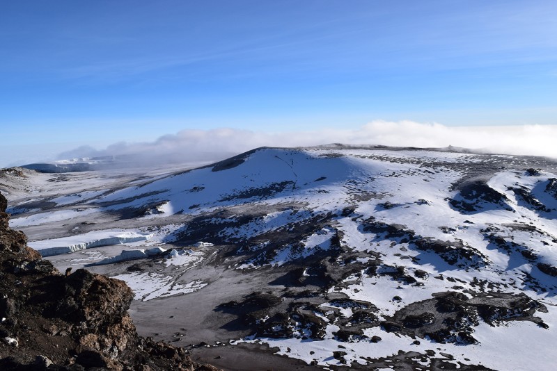 Everyone reached the summit within 10 minutes of each other, and it was awesome to have everyone up there together. 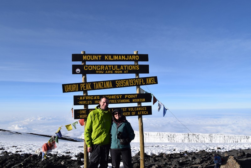 (Missing a group shot as of now... hopefully will get one soon!) 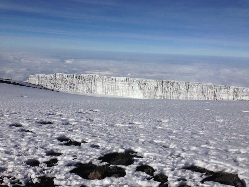 We had gained just over 4000' of elevation from Barafu, in just around 3 miles. Sylvester himself had achieved his 299th summit, which was just remarkable. I was on the summit for no more than 30 minutes, and then it was time to descend. Going back down to Stella Point was a piece of cake from Uhuru, but the fun began once we headed back down towards Barafu. Since there is a good amount of scree, it's easier to 'ski' down the switchbacks rather than try to walk them at a normal pace. Gaiters are a good thing to have for this stretch! Even with the loose trail, the descent was relatively painless and took about 3 hours. 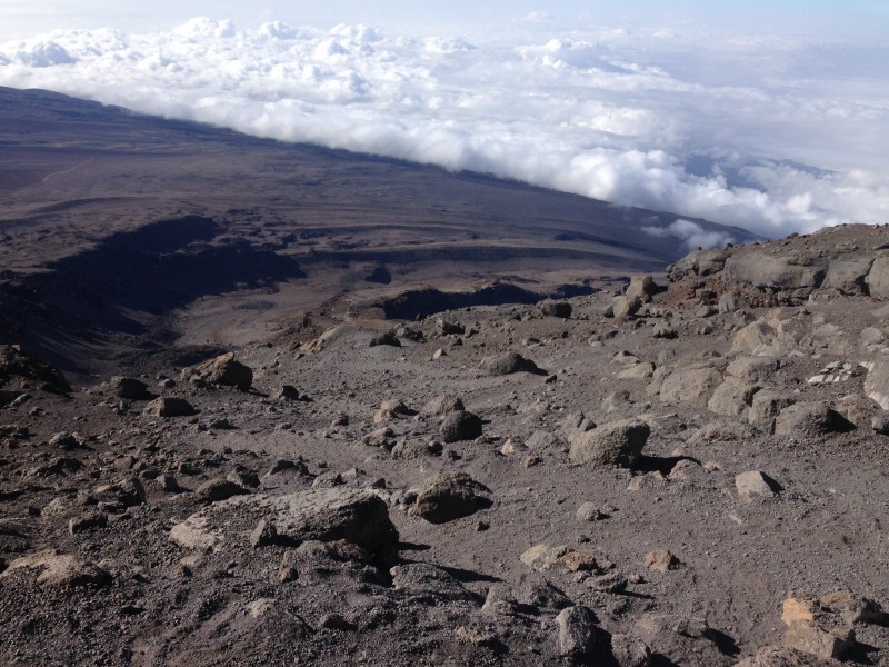 Once we were back at camp, we took a quick nap (no problems falling asleep this time!), had lunch, and continued down to the Mweka Huts. We descended into some clouds and later on rain, which made the trail quite slick at times. You definitely need to watch your footing on this stretch of trail. 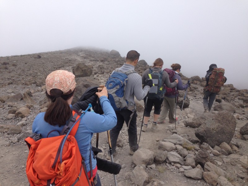 The trail in total from the summit to the huts is about 7 miles, with a loss of over 9,000' feet in elevation. Everyone was definitely worn out at this point and after dinner, nobody had trouble falling asleep. July 1, 2015 (Wednesday) This was it! We left camp right around 9 that morning, and descended around 5.5 miles (almost 5,000' feet down) through the forest to the Mweka Gate. 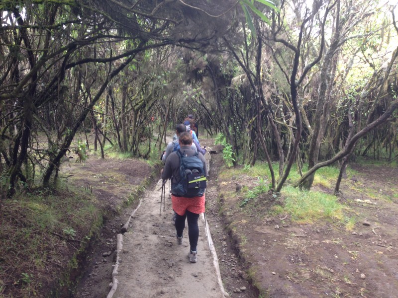 We finished within 2 and a half hours after setting out, and then we went through the check-out process. We signed out with the National Park, and we also were requested to complete surveys from Zara Tours. We hopped into a Land Cruiser with our guides, and with Kilimanjaro Beers in hand, we set off for the Springlands Hotel. It was here that you take care of the tips & everything else needed post-trek. We also invited our guides back to have dinner with us that night (which they accepted), and they regaled us with stories of some of their most interesting clients. July 2-6 We went on a safari, and rather than detail everything, I'll just say that if you go, you have to go to the Serengeti. The other parks we visited paled in comparison to this one. Our first night in the Serengeti wild camp, you could hear a herd of zebra walking between the tents. On our second night there, the chefs prepared a barbecue for us, which we found out later had attracted the hyenas. We were escorted back to our tents that evening and heard the cries of the jackals and hyenas outside of our tents for a while before falling asleep. It was pretty cool. Here are a couple of pictures from our days on safari" 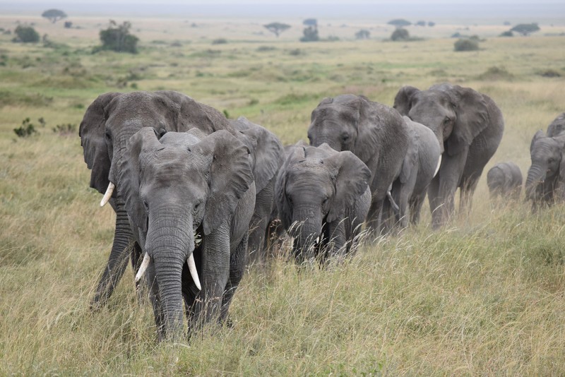  On July 7, we were able to reconnect with Sylvester and Ali, as they had just returned from another climb with 2 Norwegians. It was great spending a few hours with them, and that night, I flew back to the U.S., and thus ended the trip of a lifetime. Final Thoughts I feel very fortunate that everything about this trip came together as it did. The route we chose, the weather, the people we met, the people we had on our team... everything about it was awesome. I do want to say specifically though, that Sylvester & Ali were a huge part of why the trip was so enjoyable and was a success for all. These guides took the time to get to know us, made us laugh all the way up, ensured that everyone was in good condition both physically and mentally, and ultimately became good friends. If you do choose to climb with Zara, make sure to request these guys"you won't be disappointed! I give huge thanks to Sylvester & Ali and our whole team from Zara who made sure we had an incredible week on the mountain. Thanks to all my family, friends, colleagues and 14ers.com community members who have been encouraging me throughout the whole process of preparing for this climb. Thanks as well to Bo, Meg, & Spencer for being great teammates, and to Sarah for agreeing to go on this trip to Kilimanjaro in the first place! It was an awesome 2 weeks! If you made it this far, thanks for taking the time to read about my Kilimanjaro journey. I hope that if you do plan to climb this peak in the future, that this report will be helpful to you. I now look forward to the next adventure, wherever it may be. Maisha marefu! Cheers! Paul Thumbnails for uploaded photos (click to open slideshow):
|
| Comments or Questions | |||
|---|---|---|---|
|
Caution: The information contained in this report may not be accurate and should not be the only resource used in preparation for your climb. Failure to have the necessary experience, physical conditioning, supplies or equipment can result in injury or death. 14ers.com and the author(s) of this report provide no warranties, either express or implied, that the information provided is accurate or reliable. By using the information provided, you agree to indemnify and hold harmless 14ers.com and the report author(s) with respect to any claims and demands against them, including any attorney fees and expenses. Please read the 14ers.com Safety and Disclaimer pages for more information.
Please respect private property: 14ers.com supports the rights of private landowners to determine how and by whom their land will be used. In Colorado, it is your responsibility to determine if land is private and to obtain the appropriate permission before entering the property.

