Download Agreement, Release, and Acknowledgement of Risk:
You (the person requesting this file download) fully understand mountain climbing ("Activity") involves risks and dangers of serious bodily injury, including permanent disability, paralysis, and death ("Risks") and you fully accept and assume all such risks and all responsibility for losses, costs, and damages you incur as a result of your participation in this Activity.
You acknowledge that information in the file you have chosen to download may not be accurate and may contain errors. You agree to assume all risks when using this information and agree to release and discharge 14ers.com, 14ers Inc. and the author(s) of such information (collectively, the "Released Parties").
You hereby discharge the Released Parties from all damages, actions, claims and liabilities of any nature, specifically including, but not limited to, damages, actions, claims and liabilities arising from or related to the negligence of the Released Parties. You further agree to indemnify, hold harmless and defend 14ers.com, 14ers Inc. and each of the other Released Parties from and against any loss, damage, liability and expense, including costs and attorney fees, incurred by 14ers.com, 14ers Inc. or any of the other Released Parties as a result of you using information provided on the 14ers.com or 14ers Inc. websites.
You have read this agreement, fully understand its terms and intend it to be a complete and unconditional release of all liability to the greatest extent allowed by law and agree that if any portion of this agreement is held to be invalid the balance, notwithstanding, shall continue in full force and effect.
By clicking "OK" you agree to these terms. If you DO NOT agree, click "Cancel"...
Ah the infamous Lake Como group of 14ers...long on my radar but filled with apprehension: the grueling nature of the Como Road, the objective dangers of climbing the hourglass, and a rambunctious bear roaming around the lake. It's been easy to keep putting 'em off. When Justin (noinu09) posted on the forum looking for partners for the Little Bear to Blanca traverse, I finally had a good excuse to tackle these difficult peaks. Our plan was to go for all three, the full Lake Como hat trick.
Justin was on the tail end of an extended climbing trip, including having just done the Crestone traverse the day before. I met him and Peter (pete26) at the turnoff for the Lake Como road the night before. Even though we all brought gear, just in case, to pack in and take some mileage off the road, we all decided that given the recent bear activity at the lake, it would be more prudent to go for the whole group in one push.
We parked at about 8,000' and got a few hours of sleep as the sun set. We reluctantly woke up around 0230 and Peter very expertly maneuvered his 4Runner up to about 9,700' on the road. The fact that we were able to get up so high on the road made a huge difference, which was most appreciated when walking back down the road at the end of the day.
We hit the trail by foot at about 0400 and made quick work getting to the lake.
Little Bear and reflection off Como in the early morning. Looking across the basin, Ellingwood looking lovely.
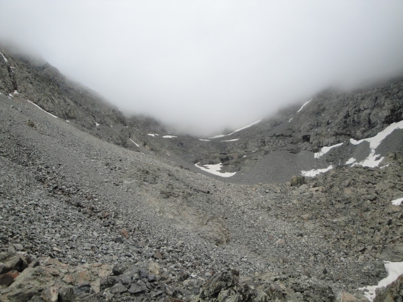
We stashed our poles on the other end of the lake and easily found the turnoff to access the gully that leads up to Little Bear's west ridge. The gully was a bit loose but we each picked a line and made our way up. I thought it was easiest to stay on the sides of the gully, where the rock was more stable, than to go right up the middle.
Working our way up the gulley.
Once on the ridge, the route to the hourglass was pretty obvious; however, I think we dropped a bit lower than the route proper. In any case, the hourglass is obvious and you just keep working your way towards it. While en route to the hourglass, we saw someone topping out on Little Bear. We were still a ways from the hourglass and were hoping they would be down and out by the time we got to the base.
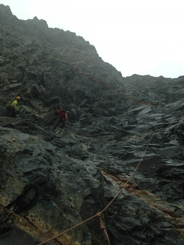
There had been sporadic light rain throughout the morning so by the time we reached the base of the hourglass, we were a little concerned about how much water would be running down and how slippery the rock would be. There was indeed some running water and the rock was slippery but manageable. We stayed on the left side of the hourglass and carefully worked our way up. The wet conditions significantly increased the difficult of the climbing, as would be the theme for the next few hours...
In the hourglass. Slippery when wet! Photo cred: Peter
Most of the reports about the fixed ropes were accurate. There were two ropes down the main part of the hourglass. The orange one had significant damage throughout, most of which was tied off at various points. There was a second rope next to the orange one, which seemed in better condition. We didn't use the ropes on our ascent but they could be used as a handhold in a pinch. Near the anchor of those two ropes, off to the right side of the hourglass, there was another fixed rope. We didn't get a close look at that one since we made our way up to the left.
Up to this point, we still hadn't seen the group that had summited while we were still on the ridge, so we had assumed that they were also doing the traverse. Not more than 10 minutes after we were out of the most dangerous part of the hourglass, we heard multiple rock falls (an occurrence which is more likely than not to occur when descending this part of the route). The group we had seen summit earlier had finally made their way back down. They were coming down climber's right side of the hourglass, thankfully the opposite side of us. I felt extremely fortunate for our timing. If we had been 10 or 15 minutes later, our experience would have been much different. Rockfall is by far my biggest anxiety when climbing and rockfall was what made me most nervous about climbing the hourglass. Needless to say, I was very relieved to be out of the hourglass unscathed.
The remaining route to the summit was straight forward- just keep heading up in the line that suits you. We reached the top at 0845.
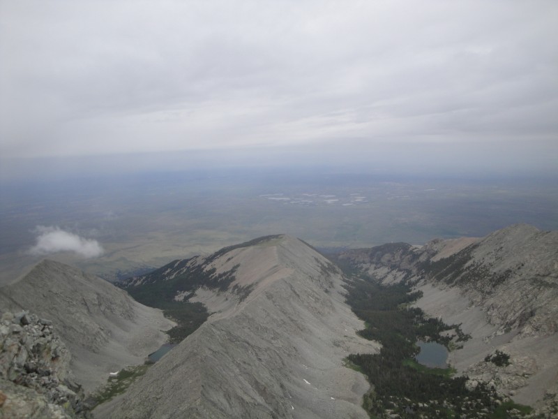
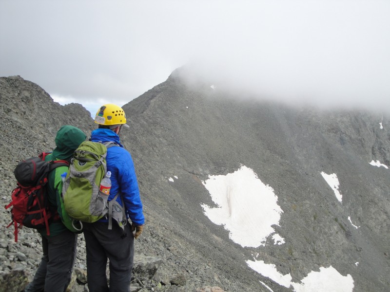
Traverse to Blanca. Looking west towards the valley.
While on the summit, we had a snack, enjoyed the views, and contemplated our next move. We were a little disconcerted about the conditions so far. There had been some light rain off an on during the morning making the rock wet. It had stopped raining for a while and there was no indication of thunderstorms. It even appeared as though the clouds might have been opening up a little. We decided to continue on with our plan and move on with the traverse to Blanca. In all honesty, I was glad to not have to descend the hourglass.
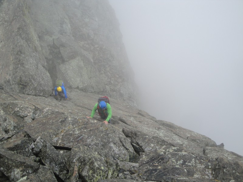
The difficulty of the traverse becomes immediately obvious, as we thought the descent off Little Bear was one of the most difficult parts of the whole process. The rock was still wet from the recent drizzle, which was even more slippery on the lichen covered rocks. We had to be extremely careful with our foot placements, even more so than the route already demands from its climbers.
Initial down climb off LB. Photo cred: Peter Photo cred: Peter
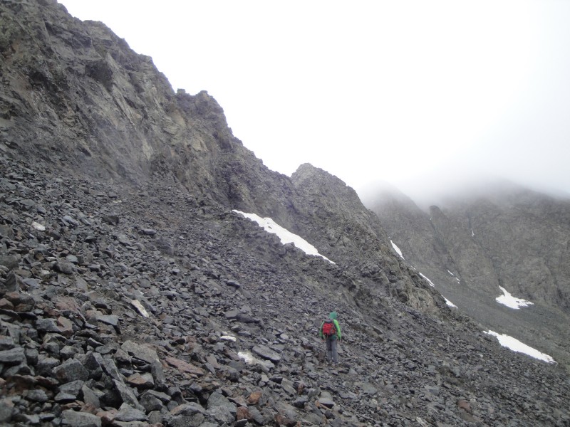
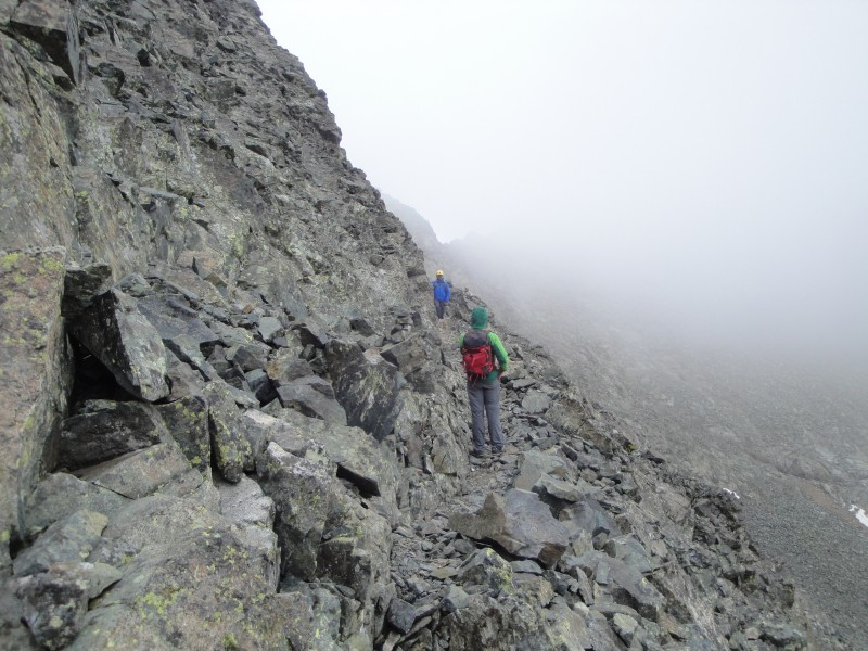
We had all read through many trip reports on the traverse and felt like we had a good grasp on the route. The general advice for the first half of the traverse is accurate: you stay on the ridge crest for much of the time and when that is no longer a viable option, you usually find a ledge system somewhere on the left side. The route really feels like a series of puzzles that must be solved. The satisfaction of completing one puzzle is short lived, as another one soon presents itself. The ledges were extremely airy, and we were often enveloped in fog, which made the climbing...interesting.
Photo cred: Peter Some airy ledges. Focus!
There was one place in particular that took a while for us to figure out. We could see a cairn sitting on top of a large tower but we could not figure out a way to reach it. Staying on the crest was not an option, as there was a very abrupt drop off. I was considering a route to the right, which looked ok initially but ultimately faced the same problem as staying on top of the ridge. The only viable option was a precarious looking ledge system about 20 feet below us but we could not find a reasonable way of getting down to it. We finally back tracked slightly and found a place that we could carefully get down to the ledge, and then even more carefully move across it. Again, we were struggling with wet, slimy rock and keeping our feet planted was of the utmost importance. A slip on any of these ledges was not an option.
Calming the nerves.
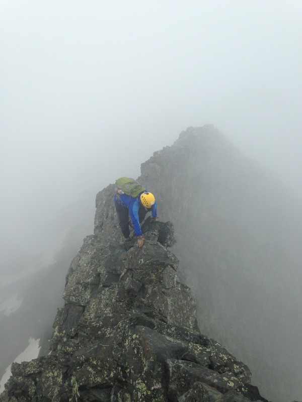
After about two hours, we had finally made it to the saddle. This was a major relief, as we knew the climbing would be easier (note: not easy) the rest of the way. Again, the route information in previous reports was valuable. We bypassed the first tower on the right and went up and over the second and third towers.
Down and around the first tower. Climbing up to the second tower. Looking back at the first tower. It is obvious why this one is not climbed.
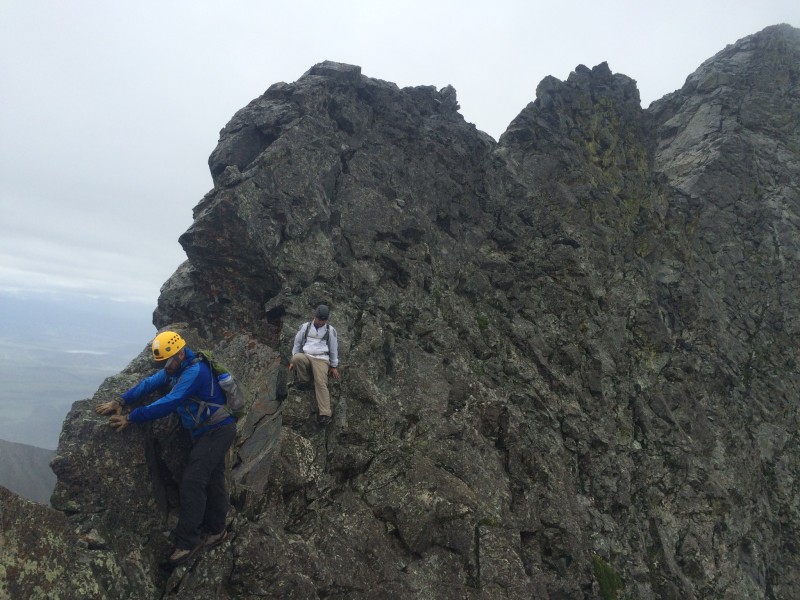
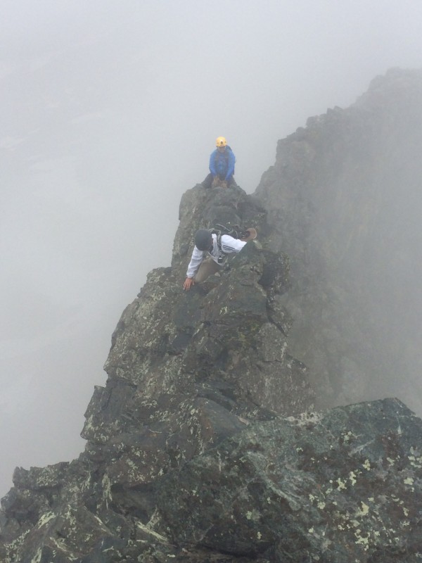
Between the second and third tower is the attention-grabbing, steroid-pumping catwalk. There are a series of catwalks throughout the route, especially during the first half, however none of them compare to this particular catwalk. In fact, nothing on any mountain I have been on to this point even compares to this catwalk. It is extremely narrow, forcing you to straddle or bear walk over it. Unlike the knife edge on Capitol, there is nothing on the sides to work with, forcing you to stay directly on top. It is also extremely sustained, stretching on at least 3 times the length of Capitol's knife edge. Although the rock feels stable, it doesn't appear to be. It looks like it could crumble at any moment. There are even points on the catwalk that appear to be overhanging to the left, giving the feeling that the rock is actually suspending you over the hundreds of feet below you. We weren't sure if the fog that we were climbing through was actually good for our psyches, since we couldn't see the ground or how far up we were. It reminded me of wading in a really deep lake, not knowing how much there actually is below you.
Preparing for the catwalk. See what I mean!? Photo cred: Peter
The last push to the summit of Blanca was straight forward. We felt a huge sense of relief and satisfaction, for making it across this traverse and doing so safely. I was pumped and coursing with excitement. It had taken us about 3.5 hours and adrenaline had been running though my veins almost the entire time. The traverse demands focus from all senses and requires careful and considerate movements.
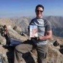
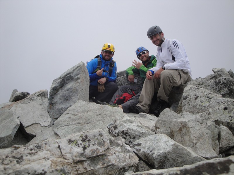
Approaching the summit pitch. Blanca summit. Well done, boys.
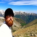
It was noon thirty by the time we summited Blanca and the weather conditions had held stable throughout: foggy, damp conditions throughout but no threat of electricity. We rested our minds and bodies for about 15 minutes and then decided to complete the hat trick and make our way over to Ellingwood. We stayed pretty close to the ridge the whole way, and the Class 3 climbing here felt like a breeze compared to what we had just been through. It took about an hour to make our way to Ellingwood. There were some intimidating marmots guarding the top of the mountain but they were kind enough to let us pass.
Finally below the clouds again. Highway between Blanca and Ellingwood. Ellingwood summit. Hat trick complete!
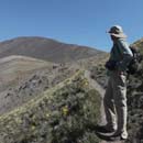
After a few pictures and a quick snack, we started making our way back down. This actually proved to be a little more difficult than anticipated, as none of us studied the route for Ellingwood very much. Peter had done the route before, but it had been a while. We pretty much retraced our way back to the Blanca/Ellingwood saddle, slowly working our way down at the same time. We eventually found the proper trail as we neared Crater Lake.
Contemplating the best way down or marveling at we just completed? Looking back up towards the B/E saddle. Crater Lake.
We took our time working our way back to Lake Como by refilling water, admiring the views, hoping the clouds would move off the traverse so we could get a decent picture of what we had done, and enjoying each other's company. We picked up our poles at the lake and made it back down the road and to the car by 1800. Altogether about a 14 hour day. This will go down as one of my most memorable days in the mountains, partly because of the extremely EPIC nature of the climb and partly because I got to experience it with two other really awesome climbing partners. Looking forward to our next climb, gentlemen. Bells anyone??
Parting view of Little Bear.
My GPS Tracks on Google Maps (made from a .GPX file upload):
That’s quite the accomplishment! Congrats on the hat–trick . . . I was pretty beat after doing Little Bear in ideal conditions (weather, no other climbers, etc.), but going forth on the traverse to Blanca and hitting Ellingwood in the same day is certainly a feat to be proud of.
Dude, what an epic journey through those three peaks! Well done, fellas! Seriously, great trip report! And in some crazy weather too. Glad you stayed safe and did some serious work!
Hey man, Great report, so glad I could be part of the team on the most unforgettable day I’ve had in the mountains. Looking forward to the bells in August man!!!
Hey guys, was hoping you’d post a TR. You stopped and visited with me on your way down Lake Como road.(older guy with white gottie). Thanks for the information you provided and encouragement. I climbed Ellingwood and Little Bear on my trip, but possibly am the only one who did not see the bear! Bummed about that:) Will return to do the traverse and pickup Blanca in the future. Thanks again for spending the time to visit. Great TR for the traverse. Chris
Caution: The information contained in this report may not be accurate and should not be the only resource used in preparation for your climb. Failure to have the necessary experience, physical conditioning, supplies or equipment can result in injury or death. 14ers.com and the author(s) of this report provide no warranties, either express or implied, that the information provided is accurate or reliable. By using the information provided, you agree to indemnify and hold harmless 14ers.com and the report author(s) with respect to any claims and demands against them, including any attorney fees and expenses. Please read the 14ers.com Safety and Disclaimer pages for more information.
Please respect private property: 14ers.com supports the rights of private landowners to determine how and by whom their land will be used. In Colorado, it is your responsibility to determine if land is private and to obtain the appropriate permission before entering the property.
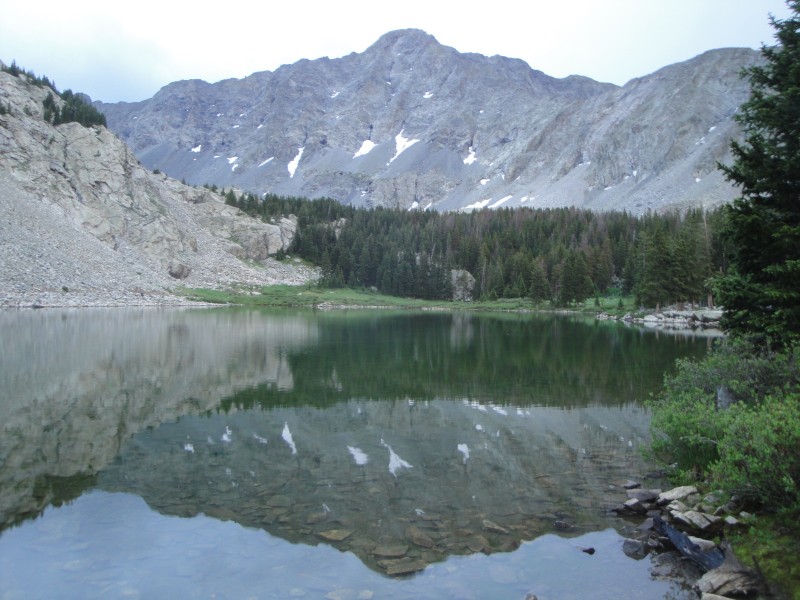


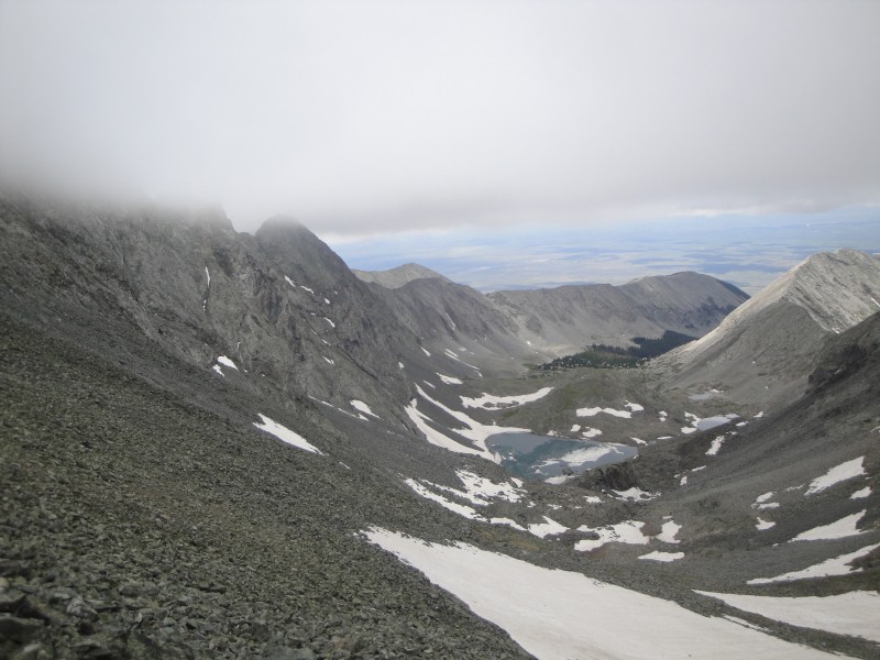


 Little Bear and reflection off Como in the early morning.")
 Looking across the basin, Ellingwood looking lovely.")
 Working our way up the gulley.")
 In the hourglass. Slippery when wet! Photo cred: Peter")
")
")
 Traverse to Blanca.")
 Looking west towards the valley.")
 Initial down climb off LB. Photo cred: Peter")
 Photo cred: Peter")
 Photo cred: Peter")
 Some airy ledges.")
 Focus!")
 Calming the nerves.")
")
")
 Down and around the first tower.")
 Climbing up to the second tower.")
 Looking back at the first tower. It is obvious why this one is not climbed.")
 Preparing for the catwalk.")
 See what I mean!?")
 Photo cred: Peter")
 Approaching the summit pitch.")
 Blanca summit. Well done, boys.")
 Finally below the clouds again.")
 Highway between Blanca and Ellingwood.")
")
 Ellingwood summit. Hat trick complete!")
 Contemplating the best way down or marveling at we just completed?")
 Looking back up towards the B/E saddle.")
 Crater Lake.")
 Parting view of Little Bear.")