| Report Type | Full |
| Peak(s) |
California Peak - 13,854 feet |
| Date Posted | 07/04/2015 |
| Modified | 08/05/2015 |
| Date Climbed | 07/04/2015 |
| Author | Stee Vee Dee |
| California Here I Come |
|---|
|
So many songs about California...With a little bit of a twist, can they all fit? January and February 2015 were a little tough on me. I had acute bronchitis complicated by high blood pressure and sleeplessness. It took a toll on me, but as I lay awake waiting for the meds to work, I dreamed of the mountains...including California Peak which I had highlighted as a good test piece to see if I was still in one piece. Fast forward to early July, California here I come. Beth, my frequent hiking partner, was struggling with shoulder problems and passed on the trip. I decided California was easy enough to do solo and apt to have a little traffic on the fourth of July in case I had trouble. Also, it was far enough south to have little if any snow on the Fourth of July in a heavy and late snow year (see other trip reports for peaks farther north).  California Peak from CR 550 at about 6:30 on the Fourth. The road to the trailhead is rough and passes through very private property. I don't fully understand the concept of no parking along a public road through private property, but once again the 5" clearance Ford Fusion reached the forest boundary and adequate parking just past the trailhead. The Zapata Trail starts humbly about .7 miles from the forest boundary and heads west with a few switchbacks into a meadow. I had set a waypoint on the GPS for a geocache on the saddle so if the trail fizzled out, I could still head for the saddle. The trail got grassy in the meadow, but could still be followed. I would describe it as more than a grassy trace, but not worn to bare dirt in spots. There were also a few cairns with posts in them. I was surprised to pass through an opening in a fence going through the meadow. I reached the saddle in about 1:15 on my 60-year-old Kansas knees. I then wandered off trail to search for the geocache. I didn't find it, but later learned that I had transposed two digits.  When I left the trailhead, there was one vehicle parked there and one pair of names on the trail registry bound for California Peak. Wishing they could all be California Girls, I met them on the way up from the saddle, early on the summit ridge. I had decided that if I was feeling much less than 100%, I would turn around when I met them and head back with them, keeping close. No problems for me, so I forge onward, fairly sure I will not see another human for several hours. The north ridge is long with several bumps as it ascends almost 2000 feet in two miles. There was no defined trail, but there were occasional cairns with the posts in them. On the descent, I figured out that these actually marked the steeper east edge of the ridge and that a more direct route was available. Going up, the only route finding difficulty was around 12800 where the ridge became broad enough to mislead me west-ward briefly around a small snow field. I had set a waypoint for the summit on the GPS, so I eventually figured out I was going a little too far off line. After several bumps and false summits, I reached 13800 and could see the true summit just one shallow dip away. After an almost six hour hike, I had reached California Peak (without any problems of Death Valley or Donner Pass). The views from the summit and going up the ridge made the trip worthwhile. 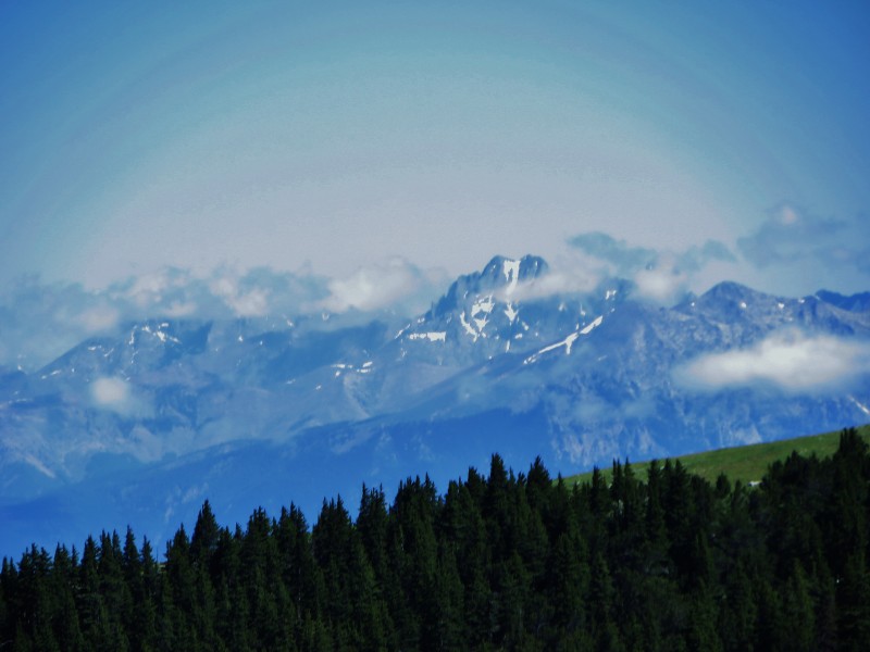 The Majesty of the Crestones from just past the saddle  Mount Herrard (featured prominently on Sand Dunes National Park Quarter)  Sand Dunes, Crestones, etc from higher up  More Dunes 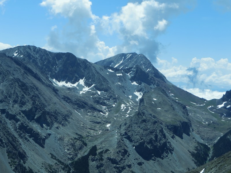 Mount Lindsay, Huerfano Peak, Iron Nipple  Mount Lindsay, Huerfano Peak, Iron Nipple 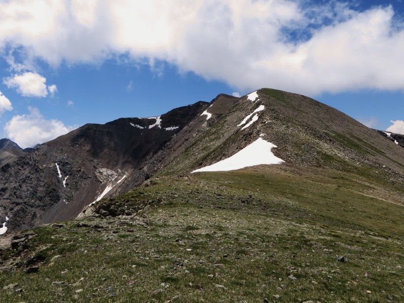 Looking on up the ridge 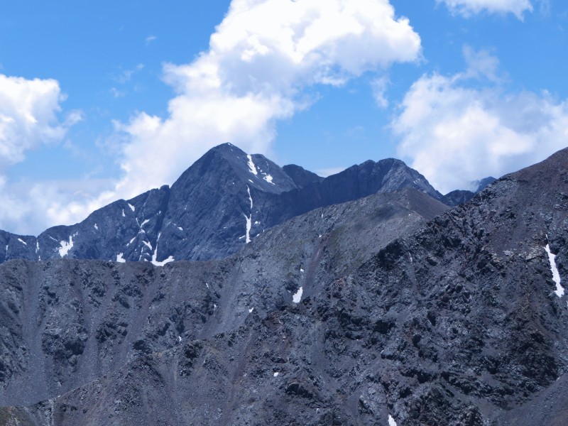 Blanca and Ellingwood Point 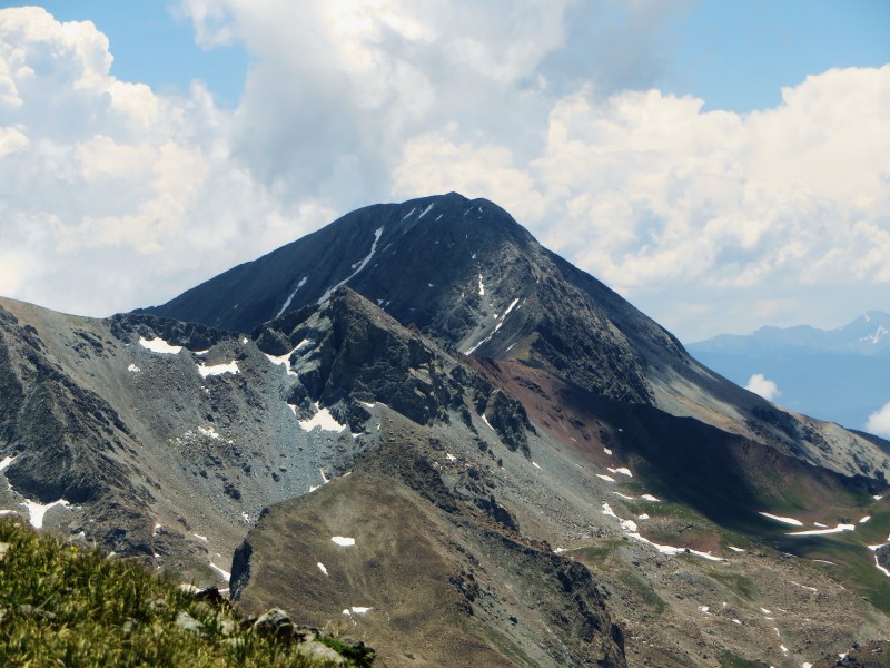 Lindsay zoomed from near the summit  Lost Lake (Lily Lake is farther south and blocked by unnamed 13er) 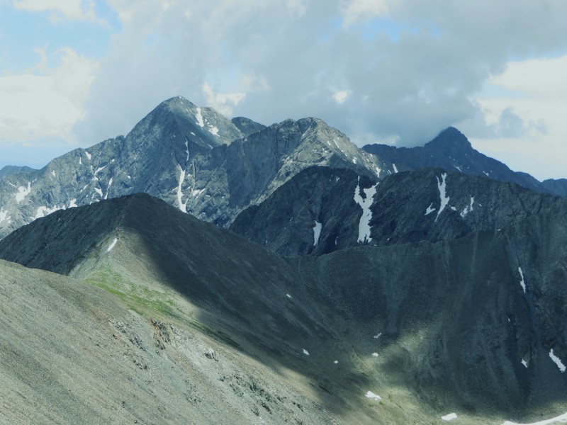 Blanca, Ellingwood Point, and Little Bear from the summit 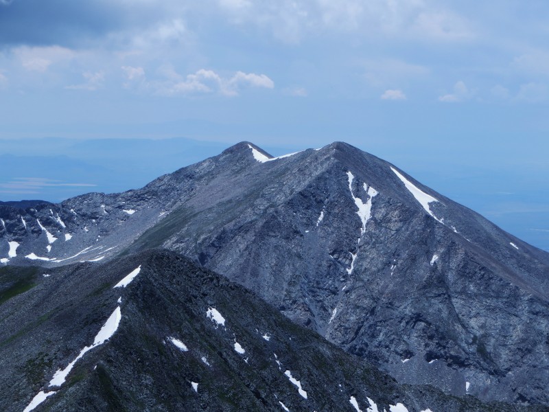 Twin Peaks to the southwest from the summit 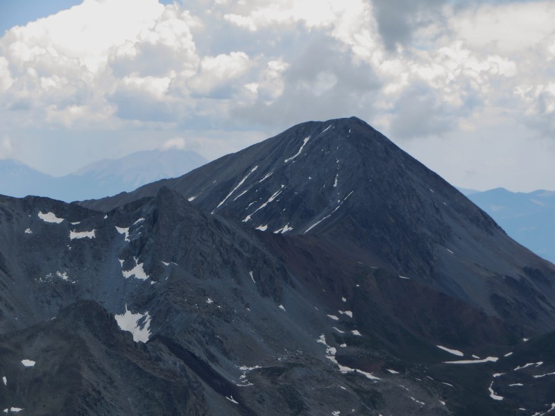 Lindsay from the summit (still on my bucket list) Of course, It Never Rains In Southern California, so I was not yet concerned about the weather, but clouds were developing and I knew I could not piddle around too long. 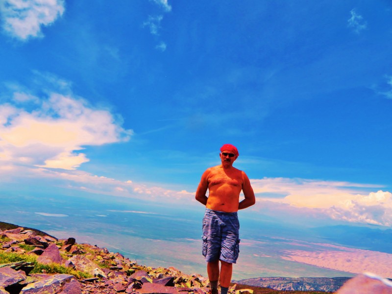 The weather pattern had been daily rain (in Walsenburg) around 5 p.m. Descending, my priorities were to get off the summit, to get below 13000 feet, to get off the north ridge, and to make it to treeline before the rains and lightening hit. I felt like Bob Seager careening down Mulholland Drive (Hollywood Nights style). The line "He was too far from home" kept ringing in my ears. A little prayer to keep the storms at bay until I got to the saddle. I did stop to take a couple of pictures of the wildflowers, but the real thing is much better than the photos.   As I got to the saddle, it began to pour. I went about 100 yards farther and plopped down in the first clump of pines. I spent an hour here, hunkered down and getting cold and wet from accumulating small hail. By now it was a little after 6 and I knew I did not want to hike out in the dark, so I found cheap plastic rain gear in my bag and starting the long march out. The ski mask helped, but my wet gloves were useless. Fortunately, the hail/grapple had stopped and I warmed up by moving constantly and breathing deeply. No falls on the slicker areas and I was back to the dry comforts of the Fusion in about an hour. So, shedding as much of the wet clothes as I could and getting into dry shoes, I started down, glad it was light enough to see the rocks in the road. It had rained a lot...but the road was not flooded and the puddles were navigable in a car. Welcome to the Hotel California...You can check out anytime, but you can never leave. As I neared the forest boundary, I saw what appeared to be an annoying sight. There was a large Dually going down and it was making a small red Camry yield to it as it went up. Then the Dually driver got out and directed the Camry where to park so the Dually could get by. Then, I saw the BARRICADE. During the day, the road had been wiped out by a landslide in the last mile before you reach the forest boundary. A "road" had been opened up to get around the landslide. The road reminded me of a fishing road (going through pasture with ruts and a lot of mud). The Camry was waiting for the Dually to go down the road and see how it was before venturing there itself. The Dually came back and said he barely made it. I decided to wait until morning, so for the second year in a row, I spent an unplanned night in the mountains on the Fourth of July.  Looking down into area near the landslide. I had minimal water, about a dozen cookies for food, and the only dry fabrics I had were a towel and a mostly dry insulated jacket. I spent the night running the defroster sporadically to help dry the clothes and keep the car a little warmer. Morning came and I found the geocache at the trailhead (about 200 feet from where I spent the night) and decided to find the Camry and drive out together. The Camry had already left, and either we both make it or we both get stuck, so I blasted out of there (only hitting one small rock) and never stopping in anything muddy. I was back to Walsenburg and a decent bed by 10:00 a.m. I guess Lindsay will have to wait a while longer. It's hard to say when (or if) the road will reopen. Thumbnails for uploaded photos (click to open slideshow):  California Peak")
 Huerfano Peak")
 Wet Mountain Valley")
 Majesty of Crestones")
 Mount Herrard (Mount Seven?)")
 Reservoir near landslide area")
 View down to saddle")
 Crestones etc across the dunes")
 east end of dunes")
 Lindsay")
 Lindsay")
 Looking up the ridge toward summit")
 Blanca Ellingwood")
 Mount Lindsay")
 Lost Lake")
 Blanca Ellingwood and Little Bear")
 Twin Peaks")
 A little fixated on Lindsay")
 Wheres the beach?")
 Wildflowers")
 More Wildflowers")
|
| Comments or Questions |
|---|
|
|
Caution: The information contained in this report may not be accurate and should not be the only resource used in preparation for your climb. Failure to have the necessary experience, physical conditioning, supplies or equipment can result in injury or death. 14ers.com and the author(s) of this report provide no warranties, either express or implied, that the information provided is accurate or reliable. By using the information provided, you agree to indemnify and hold harmless 14ers.com and the report author(s) with respect to any claims and demands against them, including any attorney fees and expenses. Please read the 14ers.com Safety and Disclaimer pages for more information.
Please respect private property: 14ers.com supports the rights of private landowners to determine how and by whom their land will be used. In Colorado, it is your responsibility to determine if land is private and to obtain the appropriate permission before entering the property.

