Download Agreement, Release, and Acknowledgement of Risk:
You (the person requesting this file download) fully understand mountain climbing ("Activity") involves risks and dangers of serious bodily injury, including permanent disability, paralysis, and death ("Risks") and you fully accept and assume all such risks and all responsibility for losses, costs, and damages you incur as a result of your participation in this Activity.
You acknowledge that information in the file you have chosen to download may not be accurate and may contain errors. You agree to assume all risks when using this information and agree to release and discharge 14ers.com, 14ers Inc. and the author(s) of such information (collectively, the "Released Parties").
You hereby discharge the Released Parties from all damages, actions, claims and liabilities of any nature, specifically including, but not limited to, damages, actions, claims and liabilities arising from or related to the negligence of the Released Parties. You further agree to indemnify, hold harmless and defend 14ers.com, 14ers Inc. and each of the other Released Parties from and against any loss, damage, liability and expense, including costs and attorney fees, incurred by 14ers.com, 14ers Inc. or any of the other Released Parties as a result of you using information provided on the 14ers.com or 14ers Inc. websites.
You have read this agreement, fully understand its terms and intend it to be a complete and unconditional release of all liability to the greatest extent allowed by law and agree that if any portion of this agreement is held to be invalid the balance, notwithstanding, shall continue in full force and effect.
By clicking "OK" you agree to these terms. If you DO NOT agree, click "Cancel"...
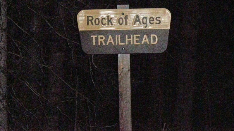
After a few twists and turns we made the journey to the Rock of Ages on Monday night and set up to climb Tuesday (June 30). We got up at the agreed-upon time and prepared to head-out"we had originally intended to be hiking by around 5 a.m. However, I needed to fill up on water, and the only reliable source of water"Big Bear Creek"turned out to be a bit farther away than I expected. Subsequently, we did not hit the trail until closer to 5:30 a.m but no harm, no foul.
.
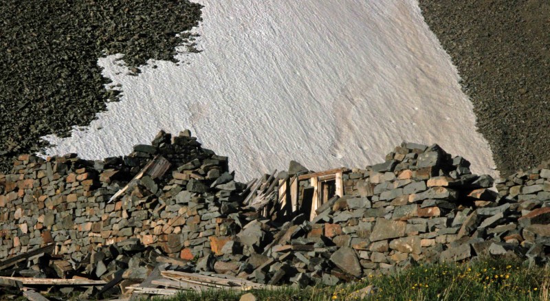
The trail turned out to be well-maintained and surprisingly well marked"every junction had a sign clearly denoting that this was the Rock of Ages trail. We proceeded onward to the remains of an old stone cabin.
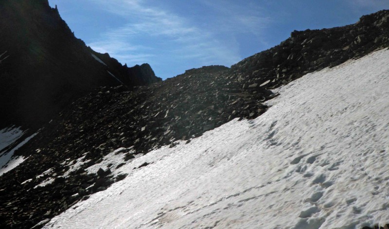
We encountered a few patches of snow here and there but nothing substantial and made good time up to this point; however, this was about to change. The remainder of the journey between this cabin and the Rock of Ages Saddle involved ascending snowfields that hadn't seen a hard freeze in some time. Miserable is a charitable way to describe postholing a good thousand feet of vertical (give or take) through rotten snow.
.
In the interest of keep things clean I will omit my actual description, though I note that I found myself second-guessing whether I really wanted to summit. Nonetheless, the stubborn side of me prevailed and we eventually made it to the Rock of Ages Saddle.
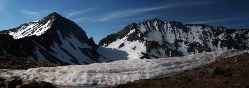
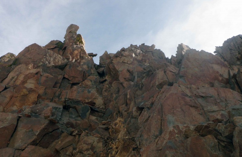
The remainder of the climb was steeper and somewhat more technical
.
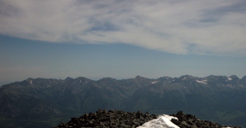
That being said, it was a welcome relief from sinking in rotten snow. We basically picked our routes and headed up. The scrambling was fun, though there were a couple places where things started out fun and became sketchy, requiring a few moves to extricate ourselves from. We also intermittently picked up a trail and cairns, which was nice when we could find it. Shortly after 10 we arrived on the summit of Wilson Peak.
After taking a leisurely break and taking the obligatory summit pictures we headed down. It was slow going; however, we managed to stay on the marked route for a bit longer than on the way up. After accidentally overshooting the Rock of Ages Saddle"it isn't that hard to do, if you're not focusing"we backtracked and began looking for a descent route back into Silver Pick Basin. The main criteria was a minimal amount of postholing. We managed to find a glissade route that wouldn't involve too much postholing at the bottom"there were rock "islands" nearby that we could jump between until we got back below the snowline.
After getting back off the snow, we picked up the trail and headed down. Exhausted and running on fumes we made it back to the trailhead in the somewhat early afternoon. As many choice words as I used on those snowfields, I'm ecstatic to have climbed another fourteener. Hopefully, I will get Mount Wilson and El Diente in the not too distant future.
Important Notes
In terms of access, the road is in excellent shape and easy with a 4WD vehicle"you might be able to get there in 2WD, though it could be a bit rough, especially the stream crossing. The road is also surprisingly well-marked.
Camping is not allowed at the Rock of Ages trailhead; however, there are some sites along the road to the trailhead. Do bear in mind that these sites are first come, first serve"crowds were definitely not a problem when I went but I don't know whether they can a problem at other times in the season. Depending on which site you're at, making a water run could take a considerable amount of time because the only real source is Big Bear Creek (the stream crossing). For this reason, I would advise anyone attempting this trip to stash some extra gallons of water in their car, or at their campsite, to save time.
As far as the climb is concerned, the Rock of Ages trail is well-signed and pretty straightforward. Although parts of it were covered by snow, I presume it's pretty straightforward and well-defined all the way to the Rock of Ages Saddle. There is some semblance of a trail and cairns beyond the saddle; however, you can't always count on it. With proper route-finding you can keep the difficulty at a manageable Class 3; however, there are more than a few places where things can get gnarly if you go off route.
Thumbnails for uploaded photos (click to open slideshow):
I left from where I live, which is on the west side of the Denver Metro area. I didn’t keep an exact count but I’d say it was good 6 hours of driving time (i.e. not including stops) from there.
Hoping to climb this next week, thanks for the helpful report! Hoping some of that pain in the a** snow might be gone! Good to know crampons/spikes/axe won’t be necessary. Congrats!
Did you run into much snow past the saddle to the summit? any ice or snow on the final summit approach? Would you recommend carrying an ice axe? My friend and I are planning to climb on July 11th.
An ice axe would have come in handy, though it was doable without one, when I did it. The bulk of the snow is between the cabin and the Rock of Ages Saddle. There were only patches of snow above the saddle, none of which noticeably increased the technically difficulty. In another week there will be significantly less snow than when I climbed it, so you’d probably be fine without an axe.
As I mentioned in my trip report, the answer is: probably. I was in a 4wd, reasonably high–clearance, vehicle so I can’t say for sure. However, I think it could be done in a Subaru––the night I came in, there was a sedan parked at the trail–head, though it was gone by the time I climbed the next morning.
Caution: The information contained in this report may not be accurate and should not be the only resource used in preparation for your climb. Failure to have the necessary experience, physical conditioning, supplies or equipment can result in injury or death. 14ers.com and the author(s) of this report provide no warranties, either express or implied, that the information provided is accurate or reliable. By using the information provided, you agree to indemnify and hold harmless 14ers.com and the report author(s) with respect to any claims and demands against them, including any attorney fees and expenses. Please read the 14ers.com Safety and Disclaimer pages for more information.
Please respect private property: 14ers.com supports the rights of private landowners to determine how and by whom their land will be used. In Colorado, it is your responsibility to determine if land is private and to obtain the appropriate permission before entering the property.