Download Agreement, Release, and Acknowledgement of Risk:
You (the person requesting this file download) fully understand mountain climbing ("Activity") involves risks and dangers of serious bodily injury, including permanent disability, paralysis, and death ("Risks") and you fully accept and assume all such risks and all responsibility for losses, costs, and damages you incur as a result of your participation in this Activity.
You acknowledge that information in the file you have chosen to download may not be accurate and may contain errors. You agree to assume all risks when using this information and agree to release and discharge 14ers.com, 14ers Inc. and the author(s) of such information (collectively, the "Released Parties").
You hereby discharge the Released Parties from all damages, actions, claims and liabilities of any nature, specifically including, but not limited to, damages, actions, claims and liabilities arising from or related to the negligence of the Released Parties. You further agree to indemnify, hold harmless and defend 14ers.com, 14ers Inc. and each of the other Released Parties from and against any loss, damage, liability and expense, including costs and attorney fees, incurred by 14ers.com, 14ers Inc. or any of the other Released Parties as a result of you using information provided on the 14ers.com or 14ers Inc. websites.
You have read this agreement, fully understand its terms and intend it to be a complete and unconditional release of all liability to the greatest extent allowed by law and agree that if any portion of this agreement is held to be invalid the balance, notwithstanding, shall continue in full force and effect.
By clicking "OK" you agree to these terms. If you DO NOT agree, click "Cancel"...
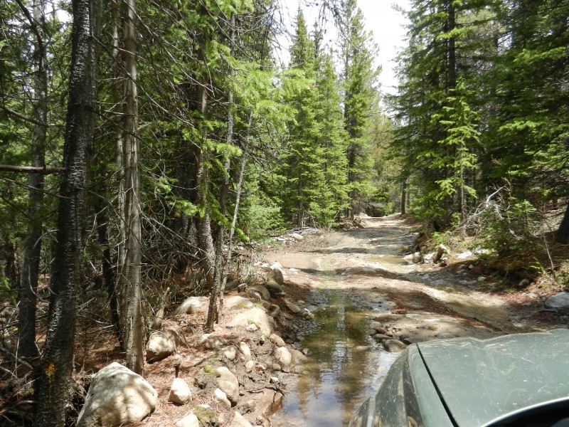
Climbing Huron Peak sounded like a great idea for Saturday morning. I left Pueblo around 6 pm Friday. I planned to drive all the way to the South Winfield 4WD trailhead, sleep in the car and get an early start while the snow was still hard. CR390 was fine and other than a fair amount of water, the 4WD road was clear all the way up (as far as I could tell in the dark). My Subaru Outback had no problems negotiating the road. A 2WD car with low clearance should definitely park at the 2WD parking area. The 4WD road is narrow but there are a lot of pull-outs to let other vehicles pass A view of the 4WD road on the way out..
I arrived at 9:30 pm and was happy to see a clear sky full of stars. That would definitely help with firming up the snow.
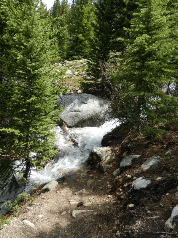
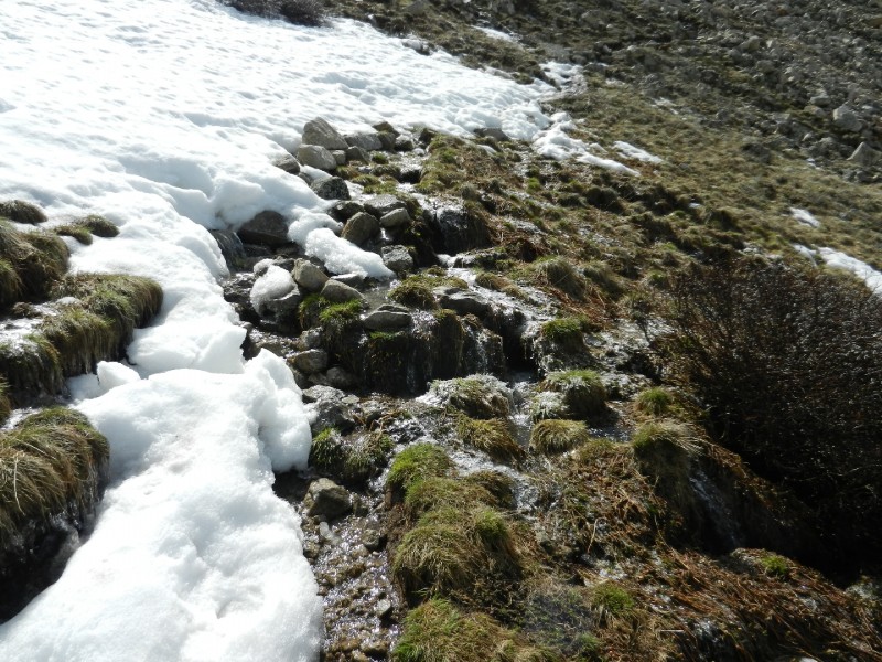
The watch alarm went off, I rolled out, and was on the trail by 5 am. The trail allows for gentle elevation gain until you cross the creek. With all the snow melt going on, the creek was really flowing making the crossing interesting. You can leap the 4 or 5 feet from the boulder to a soft landing on the far side. Main trail stream crossing. Or, if you prefer to step across, walk about 30 yards up stream (38.95520, -106.46040) and cross stepping onto a slippery stump in the creek. The slippery-stump-step-across. I took the leap on the way up and the stump on the way back. Trekking poles are very helpful here.
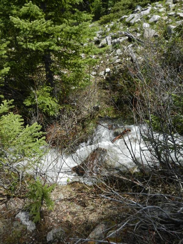
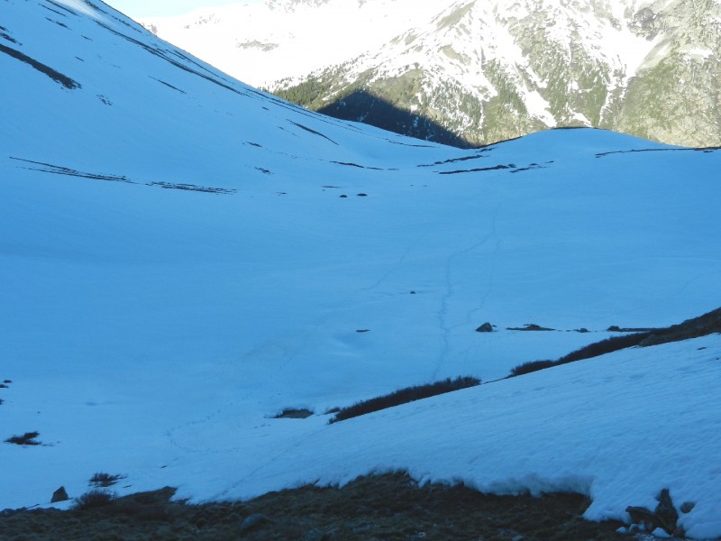
After the creek crossing, the trail climbs on a series of switchbacks to about 11,600'. There were a few snow drifts starting around 11,400' but nothing too difficult. It is easy to lose the trail in this section due to the snow drifts. After 11,600' the trail swings to a southern exposure and the trail is pretty much snow-free until you enter the basin at 12,250'. Approaching the basin. I entered the basin at 6:30 and the snow was nice and firm. Snowshoes are really helpful when crossing the basin later in the day.
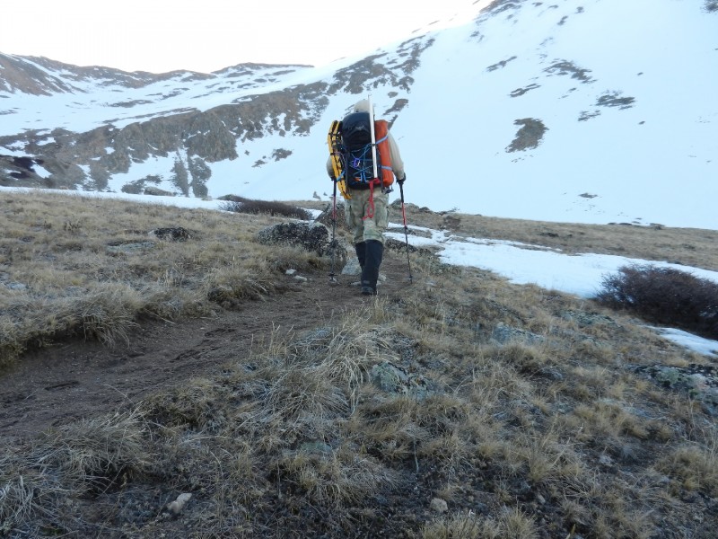
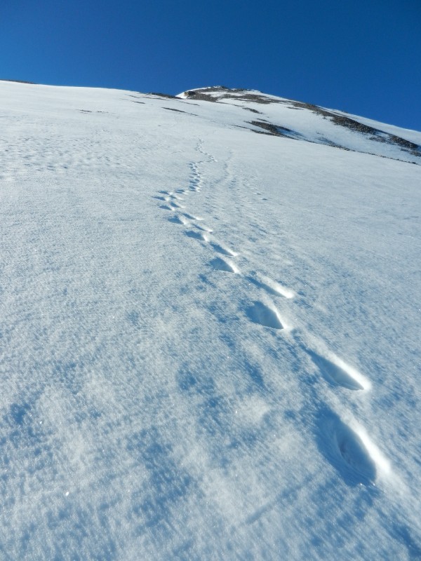
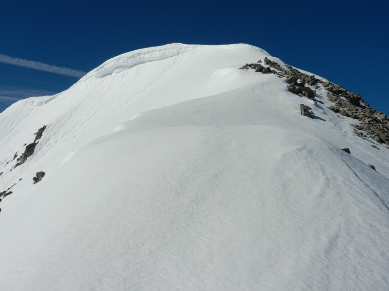
On the other side of the basin, I finally put my micro-spikes for the climb to the ridge. There were ice covered rocks and mud in spots as you gain the ridge. Icy conditions on the trail. Staying on the firm snow as much as possible makes life a lot easier. On the lower ridge, there was a mix of exposed rock and snow fields. Looking back at the lower ridge and basin. I suppose you could stay on rock if the snow got really mushy but the firm snow made the elevation go by quickly. Snow conditions were perfect early in the morning The slope angle is low enough that you can hike straight up. Snow on the lower ridge. The upper ridge was all snow. The upper ridge with a nice cornice. Make sure to stay well to your right on ascent due to the corniced ridge line. Spikes or crampons are definitely recommended.
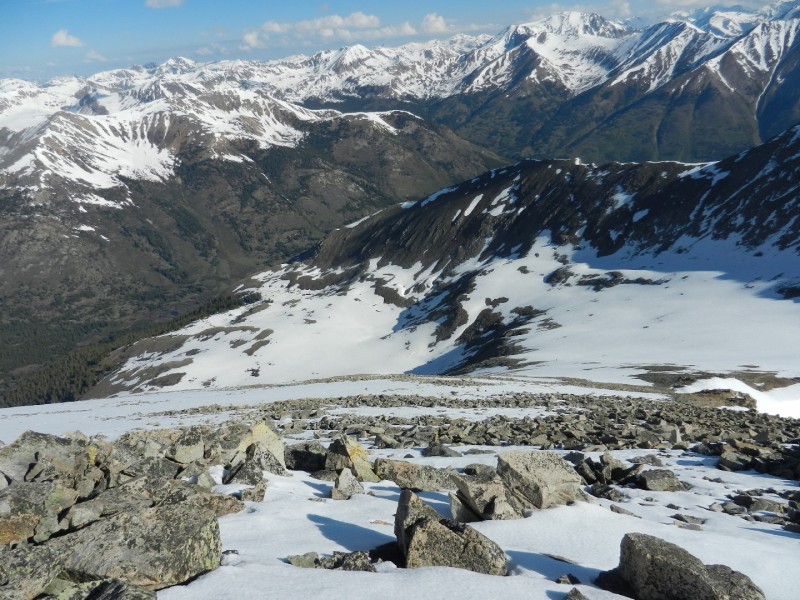
I reached the summit at 8:40 and there was just a whisper of a breeze with plenty of sunshine. The view of the Apostles is worth the climb. The Apostles as seen from the summit. To this point, I used my ice axe only once and that was to chop a butt-bucket on the summit for comfortable place to sit.
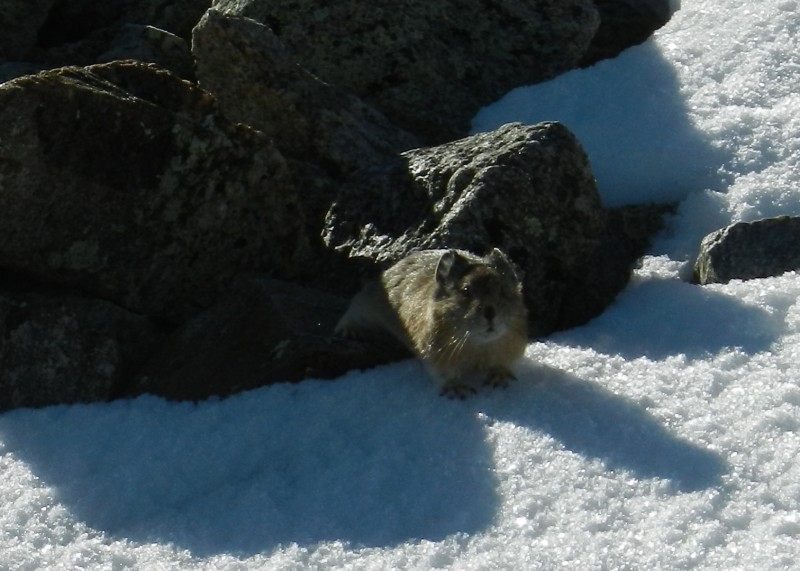
I was off the summit by 9:15. The clouds were already starting to build and the snow was getting soft. I post-holed a couple times on the upper ridge. On the lower ridge I saw a pika Pika! and a marmot. A marmot soaking up the sun. I made it all the way to the basin and had to put on my snowshoes for the trek across the now soft snow. There were several climbers behind me by about an hour or two. Hopefully, they made it across the basin without visiting "post-hole-hell".
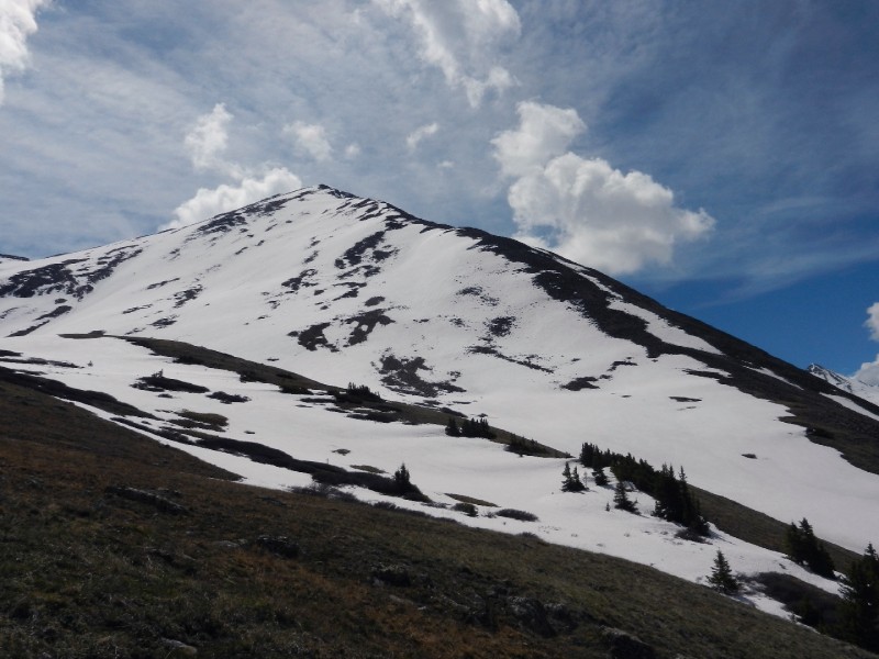
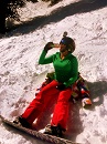
I was back at the trailhead before noon. Huron Peak turned out to be a wonderful climb. Huron Peak.
My GPS Tracks on Google Maps (made from a .GPX file upload):
Wife and I are heading up, or plan to head up, Huron on July 11th. Hopefully a lot of those icy conditions will be gone by then.
There is another thing that is gone for this region: hotel and B&B rooms! Before we hike any 14er, we prefer to stay in a hotel or B&B to guarantee a better night’s sleep and be more fully rested before the hike. I think we’ll just have to suck it up and blow up our air mattress and stay the night in the back of our Ford Explorer.
I’d guess you’re probably OK by now to get by without spikes. A condition update for a climb of Huron by lfishsays on 6/26 indicates they didn’t use spikes. It never hurts to throw them in your pack. They also help quite a bit on a steep muddy trail. Your call. Good luck with your climb.
lfishsays 6/26 condition update:
"Route: Northwest Slopes
Info: Hiked Huron on 6/26. The 4WD road is in good shape. A few rough spots but as long as you have good clearance you should be fine, although we did see a church van at the upper trailhead (props to them)...we got my buddy‘s Subaru up there last year but took my Jeep this time and it was way easier. Anyway, it was an absolutely beautiful day on the mountain. Camped at the trailhead and started the hike a little after 6:30am. As the other reports stated, no snow along the route until the basin and along a few portions of the upper route, which the husky was more excited about than we were, but nothing unmanageable. I did the hike in trail runners and didn‘t use my spikes – I would definitely recommend waterproof shoes as there is a lot of runoff above treeline. We postholed through the basin but it‘s not really a long enough stretch to worry about. Summited around 9:15 and had the obligatory beer...the weather was awesome so we stayed up there for about an hour before heading down at 10:15. Back to the trailhead at 12:15, so overall it took us about 3 hours up and 2 down. Solid day! lfishsays"
Caution: The information contained in this report may not be accurate and should not be the only resource used in preparation for your climb. Failure to have the necessary experience, physical conditioning, supplies or equipment can result in injury or death. 14ers.com and the author(s) of this report provide no warranties, either express or implied, that the information provided is accurate or reliable. By using the information provided, you agree to indemnify and hold harmless 14ers.com and the report author(s) with respect to any claims and demands against them, including any attorney fees and expenses. Please read the 14ers.com Safety and Disclaimer pages for more information.
Please respect private property: 14ers.com supports the rights of private landowners to determine how and by whom their land will be used. In Colorado, it is your responsibility to determine if land is private and to obtain the appropriate permission before entering the property.