Download Agreement, Release, and Acknowledgement of Risk:
You (the person requesting this file download) fully understand mountain climbing ("Activity") involves risks and dangers of serious bodily injury, including permanent disability, paralysis, and death ("Risks") and you fully accept and assume all such risks and all responsibility for losses, costs, and damages you incur as a result of your participation in this Activity.
You acknowledge that information in the file you have chosen to download may not be accurate and may contain errors. You agree to assume all risks when using this information and agree to release and discharge 14ers.com, 14ers Inc. and the author(s) of such information (collectively, the "Released Parties").
You hereby discharge the Released Parties from all damages, actions, claims and liabilities of any nature, specifically including, but not limited to, damages, actions, claims and liabilities arising from or related to the negligence of the Released Parties. You further agree to indemnify, hold harmless and defend 14ers.com, 14ers Inc. and each of the other Released Parties from and against any loss, damage, liability and expense, including costs and attorney fees, incurred by 14ers.com, 14ers Inc. or any of the other Released Parties as a result of you using information provided on the 14ers.com or 14ers Inc. websites.
You have read this agreement, fully understand its terms and intend it to be a complete and unconditional release of all liability to the greatest extent allowed by law and agree that if any portion of this agreement is held to be invalid the balance, notwithstanding, shall continue in full force and effect.
By clicking "OK" you agree to these terms. If you DO NOT agree, click "Cancel"...
I was hoping to get this trip report up earlier, but the week has been busy!
I did a pre-work solo climb-and-ski-climb-and-ski of Bard Peak on Tuesday. I launched from the Bakersville parking area and bushwhacked up the south side of Bard to find the thin trail leading to the South Slopes. The mushy snow in the forest between 10,500' and 11,000' was challenging to navigate in. I decided to walk up the creek itself as it provided a more stable route and the ski boots are waterproof. That worked well until I hooked a tree branch and took a face dive into the creek! Oh, well. At least it is Colorado and things dry fast. I skinned from there through the mush and then accessed the South Slopes aka "Shakespeare".
The bristlecone and limber pine forest near tree line in this area is spectacular. I suspect that this is an area that is not frequently visited by people. I was able to climb to the summit without skis on. The snow was surprisingly frozen and the booting was efficient. No need for crampons, and the slopes are not steep.
The summit of Bard Peak has amazing views of the Stevens Gulch Peaks. Grays and Torreys have skiable lines from the summits right now.
I skied Bard's East Slopes heading towards Empire. The corn was great! I have been getting my ass kicked this spring in the Mayuary winter. There have been a lot of gray days with poor visibility, crusts on top of slush, and I even got electrocuted in a storm on Mt. Machebeuf. I was so excited to hit big corn ski turns with sunshine! I skied to the bottom of the East Slopes and then skinned back up Bard Peak using the east Ridge. A quick traverse below the summit brought me back to the South Slopes / Shakespeare and I skied down from there and found the old trail all the way to the chain up pull off on I-70. Then to work!
Here is some more info on Bard Peak and the ski descents: http://www.frontrangeskimo.squarespace.com/bard-peak/
This picture is from spring 2014, but shows the broad South Slopes of Bard (Right) and Parnassus (Left).
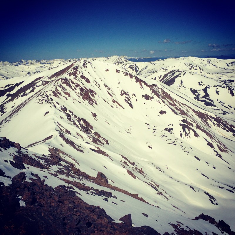
There is a stunning view of Grays and Torreys from the summit of Bard.
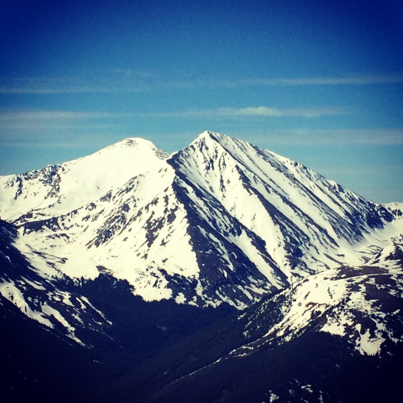
The Northeast Face of Parnassus.
A vertebrae on the slopes of Bard Peak.
Climbing back up Bard for more.
Thumbnails for uploaded photos (click to open slideshow):
We tried for a ski of Bard on Wednesday but approached via Bard Creek. Schwacking through waist deep slush with skis and boots on the pack was "fun". Cloudy skies and zero freeze the night before had us retreating from an iffy traverse to gain the eastern face. Beats sitting in the office all day, is what we kept telling ourselves – which it really does.
You got a good website there, it’s a great contribution, keep up the good work!
I’ve got minimal off–road driving experience but had no problem what–so–ever getting my stock Tacoma 4x4 up it. There is an awesome spot about a quarter mile in where you’re looking down on I–70. And I mean down, straight down, from about 1,000 feet up. Turn around is very easy at the trail head.
Need to budget 30–40 minute for those 4 miles of driving though.
Caution: The information contained in this report may not be accurate and should not be the only resource used in preparation for your climb. Failure to have the necessary experience, physical conditioning, supplies or equipment can result in injury or death. 14ers.com and the author(s) of this report provide no warranties, either express or implied, that the information provided is accurate or reliable. By using the information provided, you agree to indemnify and hold harmless 14ers.com and the report author(s) with respect to any claims and demands against them, including any attorney fees and expenses. Please read the 14ers.com Safety and Disclaimer pages for more information.
Please respect private property: 14ers.com supports the rights of private landowners to determine how and by whom their land will be used. In Colorado, it is your responsibility to determine if land is private and to obtain the appropriate permission before entering the property.
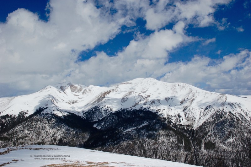


 This picture is from spring 2014, but shows the broad South Slopes of Bard (Right) and Parnassus (Left).")
 There is a stunning view of Grays and Torreys from the summit of Bard.")
 The Northeast Face of Parnassus.")
 A vertebrae on the slopes of Bard Peak.")
 Climbing back up Bard for more.")