Download Agreement, Release, and Acknowledgement of Risk:
You (the person requesting this file download) fully understand mountain climbing ("Activity") involves risks and dangers of serious bodily injury, including permanent disability, paralysis, and death ("Risks") and you fully accept and assume all such risks and all responsibility for losses, costs, and damages you incur as a result of your participation in this Activity.
You acknowledge that information in the file you have chosen to download may not be accurate and may contain errors. You agree to assume all risks when using this information and agree to release and discharge 14ers.com, 14ers Inc. and the author(s) of such information (collectively, the "Released Parties").
You hereby discharge the Released Parties from all damages, actions, claims and liabilities of any nature, specifically including, but not limited to, damages, actions, claims and liabilities arising from or related to the negligence of the Released Parties. You further agree to indemnify, hold harmless and defend 14ers.com, 14ers Inc. and each of the other Released Parties from and against any loss, damage, liability and expense, including costs and attorney fees, incurred by 14ers.com, 14ers Inc. or any of the other Released Parties as a result of you using information provided on the 14ers.com or 14ers Inc. websites.
You have read this agreement, fully understand its terms and intend it to be a complete and unconditional release of all liability to the greatest extent allowed by law and agree that if any portion of this agreement is held to be invalid the balance, notwithstanding, shall continue in full force and effect.
By clicking "OK" you agree to these terms. If you DO NOT agree, click "Cancel"...
DATES: 5/2-4/15 RT TIME: ~6 hours from camp in Garnet Canyon CLIMBERS: Greg (GregMiller), Jeff (SurfNTurf)
This trip seemed cursed from the start. The term "bad juju" was used several times during planning. We began with a solid team of four and the goal of climbing the Skillet Glacier on Mt. Moran. It was unsure whether Jackson Lake would melt in time for the required canoe crossing. The weather, which was perfect for a week both before and after our dates, looked fairly unsettled on summit day. Keegan bailed about a week beforehand to understandably take a family trip to Moab. Sam came down with bronchitis 24 hours prior to departure. Greg and I even briefly discussed staying more local or canceling altogether, but it was a short debate. Bad juju or not, we had an itch for the Tetons that had to be scratched.
With Jackson Lake iffy (it did end up melting out a day before our planned crossing, congrats to Dan and crew for their summit), we shifted our focus to other objectives. A brief flirtation with the idea of climbing the Grand in mixed conditions ended when Sam, the strongest trad leader among us, got sick. Greg and I piled into the car at noon Friday with a guidebook and open minds.
It didn't take long to settle on the Middle Teton, the third-highest peak in the range. Complex, interesting and boasting a variety of classic routes, the Middle is considered one of the real prizes in Grand Teton National Park. The Southwest Couloir, which is a Class 3/4 scramble in the summer, promised to be a rewarding spring snow climb with grand (ha) summit views. There was even the opportunity for extra credit by tacking on the South Teton from its shared saddle with the Middle. Other moderate/steep snow routes on Nez Perce or Disappointment Peak were there for the taking if we felt frisky before hiking out Monday morning.
Greg and I drove most of the way Friday, stopping just short of Jackson at a free campsite with questionable legality along the Hoback River. We picked up our backcountry permits for The Meadows area of Garnet Canyon early the next morning and began gearing up in the Lupine Meadows parking lot around 11 a.m. Unsure of what else we might attempt, we hauled in a second ice tool each, a skinny glacier rope and harnesses with a very light rack, mostly for potential rappels. We also carried snowshoes based on reports from two skiers starting up at the same time. This proved to be the single stupidest decision I've ever made. That's probably hyperbole, but still -- if there's one thing worse than wearing snowshoes, it's carrying them on your back. Which we did for almost the entire trip.
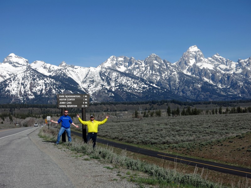
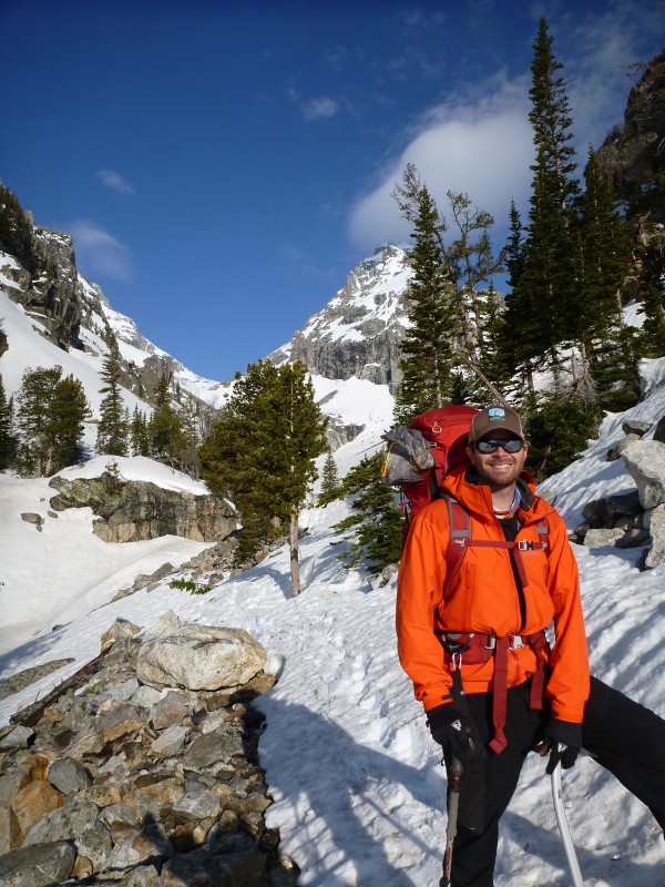
Entering the Park.
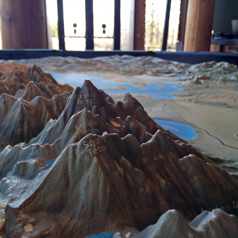
Relief map in Moose Visitor Center.
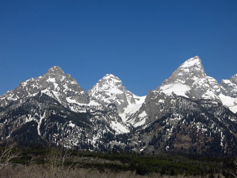
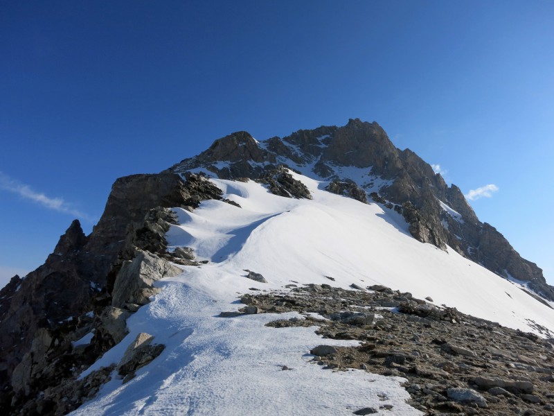
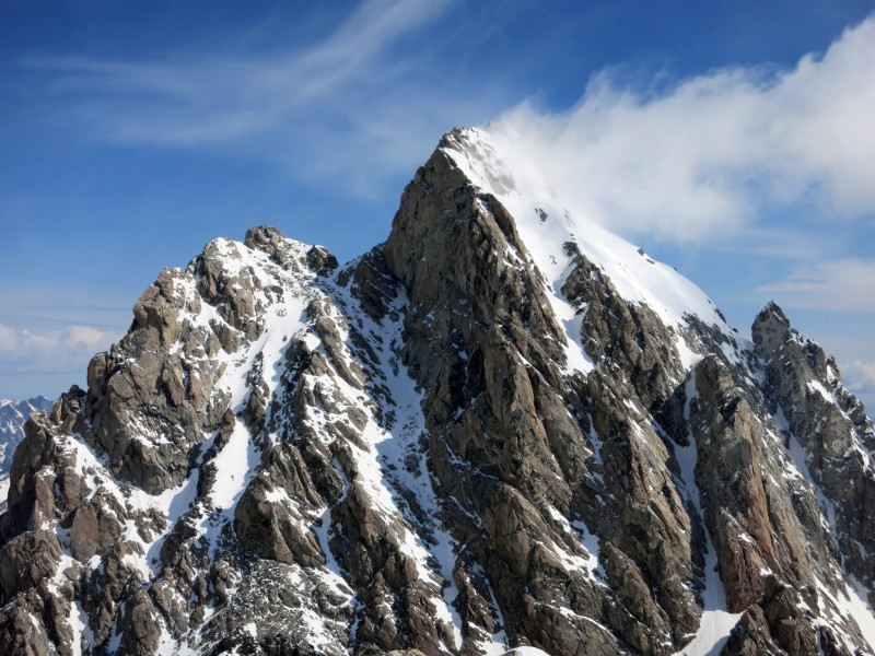
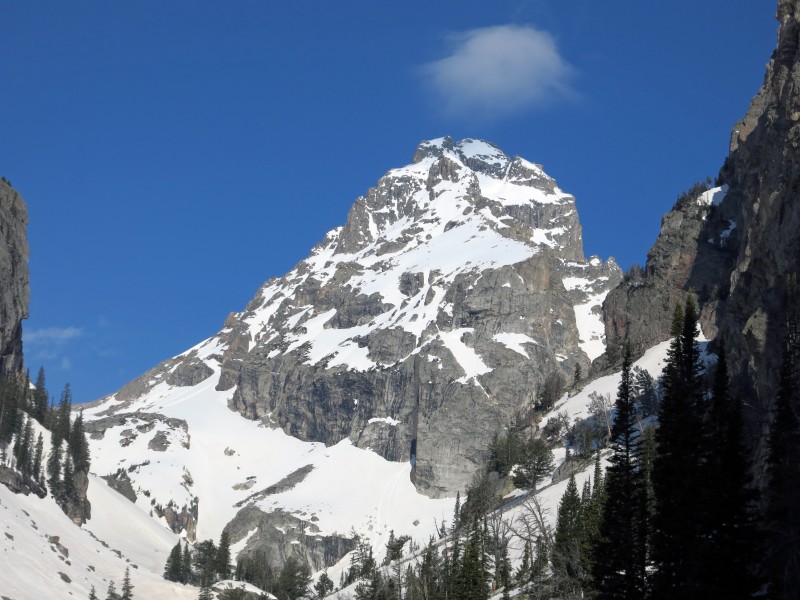
The Middle in, well, the middle.
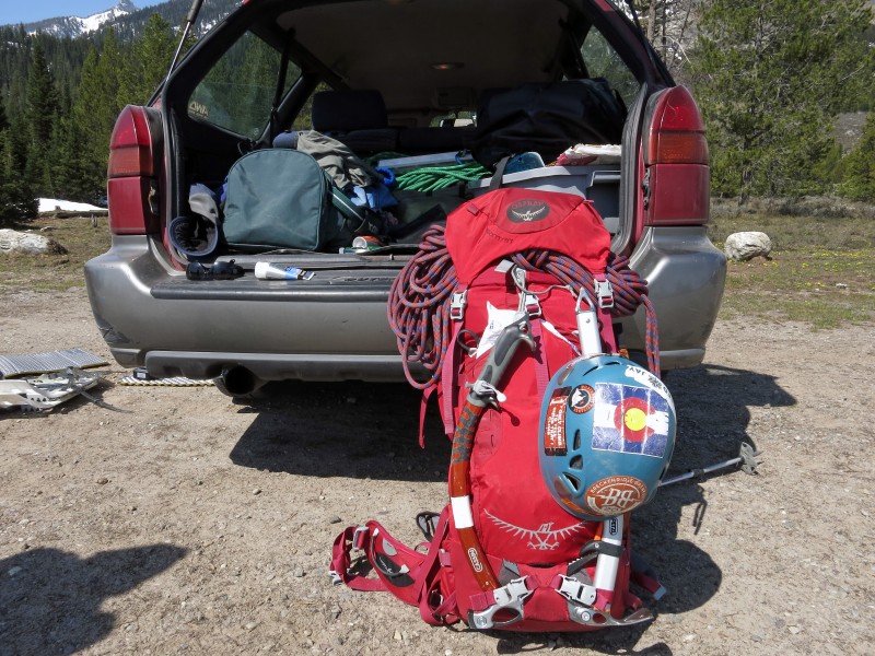
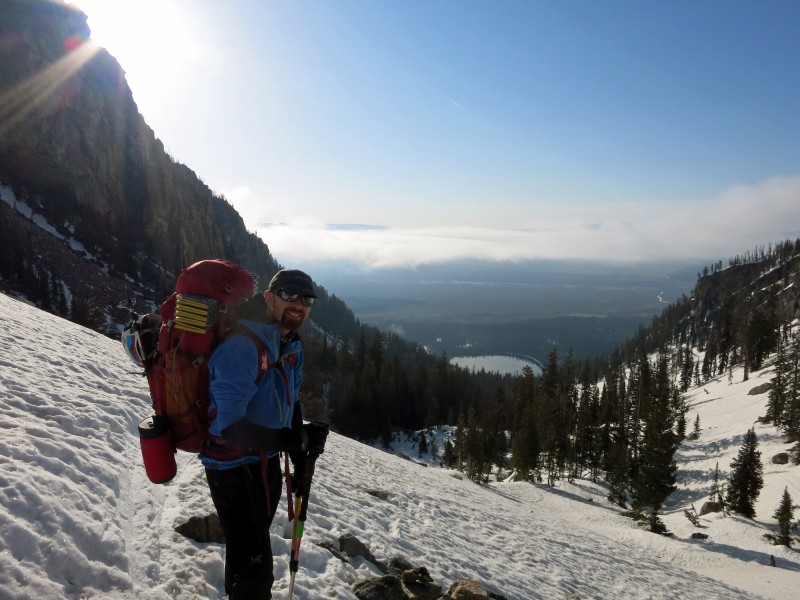
An overburdened 37-liter pack.
We were hiking up the mostly dry trail by 11:30 a.m. It winds its way up minor ridgelines before traversing into Garnet Canyon fairly high up. By the time you actually enter the canyon, the approach is almost over. The highlight of the hike was passing a homicidal sage grouse that had no fear of attacking our shins with claws and beak. She must have had a nest nearby. It followed us for a few hundred feet, striking at will, before finally leaving us alone. It took most of my willpower not to punt the damn thing with my mountaineering boots.
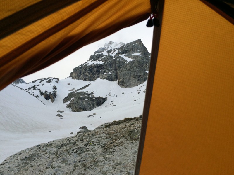
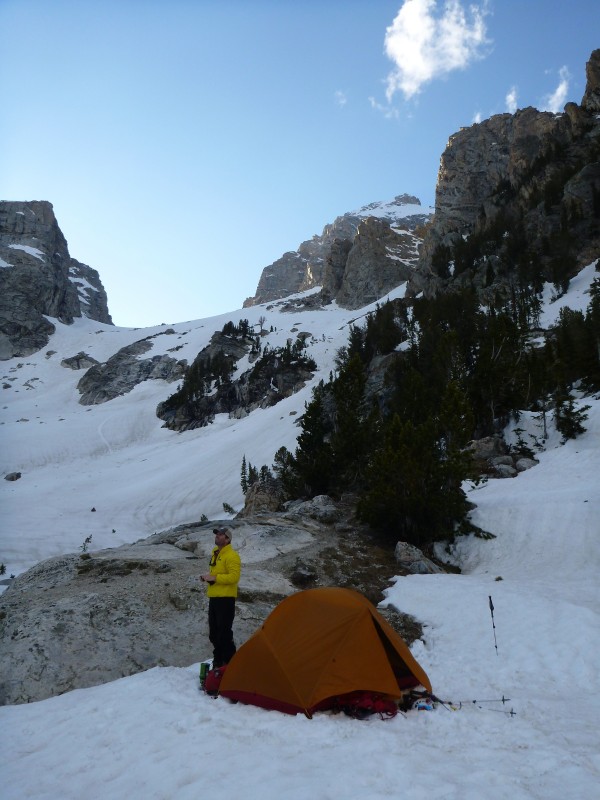
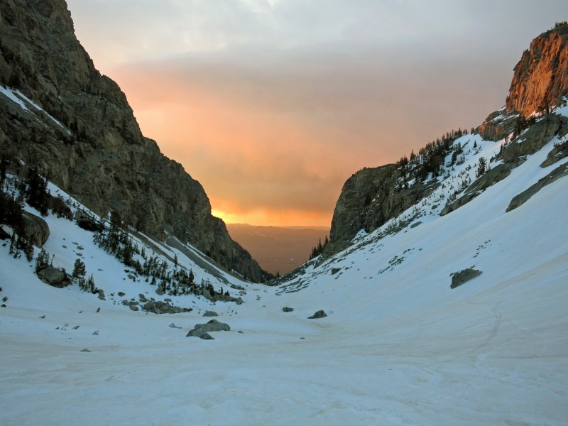
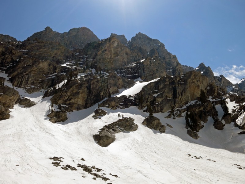
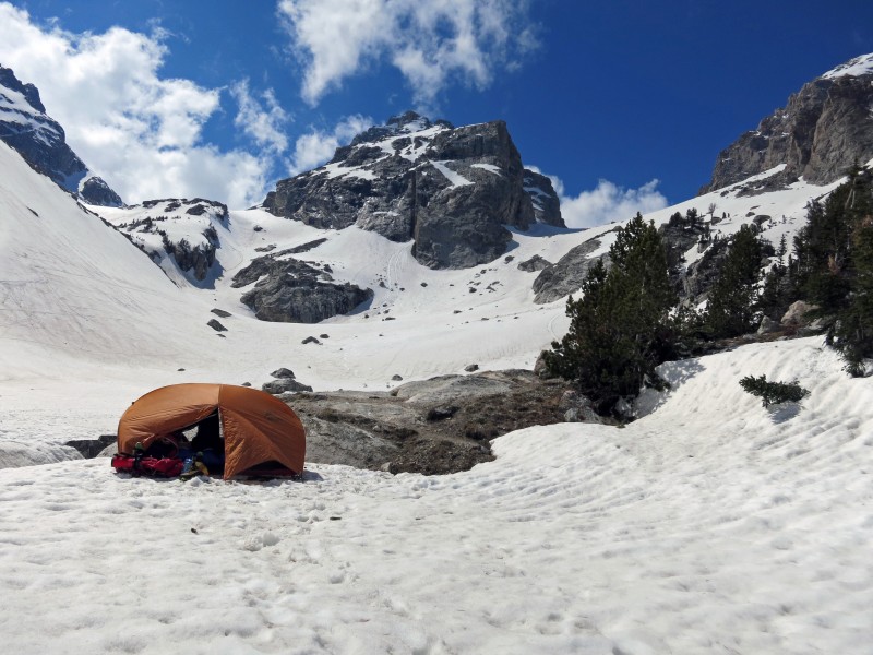
Stellar views greeted us as we entered Garnet Canyon. We traversed a few moderate snow slopes before dropping to the canyon floor, where we were made to feel small beneath Nez Perce, the Middle Teton, Teepe Pillar and of course, the Grand Teton itself. The Meadows camping zone begins at a small stand of trees where the canyon forks. This narrow area actually had considerable avalanche and rockfall danger, so we took extra time to find a safe spot that had the added bonus of being near a small patch of running water. During our two nights there, we had a wet slide, falling rocks and collapsing ice chunks tumble within a few hundred feet of our tent. Choose your campsite carefully.
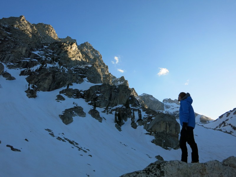
We popped up the tent, got settled, took care of camp chores and snapped a heinous amount of photos. The weather appeared every bit as unsettled as the forecast dictated, but it made for some sweet evening shots. With alarms set for 5 a.m., we climbed into the tent at about 7:30 p.m. and passed a long night berated by the wind.
Entering Garnet Canyon.
Unsettled weather.
Evening light on the Middle Teton.
Greg, taking in Nez Perce.
Surrounded by views. (Photo by Greg.)
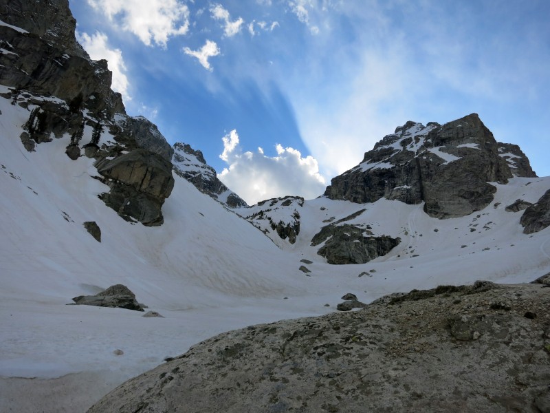
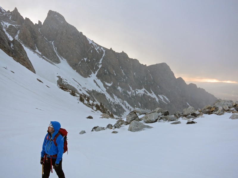
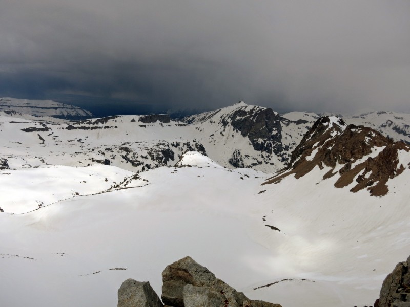
The scale in the Tetons is simply on another level. The Middle-South saddle looked tantalizingly close. Moving at a decent but relaxed pace, we figured it would take us two hours. It's rare for a saddle to have false summits, but this one required about a half-dozen. It was approaching 9 a.m. by the time we were looking down on Icefloe Lake with a clear view of our intended route above. The early morning clouds burned away for a few minutes, giving us several astonishing panoramas. Don't worry, the weather returned in short order to prevent us from ever being truly comfortable.
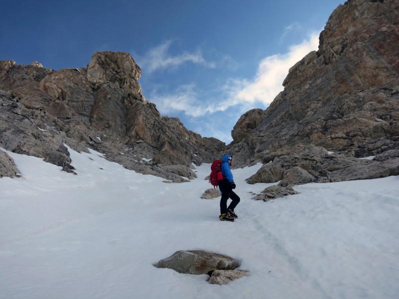
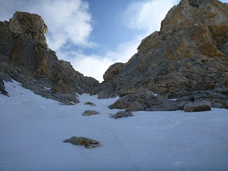
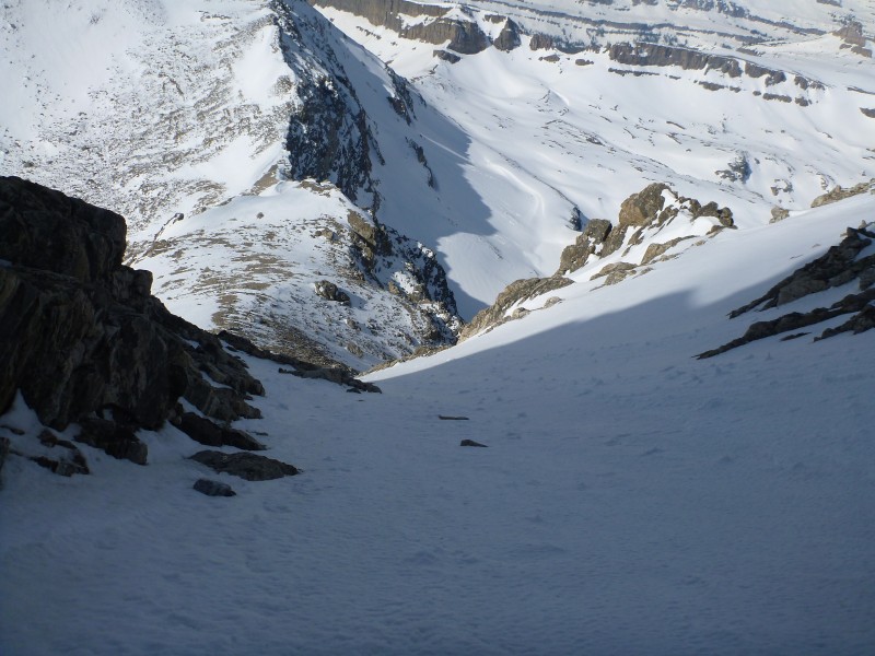
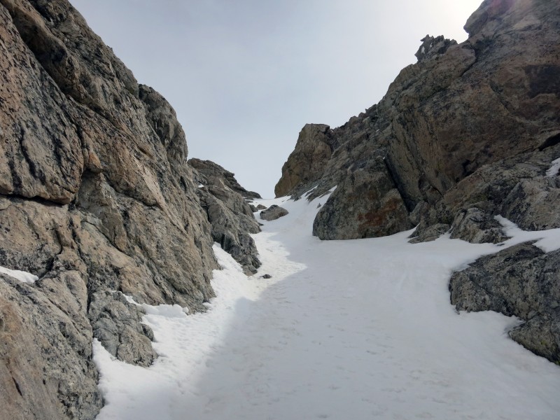
The climbing finally began. A few short pitches of 40-45ish degree snow led to a mixed traverse onto the apron. I briefly doubted the wisdom of continuing. The night had lacked a hard freeze. Much of what we were walking on was unsupportive, faceted junk. It didn't inspire confidence, and a harder layer underneath prevented much of a self-belay. I told myself to just reach the couloir proper and make a decision there. Luckily, the snow did get a little better. The prospect of a successful self-arrest was still unlikely, and the scary runout would have resulted in a long, painful ride down to Icefloe Lake 2,000 feet below. We decided it would be prudent to not trip over our own crampons.
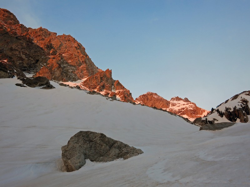
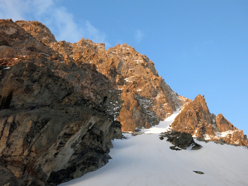
Fiery first light.
Alpenglow on Nez Perce.
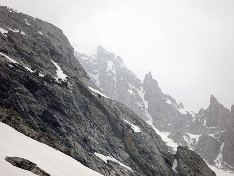
Greg looking up at our route, in annoying weather.
Come on, sun...
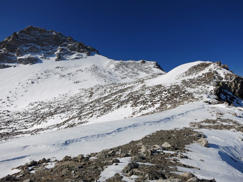
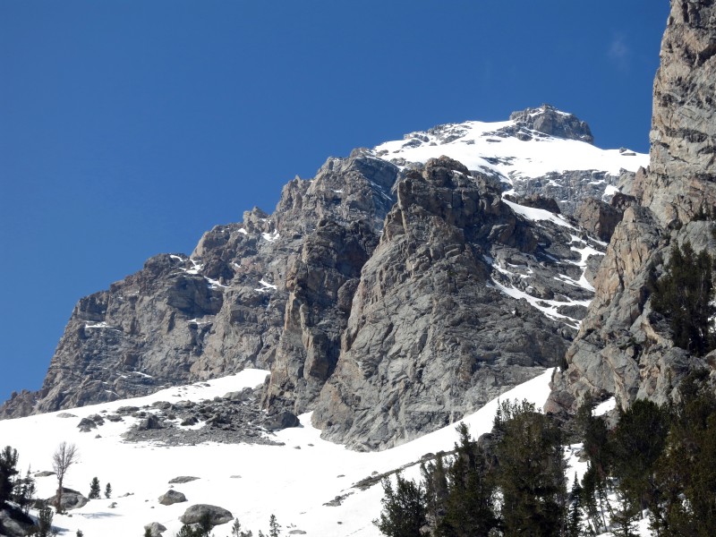
Finally, a look at the Southwest Couloir -- and blue skies.
Western Teton Range, and Icefloe Lake.
South Teton.
The angle steepened as we climbed higher, probably maxing out around 50 degrees. The snow turned fairly icy at the choke point and stayed that way until the couloir abruptly ended at a high saddle. Huge drops were everywhere. I'd gotten slightly ahead of Greg, who'd stopped to add layers for the summit push, and the view was a little intimidating to take in alone. Several confusing subsummits existed that lacked anything but exposed Class 5 routes. I determined the remaining path by simply continuing up the only moves that didn't look suicidal.
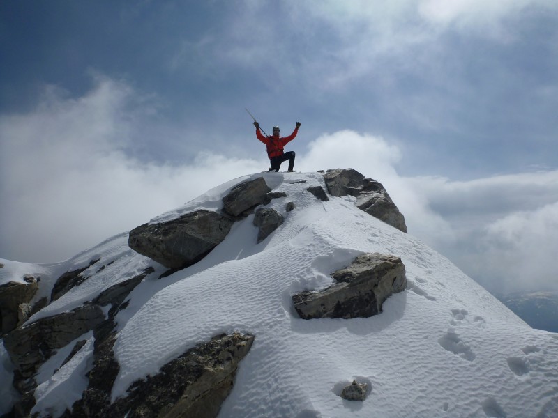
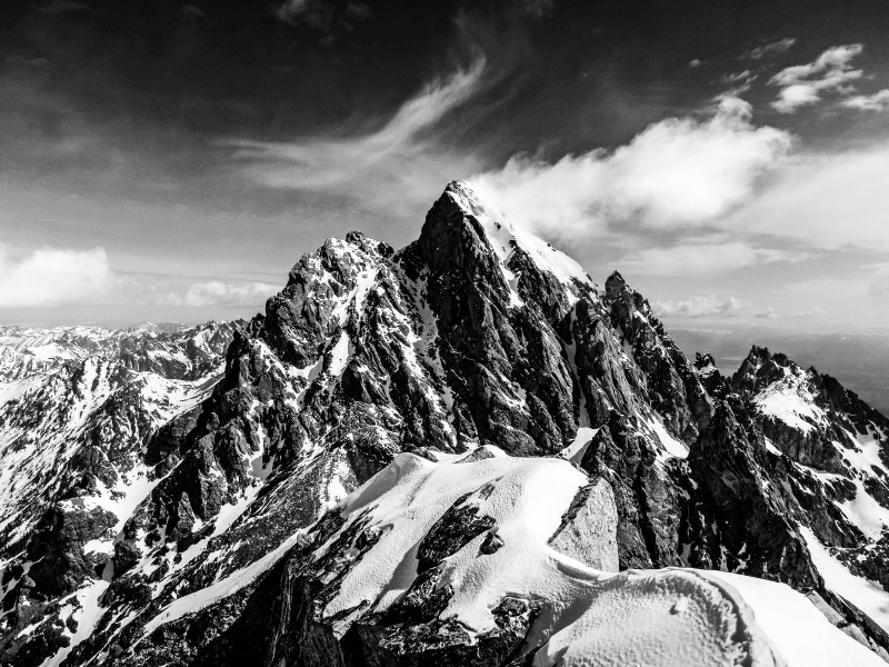
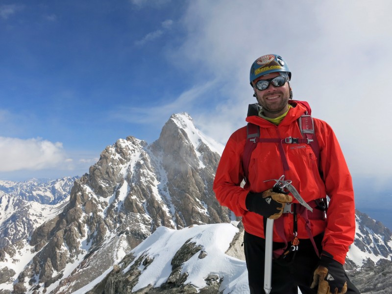
A small ice patch, a few spots of bare rock and more hard snow deposited me on the wildly exposed West Ridge. I hugged the exposed rock areas as much as possible for fear of plunging through a cornice. A series of very slow, very careful steps finally resulted in the summit, where my breath was taken away. Greg joined me on top after about five minutes, around 10:45 a.m. The airy summit only had room for the both of us, and we had to step carefully around each other while trying not to notice the thousand-foot drops on every side. We even managed a photo of both of us using a small tripod and the only acceptable selfie stick in existence. It would be impossible to put into words how majestic the Grand Teton looked from this angle on this day. I'll let the pictures do the talking.
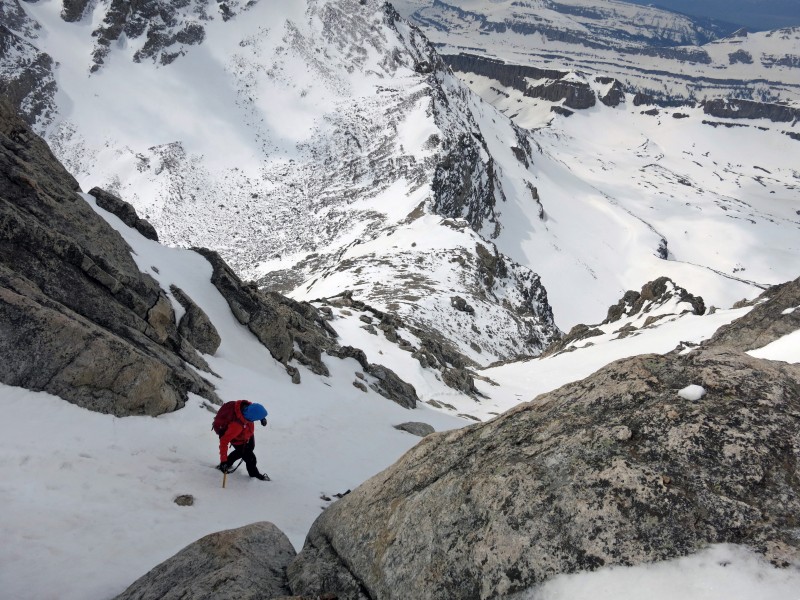
Greg entering the couloir proper.
The route. (Photo by Greg.)
The runout. (Photo by Greg.)
Greg at the upper saddle.
Summit! (Photo by Greg.)
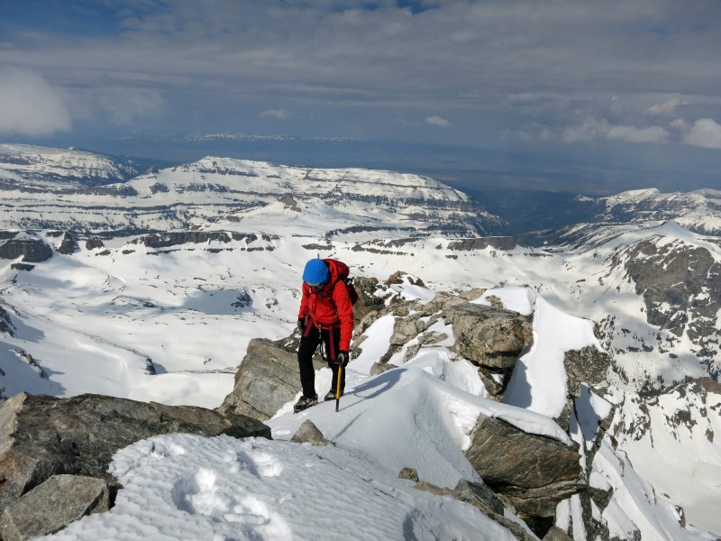
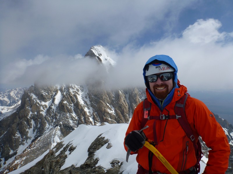
Greg on the narrow summit ridge.
The Grand Teton. (Photo edited by Nick Courtney.)
The Grand.
Summit shot 1.
Summit shot 2.
Summit shot 3.
The incessant wind got the better of us after only about 10 minutes. The snow was in improved condition for the descent thanks to the heat of the day, and we were able to face-out downclimb most of the couloir with only a couple more difficult sections. We did manage several blissful glissades through the apron and arrived back at the saddle in short order. The South Teton looked appetizing, but darkening clouds to the west forced our hand. An easy decision was made to retreat to camp without the extra credit.
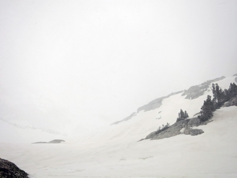
This turned out to be the right call, as we were engulfed in a whiteout about 20 minutes from the tent. With a few short lulls, we spent the entire afternoon tentbound with our soggy equipment and clothing. The sun finally returned in the evening, sometime around 5 p.m.. We both emerged from the shelter to stretch, dry gear and use the fantastic light to snap more photos.
Greg heading down.
Looking back up.
Not quite as pretty as earlier...
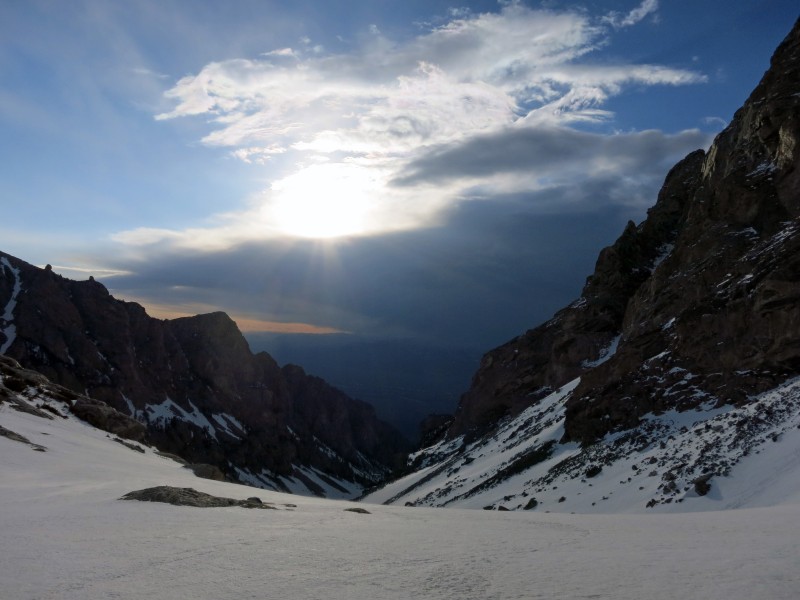
The Grand getting socked in.
Whiteout.
Blue skies in the evening.
The Grand, from near camp.
Middle Teton.
Home sweet home.
We decided against trying for anything the next morning due to time constraints. Even starting wicked early and climbing the easiest thing possible, we probably wouldn't have gotten back to Denver before midnight. Sleeping in, enjoying a leisurely hike out and getting home in time for dinner sounded more appealing. We awoke at first light, packed everything up and started walking down the canyon at 8 a.m. The 2.5-hour hike out was thoroughly enjoyable, except for another nightmare encounter with the killer sage grouse. We also narrowly missed stumbling upon a mama grizzly and her cubs, according to other hikers we encountered on the trail. I'm OK living without that experience. Greg has a 50/50 shot at being faster runner than me.
Alpenglow the next morning on Nez Perce.
Greg ready to hike out.
Middle Teton.
Saying goodbye to Garnet Canyon.
After changing clothes, partaking in a bathroom-sink shower, dividing our gear and returning the bear canister, we were on our way home. Of course, we stopped at Wind River Brewing in Pinedale for a celebratory feast and a couple good brews. Both Greg and I had given up beer for the month of April preparing for this trip, and victory hops have never tasted so sweet (OK, bitter). Hail and rain throughout southern Wyoming and Colorado slowed our progress, and we didn't make it home until closer to 10 p.m. Still, it was plenty of time to shower and relax for a bit before shifting back into work mode Tuesday morning. Thanks for the awesome trip, Greg! I wonder if sage grouse tastes like chicken....
Thumbnails for uploaded photos (click to open slideshow):
Now, that is a stellar summit and view of the Grand, ain’t it?
Nice work on getting that trip together and climbing the Middle. Its such a cool peak. So long ago (late 90s) I climbed that SW Couloir route a few times solo and once with my dad. I remember that summit ridge/pitch was especially interesting! Glad the weather held out for you. Go back and get the South – its a worthwhile climb as well.
Great job you two! Loved your summit #2 shot! Takes me back when I hiked in the Tetons almost exclusively many years ago. And I agree with Brandon, the South isn’t that much more out of the way and worth the effort. Beautiful place, Jackson Hole.
and looks like a hell of a trip. I burst out laughing at the part about the grouse. great writing as usual, Jeff.
Caution: The information contained in this report may not be accurate and should not be the only resource used in preparation for your climb. Failure to have the necessary experience, physical conditioning, supplies or equipment can result in injury or death. 14ers.com and the author(s) of this report provide no warranties, either express or implied, that the information provided is accurate or reliable. By using the information provided, you agree to indemnify and hold harmless 14ers.com and the report author(s) with respect to any claims and demands against them, including any attorney fees and expenses. Please read the 14ers.com Safety and Disclaimer pages for more information.
Please respect private property: 14ers.com supports the rights of private landowners to determine how and by whom their land will be used. In Colorado, it is your responsibility to determine if land is private and to obtain the appropriate permission before entering the property.