Download Agreement, Release, and Acknowledgement of Risk:
You (the person requesting this file download) fully understand mountain climbing ("Activity") involves risks and dangers of serious bodily injury, including permanent disability, paralysis, and death ("Risks") and you fully accept and assume all such risks and all responsibility for losses, costs, and damages you incur as a result of your participation in this Activity.
You acknowledge that information in the file you have chosen to download may not be accurate and may contain errors. You agree to assume all risks when using this information and agree to release and discharge 14ers.com, 14ers Inc. and the author(s) of such information (collectively, the "Released Parties").
You hereby discharge the Released Parties from all damages, actions, claims and liabilities of any nature, specifically including, but not limited to, damages, actions, claims and liabilities arising from or related to the negligence of the Released Parties. You further agree to indemnify, hold harmless and defend 14ers.com, 14ers Inc. and each of the other Released Parties from and against any loss, damage, liability and expense, including costs and attorney fees, incurred by 14ers.com, 14ers Inc. or any of the other Released Parties as a result of you using information provided on the 14ers.com or 14ers Inc. websites.
You have read this agreement, fully understand its terms and intend it to be a complete and unconditional release of all liability to the greatest extent allowed by law and agree that if any portion of this agreement is held to be invalid the balance, notwithstanding, shall continue in full force and effect.
By clicking "OK" you agree to these terms. If you DO NOT agree, click "Cancel"...
Route: Conundrum Couloir
Mileage: ~ 10.3 miles
Vertical gain: 4,367 feet
Car to summit: 4 hours 35 minutes
Summit to Car: 3 hours 23 minutes
Vertical skied: 3,900 feet
Beer drunk: Modus Hoperandi and Miller Light
Quick back story: with a second baby on the way and needing to spend the summer at home I wanted to have one good trip to hold me through months of urban confinement. After months-long plans to climb the Wilson Group fell through, due to my time constraints, we picked Conundrum as a quality back up.
Zdero1, Somewhatofaprick, Speth and myself left town at around 6:30 pm and drove up to the Castle Creek TH, to our great surprise and delight found the gate open. We were able to drive up the road a couple hundred yards before we found a snow covered incline which prevented further travel. After digging out the car a little we back tracked and set up camp.
The next morning Zdero and Somewhatofaprick woke up and where hiking by 2:15 am, Speth and I however chose to sleep in and did not get up until 3:15 am. After a couple donuts and some Via Speth and I were moving by 4:08 am.
Speth and I made short work of the road and within 30 minutes we had travelled the 1.3 miles to the creek cross, most of it dry. From the creek the road was completely covered with snow. After about two hours we were at the Pearl Pass turn off, about 3.5 miles from the car, where Speth and I stopped and I threw on the skis for the first time.
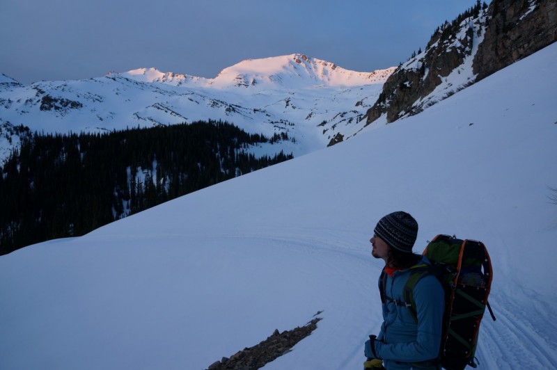
Sunrise from the road
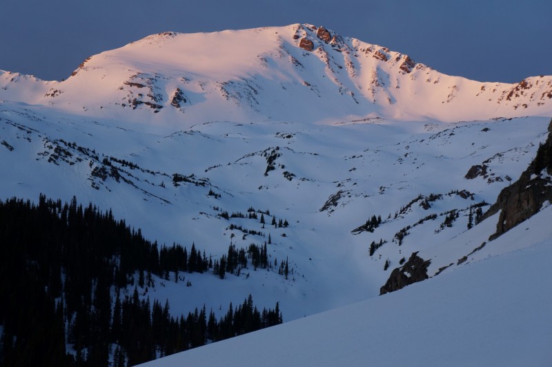
Enjoying the Alpineglow
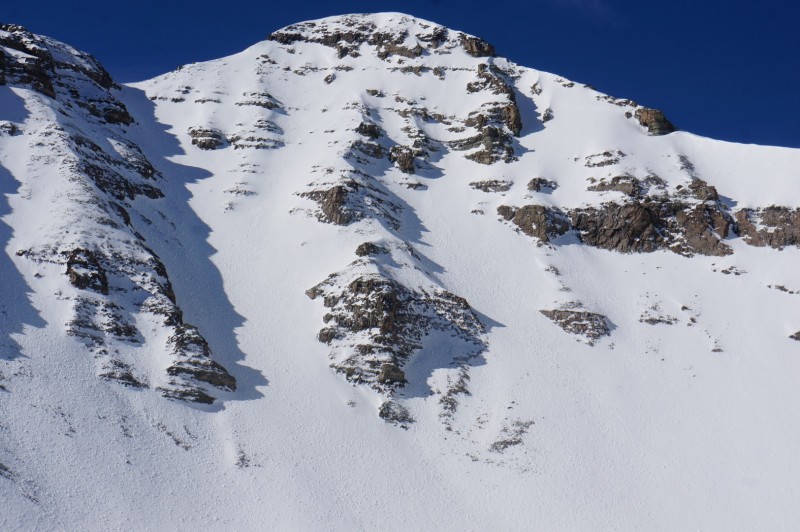
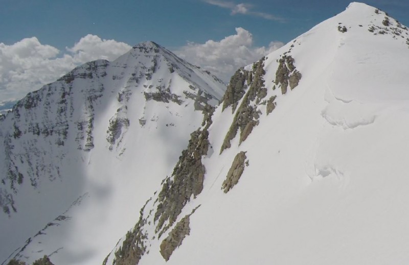
Unnamed 13,312 feet
As you come out of the trees you can skip a couple switchbacks by going straight here.
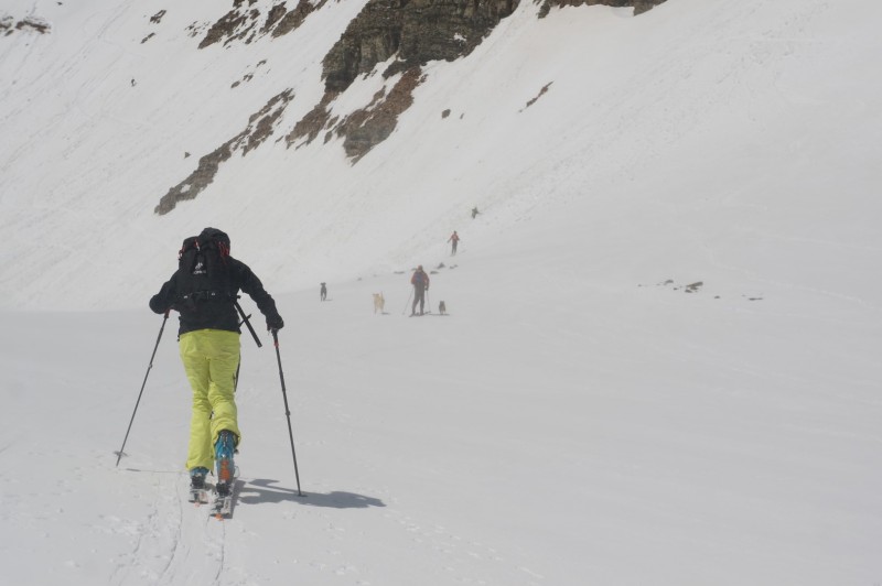
By 7 am, 5.5 miles from the car, we met Zdero and Somewhatofaprick at about 12.3K feet.
The guys decided, that based on the slide debris that came off Malamute Peak they did not feel that it was safe to continue. Speth and I felt comfortable with the risk, so after a short break we continued up the basin towards the headwall below Castle-Conundrum Cirque. It had snowed about an inch to inch and half the night before, so the snow surface was some light fresh snow on top of a spring freeze-thaw. This prevented switchbacks up the headwall, which made for interesting skinning.
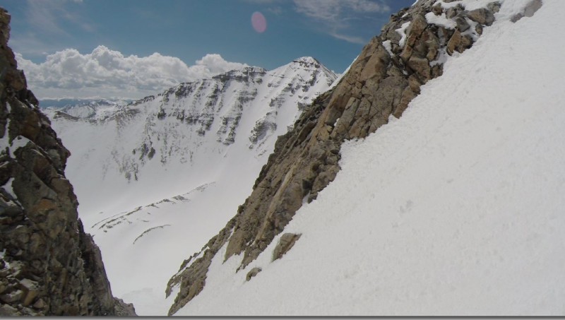
Malamute Peak from the basin below Conundrum Castle Peak, the sun moved of the north couloir at around 10:30ish
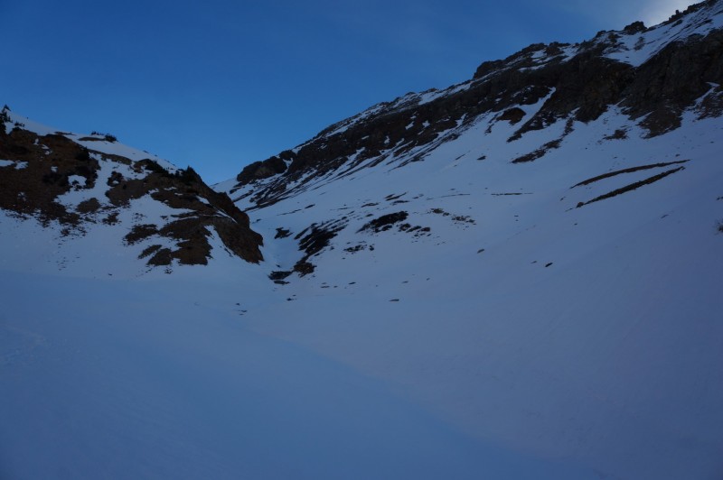
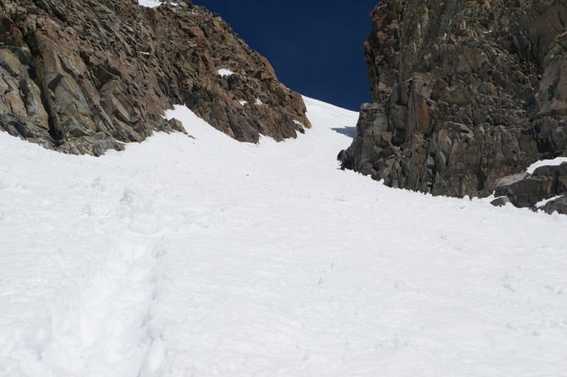
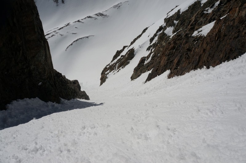
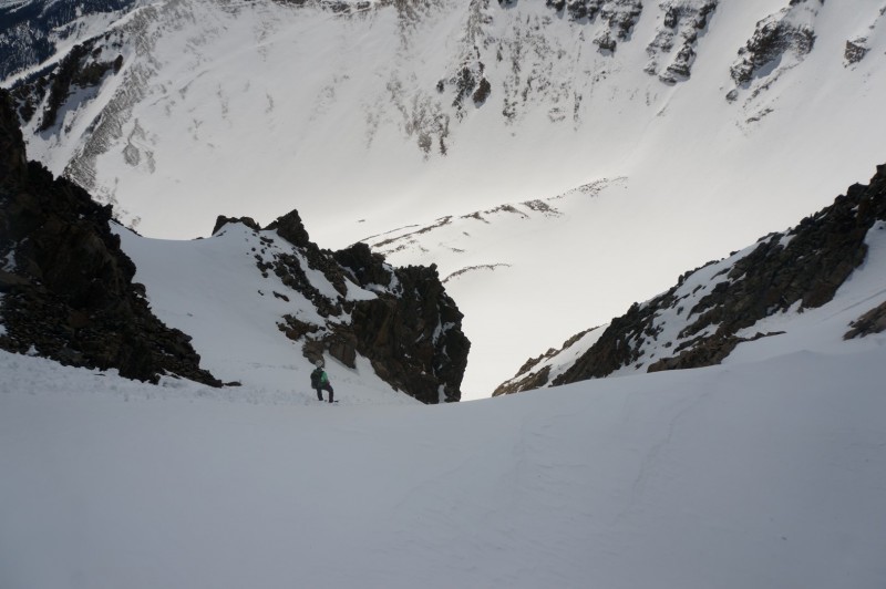
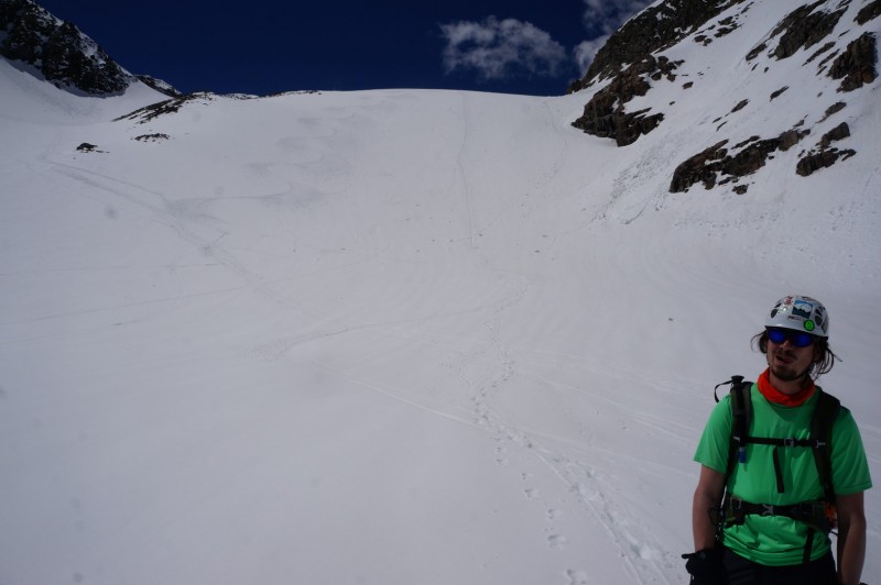
After a short break at the base of the couloir we started climbing up at 10 am. The incline below the couloir was pretty mushy, but I did not see any rollers forming. So, with a little bit of apprehension, I continued up into the couloir as it began to narrow.
Climbing below the Couloir Castle from the beginning of the couloir
There had been a point release slide that come down from the upper walls a few days or a week before and had spread debris all through the couloir's surface, which worried me that I might catch a ski-tip on the descent. At the constriction the snow was about 8-10 feet across and still shaded at 10:15, which meant that it was very hard and took 3-5 kicks in order to get your crampons some purchase.
Looking up in the constriction
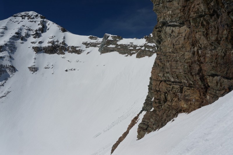
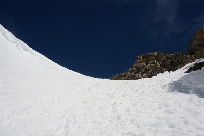
After a hundred vertical feet or so, past the constriction, the couloir opened up a little and the sun hit the snow. Which made it a little easier to climb in, but still hard enough to require a little bit of force to get your toes lodged in the snow.
Looking back down about 3/4 the way up
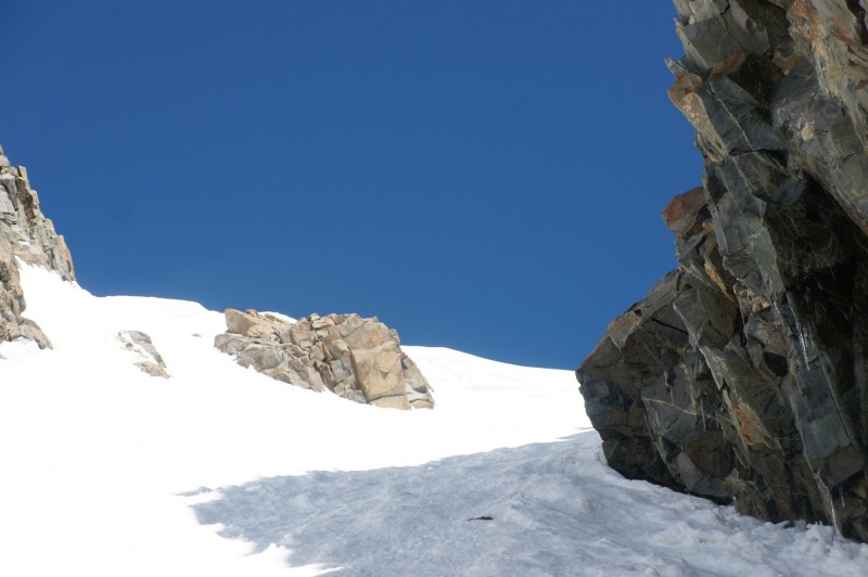
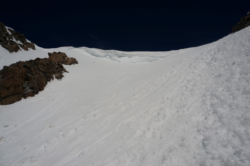
Luckily, when I topped out the cornice did not extend across the couloir so it was a quick climb up to the saddle between the false summit and the summit.
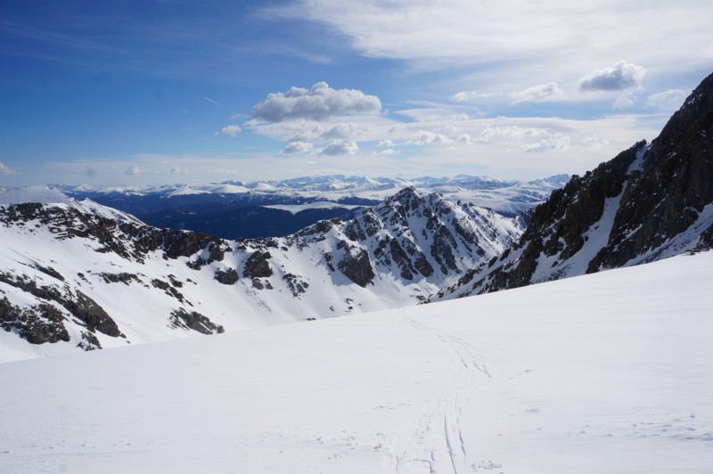
Looking up from the same point Cornice from about 50' below the saddle View Northwest from the saddle
Speth joined me a minute or two later and I ditched the skis (It was not possible to connect turns from the summit to the saddle) and climbed up a steep snow slope (we guessed 55-60 degree range) up to typical Elk Mountains-rock and scrambled up to the summit.
Speth topping out
It was 10:50 AM when we summited. On the summit I had a little freak out and almost bailed on skiing the couloir, but Speth gave me some positive reinforcement and I sucked it up and stuck with the plan to ski down the couloir.
The "hard elks"
After sending a "we're not dead" text to the wives, Speth and I descended down from the summit back to the saddle. You can traverse around the Class 3 by going hikers right, from the summit, around and then down easy snow and to the left to the saddle.
Speth beginning the descent back down
At 11:20, I dropped into the couloir and started making very cautious turns, to say I was nervous would probably be an understatement. I took it very easy, I stuck to jump turns on the upper face for fear that I might catch an edge on some of the avy debris and take a tumble. The snow however, was in great condition and I probably could have skied it a little bit more aggressively, but hindsight is 20-20... Here's a "short" video of the decent to the trees:
Top of the Couloir
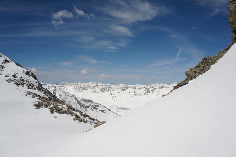
Castle from the saddle
In the middle
Skiing into the basin
As you can see the snow, even through the constriction, is soft and spring like. Lower down in the basin the snow was still a bit of dust on crust. However, the snow on the headwall from the cirque was amazing, definitely might be worth two laps if one has the time.
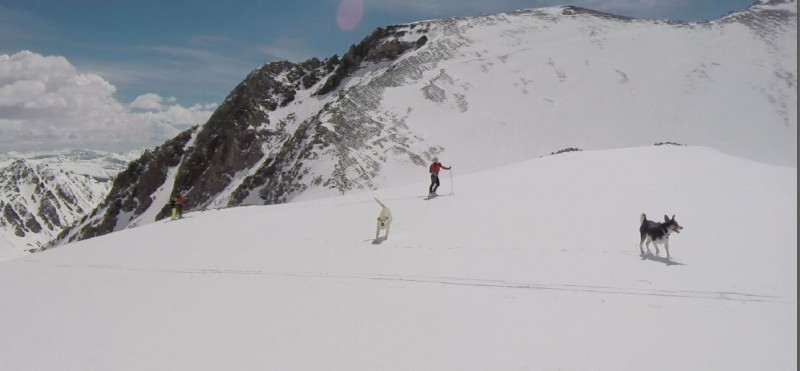
After skiing down and being chased by some dogs I waited for Speth to glissade out of the couloir and then we made our way down the valley.
Speth making his way through the steepest section. I might have exaggerated how narrow the constriction is...
Speth finishing the glissade with the pack of dogs
Fortunately for Speth, the snow was still supportive and neither of us saw any signs of impending wet slabs.
Snow was fun for the whole family, glissaders and skiers Conundrum in the distance. Anyone climbed that route lookers right off the summit? Can you see Speth right of center?
It took about two hours to get back to the Pearl Pass junction, where we stopped ate some lunch, drank some modus and watched some snowmobilers highline across the valley.
With some tasty IPA on our tongues, Speth and I made quick work of the 2.2 miles to the creek cross where I gave Speth back his unused Snowshoes, I had picked them up earlier on, and I threw the skis and boots on my pack. From the creek it took maybe 15 more minutes to walk the last 1.3 miles. It took about 3.5 hours from summit to car. Some mondo-avalanche paths lower down on the road about a half mile from the creek the snow started to be less supportive
My GPS Tracks on Google Maps (made from a .GPX file upload):
Way to go, John! That’s a great line. I watched your video and it seemed like you were a bit tentative on initiating jump turns on that steep section. If you keep skiing lines like that, you won’t even think about it after a while; You’ll be able to find a rhythm and keep the turns coming. To get used to steeper lines, a skier sometimes has to figure how to ignore the brain when it’s saying "NO! Lean Back away from that! You’re going to fall, idiot!" and feel more comfortable reaching downhill to initiate the turns and embrace the gravity. :D
Caution: The information contained in this report may not be accurate and should not be the only resource used in preparation for your climb. Failure to have the necessary experience, physical conditioning, supplies or equipment can result in injury or death. 14ers.com and the author(s) of this report provide no warranties, either express or implied, that the information provided is accurate or reliable. By using the information provided, you agree to indemnify and hold harmless 14ers.com and the report author(s) with respect to any claims and demands against them, including any attorney fees and expenses. Please read the 14ers.com Safety and Disclaimer pages for more information.
Please respect private property: 14ers.com supports the rights of private landowners to determine how and by whom their land will be used. In Colorado, it is your responsibility to determine if land is private and to obtain the appropriate permission before entering the property.