Download Agreement, Release, and Acknowledgement of Risk:
You (the person requesting this file download) fully understand mountain climbing ("Activity") involves risks and dangers of serious bodily injury, including permanent disability, paralysis, and death ("Risks") and you fully accept and assume all such risks and all responsibility for losses, costs, and damages you incur as a result of your participation in this Activity.
You acknowledge that information in the file you have chosen to download may not be accurate and may contain errors. You agree to assume all risks when using this information and agree to release and discharge 14ers.com, 14ers Inc. and the author(s) of such information (collectively, the "Released Parties").
You hereby discharge the Released Parties from all damages, actions, claims and liabilities of any nature, specifically including, but not limited to, damages, actions, claims and liabilities arising from or related to the negligence of the Released Parties. You further agree to indemnify, hold harmless and defend 14ers.com, 14ers Inc. and each of the other Released Parties from and against any loss, damage, liability and expense, including costs and attorney fees, incurred by 14ers.com, 14ers Inc. or any of the other Released Parties as a result of you using information provided on the 14ers.com or 14ers Inc. websites.
You have read this agreement, fully understand its terms and intend it to be a complete and unconditional release of all liability to the greatest extent allowed by law and agree that if any portion of this agreement is held to be invalid the balance, notwithstanding, shall continue in full force and effect.
By clicking "OK" you agree to these terms. If you DO NOT agree, click "Cancel"...
I'm not sure who Mr. Wilson is or why he was important enough to have at least two fourteeners named after him, but I've started to think his ghost is haunting me. I've attempted to ski Mt. Wilson and its southerly neighbor "South Wilson" twice. Both times I failed before I even got past the trail head.
The first attempt was in April of 2012. I didn't get more than three steps from my car before I realized I wasn't going to get anywhere. I had severely bruised my ankles on previous 14er tours in worn out boot liners. It took a month of rest before I could get back out into the backcountry again, with carefully padded boots.
I'm not sure this makes up for the wasted gas money, but I did get this cool photo of South Wilson's impressive south east face.
South Wilson on the left, Mt. Wilson on the right (April 2012)
The second attempt was earlier this winter. I made it to the lizard head/cross mountain trail head pull out, feeling fine and ready for my next attempt at the two Wilsons. The next morning I woke up feeling not so great. I pushed back the alarm one hour at a time, hoping I'd feel better the next time it went off. By the time the sun came up, I knew I couldn't get both Wilsons but hoped to get regular Mt. Wilson. I was hoping that my ill feeling was just from drinking a bit too much the night before, even though I was nearly sure I didn't drink that much, and hoped that it would pass with a bit of water and exercise.
Again, I took just a few skin steps across the snow and knew that I wasn't going to get anywhere. The day was shot. I felt terrible. I looked back at the car, about twenty feet away from me, and felt like I didn't even know if I could make it back. It looked like miles away.
Apparently I had come down with a stomach flu. The regularly six hour drive home turned into an 8+ hour drive home. The worst drive of my life. I had to pull over several times along the way, as liquids were shooting out both ends of me like a fountain. The entire way home, I stared into the fields and fantasized about just crawling out into them and dying. I made it home, and shivered in bed with a fever. The next day I felt fine.
That brings us to attempt number 3, on March 25. Third times the charm, I kept telling myself as I drove down to the San Juans, wondering what else Mr. Wilson could do to foil my attempts again.
I made it to the road side Lizard Head/Cross mountain trail head, on March 24, by late afternoon. I wanted to arrive at the TH with enough light to see where the previous human tracks lead into the forest, since in my previous two attempts I had never made it quite that far (Beside the highway is a meadow, and it is not obvious where the trail enters the forest. Fortunately for me, there were numerous tracks to lead the way).
With two hours of light remaining, I began to unwind with my favorite IPA and enjoy the early spring scenery.
I hope you don't mind if I take one extra paragraph to digress from my story. I just wanted to address a concern that a couple of my trip report readers have brought to my attention. So, apparently I've been slacking on my typical gratuitous alcohol references. Some of you are wondering if this is an indication that I've given up the sauce and become a "responsible" mountaineer. I'm pleased to tell you this is not the case! Although I have been cutting back on my alcohol consumption in order to not sabotage my ski tours (as I've sometimes done in the past), I still intend to carry on the sacred mountaineering tradition of starting and ending all tours with at least some alcohol, and I also agree that what and how much I drink is vital information to include in each trip report.
I'm also pleased to mention (ok, maybe two paragraphs of digression) that my decrescence of alcohol has so far been successful since I started at the beginning of 2015. Thanks to my invention of a day called "Sober Sunday," I had more alcohol-free days by the end of February than I had during all of 2014!
Anyway, I apologize for the lack of alcohol comments in my last few trip reports. I hope this makes up for it:
The next morning, I hit the trail at 5:45 a.m. and began following the footprints in the snow by headlamp. The trail, which heads towards cross mountain, was packed down by dozens of hikers, not all of whom agreed where the trail actually was. Nonetheless, it was easy to follow.
Around 11,000' or so, one has to leave the trail and bushwhack in a northwesterly direction towards slate creek. I figured with all the traffic on the Cross Mountain trail, there would be a skin track diverging from the trail. I kept gaining elevation hoping to find such a trail. By 11,200' I decided I wasn't going to find such a trail, and started the NW bushwhack.
The bushwhack was simple, unobstructed, and an occasional view of South Wilson made navigation easy. However, I did have to lose at least three hundred feet of elevation to get down to slate creek to avoid difficult terrain.
Slate creek. How it got its name, no one really knows
From Slate Creek, I made my way up the drainage towards Mt. Wilson's NE facing bowl.
Take a left at the ridge at the left of the photo to get into the east bowl
Lots of interesting possibilities on South Wilson's east face
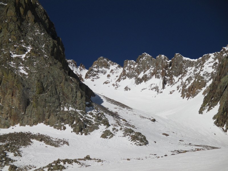
Boxcar couloir comes into view
East bowl comes into view
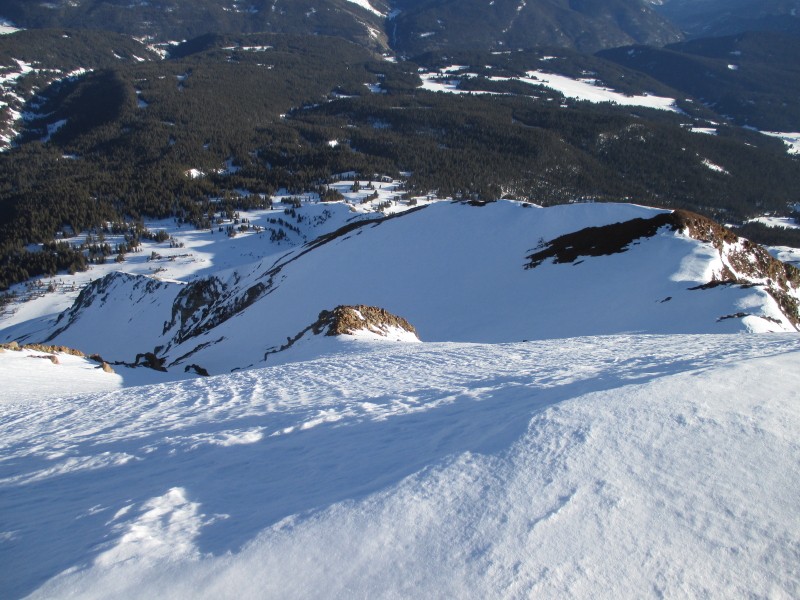
Looking down slope while ascending the east bowl
Skinning above tree line, I discovered what the ghost of Mr. Wilson had planned for me. On moderately angled slopes, my skins were not gripping. My three tours old skins had completely gone to s**t. Orange fuzz was visible from the sides. I could barely maintain any traction. When the angle steepened in the NE bowl, I had to put my skis on my back and just boot up. What should have been an easy skin up the bowl, turned into a much more time consuming booter.
"Very funny Mr. Wilson! But ruined skins are not going to stop me from climbing your peaks!"
As I was booting up, I caught sight of two skiers a few hundred feet below me. They were moving pretty fast on their skins.
"Oh, so that's what you're up to Wilson! You want to slow me down so that these skiers catch up to me, forcing me to decline solo status. F**cking hilarious, Wilson!"
Determined to not let Mr. Wilson get the better of me, I decided to throw it into high gear. If I'm fast enough to boot all my own steps, antisocial enough to not make too much conversation with those folks on the summit, and then ski before or after them, I can still claim this as a solo ski.
As I climbed, I considered where I would draw the line. At what point would I concede it was no longer a solo trip? People have asked me about this before, assuming that I regularly run into people in the backcountry. The truth is, as I tell them, I usually have the mountain to myself during the ski months, and especially on weekdays. This has been the case for the vast majority of my 14er trips. The few exceptions usually just entail a brief hello as we cross paths, or sometimes I'll just see someone from a distance and never cross paths with him. It's surprisingly easy to find solitude on the fourteeners, especially when you have a flexible enough schedule to ski on weekdays. However, on one occasion, an intended solo mission turned into a partnered mission when I arrived at the summit at the same time as two other skiers who took a different route"I ended up repeating this peak to truly get it solo. Ultimately, I tell people that you don't need strict guidelines to know when it counts or does not. You don't need to set a time limit on social interactions with passing climbers or set a minimum amount of trail breaking, ultimately, you just know when you are solo"loneliness is an unmistakable feeling.
Just before I arrived at the top of the couloir, south of the summit, one of the two skiers had caught up to me. He thanked me for the hard work of putting in the booter and offered to boot the final few steps. I politely declined (breaking trail is all apart of the challenge of going solo).
At the top of the couloir, I chatted with him for a couple minutes and then with his brother when he caught up.
Me at the top of the south couloir on the east face
They headed up the south gully to the summit as I changed layers and stowed my aluminum crampons. The scramble to the summit was nearly completely dry.
I made it to the summit, just as the boys were ready to head down. I stayed on the summit for a little while for them to leave and also to consider possible summit descents. Unfortunately, there didn't seem to be enough snow for an ethical (or safe) descent down the north ridge to the north couloir, or directly onto the east face.
Me on the summit
The requisite summit shot of El Diente
I ended up carrying my skis back down to the south couloir. It wasn't exactly what I was hoping for, but I figure if I'm smart with my backcountry skiing decisions, I will be around when the ghost of Mr. Wilson decides he wants his peaks skied again. For now I'll have to settle for Dawson's line down the south couloir.
By the time I made it to the top of the couloir, the skiers were gone. It's funny how quickly you can find yourself alone again in the backcountry. As I was gearing up, I saw two more skiers heading for and then entering the boxcar couloir. Kind of a busy day up here.
I geared up, skied down, and headed for the boxcar couloir. The entrance is to skiers right, below the south couloir. It is obvious.
Looking back at Mt. Wilson, near the boxcar entrance
Top of boxcar
The two skiers before me had apparently side stepped all of the narrow sections. Their skis were shorter than mine, and left a side-stepping trench too narrow for my skis to neatly fit in. My tips and tails hit the raised up sides of their trench. It was not easy making turns in this. Oh well, I've skied worse, and overall, the boxcar was a fun alternative to the lower angle east bowl. On the way up, I debated taking the boxcar or making fast turns down the east bowl"I think I made the right decision.
In the boxcar
It was just a little after mid day when I exited the couloir. The snow was just softening up above tree line. Below tree line the snow was very soft but very supportable. Based on my observations, I assumed the snowpack would remain safe throughout the day and decided to go for South Wilson. But first, I needed to get some more water from the creek. This forced me to descend a lot further than would be necessary to climb South Wilson from Mt. Wilson.
I decided to ascend South Wilson's lower angled south face (far left in image 1). Although I assumed the wet slab danger to be low, I wanted to play it safe and stick to as low angle terrain as possible, and to avoid traveling directly beneath cliff bands. I ended up having to climb and cross a lot more scree than I thought I would. This was miserable and tiring. The scree was loose and I triggered a few small slides. The slides were no more than a hindrance, but the leg breaker boulders sitting above me, was cause for concern.
This is not an ideal route up the mountain. If you want to climb South Wilson without needing to get Mt. Wilson first, I would recommend cramponing up the ski line in supportable morning snow.
South Wilson's summit
I made the summit, a little after 5 p.m., just as the S.E. ski line was falling into shadow and freezing over.
Proof
South Wilson's snowy summit with Mt. Wilson in the background
Steep east chute
Very steep east chute
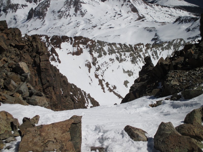
Looking down the line from near the top
Looking up at the top portion of the line
Looking down
In spite of the frozen snow, this was a really nice ski. The slope is wide open, steep enough to be fun, but not steep enough to cause any stress (I'd guess the max angle, measured in degrees, is low to mid forties). For all those who intend to ski the fourteeners, I'd definitely recommend adding South Wilson to your list. It has a fun, aesthetic line and, in my opinion, seems well differentiated from Mt. Wilson to have the feeling that it is its own mountain.
On the bushwhack out, I tried to avoid gaining elevation, but I did anyhow. It might have even been easier to retrace my steps, gain an extra 300 vertical feet and pick up the Cross mountain trail sooner rather than later.
I arrived at the car a little before 8 p.m.
Thumbnails for uploaded photos (click to open slideshow):
...is very impressive! Image #24 would of been my top out point to the ridge... albeit the cornice was almost nonexistent in February! So stoked you got both these lines Mike! The video brings back fond memories of a fun line! Thanks for writing this up!
7,500’ vert! Getting that in one day is a distant memory for me – my current rule is no ski day–trip over 4,500’. 7,500’ and I’d be coughing up blood. :D
How much longer do you think that route will be in? Any thoughts? I would guess on a normal year you could ski that till June, but this year is 1–2 months ahead of schedule, so by mid May is this thing done this year?
Spring has definitely come early this year. 4/10/2015 6:29pm
However, it’s been pretty cold up there lately. In my experience, there hasn’t been a lot of melting going on above tree line lately. The snow pack seems to be static at the moment. If these cool spring conditions continue, it might be in ’till June. On the other hand, we can’t say there won’t be a heat wave that melts it out in early May.
How long would this have taken you without the South Wilson Excursion?
Caution: The information contained in this report may not be accurate and should not be the only resource used in preparation for your climb. Failure to have the necessary experience, physical conditioning, supplies or equipment can result in injury or death. 14ers.com and the author(s) of this report provide no warranties, either express or implied, that the information provided is accurate or reliable. By using the information provided, you agree to indemnify and hold harmless 14ers.com and the report author(s) with respect to any claims and demands against them, including any attorney fees and expenses. Please read the 14ers.com Safety and Disclaimer pages for more information.
Copyright: Route information, text, risk factors, maps, GPX files, charts, photos, 14ers.com-created map imagery, flythroughs, and other content provided in this route description are copyrighted by 14ers.com and may not be copied, reproduced, republished, distributed, modified, or used to create derivative works without prior written permission.
Please respect private property: 14ers.com supports the rights of private landowners to determine how and by whom their land will be used. In Colorado, it is your responsibility to determine if land is private and to obtain the appropriate permission before entering the property.