| Report Type | Full |
| Peak(s) |
Crestone Needle - 14,196 feet |
| Date Posted | 02/15/2015 |
| Modified | 02/18/2015 |
| Date Climbed | 08/08/2014 |
| Author | DeTour |
| Additional Members | CharmingCatastrophe, Lucky |
| Crestone Needle, again |
|---|
 (Note - Text by Thorn Jarvis (DeTour). Photos by Mark Jarvis (Lucky), Maryjane Jarvis (CharmingCatastrophe), and Dennis Gurfinkel. Poetry by Robert Service. Mountain by the Lord, the Maker of Heaven and Earth.) The highlight of our August climbing trip was a mountain that wasn't even on our radar for 2014. We had come to Colorado with ambitious plans to climb Capitol at the end of our week-long trip, but a failed attempt at Pyramid on Aug. 5 left us less than enthused at taking on something considerably longer and harder. We weren't keen on trying Pyramid again, either. We wanted to do something sportier than a class 2 Sawatch walkup, but we've climbed most of the moderate class 3 14er routes. We ended up settling on Crestone Needle - a peak brother Mark and I had climbed in 2009, but my daughter Maryjane and her boyfriend Dennis had not been on. The approach was a manageable length, and we knew what we were signing up for with the steep but solid, knobby climbing offered by the Needle. And, we knew the South Colony Lakes basin and the peak itself were among the most beautiful places you could ever hope to visit. Our first challenge was getting up the South Colony Lake Road in a rented Hyundai Santa Fe which we discovered to our surprise to be a two-wheel drive vehicle. (Didn't even know 2wd Santa Fe's existed.) Parking at the 2wd trailhead down in the Wet River Valley would lengthen the hike to Capitolesque proportions - not our idea of a good way to go about our goal. Maryjane and Dennis knew that firsthand, having parked at the lower lot in 2012 for a hike to camp at South Colony Lakes and climb Humboldt, their first 14er as a couple. But the road is designated 4wd for a reason. We hoped we could at least get close to the 4wd trailhead, if not all the way. Mark crawled the Santa Fe over and around various obstacles up the first stretch of rough road, in the area clearly marked as private property. A few hundred feet short of exiting the private property, we encountered a major obstacle - a steep section of road with several large rocks jutting out in the center of the road. There wasn't room to drive around the rocks, and going over them with the momentum required to get a 2wd up the incline looked certain to bring disaster upon the vehicle. We piled out to examine the situation. Parking and hiking from that vicinity would be viable in terms of the length of the hike, but the signs said not to park on the private property. We didn't know if there would be consequences to that, but we didn't want to find out, nor did we wish to abuse the relationship with the property owner even if we could get away with it. As we tried in vain to envision a route around the rock outcropping on either side, I tugged at one of the largest boulders. To our surprise and delight, it moved a little. We set upon it with some frenzied tugging and digging, and soon had extracted it from the road. It was way too big to lift, but not too large to carefully roll off the side of the road. A couple other rocks came out in the same process, the largest one cooperating splendidly by splitting in two as we attacked it. Soon we had completed a fine road reconstruction project, including filling in some low spots with smaller rocks and strategically placing at least one flat rock to serve as a ramp up the incline - all at no charge to the anonymous property owner. We all stood back while Mark backed up and charged the Santa Fe through the obstacle - successfully. I regretted not recording his madcap blast up the hill, but it's probably for the best, because I surely would not have been able to resist the urge to post it, and it would have been highly incriminating evidence. After all, everything you just read about driving our rental vehicle up that 4wd road might have been a figment of my overactive imagination. The road improved beyond that spot (without our help) and we ended up driving all the way to the trailhead. We loaded up, took obligatory photos of the signs and the impressive foot bridge over the creek, and headed out. It's by no means a short hike, but very manageable, especially in the fine weather we enjoyed this day. When our destination peak appeared in the distance through the trees, I savored the surge of adrenalin it produced. 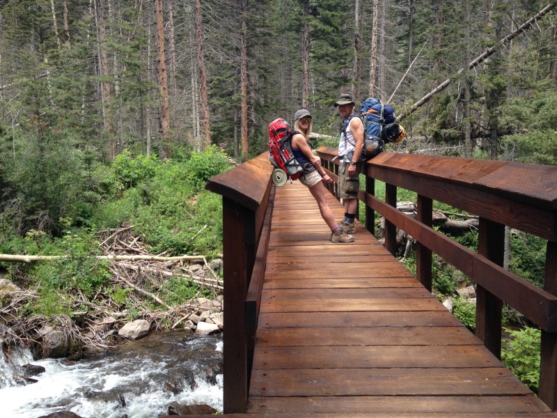  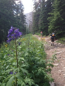 We took the standard trail, bearing southwest from the old, closed, 4wd trailhead for about a mile before turning sharply north. (We took the alternate pack trail in 2010. It runs north/east of the creek, skirting the south shoulder of Humboldt. While it appears shorter on the map, we judged it to be no easier due to added elevation gain/loss.) The standard trail is an easy walk, following an old road for almost a mile beyond the old 4wd trailhead before shrinking to a walking trail, with minimal up-and-down and the added bonus of fine views of both the Needle and Humboldt. 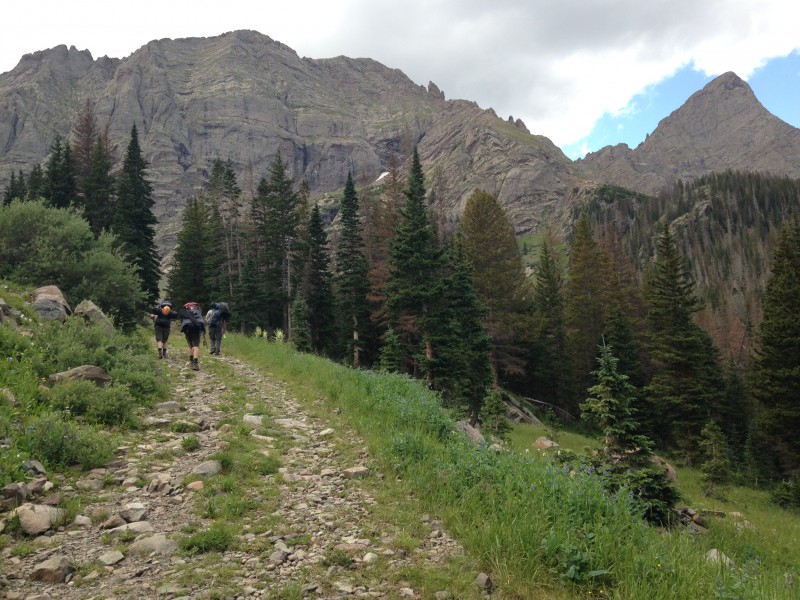 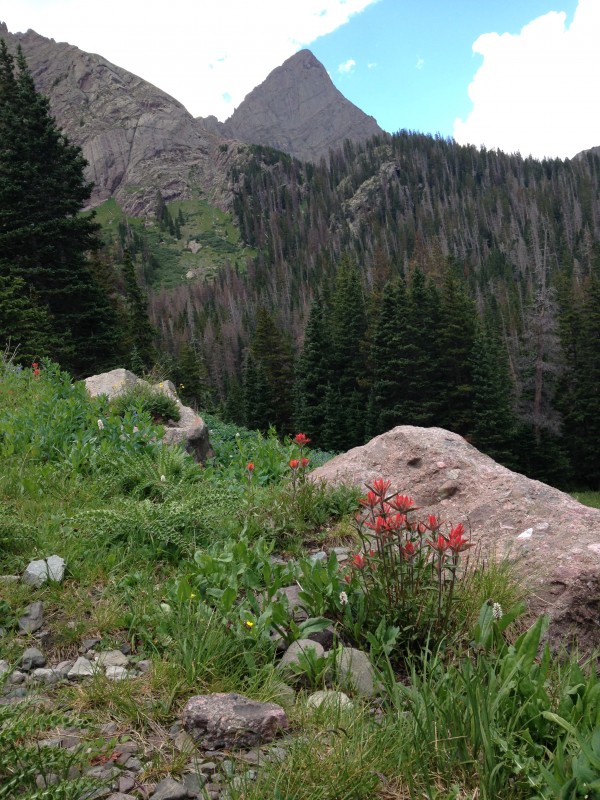 We knew exactly where we wanted to camp, having set up in the same spot at least twice before - tucked up under a tree-covered hillside that eventually rises to become the north face of Broken Hand Peak. It's at about 11,650 feet, a very short distance before the point where the Broken Hand Pass trail splits off from the trail leading to Humboldt's west saddle. When we reached that spot, we found it closed for restoration. No problem, two acceptable campsites were within a stone's throw. We set up just before a light afternoon sprinkle provided a perfect excuse for a nap. 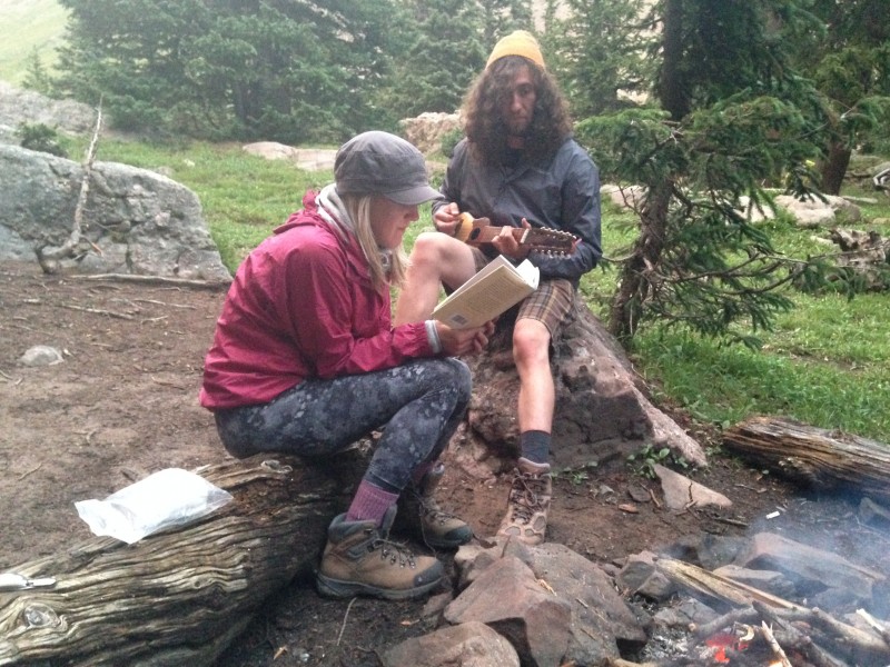 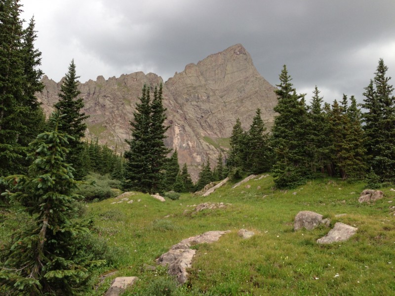 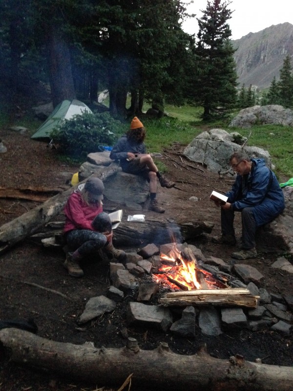 Then the skies cleared to a classic camp evening, with freeze-dried food that tastes way better than it should, live music from Dennis's charango, a little Robert Service poetry, and over it all, the anticipation of the morning's climb always in the air. I don't know if we had the basin to ourselves this night, but it felt that way. I've stood in some mighty-mouthed hollow That's plumb-full of hush to the brim; I've watched the big, husky sun wallow In crimson and gold, and grow dim, Til the moon set the pearly peaks gleaming, and the stars tumbled out, neck and crop; And I've thought that I surely was dreaming, With the peace o' the world piled on top. -- "The Spell of the Yukon" by Robert Service We set our alarms for an early start and headed up well before dawn. Nobody recorded times on any of our climbs this year, but I can say we were well up the Broken Hand Pass trail by dawn, which I believe was somewhere in the 5:30-6:00 neighborhood. The great CFI trail was easy to follow in the dark with one exception, where the trail was interrupted by a large washed-out gully. We had a bit of difficulty locating where it picked up on the other side of the gully, but someone spotted a cairn before too long, up higher than where we were originally looking.  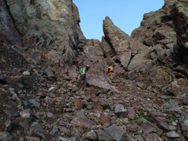 We had enough daylight to do away with the headlamps by the time we approached the class 3 section below Broken Hand Pass, which was exactly the timing we had planned for. Multiple trail segments provide several options for negotiating a loose talus slope before some fun scrambling rock emerges near the distinctive gendarmes that some credit for the name of the pass. (I believe other, more prominent "broken hand" gendarmes are visible higher on the peak, and an individual with that nickname may also have been the source of the name. Regardless of origin, it's a great name for a classic pass which Mark and I have now enjoyed three times.)   We reached the saddle feeling strong. It's worth noting the Broken Hand Pass is only a hundred feet or so lower than the saddle on Pyramid Peak's northwest ridge. I make that comparison because we were fatigued, behind schedule and severely discouraged when we had finally gained that saddle on Pyramid just a few days before. It further reinforced my conviction that we "old flatlanders" (Mark and I) need the better part of a week in-state to acclimate to high elevations well enough to climb with some strength. Buoyed by excellent weather, we started along the trail toward the Needle's upper reaches in high spirits. Almost immediately after leaving west from the pass, the trail takes you through a large cleft between two tall boulders, giving you an enticing taste of the fabulous scrambling that this mountain offers. And a short distance beyond that, another very similar jaunt. You can't help but think, yeah, this is going to be a great day in the mountains.  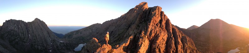 A nice trail skirts below the east ridge of the Needle, offering quick progress with a little modest elevation gain and great views of the mountain's dramatic south face. There's one downclimb along here that gave me pause both times I've encountered it, but once you scope it out and get engaged it's not difficult. Then the trail climbs a bit to skirt just below a saddle on that east ridge. It's well worth the few extra feet to take a break up at the saddle and enjoy a dramatic view of the South Colony Lakes basin and Humboldt Peak across the valley. Views in other directions are just as rewarding, including Broken Hand Peak and numerous other mountains whose names we haven't learned but whose profiles we all admired. I could definitely imagine how a resident of the area could choose to make a lifelong endeavor out of climbing the Sangres alone. Dennis decided he had to scramble up the rocky ridge outcropping east of the saddle while we rested. It was the start of a pattern for this day for him. Seems like from then on, almost every time I looked around to see what the rest of our group was up to, Dennis would be spidering along some rocky outcropping far above the standard route, glorying in the grippy Crestone conglomerate rock. 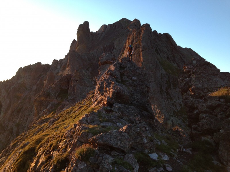 The photo below provides an uncommon view of the south face of the Needle, taken by Dennis from high atop the ridge east of the saddle. We are in the far lower left. The large shadowed area running diagonally across the upper left part of the photo is the east gully with the unmistakable landmark rock fins on the rib separating east gully from west. The crossover is not visible - it's probably above the top boundary of the photo, marked by another fin that is similar but not identical to the fins visible in the photo. You can't see the base of the east gully - the route to it would descend from where we are at to a point beyond the left border of the photo. But it's apparent that the distance from the saddle to the gully is not far. 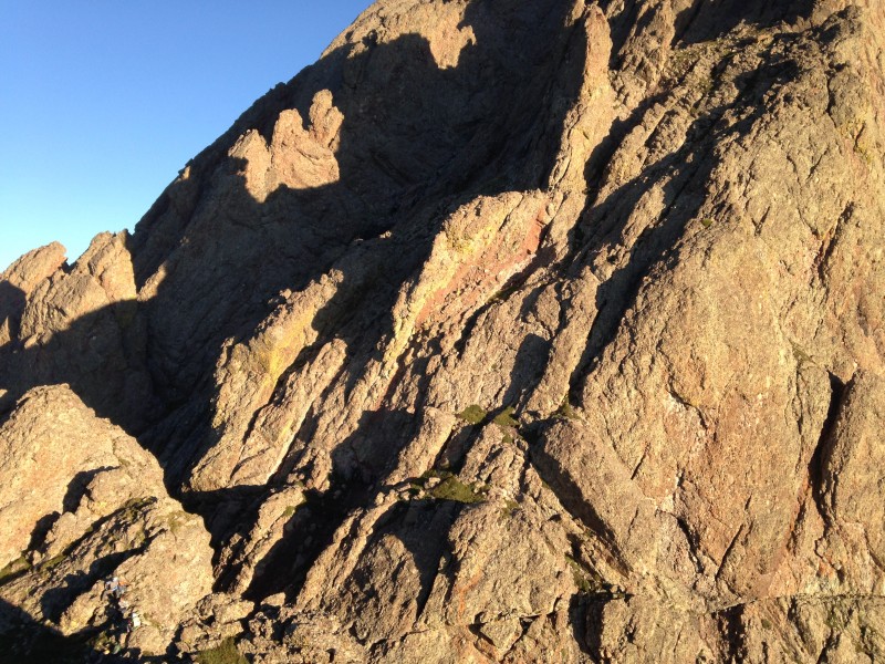 Mark and I had somehow managed to get off-route in this vicinity five years ago, ascending too early up the first gully we encountered that remotely resembled the "east gully" described on 14ers.com. Whatever it was we had climbed had been steep and narrow, mostly comprised of grippy conglomerate but with a few stretches where erosion or other forces of nature had conspired to provide less traction. It had abruptly cliffed out at a small saddle, with a steep wall of rock between us and the summit. We had managed to backtrack some and traverse over a rib into the correct gully that year. This time, we exercised a bit more patience and found the standard route to be obvious. Starting up the gully had a "ready-set-go" feel to it. While some of it is certainly walkable, it did not seem to take long at all before we were scrambling up steep slopes on the best rock any of us have ever experienced on a 14er. I remember looking down once and thinking, if a person fell it would be a while before they stopped - it would basically be a quick ride down to the little trail section at the base of this gully. 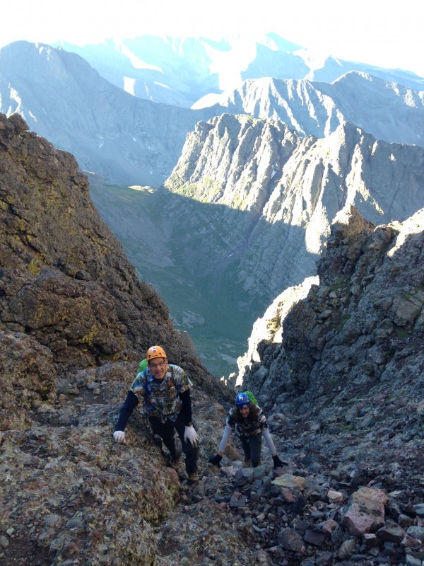 But there was essentially no risk of falling. Every spot you placed a hand or foot, the mountain seemed to reach out to greet you with an endless supply of small rocks embedded securely into the mountain as in concrete - actually much better than concrete, which is porous and vulnerable to freeze-thaw cycles. This masterpiece of nature is far superior to any man-made structure in both ascetic beauty and durability. It didn't take long for me to decide the biggest risk on this mountain could very well be overconfidence. I consciously fought the impulse to abandon sound climbing principles. Why maintain three points of contact when two, or even one, is plenty? Test every hold? Ha - you don't have to test; you don't even have to look! Just reach, or step, and wherever your hand or foot lands it finds secure contact. Except that, if you climb that way, you only have to find one bad spot on this huge mountain to meet disaster - one of those embedded rocks ready to come out, or one steep angled slope which turns out to be smooth/slick instead of a textured, grippy surface. But you could move quickly, and still safely, on this stuff, and it was very fun to do so. You could also freelance away from the standard route without the concern about encountering unstable rock that you face on most 14ers whenever you depart from an established trail. The standard route clearly went up the belly of the gully for the most part, but all of us, and especially Dennis, wandered up the sides of the gully when we felt the urge, because we could, and it was fun, and safe. 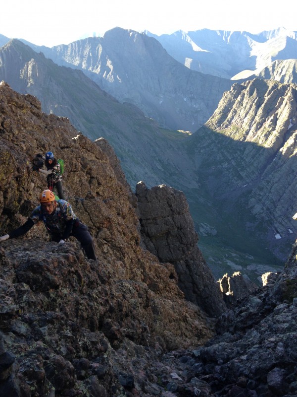 Soon we reached the point to cross over from the east gully to the west. Locating this spot had been a big concern of mine before the first time we climbed the Needle, but it had proven to be obvious when we arrived there. Easy climbing options narrow to the one clearly visible trail, which runs parallel to a gash down the center of the gully. The trail then follows a question-mark shaped loop off to the right and then back left, telling you to cross over the gash at a narrow point directly below a much steeper section of the mountain. I thought this crossover move is worth some detailed description and multiple photos, because it is the crux of the route by a wide margin in my opinion, and the one spot where the risk of a fall is elevated. The trail points you across the gash at a point where it is narrow enough that you can get down into it and reach over water-washed rocks to the other side. As you face across the gash, to your right the gully rises at an inhospitably steep angle. Ahead of you, immediately across the gash, a large rounded rock formation protrudes out toward you, offering no easy passage. You clearly have to step across the gash and work a slightly dicey move around the rock formation going left, to reach a more secure spot just beyond it. It's not far to that safer spot - maybe 10 feet. If you were to fall, the drop would not be far - again, maybe 10-15 feet - but enough to do serious damage. And, the gully drops steeply away to your left, so if you fell, you might tumble down God only knows how much further. Bottom line is, a fall here would be bad news. The bulging rock formation in front of you seems to be the one spot on the entire mountain that doesn't offer a selection of nice grippy positive holds. And, it pushes your upper-body center of gravity outward. You have to choose between finger holds in shallow features, or a general friction hold using your lower arm and palms. Either would be common techniques for a rock climber, or even on a synthetic climbing wall - with a harness. The bulge offers one nicely sized dish near the bottom to reach your leg across and place your foot. It's got a downward slope, but it's that grippy textured rock. One long step further left from that dish is the another foot placement, and solid hand grips become available beyond the bulge - once you're there you are home free on this move. To get to it you have two choices: (1) Place your left foot in the dish, bring your right foot over to it to transfer feet (it's not large, but large enough for that move), and reach with your left foot to the secure terrain. Or, (2) swivel your hips and lead with your right foot to the dish, then pivot your left foot around to the secure spot. In either case your upper-body hold is a bit too tenuous for comfort, or at least my comfort level. 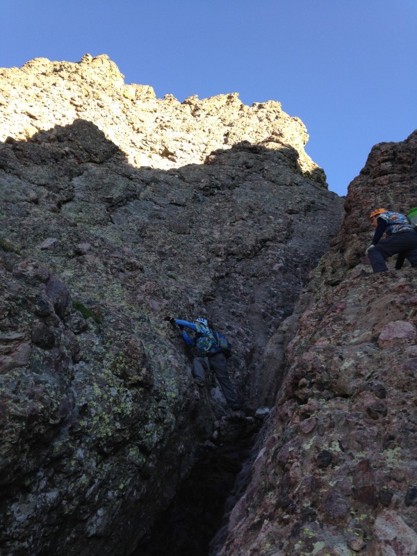 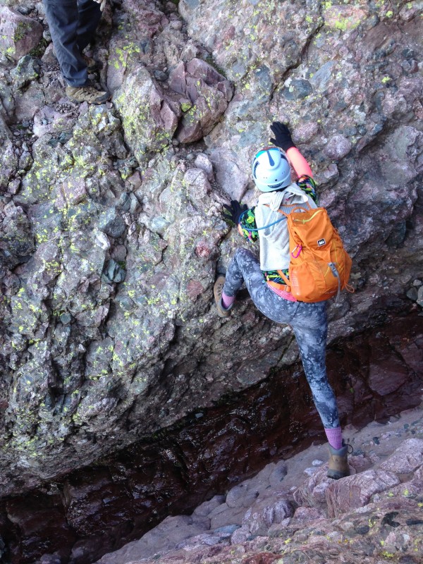 Okay, that's a lot of words for a move that's not all that hard, and in fact is a piece of cake for a lot of climbers, especially rock climbers or even those with climbing gym technique. But it's just tough enough that I could see it turning some hiker-types back, so maybe that description will help someone negotiate it to enjoy the rest of this fabulous peak. And, all that said, there looked to me like there might be other options to cross the gully, either above the spot described (and above the bulge, on sloping but more featured rock); or possibly 20-40 feet below this spot. Or, as Bill Middlebrook describes, you can climb straight up a class 4 section rather than crossing over. But that spot I described looked to me to clearly be the route almost everyone takes.  Beyond that move there is a quite enjoyable the ascending traverse up to the top of the rib. There's quite a bit of air below and to your left (on the ascent), but you have easy stepping-stones and trail segments to take you up to the rib, with plenty of secure holds, so it's not at all difficult. Views from that rib are great.  The descent down from the rib into the "west gully" is where you want to stop and take a real good look around, to identify the spot on the return trip. More than a few climbers have missed the crossover point on the descent, a mistake which could have tragic consequences, as the west gully deteriorates into a dangerous mess below that. The climb up the west gully is similar to the east in steepness and rock quality, but much of the west gully forms a sharper "V," leaving a more distinct path up the middle. But the sides still offer good climbing for those who want to indulge in that experience.  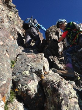 The gully morphs into a ramp near the top, parts of which offer some of the steepest, but still very secure, climbing. Majestic views of the Sangres begin to open up all around, first looking east into the South Colony Lake Basin, then northward toward Crestone Peak and Kit Carson. Then a short, glorious ridge walk, with the summit in sight just a bit higher and a few hundred horizontal feet away. This is truly a walk to richly savor, both in the moment and in your memory for the rest of your life.  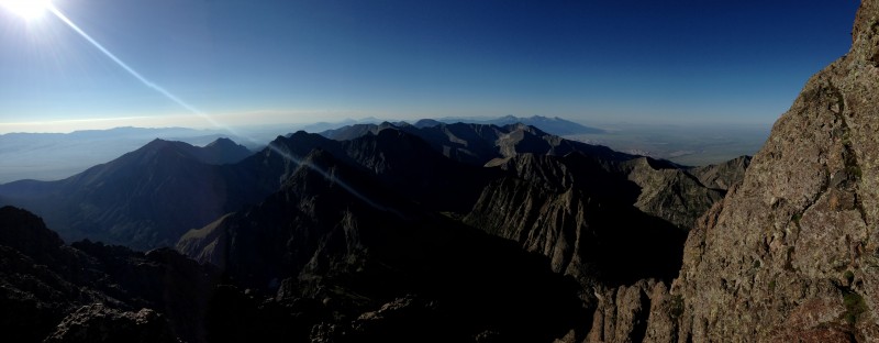 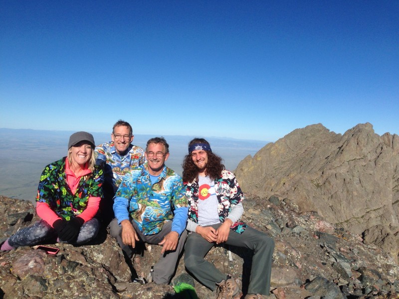 We had the summit to ourselves briefly, then were joined soon by two or three other groups, one twosome having come up the west side after completing the traverse from Crestone Peak. We shared observations about our climbs and the views, then some summer sausage, and eventually a few stories. A couple of the guys seemed genuinely amused by some of our tales, which was all the encouragement we needed to pepper them with more, various members of our group jumping in to pick up the account whenever the original storyteller paused for a breath. After describing our reconstruction efforts on the South Colony Lake Road, we segued into our tale of stranding a rented VW Touareg at 11,000 feet on Castle Peak. After we finally stopped talking and decided it was time to head down, we wondered if they weren't a bit relieved to see us go. 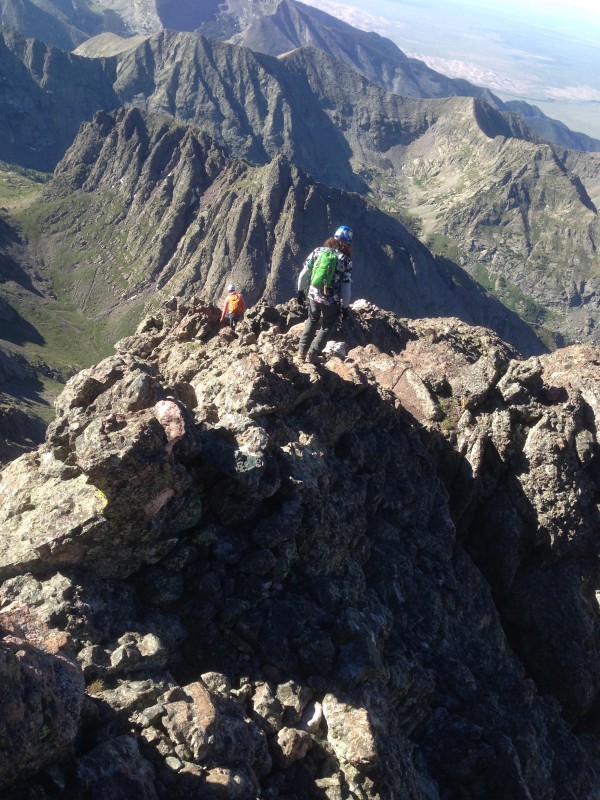 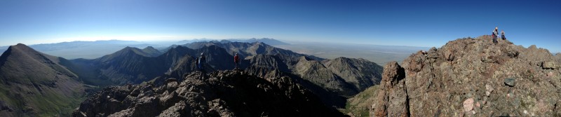 The downclimbing was easy, pretty much all of it done facing out, which afforded many opportunities to pause and take in gorgeous Sangres views to the south. The point to cross from west gully back to east was easily located. There's some pleasure in coming down off the rib in that you're looking at some substantial drops right in front of you as you descend, but you feel no intimidation. 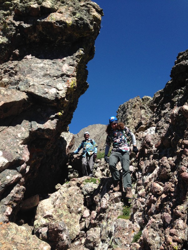 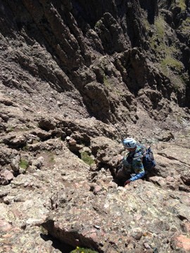 The descent move around that bulging rock at the crossover is just the ascent move in reverse. Five years before I had just jumped across the gash, to a flat landing pad on the east side. I realized since then that such a jump is a bad idea for the simple reason it invites injury if you land wrong. As we descended the east gully, Maryjane and Mark spotted what looked like a viable route angling left toward Broken Hand Pass, short-cutting past the bottom of the gully and the traverse back east. I was not thrilled with their decision to explore this alternative. I had drilled into my head the fact that the only real danger on this route comes if you go off-route. But I followed, and as it turned out, this alternate went just fine and really did seem to be shorter. I decided the reason this alternate wasn't the 'standard' route was because it would complicate the route-finding a bit if followed on the ascent. I was a bit perturbed to find an exception to Rule #6 of the No Joke Route Rules, but could not argue with the results.   When we reached the nearby saddle with view of South Colony Lakes, Dennis decided he hadn't had quite enough scrambling for the day and wanted to climb back up the ridge outcropping east of the saddle, and follow that ridge toward Broken Hand Pass. Mark and I felt no need for the extra credit points, but Maryjane agreed to accompany him, just like any incredibly awesome girlfriend would. After promising us they would be ready to backtrack if they encountered any sketchy downclimb or loose rock, they went up while Mark and I walked the trail back. MJ and Dennis didn't follow the ridge the entire way. After some scrambling they decided it was enough work for this stage of the day and rejoined us old fogies on the trail. But it made me wonder if any of the climbing fools on this website have ever tried, or considered trying, an "east ridge direct" approach to Crestone Needle - following the rocky ridge the entire distance from Broken Hand Pass, rather than skirting below it on the trail. It would no doubt be ferocious in spots, but given the quality of the rock on this mountain - and that conglomerate continued to dominate the rocky outcroppings all the way to BHP - I wondered if it would go.  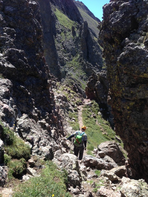 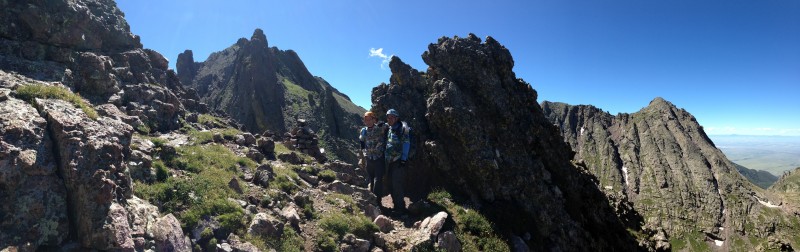 The remaining descent was spent reveling in the great experience of the day, tinged with the bit of sorrow that always accompanies our last descent of the season. On the lower sections of the trail we started encountering weekend tourist-type hikers. A father gleefully whistled his way up the road while his two teenage sons trudged along behind, looking like they were being tortured. An out-of-shape older couple with a dog asked with a tone of desperation, "how far to the lake," and then looked at each other with wide eyes when we told them. And more than a few fellow climbers, usually identifiable by their gear, would share the camaraderie of a cheerful greeting, or maybe a pause to briefly compare notes on where we had been and where they were heading. 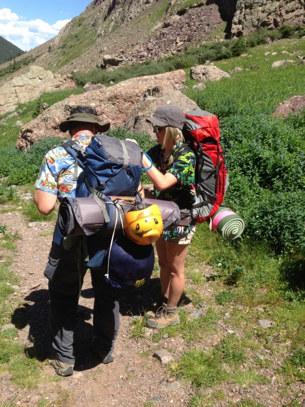 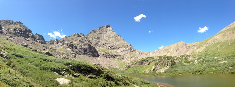 After the disappointment of not summiting Pyramid earlier in the week, this trip brought all the joy you could ever hope for in a 14er climb. I thank God and my beloved family members for the experience. And I truly hope to see the alpenglow on Crestone Needle again some day before my climbing days are over.  Thumbnails for uploaded photos (click to open slideshow):
|
| Comments or Questions | ||||||||||||
|---|---|---|---|---|---|---|---|---|---|---|---|---|
|
Caution: The information contained in this report may not be accurate and should not be the only resource used in preparation for your climb. Failure to have the necessary experience, physical conditioning, supplies or equipment can result in injury or death. 14ers.com and the author(s) of this report provide no warranties, either express or implied, that the information provided is accurate or reliable. By using the information provided, you agree to indemnify and hold harmless 14ers.com and the report author(s) with respect to any claims and demands against them, including any attorney fees and expenses. Please read the 14ers.com Safety and Disclaimer pages for more information.
Please respect private property: 14ers.com supports the rights of private landowners to determine how and by whom their land will be used. In Colorado, it is your responsibility to determine if land is private and to obtain the appropriate permission before entering the property.